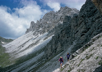
Kalkkogel peaks – an outburst of limestone in the crystalline Stubai Alps
Longest of all the valleys in the range to which it lends its name, the Stubaital is entered from the busy Wipptal. At Neder, a short distance before reaching Neustift, a major tributary valley, the Pinnistal, slices into the southern wall of mountains, and again, just beyond Neustift at Milders, the Stubaital breaks into two stems. The Oberbergtal is a pastoral valley rimmed at its head by a lovely group of 3000m peaks daubed with snow and hanging with small glaciers. The ever-popular Franz Senn Hut is located 1½hrs above Oberiss at the roadhead (minibus from Neustift), and makes a fine base from which to explore further. The Unterbergtal, the southern stem of the Stubaital, is heavily wooded, but above the forests another group of attractive snow- and ice-bound summits rise well above the 3000m mark, including Zuckerhütl, Wilder Pfaff and Wilder Freiger. Just below the snowline a whole string of huts has been built, with trails leading to them from the valley, and across intervening ridge spurs to create a truly classic hut to hut tour. Sadly, mass ski development above the Mutterbergalm roadhead has devalued the immediate area around the Dresdner Hut, but the rest of the district remains largely free from commercial exploitation, and walkers can wander from tarn to tarn or hut to hut in what must surely count among Austria’s finest mountain landscapes.

Kalkkogel peaks – an outburst of limestone in the crystalline Stubai Alps
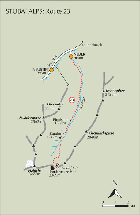
| Start | Neder (964m) |
| Distance | 10km |
| Height gain | 1405m |
| Grade | 2 |
| Time | 4–4½hrs |
| Location | South of Neder |
Standing close to the Pinnisjoch on a ridge dividing the Stubaital from the Gschnitztal, the Innsbrucker Hut is large, comfortable, and busy with both walkers and climbers. This approach is usually adopted as the first stage of the Stubaier Höhenweg (Route 28 below), but is worth tackling in its own right, for the Pinnistal through which the route journeys is a joy to wander in. It has neat pastures, soaring rock walls, and a handful of alm restaurants to relax by. The walk is easy and gently inclined as far as Karalm, but then steepens considerably for the 600m climb to the pass, from where the Tribulaun peaks suddenly burst into view across the deep Gschnitztal.

Note In his guide, Cecil Davies cautioned against walking through the Pinnistal, suggesting you’d be covered with dust raised by ‘jeeps filled with gaping tourists’. My own experience has been very different, for my wife and I had the valley to ourselves (it was in July too), and the walk was a delight.
From Neder follow the road southeast a short distance to Schmieden at the Pinnistal entrance, beyond which the road is unpaved. Remain on this dirt road all the way through the valley, alongside the Pinnisbach and with neat fenced meadows, forested slopes, and impressive rock walls soaring above them. The left-hand wall (east flank of the valley) has the 2840m Kirchdachspitze as its highest summit, while at the head of the valley, to the right (west) of the Pinnisjoch, the 3277m Habicht is the main focus of attention.
After passing one or two alms, in 2hrs come to the Pinnisalm (1560m, refreshments). This can also be reached by footpath leading from the Elfer cableway which begins in Neustift. Another path breaks away from the road heading to the right near the alm, climbing the west flank of the valley to cross the ridge between the Elferspitze and Zwölferspitze. The route to the Innsbrucker Hut, however, continues along the dirt road to Karalm (1747m, refreshments), after which a footpath strikes south across rough pastureland, then up steeply with zigzags to gain the Pinnisjoch. The Innsbrucker Hut lies just beyond the pass.

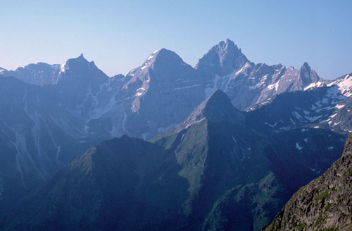
The Innsbrucker Hut enjoys a direct view of the Tribulaun peaks
Built by the Innsbruck section of the ÖAV, the Category I Innsbrucker Hut enjoys a glorious view south to the Tribulaun peaks, while the Habicht rises above the hut to the west. The normal ascent of this handsome peak by its east flank is only graded F (some fixed ropes) and takes about 2½–3hrs; there’s some scrambling involved, but the descent is notoriously dangerous for anyone straying from the correct route. The hut is also used as a base by activists tackling the klettersteig on the nearby Ilmspitze, and (as mentioned above) by hut-to-hut trekkers on the Stubaier Höhenweg. The next stage of the höhenweg is a demanding one which leads to the Bremer Hut perched above the head of the Gschnitztal. There is also the option of a steep descent by path to the Gschnitztal from the Innsbrucker Hut, which has 30 beds and 100 dormitory places, and is staffed from mid-June to the beginning of October (tel 05276 295 www.innsbrucker-huette.at).