| Start | Ranalt (1303m) |
| Distance | 5km |
| Height gain | 975m |
| Grade | 2–3 |
| Time | 2½hrs |
| Location | South of Ranalt, about 12km southwest of Neustift |
Standing high up in the Langental tributary on the south side of the Stubaital’s Unterbergtal stem, the four-storey Nürnberger Hut is another comfortable place in which to stay for a night or two in somewhat wild surroundings. The Wilder Freiger crowns the border ridge to the southwest, and a short stroll above the hut gives a broad view of the headwall peaks and their glaciers.


A 2½hr approach from Ranalt leads to the Nürnberger Hut
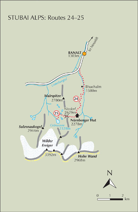
The start of the walk described here is a bus stop (ask for the Nürnberger halt) about 1km south of Ranalt on the road to the Mutterbergalm. There’s a small unmade parking area on the east side of the road, and a marked path climbs from it, steeply at first through forest, then after about 15mins the path brings you onto a track rising gently along the east side of the Langental stream. When the track forks, branch right to cross the stream and reach the B’suchalm (1580m, refreshments) about 40–45mins from the bus stop.
Above the alm the way zigzags up and across the steep west flank of the valley, climbing some 400m or so before easing to a short contouring section, then rising again through a wild landscape of rocks on the east slope of the Mairspitze. Another steep pull, and at last you reach the Nürnberger Hut about 2½hrs from the start.
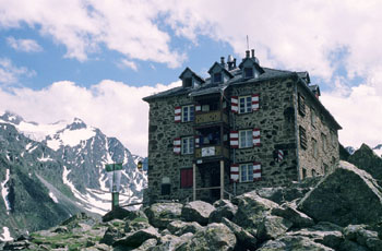
Standing among rocks and boulders below the long south ridge of the Mairspitze, the Category I, DAV-owned Nürnberger Hut has 50 beds and 92 dormitory places, and is fully staffed from the end of June until the beginning of October (tel 05226 2492 www.nuernbergerhuette.at). Built in 1886, the hut has been enlarged and improved several times since, but the panelling in the gaststube is a throw-back to earlier times. A short (20–30min) stroll upvalley brings you to an area of ice-smoothed glacial slabs – textbook geography writ large upon the landscape.