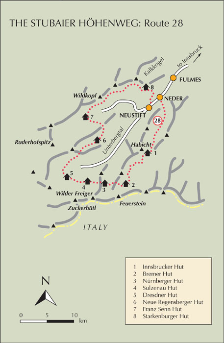
| Start | Neder (964m) |
| Finish | Neustift (993m) |
| Distance | 120km |
| Grade | 3 |
| Time | 7–9 days |
| Location | A clockwise tour of the Stubaital, starting from Neder |
| Highest point | Grawagrubennieder (2881m) |
Generally considered to be the finest hut-to-hut route in the Eastern Alps, this well-marked tour rewards with memorable views on every stage. Several of these stages are short (no more than 3hrs long), but the quality of the scenery is such that unless you are really pushed for time, or the weather is poor, a whole day should be given to enjoy the landscape, flora and wildlife seen along the way. As for the huts used for overnight accommodation, each one has its own special atmosphere which adds to the overall höhenweg experience.
Whilst there are no really demanding ascents to face, numerous ridges and ridge spurs need to be crossed, a number of which have narrow ledges or exposed sections safeguarded by fixed cables. In places the trail is little more than a row of waymarks painted on rocks, and in poor visibility route-finding could be a challenge. On the descent from the highest pass (the Grawagrubennieder), extreme caution should be exercised where there’s much loose rock.
After leaving Neder the route avoids all roads and villages until completion in Neustift. A wonderful tour, recommended to all experienced hillwalkers, it is treated to full description in the excellent Trekking in the Stubai Alps by Allan Hartley (Cicerone Press).

Day 1 Conveniently reached by public transport from Innsbruck, Neder sits at the entrance to the Pinnistal through which the first stage leads to the Pinnisjoch, with the large and comfortable Innsbrucker Hut (2369m, 4–4½hrs) standing just beyond it. This stage is fully described above as Route 23.

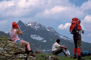
Walkers en route to the Bremer Hut, on the Stubaier Höhenweg
Day 2 This is undoubtedly one of the most demanding stages on the höhenweg. It’s a 6hr day with numerous ridge spurs to cross (plenty of fixed cables) on the way to the atmospheric Bremer Hut (2411m), overlooking a small tarn at the head of the Gschnitztal. For much of the way views will be enjoyed of peaks that form the south wall of the valley, as well as those that close it off in the west.
Day 3 A much shorter stage beginning with the crossing of the 2754m Simmingjöchl on the south ridge of the Innere Wetterspitze which looms above the Bremer Hut. The route to the jöchl involves some modest scrambling, although it’s nowhere difficult, while the descent to the Nürnberger Hut is a joy of stony basins, tiny meadows, winding streams, more brief scrambling pitches, and a region of glacial slabs at the head of the Langental. The hut is reached in just 3hrs.
Day 4 This is another 3hr stage that could easily take all day to complete, such is the quality of the scenery on the way to the Sulzenau Hut (2191m) below the Wilder Pfaff. Once again there are some tricky moves to be made on the descent from the Niederl, where the route uses a series of narrow, exposed ledges protected by fixed cables (see Route 25). The second half of the walk from the Grünausee is partly along an old moraine, now grassed over and flower-starred. All in all, an utterly delightful day’s walking.
Day 5 Continuing the westward trend taken by the höhenweg on Day 3, this stage has a choice of either crossing the 2672m Peiljoch, overlooking the Sulzenauferner, or of making the ascent of the Grosser Trögler (2902m) to gain a far-reaching panorama – especially fine is the view of the Zuckerhütl. Neither route is unduly difficult, although the Trögler option has some scrambling sections and exposure on part of the descent. Once across either the jöchl or the Trögler’s summit, an easy trail leads to the Dresdner Hut (2308m) – a 3hr stage. Sadly the hut’s immediate surroundings have been vandalised by the ski industry, although the building itself is cosy and welcoming.

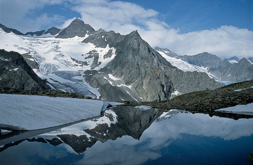
The glacier-hung Wilder Freiger above the Sulzenau Hut
Day 6 The longest stage of all (in terms of hours), taking 6–7hrs to reach the Neue Regensberger Hut on the lip of a hanging valley, by way of the tour’s highest pass. From the Dresdner Hut the day begins by heading west, but it soon turns northward, cutting across the Unterbergtal’s upper reaches, then trending northeast below the Ruderhofspitze to locate the 2881m Grawagrubennieder, a notch in a long rocky ridge, and with a steep drop on the northern side. It is the descent of this northern side that calls for extra care in order to avoid dislodging loose rocks and stones onto anyone who might be below. In the past a short glacier crossing was involved at the foot of this descent, but this glacier has now withdrawn, and you pick a way over old moraine debris and a boulder field before easing through the Hochmoostal to the hut.
Day 7 Little more than a morning’s walk (4hrs) separates the Neue Regensberger and Franz Senn Huts, but it’s another interesting stage whose highlight is the crossing of the 2714m Schrimmennieder north of the Regensberger. It’s a fairly steep climb to the col, reached about 1½hrs after setting out, and the descent on the north side of the ridge cuts down through the narrow Platzengrube before following a good trail to reach the large and invariably busy Franz Senn Hut.
Day 8 This penultimate stage is the longest in actual distance of any previous section of the Stubaier Höhenweg, but there are no cols to cross and for the most part the way follows an easy undulating course along the left-hand wall of the Oberbergtal. Given reasonable conditions, this is a most enjoyable 6hr walk and, unusual for this tour, about 2hrs along the trail refreshments are available at the Seduckalm. Towards the end of this stage you come to the Seejöchl overlooking the Senderstal, but then turn sharply to the southeast to cut across screes at the foot of the impressive Kalkkogel peaks – Dolomite lookalikes – on the final approach to the Starkenburger Hut. High above Neustift, and standing at 2237m, the hut has a marvellous view of much of the route taken over the previous week.

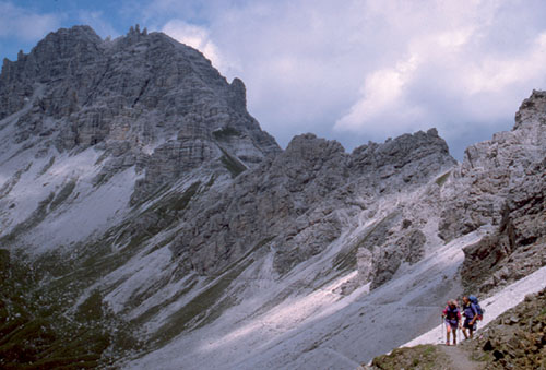
Towards the end of the Stubaier Höhenweg, the route crosses screes below the Kalkkogel peaks
Day 9 A short, but knee-achingly steep descent of more than 1200m takes this last stage down through forest to Neustift where you can collapse in a restaurant chair and reflect on the delights of the route with a well-earned drink. Or two.
The final valley in this overview of the Stubai Alps, the Gschnitztal is approached from Steinach am Brenner (railway from Innsbruck) in the Wipptal, north of the Brenner Pass. The valley flows parallel to the Unterbergtal, the southernmost extension of the Stubaital, and at its northeastern end is broad, green and pastoral, but tapering to a convergence of ridges above the Bremer Hut in the southwest. There’s a postbus service from Steinach all the way through the valley to Gasthof Feuerstein (1281m) at the roadhead, and accommodation can be found in Trins and Gschnitz. There are no campsites in the valley, and little in the way of tourist infrastructure, but at its upper end the south wall which carries the Austro–Italian border is buttressed by the impressive Tribulaun peaks, the Weisswand, Schneespitze and the two Feuerstein summits.