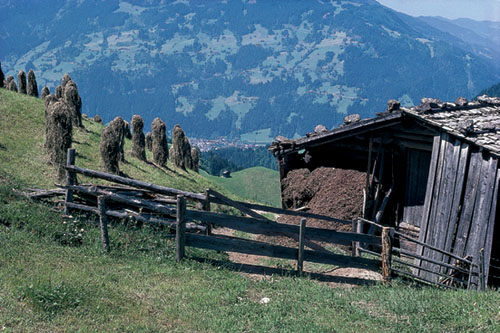
Zillertal hay meadow
| Start | Mayrhofen (633m) |
| Distance | 9km |
| Height gain | 370m |
| Height loss | 370m |
| Grade | 1–2 |
| Time | 3–3½hrs |
| Location | Southwest of Mayrhofen |
Most of this walk takes place in forest shade, but although views are necessarily restricted, interest is retained throughout. Just outside Finkenberg the deep gorge of the Tuxer Klamm is visited before returning to Mayrhofen alongside meadows, typical Tyrolean chalets, and the river Ziller.
From Mayrhofen’s railway station walk downvalley along the main road for a few paces, then cross the railway line by Landhaus Carla. Beyond the Landhaus take a footpath between fields, come to the river and follow it downstream. Cross on a road bridge, and a few metres after passing Gasthof Zillertal, turn left on a marked footpath climbing into woodland. Zigzag up the steep wooded slope to gain a birdseye view onto Mayrhofen. Beyond this rise alongside a steep little meadow to a crossing path (30mins). A few paces to the right stands Gasthaus Zimmereben (refreshments) at 853m.

Zillertal hay meadow
Turn left along the Mariensteig. This sweeps downhill, passes a shrine and crosses an open area with wild raspberries growing beside the path. A few moments after returning to the forest take the upper branch when the trail forks. You now regain much of the height recently lost, and at the next junction take the right branch once more. Signed to Penken this cuts sharply to the right and climbs to another open area with direct views onto Mayrhofen. Regaining the forest the way forks for a third time. Now take the lower option signed to Finkenberg Dorf. This is the Leonhard-Stock-Weg, named after a former Olympic ski champion from Finkenberg.
Taking an undulating course the path eventually crosses a small stream. At the next junction keep ahead. Losing more height you soon pass a series of cascades and 2mins later cross below a slender waterfall pouring over crags. At a T junction of paths turn right, shortly leave the forest and wander across a meadow to a farm and come onto a service road in the upper part of Finkenberg (1½hrs).
Go down to the parish church, and turn right just below it. Bear left beside the post office, go through a parking area and continue ahead beyond the Troppmair hotel where a lane takes you to a bridge spanning the Tuxer Klamm. This is a dramatic ravine, deep and narrow – almost like a rocky crevasse with the Tuxerbach swirling far below.
On the far side of the bridge lies the neat village cemetery. Turn right by the entrance and keep to a woodland path on the left-hand lip of the gorge. Rising easily among trees, the way emerges to a road by another bridge over the gorge. Cross directly ahead to a path which takes you onto the Teufelsbrücke – a covered wooden bridge high above the Tuxer Klamm.
Go over the bridge to the north side of the gorge, cross the road and take a cycle path along the gorge’s vegetated lip. This cuts round the right-hand side of the Almbahn gondola lift station, and continues down to the Troppmair hotel again. Return towards the post office, but turn right by the first building (sign to Mayrhofen), then left a few paces later.
Opposite Hotel Eberl turn right on a narrow service road running down past a few houses, and 2mins later branch left on a descending footpath. Take the right branch when it forks, and twist downhill through mixed woodland, then across a meadow and over a bridge. After a few paces on a road, turn right onto another footpath beside Haus Egger. This leads through more woodland on the way to Gstan where you turn right and follow Hochsteg signs before descending to the Zemmbach. Do not cross the river here but take the left bank footpath and follow the river downstream until you reach Gasthof Zillertal once more on the northern edge of Mayrhofen.