
With more than 400km of marked paths, giving the opportunity for walks of all grades, from gentle strolls to more challenging ascents, the Glemmtal has plenty to offer. Guided walks are often arranged by the local tourist offices for guests staying in their resorts, but with abundant signs and reasonably accurate maps, it should be possible to work out routes for yourself. As skiing has become a major attraction in the Glemmtal, more than 60 lifts and cable-cars now lace the slopes. It is worth noting, however, that not all cableways operate in summer – and unsightly pistes are not in most places a major hindrance.
| Start | Saalbach (1002m) |
| Distance | 11km (one way) |
| Height gain | 308m |
| Grade | 1 |
| Time | 3hrs |
| Location | West of Saalbach |
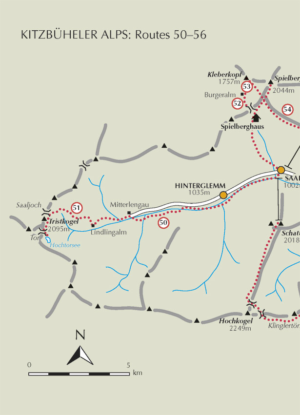
This undemanding riverside walk is an excellent way of getting to understand the valley’s layout, and gives an opportunity to visit Hinterglemm on the way to Lindlingalm, an alm restaurant nestling within the arc of mountains that encloses the Saalgraben, from where a variety of more strenuous walks begin.


Begin in Saalbach on the south bank of the Saalach, which is reached by one of three bridges. The first of these is located near the Saalbach tourist office, the second is directly opposite the Schattberg cableway station, and the third is found near Gasthof Auwirt at the western end of the village.
Across the river turn right and walk upstream along a well-made footpath. Approaching Hinterglemm, about 30mins from Saalbach, the path veers away from the river, edges a large meadow, then curves right to meet the valley road at the Wieshofbrücke. Cross the bridge towards the Theresa Gartenhotel, then immediately turn left where a gravel path continues between the river and meadows and soon goes beneath the road as it enters a tunnel.
Cross the river on the Mühlfeldbrücke, then turn right and walk into Hinterglemm (1035m, 45mins). At the western end of the village the road emerges from its tunnel. Continue upvalley, and about 8mins from the centre of Hinterglemm, recross to the right-hand side of the Saalach by a bridge in front of the Forellenhof, and follow the river upstream once more.
A little under an hour from Hinterglemm come onto the road near the valley station of the Zwölferkogel Nordbahn, cross to the south bank of the Saalach and resume upstream on a broad gravel path which soon narrows. Rising in easy stages, the path takes you high above the river among trees, then slopes down again with views ahead to the Tristkogel, the central peak in the horseshoe ridge which closes the head of the valley and forms the border between the provinces of Salzburg and Tyrol.

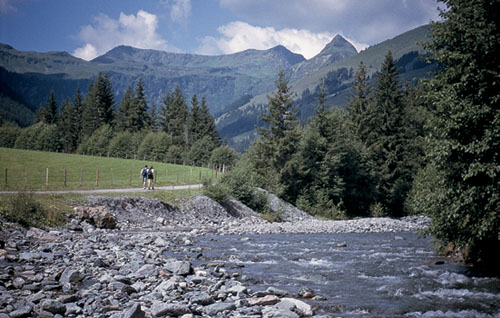
The Glemmtal near Mitterlengau
As you draw near to Mitterlengau (Lengau on the map) a tributary stream, the Vogelalpbach, appears from the south to join the Saalach. Here the path briefly veers left before crossing the tributary, cutting through meadows, then crossing the Saalach for the final time at the valley’s bus terminus by Hotel Lengauerhof (1120m, 2hrs 15mins).
Keep ahead, and in another 10mins you come to the end of the public access road at the Stefflalmbrücke. Now follow a track branching right. Heading between streams, through pasture and forest, it winds high above the river and, about 35mins from Mitterlengau, arrives at the Lindlingalm (1310m, refreshments).
To return to Saalbach, either walk back to Hotel Lengauerhof and catch a bus, or take the tourist ‘Noddy Train’ (the Talschlusszug) from Lindlingalm to the Lengauerhof bus stop.

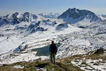
Overlooking the Hochtorsee at the head of the Glemmtal