The Saalachtaler Höhenweg
| Start | Saalbach (Kohlmaiskopf: 1794m) |
| Distance | 14km |
| Height gain | 195m |
| Height loss | 1230m |
| Grade | 2–3 |
| Time | 4½–5hrs |
| Location | Northeast and east of Saalbach |
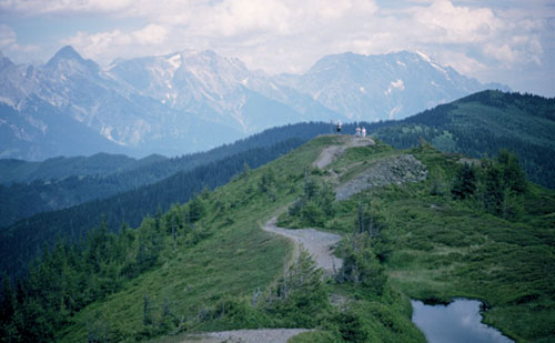
The Saalachtaler Höhenweg traces the Glemmtal’s north walling ridge crest from the Spielbergtörl to the ridge’s far northeastern end overlooking Leogang and Saalfelden. The previous walk adopted a section of this höhenweg above Saalbach, while the following route takes it eastward above the Vorderglemmtal before descending to Viehhofen, from where a return to Saalbach can be made by bus. The route is a long one, and the descent to Viehhofen can seem endless, but refreshments are available at the large Wildenkar Hut on the summit of the Wildenkarkogel, and at the Schönleiten Hut, while a gondola lift (Schönleitenbahn) provides an early ‘escape’ from the walk – should one be necessary – from the Wildenkarkogel.
As its name implies, the Saalachtaler Höhenweg is a high path which keeps to the crest of the ridge as much as possible. With nothing to impede the views, this is a very scenic trail with the limestone massifs of the Leoganger Steinberge and Steinernes Meer seen in one direction, the snow-crested Hohe Tauern in the other.
Take the gondola to the Kohlmaiskopf, descend to the saddle which lies just below and wander ahead (eastward) above a chairlift; then cut along the north side of the ridge overlooking the valley of the Schwarzleograben to the Leoganger Steinberge beyond. Bear left at a path junction (in 10mins) and make your way round the north flank of the 1817m Mardeckkopf, then return to the ridge near an emergency shelter, the Grüne-Böden-Hut, where views become more extensive.

The Saalachtaler Höhenweg
Beyond the Pründlkopf (with its ski tow), the ridge crest narrows with the trail edging along it – a delightful section with big open views all around. A short, sharp ascent is then made to the Wildenkarkogel (1910m, 1hr) where the semi-circular, shingle-walled Wildenkar Hut provides refreshment.
Beyond the Schönleitenbahn keep ahead along a track for a few paces before you take a grass path slightly left ahead, passing avalanche fences as you descend to a saddle with the Schönleiten Hut (refreshments) at 1804m, reached about 15mins from the Wildenkarkogel. At a junction of tracks go up the slope ahead to a small white chapel, and then continue up the slope on a waymarked path above the track.
Rejoin the ridge a little south of the Grosser Asitz (1914m) and follow the path southeastward below the summit to a four-way junction at 1855m (1hr 40mins). Continue ahead and 20mins later gain the summit of the Schabergkogel (1888m), a splendid viewpoint. Reach the Geierkogel (1805m) in 2hrs 20mins, after which the trail leaves the ridge, skirts to the right, then descends for 10mins to the emergency shelter of the Geierkogel Hut. Continue down the slope among trees, bilberries and alpenroses, and when the way becomes boggy, use the boardwalks provided.
About 30mins from the Geierkogel Hut the trail forks. Now, leaving the Saalachtaler Höhenweg, take the lower branch, soon emerging from woodland where you descend to a track near the Lochalm (1670m). Turn right and follow this track all the way down to Viehhofen, much of the way being through forest. Where alternative tracks appear, the main route is obvious, and when Viehhofen (856m, accommodation and refreshments) is reached, turn right along the main road to find the bus stop for Saalbach nearby.