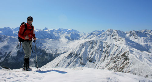
Local guide Fredi Bachmann enjoys the view from the Saalbachkogel
| Start | Saalbach (Schattberg: 2018m) |
| Distance | 18km |
| Height gain | 475m |
| Height loss | 525m |
| Grade | 3 |
| Time | 5–6hrs |
| Location | South and southeast of Saalbach |
The ridge walk of the Pinzgauer Spaziergang is reckoned to be one of the classic routes of the region. In truth the Spaziergang has two stems: the one described here, which links the Glemmtal with Zell am See, and the other – a longer route – which goes from Zell to the Burgl Hut above Mittersill.
The following walk begins at the top station of the Schattberg gondola, and heads roughly southward to skirt the Stemmerkogel and Saalbachkogel before reaching a major east–west ridge system at the Klinglertörl above the Pinzgau district valley of the Salzach. The route now turns eastward with splendid views across that valley where the needle-sharp Kitzsteinhorn dominates with its steep glacier and snowfield. The walk ends on the Schmittenhöhe for a cable-car ride down to Zell am See, from where a bus returns you to Saalbach.
Since there’s very little shelter on this walk, and no easy ‘escape routes’ should the weather turn bad, wait for a settled forecast before committing yourself to it. And take a packed lunch and plenty of liquids with you.

Local guide Fredi Bachmann enjoys the view from the Saalbachkogel
Note When buying a ticket for the Schattberg lift, explain that you will be using the Schmittenhöhe cable-car at the end of the walk. A ticket can be bought that is valid for both lifts.
Bearing in mind the length of this route, it is advisable to take an early gondola to the Schattberg’s east summit (Ostgipfel) at 2018m. You then descend by a track to a saddle between the two peaks – the other being the Westgipfel. On reaching the saddle leave the track, which curves sharply to the left, and go ahead along a path which crosses the east flank of the Mittelgipfel.
Curving to the right, cross another track (20mins) and continue to a rocky minor ridge where you bear left for a few paces, then rise up a grass ridge to the Marxtenscharte (2015m), gained about 30mins from the start of the walk. Bear left, and 2mins later when the Familienweg breaks away to the right, keep ahead to contour along the west side of a ridge among bilberry and (later) alpenrose, and pass below the Stemmerkogel to gain the 1963m Samersattel about 1hr from the Schattberg.
There’s another path junction at the Samersattel, but ignoring the right-branching trail, the Spazierweg eases southward with the Saalbachkogel ahead. The path rises along the ridge for about 5mins, then veers to the right below this peak, with the Hohe Tauern range now coming into view as you approach the Seetörl (1964m, 1hr 15mins), a narrow saddle with a couple of small ponds (the Hackelberger Seen) and yet another choice of paths.

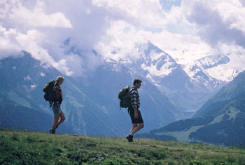
Walkers on the Pinzgauer Spaziergang
Cross to the left of the ridge on the continuing trail that curves round the northeast flank of the 2249m Hochkogel and brings you to the Klinglertörl, about 1½hrs walking time from the Schattberg. From this saddle you have an uninterrupted view across the broad Salzach valley to the massed peaks of the Hohe Tauern – a lovely vista of snow- and ice-capped mountains, a large number of which are drawn within a national park. Keep ahead, and sloping downhill, in another 7mins you come to a path junction by a small timber-built emergency shelter at about 2000m.
Bear left to make a long traverse of the southern slope of the Niedernsiller Hochsonnberg; about 30mins after crossing the Klinglertörl the path turns a spur, and in another 30mins comes to a second emergency shelter below the Klammscharte (1993m, 2½hrs). From here the path now heads southeastward before turning another spur, this one descending from the Gernkogel. The path forks here, with one descending steeply to Niedernsill which can be seen about 1200m below.
The path for the Schmittenhöhe and Zell am See curves left, heading northeast to regain the ridge at the 1918m Rohrertörl from where you look north to the Leoganger Steinberge. Continue along the ridge for a short distance to a signpost, then veer right along a track. About 30mins later the Pinzgauer Spaziergang leaves the track for a footpath at 1885m.
Note Should you need refreshment, remain on the track for a further 4mins to the Hochsonnbergalm.
The Kesselscharte (1844m) is the next point on the ridge, gained in about 4hrs 10mins. This is a charming little saddle with a few tiny pools and glorious views to north and south, and beyond it the way heads northeast among more trees and shrubs, passes beneath the Hahnkopflift ski tow, then goes down a slope used as a ski run in winter. At the foot of the slope there’s a ski hut and a junction of tracks.
Climb the opposite slope, at first steeply before the track assumes a more user-friendly gradient to loop up the hillside, finally reaching the summit of the Schmittenhöhe (1965m) with its famed view, and with Zell am See and its lake lying 1200m below.
Ride the cable-car down to Zell, and either take a bus into town, or walk the straightforward road route to the bus station located behind the post office, and there catch a bus for Saalbach.