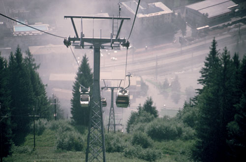
The Stubnerkogel gondola
| Start | Badgastein (Stubnerkogel: 2230m) |
| Distance | 9km |
| Height loss | 1225m |
| Grade | 2–3 |
| Time | 3hrs |
| Location | Southwest of Badgastein |
A ridge walk, gained by gondola lift, followed by a long and sometimes steep descent over pastures and through forest, brings this route to the one-time gold mining village of Böckstein.
Ride the gondola lift to the Stubnerkogel, a 16min ride which delivers you a short distance below the summit. On leaving the top station there are two tracks and a footpath. The upper track cuts just below the ridge and leads to a ski lift; the lower track descends to the middle station, while the footpath, which we take, goes along the ridge crest to a viewpoint with an orientation table. Among the many mountains in view the Grossglockner can be seen to the west.
From the orientation table the path then descends to join the upper track where you bear right and wander along the west side of the ridge. Take a path which breaks from the track to climb along the ridge itself, and in 15mins come to a path junction just above the top of a ski tow at the Zitterauer Scharte.

The Stubnerkogel gondola
Continue along the ridge, ignoring another path (Dr Reichert-Weg) which breaks to the right. After a while the ridge path goes along the left flank, then crosses to the right side of the ridge before rising steeply to the cross-marked summit of the Tischkogel (2409m, 1hr). The 2461m Zitterauer Tisch is gained in a further 20mins. Return to the Tischkogel and take a steep path which descends a grassy spur on the east slope (caution on this descent) to join the main walk at the Zitterauer Alm.
Branch left on the trail signed to Böckfeld Alm and Zitterauer Alm. The main path crosses rough grass slopes below the east face of the Tischkogel, then rises to cross a narrow spur at 2215m. Bear left and descend this grassy spur which plunges steeply on either side. Across the valley the deep cleft of the Aulauftal, headed by the Ankogel, looks very impressive. To the right the headwall of the Nassfelder Tal is splashed with snow and ice, while the rooftops of Böckstein lie more than 1000m below.
On reaching an avalanche fence continue down the right-hand side, and just before a bluff covered with dwarf pine and marked by a large wooden cross (Hirschkaukogel: 2002m), descend left into a vegetated basin.
The Hirschkaukogel cross was erected in memory of a mountaineer killed in the Pamirs while climbing Pik Communism.
At the foot of the slope bear right on a path which shortly descends to the Zitterauer Alm (1872m, 50mins, refreshments) standing beside a track coming from the middle station of the gondola. Immediately to the right of the alm building take the path of the Böcksteiner Höhenweg which soon enters forest. After an initial contour, the forest path begins its descent; at first gently, then more steeply through alder scrub and over meadows, then back into forest again. In 1hr 45mins come to Böckfeld Alm (1536m, refreshments) and a broader path.
Bear left and swing down through more forest, less steeply than before, to arrive in Böckstein about 2hrs from the start of the walk. This is an attractive place with pleasant buildings around a garden square in the middle of which there’s a fountain. Turn left at the far end of Hotel Rader, then left again on the Kaiserin Elisabeth Panoramaweg below a circular church. The service road eventually gives way to a broad gravel path on the left bank of the Gasteiner Ache, which leads back to Badgastein.