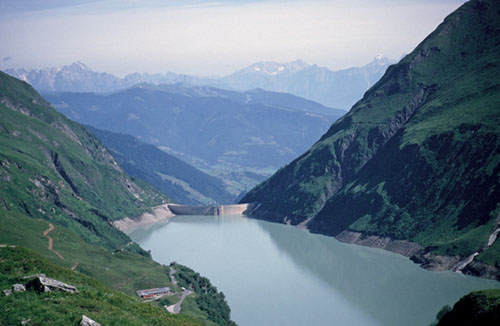
Wasserfallboden reservoir, seen from the Sedlgrat trail (Route 87)
Modest in size and facilities, Kaprun can nonetheless reward visiting walkers with a few truly worthwhile outings. Together with Zell am See across the Salzach valley at the foot of the Kitzbüheler Alps, the village forms part of the so-called ‘Europa-Sport-Region’. The Kaprunertal which stretches to the south digs into the Hohe Tauern range in spectacular fashion, its upper reaches containing two large reservoirs flanked by lofty, steep-walled 3000m mountains. An undemanding walk entices alongside the higher of the two lakes; others venture onto hillsides above it, while a very fine ridge walk makes the most of the lower hills between Kaprun and the Kitzsteinhorn. To access some of the higher walks cable cars swing visitors out of the valley to the Maiskogel above Kaprun, and onto the slopes of the Kitzsteinhorn further upvalley, where skiing takes place throughout the year. Buses run frequently through the valley, with a special service operating between the Kesselfall Alpenhaus and the Mooserboden dam via two buses and an open lift platform.

Wasserfallboden reservoir, seen from the Sedlgrat trail (Route 87)
| Start | Kaprun (Maiskogel: 1540m) |
| Distance | 10km |
| Height gain | 892m |
| Height loss | 45m |
| Grade | 2–3 |
| Time | 4hrs |
| Location | Southwest of Kaprun |
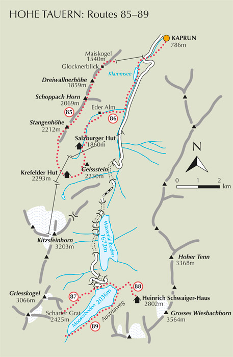
By using the Maiskogel cable car at the start of the day, plenty of time is then allowed to enjoy to the full this airy ridge walk along the Alexander-Enzinger-Weg, which is one of the classic routes of the Kaprunertal. Major summits of the Hohe Tauern are on show for much of the way, including the Grossglockner, and the walk ends at a mountain hut at the foot of the shapely Kitzsteinhorn. Options for a return to Kaprun are given at the end of the route description.

From the top station of the Maiskogel cable car, wander along a broad track signed to the Glocknerblick. It winds along the forested hillside and brings you to the Alpengasthaus Glocknerblick (1670m, refreshments) in just 20mins. As the name implies, you can see the top of the Grossglockner which is due south from here. Now follow the footpath which strikes ahead uphill among trees. When it forks 3mins later, take the left branch and rise steadily through forest, then come onto a grass crest by a ski tow. The way now skirts round the left side of the ridge, then returns to the crest to gain the top of the 1859m Dreiwallnerhöhe on which there’s a small wooden cross.
Descend about 15m to a grass saddle, then climb towards another grass-covered crown of the ridge with snowpeaks of the Glockner group on show at the head of the Kaprunertal. The Schoppach Horn (2069m, 1hr 45mins) is gained about 50mins from the Dreiwallnerhöhe, and this too is topped by a wooden cross.
The path avoids a few minor tops by cutting along the left-hand side of the ridge, then slopes down to a saddle at 2055m. Climbing from this saddle brings you onto the highest part of the ridge at the 2212m Stangenhöhe. This is not so much a summit as a very narrow section of ridge with fixed cable safeguard. Beyond this the path abandons the ridge crest and slants down the left flank, and goes from grass slopes into a more stony landscape in which old slips of snow sometimes remain into late summer, and there are several streams to cross.
In a little over 3hrs come to a large cairn beside the trail marking a junction. The left branch cuts down to the Salzburger Hut, unseen from here, but we continue ahead, now with the Krefelder Hut on show to the south. Crossing more streams and snow patches, in another 40–45mins the well-defined path brings you to the large Krefelder Hut (2293m, accommodation and refreshments), with the Kitzsteinhorn soaring above, but with more than a dozen assorted cableways and ski tows sadly disfiguring the landscape.

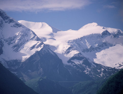
Major peaks of the Hohe Tauern are on show from the ridge leading to the Krefelder Hut
To return to Kaprun you have three main options: