
Plan your walk |
|
 |
DISTANCE: 4 miles (6.5km) TIME: 2 hours START/END: SW432245 TERRAIN: Easy MAPS: |
 The Merry Maidens is one of the best preserved stone circles in Britain. Dating from about 2540BC, its stones include only three that had to be re-erected in the 19th century, and they are equally spaced with an entrance gap on the eastern side, where there may have been a processional way. Maiden is a corruption of meyn or men, meaning stone (and pronounced main in Cornish). Merry is derived from Mary or Mari, the fertile mother worshipped as a goddess in the Middle East in 1000BC. The legend is that some merry maidens were turned to stone for dancing here on a Sabbath. The two Pipers who played the music were also turned into stones.
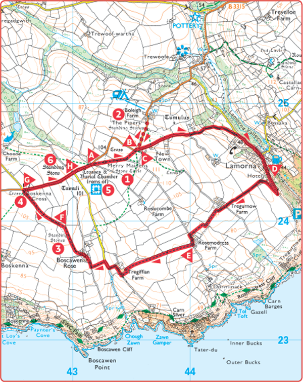
 Start from the lay by parking at Merry Maidens. Go over the stile to the stone circle. After seeing the standing stones leave this field by a stile in the top right corner. Go ahead to a stile beside a telegraph pole. Emerge at a bend in the road.
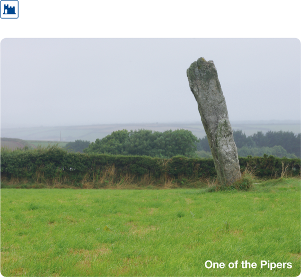
 Before continuing the route take a short detour by going straight ahead on the B3315 to see a view of the Pipers standing stones from a farm gate on the left hand side of the road.
 These two standing stones are known as the Pipers – they who played the tunes for the merry maidens to dance to. They are 15ft (4.5m) high.

 Return to the junction and turn left up an access lane towards Menwinnion Country House. Continue down an old green lane to the road. Turn right to walk down the road.
 Turn right up the lane signposted to the Cove Restaurant. Continue to a sharp right turn and go right to pass a house called Tregurno Cliff. Bear left through stone gate posts and along a hedged track. At Tregurnow Farm turn left over a stile. Continue along a field edge past the farm on your right, then bearing left cross a stone stile to join a farm track bearing to your right, with Rosemodress Farm buildings on your left.
 Turn right and continue alongside a hedge on your right to go over a stile ahead. Follow the field boundary to a step stile in a wall beside a cottage on your right. Cross this and turn right along a lane, passing a farm on your right and around a left-hand bend, then a right-hand bend. Just after this bend, turn left over a stone stile in the hedge. Walk with the hedge on your left to a track and turn right along it to a farm. Walk between buildings with the farmhouse on your right. Go across the farmyard and through a gateway on the right to reach the corner of a field. Ignoring a gate ahead, veer left to the corner of a hedge jutting out into a field on your left. Go ahead with this hedge on your right almost to the far corner, then cross the field to a stile on your left. Go over it and follow a hedge on your left, noticing a standing stone in the field on its other side.
 The standing stone across the hedge is one of a pair. Rising nearly 9ft (2.7m) out of the ground, it is aligned with the southwest Piper stone and the Merry Maidens stone circle.
 Cross a stile in the field corner ahead and veer slightly right across the next field and over a stile in the hedge opposite. Cut across a field to join a hedge on your left. Follow the hedge on your left to a stile in the corner and cross it to reach a road. Notice Boskenna Cross on your left.
 Wayside crosses indicated the routes for travellers in bygone days. Originally this cross would have stood in the middle of the road, aligned with the Merry Maidens and another cross to the west.
 Turn right on to the road and pass Tregiffian Barrow on your right.
 Tregiffian Barrow is a Bronze Age tomb, although part of it was destroyed by construction of the road in 1840. When excavated in the 1960s, a cupmarked stone was found and replaced by a concrete replica.
 Continue along the road to the car park lay by. Before leaving cross the road to a stile opposite the lay by. Go over the stile to see a standing stone in the far corner of the field.
 This magnificent 10.5ft (3.2m) high standing stone is called Gun Rith, meaning Red Downs.