The most fascinating of Malta’s many temples is actually the closest to Valletta – the Hypogeum 1 [map] in Paola. It is also known as the Hal-Saflieni Hypogeum after the name of the immediate locality. Hypogeum means “underground chamber”, and its subterranean nature sets it apart from the archipelago’s other temples. In fact it was only discovered accidentally in 1902, when workmen were preparing house foundations.
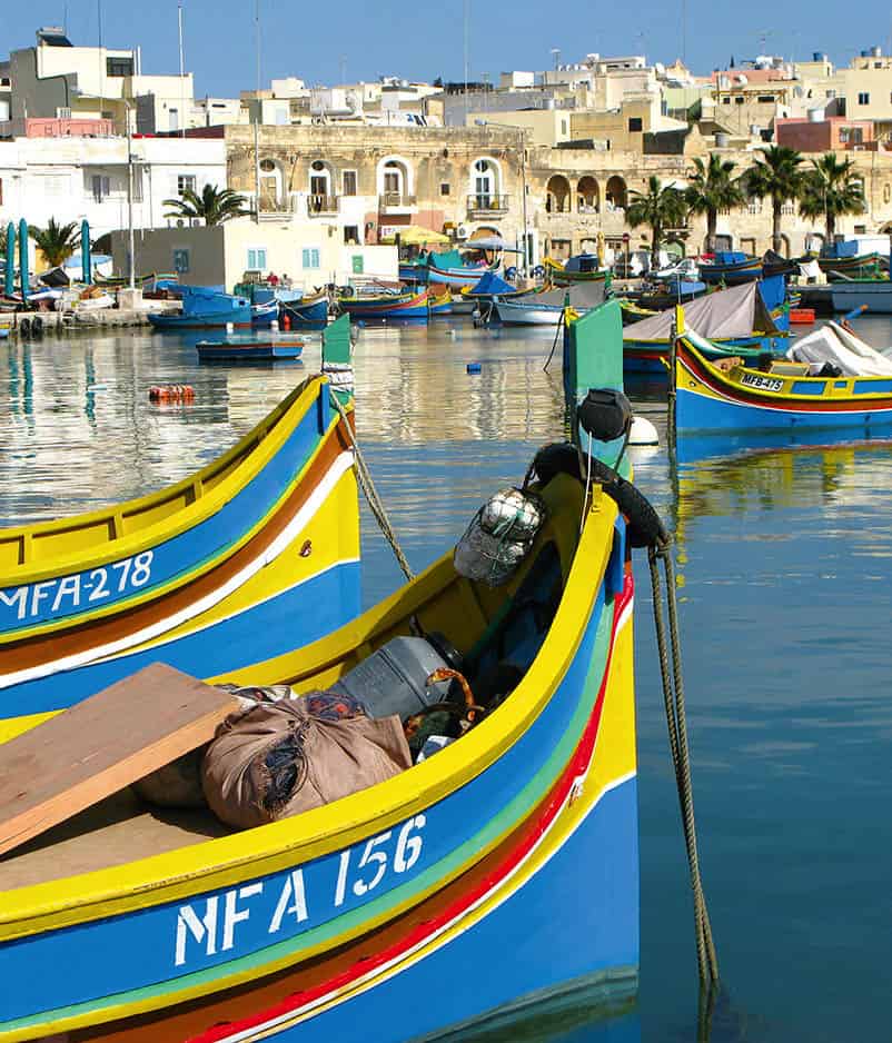
Clusters of luzzus at the harbour.
Malta Tourism Authority
The Hypogeum was dug out of the rock in around 3,000 BC by people using flint and hard rocks. They created a network of corridors and deep chambers on three levels. At the deepest level there appears to be a secret granary, which is reached by seven uneven angled steps that turn sharply to the right and have a sheer drop into a narrow chamber on their left. This deliberate drop is said to be a device to trap would-be thieves as they approach in the enveloping darkness.
Echoes of the past
The Hypogeum was a place for both ritual and burial. When discovered, it was full of fragments of bone and pottery, of which only a little has been retained. An estimated 7,000 bodies were interred here. The chambers are finely finished on a well-proportioned scale. The most impressive, commonly referred to as the “Holy of Holies”, has pillars and lintels that are architecturally remarkable. The room was probably used for the sacrifice of animals.
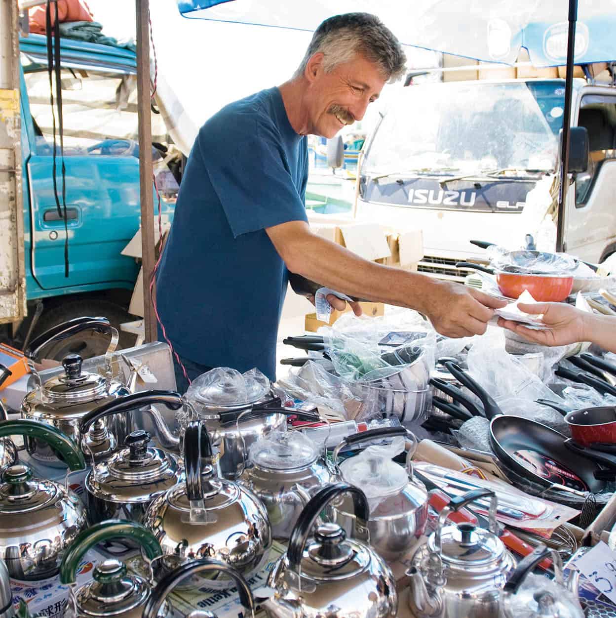
Marsaxlokk Sunday Market.
Sylvaine Poitau/Apa Publications
There are patterns and symbols on the walls and there is an oracle chamber where a square niche was cut into a wall so that the priest’s voice would echo around the temple. When the deep voice of a man speaks into the niche, the sound reverberates around the chamber; when a woman speaks into it, nothing happens. Two Sleeping Lady figurines were found in the middle chambers but, unlike the other artefacts from the Hypogeum, these are now displayed in the National Museum of Archaeology in Valletta.
The Hypogeum was closed for much of the 1990s for restoration, and there were rumours that it would never reopen as the very breath of visitors damages the soft limestone. It has now reopened, but numbers are limited to a maximum of 80 per day (8 tours daily from 9am to 4pm). It is advisable to book around a week in advance, especially during busier seasons. Book online at www.heritagemalta.org.
Tarxien
A short distance by car, still in the suburb of Paola, are the Tarxien Temples 2 [map] (pronounced tar-sheen), which were discovered in 1914 and excavated with great care (tel: 2169 5578; daily 9am–5pm; charge).
This group of four temples is remarkable for the quality of its carvings, which include not only subtle decorative spirals, but also friezes of farm animals, among them a bull, crafted to represent virility, and a suckling sow, crafted to represent fertility.
Of considerable historical importance was the discovery here of the large base of a monumental statue to Mother Earth. It indicates that these early people had created the first-known free-standing statue of a deity. Had it survived, it would have been at least 2.5 metres (8ft) high.
Certain walls and floors of the temples are discoloured with a curious dark patina, which experts believe was caused in the late Bronze Age by the funeral pyres of a new people arriving at the temples. These latter folk cremated their dead, while the original dwellers interred bodies. The temples have recently been covered with a new protective tent; a new walkway has also added and an educational mobile application has been released.
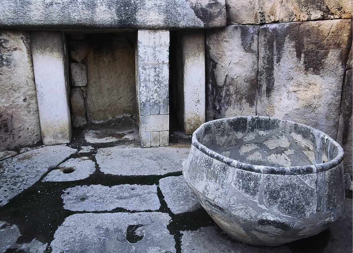
Neolithic bowl at Tarxien Temple.
Malta Tourism Authority
The southeast corner
Leave behind the faceless suburbs of Paola and head west to Zabbar, which is entered via the Hompesch Arch, dedicated to the very last Grand Master of the Order in Malta, Ferdinand von Hompesch (1797–98). In the centre of Zabbar, the Church of Our Lady of Graces, known locally as Ta Grazzia, is a masterpiece of local church architecture. It was designed by the acclaimed local architect Tomasso Dingli, but took on its present appearance in 1737, when a new facade was added. The church is small but charming.
Marsascala 3 [map] was once a quiet fishing village. Today, it has been taken over by apartment buildings and restaurants, and is a popular locals’ holiday resort, if not the sort of place where overseas visitors come. Its large bay cuts a pretty picture nonetheless, with its flotilla of fishing boats and pleasure craft and a tall Italianate campanile as a backdrop.
Follow the coast road south to St Thomas Bay, a scruffy sort of place where fishermen’s boats and broken huts litter the foreshore in a less-than-picturesque way. There is, however, that rare commodity, a sandy beach and plenty of rocky slabs on which to sunbathe. If it is crowded here, as is often the case, then a better alternative is Peter’s Pool 4 [map], just south of here on the main road.
The path down to the pool is well trodden. There is no sand, not even a shore, but if you want to swim in a glorious natural lido, then this is the place to come. Just jump or dive into the deep, clear, blue water from the rocky shelving and watch where the locals get out. But stay away from the currents, which swirl under the rocky outcrops at the pool’s end. If swimming is not your thing, there are some good coastal paths to explore and it’s easy to find your way.
A word of caution: thieves sometimes operate in this region and will casually break your car windows to gain access. The best defence is to leave nothing in your car. If an “attendant” is there, it is polite to tip.
Fact
The south is probably the most traditional part of Malta, but it is home to some very modern developments, including Smart City (www.smartcity.ae/Malta/index.php), just outside Kalkara. This purpose-built, self-sustainable township for knowledge-based industries was built in partnership with the Maltese government and is currently in development. It is set to revolutionise this part of the island.
Young sailor in Marsaxlokk.
Sylvaine Poitau/Apa Publications
Marsaxlokk
Marsaxlokk 5 [map] – which, for the benefit of tongue-tied visitors, is pronounced “Marsa-shlock” – is quite simply the prettiest fishing village on the islands. It also holds Malta’s largest fishing fleet, and the harbour, with its multitude of colourful luzzus (traditional fishing boats), is a photographer’s dream.
A market is held on the quay daily, with fruit and vegetables for the locals and lace for the coach parties. Most visitors enjoy a meal of freshly caught fish, before returning to their coach. Despite its many day-trippers, the basic structure of the village is still largely untouched. Sadly, the same cannot be said for Marsaxlokk Bay. It was here that the Turkish fleet anchored prior to the Great Siege of 1565, and the bay was also used by the invading French in 1798. In the late 20th century it was defaced by an obtrusive power station.
The area around Marsaxlokk offers some of the best views of the island and is worth exploring on foot. Delimara, with its historic fort, makes for a picturesque stop and is just a few kilometres away from the centre of Marsaxlokk.
Fact
The spectacular Zurrieq festa, held to honour St Catherine, is held every year on 4 September.
Ghar Dalam
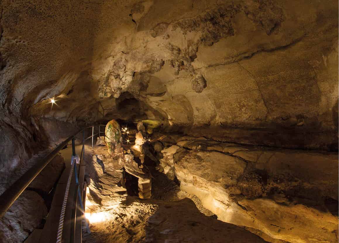
Continue on the coast road around St George’s Bay and, just before you get into Birzebbuga, signs indicate the route a little way inland to Ghar Dalam 6 [map] (tel: 2165 7419; daily 9am–5pm). Its name means “cave of darkness” and it is a natural formation some 200 metres (600ft) long, carved out by a subterranean river and only rediscovered and first scientifically investigated in 1865.
Its upper rock stratum yielded bones of humans and animals dating from the Phoenician period (1st century BC); the second stratum dated to Neolithic times (5,200–4,500 BC) and contained fragments of pottery with animal patterns, imported pieces of obsidian from Lipari and Pantelleria, and the remains of domestic animals. But it was a third layer of rock that yielded the most exciting finds: this dated from the Pleistocene era (1.8 million–11,000 years ago) and contained the fossilised skeletons, antlers and teeth of deer, bears, dwarf elephants and hippopotami (on display in a refurbished exhibition next to the cave).
Ghar Dalam Cave.
Viewing Malta
Several similar fossils have also been discovered on Sicily and have fuelled speculation that the islands once formed part of a land bridge between the African and European continents, between present-day Sicily and Libya or Tunisia. Another theory is that a major earthquake broke up the land and caused severe flooding; this may have created the Maltese archipelago and separated the two continents.
The caves were also put to good use as an air-raid shelter during the intense bombing of World War II.
From Bronze Age to Industrial Age
Close to Ghar Dalam is another ancient site, the scant remains of the Bronze Age site of Borg in-Nadur (visits by prior appointment only). However, there is no interpretation here and only the archaeologically inclined will get anything out of a visit. Of more general interest is the monument on the coast road that commemorates the summit between George Bush Snr and Mikhail Gorbachev that marked the end of the Cold War between the United States of America and the Soviet Union on 23 December 1989 (just a few weeks after the fall of the Berlin Wall). This was held on the SS Maxim Gorkiy cruiser moored in Marsaxlokk Bay, and sea conditions were so rough, with some meetings needing to be rescheduled as a result, that the event was nicknamed The Seasick Summit. Although no agreement was signed as such, the summit was largely viewed as marking a turning point in relations between East and West.
Signs along this road point invitingly to Pretty Bay and, sure enough, around the Birzebbuga headland is a sandy beach that, indeed, must have been pretty once upon a time. The panorama now, however, is dominated by the giant Kalafrana freeport container terminal, almost within swimming distance of the beach. This is one of Malta’s most important sources of income after tourism and here the two clash in a spectacular visual juxtaposition.
Boat trip to Blue Grotto.
Viewing Malta
The road winds inland past the disused airfield of Hal-Far, while the container port spreads itself thickly over this area, turning it into one giant industrial estate. Just past the airfield, look for the minor road signposted to Zurrieq. If you miss it, continue towards Luqa, then pick up the Zurrieq signs.
The Blue Grotto
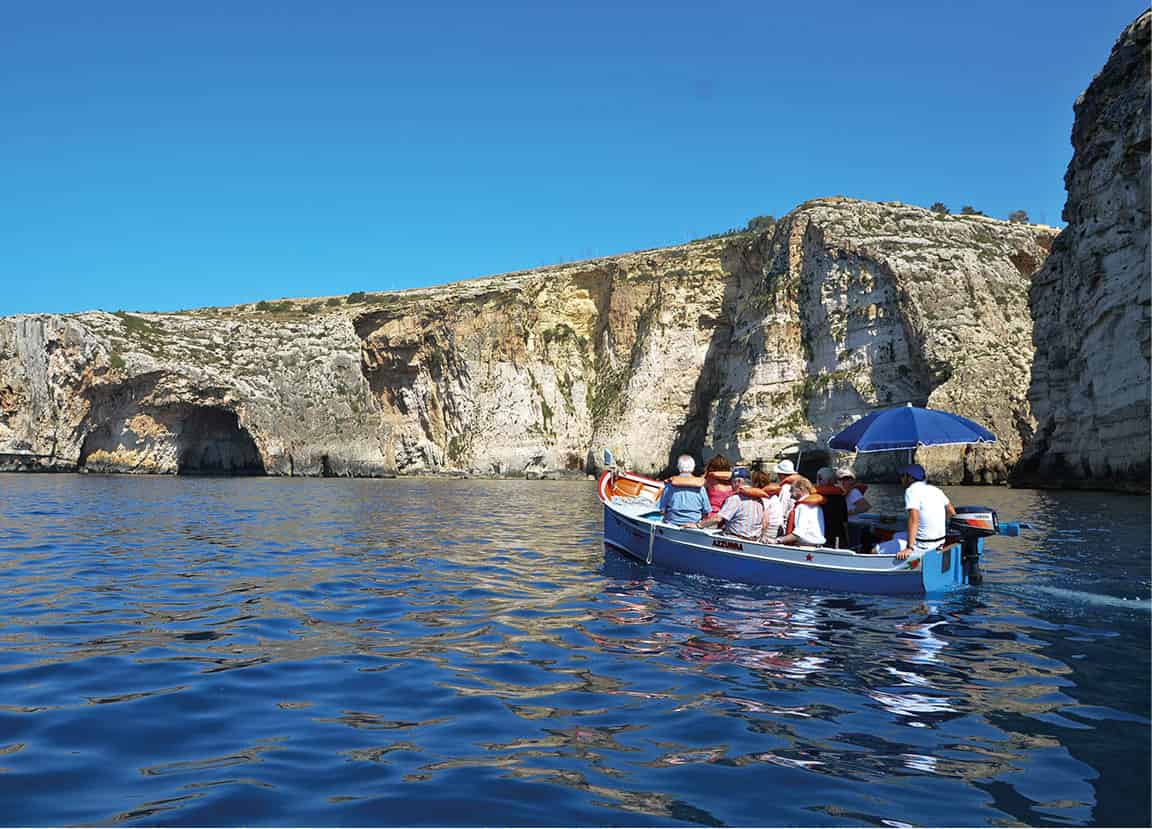
There is little to detain you in Zurrieq but just south is the tiny picturesque rocky inlet of Wied iz-Zurrieq. Here, traditional Maltese fishing boats are moored in the water in great numbers or hauled ashore to be repainted in fine colours. It is a spectacular drive into Wied iz-Zurrieq along the cliffs. From its jetty beneath the simple cafés and souvenir shops, small boats taking up to eight passengers at a time ferry visitors to the charming Blue Grotto 7 [map]. The best time to go is in the early morning, when the light reflected through the caves brings out the colour. Don’t worry about being cheated on the price of a trip. A few years ago this was a concern, but nowadays these are government-regulated and clearly marked with a bona fide ticket booth. Boats start running at around 8am and finish at 4pm every day in summer.
Fact
Between Ghar Lapsi and Dingli Cliffs is the small settlement of Tal-Providenza. This is home to the Madonna Tal-Providenza, one of Malta’s best Baroque churches.
Hagar Qim
Continue on the same road to the famous temples of Hagar Qim and Mnajdra (tel: 2142 4231; daily 9am–5pm, until 7pm in summer).
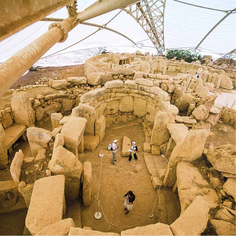
Hagar Qim 8 [map], pronounced “hadge-are eem”, means standing stones. It is at the top of the hill (by the car park) and is almost completely surrounded by a curtain wall, with three massive standing stones set into it. When the site was discovered in 1839, the Maltese Venus, the statue of the Seated Woman and several other female figurines were all found here. Many of these figurines, with emphasised body parts, are thought to be ancient tributes to fertility. They now reside at the Archaeological Museum in Valletta. The monumental facade is very impressive and gives a good impression of the huge scale of these megalithic structures. Originally, they had wooden roofs but these have long since rotted away.
A corridor leads to the interior that is made up of a series of round chambers, almost all of which have their own entrance. Both Hagar Qim and Mnajdra were used for sacrifices, with libations of milk and blood presented at the altars. The altars are upturned mushroom-shaped, possibly to stop the sacrificial blood from dripping off the edge. They were shrines to Mother Earth and it was probably believed that the dead returned to her womb only if sacrifices were offered. In the chambers there are decorated stones, libation altars and tie holes where curtains were hung in order to conceal the priestesses.
Hagar Qim temples.
Viewing Malta
The Calendar of Mnajdra
According to a recent theory, the temples at Mnajdra, like the circle at Stonehenge in Britain, fulfilled some kind of calendary function. The main entrance faces east, and during the spring and autumn solstice, the first ray of sunlight falls on a stone slab on the rear wall of the second kidney-shaped chamber. Then, during the winter and summer solstice, the first ray touches the corners of two stone pillars in the section connecting the two stone chambers.
Meanwhile, the two kidney-shaped chambers at the main entrance and in the connecting section were created with particular care. Today we talk of the precision of watchmakers; 5,000 years ago, the precision of the “calendar people” of Malta may have been just as famous.
Mnajdra and Ghar Lapsi
The site of Mnajdra 9 [map] (pronounced “im-na-eed-rah”), a five-minute walk down the steep hillside with the broad blue sea as a backdrop, is much more romantic than that of Hagar Qim. The temples here have been dated to around 3,700 BC, predating Hagar Qim by some 900 years. The badly reconstructed eastern temple consists of just one chamber and is thought to be the oldest; the two-chambered temple attached to it is probably the most recent section. The southern complex is the second oldest.
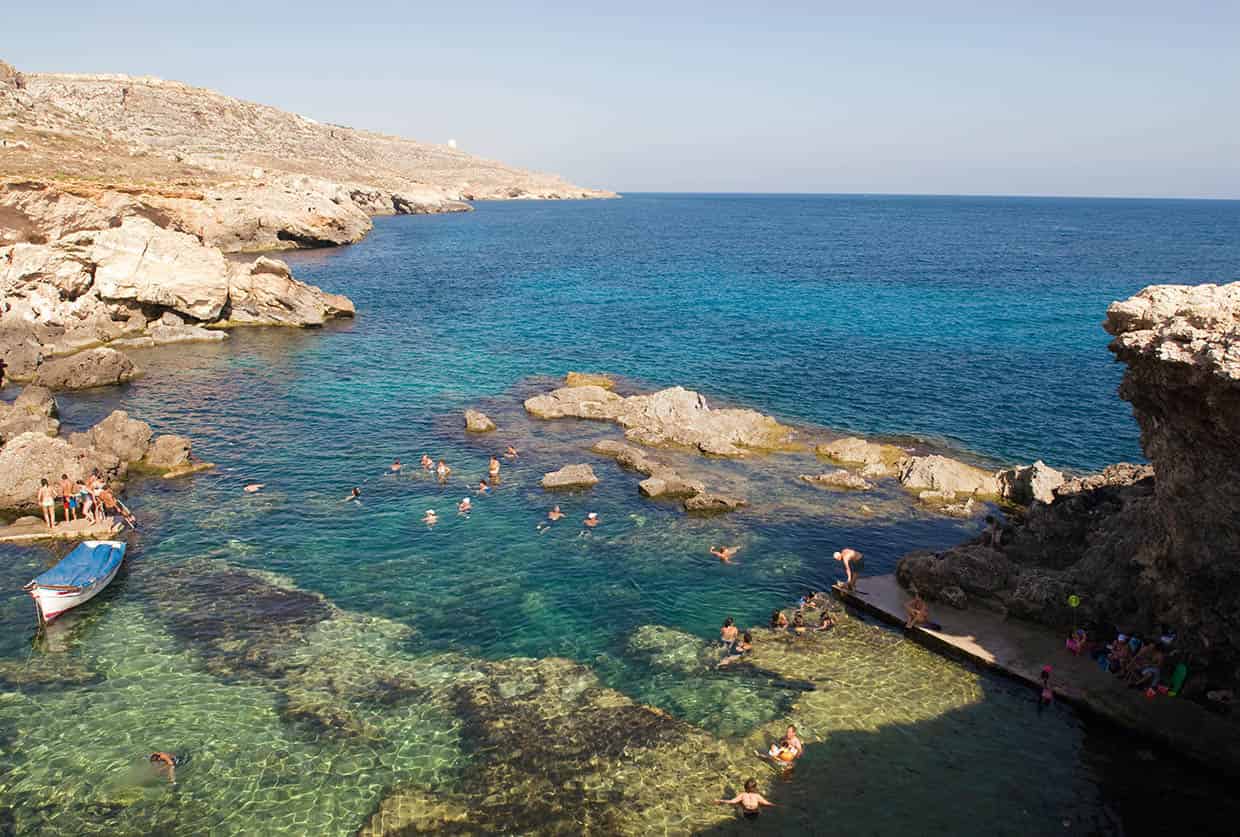
Just west of the Mnajdra temples is Ghar Lapsi ) [map], a popular bathing spot with the locals. After a hot day exploring the ancient temples it is an excellent place to take a dip. There is limited foreshore, but the locals have contrived to make this into a natural lido, with iron steps provided to make the cool clear waters easily accessible. Scuba divers also find its underwater world beautiful.
An aerial view of Ghar Lapsi.
Sylvaine Poitau/Apa Publications
The island of Filfla
The walk to Mnajdra also gives an excellent view of the tiny island of Filfla. This island sits right opposite Dingli Cliffs and is a barren and uninhabited islet that has proved fascinating throughout history. Because of the mysterious way the rock stands in the water and the way the setting midsummer sun catches it, Filfla may have been an integral part of temple ritual and the reason why the temples were built in this exposed position.
More recently, the island was used for target practice by British warships. Local lore has it that two-tailed lizards live here among the unexploded shells. Filfla has been declared a nature reserve but law-breakers, instead of landing, now pass by on boats to shoot the resting migratory birds. Access to it is only given for scientific or educational research and prior permission must be given.
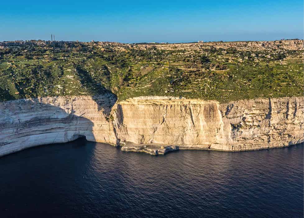
Dingli Cliffs
From Ghar Lapsi turn inland towards Siggiewi, head briefly towards Rabat, then south back towards the coast and Dingli Cliffs ! [map], Malta’s highest point. Eventually the road heading north runs out of asphalt. It’s a good idea to stretch your legs at this point. There are stunning views down some 250 metres (800ft) to the waves below, and also far out to sea. This is one of the islanders’ favourite walking spots.
Close to the Dingli Cliffs is the enigmatic Clapham Junction (Misrah Ghar il-Kbir), where the sharp-eyed may see the best examples of Malta’s famous cart tracks (for more information, click here). It was the remaining traces of these mysterious tracks that supposedly prompted a visiting Englishman to remark that the area reminded him of Clapham Junction, one of London’s busiest train stations.
The Inquisitor’s Summer Palace
Also close by, along a country road down the lush valley to Siggiewi, is the Inquisitor’s Summer Palace. A remarkable and beautiful house concealed on the side of the hill, it was built in 1625 by the Inquisitor, Horatus Visconti, as his summer residence. The elegant building is only one room deep, with all rooms interconnecting. There is a small chapel at one end and beneath its terrace apron are deep caves where the Inquisitor’s staff are said to have lived. For years, the palace lay abandoned. Now it has been renovated and is used by the prime minister as his summer residence (open only occasionally to visitors).
Dingli Cliffs.
Viewing Malta
Buskett Gardens
Buskett Gardens @ [map] is Malta’s largest wooded area – a delightful spot, cool and shady in summer, ripe with oranges in winter. The name “gardens” is something of a misnomer as this is essentially a wood comprising fir, oak, olive trees and citrus groves, and gets its name from the Italian, boschetto, meaning “a place where aromatic firs grow.”
Buskett is particularly popular with picnickers, and for more than 300 years, on 29 June, one of the most popular festas in Malta, Mnarja – the feast day of St Peter and St Paul – has been celebrated here. Its name comes from the Latin word illuminaria, used originally by the clergy to describe the lighting up of the churches of Mdina and Rabat in honour of the two saints.
The day traditionally starts with horse and donkey races on a road that leads up to the Saqqija hill entrance into Rabat. Here, there is a stone balcony on which successive Grand Masters and governors sat to watch the races, and later present banners to the winners. These were then taken by the winners to adorn their parish church.
Tip
December to January is a good time for a stroll in Buskett Gardens as this is when the oranges are picked and their sweet scent permeates the air.
Verdala Palace.
Viewing Malta
Today, excitable crowds gather in Buskett Gardens to cook rabbit, drink wine, and sing and dance well into the night.
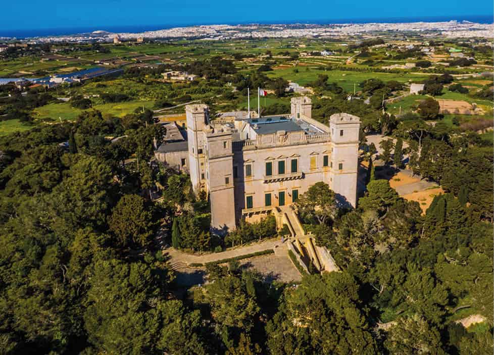
Verdala Palace
On the northern outskirts of Buskett Gardens, on elevated ground surrounded by woodland, is Verdala Palace £ [map], a silent, romantic castle, which is half-villa and half-fort (rarely open to visitors; for information tel: 2122 2966).
Designed by Gerolamo Cassar in 1586 for Grand Master Fra Hugues de Verdale, Verdala may look like a traditional medieval castle, but it was never designed to withstand serious assault. However, its four corner towers are positioned to afford excellent musket fire should it ever be required. The castle has been enlarged and embellished over the centuries – with the British in their later years installing plumbing and sanitation as they converted it into the governor’s family’s summer residence. Today, palace is the President of Malta’s official summer residence.
It has a quiet grandeur, with frescoes in the main room depicting highlights from the life of Grand Master Verdale. There is a fine staircase to one side leading to the roof, from which there is a superb view of the countryside. Within its stone walls is a concealed chamber with rings in the floor and wall where it is said that prisoners were chained and tortured.
The Chapel of St Anthony the Abbot, built in the 16th century, is in the grounds. Viewed from Buskett Gardens below, note the trompe-l’oeil windows painted to create the impression of symmetry.