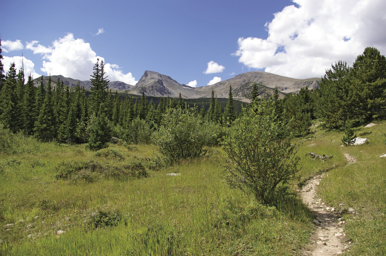
Continental Divide from Buchanan Pass Trail at mile 3.6 (Hike 31)
Introduction
Hikers in the Denver and Boulder area, rejoice! Within about an hour’s drive, you can experience every facet of hiking in Colorado except western canyon country. From open prairies to old ranches preserved as parks in the foothills to crystal clear mountain streams and lakes, you can select a terrain and length to suit you on any given day. With such beautiful public lands so close, you have no excuse to stay at home. Time to take a hike!
The spine of mountains that lie easternmost in Colorado from the Wyoming border to about Castle Rock is known as the Front Range. To confuse everyone, the cities just east of the mountain range are also called the “Front Range.”
Since 1912 people in the Front Range have seen value in preserving land and in wandering about in natural areas to replenish their spirits. As I mentioned in the acknowledgments, I’m so grateful to people over the last hundred years for having the foresight to preserve lands, maintain them, and continue to obtain and care for lands into the future. I often said “thanks” while hiking when a trail would suddenly wind past a subdivision or when a new huge house appeared in the backdrop of an area I had previously hiked. If these lands had not been preserved, I’m confident they would be covered with hundreds of houses by now.
Continental Divide from Buchanan Pass Trail at mile 3.6 (Hike 31)
Because the Denver metro area is roughly 30 by 40 miles, I used the metro-area beltways as the “starting” places for the hour drive. Originally I had not planned to include anything near Colorado Springs, but Cheyenne Mountain State Park opened in 2006 with great trails and I couldn’t resist.
Cities, counties, the state of Colorado, USDA Forest Service, National Park Service, and U.S. Fish and Wildlife Service have all designated lands for both recreation and wildlife preservation from the eastern edge of Denver west to the Continental Divide. Whether you enjoy wildlife, geology, or history, or just want to get away from the hustle and bustle of the city, you can’t go wrong living in Denver- Boulder area. Many people move to this metropolis on the plains because so many outdoor amenities are available in relatively short distances.
For this book I chose a number of my favorite hikes going back thirty years, especially those in Boulder’s Open Space & Mountain Parks and Rocky Mountain National Park. I love high lakes and alpine tundra in particular. Many open space parks with great trails have been established since the early 1990s, and I totally enjoyed exploring new terrain for this book. I also chose a number of hiker-only or hiker/equestrian-only trails because so many hikers I met said they really enjoyed those trail designations. In 2008 I discovered recently opened trails that provide great hiking in Hermit Park Open Space, Bobcat Ridge Open Space, Spruce Mountain Open Space, and Cheyenne Mountain State Park. Thanks to two managers who accompanied me on trails that were not yet open to the public.
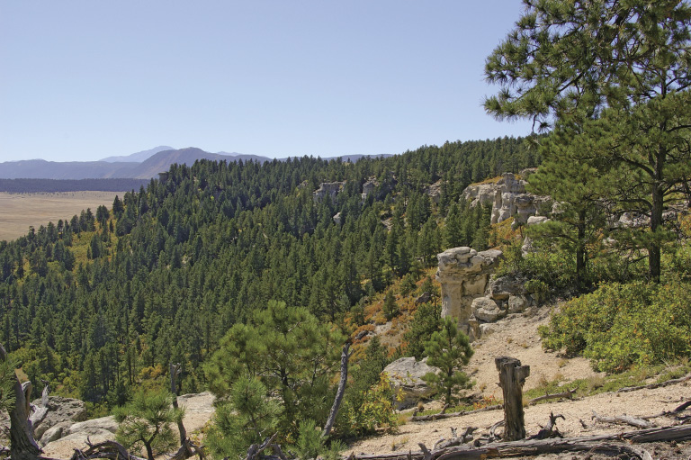
View of Spruce Mountain’s rim and Pikes Peak from Spruce Mountain Trail (Hike 28)
New trails will be opening on Douglas County Open Space and Jefferson County Open Space lands by the time this book is published, and eventually in Staunton State Park near Pine and the newly established Rocky Flats National Wildlife Refuge between Boulder and Golden.
I’ve divided this book into three sections: Plains, Foothills, and Mountains. This division creates three north–south strips, each higher in elevation than the one to the east. In each strip I started with hikes closer to Boulder, and the order of hikes is via which highway you take from Boulder, Golden, or Denver. The strips are useful in determining hiking seasons and winter snow depth. You can hike many of the plains trails year-round except after a major snowstorm. Some shady areas may harbor snow or ice, so be alert. Most of the mountain trails are not snow-free until late June.
Plains hikes include those in “flatter” areas to the east of the foothills. Some hikes climb mesas towering over surrounding lowlands. I enjoy hiking on the plains and the “islands in the sky.” Wildflowers, grasses, and wonderful views—not to mention some spectacular geology and remains of plants and dinosaurs from millions of years ago—reward hikers. The wind blows freely, cleansing my spirit.
Foothills are the lower mountains that rise abruptly from the plains. Mostly covered in ponderosa pine and Douglas fir, these trails offer a variety of steepness and usually provide good viewpoints along the way. Many include historical features, from old railroads to mansions. Others explore former ranch lands with interesting rock formations. Roughly speaking, this strip is east of State Highway (SH) 119, SH 7, and Idaho Springs and west of the “flat” plains.
The mountain hikes take you to beautiful lakes, wonderful wildflowers, and scenic vistas. Roughly speaking, this strip is west of SH 119 and SH 7.
You may wonder why some popular parks or areas are not included in this book. Occasionally a land management agency requested that I not include certain areas due to overuse or user conflicts. With so many options from which to choose, eliminating these areas just made room for other wonderful hikes.
Because of the varied elevation of the three sections in the book, here are some guidelines as to approximate times when trails dry out (from the USDA Forest Service Dillon Ranger District). Check with the listed land management agency for current trail information.
A word about the details in this book: Featured trails were hiked during 2007, with some trails hiked or re-hiked in 2008. The information is as accurate as possible from that time frame.
Trail mileage is as much an art as a science, even for land managers. I used a Global Positioning System (GPS) to obtain the mileage. In some areas, poor satellite reception may have provided less-than-accurate information. Please realize that trail locations and conditions, roads, and signage are subject to change over time. Even trailheads can move, and some trails are rerouted to prevent environmental damage. Finding accurate historical information was sometimes interesting when different books contained conflicting information! I tried to find appropriate Web sites, only to discover URLs change rapidly.
Henry David Thoreau said, “In wildness is the preservation of the world.” Aldo Leopold added years later: “When we see land as a community to which we belong, we may begin to use it with love and respect.” My wish for you is to enjoy hiking and learn about yourself and the world around you to which we all belong. Remember, only we can preserve wildlands for ourselves and future generations.
As you hike these trails that are easily accessible from the Denver–Boulder area, capture part of nature’s spirit and hold it close to your own. Leave a piece of your spirit as well so that no matter where you travel or live, the peace and beauty of this wild country will remain with you forever.
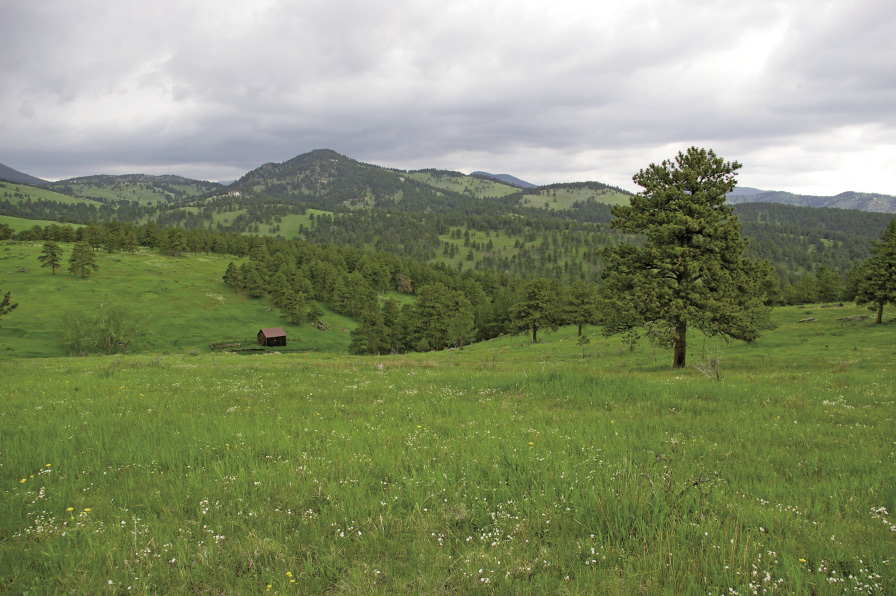
Old barn at White Ranch Park in spring (Hike 20)
Front Range Weather
An interpretive display at the Moraine Park Museum in Rocky Mountain National Park explains: “Climate is what you expect. Weather is what you get.”
Difficult to forecast and prone to change quickly, Colorado’s weather is a wonder in itself. A temperature drop of 10˚ to 20˚F in one hour is not unheard of. Along the Front Range, March and April are the snowiest months, and September is the least cloudy. Snow sometimes buries Denver and the foothills in either September or October and also in mid-May, killing your newly planted garden. The majority of precipitation along the Front Range falls from April through September. The average precipitation in Denver is about 17 inches.
A low-pressure system sitting in Colorado’s southeastern corner often produces the worst weather. The counterclockwise circulation pushes storms up against the mountains, where they may sit for a few days. Another event, typically from November through March, are chinook winds. These warm “snow-eaters” blow over the Continental Divide, picking up speed like a waterfall while descending the east slope. With hurricane force they blast the area between Colorado Springs and Fort Collins. In January 1982, 120-mile-per-hour winds were recorded in Boulder.
Normal high spring temperatures in Denver range from 52˚F in March to 71˚F in May, making hiking pleasant on the plains. During spring the foothills, rising up to 4,000 feet higher than the plains, can be snowy in places and dry in others. You’ll need to ski or snowshoe in the mountains.
Summer brings temperatures in the 80s, 90s, and even 100s to the Denver metro area. Time to escape to the high mountains, where snow usually melts by July 4 and flowers peak in mid-July to early August. Colorado experiences a monsoon starting about mid-July and ending in early September. Moist air combines with the forces that produce thunderstorms, making the afternoon event more a certainty than a rarity. Three problems result from thunderstorms: One is lightning, a killer from above. The second is a flash flood, which can roar out of nowhere, destroying everyone and everything in its path. The third is more subtle—rain in Colorado tends to be cold, and unprepared hikers can become hypothermic very quickly, even in the middle of summer.
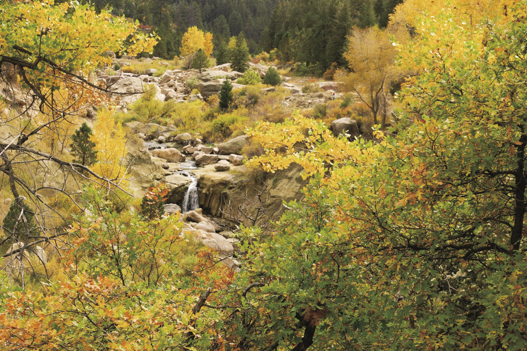
Autumns can be beautiful, with normal high temperatures in Denver ranging from 77°F in September to 53°F in November, a great time to hike and enjoy gorgeous fall colors!
An interesting rule of thumb: For every 1,000 feet of elevation gained, the temperature drops about 4°F. When it’s 80°F in Denver at 5,280 feet, it may be only 49°F at the top of 13,132-foot Mount Flora, the highest point in this book.
Flora and Fauna
The hikes in this book range in elevation from 5,080 feet to 13,132 feet across about 60 miles as the crow flies. In the rain shadow of the Rocky Mountains, the plains are high and dry with about 17 inches of precipitation per year. As you travel west and up in elevation, moisture increases, especially with winter snows. Summer high temperatures may only reach 50°F. With such extremes in a short distance, a wide variety of flora and fauna call Colorado home.
In the high plains around Denver, shortgrass, midgrass, and tallgrass prairie dominates the landscape, depending on elevation and moisture. As the land rises, you pass through mountain shrublands, juniper, ponderosa pine, Douglas fir, mountain grasslands and meadows, mountain wetlands, lodgepole pine, aspen, spruce-fir, limber and bristlecone pine, and alpine tundra ecosystems. Some of these communities favor shady, cooler areas while others prefer hot and dry.
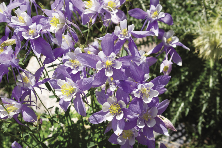
As you hike through different ecosystems, notice what plants and animals live among which trees and the different soil types. For example, aspens grow in moist, protected areas. Bushes such as chokecherry, gooseberry, serviceberry, and snowberry provide browse for mule deer. Grasses and other plants offer good eats for elk, who also scrape the bark off aspens in winter. Black bears often leave claw marks climbing their favorite aspen tree. The pink Wood’s rose, blue, and white columbine (the Colorado state flower), mariposa lily, white geranium, strawberry, and blue lupine are a few of the flowers you’ll see. Keep an ear open for the chick-a-dee-dee-dee call of the mountain or black-capped chickadee.
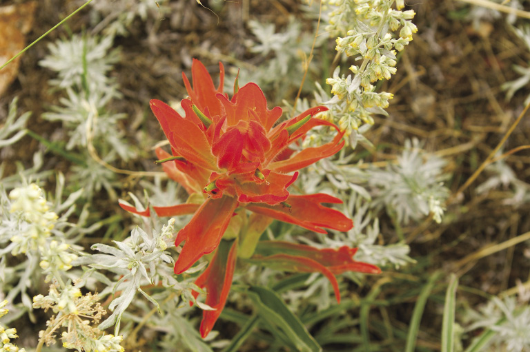
Indian paintbrush
Prairie dogs, mule and white-tailed deer, coyotes, and pronghorns rule the plains. Little critters provide food for coyotes, foxes, eagles, hawks, and even the great horned owl. Elk, mule deer, and black bears live in forested areas, while mountain lions prowl rocky slopes. On cliffs and rocky steeps, mountain goats and Rocky Mountain bighorn sheep somehow survive. Long gone are grizzly bears and wolves. Canada lynx were recently reintroduced in the mountains amid much controversy. You can still see bison at Rocky Mountain Arsenal National Wildlife Refuge, Daniels Park, and Genesee Park.
The plains are mainly grasslands, with cottonwood trees along watercourses. Several types of cactus and yucca can make for painful experiences. Watch out for rattlesnakes, too.
As you gain elevation, animals and plants show their adaptations to shorter summers, less oxygen, colder temperatures, and high winds. Above treeline, you can’t miss the cute little pikas scurrying around with mouthfuls of grasses or the lazy marmots sunning themselves on rocks. Chipmunks, ground squirrels, and marmots will almost attack you, expecting a handout. Please don’t feed them, as they may stop foraging for themselves. Crows, magpies, blue Stellar’s jays with their black crowns, and pesky Clark’s nutcrackers and gray jays (nicknamed “camprobbers”) are easily spotted birds.
Blue columbines, Colorado’s state flower
Fishing in Colorado can be superb. Native cutthroat trout are making a recovery after introduced sport fishes such as rainbow and brown trout almost outcompeted them.
If summer has experienced normal or greater precipitation, mushrooms pop out in August and early September. Many mushrooms are poisonous, while others are edible and incredibly delicious. Don’t pick any unless you know what you’re doing!
Bristlecone pines grow in Colorado roughly south of I-70. These incredible trees live 1,500 to 2,000 years in our state. Between the alpine tundra and spruce-fir or limber pine ecosystems, you’ll find krummholz (German for “crooked wood”). These stunted trees, usually Engelmann spruce, subalpine fir, or limber pine, form tree islands with a few flag trees sticking up. The deadwood on the windward side protects the rest of the tree organism, so please don’t use it for firewood.
The most incredible plants grow above treeline: alpine forget-me-nots, sky pilot, moss campion, old-man-of-the-mountain, alpine avens, Parry’s clover, and more. Each flower has its own particular niche, whether on wind-blown slopes or next to sheltering rocks. If you have a chance, learn about this incredible land above the trees and what you can do to protect it.
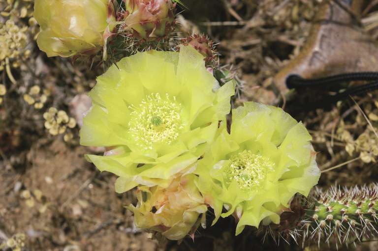
Yellow blooms of prickly pear cactus
Leave No Trace
Everyone needs to pitch in to keep our Earth clean, beautiful, and healthy. Please follow Leave No Trace practices whenever you’re outdoors. Visit www.LNT.org for more information.
Leave No Trace Principles (from www.LNT.org)
Please understand and practice these principles on every hike and backpack.
“The Leave No Trace program establishes a widely accepted code of outdoor ethics to shape a sustainable future for wildlands. Originating in the 1970s with the USDA Forest Service, Leave No Trace was developed to help recreationists minimize their impacts while enjoying the outdoors. In 1991 the Forest Service teamed with the National Outdoor Leadership School (NOLS) and the Bureau of Land Management as partners in the Leave No Trace program. NOLS, a recognized leader in developing and promoting minimum-impact practices, began developing and distributing Leave No Trace educational materials and training.
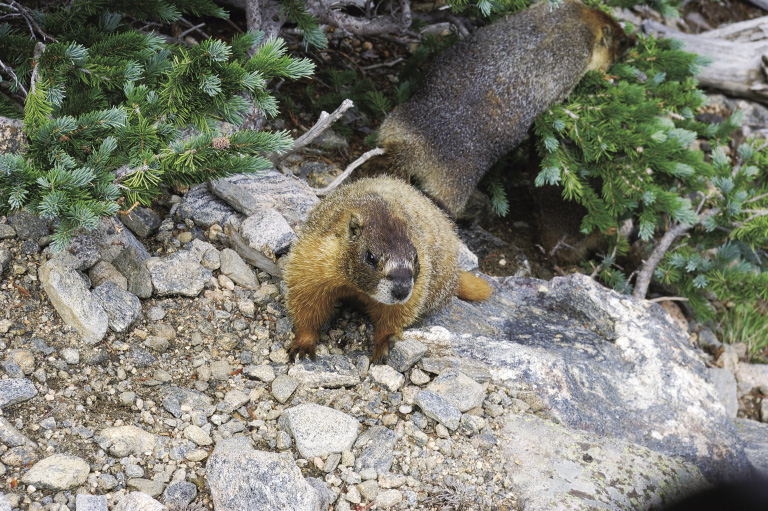
Yellow-bellied marmot
Today, the nonprofit organization the Leave No Trace Center for Outdoor Ethics established in 1994, manages the national program. The Center unites federal land management agencies—the USDA Forest Service, National Park Service, Bureau of Land Management, and U.S. Fish and Wildlife Service, with manufacturers, outdoor retailers, user groups, educators, and individuals who share a commitment to maintaining and protecting our natural lands for future enjoyment.”
For further information call the Center for Outdoor Ethics at (800) 332-4100, (303) 442-8222, or visit www.LNT.org.
Green Tip:
Keep your dog on a leash unless you are certain it can follow your voice and sight commands. Even then, keep the leash handy and your dog in sight. Do not let it approach other people and their pets unless invited to do so. Some people are afraid of all dogs. Even if your dog is usually well-behaved, it may suddenly act differently around strange people.
Falls on Cherry Creek in Castlewood Canyon State Park (Hike 11)
Leave No Weeds
Noxious weeds can be harmful to wildlife. These weeds tend to crowd out our native flora, which in turn affects animals and birds that depend on them for food. Yes, just like birds and furry critters, we humans can carry weed seed from one place to another. To minimize the spread of noxious weeds:
Learn to identify noxious weeds and exotic species. The Colorado Weed Management Association is a good source of information; check them out at www.cwma.org.
Regularly clean your boots, tents, packs, hiking poles, and vehicles of mud and seeds. Brush your dog, horse, goat, or llama to remove any weed seed. Avoid camping and traveling in weed-infested areas.
Getting Around
Public transportation in Denver and Boulder is mostly via Regional Transportation District (RTD) buses or light rail. While you can take a bus throughout both cities and even up to Nederland, Lyons, Parker, Evergreen, and Conifer, getting to the trailheads in this book unfortunately requires a vehicle. For information on RTD routes, browse www.rtd-denver.com just in case new stops and routes are developed. You can also call them at (303) 299-6000 or (800) 366-7433.
Area Codes
The Front Range area of Colorado is split into three area codes. The Denver metro area and towns roughly up to the Continental Divide use 303 and 720. This includes the area from Castle Rock on the south to Longmont on the north. For Colorado Springs and points south and east and somewhat west, the area code is 719. For the rest of the state, including Loveland and Fort Collins, the area code is 970. Most people find the division of these area codes quite confusing.
Cell Phones and GPS Units
A word of caution: Cell phone coverage is lacking on many of the trails and even some of the state highways mentioned in this book. On a few hikes, drainages are narrow and GPS units have trouble connecting with enough satellites for good readings.
Road Information
In Colorado, call the Colorado Department of Transportation (CDOT) at (877) 315-7623; in the Denver metro area or out-of-state, call (303) 639-1111. Or visit them at http://cotrip.org for road conditions, closures, and construction status.