View out to the heads
WALK: 8 km return, approximately – longer or shorter depending on where you turn around
TIME REQUIRED: 3 hours
BEST TIME: A blue-sky day
GRADE: Easy
ENVIRONMENT: Outstanding views of Sydney Harbour, banksia heathland, angophora woodland and Sydney sandstone
BEST MAP: Walking Tracks of the Middle Harbour Valley and Northern Sydney Harbour Foreshore Sheets 3 & 4, STEP Inc
TRANSPORT: Several bus routes can deliver you to the south end of Beatrice Street, Clontarf; a short walk from the beach: www.131500.com.au
TOILETS: At Clontarf Reserve at the start of the walk
FOOD: Seaforth shops, 2 km from Clontarf; Clontarf beach has a kiosk
TIPS: In summer, bring your swimmers and a snorkel and mask

 This delightful route goes through one of the largest intact areas of bush on Sydney Harbour, offering some truly stupendous views over North and South heads, Aboriginal engravings and some delightfully quiet stretches of sand.
There are a few lovely spots on Sydney Harbour where the bushland has survived relatively unscathed – places such as Balls Head, Kelly’s Bush and Berry Island. In some places Aboriginal engravings can be seen. The area between Clontarf and Forty Baskets beaches has one of the largest remaining sections of bushland. It is part of the very popular Spit to Manly walk, which is a wonderful 10 km classic and heavily used on weekends.
This slightly shorter version picks the eyes out of that walk, starting and finishing at peaceful Clontarf Beach (with adequate parking, toilets, a picnic area, playground and pleasant swimming), and includes a diversion to a 100-year-old lighthouse.
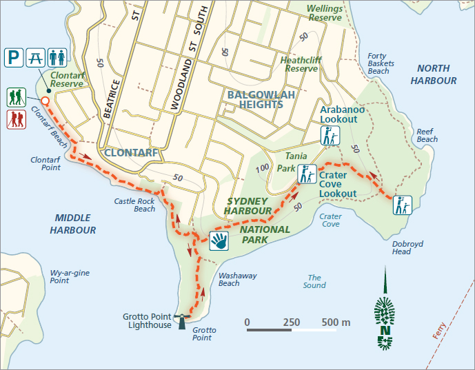
Facing the water at Clontarf Reserve, head left along the beach. At high tide, you may have to wade past a few waterside houses, or backtrack and walk along the parallel road. There is room to walk past when the tide goes out.
At the end of the sand, the track goes uphill at Clontarf Pt, past a series of lichen-stained sandstone boulders, overhangs, creeks and ferns. The vegetation is a little weedy through here, but don’t be disheartened, there are some lovely sections to come. A few tracks head off to the right to scraps of sand, and if the water is clear, there can be some excellent snorkelling around some of the little headlands and coves. A few other small tracks head off up steps to the left, but most of these just end at houses, so stay on the obvious route.

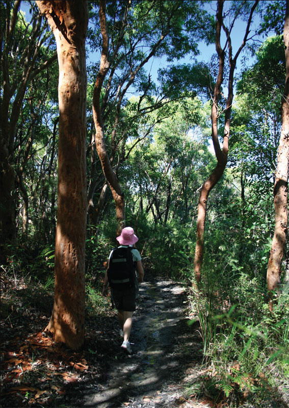
Angophoras or smooth-barked apples
The only confusing part of the route is near Castle Rock Beach, when you come to a T-intersection, with unclear signage. Going left will take you uphill to a road. Instead, dogleg right towards the beach, then left after 20 m to continue on the route. You can also pop down to the water to enjoy the little beach.
The next section is lovely. Called the Castle Rock Track, it features large sandstone caves, and some gorgeous smooth-barked apple trees, or angophoras. These common Sydney trees, sometimes also called Sydney redgums, have vibrant pink or orange trunks and often have contrasting lime-green bracken growing around their bases, which seems to bring out their colours even more.
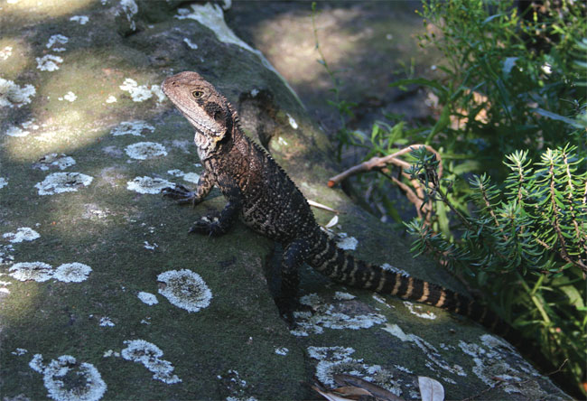
At the next track intersection (after a little jig uphill), deviate from the Spit to Manly Walk by turning right and following the rugged 500 m track, through banksia tunnels and angophora woodland, down to the stumpy white lighthouse at Grotto Pt. It was built in 1910–11. Some quite friendly eastern water dragons inhabit the rocks and bushland around the lighthouse, and it’s quite easy to get a close look at them.

Eastern water dragon
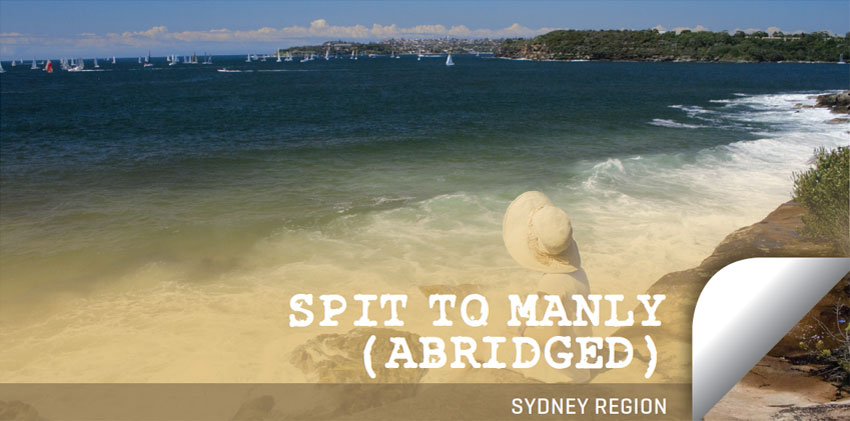
After a break, head two-thirds of the way back up the Grotto Pt side track, and take the unmarked track off to the right. It heads east, down steeply for 100 m or so to an unfenced cliffline, above waves crashing onto Washaway Beach. It’s a lovely little-visited spot to sit and observe the sailboat races and the splendour of the harbour opening.
From here head back up and right onto the main track and after another couple of hundred metres you’ll see the Grotto Pt Aboriginal engravings on the right-hand side. There are kangaroos, fish, boomerangs and spirit figures to pick out – although in the middle of a summer’s day they may be hard to spot (most fainter Aboriginal engravings are easier to see when the sun is low in the sky or after rain).
Continue uphill, through some lovely bushland with boardwalks installed to protect the coastal wetlands. You can keep your eye out for flannel flowers, fairy-wrens and firetails, but it might be hard to focus on these when the views of the harbour get better and better. At one point a rock platform gives an ideal eyrie to view the water, and a little further on you’ll find the fenced Crater Cove Lookout. Near the very top of the hill a track heads off to the left to Arabanoo Lookout, but the views there really aren’t any better than Crater Cove. Continue along the main track a little further. It starts to go downhill and soon you’ll reach another lovely rock platform with widespread views over Dobroyd Head, Manly and North Head. The track keeps going downhill, to more delights such as Reef Beach and eventually Forty Baskets Beach, but this is as good a place as any to turn around if you want to get back to Clontarf. Just head back the same way you came, without the detour to Grotto Pt Lighthouse, and enjoy a final swim at Clontarf. The rest of the Spit to Manly walk can wait for another day.