
Intricate designs in white ochre
WALK: 5 km loop
TIME REQUIRED: 1.5 hours
BEST TIME: Cobar’s tourist season is considered to be Easter through to the October long weekend (cooler months)
GRADE: Moderate
ENVIRONMENT: Stony arid country with open woodlands and grasslands
BEST MAP: National Parks Back O’Bourke, National Parks and Wildlife Service
TOILETS: Pit toilet at the start of the walk
FOOD: Cobar (an hour’s drive away) is a thriving mining town, with large supermarkets, service stations, takeaways, cafes, bakeries and restaurants
TIPS: To take good photos, look for the camera holes in the cages that protect the artwork
 This site has perhaps the densest area of Aboriginal rock art in the state, with an extraordinary 1300 motifs within a few hundred metres.
Formerly a sheep station, the Mt Grenfell Historic Site was hidden from most white eyes until the 1960s. It is an amazing concentration of Aboriginal rock art.
This little loop walk passes the three caves with their layer upon layer of art, and is well worth the hour-long drive from Cobar. There is no camping at Mount Grenfell though, so be prepared to travel back again at the end of the day.
First travel 40 km along the sealed Barrier Highway, west of Cobar, then turn right onto the marked dirt track. This road should be open to sedans for most of the year, but can become deeply rutted or impassable after rain. As in all western parts of the state, take particular care if driving in the early morning or late afternoon, as red kangaroos may well bound in front of your vehicle. Female reds are more of a bluey-grey, and are often called ‘blue flyers’. Other animals you are likely to encounter include feral goats, gnawing many of the trees to head height or higher, gaily coloured mulga parrots, emus and butcherbirds. The long grasses are also home to many snakes.
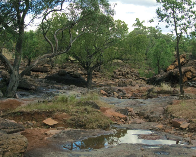
Rocky landscape near the artworks
After 32 km of dirt, you will come to the carpark, and a pit toilet. There is no reliable drinking water here, so make sure to bring your own.
Previously, the road went another kilometre closer to the artworks, but it has been gated off, so the walk starts with a very easy stroll along the old road to the old parking area, with a picnic table and some interpretive signs.
The Ngiyambaa Walkabout track leads off to the left here, and ascends slowly through the sandstone country to the top of the ridge. You will walk through a woodland with red and yellow box trees, wilga, mulga, white cypress, grey mallee and spear grass.
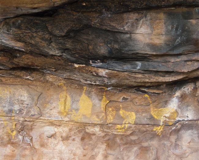
Emus in yellow ochre
The top of the ridge provides views of the 73 500 square kilometre Cobar Peneplain, stretching out in all directions. You should be able to pick out some mining infrastructure in the distance.
From here the track winds down to the creekline, and the first of the three caves that are covered with paintings, in red, white and yellow ochres. There are emus, kangaroos, dancing figures, handprints and some intricate abstract designs thought to relate to the Brewarrina fish traps, some 200 km away.
You will immediately notice that the ambience of the area has been destroyed by the installation of large cages over the artwork. This has been done primarily to protect the artwork from the goats that would otherwise use the caves for shelter, but also as protection from vandals. Thankfully the builders installed some camera holes along the fences, for those who want a clear shot.
A dripline of rubber sealant has also been installed to prevent water from affecting the painted surfaces.
As in large art sites in Arnhem Land, the 1300 motifs have been painted on top of each other over time, and it is worth spending some time looking deeply into the art in each cave before moving onto the next. The caves are all within a 300 m stretch.
Just nearby (on a marked, short deviation) is a little permanent waterhole. Although filled up with silt now, it would have been maintained by hand for thousands of years, providing a sure supply for countless generations of Ngiyampaa who used this area.
Once you have finished your contemplations at this special spot, it is just a short stroll along the track back to the old picnic area, and then down the old road back to the car.
The well-defined track to the mountain
WALK: 6 km return
TIME REQUIRED: 2 hours
BEST TIME: Bourke’s tourist season is considered to be Easter through to the October long weekend (cooler months)
GRADE: Moderate
ENVIRONMENT: Arid zone rocky mountain, white cypress forest
BEST MAP: National Parks Back O’Bourke, National Parks and Wildlife Service
TOILETS: Pit toilet at the start of the walk
FOOD: Bourke (an hour’s drive away) has supermarkets, service stations and a pub
TIPS: Take the day to explore the other parts of this national park, including some excellent Aboriginal art at the Mulgowan precinct; bring plenty of water
 This arid-zone walk is in a stunning red-dirt national park, and with such flat land around, it doesn’t take long to get a great view. The walk climbs to the summit at 500 m, from the surrounding plain at an elevation of about 200 m.
This is one of the walks in this book where the destination isn’t as important as the journey. Gundabooka National Park is a stunning combination of bright-red dirt and mulga avenues off the sealed Kidman Way, about 50 km south of Bourke, and is well worth visiting. It goes from the banks of the Darling River, across vast plains to the Gunderbooka Range. You will almost certainly see emus, red kangaroos and the bright green flashes of mallee ringnecks, as you head to the imposing Mt Gunderbooka.
From Bourke, the national park is situated just beyond the black soil country on the Kidman Way. If you are watching for it as you drive, you will notice the vegetation very clearly change from open plains, to thicker, higher vegetation when you hit the red soil country. The turn-off to the national park is clearly signposted. Once off the highway, it is all dirt road, but it should, with care, be manageable in sedans as long as it hasn’t been raining. (The sandy soils can become very slippery after rain.) Higher clearance vehicles are preferable.
About 7 km off the highway, you’ll see the turnoff to Mulgowan, which is an excellent Aboriginal art site. The Ngemba people have visited this area for many thousands of years, eating wild oranges and limes, bush bananas and the seeds of nardoo. The outstanding art here connects both to Mt Grenfell further south, and Brewarrina to the east.
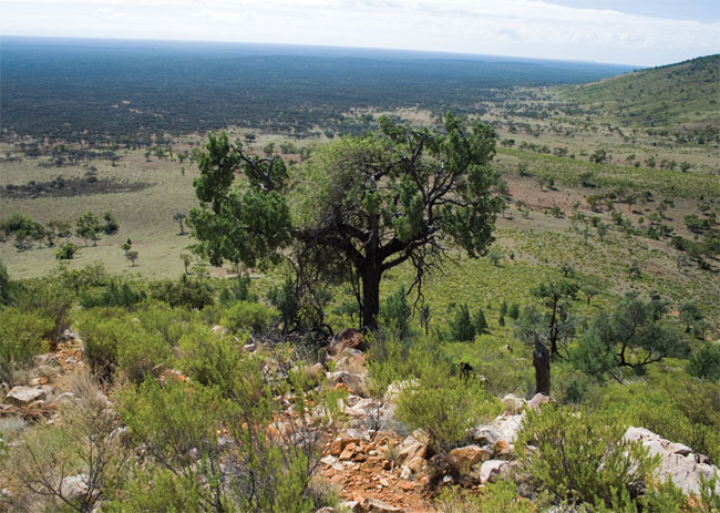
Views of the long, flat plains
Keep going along the main track for another 35 km, passing the turnoff to Dry Tank. Most of this road is excellent to drive on, although there can be some corrugations on the corners. Keep an eye out for emus, running with their feathered skirts bobbing up and down.
Turn left towards the signposted Bennets Gorge, which is a 12 km rough track to the picnic area. Along the track you will get some views of the magnificent massif that you are about to climb, with its orangey sandstones. There is a pit toilet and two gas barbecues at the carpark. If you are keen to have a picnic before you start and don’t need the barbecues, then walk a few hundred metres up the track, and there is another picnic table under a large shady tree, which has uninterrupted views of the mountain and the plains.
The walk starts with a wide track that heads up a slight rise for about half a kilometre up to two bench seats and interpretive signage. You’ll walk through yellow arid-zone grasses, and later pass box trees and bloodwoods towards the base of the mountain.
Past the bench seats and signage, the track can become a little vague, so it’s worth remembering where the route goes: to the base of the rounded hill to your right, then up over the saddle at the top of the gorge, and to the top of the mountain. It can look a little daunting, but it isn’t that difficult and most people should be able to manage. Whenever you need a breather, take a rest under one of the twisted white cypress trees and enjoy the vast vistas behind you.
The track initially crosses a creekline and across to the base of the mountain. It then winds up the rounded hill like a mulga snake. Because the surrounding country is so flat, you get great views from very early on in the climb. The path is literally a goat track, and feral goats will probably accompany you at least some of the way. Graziers in the district round up the goats for meat.
Every 50–100 m there is a track marker (an eagle), which can be reassuring. It is quite easy to deviate off the track, particularly on corners, but most of the dummy paths peter out after a few metres, so it is easy to retrace your steps and find the main track.
At the top of the ridge the track flattens out considerably and heads through a thicker cypress forest. There are a few clearings here that provide excellent views, particularly to the other side of the mountain.
The track keeps winding gently up to the actual summit. Unfortunately the summit itself is a little disappointing. It has a large cairn, but because it is quite flat, and the trees are 3–4 m high, there are no panoramic views. It’s worth sitting for a few minutes and having a drink though, and you may see a whole variety of birds, including wedge-tailed eagles overhead, inland thornbills in the trees, splendid fairy-wrens on the ground and the gorgeous painted honeyeaters in the shrubs.
Return the same way, but it is worth deviating a little from the track on the way down to get to some of the obvious rocks near the edge of the gorge, as they provide a much clearer view.
As you cross the saddle and along the ridge, have a look down to the gully floor on your right, where a large boulder has been split asunder and is standing upright like an opened mussel.
The walk isn’t particularly long, but as you will need to take care on the jagged, slippery and winding path on the way down, you will need at least two hours.
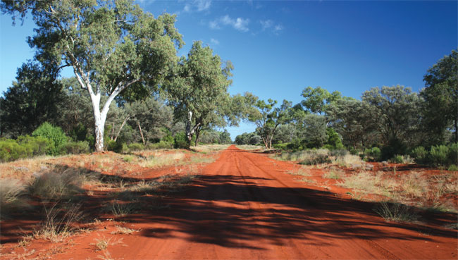
The sandy track into Gundabooka National Park
Views of farmland from the rocky escarpment
WALK: 2.5 km loop
TIME REQUIRED: 1 hour
BEST TIME: Cooler months, particularly spring
GRADE: Moderate
ENVIRONMENT: Rocky intermittent creek gully, cliffs with views, sparse pine woodland
BEST MAP: www.environment.nsw.gov.au/nationalparks/parkHome.aspx?id=N0008
TOILETS: Pit toilet at the start of the walk
FOOD: Griffith, about 40 minutes away, is a large town with many options including lots of fresh produce, with roadside stalls in season
TIPS: Take a half-day to explore the rest of the unusual Cocoparra National Park and keep your binoculars at the ready
 This attractive little gorge is dry for much of the year, but can have pools that provide an oasis for a host of birds and other animals. The walk wanders through the gorge, with its towering red cliffs, then finishes on top of the cliffs, looking down at the gorge and across the plains.
The ranges of 13 000 ha Cocoparra National Park sit prominently above the irrigated farming country near Griffith. It’s the sort of national park that needs a bit of time to be appreciated, as its beauty isn’t immediately apparent when you arrive. Much of the park was used for cropping and grazing before it was declared in 1969. This is one of several short walks in the park.
To get there, head out past De Bortoli Wines towards the ranges. The easiest way is to take Myall Park Rd from Yenda, and follow it until you reach the Mount Bingar Road, a well-graded dirt track that heads off to the right (signposted to the national park). It will turn sharply left, then right, then left and right again before running into a T-intersection at the Whitton Stock Route. Here there is a park map and information board, and if you turn left you’ll soon find the turnoff to Jacks Creek. There is a picnic area with free gas barbecues and a pit toilet, but no fresh water.
There are some more information signs at the beginning of the walk, which heads directly out from the carpark. You’ll go through groves of tea trees, acacias and grevilleas, and if you’re observant, may spot nodding blue lilies and orchids and some of the park’s other 450 plant species.
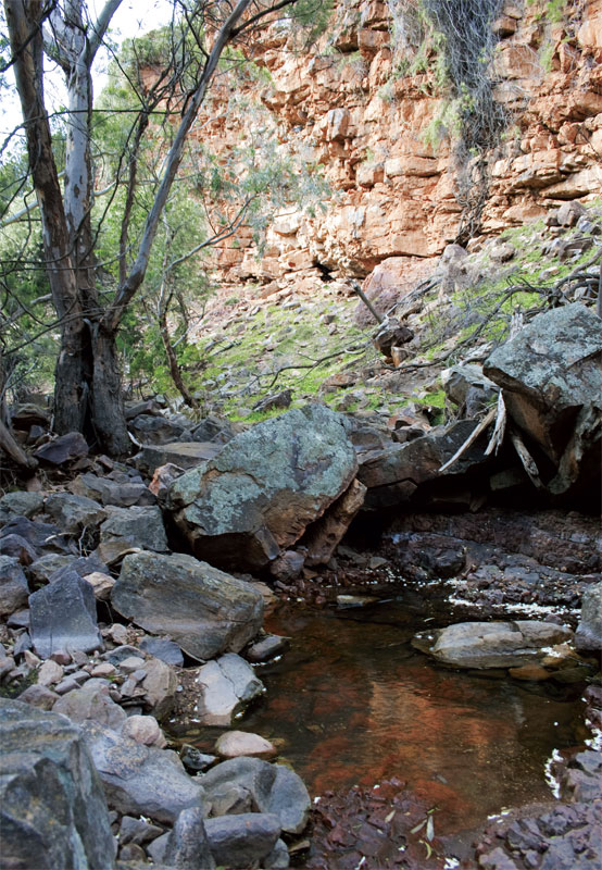
Waterholes can be a magnet for wildlife
Some 140 bird species have also been spotted here, so keep your eyes peeled and binoculars out, and you may spot species as diverse as budgies, grey fantails and enormous wedge-tailed eagles.
The track can be walked in either direction, but it seems sensible to go straight through the gorge early on, walking the loop in an anti-clockwise direction. Fairly soon the track becomes very rocky and sandy as it winds through the gully, which will almost certainly be dry. The track can become a little hard to follow at times, but it basically follows the bottom of the gorge. Either side of you, stunning orange cliffs, up to 44 m high and made up of sedimentary rocks formed 400 million years ago, hold kurrajong trees and wonga vine.
Feral animals have made the area a bit of a home, so as well as kangaroos, you’re likely to see mobs of goats, and maybe even foxes.
After about 700 m, the track heads sharply up to the left, up among the cypress pines. Other trees on the ridge include currawang (an acacia), Dwyer’s mallee gum and hill tea tree.
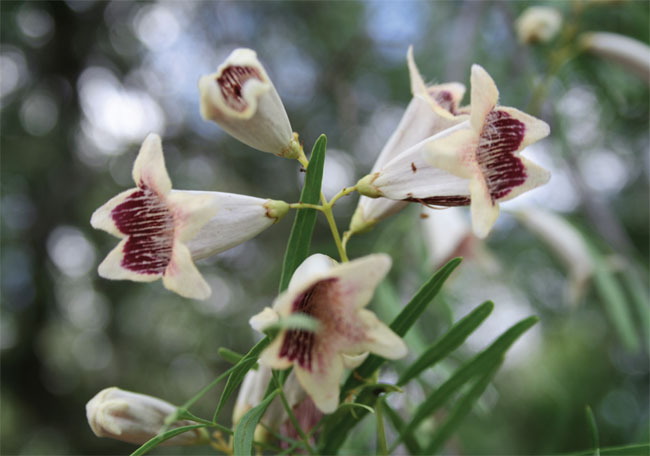
Wonga vine
At the highest point, the track is 100 m above the carpark. Once up the hill, the route heads along the edge of the gorge, and there are three great spots to look down into it, and then over the trees to the wide open plains beyond. There’s also a bench beside a little soak in some grassy woodlands that is reportedly a good birdwatching spot.
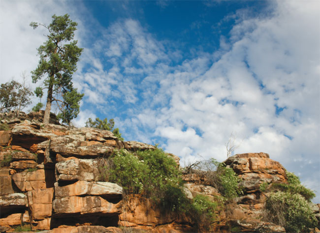
Soon the track winds back down the hill, and you’ll rejoin the original track just near the carpark.
Butterfly leaves woolly ragwort
WALK: 6 km return
TIME REQUIRED: 2 hours
BEST TIME: Cooler months
GRADE: Moderate
ENVIRONMENT: Arid zone mountain with views over vast plains, cypress forest, rare vegetation
BEST MAP: This book
TOILETS: There is a flushing toilet at the start of the walk
FOOD: The Rock township, about 3 km down the road, has a general store
TIPS: The walk is longer, but not nearly as steep, as it looks
 Punching more than 300 m above the surrounding plains south-west of Wagga Wagga, this mountain offers outstanding views. As a bonus, you’ll encounter the world’s largest stand of a rare and unusual plant species.
About half an hour’s drive south-west of Wagga Wagga, you’ll find the cute little town of The Rock. In one of the great legends of Australian idiom, it was once called Hanging Rock, but the bit that was hanging supposedly fell off, and the town changed its name to The Rock.
On the drive from Wagga, through low-lying sheep country, you’ll see the mountain called The Rock looming more than 300 m over the plains. It has been a special Wiradjuri site for many thousands of years, used for male initiation ceremonies.
Turn into the township and then past it for another 3 km to the signposted turnoff to The Rock Nature Reserve. The short dirt road to the carpark was in poor condition at last check, so take care in sedans.
At the carpark you’ll find gas barbecues, picnic tables and flushing toilets. The start of the walk is signposted and obvious.
Although the route up the mountain looks steep and short, track planners seem to have worked hard to take you the easiest way up possible. The walk, called the Yerong Nature Trail, goes along the base of the mountain, then slowly up the front side and finishes right around the back, and the rise is rarely strenuous.
As you walk through the cypress forest at the base of the mountain, keep an eye out for the spectacular glossy black-cockatoo with its fire-engine-red tail feathers. Other birds to look for include babblers, red-capped robins, tree creepers, as well as the ubiquitous currawongs and peewees (or magpie larks). Orange and black butterflies will no doubt flit around, and you may even be lucky enough to spot a yellow-footed antechinus – a small mouse-like marsupial – darting through the scrub.
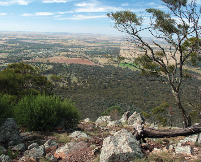
View from the summit of The Rock
You’ll walk about 1.5 km before the track starts climbing, and then it is a fairly steady rise to the top, with some views over the plains. There are stairs and occasional short-cuts through the switchbacks, but try to stay on the main track.
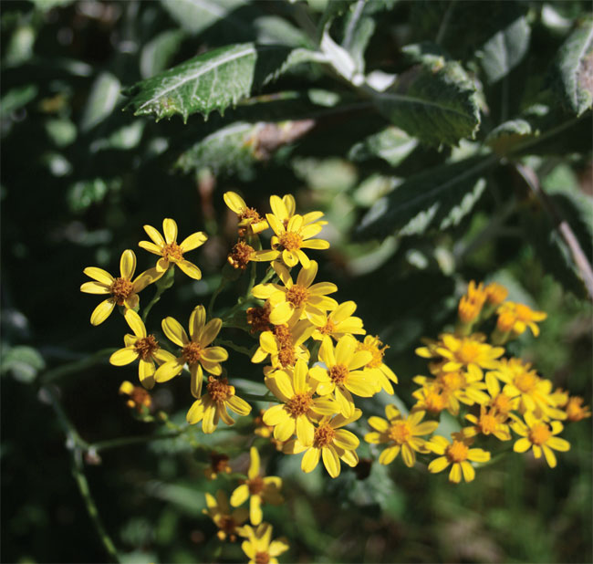
Woolly ragwort flowers
Towards the start of the main cliff line, you’ll encounter one of the great treats of this walk – the largest stand of woolly ragwort anywhere in the world. This unusual, yellow-flowering shrub is found at the base of the cliffs and has large leaves that are woolly on the underside. Make sure you stop and feel them. The woolly texture is an insulating layer that minimises water loss.
Towards the top, the primary track makes a U-turn to the right, and is slightly hidden by a large boulder. It is a little confusing as another track goes straight ahead. However, if you miss the turn, it doesn’t really matter, as from here you should be able to pick your way to the summit. The straight-ahead track goes to a rocky spine on the back side of the mountain, with lichen-covered rocks, and it is easy enough to follow this to the top.
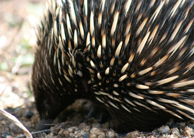
Echidna
At the top you’ll find a bricked in fire-ring, and although the trees prevent a full 360-degree view, it is a gorgeous place to wander around and admire the vista to the horizon on every side. Enjoy a drink and some food and a break, before heading back down.
Summit of Mt Exmouth, with view over Warrumbungle National Park
WALK: 20 km return with short loop
TIME REQUIRED: 6 hours
BEST TIME: Spring
GRADE: Hard
ENVIRONMENT: Volcanic lava mountain, wildflowers, big xanthorrhoea forest, 360-degree views from the highest mountain in Warrumbungle National Park, and a rock arch
BEST MAP: Warrumbungle National Park, National Parks and Wildlife Service
TOILETS: There is a pit toilet at the start of walk; the park visitor centre, about a 5-minute drive away, has flushing toilets
FOOD: Coonabarabran, a 30-minute drive away, is a large town with restaurants, supermarkets, pubs and takeaways
TIPS: Mt Exmouth is an awesome destination, but the walk in and out is mainly on a very long and fairly uninteresting fire trail. Therefore, walkers may prefer to add an out-and-back addition to the Grand High Tops loop (see pp 329–34), which avoids the bulk of the ascent (as you will already be up fairly high).
 The highest mountain in Warrumbungle National Park at 1206 m, Mt Exmouth sits slightly to the west of most of the other topographic features; a hulking, looming presence. Home to wedge-tailed eagles and an extensive forest of xanthorrhoeas on its south side, it provides an incredible view over the park and the plains beyond. The walk in ascends nearly 800 m, most of it on a fire trail.
Done the Grand High Tops? Belougery Split Rock? Looking for another Warrumbungle challenge? After testing the resolve and dedication of walkers, this epic route will reward a thousand times over with the views from the top and the delightful surprise on the southern approach.
Start at the Split Rock carpark, taking the main fire trail that leads south. Ideally you will do this walk in spring, which will provide lots of wildflowers to look at as you climb steadily upwards – in particular bright yellow wattles. The Warrumbungles are at the junction of wetter eastern and dryer western vegetation communities so have quite diverse plant life. Apart from the flowers, the birdlife and the chance of seeing a koala, there isn’t much to break the trudge, and the hulk of Mt Exmouth on the right of the track may even appear to grow higher.
About halfway up the fire trail, you’ll come to the Burbie Spring campsite. There is a pit toilet and even a tap here (connected to the spring). Lots of Aboriginal artefacts have been found in this area, but all must be left in situ.
At the top of the Burbie Fire Trail, you’ll find another small campsite, Danu Gap. From here the management trail continues straight ahead, the small Mt Exmouth foot track goes right (to the west) and the Western High Tops track goes to the left. It is well worth popping along the Western High Tops track for a kilometre or so, across a scree slope, and then ducking up to see Cathedral Arch – a huge rock archway, with a glorious white gum standing on top.
Head back to Danu Gap and then up the Mt Exmouth track. From here the walk is increasingly interesting as it skirts right around the southern side of the mountain before coming up it on the western side. You’ll soon encounter the extensive and beautiful xanthorrhoea forest, with the shaggy-haired trees almost covering the steep hillside on either side of the track. There are a couple of tricky ledges to walk along before the track curves around and up to the ridge line.
A false summit invites exploration on the left, but the main track continues right, past some spinifex and more xanthorrhoeas to the summit cairn and the spectacular views in every direction.
Retrace you steps until the final few kilometres, when you can detour along the Burbie Canyon track to the left. Although not a high-walled canyon, it is a lovely spot, with abundant birds, kangaroos and, unfortunately, feral goats. This track meanders across grasslands before bringing you out to the main road. Then turn right and walk along the road for a bit over a kilometre to get back to the Split Rock carpark.
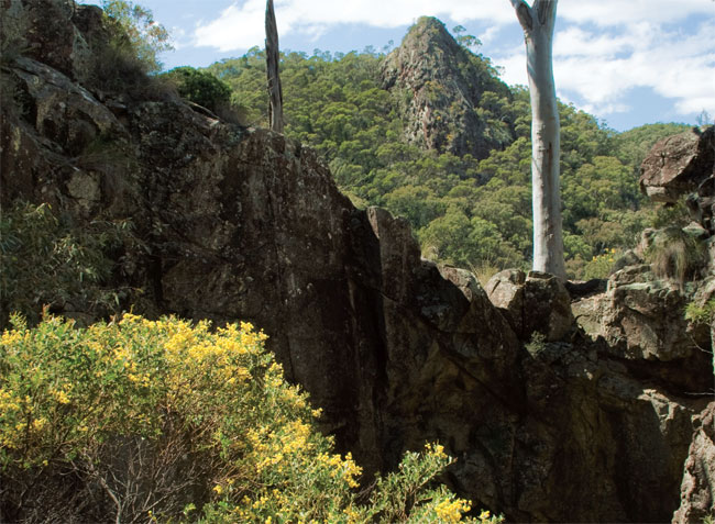
Cathedral Arch
View from the carpark
WALK: 4.6 km loop
TIME REQUIRED: 2.5 hours
BEST TIME: Late afternoon, clear weather, spring
GRADE: Hard
ENVIRONMENT: Volcanic lava mountain, wildflowers, black cypress pine woodland, 360-degree views
BEST MAP: Warrumbungle National Park, National Parks and Wildlife Service
TOILETS: There is a pit toilet at the start of walk; the park visitor centre, about a 5-minute drive away, has flushing toilets
FOOD: Coonabarabran, a 30-minute drive away, is a large town with restaurants, supermarkets, pubs and takeaways
TIPS: The peak is a great place to see the sunset, but you will need to carry a torch and be careful getting down after dark
 This fantastic walk takes you 350 m up from a grassy woodland area where kangaroos graze, through black cypress forests to the top of a dramatic, split volcanic feature with impressive views on all sides, including of the rest of the Warrumbungles. The top section is listed as ‘dangerous with rock-climbing involved’ but don’t let that scare you off, as it is mostly easy rock scrambling with the route marked well with reflective markers.
Belougery Split Rock towers over the Split Rock carpark, its twin volcanic spires separated by a vegetated area. This loop walk reaches the top of the higher spire, and you can do it in either direction. Anti-clockwise (as described) gets you to the summit fastest, but if you are going to be out after dark, it is recommended you do it in the other direction.
Take the fire trail south out of the carpark. It stays flat for a little while, passing some glorious western golden wattle with flowers the iridescent colour of canola. The dominant tree species here is black cypress pine.
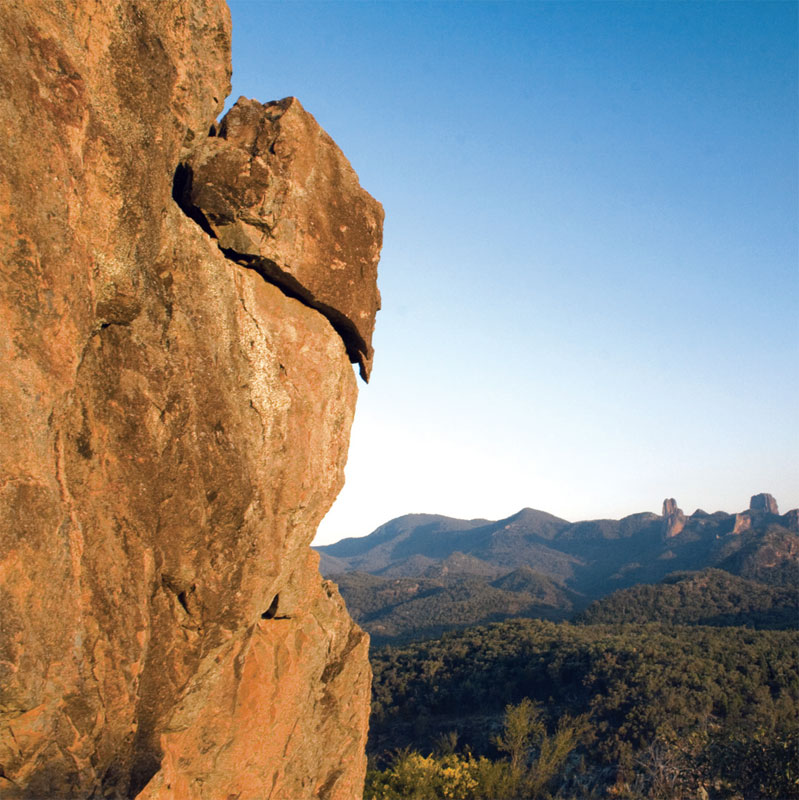
Volcanic rock
After a few hundred metres, the track splits, with the main fire trail continuing to Burbie Spring and up to Mt Exmouth (the highest mountain in Warrumbungle National Park), and a smaller track heading left, up the creek line to Split Rock. Take the little track which snakes steeply up to the saddle, and then up the ridge to a steel stairway. A gate and sign warns that the track above is steep and dangerous, but as long as it isn’t wet, most people should find it a fun adventure: the climbing is not difficult, steps have been cut into the rock and there are reflective markers to follow. It’s only a few hundred metres up this section to the summit, and the views over the rest of the national park, and then out to the surrounding district, just keep getting better and better.
Summit view over Warrumbungle National Park
As you climb to the summit, you’ll enter a heathland that in spring is alive with wildflowers, including golden and knife-leafed wattle, fringed heath myrtle, kunzia and a garden of smaller flowers. To the east you will see the Siding Spring Observatory, and the long jagged features of the Warrumbungles stretching out magically. It will be hard to pull yourself away.
The return part of the walk is slightly longer. Climb carefully back down to the steel stairs, then turn left along a fairly eroded track along the base of the cliff. Where it comes to the other half of the split rock, a small track wanders onto the face for those who want to climb a second time. The main track, however, continues down, through some tall, shaggy xanthorrhoeas, offering views back out to the west as it descends into the cypress pine forest, and then down to the carpark.
Crater Bluff from Grand High Tops
WALK: 16.5 km loop
TIME REQUIRED: 6 hours
BEST TIME: Cool, clear days in spring
GRADE: Hard
ENVIRONMENT: Dramatic volcanic landscape, wildflowers, black cypress pine woodland, 360-degree views, eucalypt woodland
BEST MAP: Warrumbungle National Park, National Parks and Wildlife Service
TOILETS: Pit toilet about 100 m into the walk and at Balor Hut, halfway through the walk
FOOD: Coonabarabran, a 30-minute drive away, is a large town with restaurants, supermarkets and takeaways
TIPS: Those keen to extend this walk into a very long hike can go from Ogma Gap out to Mt Exmouth, the highest point in Warrumbungle National Park. Balor Hut, near The Breadknife, can be hired for $5 per person per night, and is a great base to stay for a night. You will need to carry sleeping gear, but no tent, and there is usually water in the tank.
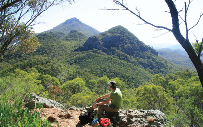
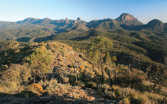
 A NSW classic, this is the best known walk in Warrumbungle National Park, offering close, stunning views of all the park’s volcanic icons: The Breadknife, Belougery Spire, Crater Bluff and Bluff Mountain.
When this part of the continent passed over a volcanic hotspot about 13 million years ago, it formed a massive volcano, towering about 1000 m above the surrounding plains, and lava rose up from many subsidiary vents. Over eons, much of the volcano was eroded away, leaving the hardened volcanic plugs and features that rise up spectacularly – in particular the narrow feature of The Breadknife, the prominent Belougery Spire and Crater Bluff.
Some 60 years ago, bushwalkers and rock climbers were so taken with this impressive landscape, they set about ensuring it was protected as a national park. Very popular during the 1970s and 1980s, it has fallen out of the public eye a little in the past two decades, but has excellent, cheap campsites (powered and unpowered), extensive wildlife (including koalas, emus, and kangaroos), dramatic scenery, fantastic rock-climbing and a brilliant mixed bag of different length walks.
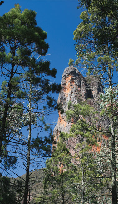
Justifiably, the best known walk in the park is the Grand High Tops, which goes up to and around the iconic features making for an absolute classic day out. You can walk it in either direction, but going clockwise means you have the tough climbs at the beginning and finish in the relatively shaded gully of West Spirey Creek.
Start at Pincham carpark in the centre of the park, and take the marked track, ignoring the track to the right. After a kilometre or so, your return route will come in (across a bridge) to the right, but keep going straight ahead. The first half of the track is well made, with paved areas and wooden bridges. In the early morning you’re more than likely to see eastern grey kangaroos, and a range of birds.
A diversion left, on Gould’s Circuit, is highly recommended. It adds a couple of steep climbs, and a few kilometres, but will give you two great vantage points, in particular the second high point, called Macha Tor. Unfortunately, after this high point, you have to descend all the way to the valley floor again on an eroded track. But you will have the pleasure of passing through a cypress pine forest with flowering peas and other wildflowers.
Once back on the main track, turn left, through a lovely section of the gully that has xanthorrhoeas, wildflowers and lots of birdlife. Spirey View, just 150 m off the track, won’t offer as good an overall view as you’ve seen on Macha Tor, but does have a slightly better vista of The Breadknife, showing how narrow it is.
Soon the track starts climbing again with some awesome views of Belougery Spire on the left. Keep an eye out for rock-climbers high up on the face. The track has long paved sections (a bit of a yellow brick road) and a large, well-made set of steel and timber stairs that take you up steeply to the turn-off to Balor Hut (about 100 m away). The hut has a pit toilet outside. If you don’t require the toilet, stay on the track that veers left (not the short cut past the hut to Dagda Gap) and you’ll climb up directly below the Breadknife, with more close views of Belougery Spire. Once you reach the ridge line, at 992 m, some 500 m above where you started, you’ll get an absolutely crackerjack view of the towering Crater Bluff over the back, and there is plenty of room in among the rocks to take a well-earned break. Take this opportunity, because there’s a lot more of this walk to go (although mostly downhill from here).
The route continues along Dagda Gap, and then you’ll find one of the few confusing signs, pointing back to the right to the carpark. This is the shortcut route and would take you back to Balor Hut and the way you came up. It is much better to complete the slightly longer loop, even though the views aren’t as spectacular in the second half.
Continue along, and you’ll begin to get a great look at Bluff Mountain on the left, with its cubic rock structure on the lower section of the north face. Some interesting rock climbs go up this feature too.
Turn right at Dows Camp (named after the bloke who built this track), down to another great vantage point called Point Wilderness, and then Ogma Gap. Those who want a really long day out in the bush can deviate here along the Western High Tops to Mt Exmouth. Otherwise, head down into the lovely shaded eucalypt forest along West Spirey Creek. The route crosses the creek several times. Keep an eye out for birds, koalas, goannas, other lizards and snakes.
After a lovely hour or so along the gully, you’ll cross a bridge and be back on the original track. Turn left and head back to the carpark.
Precarious walking up the volcanic remnant
WALK: 4 km return
TIME REQUIRED: 2.5 hours
BEST TIME: Cooler months, mornings
GRADE: Hard and potentially dangerous
ENVIRONMENT: Volcanic ring dyke, cliffs, forest and scrub
BEST MAP: Mount Kaputar National Park, NSW National Parks and Wildlife Service
TOILETS: Toilets are located 10 km up the road at Bark Hut camping area
FOOD: Narrabri (45 minutes’ drive away) has supermarkets, service stations, restaurants and pubs
TIPS: Possibly avoid if you are scared of heights
 A dramatic and exhilarating walk, this starts in some pleasant forest, climbs nearly 400 m in altitude and culminates in an off-track scramble up the steep and jagged rocks of an ancient volcano.
Some 21 million years ago, this part of the continent drifted over a volcanic hotspot, 7 km underground. For the next four million years, a spectacular volcanic landscape was formed above the hotspot. It is estimated that at times the volcano was more than 2000 m high. The continent continued to drift and later the same hotspot gave rise to the Warrumbungles, which you can see on the horizon from the summit of Mt Yulludunida.
Over time, what was left from the violent volcanic eruptions eroded into a series of dramatic features, including volcanic plugs, the upthrust Nandewar Range, and a large ring dyke, where the middle of a caldera has gradually sunk. This walk takes you to that ring dyke, and to a peak on its outer edge. At times those with a fear of heights may find it perilous, and care should be taken, as a tumble down the rock face would be potentially fatal.
The walk begins at Green Camp, 1.5 km after the dirt road into the park changes to bitumen. It’s the first turn-off after the information sign near the park entrance. There is no toilet or water at Green Camp, but there is a picnic table. The start of the track is obvious.
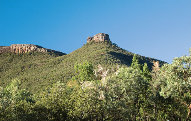
Volcanic plugs and dykes abound in Mt Kaputar National Park
The first section of the walk is through a very peaceful woodland of scattered xanthorrhoeas. Keep your eyes roving from the smallest things on the forest floor, such as beautiful coral fungi, wildflowers or the legendary pink slug; up to the profusion of birds above. There are 180 bird species in this park, including crimson rosellas, raucous cockatoos and the haunting grey goshawk (though in this forested section, you’ll have only the accompaniment of small twittering birds to disturb your reverie).
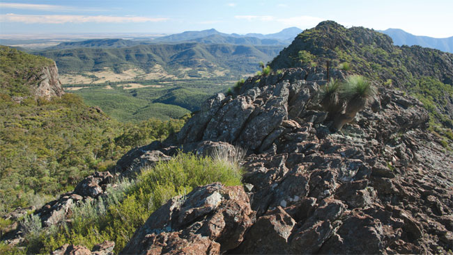
View along the spine
Soon you’ll hit the first lot of stairs, and the walk climbs solidly from here up to the 1225 m peak. At one point early in the climb, when the track turns sharply left, there is a little rocky area straight ahead with your first great views. If you miss this, there are other opportunities a few hundred metres further on.
The track is quite eroded and difficult to walk along in places, with some high steps. At the saddle, the track flattens slightly and powers through montaine heath, with plants such as kunzeas, before rising again through the last bit of forest.
About 1.5 km from the carpark, the track suddenly stops as you pop out at the rock face. Although the ring dyke is no longer complete, you can see the basic shape of it, and the bald Mt Yulludunida rising straight ahead of you. There is no track from here – initially there are a couple of fence posts and some cairns, but you may lose track of them. The main route, with the most obvious cairns, heads slightly down to the left before rising up close to the summit. This is a great way to come back, but a more exciting way to get to the summit is to head diagonally upwards (not immediately to your right) towards the ridgeline. You’ll have to make your way through a few trees, and do a bit of rock scrambling that will tend towards rock climbing at times, but the rock is solid and there are usually excellent handholds. Occasionally you’ll find slightly smoother bits of rock, or areas where edges have been knocked off, and you’ll know that others have been here before.
Once you reach the jagged ridge, you’ll get a great view over the other side. Walking along the ridge isn’t as easy as it looks from the ground though, as the spine is jagged and you’ll need to pick your way through the rocks and occasional waterholes.
The final hop up to the summit is on smoother, slightly steeper rock, but if you’ve made it this far you’ll have no problem with the exposure. There is a large summit cairn (which may be full of flying ants that will take exception to your presence) and great views all round.
On the way back down, there may be times when it is easier to go carefully backwards, facing the rock and keeping your hands on it.
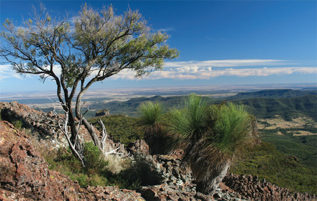
Xanthorrhoeas and other vegetation clinging to the cliff
Mt Kaputar National Park
WALK: 2.5 km return
TIME REQUIRED: 1 hour
BEST TIME: Clear days any time of year
GRADE: Moderate – some steep stairs and rock scrambling at the top
ENVIRONMENT: Volcanic cliffs, subalpine forest
BEST MAP: Mount Kaputar National Park, NSW National Parks and Wildlife Service
TOILETS: Pit toilet at Bark Hut camping area, 2 km down the road
FOOD: Narrabri (45 minutes’ drive away) has supermarkets, service stations, takeaways, cafes and pubs; for top-quality fare in a contemporary atmosphere, with indoor and outdoor eating areas, try the Crossroads Hotel: 170 Maitland Street, (02) 6792 5592
TIPS: Allow some extra time to see some of the park’s other highlights
 An exciting walk in an extraordinary volcanic landscape, this will take you through subalpine woodland to a high perch on the edge of dramatic cliffs.
Mount Kaputar National Park, near Narrabri, is one of the most underrated national parks in NSW. Its towering jagged outline, with volcanic plugs and pointy peaks, can be seen from many kilometres away, and with heights up to 1500 m above sea level it can get snow on its subalpine summits. There are 13 listed walks in the 54 000 ha park, and keen bushwalkers could easily spend a few days here.
It’s an adventure just getting into the park with a 45 minute drive east of Narrabri through low-lying farmland. The road is unsealed and rough once you enter the park, and care needs to be taken as it winds up the hill, with a perilous unfenced drop on the left side. There is an excellent information bay about 2 km past the park entry with information on everything from the volcanic geology of the park 21 million years ago to the rare 15 cm long pink slug that can be found on rocks and trees after rain.
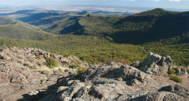
Views stretching to the horizon
In the mornings, to make the drive even more adventurous, you will probably encounter common wallaroos and dark swamp wallabies hopping across the road. Boulders may also tumble down the steep mountainside onto the road.
The dirt section of road finishes after about 6 km, and then you are back on a sealed, narrow and winding road that continues ever upwards, providing some excellent views, including of the impressive castle-like Euglah Rock to the south, all the way to Warrumbungle National Park on the horizon.
You will pass the signposted turnoffs to Green Camp, Coryah Gap and Bark Hut before getting to the Governor turnoff on the left-hand side of the road. The carpark is only 50 m off the road. When you get out of the car you will notice that the temperature is probably about 10°C cooler than in Narrabri, keeping this walk relatively cool, even in the height of summer.
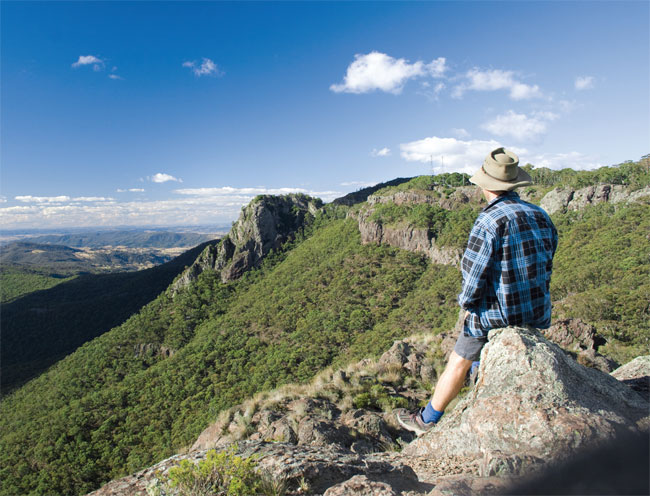
The summit offers extraordinary vistas
The walk starts out with a flat wander through a gum woodland, on a sealed track suitable for wheelchairs, to an excellent lookout on the edge of the cliff. From here you can easily see The Governor to your immediate left, and past it to Mt Mitchell, then right around to Mt Grattai in the distance on your right.
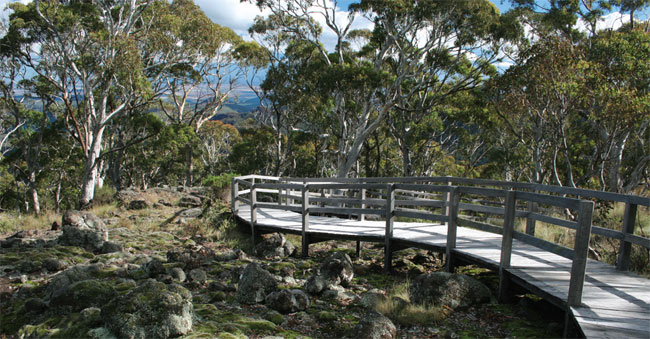
Well-constructed boardwalk between the lookout and The Governor
The track continues through lovely subalpine woodland, with some vibrant green mosses growing virulently on the rocks. A series of well-constructed wooden boardwalks and steel stairs then take you down the saddle between the lookout and The Governor. There is a thick tea tree forest here, and you will start to see some of the yellow reflectors that will guide you the rest of the way. If there is water around, be careful on some of the smoother rocks as they can be extremely slippery. There may be some lovely sub-alpine flowers about, such as everlastings.
After ascending steel stairs up to The Governor, the track becomes quite rocky, and follows a water runnel. Veer left halfway up this water runnel, rather than going straight up the steepest section of rock, and then wind back to the highest reaches.
Once on the rocky platforms, the track peters out and you can take your time exploring this 1400 m summit, taking in the breathtaking 270-degree views. It’s a great place for a picnic lunch. All cliff edges are unfenced, so take care particularly with younger children.
After you have explored the summit for a while, head back the way you came.