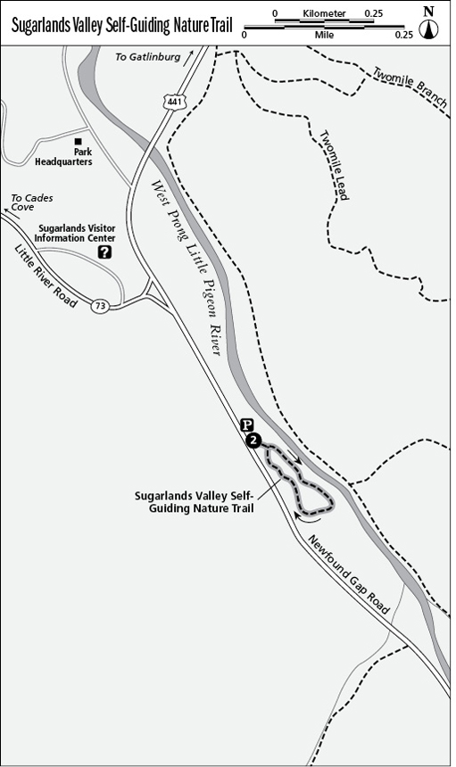
2 Sugarlands Valley Self-Guiding Nature Trail
This fully accessible trail is a must-see Smokies experience for even the hard-core hiker. It is very well done, with wonderfully informative interpretive plaques as well as tactile exhibits for the visually impaired. This path conveys the appeal of the well-watered, verdant valleys that drew so many settlers to the foot of these high mountains.
Distance: 0.5-mile loop
Approximate hiking time: 30 to 45 minutes
Trail surface: Paved
Other trail users: None; no dogs or horses allowed
Best season: Early summer
Canine compatibility: Dogs not permitted
Fees and permits: None
Schedule: Closed only when inclement weather closes Newfound Gap Road
Maps: USGS Gatlinburg; TOPO! Tennessee, Kentucky
Trail contacts: Information about trails, camping, road closures, as well as downloadable maps and a “Smokies Trip Planner” are available online under the “Plan Your Visit” part of the park’s excellent Web site, www.nps.gov/grsm. The Backcountry Information Office is open 9 a.m. to noon, 865-436-1297.
Special considerations: A nature trail brochure is available to buy at the trailhead.
Finding the trailhead: The trail starts on the east side of Newfound Gap Road, 0.4 mile south of Sugarlands Visitor Center and 13 miles north of Newfound Gap. GPS: N35 40.770' / W83 31.873'
The Hike
You’ll be nicely acquainted with this and other Smokies lowland valley locations once you’ve traveled this trail. From the early 1800s, the rough road through Sugarlands Valley was the main route between Gatlinburg, or White Oak Flats, and the Cherokee area of North Carolina. Farms and communities spread up the lower sections and logging here was lighter than at many places in what is now the park. In the ninety or so years since farmers, loggers, and even the first trickle of vacation-home builders left the fledgling national park, there’s been a dramatic reclamation by nature.
The loop splits just past a bridge with an embedded bench. There’s no arrow, but go left (east). Two startling river-rock chimneys appear in the trail’s first curves, all that remain of some of the Smokies’ earliest vacation homes (circa 1900). Not far beyond, at brochure stop 3, a side shoot of the paved trail leads left (east), where the old road is particularly identifiable beside the West Prong Little Pigeon River as it rushes all along this side of the trail. This path’s artfully weaving exploration of the terrain is itself an aesthetic experience. Keep your eyes peeled throughout this hike for evidence of other walls and rock piles—the trail passes right through one stout stone wall.
All along the trail, bas-relief plaques present opportunities for the visually impaired to touch the shapes of leaves, fish (more than sixty species are found in the park), salamanders (more here than in any other spot in North America), poison ivy, the deeply-grooved bark of sourwood, and more.
The trail turns along the end of the loop at 0.3 mile and kids can easily step off and down to a small side stream running beneath the Newfound Gap Road not far away. As the loop nears its junction, one insightful sign shows the stages of forest recovery after settlement with a depiction of the scene beside the trail that includes the cabins that once stood by the chimneys in the distance.
If you’d like to see other defined sections of the old road across the Smokies, consider a few of the nearby quiet walkways under Hike 1 or take the loftier Chimney Tops Trail. Where that trail turns right/west (at 0.9 mile), follow the Road Prong Trail left (south, then east) as far as you care to walk.