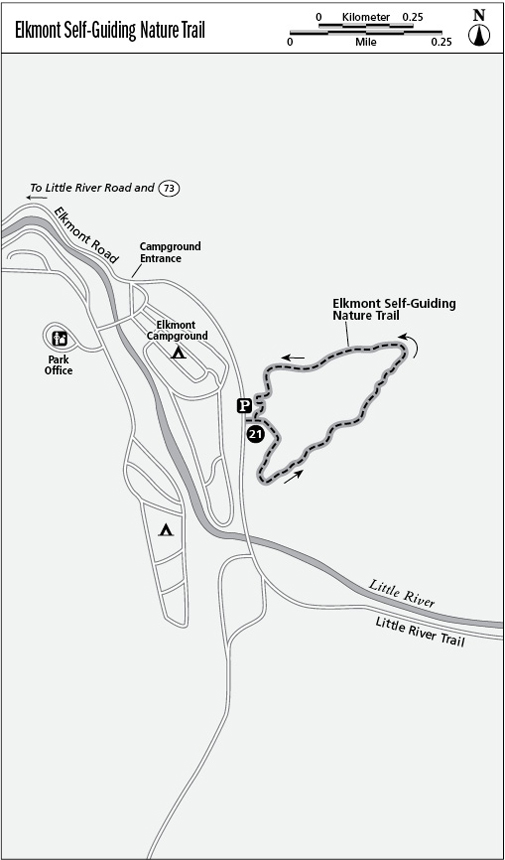
21 Elkmont Self-Guiding Nature Trail
This is one of the best of the nature trails in the park that focuses on the changing Smokies’ landscape. The path and accompanying brochure do a good job of pointing out the clues to where human activity has disturbed the forest, and of explaining how nature is responding.
Distance: 0.8-mile loop
Approximate hiking time: 45 minutes
Trail surface: Stable forest trail with a very rooty section at the top of the path
Other trail users: None; no dogs or horses allowed
Best season: Spring for wildflowers, and late summer for profuse mushrooms
Canine compatibility: Dogs not permitted
Fees and permits: None
Schedule: Adjacent Elkmont Campground is open year-round.
Maps: USGS Gatlinburg; TOPO! North Carolina, South Carolina
Trail contacts: Information about trails, camping, road closures, as well as downloadable maps and a “Smokies Trip Planner” are available online under the “Plan Your Visit” part of the park’s excellent Web site, www.nps.gov/grsm. The Backcountry Information Office is open 9 a.m. to noon, 865-436-1297.
Special considerations: For campers in the Elkmont Campground’s A through F sites, a side trail leads to the nature trail between sites C11 and C12. Restrooms are located just across from those sites, making them accessible from the Nature Trail.
Finding the trailhead: Turn onto Little River Road at Sugarlands Visitor Center, and drive 4.9 miles to a left (south) turn toward Elkmont Campground. Bear left (east) past the campground entrance at 6.3 miles, and turn left (east) into the nature trail parking area at 6.7 miles. GPS: N35 39.459' / W83 34.834'
The Hike
The Elkmont Campground area was the site of a major logging operation in the early twentieth century. A logging railroad from Townsend, Tennessee, reached through this area to the heart of the Smokies. The extensive timbering that occurred largely clear-cut the forests, and the trail shows how the wholesale removal of trees has determined where different species have come to dominate in settings that offer them more or less ideal conditions for growth.
The trail leaves the parking area to the right (east). You’ll notice what appears to be an old foundation near post #1. Cross a single log bridge with asphalt tread to aid your grip. You can’t miss the old logging railroad that the trail follows past posts #2 and #3 before it veers away to the right. A mossy scenic seep appears past posts #4 and #5, where an old spring box sits beside the trail. In this area you’ll be amazed by a poplar to the left of the trail that’s been explosively shattered by lightning. Speaking of forest products—here’s a lifetime supply of toothpicks.
At post #6, a side trail wanders left (northwest) of the main trail along the little stream, and then rejoins the formal path as you cross a single log span and start your rise out the drainage at about 0.2 mile. Notice how the trail rises into a richly aromatic understory of rhododendron and mountain laurel, with galax beneath. At about 0.3 mile the trail crests as it passes a few benches on a very rooty tread that might give the unsure of foot a second thought.
A sharp left turn takes you down toward the parking lot. Just above your car, be sure to follow the zigzag of reinforced switchbacks designed to prevent erosion and bootleg routes that had developed on this side of the parking area.

Miles and Directions
0.0 Start to the right (east), passing post #1 and crossing a log bridge.
0.2 Rise out of the drainage.
0.3 The pathway is pretty rooty across this high point of the trail.
0.8 Arrive back at the trailhead.