Six
NORTHWEST
LAMOILLE AND FRANKLIN COUNTIES

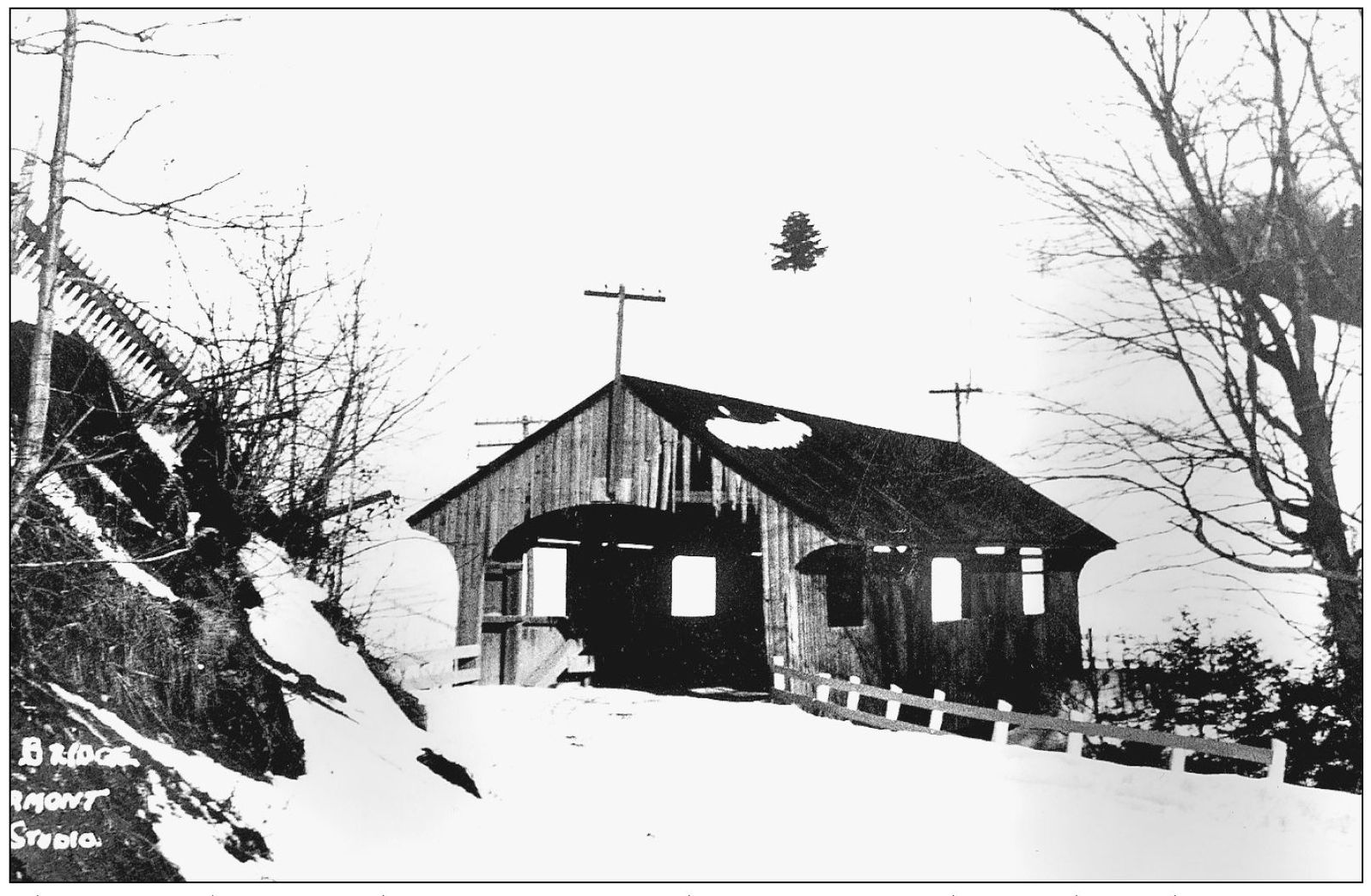
The Lamoille River is the major watercourse of its namesake county. George Washington Holmes and other local builders had a liking for the Burr truss, and the queenpost was widely used for shorter spans. Builders in Franklin County, such as the Jewett brothers, often used the Town lattice truss, though the Burr truss was once found here, too. Both the Lamoille and the Missisquoi Rivers flow through Franklin County on their way to Lake Champlain. Vermont’s far northwest corner is Grand Isle County, but here, the streams are small and there were no known covered bridges. Stowe once had 10 covered bridges on various truss plans. Of those 10, one still stands. The local housing style usually had a slight but abrupt portal overhang, which may in some cases have protected an extension of the upper chords of the truss. This example crossed the Waterbury River at the village of Moscow until 1950. (Henry A. Gibson, September 13, 1948.)
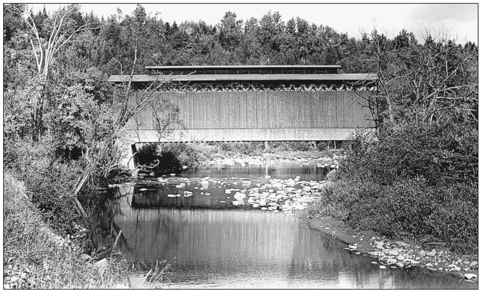
The St. Johnsbury and Lake Champlain Railroad used many covered bridges. Three of them that were located over the Lamoille River in the Hardwick-Wolcott area survived into the 1950s, and one still remains. (Hardwick is in Caledonia County, but since the bridges were near each other, they are considered as a group here.) All three bridges were similar in appearance but different in length. The structure on the roof allowed smoke from steam trains to escape, which lessened the chance of fire. Note that this bridge, east of Hardwick, had a smoke vent of 17 sections. (Raymond Brainerd, September 19, 1940.)
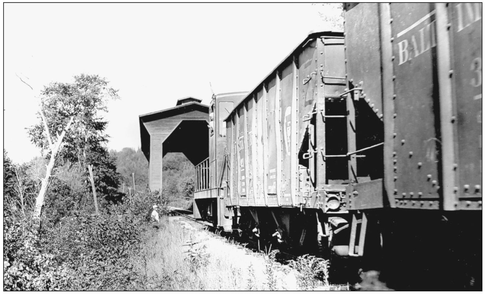
The name of the railroad was later changed to the St. Johnsbury and Lamoille County Railroad, keeping the same initials. Here, an early diesel-powered train crosses the bridge located east of Hardwick, which burned down in 1959. (Henry A. Gibson, September 13, 1948.)

This view of the existing Fisher Bridge, on the St. Johnsbury and Lamoille County Railroad, east of Wolcott, shows how difficult it can be to tell photographs of the three railroad bridges apart. Note, however, that this smoke vent has 11 sections. The third bridge, west of Wolcott, had 19 sections. (Joseph D. Conwill, October 2, 1983.)
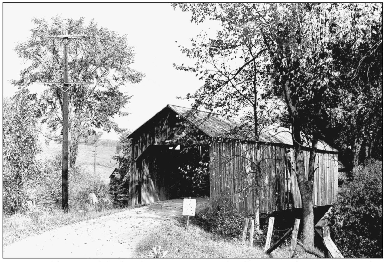
Waterman Bridge crossed the brook of the same name about two and a half miles south of Johnson. The main span used a queenpost truss, but there was also a short covered approach span with no truss at all, just stringers under the floor. (Henry A. Gibson, September 13, 1948.)
Downtown Johnson had a little set of twin covered bridges over channels of the Gihon River. Their oversized roofs resembled kites. (Raymond Brainerd, September 6, 1937.)
This very early view of the Power House Bridge, just east of Johnson, shows the structure’s original arched, board-and-batten portal style, similar to bridges a little farther northwest in Waterville. The portals were long ago modified to an overhung style with no arch. (Photograph by Mills Studio; Richard Sanders Allen collection.)
Scribner Bridge, which spans the Gihon River east of Johnson, enjoys a classic old Vermont agricultural setting. The very low truss work has caused speculation that it may have been an open bridge or a boxed pony truss originally. (Joseph D. Conwill, October 2, 1983.)

Scott Bridge still carries traffic over the Brewster River near Jeffersonville. It is not to be confused with the Scott Bridge of Townshend, which is closed. (Raymond Brainerd, September 6, 1937.)
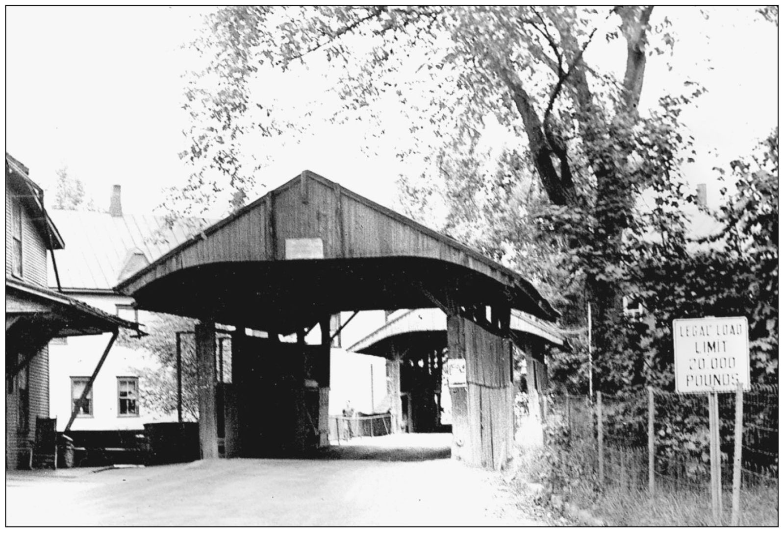
The St. Johnsbury and Lamoille County Railroad crossed the Lamoille River at Cambridge Junction on this covered bridge, which was removed in 1967. The portal was well stained by smoke from passing steam trains. (Henry A. Gibson, September 14, 1948.)
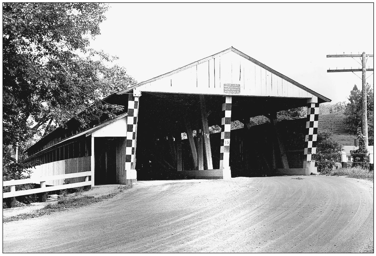
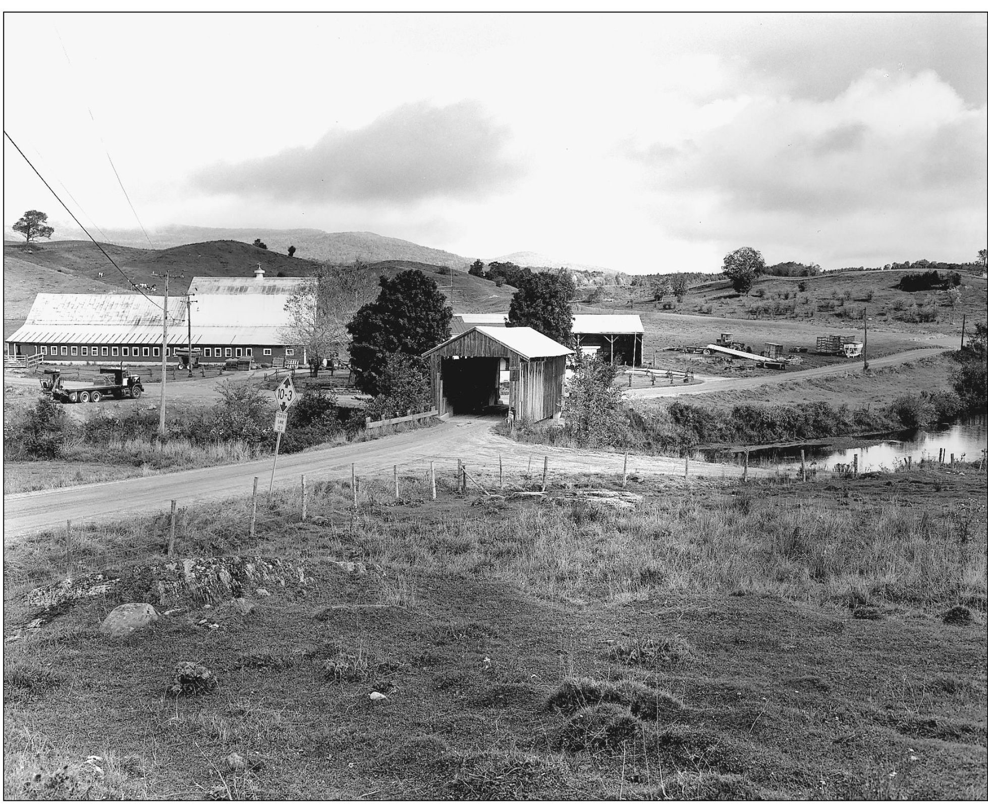
For over a century, the double-barreled Big Cambridge Bridge served the hamlet of Riverside, at the northeast edge of Cambridge village, on what became state Route 15. It was scheduled for replacement in 1950 but was saved and moved to the Shelburne Museum, where it passes a happy retirement as an historical exhibit. (Raymond Brainerd, September 6, 1937.)
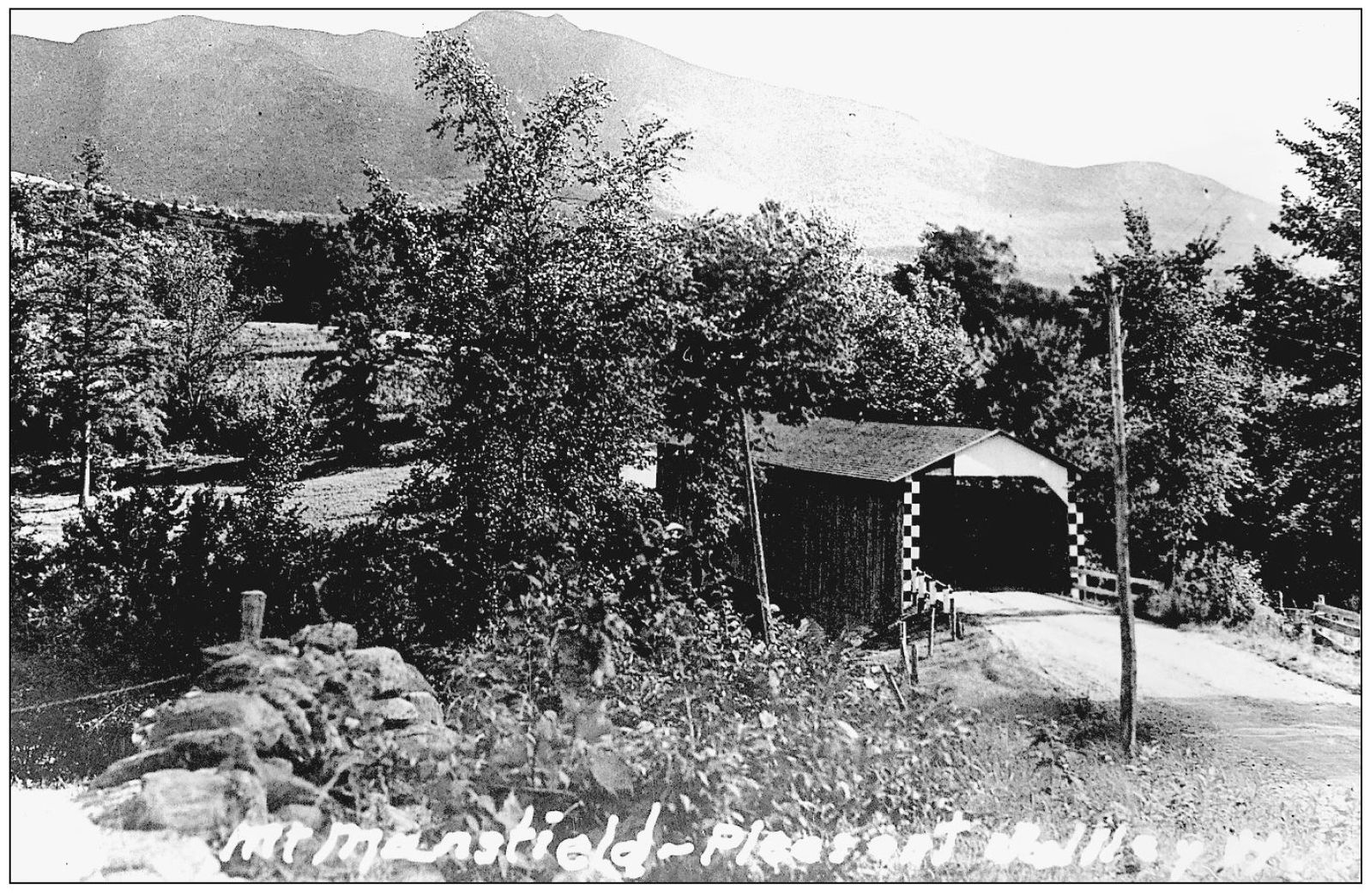
Safford Bridge, in the Pleasant Valley section of Cambridge, enjoyed a spectacular setting below Vermont’s highest mountain, Mount Mansfield. (Author’s collection.)

The covered bridge at Belvidere Center is gone, but there are still two covered bridges on side roads in the western part of town. (Richard Sanders Allen, September 1938.)

Waterville has three covered bridges over the North Branch of the Lamoille River, also known as the Kelly River. Montgomery Bridge is a little over one mile north of the village and dates from 1887. (Henry A. Gibson, September 14, 1948.)
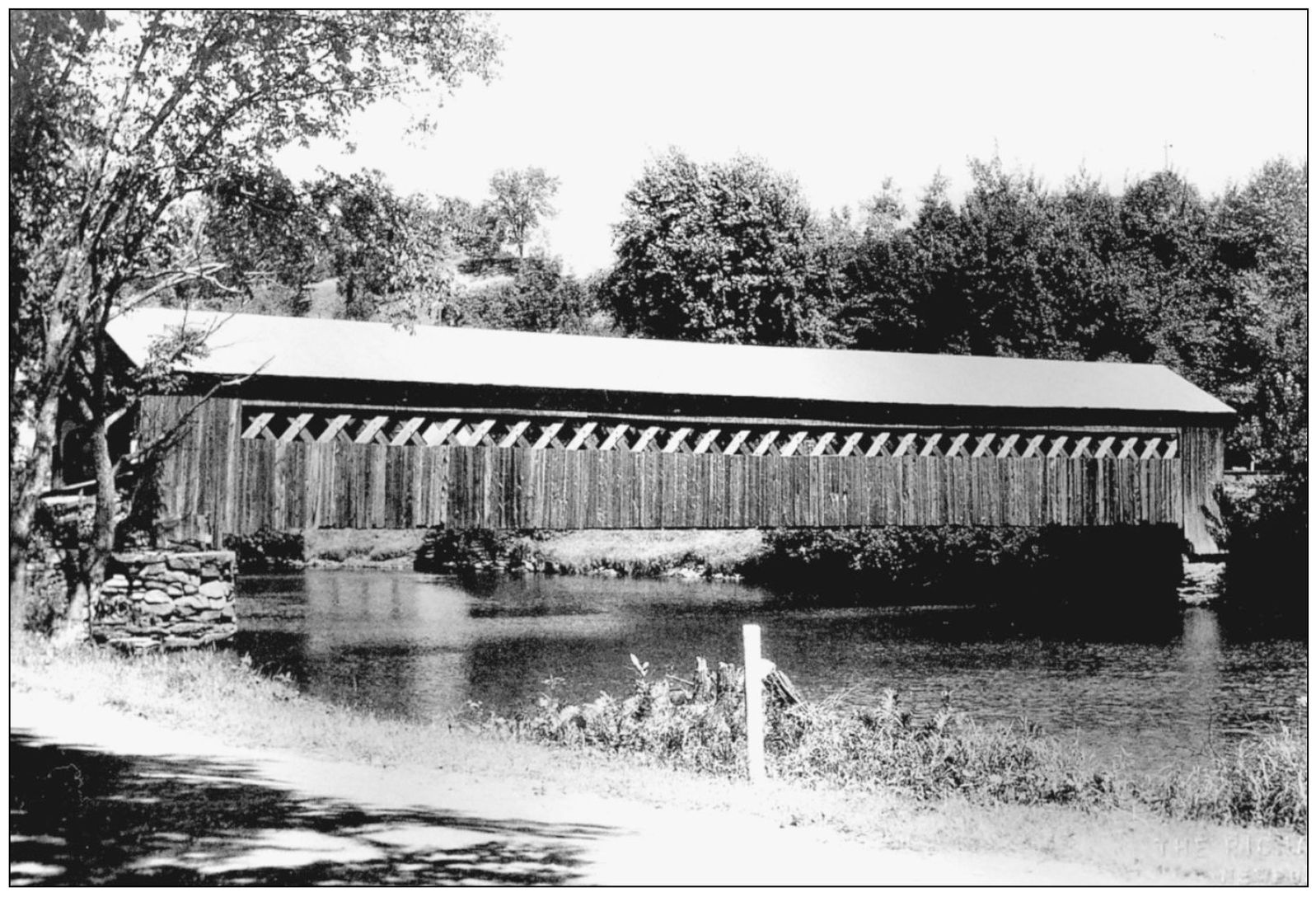
This attractive Town lattice truss crossed the Lamoille River at Fairfax Falls. (Richard Sanders Allen collection.)
Fairfax still has a covered bridge on Maple Street, which dates from 1865. (Henry A. Gibson, September 14, 1948.)

Fairfax also had this neat looking double-barreled bridge, which spanned the Lamoille River at the south end of the village. (Author’s collection.)
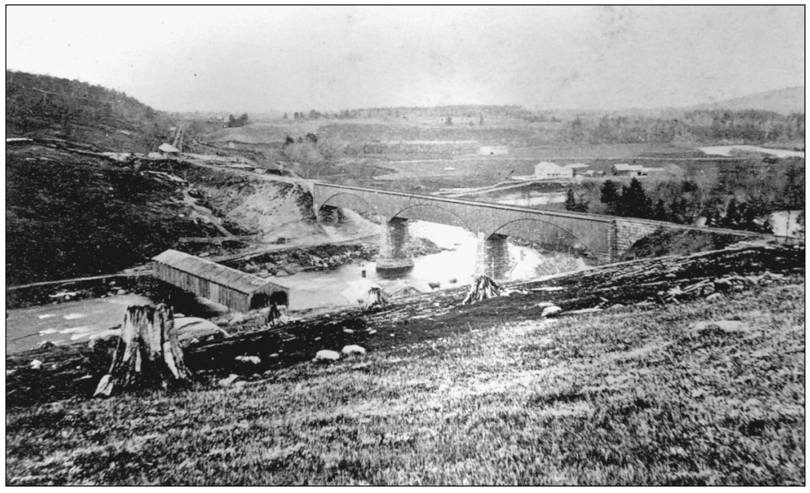
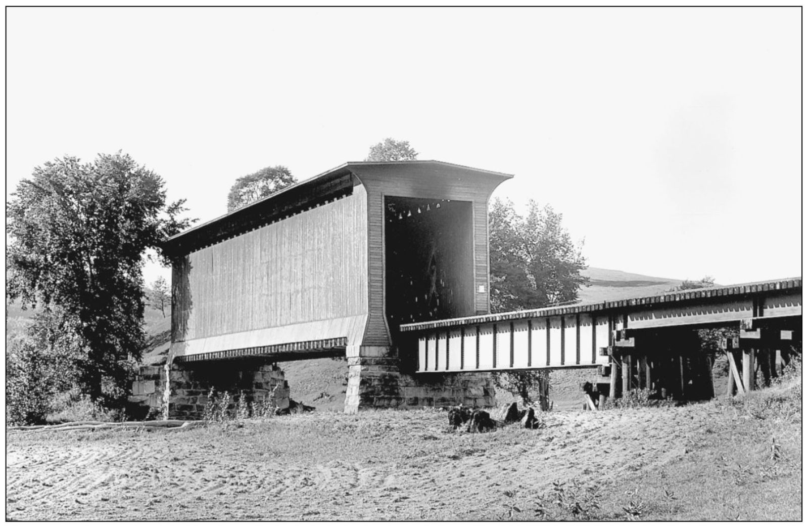
Georgia Station (East Georgia) was home to both a double-barreled highway bridge and a high-level deck truss railroad bridge over the Lamoille River. The siding of the railroad bridge followed the arch of its truss, which was a trademark of famed builder Henry R. Campbell. Note the over-cleared early landscape and the remnant stumps of the “forest primeval.” The area was surely more attractive half a century later. (Christine Ellsworth collection.)
East Fairfield’s covered bridge dates from 1865 and still exists today. However, it has been closed for many years now and is in poor condition. (Raymond Brainerd, September 30, 1950.)

This old bridge served the curiously named locality of St. Rocks in the town of Fairfield. (Raymond Brainerd, September 30, 1950.)
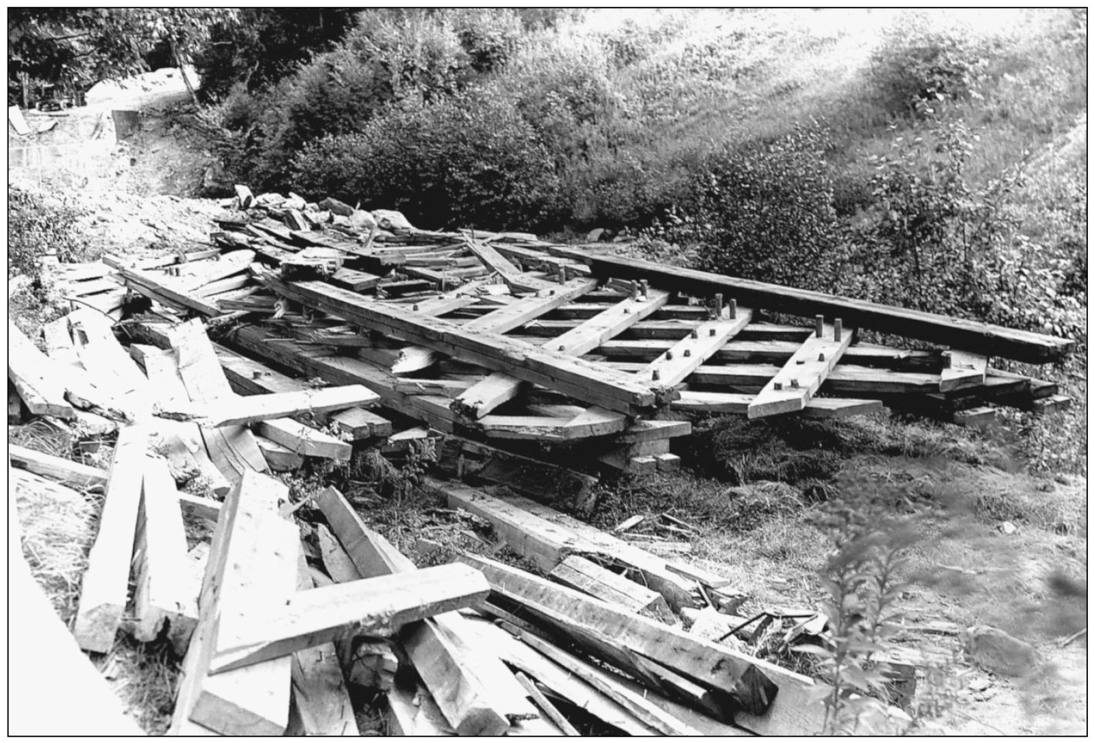
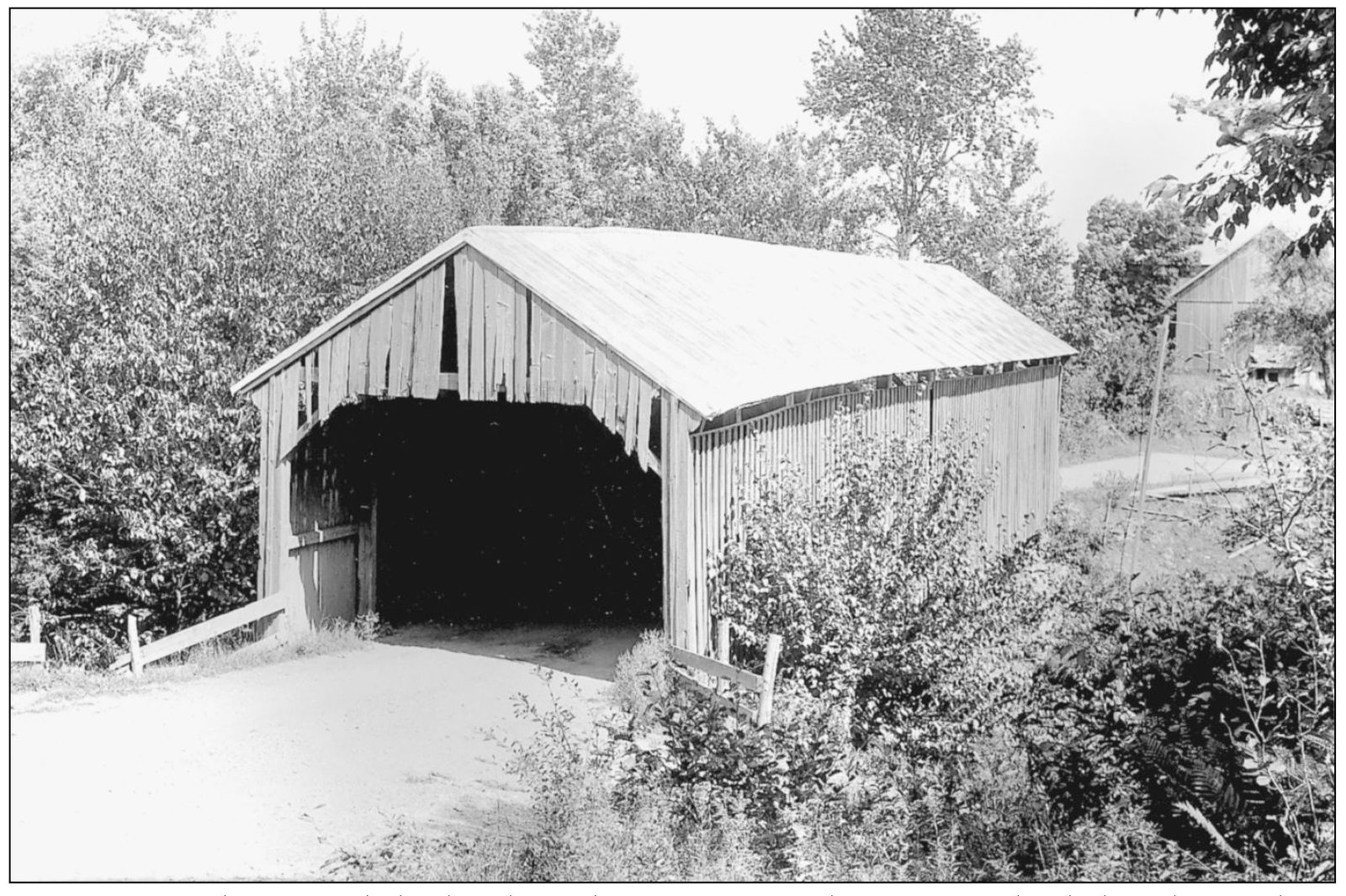
Covered bridge preservation was not yet an accepted idea in the 1940s. When the photographer visited the Shingle Mill Bridge near East Enosburg, he found only these remains. (Henry A. Gibson, September 15, 1948.)

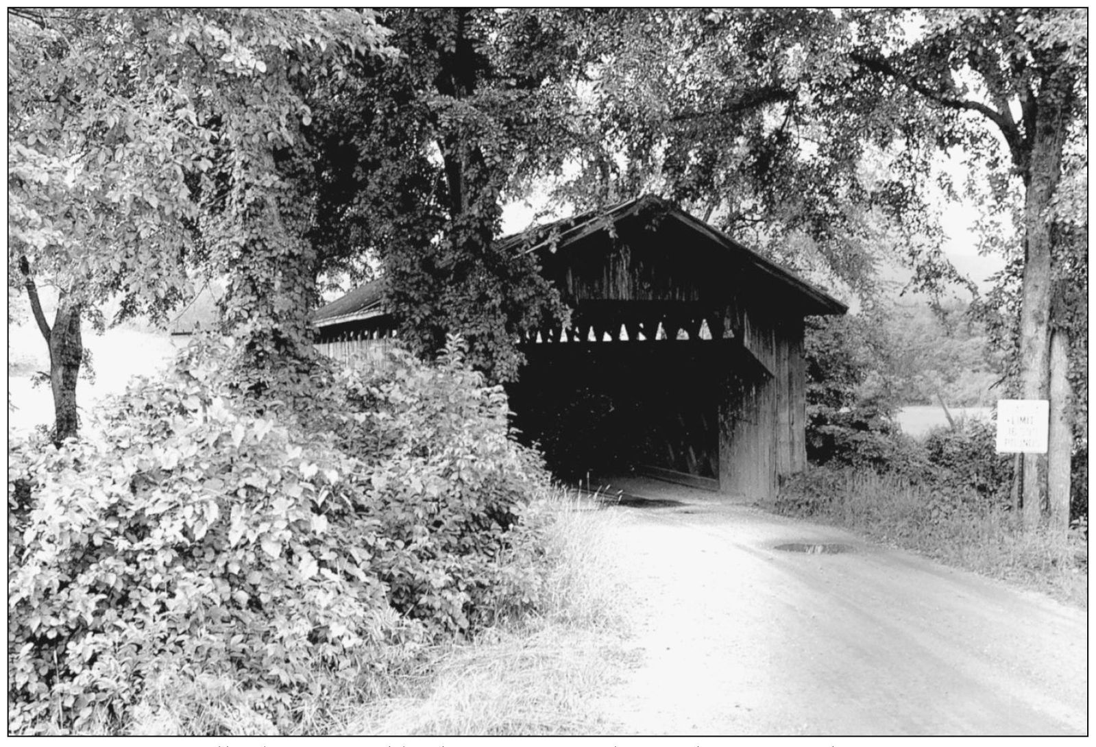
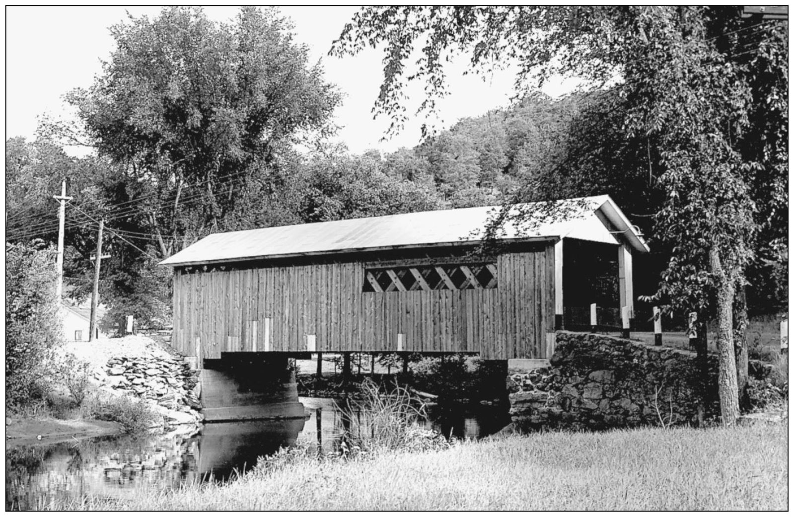
Hopkins Bridge spans the Trout River in Enosburg, almost on the Montgomery town line. (Joseph D. Conwill, September 7, 1985.)
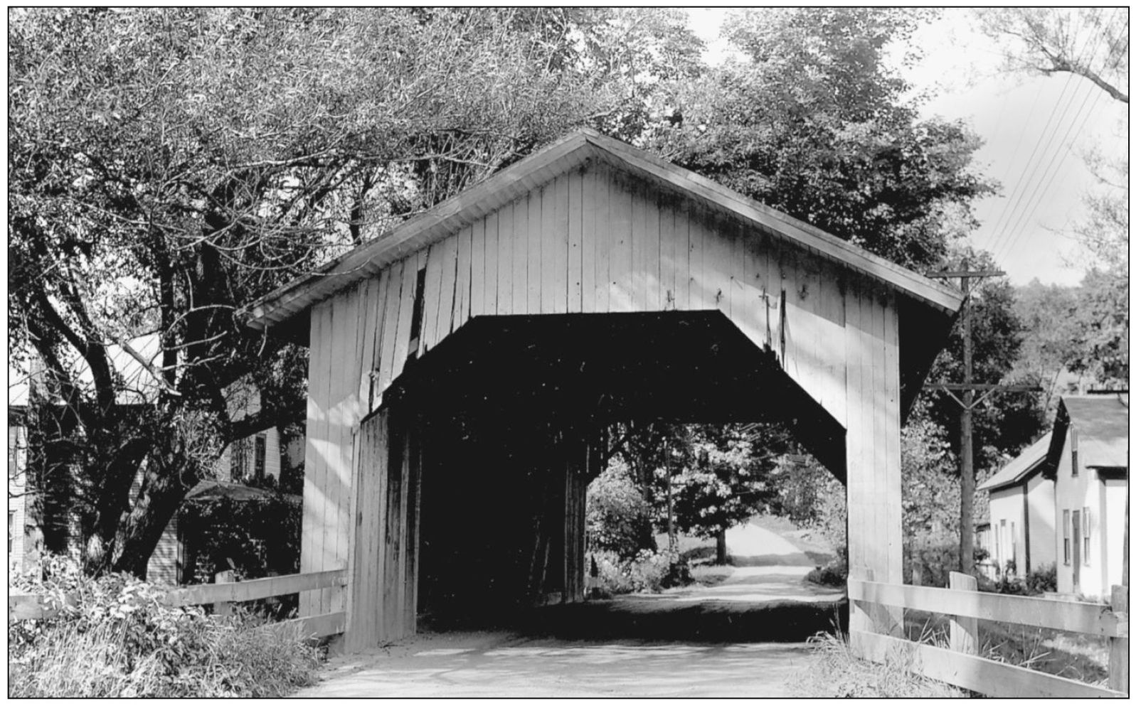
Montgomery is still a big covered bridge town. Longley Bridge crosses the Trout River west of the village, but the road has been straightened and trees no longer shelter the bridge. (Herbert Richter, August 10, 1956.)
These two bridges served state Route 118, just west of Montgomery. Charlie Clapp Bridge, located over the Trout River, is seen from inside Levis Bridge on West Hill Brook. (Richard Sanders Allen.)
Comstock Bridge also served Route 118 in Montgomery between Levis Bridge and the village center. The highway was relocated to straighten a curve, but the 1883 covered bridge still carries traffic on the old road. (Raymond Brainerd, August 11, 1941.)
Fuller Bridge, right in the middle of Montgomery village, was built by Sheldon and Savanna Jewett in 1890. The brothers lived locally and built all of the other existing covered bridges in town. Fuller Bridge served for 110 years, but the trusses on one side suffered repeated flood damage. In 2000, it was torn down and replaced with a new replica of similar construction. (Henry A. Gibson, September 15, 1948.)
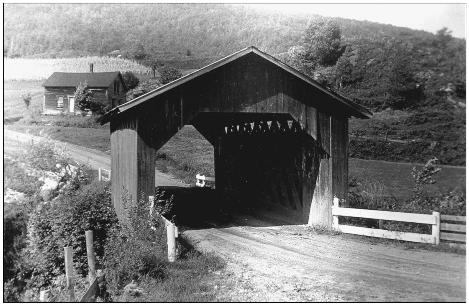
Hutchins Bridge still spans the South Branch of the Trout River, a little over one mile south of Montgomery Center. The eastern end formerly rested on a streamside ledge outcrop, but this interesting natural abutment is now encased in a wall of concrete. (Henry A. Gibson, September 15, 1948.)
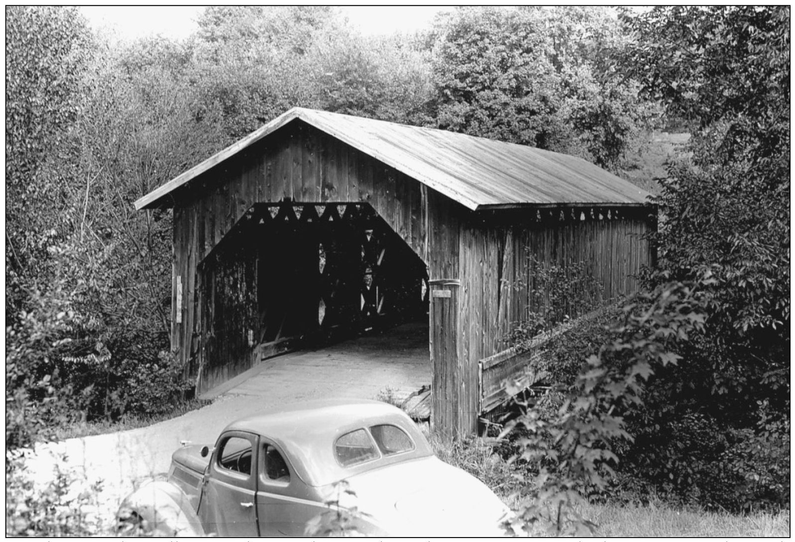
Hectorville Bridge spanned the South Branch of the Trout River on Gibou Road and was the next crossing south of Hutchins Bridge. (Richard Sanders Allen.)

Hectorville Bridge was closed not long after this photograph was taken, and its condition gradually worsened. In 2002, it was removed and placed in storage for possible rebuilding at a less isolated location. (Joseph D. Conwill, August 19, 1984.)