DISTANCE: 9 miles (14km) driving, 2 miles (3km) walking
TIME: 2–3 hours
START: Hilo Airport
END: Hilo Bay Café
POINTS TO NOTE: Fly in to the Hilo Airport directly from a neighbor island, or drive from Kona over the improved Saddle Road, which takes you through the heart of the Big Island. If coming from Waimea, you’ll see the beautiful, rugged Hamakua Coast – allow an extra hour for the drive along the coast. Pack a poncho, because it rains nearly every day in Hilo. There’s enough to do to spend a day or three, and the drive from the more touristy Kona side is long – sometimes more than two hours.
First impressions of Hilo, the government seat of Hawai‘i County, often underwhelm. Hawai‘i’s second-largest city outside Oahu, Hilo feels more like a big town, which it really is. It certainly harbors no pretenses in humoring the tourist, and thus its charm. Hilo’s focus is the harbor. Tsunamis – or tidal waves – in 1946 and 1960 destroyed part of the downtown business district and took lives, but many of the old buildings remain.
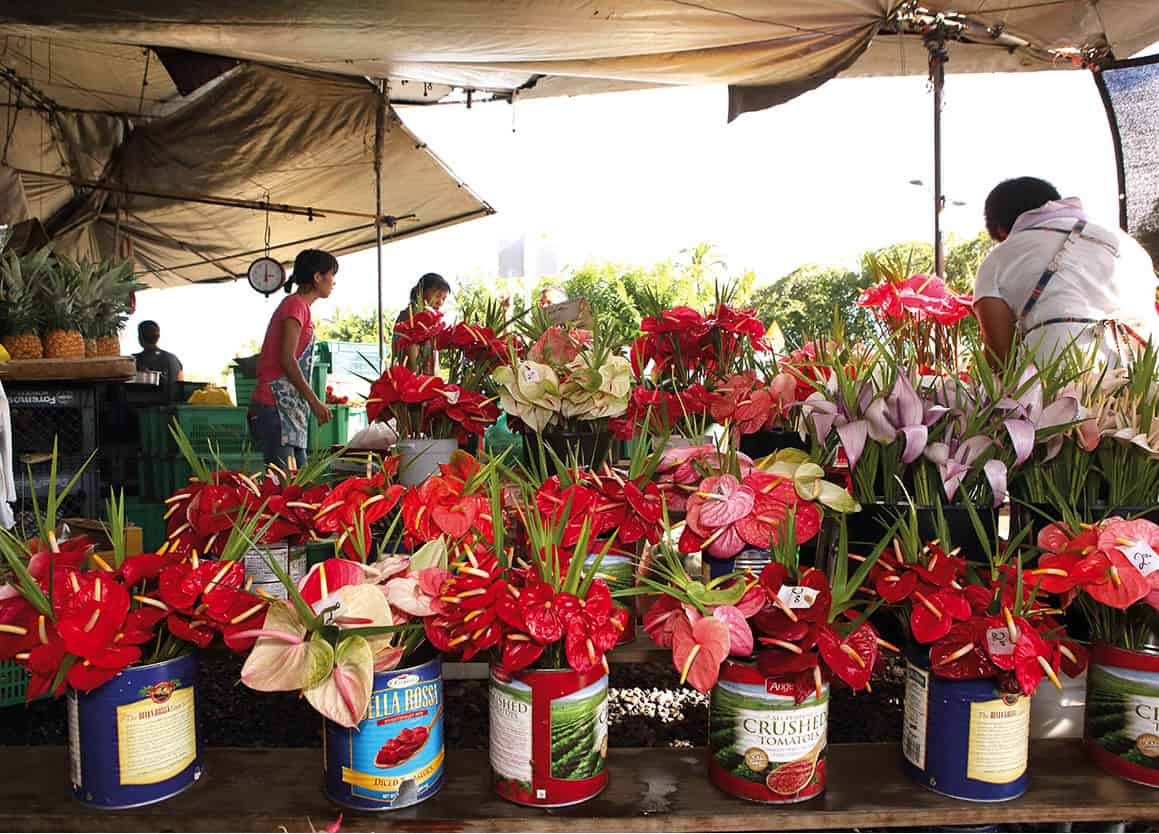
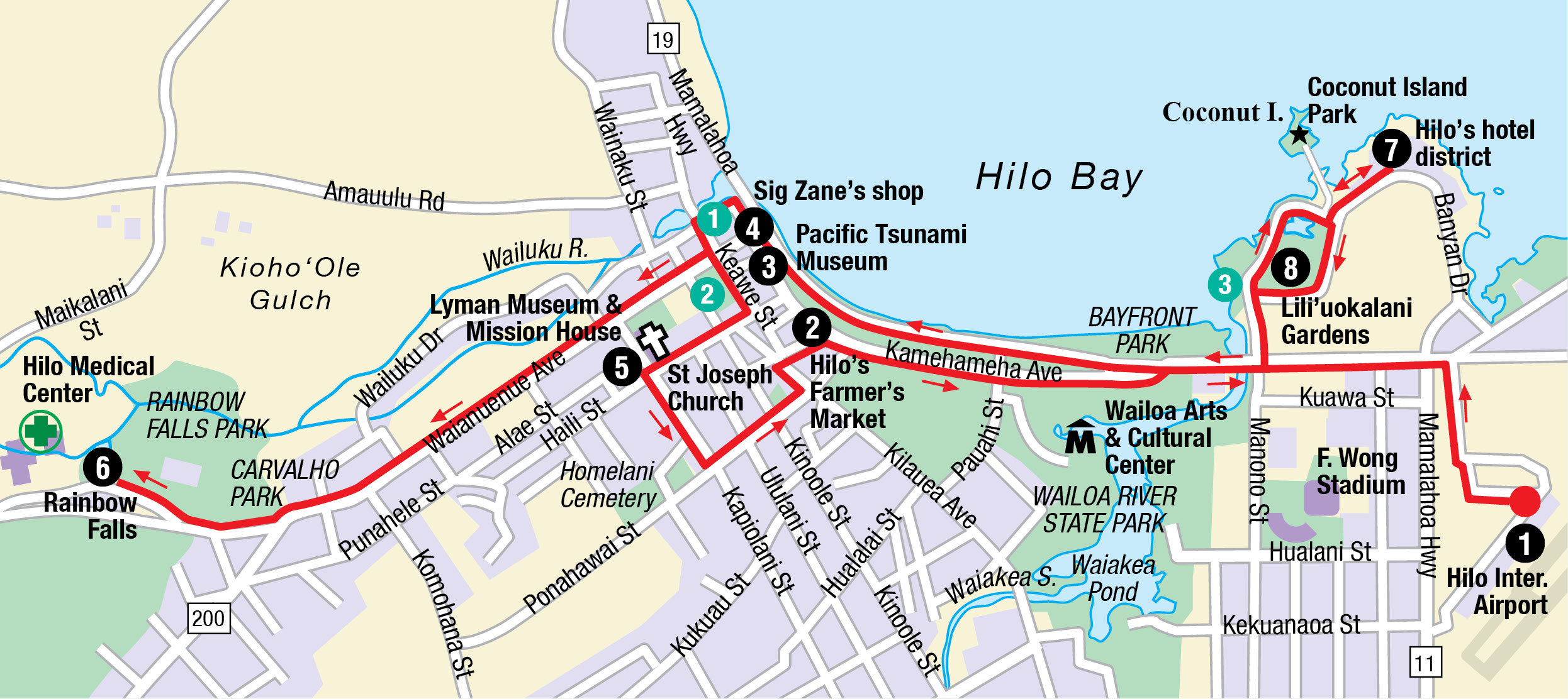
From the airport 1 [map], which is close, but not right in it, drive into Hilo via Route 19, Kamehameha Avenue, to Mamo Street. Left onto Mamo Street puts you right in the heart of Hilo’s Farmer’s Market 2 [map] (www.hilofarmersmarket.com; Sun–Tue and Thu–Fri 7am–4pm, Wed and Sat 6am–4pm), one of the best in the state, especially on Wednesdays and Saturdays when more than 200 vendors are present. You’ll find avocados and papayas bigger than your head, local homemade products and gifts, all for great prices. Take your time wandering the stalls, where samples abound – you’ll likely leave feeling like you had lunch.

Anthuriums at Hilo Farmer’s Market
Steven Greaves/Apa Publications
From the farmer’s market, leave the car behind and walk along Kamehameha Avenue’s charming storefronts. The Pacific Tsunami Museum 3 [map] (www.tsunami.org; Tue–Sat 10am–4pm) captures the devastation that of two tsunami that are integral to this town’s history. While heartbreaking, it’s also very well done and informative. Local designer Sig Zane’s shop 4 [map] is among the most popular – local men wear these aloha shirts across the state for business attire. Even the Governor and Mayor are often seen sporting Sig Zane’s shirts.
For another taste of locally created food and wares, continue north on Kamehameha Avenue to Locavore, see 1, an eclectic mix of gifts and treats all made in the Hilo-Hamakua area. Just up the street, the Hilo Town Tavern, see 2, which features live music in the evenings and draws in the locals, is the real deal – this is where Hilo folks come to unwind. Pop in for a beer and to make new friends.
Travel south on Keawe Street until you reach Haili Street, then turn right and walk to the Lyman House Memorial Museum and Mission House 5 [map] (www.lymanmuseum.org; Mon–Sat 10am–4.30pm; Mission house tours at 11am and 2pm). The museum’s first floor is dedicated to Hawai‘iana. Upstairs is the secret treasure: world-class rock and mineral, and shell collections. In the museum’s gift shop, pick up an inexpensive walking tour map of old Hilo.

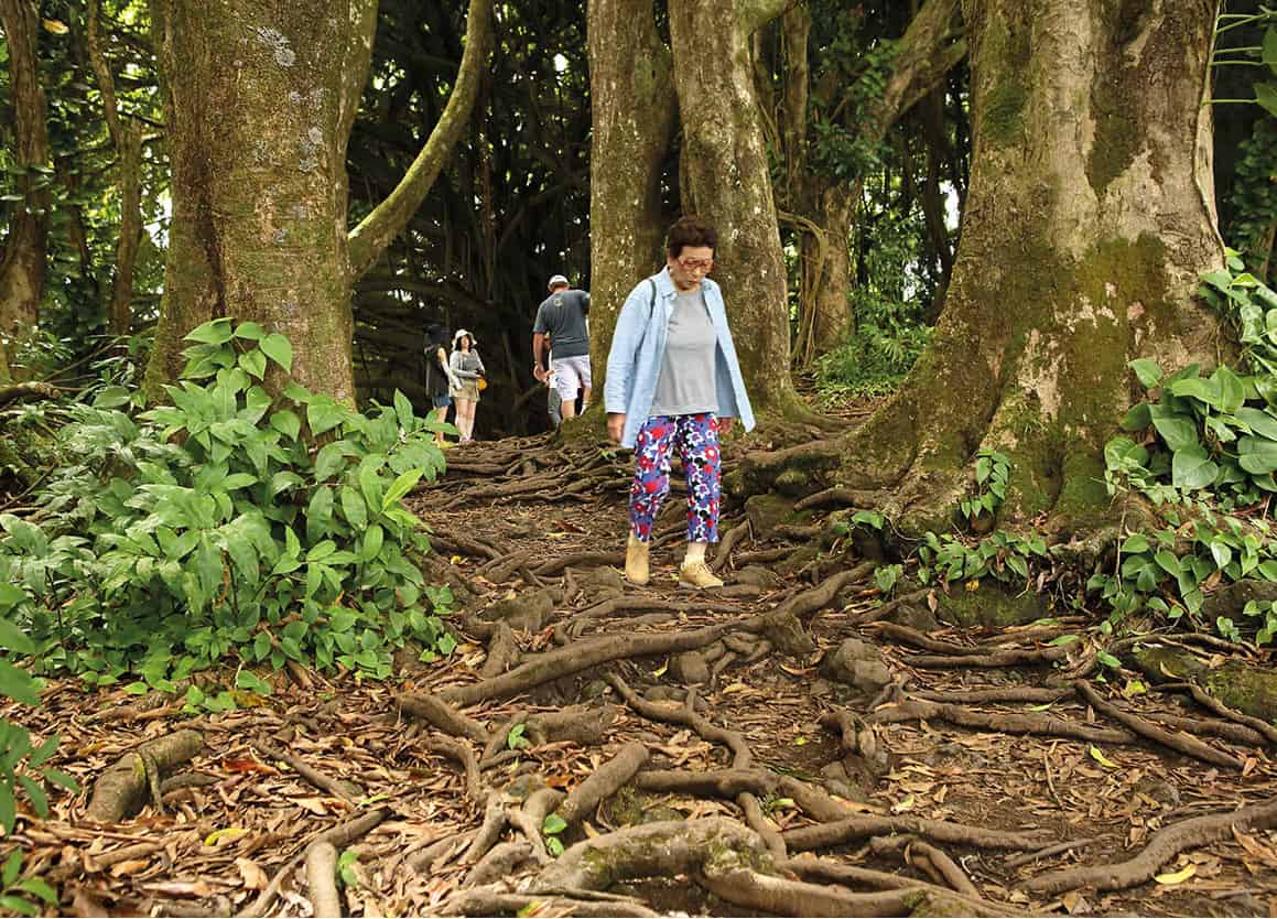
Vegetation near Rainbow Falls
Steven Greaves/Apa Publications
Take the short walk back to your car, and pop over to Rainbow Falls 6 [map] – Hilo really does have a waterfall right in town! Follow Kamehameha Road north to Waianuenue Road (Route 200), go left and follow it to Rainbow Drive. The waterfall will be on your right. The waterfall ranges from a trickle on dry days to a raging river when it’s raining in the mountains above.
After visiting the falls, travel back to Kamehameha Avenue and follow it south along the bay, making a left onto Banyon Drive. This is Hilo’s hotel district 7 [map], with the very modestly priced Hawai‘i Naniloa and the Hilo Hawai‘ian both offering comfortable, if slightly shabby, accommodations along with excellent coastal views. Opposite is Lili’uokalani Gardens 8 [map], an uncrowded, serene Japanese garden of stone bridges and lions, lanterns,
and a tea ceremony pavilion. Park the car and walk the gardens out to the point, finishing up at Hilo Bay Café, see 3, for a meal with a view so stunning you may forget to eat. Ask for an outside table in the shade, and whatever the fish special is, order it.

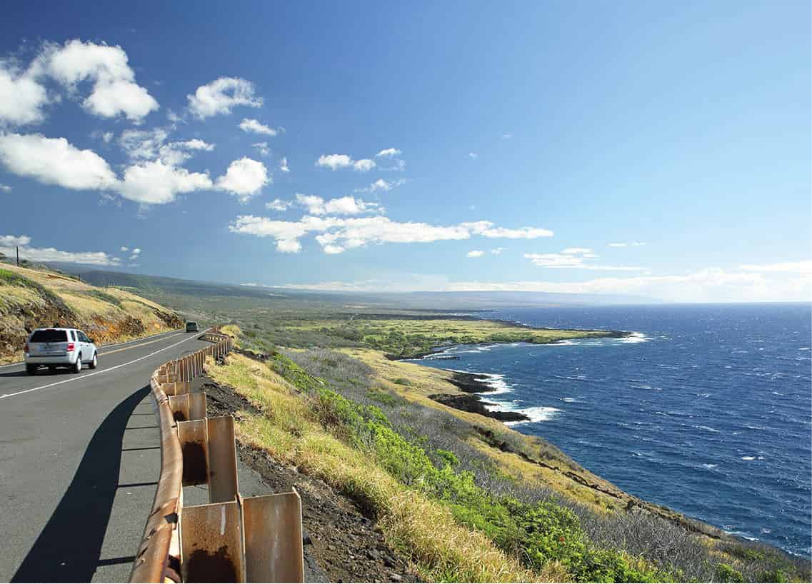
View of the Pacific from Route 11
Steven Greaves/Apa Publications
South of Hilo is a splendid scenic drive down Highway 130 towards the coast and recent lava flows, and Route 11 connects to Route 10, through Volcanoes National Park (for more information, click here). Hilo is the closest town with accommodations outside the park.

Rainbow Falls
Steven Greaves/Apa Publications
Food and Drink
1 Locavore
60 Kamehameha Avenue; tel: 808-965 2372; www.bigislandlocavorestore.com; Mon–Fri 9am–6pm, Sat 9am–3pm; $$
Locavore is not a restaurant per se, but there’s plenty to eat in this grocery/deli/shop. Absolutely everything here is fresh and local, so you can’t go wrong for a midday snack or lunch overlooking the bay.
2 Hilo Town Tavern
168 Keawe Street; tel: 808-935 2171; www.hilotowntavern.com; pupus and drinks $–$$
The Hilo Town Tavern is the only place in town when it comes to nightlife. Check out open mic night (Monday) and various DJs and local live music while enjoying libations with the locals.
3 Hilo Bay Café
123 Lihiwai Street; tel: 808-935 4939; www.hilobaycafe.com; Mon–Thu 11am–9pm, Fri–Sat 11am–9.30pm; $$–$$$
Here you’ll find Hilo’s fanciest fare, with fresh caught ocean fish, hand-rolled sushi and artisan cocktails. Reservations are recommended.
