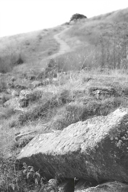
The view up towards Top Withins from the remains of Middle Withins (Anni Vassallo ).
The numerous British and international visitors that plod up to the farmstead at Top Withins are usually intrigued by its confusing ruin, wandering around its interior in an attempt to make sense of its jumble of surviving walls, rebuilt walls and tons of tumbled masonry. Their bafflement is hardly surprising, for its structure is the result of numerous changes made over a period of around 450 years, making its development very difficult to determine with any degree of accuracy. Fortunately a useful range of sources, including archives, photographs and, most importantly, parts of the building itself, are still available for study. By drawing these factors together, it has been possible to propose the following sequence of construction and rebuilding which brought Top Withins to completion around the early to mid-nineteenth century (see Pl. 10-14).
The Elizabethan House
The decision to build the earliest farmstead in this particular location on a steeply sloping area of high moorland was most probably determined by the presence of its spring of clear water. Here there was an annual rainfall of over 60 inches or 1,500mm each year, showers falling on an average of two out of every three days. 1 Situated at 1,376 feet, some 420 metres above sea level, Top Withins lay only around 100 feet, or 30 metres, below its surrounding hills, and it must have been deliberately sited here to take advantage of the highest available spring. This lies around 40 feet to the east of the house, and appears as a small rectangular structure on the Tithe Map of 1850. From its sides water would have been carried into the house for drinking, brewing, washing and cleaning purposes, and into the barn and stable for watering the cattle and horse. Although overgrown, it still runs clear, following the northern side of the Pennine Way down toward Middle Withins farm, which it also served, before descending into the South Dean beck. Its supplies were essential for cooking, brewing, dairying, washing, wool-textile production and watering cattle over the winter months.
A further advantage of the site was its good stone. In 1591 William Bentley of Withins made his will in which he confirmed that his sons Martyn and John were to have ready access to their brother Luke’s Top Withins lands to extract stone. Some of this was used by John to build walls to separate the fields of Top, Middle and Lower Withins, but it had probably already supplied the main building stone for their respective farmhouses, as well as that erected here by Thomas Crawshaye before 1567.
Local experience had proved that some of the best stone lay just below the thin turf on the brink of the high moorland plateaus, as on the hill just to the west of Top Withins. Here, at around 1,400 feet above sea level, was a bed of Rough Rock Flags, which, occurring in relatively thin layers, was easily quarried and useful for building as may be seen in many of the walls of the Top Withins farmhouse. The overgrown remains of Luke Bentley’s delf (the local name for a quarry) can still be seen on Delf Hill, together with the long-disused sledge or cart tracks leading down to the farmhouse and on in a north-westerly direction towards Stanbury.
The rough rock flags were unsuitable for carving lintels, doorways and window frames, but other suitable rocks were to be found nearby, notably the Woodhouse Grit. These were ideal for making both lintels and neat rectangular building blocks, such as may be seen in the evenly coursed walls of the barn end at Top Withins, and in the other Withins farmhouses.
Any settlement at Withins was dependant on a good supply of fuel. There was insufficient woodland here to maintain fires, but fortunately the whole of the upland area was covered with beds of peat of varying thickness. These had formed as the waterlogged remains of cotton-grass and sphagnum moss had accumulated and consolidated into a soggy dark brown mass over the last five millennia. Overgrown sledge or cart tracks from Top Withins suggest that the main peat diggings were around Withins Height to the west of the farmhouse and toward the Alcomden Stones to the north-west.
Each farm harvested its own supplies in June, when the topmost layer of living vegetation was neatly pared off. Defined in 1775 as ‘flaights’, this ‘surface of the commons, or waste, uncultivated places, cut off, and dried for fuel’ had to be sliced free of the peat using a triangular-bladed T-handled flaight spade. 2 It might then be either dried for fuel, or relaid over the peat bed to protect it for future use and to avoid erosion. Flaights must have been cut around half a mile to the north-east of Top Withins, where the Pennine Way crosses Flaight Hill, a further Flaight Hill lying a mile to the south, on Wadsworth Moor (see Pl. 20).
Once the flaights had been stripped off, the pure, black peat could now be cut using a wooden peat spade shod with an L-shaped iron blade. In this area each peat measured some 10 x 3 x 15 inches (25 x 7.5 x 38cm) when cut. At this stage it was still relatively soggy and easily broken, and so the peats were laid out in rows on the moor until they became firm enough to handle. After being set on edge for a while, they were built up into small stacks to finally dry out as hard, tough slabs. Now they were carried down to the farm, probably using a horse-drawn sledge to follow the track up to the north-western gable of Top Withins. Here it would be passed in through the narrow doorway for storage in the peat house.
Peat was seen as a healthy fuel ‘which when prepared for fuel, by drying in the sun, is reckoned a wholesome firing. It has been remarked, that where the use of it prevails, pestilential disorders have been more rare, and less fatal’. 3 It could be burned both on a flat hearthstone and in a grate or range, giving a good, steady but almost flameless heat, and giving off a pleasant ‘reek’ or smoke. ‘Colons’ were often used as kindling, these being the dried stalks of heather or furze, including those left on the moor after the heather had been burned off to promote new growth as food for grouse. 4 If all went well, the peat harvest was all gathered in before 12 August when the grouse shooting season commenced. Over the following year the Sunderlands would now be able to climb the steps leading from the farmyard up into the peat house, collect the peats and use them to heat their house, cook their food and boil their washing, all for nothing more than their own labour.
Peat continued to be the main fuel in the uplands around Haworth throughout the nineteenth century, but from the 1830s a number of local farmers began to extract coal from their own enclosures. 5 Before 1850 a 111-feet-deep pit had been sunk down to a 12- to 14-inch seam just to the east of the South Dean farmhouse, around a mile down the valley from Top Withins. Five men and two boys were working here in 1851. The formation of the Stanbury Coal, Iron & Lead Co. in 1862 sought to develop the seams of good-quality engine coal found here but, undercapitalised and then made totally unviable by the arrival of the railway from Keighley up to Haworth in 1867, it had to close down completely. Much cheaper coal from the Bradford and Halifax collieries could now be carted up from Haworth.
Given these natural resources, the Elizabethan pioneers who first enclosed the upper part of the South Dean to form the Withins farms clearly recognised that a good, if basic, living was to be had here. This was entirely dependent on two factors, however: the incomes to be derived from the farming of sheep and cattle, and the growing prosperity of the domestic wool-textile industry. Standing at 1376 feet, or 420 metres above sea level, Top Withins remains one of the highest and most exposed of the little hill farms of the South Pennines, its eastern prospect extending as far as the North York Moors and the power station at Drax, some 65 and 45 miles away respectively, these both being visible on clear days. Beyond, there is no higher land for some 2,500 miles to where the Urals rise in central Russia. It was on this exposed plot that the rough moorland was first cleared for farming, and its enclosing stone boundary walls were probably built around the early to mid-sixteenth century.
The earliest documentary reference to buildings at ‘Wythins’ is dated 1567. By 1591 the land was already in the occupation of the three Bentley brothers, each with his own house at Top, Middle and Near or Lower Withins respectively. The only parts of the Elizabethan Top Withins that can be positively identified today are the window head and jambs of a two-light mullioned window which were later reused as part of the six-light parlour window at the back of the house. Their concave mouldings are characteristic of West Yorkshire houses of this period, as seen at Hollin Hey, Cragg Vale in the Calder Valley, built in 1572, and Arthington Nunnery, Wharfedale, of 1585. The only other probably Elizabethan or early Stuart feature to remain here is the central wall which now forms part of the back wall of the housebody, the back wall of the barn (except for its top right-hand corner) and the ground-floor section of the barn’s end wall. This was originally an external wall, mostly built from narrow courses of rough rock flags in the barn, with relatively course blocks of gritstone in the housebody section. There are two small windows with gritstone surrounds cut with a simple 45º chamfer to light the barn, with the adjacent doorway having its head and quoined jambs made in the same stone, but without any chamfers. All the other masonry here butts up against this wall, proving it to be the earliest part of the surviving building. It was probably the back wall of a longhouse, with a living room or housebody and back outshot at its upper end and a barn and mistal or cow house lower down, all under one roof.
The Rebuilding of 1743
In the building contract of 4 April 1743, Joseph Pighels, Isaac Heaton and Matthew Whalley agreed to pull down a house at Withins, rebuild it on the old foundations, carve six new windows, and provide and fix the ‘theaking’ of sandstone slates. All was to be finished by 1 August, or else the masons were to remain unpaid. This contract confirms the date of the next phase of building at Top Withins, explaining the demolition of every part of its predecessor, except for the wall described above, and the construction of the walls which butt against it. The six new windows were for
1 of 4 lights for the front wall of the housebody.
1 of 6 lights for the front wall of the housebody chamber, to light a loom.
1 of 2 lights for the back wall of the parlour (the other being re-used Elizabethan).
1 of 2 lights for the end wall of the parlour.
1 of 5 lights for the parlour chamber, to light a loom.
1 for the gable wall of the attic.
By reusing the old foundations, the walls of the new house formed a rectangular block, with a large housebody to the front and a smaller parlour to the rear, these being separated by part of the old wall on the ground floor. Above rose two chambers and an attic in the roof space. The housebody was entered through the front door, which had a pair of square jambs fitted with iron pintles for hanging the door. To its left a row of square mullions provided a four-light window, while inside a fireplace and shallow chimney breast were built into the left-hand wall, with a doorway with chamfered gritstone lintel just beyond it.
This door led into the new dairy, a barrel-vaulted chamber half submerged into the hillside to keep it cool. A fireplace with a flue at its front end was provided for heating milk in open kettles for making cheese, or for boiling water to sterilise the dairy equipment. No evidence now survives to confirm how the dairy vault was roofed, for as the quoined joint halfway down the back wall proves, it never rose above ground-floor level. Since dairy windows were exempt from the window tax of 1695–1851 if they were captioned DAIRY on the outside, the single dairy window has this word carved along its lintel in typical early to mid-eighteenth century lettering.
From the left-hand back corner of the housebody a door with plain gritstone slabs as lintels led through into the parlour. Its main features were three two-light mullioned windows. One of the pair on the back wall reused the lintel and jambs of the Elizabethan window, while the other, along with the window in the end wall, were newly carved in gritstone, with 45º chamfers. The upper part of the old wall separating the housebody from the parlour was rebuilt to include a flue from the fireplace serving the parlour. This passed up within the thickness of the wall to join the main chimney stack, and could be seen as a diagonal row of stone slabs in photographs of the 1960s, when the wall plaster had fallen away. Unfortunately this feature disappeared when the ruins were consolidated.
The fourth and final doorway from the housebody led off the back end of its new right-hand wall, through into the barn. At this date the original barn appears to have remained intact, its back wall continuing as one build around its gable end, then returning along the front wall to where it abutted the new house next to the front door.
Virtually all of the new first-floor rooms and the attic have now disappeared, but the combination of archival evidence and photographs taken during their period of decay confirm their layout. Above the housebody the house chamber had a six-light window of square-cut mullions and a small fireplace set into a shallow chimney breast on its left-hand wall. A door through the right-hand end of its back wall led into the parlour chamber, which had a five-light mullioned window for illumination. The attic above was lit by a single window in its right-hand gable, looking out over the roof of the barn. Finally, at the tip of the left-hand gable a typical South Pennine chimney was constructed of gritstone ashlar, with a chamfered ledge around its base and an ogee moulding around its cap.
The Peat House
At a later date, probably in the later eighteenth century, the dairy walls, along with new walls extending from the left-hand end of the front, were raised to form a first floor. This was to create a convenient peat house, one door in its end wall being entered by a short flight of stone stairs from the main cart track for taking in the peats cut from the higher parts of the moors. Another door at the right end of its front wall had steep steps descending into the front yard, so that the peat could be carried along to the front door to fuel the internal fires. The roofline of the peat house continued that of the main house, photographs recording how their slates had been skilfully interleaved to create a watertight junction. During these alterations the chimney of the dairy fireplace was removed and its flue probably sealed by a flagstone. After ruination John Lock (see Appendix E) was able to peer down this hole to see into the dairy below. 6
The Barn
Judging by the style of its evenly coursed fine gritstone ashlar front, the barn was extensively rebuilt sometime around 1800. The front wall was completely rebuilt from the ground up, now having a deep porch with outward-opening barn doors to provide covered access for hay-carts etc. The smaller door to its right, at an appropriately lower level, led into the mistal or cow-house, its long stone jambs being carved with a narrow 45º chamfer. Round the corner, the end wall of the original barn still survives to first-floor level. Its upper section was rebuilt at the same time as the front wall, the division between the old and new parts of the gable end being indicated on its external face by a row of square put-log holes, used to hold wooden scaffolding in place. Inside, the same line is seen as a slight thickening of the wall, along with a row of projecting blocks of stone. These were used to support a hay-loft over the cows, ideal for storing hay brought in by the barn door, and for dropping it down into the stalls. Most of the back wall of the barn retains its Elizabethan masonry, only its top right-hand corner being rebuilt. The extent of rebuilding can be seen on the external corner of the back of the barn, where the long stone quoins stop, and coursed rubble walling continues up to the eaves. The deep stone porch, with its sloping flagged roof giving added protection from rain and snow, is an almost unique feature in this area, the only other example around Haworth being just a few hundred yards away at the farm New Laithe. It is of particular significance in identifying the Top Withins site as being ‘Wuthering Heights’, since Emily Brontë describes how Hareton was instructed to ‘drive those dozen sheep into the barn porch’, something he could not have done elsewhere.7
The Stable
About the same time that the barn was being rebuilt, a stable was added by building an L-shaped wall in the angle between the parlour and the back wall of the barn. It was entered by a square-jambed door facing downhill, with a narrow window to one side, and another directly above. Inside it was paved with large rectangular stone blocks, a pair set a few feet away from the barn wall having sockets to support the woodwork of the stall.
Building the stable in this position made it necessary to block the window in the side wall of the parlour. To compensate for this loss of illumination the two two-light windows in the back wall were rebuilt and extended to create a continuous six-light window. It still retains its Elizabethan, 1743 and early nineteenth century mullions, window-heads and sills.
The Outbuildings
Directly in front of the barn door stood a small outbuilding built of narrow-coursed stone with large ashlar quoins and a gabled roof covered in stone slates. The only photographs of this building show just the sides which faced away from the farmhouse. It had a square central window in its back wall, but no evidence survives to confirm the appearance of the side which faced onto the farmyard. There are no clues to suggest its use; it may have been a peat house used before the large peat house was built onto the end of the house, or it may have housed either pigs or poultry.
The Privy
Stone-built privies are rarely found on upland farms before the early nineteenth century, many people apparently using either the midden or muck-heap, or else the surrounding environment, for toilet purposes. The privy at Top Withins was sensibly situated at the lowest part of the farmyard, a short distance below the back wall of the barn. It was a small stone building with a roof made of sloping slabs. It lacked any form of plumbing, probably having an ash-pit beneath, which would be regularly emptied and its contents used as manure.
Field Walls
The main cart access to Top Withins ran across the uphill end of the house, being bounded by the drystone walls that extend to each side of the peat house gable. The main gate into the farmyard in front of the house had a pair of gateposts, which still survive, and from which hung a wooden gate. Just beyond this gate, three walls, each parallel to the front of the house, formed a pair of narrow enclosures which probably served as garden plots for growing cabbages, onions, potatoes etc. The middle wall terminated at the outbuilding (see The Outbuildings as above), beyond which a narrow gate and a wall curved round to enclose the lower part of the farmyard, finishing a few feet beyond the front of the barn. From here the main footpath and single-horse track descended towards Haworth, the row of paving running along the end wall of the barn resembling that of the local pack-horse tracks. Next to the back wall of the barn the track passed through a narrow gateway in a short length of wall which descended to the privy (see The Privy as above), to complete the circuit of the farmyard.
Top Withins Today
Up to the late 1930s to early 1940s Top Withins, although deserted, remained substantially intact, but soon afterwards the roof began to collapse, followed by the upper sections of the walls. By 1960 only a small area of the barn roof remained intact, the first storey of the front of the house and most of the peat house having tumbled down, along with the outbuilding, privy and most of the farmyard walls. Over the following decade the combined effects of wind, frost and inconsiderate visitors saw the loss of the attic wall and most of the first storey of the house, along with the wall dividing the housebody from the barn and the vaulted roof of the dairy. The accumulation of fallen masonry completely buried the interior and exterior of the house to the depth of around 4 feet or 1.2 metres, completely masking the original ground levels. Fearing for the safety of the fast-disappearing building, a series of repairs was then carried out using cement mortar not only to consolidate the surviving masonry, but to build up the wall tops to an even level. This certainly prevented further decay, but since the rebuilt sections took little or no account of the original features, it also added to the confusion of future visitors. To help them understand the surviving remains, the following tour starts at the back, downhill corner of the barn, where the footpath from Haworth arrives, and proceeds clockwise around the building (see Pl. 13).
The Barn
The lower part of the gable end probably dates from the mid- to late sixteenth century. Note its projecting foundations and the row of put-log holes halfway up, used to support scaffolding when the upper section was rebuilt around 1800. The paving here is for the footpath and single-horse track coming up from Haworth. Beyond it, a short distance below the back corner of the barn, the small mound marks the position of the privy.
Turning the corner, the new front wall of the barn of around 1800 can be seen, with the small door into the mistal or cow-house to the right. Inside, the projecting stones halfway up the gable wall show the level at which it was rebuilt, and where a floor was added to create a hay-loft. Most of the back wall, its original small windows and blocked doorway, appear to be of the primary Elizabethan construction. The large stone columns meanwhile were probably added at a recent date, to consolidate the building. The addition of deep porches to Pennine barns made them much more weatherproof, and enabled the doors to open outwards, saving lots of space inside for storing carts, hay and bedding for the cattle. Note the original iron pintles used for hanging the large wooden doors which stood on the line of the modern stone blocking.
The Farmyard
Leaving the barn by the mistal door, and walking forward for a few paces, the footings of the curved wall which enclosed the farmyard still emerge from the overlying turf. Following these round to the area in front of the barn porch, the foundations of the rectangular outbuilding can be seen on a low, relatively flat mound. From here a central wall ran uphill to the surviving boundary wall, a wall in front forming one narrow sloping garden, a third wall behind forming another, which also enclosed the surviving trees. All the large deciduous trees found at this level were deliberately planted to provide much needed shelter to the exposed farmsteads, the surrounding moors remaining treeless.
The House
The front of the house lay immediately to the left of the barn. As rebuilt in 1743, it was only one room wide, with mullioned windows at ground- and first-floor levels. The present flight of rough steps leading up to a ‘doorway’ is entirely modern and in the wrong position, for this was the solid end of the wall dividing the house from the barn. The vertical stone just to the left of the ‘door’ is the broken-off top of the original right-hand door jamb. Part of the left-hand jamb, with iron hinge-pins and graffiti carved by twentieth-century tourists, has been built in just behind it. Most of the rest of the front wall is a modern rebuild, but a vertical stone at its left-hand end is the jamb of the ground-floor mullioned window. Here the tumbled masonry is around 4 feet deep, covering much of the surviving wall and also the site of the front porch.
The room behind is the housebody of 1743, only the (lower parts?) of the back wall being Elizabethan. Just the top of the fireplace lintel and part of the chimney breast now emerge from the rubble at the left-hand side of this room, with the lintel of the dairy doorway to its right. The door by its side led through into the parlour, while the door in the back right-hand corner gave direct indoor access to the barn and mistal, ideal for winter use. The upper section of the back wall has been entirely rebuilt, removing evidence of the sockets for the floor joists, and the upper door which led into the chamber over the parlour.
The Peat House
Returning to the farmyard, the section of the wall to the left of the housebody was part of the added peat house. Most of the visible masonry of the outer face has been rebuilt, but its inner face still shows where the doorway at its right end has now been blocked up. Here again the original ground level lies beneath a deep layer of rubble, burying the original flight of steps that led down into the yard, for bringing the dried peats into the house. The end wall of the peat house had a gable that rose up to the roofline of the main house, a door just above the original external ground level enabling cartloads of peat to be conveniently unloaded here for storage over the winter months.
The Dairy
Towards the back of the peat house, the remains of the vaulted roof of the half-buried dairy appear just above the present mass of rubble. On passing round the corner to view the back wall, it can be seen where the peat house was built on top of the dairy in 1743, a vertical row of quoins showing the position of the original external corner of the parlour chamber. Close to ground level the dairy window bears the word DAIRY, so that it would be free of window-tax.
The Parlour
The next section of wall downhill was the parlour – a room actually used as a back kitchen. Originally built in 1743 with a pair of two-light windows, it was later altered to form a six-light window. Its mullions and window-heads includes a set of dates: Elizabethan characterised by hollow chamfers, a set of 1743 with 45º chamfers, and another of the early nineteenth century which are roughly carved and rectangular in section. The blocking of the central window is a modern addition.
Looking into the parlour itself, there is a blocked-up two-light window of 1743 in the left-hand wall, and the opening of a flue in the back wall, built to serve a fireplace and a bakestone for making oatcakes.
The Stable
Probably added around the 1850s or 1860s, since it does not appear on the First Edition Ordnance Survey map, this would house the Sunderlands’ ‘galloway’, a strong multipurpose bay or black horse of around thirteen or fourteen hands that had probably been housed in the barn up to this time. The stable retains its original paving, two of the blocks having sockets to support the wooden uprights of its stall. The left-hand wall inside is probably Elizabethan, and has a blocked door and two narrow windows of this period. Meanwhile the two-light mullioned parlour window of 1743 on the back wall had to be blocked up after the stable was built. This caused a considerable loss of light and an open view from the parlour, explaining why the external parlour window had to be enlarged around this time.
On leaving the stable, the back wall of the barn can now be seen, most of it being Elizabethan, and still retaining its original large quoins part way up its external corner. The upper part of its downhill end was rebuilt around 1800, as indicated by the lack of quoins in the top courses of the corner, just below roof level.
The Spring
The spring lies in the rough meadow area at the back of Top Withins, almost in line with the parlour window. Its waters run in a narrow channel a short distance below the farmstead, then by the footpath leading down to Haworth and so down into South Dean Beck. It runs constantly throughout the year.
This completes the tour of Top Withins, but there are good footpaths leading north-easterly to Stanbury and south-westerly to Walshaw Dean, these forming part of the Pennine Way. A further footpath follows the cart-track northward along the drystone wall above Top Withins towards Stanbury, while another leads downhill to the west, along the Hebden Bridge–Haworth Walk and Brontë Way to Haworth via the Brontë Bridge, this providing the most popular means of access for today’s visitors.
The view up towards Top Withins from the remains of Middle Withins (Anni Vassallo ).