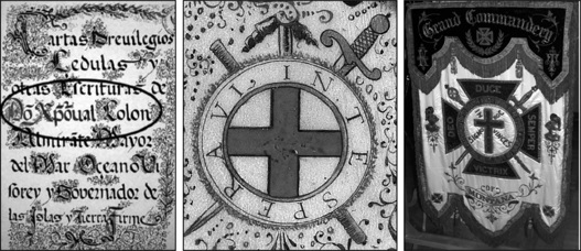
What should be apparent in this book is not only a common ideological thread that weaves through time involving several secret organizations, but also common symbols. The Hooked X is one. Later, several examples of modern symbols will be presented that suggest an influence by modern secret organizations like the Freemasons. In many cases, it is difficult to determine whether a Freemason was involved in the use of secret symbols, but invariably it turns out one was.

In Christopher Columbus’s Book of Privileges there are two examples of the Hooked X symbol. One could be argued is a stylized X symbol (left), but the other found on page one of the document, is a crossed rod and sword making the unmistakable symbol (middle). Interestingly, the crossed sword and staff Hooked X symbology is still used to this day as seen in this example of the Masonic Knights Templar Grand Commandery banner in the Grand Lodge of Montana (right). (Internet; Internet; Wolter, 2012)
One example is a sign almost everyone in the United States will recognize as a large real estate company whose logo incorporates the Templar colors of red and white along with a single angled blue stripe. When the logo is flipped upside down, a very prominent and obvious Hooked X is revealed.
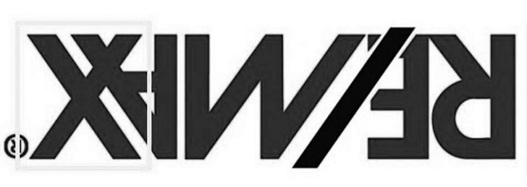
The question, of course, is: was this intentional or an interesting coincidence? Readers will have to decide for themselves if there might be an underlying motive. However, it will quickly become apparent in the other examples of modern recognizable logos so common in our society that a common thread of symbols and colors recurs often. Creators of these logos and symbols can easily plead plausible denial, and there’s no way to prove their intent. However, in the Remax logo and other examples to be presented, there might be too much smoke not to have something burning somewhere.
While examples of the Hooked X and it’s association with highly secretive organizations continue to materialize, we need to be cognizant of other symbols used by followers of the these groups and their alternate ideology relative to the Roman Church. The “X” symbol is certainly one of the symbols that recurs frequently during the research presented in this book. One notable example showed up in the summer of 2011 in the artwork of arguably the most famous artist in the history of the world.
On June 29, 2011, Judi Rudebusch forwarded a link to a New York Times article announcing that a long lost painting by Leonardo DaVinci had recently surfaced. The painting is of the common Salvador Mundi (Savior of the World) image with Christ holding a glass orb in his left hand and his right hand (with the index and middle fingers crossed) upraised in blessing. The painting reportedly once belonged to King Charles I and II, but went missing for over 200 years. It is believed to be worth in the neighborhood of two hundred million dollars.
What immediately struck Judi, and me, the moment we saw it was the obvious “X” in the garment emblazoned across Jesus’ chest. DaVinci has long been rumored to be a heretic and is alleged to have been a grand master of the Priory of Sion from 1510-1519.27 If true, then the prominent “X” in the lost painting is likely a clear symbol to the enlightened ones of both DaVinci’s and possibly Jesus’ true religious beliefs. The timing of this new painting’s discovery is also very curious. With the coming of the New Age, many people with gnostic and esoteric leanings have told me personally that things will be coming forward that hint ever stronger the previously hidden beliefs and agenda that is diametrically opposed to the Roman Church. (See color section, Figures 37 & 38)
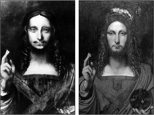
This long lost Leonardo DaVinci painting of the Salvador Mundi came to light in a New York Times article on June 29, 2011. In subsequent published articles, two images of the painting were posted that while very similar they are definitely not the same. One thing that is clearly the same is the prominent “X” within the garment on Christ’s chest that could be DaVinci’s veiled reference to his alternate religious beliefs. (Internet, Internet)
The many news stories swirling about the DaVinci painting had two accompanying images, one in black and white and the other in color. While the imagery was the same, the images were not. The reason for the differences was not explained, and, like many of DaVinci’s paintings, there were many things within the artwork that suggested mysterious messages to those who knew what to look for. Not the least being Jesus’ overall androgynous look, reminiscent of the many statue carvings of the “heretic” Pharaoh Akhenaton, at Armana, Egypt. My association of the ancient king of Egypt and “King” Jesus will become apparent later.
The newly discovered painting inspired research into DaVinci and the symbolism in his paintings, which invariably led us to examine his masterpiece in the refectory of the Convent of Santa Maria delle Grazie in Milan, Italy. One thing was pointed out to me by Margaret Starbird. On the far left side of the painting, on a wall directly above the head of Bartholomew, is what looks like a gold Grail cup.28 When a high resolution image is made of the cup and magnified, it turns out that it is actually a half circle with a vertical line attached to the right (east) side. This symbol is certainly not random and clearly DaVinci had something else in mind besides a cleverly disguised Grail cup when he painted it.
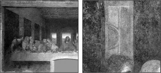
In Leonardo DaVinci’s The Last Supper, Margaret Starbird pointed out a gold grail cup above the head of the disciple at the far left (yellow box on left). Upon closer inspection the cup transforms into a geometric pattern that is the right half of the “circumpunct” with two vertical lines (right). In Freemasonry, the right vertical line on the east side of the circle is symbolic of the winter solstice and pagan belief in the resurrection of the sun as the days get longer. This symbol suggests that DaVinci had knowledge that only a members of secret society would be privy to in the sixteenth century.
In Freemasonry, the point within a circle is one of the oldest symbols on earth and is called the “circumpunct.” Besides being the alchemical symbol for gold it also represents many symbolic and allegorical concepts such as, “man within the universe,” “the heavens revolving around the earth,” the “open eye,” or in Egyptian hieroglyphics as the symbol for the sun. If two vertical lines are attached to the east and west sides of the circle, the symbol represent the summer and winter solstices.29 The two solstices are also symbolic of the two patron saints of Freemasonry, John the Baptist and John the Evangelist. Their feast days fall on the longest and shortest days of the year and, due to wandering calendars over many centuries, the dates celebrated with pagan feasts for thousands of years now fall on June 24 and December 27.30
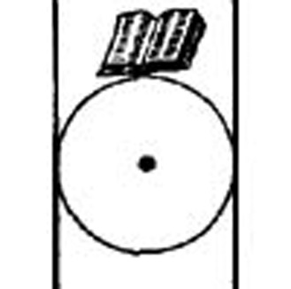
The point within the circle is an ancient symbol that in modern times is called the “circumpunct.” One of the many allegorical concepts of the symbol is “The heavens revolving around the earth”. The two vertical lines represent the summer (left side) and winter (right side) solstices. In Freemasonry, the vertical lines also symbolize the Patron Saints of John the Baptist and John the Evangelist, whose feast days coincide with the solstices. The bible above the circle teaches Masons to consult the Bible or other sacred texts to achieve balance and direction in their lives.
In DaVinci’s Last Supper, the Grail cup is actually the right half or winter side of the solstice symbol which is allegorically represented in Freemasonry by John the Evangelist. The Winter solstice has long symbolized resurrection, or “rebirth of the sun” as the days began to get longer. Perhaps DaVinci was subversively foretelling a literal resurrection of the sun as opposed to the belief in the resurrection of Jesus after the Crucifixion that was soon to follow this feast. What the symbol also reveals is DaVinci’s extensive knowledge of heretical pagan symbolism that would have been consistent with the knowledge base of a grand master of the Priory of Sion.31 While this evidence certainly doesn’t prove he was a grand master, the symbolism found in these and his other paintings are consistent with the long rumored allegation.
On one of the trips for the filming of the America UnearthedTM series, the crew and I traveled to Dublin, Ireland, and then roughly thirty miles north to an area known as the Boyne Valley to the 5,000-year-old megalithic structure known as Newgrange. On November 11, 2012, my friend and Templar historian, Alan Butler, joined us for a most enjoyable day shooting for an episode on mysterious stone structures in North America that incorporated summer and winter solstice illumination events into their construction.
While standing at the entrance of the massive stone and earthen mound reciting our lines and peering into the light box that allows sunlight to enter the chamber lined with large stones to illuminate the floor of the back recess at the extreme end inside at 9:00 a.m. on the winter solstice, I noticed something. The front edge of the lintel stone directly above the light box opening had X’s carved into it. After looking closer we realized there were vertical lines between the X’s clearly delineating they were not lozenges.
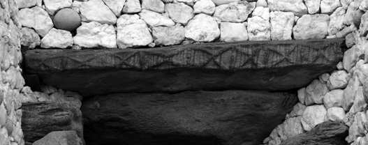
On the front edge of the lintel stone over the light box that allows the light of the sun to enter the chamber at Newgrange there are eight X’s carved into the stone. (Wolter, 2012)
The other curious thing about these X’s was that the lines were not grooves carved into the stone, but were standing out from the surface roughly one-half inch. This meant whoever carved them went to much more effort to create them by removing the stone around them, than if they had simply carved the lines into the surface.
While Alan and I were standing in amazement, appreciating the effort of the carver, one of the cameramen in our crew, Colin Threinen, asked, “How many X’s are there?” I quickly counted them. This time Alan and I were not so amazed. There were eight of them. At the same instant we looked at each other and said, “Venus.”
We both knew that in addition to the sun’s rays entering the chamber at Newgrange at sunrise on the winter solstice, so too would the light of Venus shortly before. Both our minds began to race as we bandied back and forth the idea that perhaps Newgrange was not only constructed by ancient Irish people over 5,000 years ago to capture the light of the sun, but also as a Temple to the planet Venus! By the end of the day we were both convinced Newgrange was most likely built primarily with Venus, the Goddess in the heavens, in mind.
This realization of the undoubted involvement of Venus at Newgrange brought another thought to mind. Only a couple of miles north of Newgrange lay the ruins of Mellifont, the first Cistercian Abbey in Ireland, established in 1146. The next day the crew and I traveled to see the ruins, and the one remaining structure has an unmistakable architecture that matches the mysterious round tower that sits on eight heavy columns at Newport in Rhode Island. Neither Alan nor I found it to be a coincidence that Newgrange was on the land owned by Cistercians at Mellifont. Historians say the chamber wasn’t discovered until 1699.32 However, Alan and I speculated, on camera, that we were certain the monks had to have been well aware of the massive structure and almost certainly understood its true function centuries earlier.
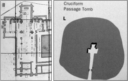
The cruciform shape of many medieval churches including the example here at the Cistercian Abbey at Mellifont in Ireland is strikingly similar to the cruciform shape of the Stone Age chambers such as Newgrange, Knowth, and Dowth in the Boyne River Valley in Ireland. These chambers, situated on the lands or “Grange” of the Cistercians at Mellifont, likely were the inspiration for the cruciform shape of their churches and cathedrals. (Wolter, 2012; Brennan, 1994)
Martin Brennan’s book about Newgrange and other Stone Age sites in the Boyne River Valley, The Stones of Time, notes that the sun enters the chamber at Newgrange and illuminates the back recess at the innermost point in the structure just before 9:00 a.m.33 This fact instantly brought to mind the Newport Tower illumination of the egg-shaped keystone event that happens on the winter solstice at 9:00 a.m.!
Another revelation dawned on me as I read Brennan’s book and studied the drawings of the Newgrange chamber ground plan. The area where the beam of sunlight hits at the end of the chamber is divided into three roughly equal-sized spaces. These spaces are called the end, right and left recesses. The shape of the chamber and the three recesses is strikingly similar to the typical footprint of many Christian churches which when viewed from above make a crucifix. In fact, this shape is called a cruciform style.
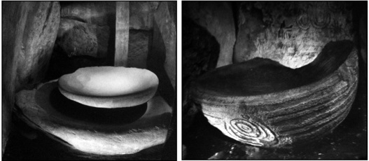
Large stone basins were found in the right recesses at Newgrange (left) and Knowth (right). Thought by archaeologists to have been used for burials, they likely were used for ritual bathing and almost certainly inspired the practice in monastic orders like the Cistercians. (Courtesy of Ken Williams)
Not only did this strike me as the possible inspiration for this common church design, but the stone basin I saw in the right-hand recess at Newgrange resembled baptismal fonts I’d seen in all ninety-nine churches on the Island of Gotland several years earlier. Most archaeologists and researchers believe these stone basins were where the bones of individuals were placed during a ritual for the dead. To me it seemed just as likely the basins were used for ritual bathing. Further, along with the design of the innermost recesses of the chambers, the stone basins were likely the inspiration for the Cistercians who built many of their churches and cathedrals using this cruciform design and lavatoriums in their monasteries with stone fonts or elaborate stone fountains for ritual bathing.
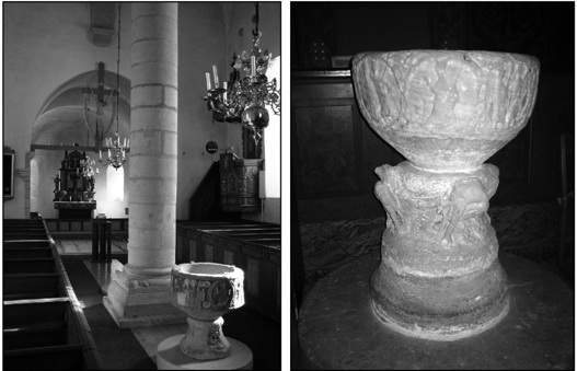
Over ninety of the ninety-nine Cistercian churches on the island of Gotland are small and do not have crossing transepts. However, nearly every one of them has stone-made baptismal fonts that are roughly the same size as stone basins inside the Irish Stone Age megalithic mound structures of Knowth, Newgrange and Dowth. The ornately carved and painted font at Vall Church sits in the middle of the church (left) while the highly weathered sandstone font at Lojsta Church sits where the right transept would be when looking at the altar (right). It seems highly likely the tradition of ritual bathing by the Cistercians was inspired by the Stone Age cultures who built the “rebirth” on the winter solstice earthen mounds that dotted their lands in Ireland. (Wolter, 2004; Wolter, 2004)
At this point, the now boiling cauldron of coincidences was rapidly coming together. In my previous Hooked X book, I concluded the Newport Tower was originally built by the Knights Templar sometime between 1200 and 1400 A.D. This monastic military order was originally founded by the Cistercians in 1128. Certainly at least one or two Cistercian monks would have traveled to the New World on the Templar voyage that resulted in the construction of the Newport Tower. The highly educated monks would have been responsible for ensuring the illumination of the egg-shaped keystone occurred at exactly 9:00 a.m. on the winter solstice. It was a critical element of the ideological beliefs as well as their functioning observatory.
The question now becomes, could the ancient Monotheistic Dualism ideology I have insisted the Cistercians and their Templar brethren embraced have evolved from the beliefs of the megalithic Stone Age people who built structures like Newgrange and later Stonehenge? It seems all the more likely as well as their reverence for the astronomical movement of the stars, planets, moon, and the sun.
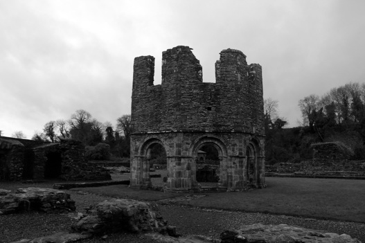
At the ruined Cistercian Abbey of Mellifont the partially intact lavabo remains where the monks practiced daily ritual bathing of their head, hands and feet, before and after meals. Originally constructed in 1142, the first Cistercian Abbey in Ireland had extensive lands called “granges,” which included the Stone Age megalith of Newgrange. It seems a near certainty there is a connection between the solar illuminations at Newgrange and the Newport Tower that both occur at 9:00 a.m. on the winter solstice. (Wolter, 2012)
On October 27, 2011, I received the same email link from two different friends of a short YouTube video about Kevin Knight, a University of Southern California researcher who had recently cracked the code of a 105-page enciphered book that dated back to the 1760s. After watching the video, I clicked onto the article about the story, which had a link to an on-line copy of the original manuscript. Fellow researcher and friend, Judi Rudebusch, one of those who sent me the link, asked me to look closely at the X-like character on the thumbnail sized image of the example page. When I pulled up the high resolution version of the example page from the manuscript something immediately jumped out at me, a Hooked X!
Instantly, I flashed back to the hooked characters in the Larsson Papers found in Sweden in 2004 that dated back to 1883 and 1884. Could they be connected somehow? Before the day was out, I’d found out that the book was from the East Berlin Academy in Germany, and could be dated back to circa 1760. The manuscript deciphered by Knight and his Swedish co-researchers from the University of Uppsala, Beata Megyesi and Christiane Shaefer, records the rituals and apparent political leanings of a secret society in Germany. Within the text are eight, still un-deciphered larger characters which include the stylized Hooked X Knight and his colleagues called “Big X.”
After studying the dozens of examples of the character in the manuscript, some interesting details became apparent. First, like the Hooked X carved on the pillar at Rosslyn Chapel the “hook” extends both above and below the upper right arm. Another curious feature of the Copiale Cipher Hooked X is the circle at the top of the upper left arm. The circle is an obvious code reminiscent of the punch marks at the ends of the carved lines on many characters on the Kensington Rune Stone added by the carver after he carved the inscription. The character also has what appears to be a dot at the top of the upper right arm as well. This could be a simple stylization made by the scribe or it could be yet another code.
Clearly the Hooked/“Big” X symbol in the Copiale manuscript is being used as a reference to another contemporary secret society. This is consistent with my own interpretation of how the Hooked X was used on the five North American rune stones, both for the “a” sound within the text of the inscription and as an important symbol of their religious and political ideology, essentially saying who they were. Some have argued that my land claim thesis for the Kensington Rune Stone can’t be because the inscription makes no reference of the land being claimed in the name of a king or monarch like many French land claim plaques found in North America. The Knights Templar order couldn’t use their former name since they were outlawed. They were still a sovereign entity beholden to no monarch, and by 1362 they certainly didn’t answer to the pope. I would further argue that the Hooked X symbol, which occurs twenty-two times within the inscription, proclaims clearly who was claiming the land and/or marking a boundary.
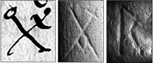
The Copiale Cipher contains seven oversized symbols within the coded manuscript including what appears to be a stylized “Hooked X” the scribe called “Big X” (left). The symbol is being used to reference an apparent rival Masonic order and contains a number of interesting modifications that are likely codes of some kind. The bar of the “X” crosses over both sides of the upper right arm and is similar to the bar in the “Hooked X” carved into one of the pillars inside Rosslyn Chapel in Scotland (middle). The upper left and right bars have a small circle and dot which appear to have been added by the scribe much like the carver of the Kensington Rune Stone added a punch to the lower right leg to one of the “R” runes (right). (Internet; Wolter, 2008 & 2002)
The fact that the Hooked X in the Copiale manuscript is larger in size than the majority of the characters may indicate its importance to the secret society. Another interesting possible connection of the German Copiale manuscript and the Kensington inscription is the presence of umlauts, or double dots above numerous characters. These were thought to be a Germanic influence on the Kensington inscription observed by many runic scholars. In our book, The Kensington Rune Stone: Compelling New Evidence, my co-author and I speculated that the carver of the inscription was likely a Cistercian monk who may have been educated on the Swedish island of Gotland. The Germanic influence on Gotland in the fourteenth century is well documented as the Gutish law on the island was not only written in Swedish, but German as well. The double dotted umlauts above several of the “a” and “o” runes were likely a result of that medieval Germanic linguistic influence.
In January of 2012, I had a number of discussions about the “Big X” in the Copiale Cipher with John Freeburg, the lodge education officer of the Anoka Masonic Lodge in Minnesota. His assessment of the document is that it is clearly an explanation of masonic rituals and the translation put forth, “Needs work.” When I asked his opinion of the Big X he said, “The eighteenth-century Masonic order that wrote this document was likely a Protestant-leaning group who were referencing a rival Catholic-leaning Masonic group with its leadership likely being within the European royal houses.”
Joe Rose, another friend and Freemason, has taken an in-depth look at the Copiale Cipher manuscript. He believes the document is a ritual of one of the “high” degrees in France and Germany during the mid-1700s. Joe explained that a “high” degree is one that emphasizes scientific enlightenment that comes after the third degree or master Mason degree. Joe also believes the Big X symbol in the Copiale Cipher refers to what he called “regular” Freemasons that do not progress beyond the third degree.34
The importance of the Copiale manuscript and the Hooked X/Big X symbol within it cannot be understated. My thesis that the highly secretive leadership of the medieval Knights Templar/Cistercian orders evolved into equally secretive occult and esoteric masonic secret societies during the Age of Enlightenment such as the Rosicrucians, is bolstered by this new discovery. I am also convinced this leadership was comprised dominantly of individuals who were direct descendants of Jesus and Mary Magdalene.
The Copiale Cipher also brings into the discussion once again the discovery of the Larsson Papers in Sweden, in 2004. These papers include two sheets of paper from a recently donated collection to Daum (Institute for Dialectology, Onomastics and Folklore research in Umeå) that contained Swedish writing interspersed between two rune rows, a Masonic box code alphabet, and the same Pentadic numbers used in Arabic placement as on the Kensington Rune Stone. Dated December 1883, and April 16, 1885, the two sheets originated from Edward Larsson (1886 to 1950), who was a tailor by profession. The infamous Hooked X rune is found on both sheets along with several other hooked characters.
The initial reaction to the Larsson Papers of skeptical scholars was to seize the opportunity to reignite the Kensington Rune Stone hoax theory by claiming an immigrant could have brought the Larsson alphabets to America and then used them to carve the inscription. Of course, my geological weathering studies and the Dotted R make this claim impossible. Until they come to terms with what the artifact is, a Knights Templar land claim document with multiple aspects to the inscription, they have no chance of understanding it.
The fact is the Copiale Cipher, which is unquestionably a Masonic document that contains the Big X/Hooked X symbol used to represent a unique Masonic order, provides supporting evidence that the Larsson Papers, which also contains the Hooked X symbol, are indeed connected to a unique Masonic organization most likely in Sweden. The other interesting thing about the Copiale Cipher (originating in Germany), the Larsson Papers and the Kensington Rune Stone (Sweden) are they are all associated with countries in the Baltic Region.
More research needs to be done on both the Copiale Cipher and the Larsson Papers to put them into proper perspective. However, the unquestioned association of these documents with highly secretive Masonic organizations in the period after the demise of the Knights Templar order (officially in 1314) provides factual evidence of a connection between the two groups. This connection has long been speculated by many researchers, and these recently discovered documents provide two critical new pieces of evidence that now make that speculation a near certainty.
Each of the ten known medieval examples of the Hooked X symbol appear to be associated in one aspect or another with a Cistercian/Knights Templar/Knights of Christ group involved in clandestine operations in North America. Perhaps the “hook” itself was meant to be pointing to the left on purpose as if saying, “We are taking our people, our royal bloodline, and our ideology to the west.” In all ten examples, carved into stone or metal, or written onto parchment or paper, the Hooked X was a highly secret and important coded symbol emblematic of a religious and political ideology that was both figuratively and literally at war with the Roman Catholic Church. The primary reason is they wanted to permanently suppress Jesus’ bloodline descendants whose very existence threatened the foundation of the Church: the divinity of Jesus. In essence, the Hooked X is the symbol of Jesus’ bloodline families.
On January 12, 2008, I gave a presentation on the Kensington Rune Stone at the Chanhassen Library in Chanhassen, a small western suburb of Minneapolis, Minnesota. Maria Awes, an investigative producer with WCCO-TV in Minneapolis, who had interviewed me in the past about my work on the Kensington Rune Stone and other projects, told me her husband, Andy, would be there to hear my lecture. Afterwards, Andy introduced himself. Andy had enthusiasm and energy and laid out his vision for making a documentary about the rune stone. Janet and I both knew we had found the right person to work with to make the film we always wanted.
Maria was an excellent researcher and writer with a real talent to succinctly summarize a story from a decade of experience working as an investigative reporter. Her talents proved invaluable in writing the script, planning the travel arrangements, and arranging the experts and questions to be asked for the dozens of interviews we conducted.
Andy maximized every minute, mile, and dollar invested. What he accomplished with his three-man crew was comparable to what other production companies typically did only with much larger crews. The best part was we all got along well personally and nearly always agreed on how to tell the story. Bo Hakala’s mild demeanor accentuated his immense talent as a videographer. It was fun watching him and Andy craft the interviews and shoot the video that made the film so visually beautiful.
Within a couple of weeks, we had assembled a group of investors with a signed agreement in place. For the next six months our four-man crew of video photographer Bo Hakala, sound, lighting, and “anything else we needed done” guy, Ben Krueger, director, Andy Awes, and me traveled to Europe (twice), Canada, and locales in the United States, retracing my research of the past eight years.
Once the filming in Europe was done, Andy pieced together a trailer that he kept secret until he surprised me by unveiling it during our East Coast trip filming of more artifacts and sites. It was an incredible four minutes I couldn’t imagine being done any better to sell this project. In January of 2009, they entered the Secret History of North America trailer into a contest for best emerging producers at the annual National Association of Television Production Executives Conference and won first place.
Andy and Maria were ecstatic when they called with the news and said every cable network there wanted to talk with them about the project. Within a month we had struck a deal with the History Channel to produce a two-hour documentary. Because History now owned the film, they decided to change the name of the film to Holy Grail in America. I wasn’t happy about it. Comparison with Dan Brown’s DaVinci Code came from this, but we knew our story wasn’t fiction, and it was really good. Eventually, I realized more people would likely tune in to watch it with the new title. I knew the content was more important.
The film premiered on September 20, 2009, at the Riverview Theatre in South Minneapolis. Everyone who had participating in financing, making the film, or who had been involved in the research was there. Janet and I were humbled to have our work showcased in such a powerful and classy way. It was truly a memorable and historic night. Historic also was having this research begin to reach worldwide audience. This generated new leads to more sites and artifacts, many relegated to historical obscurity by ego, incompetence, negligence, and apparently in some instances, an intentional effort to conceal. Some of the most interesting and important of these new discoveries are presented here.
In the three years since the release of the first Hooked X book several new stone holes have been discovered and recorded. The total number of known stone holes in the Upper Midwest of North America has now surpassed 100. As awareness of these curious manmade artifacts increases, surely more will be found. Currently, South Dakota researcher Judi Rudebusch has taken the lead in compiling a stone holes database. For those who think they may have discovered a stone hole, I’d like to encourage them to contact either Judi or me. We encourage people to send photos and a GPS location if possible.
Because there is no documented modern explanation for the roughly one-inch diameter by anywhere from one to nine inches deep, rounded triangular shaped holes, we continue to postulate the manmade holes are likely of pre-Columbian origin. Their likely purpose was for use as trail markers, marking land boundaries, and for surveying. As presented in my previous book, at least half a dozen stone holes at the Ohman Farm triangulate to pinpoint the location where the Kensington Rune Stone was discovered. This serves as evidence for the intended purpose of the stone holes which likely included other functions.
In 1806, when Lewis and Clark embarked on their historic adventure across the newly purchased land from France known as the Louisiana Purchase, they received the following instruction from Thomas Jefferson, “Beginning at the mouth of the Missouri, you will take observations of latitude and longitude, at all remarkable points on the river, and especially at the mouths of rivers, at rapids, at islands, and other places and objects distinguished by such natural marks and characters, of a durable kind, as that they may with certainty be recognized hereafter.”
This interesting quote makes one wonder if one of those “remarkable points” of “a durable kind” could have been stone holes left by earlier Templar visitors. Admittedly, this is sheer speculation. However, the reader will soon see it seems likely the third president of the United States received secret information about pre-Columbian Templar visits to North America. The association of the numerous stone holes at the Ohman Farm with the Templar relic known as the Kensington Rune Stone, and the existence of well over one hundred known stone holes of a similar type across the continent makes the knowledge of these artifacts by certain founding fathers a distinct possibility.
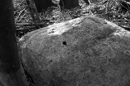
On December 26, 2011, Janet and I visited the Darrell Quaas farm in Dassel, Minnesota, to examine this stone hole. The roughly one-ton glacial boulder has an approximately one-inch-wide by four-inch-deep hole with a rounded triangular shape typical of the stone holes found all over the Upper Midwest over to the East Coast of North America. As more people become aware of them, many more are sure to be found both in North American and likely other continents as well. (Wolter, 2011)
After Holy Grail in America aired on the History Channel on September 20, 2009, I received a flood of emails, letters, and phone calls. Aside from a couple people with apocalyptic predictions for daring to write about such sensitive Christian subject matter, the vast majority of comments were very supportive, and several offered exciting new leads. One of those leads came from a man I’d known for years who, like me, was an avid collector of Lake Superior agates.
Daryl Johnson called and said he’d heard a lecture by a woman who talked about the history of Pine County, Minnesota. During her slide program she showed a picture of a glacial boulder with a familiar name and date carved on the surface. The date was “1679” and the name was “Du Luth.”
Daryl didn’t know the boulder’s location, but I found someone in the community who did. John Ecklund, whose grandfather settled in the community in the 1910s, was very helpful. He said, “There aren’t many people left who know the location of the boulder, but I do and would be happy to show it to you.” We made plans to see the stone on October 16, 2009, and I invited one other person to join me who could offer additional geological insights. It had been several years since we were in the field together, but I knew my former advisor, mentor, and friend, Professor emeritus Charles L. Matsch, would enjoy seeing this artifact.
John and his son, Eric, led us a couple of hundred yards into the woods on a cool and sunny mid-October day to a large boulder of the familiar sandstone from the Hinckley Formation. We could see the inscription from several yards away, but were struck by the advanced weathering of the carved characters upon closer inspection. I took several pictures with my camera and portable microscope. The carved lines exhibited rounded edges with exposed sand grains in the grooves that were identical to the surfaces on the rest of the boulder. One point Charlie and I agreed on was that the carving wasn’t recent, and very likely was made three-hundred thirty years ago.
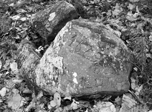
In Pine County, Minnesota, a roughly 1,000-pound, sandstone glacial boulder contains an inscription of the date “1679” and the name “Du Luth.” The inscription appears to be genuine and would be consistent with the known exploration of land west of the Lake Superior by French explorer, Daniel Greysolon Sieur Du Luth, from 1678 to 1682. (Wolter, 2009)
Two curious features of the carving were the presence of two punch marks that seemed out of place. One was to the upper left of the number “1” and the other was to the lower right of the first “U.” Neither punch mark seemed to belong, but they were clearly manmade. Therefore, they were put there for a reason. It would be only a couple of weeks before I would learn of a compelling possibility for the punch marks.
The mysterious punch marks on the Du Luth Stone prompted me to think about punch marks I had seen on other inscriptions. After going back and reexamining the five rune stones with the Hooked X, they all had similar punch marks in curious places. Even though my co-author and I had accounted for most of the punch marks, or dots, I found during my microscopic examination of the Kensington Rune Stone, we didn’t have an interpretation for all of them.35 One word separator, in the middle of line five, stood out because of double punches that made four holes instead of two.
The double-punched word separator on line five of the Kensington Stone is reminiscent of word separators on the Spirit Pond Map Stone’s map side that could also be some kind of code meant to be read by one of the carver’s own.
The Narragansett Rune Stone appears to have two, previously unnoticed punch marks at the beginning of the inscription, in much same position as the Du Luth Stone, and at the end. While a single punch word separator at the end of the second line is possible, it could be the carver’s intention to acknowledge God, to possibly bless or protect the message. Another possibility: the punch marks at the beginning and end of the inscription are some kind of watermarks confirming the legitimacy of the message. We will see another example of marks at the beginning and end of another message carved in stone later in the book.
Margaret Starbird was the first to call my attention to what the punch marks could be.36 Starbird cited Herbert Silberer’s book, Hidden Symbolism of Alchemy and the Occult Arts, where he explained, “The center of the sun [God] is to be seen in the symbol (a circle with dot in the center).” Apparently, the dot, or punch, without the circle is also an acknowledgement of the presence of God.37 This would work well for an inscription carved in stone, since carving a circle would be time consuming and difficult.
The practice of acknowledging the Creator with punch marks and dots appears to have been passed on from the medieval period into the Renaissance era through secret societies with Templar connections. Explorer Christopher Columbus incorporated several dots within his mysterious sigla. In the three examples pictured on page 106 of The Hooked X, Key to the Secret History of North America, the pattern of dots is different in each Columbus sigla, suggesting either a code or possibly multiple references to God. If indeed these punch marks and dots are acknowledgements by the carvers to the presence of God, these previously overlooked marks represent a whole new aspect of compelling evidence consistent with the medieval origin of these artifacts.
Another interesting example of dot codes I have come across were carved onto a mysterious eighteenth-century powder-horn belonging to Jeff Jones of Pennsylvania. Jeff inherited the powder-horn from a family lineage he claims descended from George Washington. This claim was somewhat problematic in that some researchers claimed that Washington was sterile and, therefore, could not have any direct descendants. However, like many popular myths in our culture, conclusive evidence has not yet been presented.
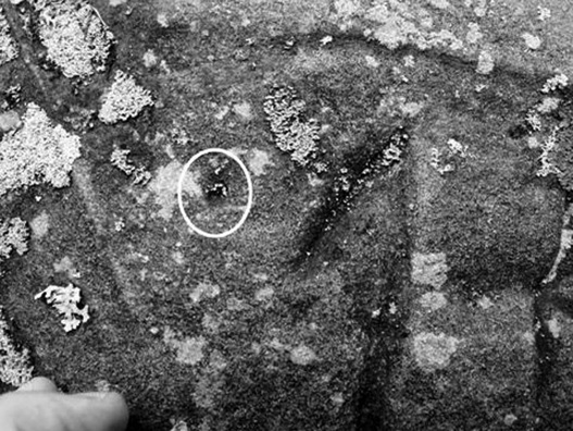
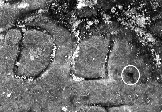
On October 16, 2009, Professor Emeritus Charlie Matsch and I noticed two round, manmade punch marks were present to the upper left of the number “1” (above), and to the lower right of the upper “U” of the “Du Luth” boulder (below). (Wolter, 2009)
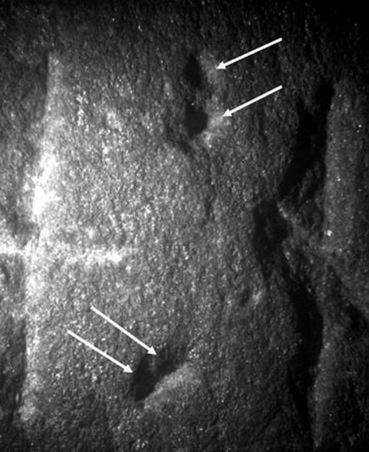
On line five of the Kensington Rune Stone one of the word separators has been double punched, creating four holes instead of two. These added punches could have been an acknowledgement of the presence of God by the Cistercian monk who carved the inscription. Word separators in the five North American runic inscriptions with the Hooked X have two vertically aligned punch marks. (Wolter, 2002)
In 2010, Mr. Jones submitted a DNA sample that did, in fact, produce results consistent with other distant members of the Washington family. No final conclusion yet, but his collection of early American artifacts is quite impressive, and it includes the powder horn. Jeff explained the clearly visible dots on his horn, along with what he called carver’s “knockouts” were made to identify specific letters meant to be either dropped or added to create anagrams and secret messages.
A “knockout” is where the carver dug out a shallow pit within a part of a letter that was then blackened out. Three of these knockouts are clearly visible within parts of three letters on Jeff’s horn. He believes he has deciphered the secret messages his ancestor encoded into the horn that reveals the true identity of his ancestor and his incredible story that has thus far escaped recorded history.
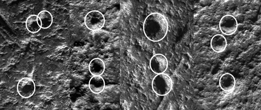
On the Spirit Pond Map Stone (map side) four of the five word separators have three punch marks in what appears to be a random pattern. (Wolter, 2006)
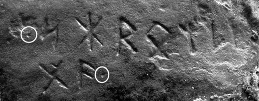
Single punch marks are present at the beginning and the end of the Narragansett Rune Stone inscription, which is comprised of a total of nine runes. Only five characters are pictured here. (Wolter, 2008)
Jeff says the horn was originally made at the time of the Revolutionary War, but wasn’t carved until 1839. The message was reportedly carved by his great-great-great-great-great grandfather Chris Jones, and was apparently meant to reveal his multiple alias names that he changed out of necessity during times of intrigue in early American history. Because this ancestor is allegedly George Washington’s illegitimate son, he was first named him Isaac Newton Martin, after the famous English mathematician and astronomer.
When Martin was an eighteen-year-old Minuteman in 1775, he was captured by the British and eventually ended up on the famous ship Bounty when the mutiny led by Fletcher Christian occurred in 1789. Isaac Martin was supposedly killed on Pitcairn Island in 1793, but Jones claims Martin and Christian faked their deaths and reportedly made their way New Orleans by 1808, after changing their names to Jean Lafitte (Fletcher Christian) and Marcus Lafitte (Isaac Martin).38 Marcus eventually changed his name again to Chris Jones in 1810 after returning from France. If true, it would be one of the most amazing stories in American History.
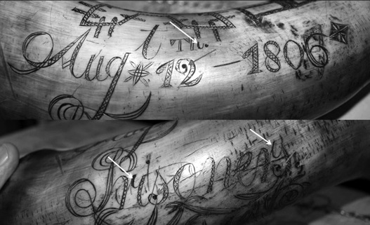
This late eighteenth-century powder horn contains dots and carved out and then darkened portions of letters called “knockouts,” that were made by the carver to create anagrams and secret messages. Jeff Jones, the owner of this powder horn says the dots and knockouts were made by his distant relative to create secret anagram messages. Interestingly, the capital “A” in Aug(ust) has a “v”-shaped crossbar thus producing the encoded symbol “AVM.” (Wolter, 2011)
The messages on this horn, however, are not what are important in this discussion. What is important are the dots and other symbols placed within certain texts, whether carved in stone, bone, ivory, or written on paper or parchment. This is an ancient practice used by members of secret societies or groups that likely included our founding fathers. In this case, we might have an artifact directly connected to the family of George Washington, who is, arguably, the most historically well-known member of the Freemasons in the United States.
While punch marks carved into stone or dots drawn on paper during medieval times through the Renaissance could have been acknowledgment of the Creator, it’s just as likely they served another purpose—a code. Perhaps both.
We documented several facts that day in the field with Charlie, and later that week with the help of Gilles Durocher, a family friend in Quebec, Canada. Gilles, recently retired after thirty-three years working for the Canadian archives, said Du Luth retired and eventually died in Montreal, in 1710. Gilles was able to find original documents written in Du Luth’s own hand that helped answer questions about this interesting early explorer. Another reference helped us trace his steps to what would eventually be the port city named after him, “… about the 27th of June, 1679, because it is known that on the 2nd of July, 1679, he planted the banner of France, His Majesty’s Arms, ‘in the great village of the Nadouecioux, called Izaty’s, where never had a Frenchman been no more that at the Songaskitons and Houetbatons, distant six leagues from the former, where I also planted the His Majesty’s Arms in that same year, 1679.’”
I visited the site again on November 21, 2009, with Dave Mather, an archaeologist with the Minnesota State Historic Preservation Office. On this visit, we were escorted to the site by landowners. While clearly stating his reasons for being skeptical, it was also clear Dave found the inscription to be very interesting. In addition to making visual observations and trying to learn what we could from the landowners, I had brought a metal detector along and scanned the immediate area around the stone. Hopeful as I was that there might be a buried metal plaque, no metal artifacts were detected.
After the site visit, Dave and I examined a large monument of Hinckley Sandstone in a park within the Askov city limits. The monument was reportedly erected in 1927, and I took both macro and microscopic photographs of the manmade surfaces for relative-age weathering studies. We also collected weathering data from two more monuments of Hinckley Sandstone in the Askov cemetery, dated 1927 and 2008.
Dave could easily understand and appreciate what I was trying to do with the weathering studies and was able to get his other questions answered by Gilles Durocher. After discussing every aspect of this artifact we could think of, we agreed there were few, if any, red flags. All that was needed was for me to complete the laboratory work and for both of us to write our reports.
The following is a list of facts consistent with the boulder being a historically important seventeenth century artifact:
With an ode to geologist Newton H. Winchell and the language he used in concluding the Kensington Rune Stone was a genuine artifact, I concluded that the Du Luth Stone inscription was also genuine with the following: “The preponderance of the geological, historical, and geographical evidence is consistent with the Du Luth boulder having been carved by the Daniel Greysolon Sieur Du Luth exploration party at the date stated in the inscription.”
On December 21, 2010, my birthday, I decided to fly out east, hoping to see the illumination in the Newport Tower. I made a quick stop at the Westford Knight before heading west to Pinnacle Mountain in New Preston, Connecticut.
I had ever seen the four Hebrew inscriptions at the top of the Mountain first recorded by Ezra Styles, then president of Yale, and this was going to be the day. The public trail on the north side of the mountain about 1,000 feet above the base. Forty-five minutes later I reached the treeless top. The area was an outcropping of granite with several large boulders scattered about. The view overlooking Lake Waramaug to the west was breathtaking.
For well over an hour, I scanned the granite bedrock and large boulders but couldn’t find the Hebrew inscriptions. A cold wind was sapping my resolve when after deciding to make one more sweep of the area, I spotted them.
Within a minute I found all four Hebrew names carved into glacially rounded granite gneiss surface and each had a semi-circle carved over the letters. While it wouldn’t be possible for me to say exactly how old these manmade characters were, I did notice that this particular area of the rock had a lot of fine-grained secondary quartz veins which made the rock smoother and more durable than granite gneiss with less quartz. I wondered if the carver knew this area would make the carvings last longer and concluded that he probably did.
Whether these Hebrew names were carved only a few or several centuries ago was impossible to determine on this day. However, that they dated prior to “contact” was still a distinct possibility.
After a vigorous hike down the mountain, I continued on to the Newport Tower. At 7:30 a.m. there was no sign of the sun peeking through the overcast. A dozen or so Freemasons arrived, including Rick Lynch. I was soon giving short lectures about the Masonic keystones, the various solar, lunar and Venus alignments as well as the illumination. Even though I didn’t see the light box, I met some interesting people as the group swelled to about thirty by 9:00 a.m.
Gloria Amendola, who showed me several Templar and Cathar sites in France, surprised me by showing up with her friend, Kim Bacik. We all parted for a late breakfast 11:00 a.m. Just as we sat down, the sun popped out.
Our next stop was to meet Irene Daponte, who had contacted me about an inscribed boulder she had found earlier in the year on the shore of Narragansett Bay near downtown Newport. The tide was quickly receding as Irene led our group to the boulder that was mostly submerged in the sand. As the waves slowly receded, Rick Lynch started shoveling away the sand, eventually exposing a clearly visible, but significantly weathered inscription on the south side of the boulder that read, “IN HOC SIGNO VINCES.”
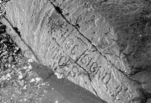
On December 21, 2010, after an hour of shoveling during the receding tide we were finally able to reveal the highly weathered Latin inscription that when translated into English reads: “In this sign you will conquer.” Barely readable carvings were noticed on the top and opposite side of the boulder. Inscribed boulders like this one and the Narragansett Rune Stone should be removed from the beach and relocated where they can be protected for future study. (Wolter, 2010)
After clearing off barnacles and seaweed from the exposed top of the boulder we noticed two other carvings on the top and northeast sides that were difficult to see. Coming back at night and casting low angle light across these carvings would have to wait for another time.
“In Hoc Signo Vinces” is an old Latin phrase meaning, “In this sign you will conquer.” The earliest known use of the phrase was by the Roman emperor, Constantine I, adopted a similar Greek phrase as a motto just before the Battle of Milvian Bridge against Maxentius, in 312 A.D.39 The phrase has been used throughout history on the coat of arms by nobles, on the seal of the Jesuits, by schools, fraternities, and by the modern military. The medieval order of Knights Templar also used the phrase as does modern Freemasonry where it appears on the Knight Templar Cross in the York Rite branch.
My second trip to see the stone was five months later on May 16, 2011. Irene Daponte joined me again along with Steve and Peter Dimarzo, two local amateur archaeologists who have found many interesting artifacts and sites around Narragansett Bay. Low tide was very low at around 1:00 p.m. which allowed us to dig out around the boulder in an attempt to determine its size.
As we began digging sand away, a woman appeared at the seawall overlooking the beach and introduced herself. Carol Pardee lived across the street closest to the boulder and said she remembered the inscription from when she was a little girl, sixty-five years earlier. Carol said her deceased grandparents talked about the inscription long before that. This was helpful information that gave us a minimum age for the inscriptions.
We never did reach the outer edges of the stone before hitting the water table, but were able to get a better look at the other inscribed words we couldn’t make out in December.

On our second trip to the stone on May 16, 2011, I was able to create darkness under my rain jacket and shine a flashlight across the previously unreadable carvings on the top and opposites sides of the boulder. The carvings appear to be “Ding, Ding” (underlined in white) as in the sound of a bell. (Wolter, 2011)
With a temporary shelter erected it over the stone creating shade. I then put my dark rain jacket over the stone and stuck my head under it and highlighted the characters with a flashlight. Gradually, I was able to make out the words, “Ding, Ding.” We were all a little surprised and confused at first, but on my drive back to Hartford, Connecticut, I talked to Ron Reed, who offered some interesting insight.
Ron, an ex-Navy guy, said whenever an officer left or boarded a military ship, a bell was rung. The bell “dings” two times for a lieutenant and four times for the captain. Ron also reminded me that the US Naval Academy was moved from Annapolis, Maryland, to Newport, Rhode Island, for four years in 1861, and the Naval War College was established in Newport in 1884. We discussed the possibility that the inscriptions could have been carved by a zealous naval recruit. The weathering of the carvings by wave action on the beach could certainly be consistent with a hundred or so years.
However, one cannot exclude the possibly origin related to the medieval Knights Templar, who we know were in Narragansett Bay centuries before Newport was founded.
One of the Freemasons we met at the Newport Tower was the incoming grand master for Rhode Island, Chip Halstrom. Chip joined us to see the “In Hoc” Stone. Before walking down to the beach he showed us a very interesting artifact. Out of his pocket he pulled a Masonic medal that had a bust of George Washington inside an oval with the words, “Washington Com(man)d(r)y K(nights) T(emplar), Newport, R.I.” Hanging below the top part of the medal was a beautiful rendition of the Newport Tower. Chip said he bought the medal off Ebay. However, neither Chip nor Rick Lynch, both Knights Templar Freemasons, had any idea where such a Masonic metal had come from.
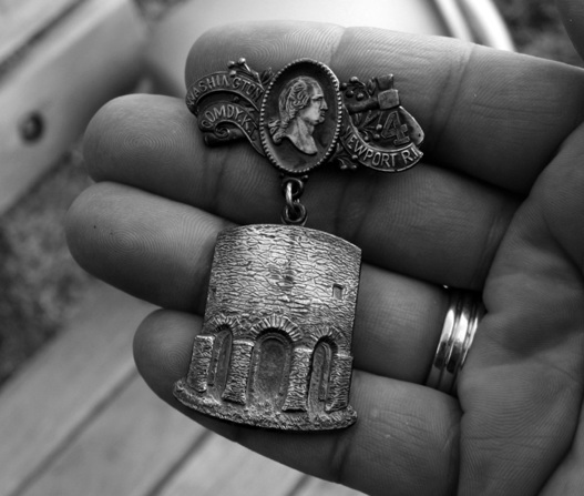
On December 21, 2011, Chip Halstrom, the 2012 incoming grand master of Rhode Island, showed us a Masonic Knights Templar medal with the Newport Tower jewel hanging below an oval with a profile image of George Washington. (Wolter, 2011)
We all agreed the medal dated back to at least the mid-1900s and found it very interesting that a modern Masonic Knights Templar order would pick what many people erroneously believe was an old stone “Windmill” for such a medal. It made us all wonder if some older Masonic body knew more about the ancient tower than they were telling.
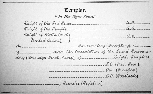
When a candidate completes the required degree work and becomes a Masonic Knights Templar they get a receipt. In this example found in the 1910 edition of History of Freemasonry and Concordant Orders, the “In Hoc Signo Vinces” phrase is found.
Yet another call from Nick Johnson, who had seen the film and had made an interesting discovery. He said he was hiking along the Arkansas River on the south side of Tulsa, Oklahoma, when he spotted a bull carving on a large slab of rock, a mile or so downriver from the power plant that controlled the flow of water. Nick asked three friends to help him get the several-hundred-pound slab of rock out of the river and into the bed of his truck.
He asked if I was interested in examining his find under the microscope. I asked him how soon he could bring it to the lab in St. Paul. On March 12, 2011, Nick arrived. He showed me the stone in his truck. Even in direct sunlight, I could see the two-foot long bull carving with high curving horns with four wavy vertical lines. In front of the bull’s snout was a vertical pole with horizontal lines running its length. Both ends of the pole dropped into large areas where the rock had spalled away roughly an eighth of an inch deeper than the pole.
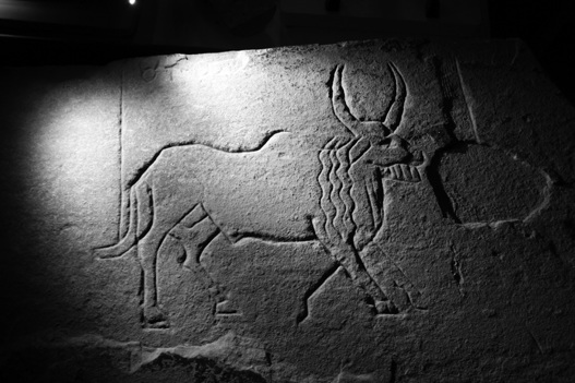
On March 12, 2011, Nick Johnson arrived at the American Petrographic Services Inc. laboratory with his approximately 500-pound slab of sandstone with an Egyptian style Apis Bull carving he found while collecting arrowheads along the Arkansas River, in Tulsa, Oklahoma, March 9, 2011.(Wolter, 2011)
Directly above the bull’s hind quarters were four symbols carved in a line along the top edge of the slab. The first symbol was clearly a circle with horns that looked exactly like the astrological symbol for the constellation Taurus. The next three symbols had partially spalled away and were difficult to discern.
Looking at the bull again, I noticed a line carved between the two front legs that appeared to be a fifth leg or possibly the line was drawn as if to indicate motion of one of the legs. Another curious perfectly straight vertical line extended from two-thirds of the way to the end of the tail straight up to the edge of the rock, an inch to the left of the Jupiter symbol.
After our cursory exam of the carving in the back of Nick’s truck we placed the slab onto a table with rollers and brought it up into the lab. We centered the digital microscope over the carved lines on the hind end. When the image came up it was clear the stone was fine-grained sandstone and the walls of the grooves were rounded from weathering. At this point, I set the magnification to 200X and generated a three-dimensional image of one wall of the groove. When the 3D image came up on the computer screen, Nick and I, and everyone in the lab were surprised at what we saw. The individual sedimentary layers had differentially eroded back making the once straight and steep carved wall of the groove significantly wider and terraced like the old weathered steps of an ancient stone temple badly in need of repair.
I asked Nick if I could make a small test groove along the bottom edge of the slab over a foot away, but into the same sedimentary layer the carving was in. Nick said, “Go ahead,” and I then carved a fresh line to roughly one-quarter-inch, the same depth as the carved lines of the bull. I then placed the microscope over the test groove and took a 3D image at the same magnification. When the image came up this time, the contrast between the two was dramatic. The walls of the groove were straight, smooth, and steeper with no terracing of the sedimentary layers as would be expected. The interpretation was simple and while it was unknown how long it took for the advanced weathering profile to develop in the bull carving it clearly indicated significant age. (See color section, Figures 6 & 7)
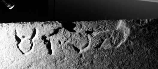
Directly above the bull’s hind quarters were four symbols carved in a line along the top edge of the slab. The first symbol is a circle with horns and the others are spalled away to the point of being not discernible. (Wolter, 2011)
In January of 2008, I received an email with fuzzy, nighttime pictures of what appeared to be a runic inscription carved into a rock wall with some mysterious characters and diamond-shaped lozenges. It looked interesting, but the little background information I was able to get led me to think it was probably something done in the last one hundred years or so, and I forgot about it.
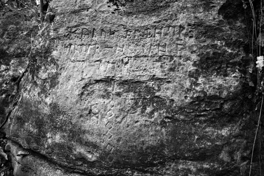
The Independence Runic inscription is carved into a five-foot tall vertical limestone rock face only a few miles from the Missouri River near Independence, Missouri. (Wolter, 2011)
In September 2009, my friend Wayne May, sent me some photographs he had taken during a visit to see the inscription a few days earlier. Wayne’s pictures, taken in daylight, had very clear characters. He said the carvings looked old to him and that I should take a look at it. In June 2010, I had the opportunity.
Wayne had a friend, Forrest Leggett, who lived near the site and offered to be our guide. Committee Films was in the midst of making another film for the History Channel about pre-Columbian exploration and sent Phil Joncas to meet Forest and me in Kansas City to film our visit. The terrain was a heavily wooded valley. The stream running through it eventually drained into the Missouri River just a few miles away. Phil and I followed Forrest across a field, railroad tracks, a stream and up the opposite bank back into the woods. Forest pointed out massive blocks of limestone bedrock slowly sliding down toward the stream eroding its banks. Suddenly, Forrest stopped and pointed to a wall of limestone bedrock and said, “There it is.”
The inscription had blended into the rock face. Upon a closer look, I was struck by how deep and skillfully the characters had been carved. I was also impressed with my initial review of the inscription’s weathered appearance. It certainly wasn’t fresh, and I would learn from Forrest that the earliest known reference was reportedly in the 1920s.
Phil, Forest and I spent roughly two hours taking measurements, photographs, and a sample of the rock from about fifteen feet away. I was sure the rock was a limestone, but its weathering properties would depend on what kind of a carbonate rock it was, and I could only make that determination in the lab.
Within days I had a thin section made and reviewed it under the polarized light microscope. The rock was very dense and compact micrite (muddy) limestone with occasional fossil shell fragments. When we cut and polished the sample, it showed a clearly defined lighter-color weathering profile at the surface that was roughly one-eighth of an inch deep. By June of 2011, my new Keyence three-dimensional digital microscope allowed high resolution and high magnification images. The sample of the rock collected from the Independence inscription stone was carved into revealed a surprising and very interesting surface under the new digital microscope.
Part of the surface was covered with patches of light-gray lichen with shallow pits on the surface. Where the lichen had come off, it had left a series of circular pits that looked the dimples on a golf ball. It appears the lichen produced acid that attacked the limestone surface, producing the pits. The pitted surface excited me because it gave me something I might be able to use to compare with the inscription if I could get the new microscope down to Missouri.
On October 8, 2011, David Brody and I met in St. Louis, Missouri, and then met up with the landowner who led us back to the inscription across his property in our rental Jeep. The final leg of the journey required moving logs and driving over washed out gulleys on an old elevated railroad bed that nearly swallowed the Jeep. Once at the site, I pulled out a plastic table and set up the digital microscope. David scouted the rock faces along the ravine for more rumored carvings while I did my examination.
This was my first chance to take the new equipment into the field and it didn’t disappoint. The lens zoomed into the grooves and the images that came up onto the screen were bright, clear and detailed. One of the things I was looking for were the golf ball-like dimples on the surface of the carved grooves, but there were none to be found.
David found no other inscriptions. I showed him some of the images of the rock surfaces inside the carved grooves. Dave said, “You’re not seeing the lichen pits are you?” I shook my head and said, “I would have expected at least some pitting, and it’s making my ‘spider sense’ tingle.”
By around 5:00 p.m. it was time to pack up. We thanked the landowner for his hospitality. Later that night, we talked about what needed to happen next.
“It’s up the runologists now.” I said to David.
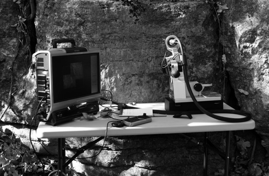
On October 8, 2011, I was able to use the latest three-dimensional digital microscopic technology in the field to examine the Independence Rune Stone in Independence, Missouri. (Wolter, 2011)
He agreed and then asked me the question I knew was coming, “So, if you had to say, how old do you think the inscription is?”
I said, “Well, David, I’d say it’s between one hundred to one hundred fifty years tops.” As much as I would have loved for that inscription to be pre-Columbian, both the science and my gut, said, “No.”
Ironically, within only a couple of months we received the news from the runologists we were waiting for. Only a month after David and I had been there, another group visited the site, which included James Frankii, a German professor at Sam Houston University in Houston, Texas. As part of his doctoral studies, Frankii studied Latin, Old French, Old High German, Old Saxon and Old Norse. He and the group concluded the vertically aligned symbols were the date he believes the inscription was carved: 1888. The remainder of the inscription includes the name of the carver, Cyrus Arthur Slater, and his wife, Hannah, both English immigrants, who arrived in America in 1881.40
A number of people were very disappointed when they found out the inscription wasn’t pre-Columbian. I too, would have loved for the inscription to have been ancient, but it wasn’t. This inscription was a good example of why people have to always be careful when dealing with historical mysteries. In this case, both the hard and soft science investigations reached the proper conclusion.
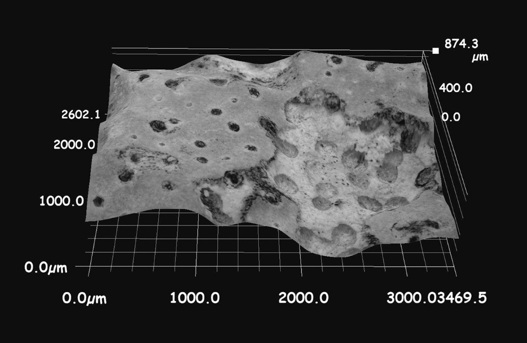
This digital image of the surface of a sample collected from the bedrock outcrop roughly ten feet from the Independence runic inscription. The light gray area is lichen with dark gray spots. Acid from lichen has attacked the surface of the limestone surface leaving circular pits clearly visible in the white area where the lichen has come off. (Wolter, 2011)
Another lead that came from Paul Weishaupt, a man who lived near Tucson, Arizona. He forwarded pictures of an inscription he and two friends, Frank Belluardo, Jr., and Jim Cardamone, had found at the entrance to a cave high in the Mustang Mountains. To my surprise, I recognized the characters immediately as Anglo-Saxon runes, but in Arizona? It seems improbable, but I also knew it wasn’t a matter of if I would see the inscription, but when?—March 19, 2011.
We followed our guides along a desolate road into the Mustang Mountains. It took an hour and a half to reach the saddle between the two peaks. Frank found a couple of pottery shards at an ancient campsite and shared his past experience with archaeologists. Every time he brought up the idea of pre-Columbian exploration, it was roundly dismissed. Frank said eventually he was no longer invited on any more digs. So it goes apparently.
The cave was naturally eroded along a joint fracture extending about forty feet into the mountain. The mouth of the cave was about twenty feet high and, as we entered, I walked across a large flat boulder. Stopping me dead in my tracks were dozens of skillfully carved characters arranged neatly into five rows.
My first impression of the inscription was that it was recently carved. The bottoms of the grooves were white where the dark-gray limestone had been crushed by the chisel. I also noticed the entire face of the boulder was covered with a white calcite coating. The adjacent dark-gray flaked areas exhibited virtually no weathering or buildup of secondary calcite, which covered the limestone boulder’s surface the inscription had been cut through. This gave the inscription a freshly made look. But this was not the time to draw any conclusions, so I went to work collecting as much information as I could. After collecting a small sample I chipped off the back side of the stone, I took several photos of the carved characters using my handheld portable microscope.
Paul, Frank, and Jim relayed how they led a group of archaeologists, which included the Arizona state archaeologist, to the site in 2010. They said they were very interested and took many pictures of the Native cave art, but ignored the runic inscription. When they asked the archaeologists for their opinion they replied, “Modern graffiti.”
We took pictures of the beautiful Native American wall paintings and carvings inside the cave. Most of the designs were of various patterns, spirals, and one swastika-like sun symbol. All the native art was covered with black soot from campfires reported set by “illegals” making their way into the country. About halfway into the cave, we found the first word of the runic inscription carved into the east wall, twice. The three-to four-inch-tall runes were bright white from being cut into crystalline calcite lining the wall.
Why these runes were carved two times inside the cave was a mystery, but then we started to think about possible solar alignments. The cave ran almost due north-south into the mountain. The only possibility of sunlight penetrating the cave would be on the winter solstice when the sun would be at its lowest point in the southern sky. Still two days from the spring equinox, we knew we had nine months to think about it.
Before beginning the trek back down the mountain, we scouted around and found two smaller caves. Just inside one of the caves was the rotting corpse of a wild boar. As I moved in to get a closer look, something stirred in the fur. Blending perfectly was a three-foot-long coiled rattlesnake that nervously slunk its way deeper into the cave. As I slowly backed away, I felt empathy for both the ancients and the illegals who risked entering these caves.
The motivation to make the difficult climb and risk the rattlesnakes was likely religious for the Natives who must have considered this cave a sacred site. The bone-white crystalline calcite inside the cave and the chalk-white secondary calcite covering the inscribed boulder might also have inspired the visitors (white monks possibly?) who came before us.
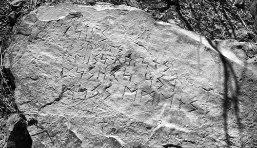
On March 19, 2011, Paul Weishaupt, Frank Belluardo, Jr., and Jim Cardamone, led my family and me on a hike into the Mustang Mountains of southern Arizona, where they found a runic inscription carved into a boulder at the entrance to small cave. The forty-two-character-long inscription also had a Christian style cross carved a few inches below the last line of runes. (Wolter, 2011)
A week later, we received a call from Michael Carr, who we had met through email correspondence in January of 2011. Michael had contacted me after seeing the film to share his discovery of yet another Hooked X! He forwarded a photo of a small brooch that did indeed have our symbol, along with seven other symbols, scratched into the outer circle.
The Early Saxon, circa sixth-century brooch had a swastika-like design in the center and was unearthed by Hamon Le Strange, a prominent Norfolk baron and master Mason, at a dig in Old Hunstanton, near Norfolk, England, in 1900. Le Strange brought in McKinney Hughes, perhaps the most preeminent excavator at the time, and they discovered a trove of treasure on Le Strange’s property. The brooch was found with a skull, but it was away from the main trench where other treasure was found. It was interesting how the Hooked X was standing alone as opposed to being part of a word within a runic inscription.
Knowing Mike had done his graduate work in England and studied Anglo-Saxon runes, I emailed him a picture of the Mustang Mountain inscription for his opinion. His first impression was that the inscription was likely carved to mark a grave, or in this case a tomb. We had thought about the same possibility. We told Michael how the cave had an earthen berm at the entrance that then sloped down moving into the cave. The inscribed boulder was at the bottom of the berm with the inscription facing into the cave. A few feet in the cave, the floor rose up several feet into a small mound. The uneven topography at the mouth of the cave made me wonder if any of the earth had been moved.
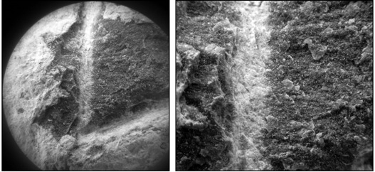
These pictures of the midsection of the second character on the fifth line were taken with a handheld digital microscope at magnification of 3X (left) and 10X (right). The white lines are the grooves created where the chisel stuck the rock, the adjacent gray areas are the flaked limestone, and the surrounding white area is the secondary calcite coating the surface of the boulder. (Wolter, 2012)
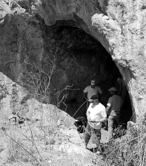

The author (dark cap) ponders the runic inscription in front of him carved on boulder while guides Paul Weishaupt and Frank Belluardo, Jr., and Grant Wolter (bending) look on (above). A group of five spirals were among several Native American carvings and painting found inside the cave (below). (Janet Wolter, 2011; Wolter, 2011)
Michael also mentioned that he found several “exotic” alphabets researching the inscription at monasteries in England. He explained how the monks would craft “secret” alphabets that incorporated standard runic characters together with more obscure symbols. Many of these alphabets were unique to a particular abbey. He then said, “There are some strange combinations in this inscription which actually make it seem more authentic.”
We then discussed that most runic scholars in Scandinavia had only studied the corpus of thousands of “public” rune stones scattered throughout the countryside in plain sight. Most of these inscriptions are simple and straight forward, “This stone was raised by Thorvold to honor his brother …”, or “This stone was carved to commemorate King …” They are not used to looking at secret inscriptions with mixed or unusual characters foreign to them. Rune stones like the Kensington, Spirit Pond, Narragansett, and the Mustang Mountain inscriptions are not what they are used to seeing and struggled to decipher them.
This would explain why they reacted so strangely when the Larsson Papers (two sheets of paper dated 1883 and 1884, donated by the family of Edward Larsson, that contained two runic alphabets and include the Hooked X) came forward shortly after our visit to Sweden in October of 2003.41 They were clearly Masonic in origin and marked the first time the seven mysterious runes on the Kensington Stone had ever been seen. The runic scholars said for over 100 years that the characters didn’t exist, yet they did exist secretly within Masonic societies and were likely created much earlier by a scribe monk in a medieval monastery.
Our conversation turned back to the cave and the possibility of it being a tomb. We knew it was time to talk to Paul Wieshaupt. He was quite surprised, but pleased that we had made progress. Before we could suggest it, Paul brought up doing a ground penetrating radar study of the cave. He agreed to look into it, and if he, Frank, and Jim found anything interesting we promised we would help with the next logical step, a dig.
I got another chance to visit the cave on June 1, 2012. We were joined for the filming by Steve Ross, archaeologist with the Arizona State Land Department.
If someone from the twelfth century was buried in the Mustang Mountain cave, we thought they were either in the mound inside the cave or in the berm just outside it. At one point as I sat next to the inscription, I noticed water running down the walls had dissolved the limestone leaving calcite deposits in streams that flowed into a buildup of sand and rock fragments cemented together along the walls about three feet above the present surface next to the inscribed boulder. Suddenly it hit me; the caliche deposits present on both sides of the cave had developed when the ground was at that level. This meant that a large amount of material had been moved from just inside the cave.
Then another thought hit me that prompted me to look at the boulder next to the wall. The previous ground line was higher than the inscribed boulder, meaning it could have been buried after it was carved which would explain the lack of weathering.
Earlier, Steve had shared that the site had been recorded to the state archaeologist’s office in 1984 and there was no mention in the report about the runic inscription. This meant it was buried and not visible at that time, or the boulder was visible and the inscription was carved after that time. After explaining how caliche deposits develop to the group, everyone understood what the possible implications were.
Mike Carr would eventually provide a translation for us that confirmed this inscription was indeed carved as a memorial. Mike’s translation also included a name, Rough Hurech!
The body (in contrast with the soul) fits/lays
Rough Hurech here
He enjoyed (entertainment/joy/merriment) - the secret stolen
Rough Hurech’s body - fame and glory
Dust beyond Eden (Eden’s Temple)
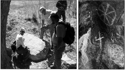
This picture of Janet Wolter, Paul Weishaupt, and Frank Belluardo, Jr., studying the inscription was taken standing atop the small mound of dirt inside the cave (left). A Latin style cross identical to the cross carved below the inscribed boulder was carved over a Native spiral on the upper back wall of the cave (right). (Wolter, 2011; Wolter, 2011)
We made another significant discovery on this visit that confirmed my suspicions of the first trip. The first word of the inscription was carved twice into the east wall roughly halfway into the cave. After pondering why, I speculated that maybe they put it where the sun would hit it on the winter solstice. Photographer, Bo Hakala, said he had an application on his iPhone that might help answer the question. He pulled up the program which when in camera mode, showed a green line marking the horizon, and a curved blue line marking the path of the sun across the southern sky on the winter solstice. Bo then put his camera next to the carved word on the wall and pointed his phone toward the mouth of the cave. Sure enough, the blue line crossed just into an opening at the top of the cave entrance at just before high noon!

Michael Carr forwarded this picture to me in January, 2011. This Early Saxon (circa sixth century) brooch has a swastika design with eight symbols scratched onto the outer ring including the Hooked X (arrow). The brooch was found with a skull near an excavation in Old Hunstanton, in Norfolk, England, in 1900.
After the filming was done we all hiked back down in the shadow of the mountain as the sun fell quickly in the western sky. Paul and Jim returned on December 21 and confirmed at least the first word on the cave wall was illuminated by the sun before the clouds moved in just before noon. These confirmed this important discovery, along with the buildup of the berm gave further credibility that this could be a medieval site. If a body was eventually found and it dated to the medieval period, it would be incredibly important and would radically and instantly change history as we know it.
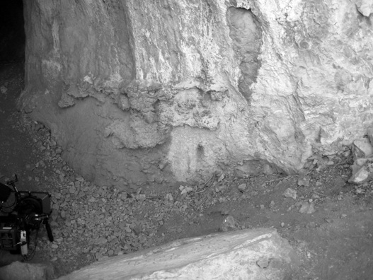
The buildup of material on the limestone cave walls near the entrance was made when water running down leached out calcite from the bedrock. The water evaporated and cemented sand and a rock fragment into a hard substance called caliche at the previous ground level. The line of caliche indicated that up to four feet of material had been dug out and used to create the berm just outside the entrance. Could vandals have removed material at the entrance and taken artifacts and remains from a twelfth century burial? (Wolter, 2012)
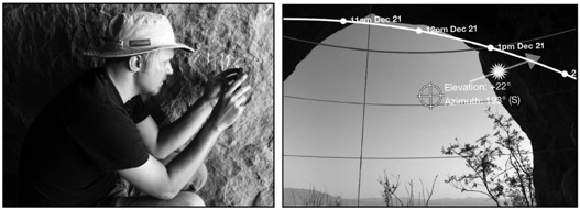
On November 10, 2011, Bo Hakala places his iPhone against the runic carving on the cave wall using an astronomy application program to check if the sun will illuminate the characters (left). The picture Bo took shows the sun will indeed hit the carved characters at noon for approximately one-half hour on December 21 (right). (Wolter, Hakala, 2011)
After watching Holy Grail in America, Nancy Millwood said she had to get in touch with me. On January 30, 2011, I received an email from my friend, Rick Osmon that a woman in Pensacola, Florida, was trying to contact me. She had a rune stone she had found in North Carolina in 1970. A couple days later Nancy Millwood sent me a half dozen photos of her stone. I immediately recognized the characters as runes, Anglo-Saxon runes. However, several characters had clearly visible single, double and triple dots above them reminiscent of the Scandinavian runes with umlauts like on the Kensington Rune Stone.
Her excitement at finally finding someone who took an interest in her stone was evident. She relayed her forty years of frustration with academics she had contacted who showed little interest in helping her understand what she had found. On February 12, 2011, I met Nancy in Pensacola, Florida.
Nancy revealed her prize. The roughly one-foot by one-foot by an inch-and-a-half-thick slab had the slightly greasy feel of soapstone and was broken across the upper left side. The smaller long piece fit snugly to the larger piece, revealing six lines of text carved deeply into the flat surface that had the undeniable marking of having been cut by human hands. The saw marks on both the front and back sides were very irregular, clearly not consistent with a mechanical saw. The variable thickness of the slab also gave the impression the slab was hand-cut from a larger piece of stone.
The inscription was comprised of forty-five runic characters divided into six lines. Two runes had single dots, eight had double dots above them, and three “M” runes had three dots above each arm.
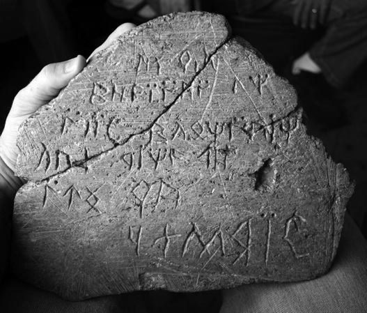
On February 13, 2011, I met Nancy and Mason Millwood in Pensacola, Florida, to examine the runic inscription she found as an eleven-year old girl in North Carolina in 1970.(Wolter, 2011)
I examined the stone for the next five hours. In addition to taking close-up photographs of the characters, I videorecorded a twenty-minute interview with Nancy where she relayed her entire story. She allowed me to take a small sample of the stone from the back side for testing and loaned me the only photograph she had ever taken of the stone. The faded slide had some water damage, but the inscription was still visible. The slide was dated January 1979 and proved she had the stone since at least that time.
The slide was one of eleven copies, the others had been sent to ten different institutions along with a letter asking for help. Nancy said she never heard back from any of them. As I listened to her story, I could feel her sense of relief that she was close to finally getting some answers. She was like many other everyday people who had found things and simply were curious to know what they were and who made them. Even though I couldn’t guarantee her anything, she seemed satisfied that at least I would try.
By June 2013, we had yet to be able to have the inscription translated. I promised her I wouldn’t let her be taken advantage of, and until I am confident she and her inscription will not be exploited we will continue to wait.
Another great lead from the Holy Grail in America film came from a man who lived in Franklin, Pennsylvania. Tom Anderton called and said there was an underground chamber made of cut stone and mortar that he said, “Has a spring flowing in it.” Intrigued, I asked Tom for photos. The early springtime images were taken in a wooded area on what appeared to be relatively steep slope in a remote area in the mountains not far from the Allegheny River.
After reviewing his pictures and thinking about the chamber’s location near the top of a mountain I wondered if there could be some kind of alignment or illumination event associated with it. I then asked Tom, “What side of the mountain is the chamber on?” After a short pause he said, “It’s on the west side.” This meant that if there was a solar alignment it would have to be with the setting sun and suggested he be inside the chamber on the summer solstice or within a day or two of it. He said he would and let me know what happened.
By the time June 21st rolled around, I’d forgotten about the chamber and was taken by surprise when the phone rang with an excited voice on the other end. “Scott, you were right. At about 7:30 p.m. Jack Susco and I were standing inside along the wall next to the basin and the sun came in and lit up the whole chamber. It was amazing!”
I knew I had to get out there as soon as I could.
August 30, 2009, Tom and Jack drove Vance Tiede, an archaeologist I thought would find the mysterious chamber interesting, up the mountain road. They walked a logging road that began to parallel the relatively steep mountain slope when Tom said, “I think this is it.” He walked a few steps off the trail down to what looked like a pile of stones. Upon looking closer they noticed the stones had been intentionally shaped into blocks and arranged into what turned out to be an air vent. Tom removed a large stone that covered a ten by eight-inch-sized vertical shaft stuffed with rocks about two feet down.
Tom continued down the hill that opened into a small ravine carved by a small spring. The ravine had four large blocks of stone that, upon examining more closely, he noticed had been shaped into roughly five feet long by two-foot-wide by twelve-inch-thick slabs. Just above where the spring flowed out of the ground, Tom began to move several stones that covered the entrance to the chamber. Tom then said, “We keep the entrance covered so animals don’t crawl in there. We aren’t too worried about people finding it.”
Within minutes, Vance and Tom squeezed through the tight entrance that quickly opened up into a roughly twenty-foot-long by six-foot-tall tunnel made of stone walls with neatly placed two-foot wide lintel stones above their heads. They aimed their small flashlights into the darkness ahead, and they heard water trickling. After a few more paces they stepped onto a stone ledge that turned out to be the front edge of a basin with water flowing into it. Shining their beams downward they saw a perfectly cut, four-inch-diameter hole in the front wall where water could flow out of the basin and then seep into the ground.
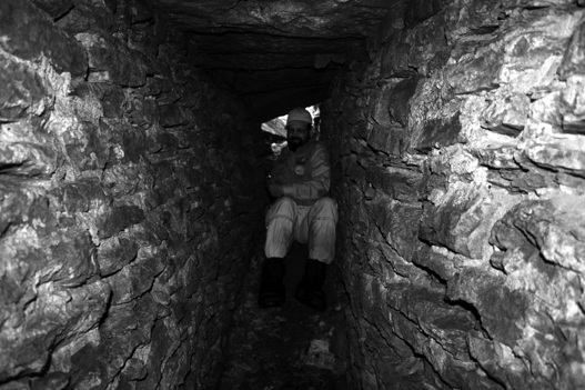
After squeezing through the entrance, Vance Tiede slides down into the two-foot-wide stone walls of the tunnel leading into the Hemlock Chamber on August 30, 2011.
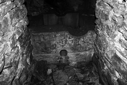
The two-foot-wide stone walled tunnel entrance leads to a stone basin that spring water flowed into and then drains out a four-inch-diameter hole skillfully cut into two blocks allowing water to then seep into the ground.
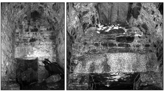
The east end of the spring chamber has a ten-by-eight-inch vent to the surface at the top of the rounded ceiling. The spring flows from a crack in the sandstone bedrock through the two foot wide by three foot tall opening in the lower left side of the back wall (left). Looking back toward the entrance there is a one foot thick lintel stone below a triple keystone securing the ceiling (right).
Above the overflow hole was an eight-inch-wide channel groove on the top front edge to allow water to flow out once the basin filled when the lower hole was plugged. At this point, the chamber widened to four feet. As they stepped up onto the basin, they could see the top of the eight-foot-long chamber was rounded to a maximum of eight and a half feet in height. The barrel vault was secured with a triple keystone that ran the entire length of the ceiling. On the east end of the ceiling, they noticed the vent opening that led to the pile of stones they had seen at the surface when they arrived. Looking back toward the entrance they noticed the first massive one-foot-thick lintel stone leading back down the tunnel.
Spring water flowing from a crack in the sandstone bedrock along an expertly cut winding groove trickles into a thirty by thirty-inch square cut stone basin inside the Hemlock Chamber. Because of a solar illumination inside the chamber on the summer solstice, the builders likely used it for religious ritual bathing.
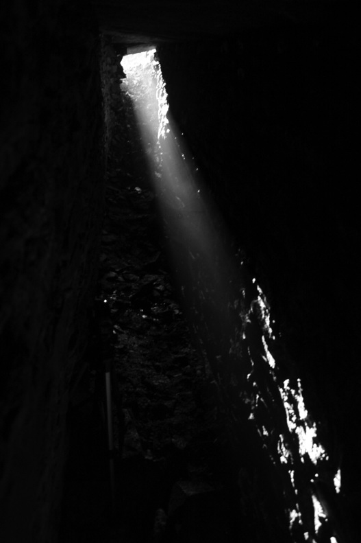
The mist-enhanced rays of the setting sun shine along the east stone wall of the entrance to the Hemlock Chamber on June 19, 2011.
The construction of the stone walls in the entrance tunnel was unusual. Sand was used between the stones with a lime mortar then applied on the exterior joints, which kept the sand from falling out. The construction inside the chamber was similar except mortar appeared to also have used to plaster all walls and the ceiling. Much of the plaster had fallen off the inside walls, and it was very dirty. However, the walls were still very white in color, and even tiny flashlights lit up the chamber quite well. The ceiling, dotted with spiders and cave crickets, also had several white calcite stalactites hanging down that were up to a couple of inches long.
Upon learning this, my first thought was maybe the stalactites could be used to date the chamber. However, I’d need to know more about how it was constructed on the exterior or if there was anything used to waterproof it. That would require an archaeological dig that might also yield some organic material such as pieces of wood buried at the time it was backfilled that could be dated.
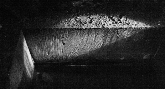
A flashlight highlights the tell-tale scratches along the walls of the stone basin that are consistent with having been done by hand and not modern machinery.

On June 19, 2011, the setting sun cast its light through the misty air inside the mortar and stone underground chamber
Looking down at the thirty-inch-by-thirty-inch square basin, Vance and Tom listened to the steady trickle of pure, icy cold water and wondered aloud, “What could this structure have been used for?” They kicked around the possibilities they thought people might come up with like a slave tunnel, a bath house, or place for food storage. Upon analysis, none of these made any sense, especially because the location was so remote. The only thing they could come up with that seemed the least bit plausible was that this chamber was used for ritual bathing. The fact that the rays of the setting sun on the summer solstice illuminated the chamber cannot be a coincidence and suggested its likely intended use in a religious ritual.
As exciting as it was to review the chamber photos with Vance in late August, I knew someone had to go back on the summer solstice. On June 19, 2011, David Brody and Tom returned to the chamber, hoping for a clear day. They decided to stay inside and stand along the south wall as the sun set in the western sky. They had set up a video camera to record the event and took still photos over the course of the forty-five-minute-long show as it unfolded. As the mist-enhanced beam of sunlight worked its way inward along the north stone wall of the entrance, David and Tom were transfixed.

In 2009, Jack Susco made this excellent detailed cross-sectional drawing of the underground Hemlock Chamber near Franklin, Pennsylvania.
The sun’s rays created a beam of light that hit the front wall of the basin and shot through the four-inch diameter hole over the top of the water in the basin. The sunlight reflecting off the ripples on the surface from the trickling water and enhanced by the white plaster walls produced a spectacular light show in the chamber. As amazing as this was the best was yet to come.
As they waited in the dark, David and Tom talked about the high quality construction of the chamber that belied a utilitarian purpose and seemed more intent on, as David suggested, “Pleasing their Gods.” He also observed that the large stones showed no evidence of the “plug and feather” method of splitting the largest stones—placing wood pegs or cork (or engineered metal rods that create tensional force in modern times) into drilled holes and then causing them to expand by wetting them. Sometimes ice was intentionally allowed to form in the drilled holes in winter to break the stone. David then cast his flashlight beam at a low angle to the wall of the cistern where he could see the tell-tale scratches that clearly indicated the work was not done with modern machinery and added, “They used good old-fashioned hand tools to skillfully shape the masonry.”
As the sun continued to sink in the western sky, the light beam rose above the top of the stone basin and shot back up the winding channel cut into the stone blocks on the chamber floor. David and Tom were speechless as the laser beam-like sunlight illuminated the crack in the sandstone bedrock where the spring water flowed from the earth. It was a spectacular allegorical fertilization of mother earth with the male solar deity in the heavens.
Experiencing the illumination, David and Tom felt that making anything other than an esoteric spiritual or religious interpretation seem ridiculous. The only unanswered questions were who built this incredible structure and when did they do it? My first inclination, upon examining the photos, was to suspect the Knights Templar, who likely were in this area during the late medieval period. Oil was known to the Natives in the region, who set ceremonial fires to the volatile dark liquid that floated on the river and became trapped by fallen trees and debris. The Templars likely would have understood the value and importance of oil that was first discovered in the modern era on this continent at Oil City, Pennsylvania, in the mid-1800s.42 However, as much as I would like to believe the Templars were responsible for the chamber’s construction, I highly doubt they were. In fact, because of the heavy Masonic influence in the area, especially in Franklin, there likely was another more plausible explanation.
The City of Franklin, Pennsylvania, was laid out by Andrew Ellicott, who also laid out the incredible sacred geometry of Washington, D.C. I suspect those responsible for construction of the Hemlock Chamber were a side order of esoteric Freemasons. The fact that the chamber aligns with the summer solstice and not the winter solstice is also significant. Arguably, the most important day of recognition in Freemasonry is John the Baptist’s feast day on June 24th, which is when the ancients celebrated the summer solstice by paying homage to the forces of nature including fire, water, and plants.43 Because of the connection of the summer solstice to Freemasonry, together with the fact that there was a lot of oil money in this area in the past one hundred and fifty years, my guess is that’s probably how old the chamber is. At some future time, some archaeological work might be done that could shed more light on the origins of this incredible site.
Over the past five years, Janet and I have noticed a disproportionately high percentage of pre-Columbian artifacts and sites within or near ultramafic volcanic rocks deposits and extra-terrestrial meteor and possible comet impact areas. Examples that jumped out early include the Ohio Serpent Mound, the Southern Illinois area of Little Egypt where the Burrows Cave artifacts were reportedly found and the massive, recently discovered impact site that includes most of the area around Lake Superior where there are tens of thousands of ancient copper mines dating back over six millennia. We speculate that one of the primary reasons ancient visitors from other continents came to North and South America was for precious metals and other economic minerals such as gold, silver, lead, zinc, copper, nickel, titanium, various gemstones including diamonds, and oil.
It’s no secret that geologically, precious metals are found in rocks that have been disturbed by tectonic forces. This allows mineral-laden hydrothermal solutions to move and concentrate along fractures in the earth produced by faulting associated with earthquakes, upwelling of molten rock at depth, and extra-terrestrial impacts. Early explorers to North America, and most certainly the medieval Templars, were primarily interesting in finding new sources of these highly valuable metals, especially gold. It’s no secret in geology that one of the ways to locate these minerals is by looking for areas with high magnetic anomalies.
If our speculation is correct that early explorers possessed ancient knowledge of how to locate areas of high magnetic gravity using an early version of a magnetic compass, and the secrets of sophisticated skills of metalworking called alchemy, it shouldn’t come as a surprise to see this association of ancient sites and extra-terrestrial impacts. When large meteorites hit the earth in the distant past, they literally punched holes into the crust of the earth, creating a roughly vertical shaft allowing molten rock and solutions to move along this fractured zone, concentrating precious metals. One analogy of the process is similar to what happens when a rock is thrown through an ice-covered pond or lake and water shoots back up and out of the hole in the ice. A classic example of this association is the Serpent Mound in Adams County in Southern Ohio.
As one of the crown jewels of the ancient mound building cultures, the Serpent Mound has puzzled archaeologists as to its origin since it was first surveyed by Squier and Davis back in 1847. If out-stretched, the total length including the head and egg would be approximately 1,400 feet. The undulating mound averages twenty feet in width and five feet in height. However, at the center of the snake’s body, the mound is thirty feet wide at the base and gets slightly smaller toward the tail and the head.44
The Serpent Mound was built on the southwestern rim of a roughly five-mile diameter impact crater estimated to be roughly 240 million years old.45 While the geology of the area is relatively well understood, the identity of the builders of the mound is not.46 During a visit to the mound on August 11, 2009, with Beverly Moseley, a professional artist and longtime member of the Midwest Epigraphic Society, it was a special treat to receive a tour of the interpretive center that included interesting dioramas Bev had made himself. The interpretive displays were inconclusive about the age of the mound. However, soil depth accumulations and archaeoastronomical calculations of the alignment of the mound with the pole star Draconis-alpha both date the original construction to over 5,000 years ago.47
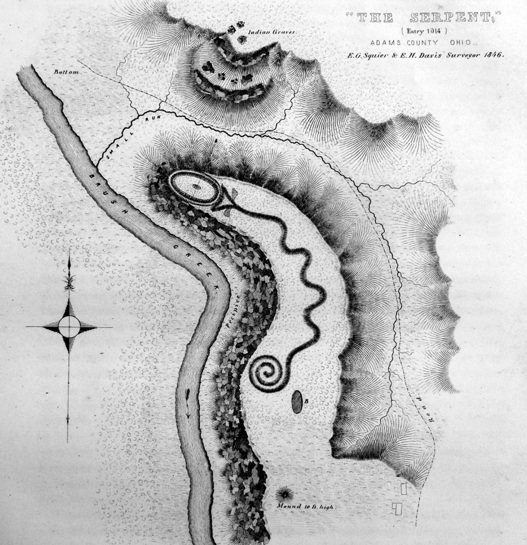
E.G Squier and E.H. Davis produced the first known sketch of the Serpent Mound in Adams County, Ohio, in 1846.
Likely unaware they were replicating where a circle of megalithic stones once stood, a spiritual group of people hold hands inside the berm of earth that makes up the egg in the mouth of the Serpent Mound in Southern Ohio on August 11, 2009. In 1848, Squire and Davis reported, “… a small circular elevation of large stones much burned once existed in its center; but they have been thrown down and scattered by some ignorant visitor, under the prevailing impression that gold was hidden beneath them.” (Wolter, 2009)
One other fact that appears consistent with the five millennia date is the reported presence of a circle of standing stones similar to Stonehenge, in Southern England, that once stood inside a perfectly formed oval embankment of earth protruding from the mouth. According to Squier and Davis, “The ground within the oval is slightly elevated, a small circular elevation of large stones much burned once existed in its centre, but they have been thrown down and scattered by some ignorant visitor, under the prevailing impression that gold was hidden beneath them.”48
A nine-foot-long, four-foot-wide by roughly twenty-four-inch-thick monolith lies partially buried in the valley below the Serpent Head outcrop in Adams County, Ohio. This stone was likely one of the standing stones that once stood inside the egg of the Serpent Mound and was thrown down the cliff by settlers. (Photo courtesy of Ancient American Magazine, Issue #89, photos © Patricia Mason and Jeffrey Wilson, M.S. Professor of Astronomy)
In 2009, Wayne May, publisher of Ancient American Magazine, hiked below the bluffs where the Serpent Mound resides and found one of the standing stones referred to by Squier and Davis. The stone shows a clear and distinct weathering line marking the above and below grade ends. It would likely take many decades if not centuries for such a well-developed weathering line to develop.49
Hamilton (2001) presented his thesis that the builders of the Serpent Mound incorporated elements of sacred geometry, symbolism, sophisticated mound architecture construction and contains “… at least twelve verifiable, geo-astronomical alignments contributed by competent archaeological researchers, independent of one another.” The solstice alignments in the bends of the serpent’s body impressed me the most. Combined with the other scientifically advanced aspects of this incredible structure it’s a strong candidate for its builders having brought this technology to North America from across the Atlantic.
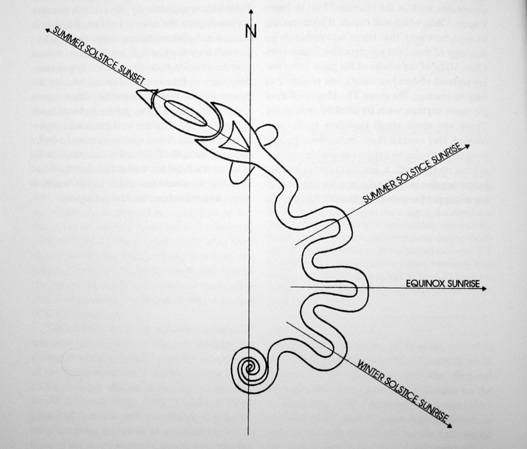
This image shows the solar alignments of the Serpent Mound in Adams County, Ohio. (Redrawn by Dan Wiemer from Hamilton, 2001)
The question is: Why did the ancients build this incredibly sophisticated mound structure on the rim of an impact crater? Since there is no history of mining in the immediate area or economic minerals often associated with meteorite impacts there had to be another reason. The likely reason was the early cultures that lived here must have had the ability to tap into some type of increased energy or magnetic anomaly related to the impact zone. This would not be unprecedented as the earliest temple sites in Europe were built along ancient salt lines, which were later determined to correspond with regular longitudinal lines of increased magnetism. Later we will see these longitudinal lines of increased magnetism in North America correspond to author Bill Mann’s “Templar Meridians.”
In 1981, Jacques de Mahieu (1915-1990), a French scholar and Nazi collaborator wrote Les Templiers en Amerique (The Templars in America), expounding his theories about the Knights Templar exploration voyages prior to their putdown in 1307. The copy I was able to purchase was in French, so I sought out help from a friend.
John Freeburg asked a French-speaking friend of his to read Mahieu’s book and give his interpretation of its contents. On December 15, 2011, John and I met with Jean-Paul Schirle-Keller, who relayed that Mahieu’s research seemed credible. One comment that resonated with me was when Jean-Paul explained how Mahieu wrote about how the medieval French people wondered why the Templars were obsessed with the French seaport on the Atlantic Ocean at La Rochelle. It seemed silly at the time to risk sailing so far around the Iberian Peninsula and into the Mediterranean Sea when overland routes across France were a fraction of the distance.
In addition, Mahieu reported that the French also didn’t understand how the Templars always seemed to have freshly minted silver currency when all the known silver mines in Europe and Africa had been long-depleted by the Romans. The answer is obvious—they had other secret sources of silver, most likely the American continents. Mahieu presents a compelling body of historical and circumstantial evidence that, in the grand scheme of the murky history of the order, fits together nicely.
At this point, it is appropriate to put professor Mahieu, his Nazi past, and his research into proper perspective. A quick Internet search will find a brief synopsis of the man whose research is labeled multiple times as “racist.” Mahieu is an easy target given his Nazi background, but in this discussion his politics are irrelevant and unimportant.
However, given his known association with the Nazis during World War II, it may have provided an opportunity that, at any other time and place in history, could never have been afforded. While the German army was pillaging Europe, the Vatican sought and obtained a tenuous truce of sorts (I’ll leave the appropriate historians to explain the nature of that interesting relationship) with the invading Germans that likely afforded certain academics like Mahieu unrestricted access to their archives. Given his detailed and reasoned arguments about the Templars, it seems likely that he obtained secret documents about the activities of the order that other scholars and researchers before or since that time have never seen. Given the contentious nature of the relationship of the Templars and the Roman Catholic Church at the time of their dissolution, whatever secret documents they obtained and the likely important information within them would have been kept off limits to anyone.
Mahieu himself suggests that the strategic port at La Rochelle served as the starting point for secret voyages of the Templars in the twelfth, thirteenth, and fourteenth centuries to ports in Africa, South, Central, and North America, and likely beyond. One of their primary objectives was to locate and mine silver, gold, copper, tin, lead, zinc, titanium, and other minerals. At one point, Jean-Paul said the story about the Templars always having silver made sense to him and shared this story he said probably relates back to their time, “To this day in France when somebody talks about money, they say, ‘I need to make some silver, or give me some silver.’”
After the liberation of France in 1944, Mahieu fled to Argentina via the Vatican ratline and studied at the University of Mendoza in Buenos Aries. Mahieu conducted archaeological studies at many pre-Columbian sites in South America, formulating theories about both the Knights Templar and Vikings visiting South and Central America many centuries ago.
In 2002, I was sent a picture of a runic inscription from Sierra del Medina in Tucumán, Argentina, South America. I don’t recall who sent it to me or any information about a translation of the inscription. This rune stone has puzzled me and my colleagues ever since. By chance in September of 2011, I was introduced to Alegandro Vega Ossorio, a South American researcher who was very cordial and knew all about the mysterious boulder inscribed with Scandinavian runes. On November 27, 2011, I received the following reply which finally put my mind at ease after nearly a decade of wondering: “Yes of course we saw this inscription, because Jacques de Mahieu found it in Tucuman Province. As you know Xavier de Mahieu works with us and Commission de Exploraciones Arqueologicas is continuing the task of Jacques.
“Yes we have this stone. Also we have several samples of different scripts from pre-Columbian times in Argentina. Following the translation of Jacques Team in 970, the script means: ‘A dos dias la casa (Aldea) de Sven’ (English would be something like this ‘At two days, Sven House’).”
Sometimes, no matter how much examination and testing is done on an inscription or artifact carved in stone, a definitive conclusion about its age or authenticity cannot be made. However, in the three cases presented in this section, I was able to apply microscopic analysis effectively on three mysterious historical artifacts and collect enough factual data to render a definitive opinion regarding authenticity. If genuine, the historical importance of the artifacts in this section cannot be overstated.
In Holy Grail in America, producers Andy and Maria Awes wanted to include a segment about the Burrows Cave artifacts in spite of my hesitation. I’d always thought the artifacts and the story were interesting, but I wasn’t sure if they were appropriate to include. Regardless, they found a clever way to weave them in and left the audience with the appropriate conclusion that Burrows Cave remains an open question. Up to this point, none have been able to document definitively whether any of the artifacts were genuine or not. That is until April of 2010.
Amateur archaeologist, Russell Burrows, then living in Olney, Illinois, reported that he had discovered an opening to a cave system that including thirteen sealed tombs with passageways filled with mostly stone artifacts. From 1982 until 1987, Russell reportedly removed somewhere between 4,000 to 7,000 artifacts from the cave system somewhere in southern Illinois.
In May of 2009, I had a chance to meet Russell. He seemed sincere when talking about the cave. At the time, he was considering ways to open the cave, but like so many times before, there was always an excuse why he couldn’t do it. I did not have a lot of confidence in his explanations. When he left, I recall thinking that whatever the truth might be, he was likely going to take it to the grave with him.
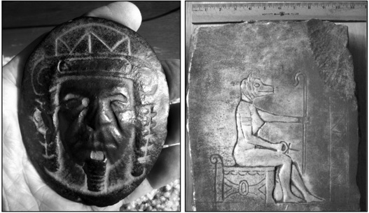
Two examples of Burrows Cave artifacts represent the most common geological types. The “black stones” (left) are calcareous concretions, and the white plates are high white marble (right). (Wolter, 2008)

This photograph of the “Isis” stone was taken by Warren Dexter, in 1987, five years after Russell Burrows reportedly discovered a cave in Southern Illinois filled with thirteen tombs and thousands of stone artifacts. (Courtesy of the New England Antiquities Research Association library at the New Hampshire Technical Institute in Concord, New Hampshire.)
In the years I had been involved with the Burrows Cave mystery, I’ve looked at roughly two thousand artifacts and purchased dozens myself so I could perform invasive testing without having to worry about damaging other collectors’ artifacts. Under the microscope, I had seen various levels of wear and apparent weathering. Unfortunately, when asked for my opinion as to the age, my answer was always the same. Without any knowledge of the environment the artifacts were exposed to, I had no weathering data to use as context. In my opinion, the age and authenticity of the artifacts was inconclusive. This was where the controversy remained until amateur researcher, Jay Wakefield, contacted me in April 18, 2010, about a Burrows Cave artifact he called, “The Isis Stone.”
Jay said he could see something on the back side of the artifact and sent a few photos for me to examine. It was very hard to see what he was talking about, so I asked if would be willing to send me the artifact to examine in the lab. A few days later it arrived. The stone itself was a high white marble with dark-gray areas of mold on both sides. Within the grooves of the carved lines on the front side was fine-grained silty sand, which was also present in recessed areas on the edges and back side. When I looked closely at the two areas Jay had pointed out, my eyes instantly recognized part or all of five letters carved in cursive writing. The three characters on the right side were plainly visible and spelled, “t-h-e” as in “mother” or “father” as commonly occurs on a tombstone.
Under the microscope, it was clear the weathering of the English letters was the same as the blank areas on both sides, yet the “Isis” image carved surfaces were not weathered. I also noticed that there were remnants of mortar on the back side with small amounts present within the depression of one of the English letters. Further, the chipped off edges along the back side had broken through some of the remnant mortar meaning the chipping had to have happened after the mortar came in contact with the back side and hardened. Thin-section review of the mortar under the polarized light microscope clearly showed the mortar to contain a finely ground, modern Portland cement.
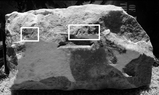
On the back side of the “Isis” stone, the remains of English cursive writing are present in two areas indicated by white boxes. The letters exhibit the same weathering profile as the original flat surface they are carved into. (Wolter, 2010)
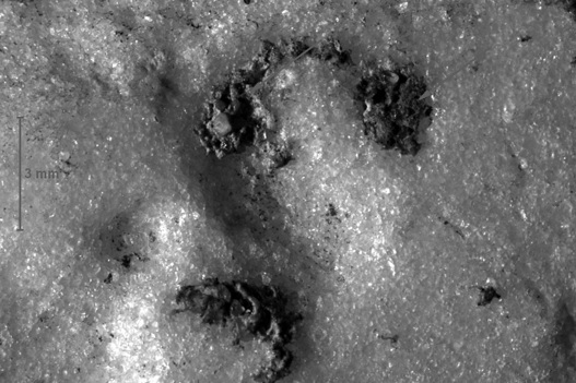
Remnants of modern Portland cement mortar were found within the depressions of the weathered carved cursive letters on the back side of the “Isis” stone. (Wolter, 2010)
A few days later I called Jay and explained my findings. Whoever had made this used an old, weathered, two-inch-thick marble tombstone and carved the kneeling Isis image onto the blank back side. The evidence on the back side laid out a clear and simple sequence of the events that could only have been done by someone intentionally trying to deceive.
At some point after the tombstone had been weathering for many decades to produce the uniform weathering of the surfaces including the carved cursive English text, wet mortar was deposited onto the back side (most likely accidentally since it partially covered a letter). Next, the back side along the edges was chipped away with a chisel in an apparent attempt to, unsuccessfully, remove the remaining tombstone inscription. Lastly, the silty sand was put onto all surfaces to give the appearance of age and disguise the deception.
Jay accepted my findings. After completing my report it was published in issue #89 of Ancient American Magazine. Publisher Wayne May deserves a lot of credit for daring to print articles about suspected pre-Columbian artifacts and sites. He receives a lot of undue criticism from mainstream scholars as a result.
The other person I made aware of the test results was Russell Burrows. In fact, he was the first person I called when I reached my conclusions and at first, he accepted them, saying he didn’t remember the piece coming from the cave. This statement raised an eyebrow when one considers that researcher Warren Dexter photographed the artifact in 1987, in a 1992 book Russell co-authored with Professor Jim Scherz, is the same white marble “Isis” artifact.50

The white arrows indicate ¾-inch-wide chisel impacts where the back side edges were chipped to presumably remove the carved cursive letters. (Wolter, 2010)
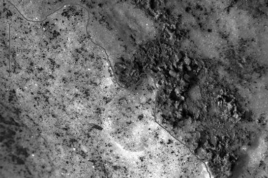
The thin dark line marks the contact where the chipped surface (top right) ends. The remnant mortar was cut through, indicating the chipping was done after the modern mortar hardened. (Wolter, 2010)
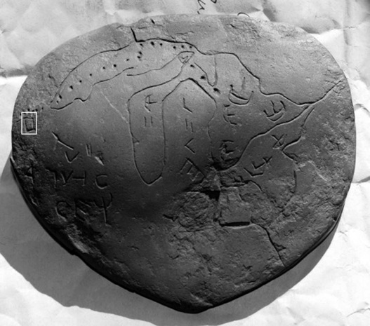
One of the black stones Russell Burrows sold to me on July 25, 2009, was a map stone of the Great Lakes with ships, text, and dots representing an apparent sailing route to the west end of Lake Superior that then proceeds west into Minnesota. The dot trail ends near a tall rectangle with an angled top that is eerily reminiscent of the Kensington Rune Stone. (Wolter, 2009)
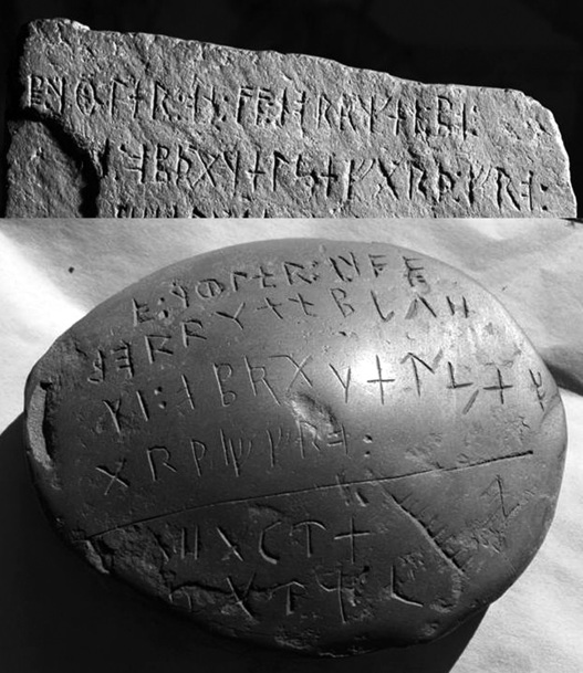
The second black stone I purchased from Russell Burrows on July 25, 2009, had runes that were essentially the same as the first two lines of the Kensington Rune Stone inscription. Notice the same angled top on the Rune Stone (top) as the rectangle on the map stone (white box at right). These stones represent either an incredible historical discovery or a clumsy hoax. In this case, it appears to be the latter. (Wolter, 2009)
To further complicate the Burrows Cave mystery, I found a few more of the suspicious black stones I purchased directly from Russell in July of 2009. Russ told me he had recently been back to Olney, Illinois, and dug up some storage bins where he had stashed artifacts many years ago. He said he had some nice affordable pieces. We struck a deal. Within a week or so, the pieces started to arrive. In one package of a half dozen stones were two that instantly caught my attention. The first was a depiction of the Great Lakes with strange text, boat symbols, and dots that looked as though they were marking a sailing route from Lake Huron across Lake Superior to modern Duluth. From there, six dots heading due west across Minnesota ended at a mysterious, vertically aligned, rectangular box. My first thought was that this area was where the Kensington Rune Stone was found, and that box sure reminded me of it. My skepticism was piqued to say the least, but the next stone I unwrapped had me laughing out loud.
The second stone was a smaller oval-shaped black stone covered on one side with text. Upon taking a closer look I recognized the characters were Scandinavian runes, very familiar runes. In fact, the first four lines were virtually the exact same characters as the first two lines on the Kensington Rune Stone. The remaining text was familiar characters I had seen on many other black stones. When I called Russ and told him what I thought, he said, “Maybe the Templars had been to the cave and the two lines of text were a key?” Of course anything is possible, and as fun as it would have been to have the Templars involved with the cave, I simply could not go there.
I don’t believe Russ didn’t know what he sent to me and if so, did he really think I would believe these were legitimate? Unlike many of the hundreds of stones I’d seen that appeared to have some weathering, these stones did not appear weathered at all. I dropped the matter with Russ knowing there was no way I would ever get the truth about these stones and put them away.
In spite of the unquestionably fake white-marble artifact and the highly suspect “Kensington” black stones, they don’t definitively prove the cave does not exist. There is no question they cast a long, dark shadow over the Burrows Cave mystery. I’m personally convinced the thirty or so white marble artifacts are recycled tombstones intentionally created by someone to deceive and make money. I’ve wandered through many cemeteries over the years, studying the inscriptions and the various rock types the monuments were made from and have seen thousands carved in high white marble. Marble was a very popular stone for monuments from the mid-1800s to the mid-1900s due largely to being relatively soft (three out of ten on the Moh’s hardness scale) which lends itself to beautifully detailed carvings and inscriptions. A very high percentage of the high white marble monuments I measured were two inches thick and exhibited weathering identical to the Isis Stone.
On May 7, 2012, I was able to add another Burrows Cave artifact to the list of probable fakes. This particular artifact has a scene of a Roman soldier in battle with a three-headed dragon that was carved into a very thin and flat, black-colored rock called carbonaceous argillite. The combination of an early spring downpour and a clogged eave downspout caused water to fill up a basement window. Water leaked into the basement and down along the wall the artifact was leaning up against. The leaking water then saturated the bottom half of the roughly twelve-inch-tall artifact. The next morning while cleaning up the mess I found the artifact laying in pieces on the carpet. The highly porous stone absorbed enough water to cause expansion that broke it apart.
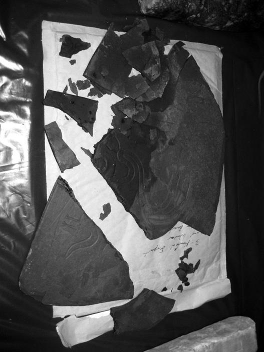
When this Burrows Cave artifact, carved into a highly porous carbonaceous argillite, became saturated when our basement flooded it expanded and broke apart. This piece would never have survived the flooding inside the cave it was reportedly found in that Russell Burrows has repeatedly said has occurred. (Wolter, 2012)
While picking up the pieces I thought about the story Russell had told me multiple times about how water had rushed through the cave, washing artifacts out of the tombs and piling them up in the bends of the cave system. I was skeptical of the stories at the time I heard them, but as I picked the pieces of this artifact I knew that story was bogus.
I’m also convinced that some of the black stones are modern fakes as well. However, the fact remains that there are at least 4,000 to 5,000 black stones, many with evidence of weathering that leave many unanswered questions. Who carved them? If it is a hoax, how many people were involved? Who could have had the vast historical knowledge depicted on the stones? Russell certainly didn’t do all the artifacts (if he did any of them at all), so who did? The reality is the Burrows Cave mystery is still an open question.
The only person who can answer these questions is Russell. As of 2013, Russell was seventy-seven years old and seemed content to take the secret of the cave with him to the grave. If he doesn’t come clean soon, either way, history will no doubt judge him to be a pariah and his cave a fraud. Personally, I don’t see him revealing the cave before he dies, and until the cave is found and can shed some context on the weathering environment, we simply cannot pass that judgment. I’m unable and unwilling to pursue any further research on these artifacts. One thing I can say is that the money I spent on Burrows Cave artifacts were a worthwhile investment. I learned much about the controversy and take pride in knowing that I was able to definitively prove at least one, and likely a total of four of the Burrows Cave artifacts are modern fakes.
I met Phil and Leslie Kalen after they contacted the archaeology department at Cambridge University in the UK. A professor of archaeology had apparently heard one of my lectures on the Kensington Rune Stone, and passed along my email address. The Kalens then sent images of the runes they found in a cave on their property in Morristown, Tennessee. After reviewing their photographs, I instantly got excited. The carvings were definitely runes. The only way to figure out what the story was to go to Knoxville.
On August 23, 2008, I met Leslie and Phil in Tennessee. Leslie explained the story of their cave. Shortly after purchasing the house four years ago, neighbors shared old stories about how there were caves under their home. At first, they laughed the stories off as rumors, but eventually curiosity got the best of them. They rented a backhoe, and Phil dug until he discovered the cave.
At their place, I could see mounds of dirt piled around a large depression only a few tens of yards in front of the house. The entrance to the cave was smack in the middle. Phil led me down a short ladder inside the cave. After descending several feet down we walked through a maze of limestone formations carved out by percolating groundwater over millions of years. It was a typical karst type of cave system very common in Tennessee.
The first inscription was the name W.T. Hopkins carved into the limestone wall about a hundred feet from the entrance. Phil led me up a ladder through a pass into another large chamber that went back about another hundred feet. The walls inside this chamber were black with soot, likely from campfires made by people we speculated could have been hiding out in the cave system. There were dozens of dated inscriptions going back as far as 1850. The runes were also carved into the walls of this chamber. As I laid eyes on them I was disappointed.
In addition to the runes, I found four different swastikas and “Hitler” carved into the walls. One of the swastikas was right next to the runes that were also modern and appeared to have been made by the same hand. Even though the inscriptions turned out to be modern, I really enjoyed crawling around in the “Kalen Cave System.”
After crawling out of the caves, I sat down with Leslie and Phil and gave my opinion about the carvings. Although disappointed, they clearly understood what they had. Leslie then shared her conversations with the archaeologists who had visited the cave a few weeks prior to my visit and recalled an interesting comment made by one of them after they had reviewed the cave carvings. Jan Smit, head of archaeology at the University of Tennessee, had told Leslie, “If you’d like to see a fake, come to UT and see the Bat Creek Stone.”
I knew about the artifact and asked them if they knew what it was. They didn’t. Knowing Leslie was Cherokee I thought she’d be interested to know about this inscribed stone discovered in one her tribe’s burial mounds in 1889.
The Bat Creek Stone was discovered by Mr. John W. Emmert in an undisturbed grave mound, number three of three mounds found together along the Little Tennessee River near the mouth of Bat Creek on February 15, 1889. Emmert was working on behalf of the Smithsonian Institute’s Bureau of Ethnology’s Mound Survey Project and reported to his immediate supervisor, Cyrus Thomas, who originally identified the inscription as Paleo-Cherokee. The Bat Creek artifacts sat in the archives in obscurity until 1964, when the inscription was noticed by Chicago patent attorney, Henriette Mertz. The artifact had been published up-side down by the Smithsonian Institute, when Mertz turned it around, she believed the characters to be Phoenician.51
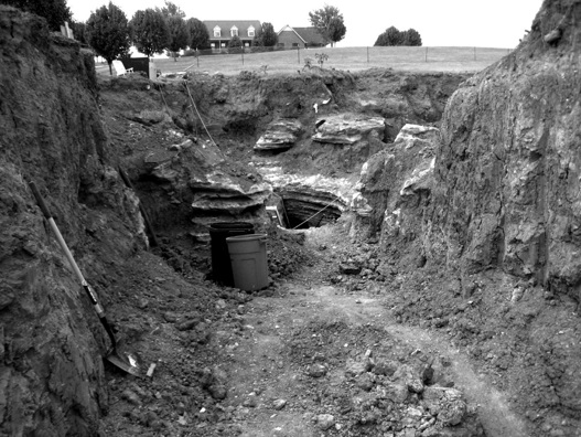
In August of 2008, Phil and Leslie Kalen followed up on rumors rented a backhoe and discovered the previously sealed entrance to a cave filled with late nineteenth-and twentieth-century inscriptions in the front yard of their Morristown home. (Wolter, 2008)
In 1971, the inscription was found to be a Roman era Paleo-Hebrew Judean text by Dr. Cyrus Gordon (1908 to 2001), who was an American scholar of Near Eastern cultures and ancient languages. In his 1971 book, Before Columbus: Links Between the Old World and Ancient America, Gordon wrote, “… a Hebrew inscription of Roman date (probably around A.D. 135) was scientifically excavated in Tennessee and published by Cyrus Thomas in the Twelfth Annual Report of the Bureau of Ethnology to the Secretary of the Smithsonian Institution 1890-’91. Thomas, without understanding the nature of the writing, published the text upside down on page 394 and quite erroneously surmised it to be in the Cherokee script.”52
Gordon went on to write, “Though the priority of the discovery goes to Dr. Henriette Mertz, it was Dr. Joseph B. Mahan Jr’ s (director of Education and Research at the Columbus, Georgia, Museum of Arts and Crafts), independent rediscovery that led to the results.” “… that if the Bat Creek Stone is turned right side up, the script is plainly Canaanite.”53
Gordon’s translated the text as, “Year 1: Comet (=Messiah) of the Jews. This confirms the Jewish nature of the inscription obviously implied by the very name YHWD. The letter-forms may be dated about A.D. 100 with enough leeway to cover refugees from Judea fleeing from the Romans during the First (A.D. 66-70) or Second (A.D. 132-135) rebellions.”54
Other artifacts found with the inscribed stone encased in what is thought to be a bundle of birch bark was lost at the time of Emmert’s excavation. The bundle was found under the skull of the only body of nine aligned with its head to the south. The other eight bodies were aligned with their heads to the north.
Other artifacts found with the inscribed stone included bone and wood tools, red ochre stones, likely used for face paint, and two bronze bracelets.
I explained to Leslie and Phil that upon learning of Gordon’s Hebrew translation, the Smithsonian quickly jumped in claiming the inscription was a fake, and, many decades after his death, placed the blame on Emmert as being the forger. Leslie especially was bothered by not only the seemingly baseless fraud claim about the inscription, but was even more put-off by the way Emmert had been thrown under the bus by the Smithsonian. Leslie then explained that her father, Donald Rose, was a senior elder with the Eastern Band of Cherokee Indian and that she would ask him about the stone and what he might know.
It turned out Don was unaware of the Bat Creek Stone as was the tribe. During one of our conversations with members of the tribe another elder, Bob Blankenship, said, “That’s another thing they didn’t tell us about.” They all agreed they wanted to pursue testing the stone and passed a resolution at the Tribal Council to submit a formal request to the Smithsonian to allow me to perform a geological examination of the artifact.
A few weeks prior to the Cherokee’s request, History Channel also put a request in to the Smithsonian to have me perform a similar examination in spite of my insistence they wait and let the Cherokee make the request. Committee Films was in the midst of making another documentary entitled, Who Really Discovered America, and planned to include the Bat Creek Stone controversy.
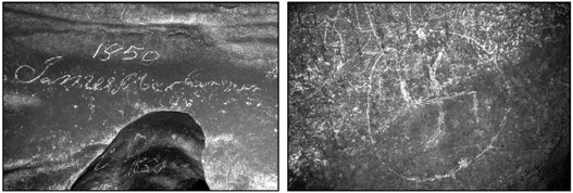
The inscriptions carved in the Kalen Cave dated from 1850, James McClaren, (left) to swastikas dated to 1947 (right). (Wolter, 2008)

The first known photograph of the inscribed stone appeared in the 1890-1891 Annual Report of the Bureau of Ethnology on page 394. The inscription is shown up-side down for Hebrew, and the two vertical scratches now on the stone, are not present in the lower right hand corner.
As expected, in January of 2010, the Smithsonian refused the History request to examine the artifact, citing the fact it was a sacred funerary object and they were entrusted with the artifact, “… on behalf of the Cherokee.” This turned out to work to the Cherokee’s benefit, for what could the Smithsonian say now other than to approve their request?
This marked the first victory toward learning the truth about this artifact. I then made plans to travel to the McClung Museum at the University of Tennessee, in Knoxville, to examine the artifact they had on indefinite loan from the Smithsonian Institute. I planned to bring my microscopic equipment along to examine the artifact for half a day and then spent the afternoon on the university’s scanning electron microscope (SEM) to confirm the chemical make-up of the stone. On May 26, 2010, I received a call from the archaeology department that the SEM was not working properly and that I didn’t need to come. Sensing something suspicious, I told the person, “That’s no problem. I’ll just spend the whole day examining the artifact under my microscope and will come again in a few weeks to do the SEM work.”
On May 28, 2010, I arrived at the McClung Museum at 9:00 a.m. where I met up with three women who were serving as witnesses for the Cherokee, Barbara Duncan, Ph.D., who served as the Education director at the Museum of the Cherokee Indian on the Reservation, Sharon Littlejohn, who served as witness for Chief Michael Hicks, and Leslie Kalen Rose, serving as witness for her father and tribal elder Donald Rose.
The people present representing the university and the Smithsonian were Jefferson Chapman Ph.D., senior archaeologist at UT, another archaeologist, and a university registrar. After the artifact had been officially handed over to me by Dr. Mason, I set up my equipment for the examination. While setting up I noticed that people in the room had distinctly split themselves up in a predictable fashion, the three archaeologists on one side of the room and the three women representing the Cherokee on the other. Whether intentional or not, I couldn’t help but chuckle at the awkwardness of the situation.
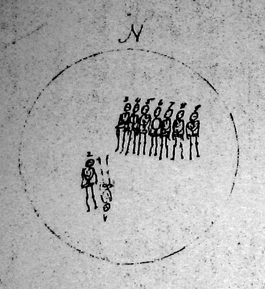
Inside mound #3 of the Bat Creek complex John Emmert found nine bodies. Seven were aligned shoulder to shoulder in the northern half of the mound with their heads to the north. Two more were discovered in the southwest part of the mound, one with its head to the north, the other with its head to the south. The Bat Creek Stone and other artifacts were found inside a birch bark bundle under the skull of the only body with its head pointing south. (Bureau of Ethnology, Twelfth Annual Report, Figure 272)
At this point, I said to Jeff Chapman, “Hey, Jeff, come over here and sit down. We’re going to do this together.” To Jeff’s credit, he came right over and sat down next to me and took serious interest. We started with the back side of the artifact that had been clearly labeled and numbered by Emmert. The first observation of note was a prominent scratch near one end of stone that was noticeably deeper on the end closest to the center and then trailed off the edge. This groove was consistent with the gouge made by Emmert, who wrote, “I punched it on the rough side with my steel rod in probing before I came to the skeletons.”55
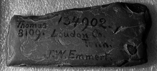
The back side of the Bat Creek Stone has the original Smithsonian (Institute) identification names and numbers. Virtually all of the approximately 1-2 mm thick iron oxide-rich weathering rind has peeled off exposing the light brown-colored, un-weathered iron-cemented clayey siltstone. Only a few remnants survive along the top and bottom edges along with a small arrowhead-shaped portion on the lower right side. The scratch made by Emmert with the metal prod at the time of the excavation is on the far right. (Wolter, 2010)
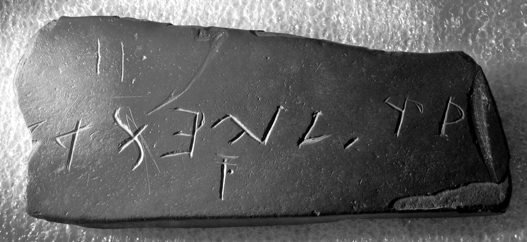
This inscribed stone was found under the skull of one of nine bodies inside a burial mound at the mouth of Bat Creek where it flows into the Little Tennessee River by the Smithsonian’s John Emmert, on February 15, 1889. (Wolter, 2010)
Jeff agreed with my interpretation of the prod scratch and seemed to enjoy the microscopic examination. When we turned the stone over to the inscription side, the surface was completely different. The dark-brown of the iron-oxide-rich weathering rind was nearly intact, and just as Emmert noted when he first described the inscribed side of the artifact, the surface was indeed polished.
The clear and distinct inscribed characters jumped off the surface of the stone. Eight characters were clearly visible and arranged in a line with only part of the final character on the far left edge present where the stone had apparently been broken. A ninth character was present that looked like a capital “T” with two horizontal bars, and a dot on the right side of the vertical line. We also noticed two additional characters in the upper left area above the nine previously noted. I spent several minutes examining and photographing each of the nine characters that all exhibited broad, rounded grooves with rounded edges. The once sharper edges and likely “V”-shaped grooves had been rounded from polishing and extensive weathering in the wet mound.
We then turned our attention to the two parallel scratches that were noticeably thinner than the other nine characters. I zoomed into the grooves with the microscope and immediately noticed something was different. The bottom of the grooves was filled with silty clay with a fracture pattern reminiscent of finger grooves made in wet beach sand. Suddenly it hit me “I get it now.”
Jeff had been watching closely. He got it too.
These two grooves still had the silty clay in the grooves made when someone scratched the surface of the stone with a sharp instrument. The critical thing is these grooves were not present in the first photographs taken of the stone some time before 1891, or in Emmert’s sketch made in February of 1889. This was in sharp contrast to the original nine characters that had none of the silty clay deposits due to extensive weathering that had removed it eons ago. What was eerily ironic was the clay-filled scratches had been made by someone when the artifact was in the custody of the Smithsonian Institution and turned out to be the key evidence to my determining authenticity. At this point I turned to the three women and said, “Well, ladies, it looks like you have a genuine artifact.”
They all smiled and seemed genuinely happy. After finishing my work and thanking Jeff and his colleagues, I told them I’d be back in a few weeks to complete the SEM work.
My second flight to Knoxville would be easier since I didn’t have to bring the microscope. The morning I was to leave, the same person at UT called and said, “The SEM is acting up again so you don’t need to come.”
Without hesitating I said, “I’m coming.” Sure enough, when I arrived in the SEM lab in the Science and Technology building the next morning, we were told the machine was working fine.
David Joy, head of the Science and Technology Department, asked me about the artifact. I quickly told the Bat Creek story. After a few minutes he said, “Possible first-century Hebrew? Well, this is important.”
I agreed. Then we went to work verifying the chemical make-up of the stone and took numerous high magnification photographs. The trips to the University of Tennessee were a success and set the stage for the next step, which was now in the hands of the Eastern Band of Cherokee—asking the Smithsonian for the jawbones so DNA testing could be performed.56
Once again Don and Bob needed to appear before the tribal council and asked me to join them and present my geological findings. On October 27, 2010. Leslie and I drove to the reservation. I first presented my geological findings. Bob and Don followed with statements of support for my work and for requesting the bones. Later the council voted in favor of the request, and a letter was sent to the Smithsonian. None of us really believed the Smithsonian would turn over the remains, and after three months of delays and excuses our suspicions were confirmed; they said they couldn’t find the bones.
After our exciting day on the reservation, Leslie and I set off for the site where the Bat Creek inscription was discovered. The area was mostly wooded with tall hills and only a few homes scattered amongst the countryside. We hiked along a trail leading to the reservoir that had flooded the Little Tennessee River decades ago.
As we approached the water’s edge near the spot on the topographic map marking the approximate location of the mound now underwater, the open tall forest suddenly turned into lush green leafy vines of the foreign vining plant species called Kudzu. The terrain was completely barren of trees, choked off by the invasive plant creating an eerie landscape. We saw no bedrock outcrops except right at the water’s edge. The rock was a very soft, silty clay-stone with areas on the surface covered with a reddish-brown iron oxide crust.
On the hike back to the car we found one small outcropping of the same bedrock that allowed me to collect a sample. Leslie asked me if this could have been the source rock for whoever carved the Bat Creek Stone. While it was impossible to know with certainty, I told her in my opinion the rock could very well have come from nearby.
The Bat Creek Stone saga continued to unfold in July of 2011, when Don Rose again went before the Tribal Council to ask their support for a resolution to draft a letter demanding the Smithsonian return the stone, and all the artifacts found with it, to the Eastern Band of Cherokee Indian. The tribe had had enough and wanted the artifacts returned where they would be permanently displayed in their museum on the reservation.57
At this same time, a two-person camera crew stopped at the McClung Museum to shoot the artifact still being displayed as a fake and upside down!
At the University of Tennessee, archaeologist Dr. Gerald Schroedl, who believed the stone was a fake, was interviewed. He claimed that anyone who believed the stone was authentic was racist, essentially saying Native Americans were incapable of building such complex mound structures and only visitors from other continents could have built them. At one point in the interview, Schroedl also believed the excavation conducted by Emmert was questionable. “He could have this thing (Bat Creek Stone) in his pocket for all I know, and when he calls up Cyrus Thomas he says, ‘Oh, yeah, we found this in the mound.’” He added, “With regard to the bracelets that were supposedly found, again the issue is context. Were they really found in the mound? Who knows?”
After presenting the results of my Bat Creek Stone examination to the Tribal Council of the Eastern Band of Cherokee Indians on October 27, 2010, I posed for a photograph with senior tribal elders Bob Blankenship and Don Rose, who hugs his daughter Leslie Kalen. Blankenship and Rose sponsored my presentation and then made a formal request for the tribe to support asking the Smithsonian Institute to return the human remains found with the stone for DNA testing.
When asked his opinion would be if the conveniently missing human remains from the Bat Creek mound were located and tested for DNA and found to be of first-century European descent, his response was, “Well, I would then assume that Emmert had found 2,000-year-old Middle Eastern bones and planted them,” as if Emmert knew that in 100 years DNA technology would become standard practice.
Whether Schroedl realized it or not, that statement called into question every archaeological dig the Smithsonian Institution had ever done. Academics cannot pick and choose after the fact which archaeological digs they consider to be legitimate depending upon what artifacts are found. This besmirched the reputation of John Emmert decades after his death apparently for the sake of maintaining the academic historical status quo of no pre-Columbian contact by Europeans in North America.
The next day when Don Rose and Chief Michael Hicks were also interviewed and asked about this, they both said, “We just want to know the truth about our history.”
On August 4, 2011, the Eastern Band of Cherokee allowed the proceedings in the tribal council to be filmed and the positive vote for the demand letter to the Smithsonian was unanimous. Before the letter was even signed by Chief Michael Hicks, news of the letter trickled back to the Smithsonian who then stated they would not stand in the way.

On October 28, 2011, Leslie Kalen and I hiked through the eerie terrain created by the vining invasive species kudzu that had choked off the native forests along the water’s edge near the now drowned site where the Bat Creek Stone was discovered in 1889. (Wolter, 2011)
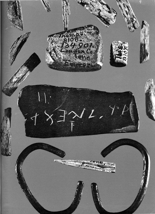
The other artifacts found with the Bat Creek Stone in 1889 were photographed in 1970 and appeared in the January, 1971 issue of Argosy magazine. This is also the earliest known image that shows the two vertical scratches in the upper left area that are not present in the first known photo published in 1890. (Wolter, 2011)
In the meantime, Leslie Kalen, personally offended by how Emmert was accused of forgery and had his reputation trampled, decided to take action. She researched Emmert’s background and located several direct descendants who knew nothing about his discovery of the Bat Creek Stone or the accusations made against Emmert. With the help of her friend James Dodson, Leslie learned that John W. Emmert was a Southern Confederate who fought and was wounded twice during the Civil War. He was also a highly respected constable and a Freemason with the Shelby Lodge #162. There was a strict vetting process one must go through to become both a member of law enforcement and a Mason.
Leslie’s research and connection with Emmert’s descendants led to a ceremony in Bristol, North Carolina, where she personally financed the placement of a new granite obelisk tombstone for Emmert on November 19, 2011.

Leslie Kalen (far left in black hoop dress) and James Dodson (second from left) pose with the John W. Emmert Family at the dedication ceremony in Bristol, Virginia/Tennessee, on November 19, 2011. (Wolter, 2011)
After having been involved with pre-Columbian research in North America for over a decade, I thought I had seen it all. I am almost embarrassed to admit that I had never heard of the Tucson Lead Artifacts prior to November of 2011. I was introduced to a new set of mysterious artifacts that the academicians had written off decades ago. By chance, Maria Awes with Committee Films was searching the Internet for interesting artifacts and sites they could film me examining as part of preparation for a pitch for what would become the television series America Unearthed, TM with me as the host. We were already planning to film the recently discovered runic inscription in the Mustang Mountains south of Tucson, when Maria found the lead artifacts right in Tucson proper at the Arizona Historical Society.
On November 10, 2011, I had the opportunity to review a cache of thirty-two lead artifacts found buried five to six feet deep in caliche-encased alluvial gravel outside of Tucson, Arizona. The lead artifacts, found in the 1920s, include eight crosses (six are two-piece crosses riveted together), seven ceremonial swords, fifteen spears, spear heads and shafts, one clay plaque, and one lead fan-shaped baton.
We were at the Historical Society primarily to film, but I got some time with the artifacts. Prior to that, I discussed the artifacts with Don Burgess, a journalist who wrote a lengthy article in the spring 2009 issue of Journal of the Southwest. I had read Don’s article and other background material about the artifacts prior to our meeting. It was like “déjà vu all over again” as Yogi Berra so eloquently put it. Don had concluded the artifacts were fakes and like so many others determined to prove their case, his arguments were riddled with issues.
An introductory article, Invented and Manufactured History, by Raymond H. Thompson, director emeritus, Arizona State Museum and editorial advisor for the journal, leading into Don’s paper, clearly was designed to bias the reader. Then in the article, Don didn’t score many points with me when he interjected with his take on the Kensington Rune Stone. He intimated there was new research writing, “… some believers in the ‘first famous rune stone’ claimed they had new proof, but the doubters concluded it was another hoax.”
As much as I wanted to, I didn’t bring the Kensington Stone up during our discussion on camera. What I did bring up were issues I had with his “reasons for rejecting the artifacts as authentic.”58
The geological features I observed during my initial review of the lead artifacts in November of 2011 were interesting enough for a closer look. Katherine Reeve, the department head of the library and archives, was extremely gracious, and when I asked to come back with the digital microscope to examine a few select pieces, she went out of her way to accommodate my request.
On January 31, 2012, I showed up at the museum where Kate was waiting for me. She led me into her office where the six artifacts I had requested to look at were waiting. I set up the digital microscope and went to work. After collecting images and data of the artifacts, I made a copy of a 352-page report written by Thomas W. Bent in 1964 entitled The Tucson Artifacts: A narrative report of the discovery, the unearthing, and the failure of the subsequent investigations to solve this mystery. Bent’s report had never been published and while many of the facts listed are the same, it presents a completely different perspective on the artifacts than Don Burgess’s article.
In Bent’s Chapter 13, “Publicity Promotes Controversy,” he reproduces an article published by the Arizona Daily Star in December of 1925, entitled, “Leaden Relicts May Mean New Chapter of History: Roman Jews in ‘Terra Calalus,’ America, From 775 A.D. to 900; Announcement of the Discovery of Leaden Artifacts Bearing Inscriptions in Latin and Hebrew” by Clifton J. Sarle, Ph.D., and Mrs. Laura Coleman Ostrander.
This article does a great job of describing the facts and context surrounding the discovery, the subsequent excavations, the inscriptions, and the controversy at the time. I have purposefully omitted the sections of this announcement that dealt with the speculative aspects of the inscriptions, such as who might have been responsible for carving them, and present here what I believe is the relevant factual information.
Leaden artifacts of great antiquity have been unearthed near Tucson, Arizona, during the past year. All of the objects bear significant drawings, a number of them inscriptions in Latin and two in both Hebrew and Latin. Many dates also are given. The story revealed opens a new chapter in the pre-Columbian history of America. It is a record of colonization in America by Europeans, in 775 A.D., and a brief chronicle of their life here, covering a period of 125 years.
To many, on first consideration, the claim that the Atlantic was crossed and America colonized by Mediterranean people 717 years before the coming of Columbus will seem preposterous. But to others, however startling as this discovery may seem, it will appear quite in line with the volume of evidence gleaned in recent years in various fields of investigation, which points convincingly to Old and New World maritime intercommunication back even into centuries B.C.
Cross Found Near Tucson
A chance find by Mr. Charles E. Manier of a pair of large leaden crosses protruding from a gravel stratum near the base of a lowlying bluff which flanks the westerly side of the floodplain of the Santa Cruz River for several miles below Tucson, was the beginning of this most important discovery. The Silverbell highway follows approximately the boundary line between this bluff and the floodplain, and one traveling this road passes a number of old lime kilns, long abandoned, which were built into the face of the bluff.
On September 13, 1924, Mr. Manier, accompanied by his father, who was visiting him from California, was returning along this road from an auto ride, when, at the suggestion of the latter, they stopped to examine one of these kilns. This kiln, like the others, was constructed by digging a large well-like pit in the edge of a bluff, which was then lined with adobe blocks and faced with brick. A trench was then excavated leading inward to the base of the kiln where through an orifice the lime, when burnt, was removed. Rainwash of the many seasons had exposed the ends of these crosses on one side of the cut and led to Mr. Manier’s fortunate discovery.
Inscriptions Discovered
When discovered, these crosses were fastened together in such a manner as to appear as one, and it was only while washing the dirt from them after carrying them to his home in Tucson, and a neighbor had called his attention to an apparent line of division running around the side of the cross, that they were separated. It was then found that they had been fastened together by leaden pegs. The opposed faces were smoothly finished and coated with a wax-like substance, the removal of which revealed carved inscriptions in Latin, drawings and dates.
The dates and facts, set forth by translation, aroused Mr. Manier’s keenest interest, and he determined to excavate in hopes of finding other material that might add to these astonishing statements and prove or disprove the antiquity indicated by the dates. A few weeks later he joined forces with Mr. Thomas W. Bent (1896 to 1972) and the work was begun. Later, these gentlemen invited C.J. Searle, until recently and for eight years professor of geology at the University of Arizona, Tucson, to advise them as the best method of conducting the excavation and to make a study of the field relations of their find, including, if possible, a stratigraphic correlation with the prehistoric aboriginal culture of the region, to which he had given some study. Shortly thereafter, at Dr. Searle’s suggestion, Mrs. Laura Coleman Ostrander, a teacher of history in the Tucson public schools was invited to collaborate with him in the preparation of both popular and technical articles on their discovery. This article, therefore, should be regarded merely as an announcement.
Excavation Carried Forward
Excavation thenceforward was conducted in such a manner as to maintain at all times, as nearly as possible a vertical face from top to bottom in the soil and to a depth a little below the level at which it had been determined the objects occur. In this way objects encountered as excavation progressed would be free from falling earth and most likely to be immediately sighted, lessening the chance of injury by the workman. This method also provided for the examination of many of the objects while still imbedded in the soil, and the study of the uninterrupted full five or six feet of overlying soil, the taking of measurements, photographing and the calling of competent and authenticated witnesses as to the conditions under which the objects were found.
Intermittently, as funds have been available, the excavation has been carried on. Today the excavation is roughly triangular in outline. The base of the triangle, 80 feet long, begins at the side of the highway and its apex extends the same distance back into the gravel bluff, well past the lime kiln. An old land surface gradually rising towards the back of the excavation, and on which these objects were strewn as they fell from the hands of man over one thousand years ago, has been uncovered. The finds include several other crosses, a paddle-shaped object (ceremonial) and a number of heavy two-edged swords and short hand spears. A number of the weapons are heavily scarred and few are broken as though done in combat, and the general disposition of these finds portrays the confusion of a pitch battle. How much additional material will be found as exploration uncovers more of this old land surface cannot be told. Perhaps we may find the ashes of their fires or the place where they smelted the ore for the lead of their crosses.
Imbedded in Caliche
The surface on which these finds were made was buried from three and a half to six feet in depth, increasing gradually as excavation penetrated the bluff. The objects themselves are generally found firmly imbedded in a lime-cemented gravel, often so resistant that objects have to be removed with a pick. The material overlying in general is coarse, angular and poorly assorted and showing very indistinct stratification. Many water-worn limestone boulders, often too large for a man to lift, lie in a plane just above the relics. This seems a well-defined feature, which may be traced for some distance, showing in the sides of the dry flaring washes, which deeply dissect a plain bounded at its lower edge by the bluff, through which the floodwaters from the flanks of the Tucson Mountains are discharged to the channel of the Santa Cruz. At the top of the section is a well-defined darker stratum often fifteen inches or more thick, a true soil, in which scant vegetation of the dry slopes finds root. Immediately below the soil and formed by evaporation of lime-charged groundwater, is a thick zone solidly cemented by deposition of lime and of white color, known locally by the Mexican name ‘Caliche,’ by geologists as desert limestone. In fact, cementation of the subsoil is the rule and has greatly retarded the work of excavation.
Unbroken Ground
The depth at which these objects are buried, the firm cementation of the gravel stratum in which they occur, the unbroken and undisturbed condition of the caliche shell and overlying soil, form a seal which nature has placed upon these artifacts, not to be counterfeited, and has remained unbroken through the centuries which the dates incised upon these cruciform tablets by the old scribe, who signed himself ‘O. L.,’ indicate. The covering of these objects was brought about by rain and stream action bearing material from higher to lower ground under the impelling force of gravity. Subsequent to the burial of these objects, torrential rains have done much to modify these slopes and have carved them into many minor reliefs.
An episode in the history of the region, possibly later, perhaps antecedent and surviving for several centuries after the passing of these Roman Jews, was the coming of a race of people who left the litter of broken pottery near the watering hole. Certainly at this particular locality the aborigines came much later. Fragments of their pottery have been found upon the recent surface scattered in the last formed stratum, the soil even covering the top of the bluff. The underlying strata, the lowest of which concerns us as bearing the artifacts may in their arrangement and order of formation be compared to the layers of a cake. The bottom layer is laid down first and the top last and the frosting (or soil) added last of all. This pottery is in the main of the type designated by archaeologists, from the paints used in the ornamentation, ‘red-on-gray,’ and there is also some of a later type found here, designated ‘black-on-white.” These potteries will be recognized by all archaeologists as pre-Columbian and lying as they do at a stratigraphically high horizon, and overlapping this site, is another proof of the greater antiquity of the leaden artifacts.
Could Not Be Forged
The great antiquity of these leaden objects, as shown by the dates, and the unique combination of details, the outgrowth of the peculiar conditions obtaining in the western Old World during the early Middle Ages, in the aboriginal setting of America, could not well be forged or duplicated, and the field relations, which have been carefully studied, confirm the genuineness of the record carried by these artifacts as beyond the shadow taken to the excavation and shadow of a doubt. Furthermore, competent witnesses have been taken to the excavation and shown, many of them numbered among the scientific faculty of the University of Arizona, and they have uniformly expressed themselves as convinced of the genuineness of Mr. Manier’s discovery.
Upon reading Bent’s report, I was struck by his commitment to detail in the documentation and the care that went into the excavations of the first twenty-seven artifacts. Credit for this belongs to C.J. Sarle, Ph.D., who advised Bent and Manier on the proper methodology for documenting finds as their excavations progressed. The data collected is better than some professional reports I’ve read. I was also astounded at how Don Burgess and other skeptics could be so flippant in their conclusions that the artifacts were fraudulent when the provenance of their discovery was so well documented with consistent and clear facts.
The following is chronological listing of the thirty-two artifacts collected and includes the date discovered, who found it, the type of artifact, and the depth from the surface where it was found:
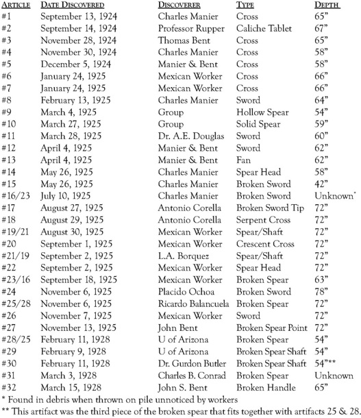
It became clear reading the background information and specifically, Thomas Bent’s thorough report that, like so many other pre-Columbian mysteries in North America, aspects of the human element played the dominant role in the evaluation of the Tucson artifacts as opposed to hard science. The skeptics asserted themselves within days of Manier’s initial discovery—the two halves of the cross he brought to the Arizona State Museum at the University of Arizona, where the date was translated to circa 800 A.D. by Frank Fowler of the Classics department.
On September 21, 1924, the discovery was first reported by the Arizona Daily Star where Fowler reportedly claimed the inscriptions were “poor and disjointed and that it was improbable that the tablets could be more than nine hundred years old.” Upon reading this statement I felt that déjà vu again. Like the Kensington Rune Stone, early experts were quick to dismiss an artifact that likely had them baffled. Time and again, when faced with something that challenged their current knowledge base and the status quo, history demonstrated that scholars feel compelled to render an opinion whether they have factual support or not.
Even the University of Arizona, who independently worked the Silverbell Road site under the direction of Byron E. Cummings, former dean and professor of archaeology, from mid-January to March 9, 1928, would be a huge let-down for Bent and Manier.59 After finding five artifacts during their time at the site, it took Cummings two years to submit the promised report and he never turned over any field notes or photographs to Bent and Manier.
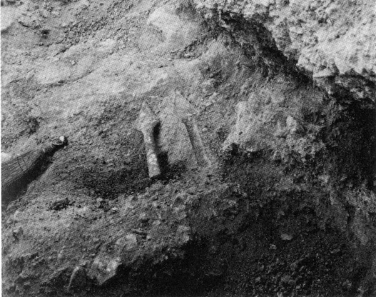
Artifact #10 left a perfect mold in the caliche that encased it fifty-nine inches below the surface when it was excavated on March 27, 1925. (Photo courtesy of the Arizona Historical Society)
This close-up shows artifact #12 and #13 in situ prior to extraction on April 5, 1925. (Photo courtesy of the Arizona Historical Society)
This is eerily reminiscent of the promise made to the Runestone Museum by the Swedish investigation team when I traveled to Stockholm and left the Kensington Rune Stone for four months. One of the conditions for allowing them to investigate the artifact was that, upon completion of their research, they would issue a final report. That report never materialized.
One story I have never shared during my early involvement with the Kensington Rune Stone, happened when I returned to Sweden to ensure the stone’s safe return to Minnesota. After spending three months at the Historical Museum in Stockholm, it was brought north to the Hälsinglands Museum in Hudiksvall, Sweden, for a special one month exhibition. On the last day of my stay, the leader of the scientific investigation team, Runo Löfvendahl, came to Hudiksvall where he and I spent seven hours alone looking at the artifact.
During that time, we discussed the geological aspects of the stone, and he agreed with what I had documented in my report. Upon completing our examination, we went down to the lobby of the museum and wrote down our findings on a sheet of paper. After listing the geological points we’d agreed to, I drew a line at the bottom, signed my name, and then slid the paper over to Runo and said, “Sign it.” With tears welling in his eyes, he looked at me and said, “I can’t.”
As frustrating as it has been dealing with academics both in Sweden and the United States, it must have been very difficult for a seemingly honest person like Runo to have to sneak away from his colleagues to feel comfortable conducting intelligent research. This experience convinced me there were larger negative forces at work in Scandinavia other than just problems of the human condition.
In another interesting parallel with the Kensington Rune Stone, the University of Arizona entered into an agreement with the Bent and Manier to purchase the artifacts upon satisfactory completion of their excavations at the discovery site for $16,000. In 1909-1910, the Minnesota Historical Society also reached a tentative agreement with then custodian of the artifact, Hjalmar Holand, to purchase the Kensington Rune Stone for $5,000 after an investigation conducted by Professor Newton H. Winchell. In both cases, the investigations were conducted, but, due in part to the negative opinions of people with limited knowledge of the facts, neither purchase was consummated.60
Thomas Bent’s frustration with the academic community in general and the University of Arizona’s involvement in the excavations is evident throughout his report and it’s hard not to sympathize with him. Writing with the benefit of his intimate personal involvement, a comprehensive knowledge of the facts, and forty years of reflection, Bent comes across as credible with a sound and reasonable reflection of all aspects of the mysterious history of the artifacts. Bent laments at the unfounded negative opinions of “experts,” most of who never personally saw the artifacts or the discovery site. He refutes criticism with relevant facts that contradict the unfounded claims with up to six-foot deep, undisturbed, caliche-encrusted alluvial deposits covering the artifacts as the factual rock of Gibraltar in this case.
In spite of the disappointing results of the University of Arizona digs lead by Byron Cumming, Bent was an ardent defender of the genuineness of the artifacts who responded to criticism from scholars in the East with the following quote that appeared in The New York Times on December 13, 1925: “Such an attitude is to be expected; the archaeologists in New York naturally want the last word in establishing the validity of the finds. I can safely say that any one of the men who have viewed the scene of the excavations will say again, as they have already, that the finds are genuine.”
Regardless of these opinions there were a number of compelling geological facts I was able to document that are consistent with lengthy burial.
The five artifacts I selected for closer examination were #1A, #12, #13, #18, and #20. These artifacts exhibited interesting secondary deposits of calcite and other minerals that filled in or covered parts or all of the carved lines in the lead. The back side of artifact #1A had a very rough surface with white secondary calcite deposits (caliche) within depressions in the metal intermittently scattered over the entire surface. Under magnification, sand grains of various sizes were present cemented onto the cross after burial. Several recessed areas on the back side also had fibrous green malachite, and deep-blue azurite, both copper carbonate minerals that form from the weathering of copper ores. The source copper was likely present as an impurity within the lead deposits originally smelted to make the artifacts, which then weathered out over time within the sand and gravel deposits the cross was discovered in. (See color section, Figures 8 & 9)
I wanted to take a closer look at the calcite deposits within the grooves of the carved lines on the surface of the other four artifacts (#12, #13, #18, and #20). Most grooves were filled with calcite deposits essentially the same as hard water scale deposits on leaky pipes. Under the proper conditions these deposits don’t necessarily take a long time to form. However, in this case the artifacts had to first become buried within the sand and gravel before the process started. This process likely took at least many decades and most likely many centuries.
A group of people being shown the location of a find by a man crouching at the base of the caliche cemented wall of the excavation in February of 1928. (Photo courtesy of the Arizona Historical Society)
University of Arizona President, Byron Cummings, who was also a professor of archaeology, points to one of the artifacts still in place prior to extraction during excavations supervised by the University of Arizona, in February of 1928. (Photo courtesy of the Arizona Historical Society)
Two days after the second examination on February 2, 2012, I drove out to Silverbell Road to examine the lone surviving lime kiln and the discovery site where the artifacts were found. The lime kiln was situated roughly fifty feet off the road. As I walked around the kiln, I noticed layers of crushed limestone gravel and lime accumulated along the perimeter of the deteriorating brick chamber. The rustred adobe bricks comprising the roughly eight-foot diameter circular chamber where limestone was put into the kiln to be fired was crumbling, leaving a trail of debris on the slope leading into the old trench. I could imagine how Charles Manier had walked up the trench to the bottom of the lime kiln and found the first lead cross sticking out of the eroding cliché cemented sand and gravel bank.
I then drove northwest along Silverbell Road roughly one-quarter mile to the actual discovery site directly across the road from Christopher Columbus Park. David and I chuckled at the irony of the name of the park and its proximity to the artifacts’ discovery site. We had also been told the area where the excavations took place in the 1920s had been bulldozed flat with a roughly fifteen-foot high sand and gravel bank for us to examine.
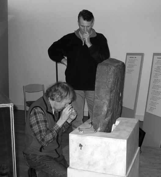
On February 10, 2004, Runo Löfvendahl and the author (standing) examined the Kensington Rune Stone for seven hours at Halsinglands Museum in Hudisvall, Sweden. (Wolter, 2004)
Studying a map of the area, I noticed the Santa Cruz River was only a hundred yards over there. It makes sense this site would have been near a significant waterway.
At the exposed sand and gravel bank, I climbed to the top. The alluvial deposits were essentially the same as the hundreds of gravel pits in Minnesota, Iowa, Wisconsin, and Michigan where I’ve searched for Lake Superior agates over the past thirty years. We have some caliche cemented deposits but we have a lot less limestone and other carbonate rocks in our gravels than here. The dominant rock type comprising these gravels was limestone, which was the source of the secondary calcite cement.
The sequence of sand and gravel layers from the surface to the six-foot level was essentially the same as described by Thomas Bent and geologists who visited the excavation. The upper four feet was moderately cemented sand and gravel with pockets of loser material. The next roughly twelve-inch-thick layer below contained well-defined cross-bedded sand and gravel layers deposited during a heavy storm run-off event in the distant past. I was later asked about cross-bedding by my son, Grant. “If you have a foot of material deposited in one storm wouldn’t it only take a half a dozen events to build up six feet of sand and gravel deposits?”
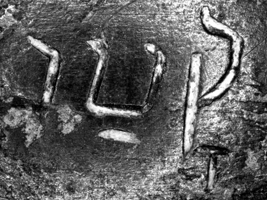
The grooves within the Hebrew characters on artifact #20 are partially filled with secondary calcite deposits (20X). (Wolter, 2012)

A closer view of the lower portion of the Hebrew “Tet” on artifact #20 shows minor amounts of white secondary calcite in the otherwise clean lead grooves (200X). (Wolter, 2012)
I answered, “No, it’d take a lot longer than that. The reason is after a stream deposits a foot of new gravel in one area, it’ll move over and flow into an adjacent low spot until it fills up to the same level. A stream might take dozens of storm events to build up to the same level as the first cross-bedded layer before it flows over it again, depositing new material. That’s why it’s reasonable to have taken roughly twelve hundred years for the six feet of material to have been laid down over the artifacts.”
After having twice reviewed the lead artifacts, the discovery site, and the lone remaining lime kiln along Silverbell Road, and after reading Thomas Bent’s detailed report, I can respond to points, made at the time, of why the artifacts were fraudulent when the geological evidence alone made it clear they were indeed ancient:

A different area on artifact #20 shows grooves that are near to completely full of white secondary calcite that has also accumulated on the surface of the lead partially covering some of the grooves. (Wolter, 2012)
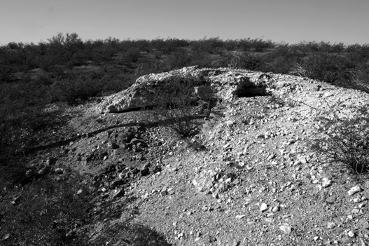
On February 2, 2012, I visited the lone remaining lime kiln along Silverbell Road in southwestern Tucson, Arizona. These lime kilns were constructed in the early 1880s to make lime for plaster and mortar for the construction of buildings. It was along the weathered trench leading the bottom of one of these kilns that Charles Manier found the first lead cross on September 13, 1924. (Wolter, 2011)

At an exposed bank at the discovery site of the Tucson lead artifacts on February 2, 2012, the author points out the roughly one-foot thick layer of cross-bedded sand and gravel deposited during one heavy storm runoff event in the distant past. The lighter colored, massive layer below the cross-bedded layer is much harder due to the heavy buildup of secondary caliche. It was within this roughly six-foot deep caliche layer that the lead artifacts were excavated from. (Wolter, 2012)
Nay sayers also trotted out the old argument about the lack of accepted contemporary pre-Columbian evidence anywhere in the vicinity. Putting the new runic inscription south of Tucson aside, this argument is another red herring. As I’ve said many times, a lack of evidence proves nothing. Simply being out of context for the currently known history of North America is not a viable argument to support the claim the artifacts are forgeries or fake. In fact, the geological evidence is consistent with lengthy burial and, therefore, supports the artifacts’ authenticity, which requires a yet another new chapter of North America history be written.
There is one symbol that occurs twice on artifact #20 that instantly jumped out at me. Near the pointed ends of the crescent in the upper half of the cross is what looked like a dead ringer for the compass and square symbol, the most common symbol of Freemasonry. In this case, it cannot be related to modern Freemasonry being found on an eighth or ninth century artifact. Therefore, there must another explanation for it. Some research produced a plausible and highly likely explanation.
The compass and square symbols resemble magic squares that date back thousands of years and were used for their mystical and magical properties in China, India, and the Middle East.61 While magic squares can be many sizes and incorporate many numbers and mathematical arrangements, the simplest example is comprised of three rows and three columns with a total of nine squares. Inside each box are the numbers 1 through 9 arranged in such way that if all rows and columns are added up they will equal 15 as will the two diagonals. This sequence is 4, 9, and 2 for the top row, 3, 5, and 7 for the middle row and 8, 1, and 6 for the bottom row.
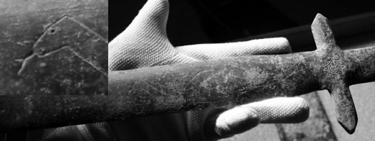
Artifact #12 is a 17½” long sword with what looks like a dinosaur carved into the blade. The dinosaur argument has been one of the skeptic’s main arguments against authenticity. However, the creature has a forked tongue (inset) which has not been found in the dinosaur fossil record. This image is most likely that of one of many species of lizard found in the Tucson area. (Wolter, 2011)
By using Gematria, the ancient art and science of substituting numbers for alphabetic letters (usually Hebrew or Greek), words or messages can be encoded. Freemason William Burkle believes that by connecting the numbers 8, 9, and 6 for the compass symbol and 3, 1, and 7 for the square symbol within the Hebrew magic square, when decoded, it likely stands for the equivalent of the Tetragrammaton, or the immutable word of the Creator.
It’s highly likely the symbol has a sacred ancient Kabalistic meaning for the compass and square-like symbols on this particular artifact since it is associated with Hebrew words and early Jewish religious symbols.

Near the points of the crescent on artifact #20 was two carved symbols that looked exactly like the compass and square of Freemasonry. (Wolter, 2011)
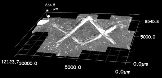
A close-up view of the compass and square symbol on the left side of the crescent on artifact #20 shows the grooves partially filled with white secondary calcite deposited over the centuries when it was buried under nearly six feet of sand and gravel near Tucson, Arizona. (Wolter, 2012)
There is another pre-Columbian example in New World of the compass and square that indicates highly sophisticated cultures in Columbia, Panama, and Costa Rica that had an amazing grasp of the ancient arts and sciences. In October of 2010, I was introduced to the some amazing pre-Columbian gold statuary by Greg Cavalli. The metallic artifacts were crafted in exquisite detail out of an alloy comprised of copper, zinc, and gold called tumbaga. One of the largest artifacts in his collection contained something that had me scratching my head. The thirty-inch tall, five-and-a-half pound tumbaga statue of a female holding an infant in her arms was wearing only an apron covering her front and back pelvic regions. Incredibly, the design etched onto the apron was a dead ringer for the compass and square symbol of Freemasonry.62


This Masonic-like apron worn by this thirty-inch-tall female tumbaga statue from the Tairona region of Columbia has a design reminiscent of an inverted compass and square. (Tom Shearer, 2012)
Another interesting side note to the lead artifacts relates to a 2001 book by Crichton Miller where he recounts his rediscovering the ancient surveying and navigational device he calls the “working cross.” Miller successfully applied for a United Kingdom patent on the device, which bolsters his claim. Artifact #18 is a Christian style cross with an entwined serpent that has both Latin and Hebrew inscriptions. The artifact also has football-shaped flared fins inscribed in Latin roughly one-third of the way up the long cross. At roughly two-thirds of the length there is horizontal bar reminiscent of the Christian cross with a circle joining the four cardinal points of the crossing bars creating a common symbol called the “Circle Cross,” which is essentially the same as Miller’s working cross.
Miller discusses the Tucson lead artifacts, and the tone of his writing is in support of their authenticity. What surprised me was he made no mention of the circle cross/working cross on artifact #18. He convincingly argued that ancient sailors up through to the Knights Templar used his device, but knowledge of the working cross used to build among other edifices, the Pyramids of Giza, was lost when Roman Christianity rose to prominence. Miller believes that much of the knowledge of the ancients was lost to humanity when the library at Alexandria, Egypt, was burned by the Catholic Church in the third century A.D.
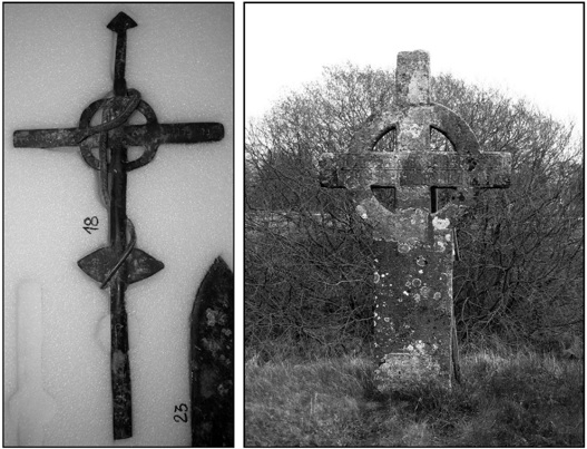
Artifact #18 of the Tucson lead artifacts has a circle cross with a lead serpent entwined around it. This artifact appears to support Crichton Miller’s rediscovery of the “Working Cross” that he convincingly argues would have been required knowledge for ancient cultures to successfully navigate the oceans. (Wolter, 2011 & 2005)
The lost Jewish colony of the eighth and ninth centuries who found their way to what is now Tucson apparently did have this knowledge and artifact #18 supports that supposition. If Miller’s research is correct, having the working cross would have been a requirement to successfully navigating across the Atlantic Ocean to North America.
Given the well-established provenance of the discovery and extraction of the artifacts together with the complete lack of evidence of planting or other nefarious activity these artifacts, and the numerous centuries estimate for the caliche and copper carbonates to form on the artifacts, they must be accepted as genuine historical artifacts.
Figure 1. This head-on view shows where the carver’s point-chisel struck the center of the plateau of rock in the “thorn” rune in the word “death” on line eight of the Kensingston Rune Stone, and then cut a channel downward when the chisel slipped. The chisel stopped after running into the previously carved groove comprising the loop of the character, creating a deeper hole. (25X) (Wolter, 2011)

Figure 2. The 3D imaging capabilities of the Keyence microscope includes the ability to create cross-sectional profiles where desired. In this image across the upper part of the Dotted R shows the maximum depths and cross-sectional profile of both the pit and a carved line. (Wolter, 2011)
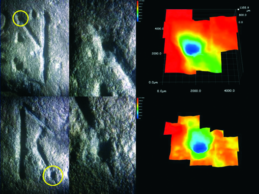
Figure 3 (composite).

Figure 4 (Composite)
The first four runic characters on the Kensington Rune Stone that were modified by the carver after the inscription was carved were the letters “g”, “r”, “a”, and “l”. These modifications added both directly onto and adjacent to specific carved lines were definitively confirmed to be manmade and therefore intentional by using 3D digital microscopy in September of 2012. The rainbow colors applied to the digital images on the right represent the yellow circled areas on pictures of these runes on the left taken by the author in 2002. These colors correlate to depth with red being the highest elevation documented and blue being the lowest. (Wolter 2002 [top]; Wolter, 2012 [bottom])
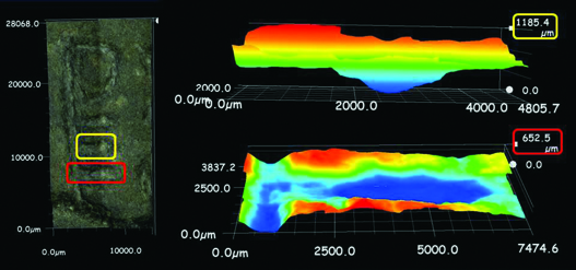
Figure 5 (composite). The punch mark made at the end of the second horizontal bar in the Pentadic number eight in the Kensington Rune Stone inscription was positively confirmed to be manmade using digital 3D microscopic technology in September of 2012. The cone shaped depression of the punch mark (top right) is nearly twice as deep (1185 microns) as the average maximum depth of the lines carved in the character (approximately 650 microns) and was clearly added after the inscription was carved (bottom right). (Wolter, 2012)
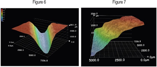
The new digital microscope visually illustrated a classic “v”-shape in the test groove carved into the same layer as the bull carving (Figure 6). This was in contrast to the broader, terraced profile along sedimentary layers of the carved grooves of the bull that was consistent with an advanced weathering profile and significant age (Figure 7). (Wolter, 2011)
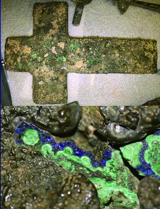
Figures 8 & 9
A closer view of the malachite and azurite on the backside of Artifact 1A (top) shows its fibrous nature indicating it formed by the weathering of copper ore likely present within the lead over an extended period of time (like many centuries) while buried within the caliche-encrusted sand and gravel deposits. (Wolter, 2012)
Figure 10. As Enrico Altmann and I walked around the altar of Eglise Notre Dame Church, France, at exactly 9:00 a.m. on March 30, 2010, we noticed statues of Mary and child on a pedestal wrapped in red and gold robes and flanked by candleholders with red and white candles. On either side of the statues and candles were twin stone columns wrapped in red cloth and awash in vertical columns of sunlight passing though the upper level windows of the church. (Wolter, 2010)

Figure 11. In one of the stain-glass windows at Eglise Notre Dame Church, France, two of the banners held by men opposite Mary and Child have names clearly suggesting an Egyptian origin. On the left is “Osias,” an apparent reference to the male God Osiris, and to the right is Amon R, an ode to the rising sun of the New Religion of Egypt that revered the rising verses the setting sun (Amen Ra) first introduced by the “heretic” pharaoh Akenaton? (Wolter, 2010)

Figure 12. On January 6, 2012, Bill Mann shared his Knights Templar Preceptor jewel with eight-pointed white cross with gold Maple leaves of Canada and the red-colored Cross of Lorraine in the center. On the red and white colored neck ribbon is a pin with a shield with black and white colors of the Cistercians, the ideological brethren of the Templars, and symbolic of the religious concept of “Dualism.” Across the shield is the name of his Templar Preceptory (Commandary in the United States), Godfrey De Bouillon No 3. The red ribbon with gold trim held his 32 degree Scottish Rite Templar jewel. What Mann said was even more important to him was his Mide’ win Shaman’s bundle with cedar, sage, sweet-grass, tobacco, and the secret hidden “5th Element” of the medicine cloth which reflects the red of the Templars.(Wolter, 2012)
Figure 13. The four sacred posts of the Mide’wigan for the four degrees are placed in the ground and are four feet high and six to eight inches in diameter. The posts are round and painted the following colors: red with a green strip around the top (first degree), red with white spots with a stuffed owl on top (second degree), cut square verses round and painted black (third degree), and an equilateral cross. (Bureau of Ethnology, Seventh Annual Report, Plate XV)
Figure 14. There are several specific methods of face painting of the Mide’ Shaman during the four degrees. The four colors used are various combinations of red, white, green, and black. In the third degree within the Mille Lacs Society, in Minnesota, circa 1830, the Mide’ paint red and white spots on their faces. In this portrait, the Mide’ Shaman wears a red-and-white striped scarf reminiscent of the stripes of the America flag. (Bureau of Ethnology, Seventh Annual Report, Plate VI)
Figure 15. The Cross of Lorraine originated from the True Cross with the scroll affixed near the top by the Romans who mockingly inscribed “Jesus of Nazareth, King of the Jews.” This particular painting is a thirteenth century depiction found at Saint Catherine’s Monastery at Mount Sinai.

Figure 16. A tilted Cross of Lorraine adorns the pillbox shaped “White Hat” worn in the Lodge by a 33rd-degree Freemason. This cross is the patron symbol of the Knights Templar that was bestowed upon them by King Baldwin II after they captured Jerusalem from the Saracens in 1099. The angle of the tilted cross is 22.5 degrees; the same angle of declination of the planet Venus at its maximum height in the sky as a morning and evening “star.” (Internet)
Figure 17

Figure 18
Both Nabisco Corporation and the American Lung Association incorporate the Cross of Lorraine into their logos. The American Lung Association chose the symbol to represent their “crusade” against lung disease, but could there also be some kind of an association with the first century bloodline families? (Internet/Internet)

Figure 19. A red Cross of Lorraine (on a white background) tilted forty-five degrees from vertical is found in the logo of one of the biggest energy companies in the world; Exxon Energy. One interpretation of the red and white colored logo could be that the Cross of Lorraine symbolized the bloodline families that were brought across the Atlantic Ocean, symbolized by the blue band at the bottom, to the New Jerusalem to the west which is the direction the Cross of Lorraine is pointing. (Internet)

Figure 20. This painting of the Mandan Chief, Mato-Tope (Four Bears), was painted by Karl Bodmer, in 1833, and shows the sacred colors of both the Israelites and the Mandan of blue, red and yellow. (Wolter, 2012)

These two examples of the Washington Family crest incorporate red and white horizontal stripes and both red and white five-pointed stars. The crest with white stars was found on the Jenyn’s Roll that dates to circa 1390. The crest with red stars appears in stained glass at Selby Abbey in Yorkshire and dates to the fifteenth century. Notice the “X’s” conveniently located around the crest in the stained glass. (Internet/Internet)
Figure 23. On the evening of June 30, 2009, Donald Ruh showed us the artifacts I had watched him find in a videorecording he made inside a small cave on the side of a mountain in the Panther Mountain Impact Area. (Wolter, 2009)

Figure 24. The rounded chest of this ten-inch long ceramic jaguar vessel gives the impression of rounded ends when they are actually square. This style (to say nothing about the red color on a white background) is strikingly similar to the Knights Templar cross used by the order in the thirteenth century. The ceramic vessel was reportedly unearthed from a tomb in western Panama, in 2011, and based on the style of the cross was likely made between seven to eight hundred years ago. (Wolter, 2011)
Figure 25. The stained glass window at Hodnet Church, in Shropshire, England, depicts the authors of the four Gospels, Mathew, Mark, Luke and John. The far right figure that allegedly represents St. John (or Luke?) appears to be a woman. The three other figures are bearded and have their left foot forward. The thinly-disguised female figure does not have a beard, is wearing a woman’s gown, appears to have breasts, has her right foot forward, and is holding a gold chalice. If it wasn’t obvious the figure is Mary Magdalene the red and greens color of her clothes and the ribbons in front of each saint create a male peak symbol (left two), and a female “V” symbol provides conclusive evidence. (Courtesy of Graham Phillips)
Figure 26
Figure 27
Inside the pulpit at Notre Dame Church, in Montreal, are numerous depictions of Mary Magdalene and other women of historical importance in Montreal, both of European descent and Native American. I found it interesting that the Native woman is depicted wearing the red and white Templar colors. (Wolter, 2009)
Inside Notre Dame Church in Montreal was a painting of a golden haired woman wearing orange, green-and-blue vestments holding three Canadian maple leaves with an Egyptian lily atop the crown on her head. In her lap is what looks like a baby girl with short curly red hair. The painting appears to depict Mary Magdalene with a daughter (Sarah?) and a crown over her head symbolic of royalty (Figure 28). In one of the Stations of the Cross paintings in the church was the Magdalene with the same golden hair wearing green and orange (Figure 29). Notice also the left hand of the child is making the secret “M” sign as an acknowledgement of the 13th apostle whose lap she is sitting on. (Wolter, 2009)

Figures 30, 31, & 32. While researching his genealogy in Scotland in September of 2012, Steve St. Clair discovered his family was granted land by their blood relatives the deMorville Family in 1170. The deMorville Family crest is a Lion Rampant on a blue shield wearing a gold crown. Steve was unaware the lion symbolizes the Royal family of King Jesus who was part of the Hebrew tribe of Judah. On the Nova Scotia flag is compelling symbolism that appears to suggest the designers knew about the legend of Prince Henry Sinclair, a prominent Knights Templar symbolized by the red and white colors of the lion inside a shield. The lion’s tail is in the shape of a scimitar, an Arabic sword, likely representing the medieval Templars respect for the Arabs and their proficiency with numbers, mathematics and geometry. The large blue-colored “X” symbolizes the azure blue color of royalty of the heretics in the eyes of the Roman Catholic Church who embraced Monotheistic Dualism originally begun by Jesus’ distant ancestor Pharaoh Akhenaten. The upright Lion Rampant is also the official emblem of Jerusalem whose primary colors are blue, yellow and white. (Courtesy of Steve St. Clair, 2012; Wolter, 2012; Internet)

Figures 33, 34. The official flag of Nova Scotia includes the yellow shield completing the four color symbology of blue (water), white (purity), yellow (the sun), and red of the Templars and the bloodline of Jesus and Mary Magdaline some of them carried in their veins. The Canadian Flag contains additional interesting symbolism beyond the obvious red and white colors of the Templars who first came to the shores of what is now Canada in the twelfth century. The numerology of twelve points on the Maple Leaf could very likely represent the twelve constellations of the Zodiac. (Wolter, 2012; Internet)
Figures 35, 36. Modern stained-glass windows depict John the Baptist baptizing his disciple Jesus with the Holy Spirit, which is actually the sun-God Ra, in the form of the dove which has its rays shining down on both men. In both images, Jesus, has his arms crossed in the classic Osiris pose of the heretics who embraced the Hooked X ideology of Monotheistic Dualism. (Wolter, 2011)
Figure 37
Figured 38
David Tenier’s mid-seventeenth century painting of the monks’ St. Paul and St. Anthony contains symbolism that likely reflected his true ideological beliefs which included the contrasting dark and light halves of Dualism. Another of the many symbols in the painting the author sees can be found in the “X” created by the stick in St. Anthony’s hand and the one leaning against the block of rock. Could the upper left vertical edge of the rock above the stick be intentional to create the Hooked X? (Internet)
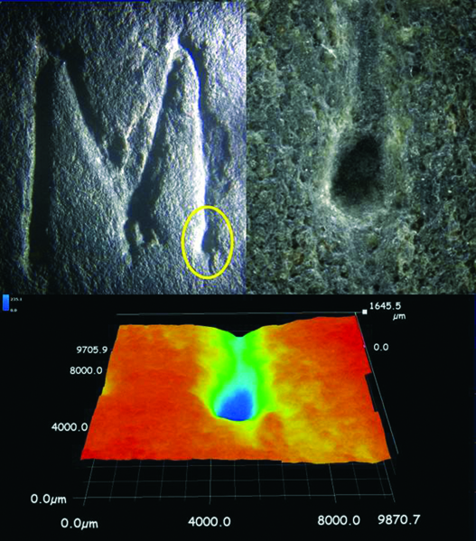
Figure 39 (composite). There is an intentional punch mark that was added to the bottom end of the far right leg of the Latin M on line eight by the carver of the Kensington Rune Stone inscription who was almost certainly a fourteenth century Cistercian Monk or Templar Knight. The punch mark was likely added as an acknowledgment to who they believed was the thirteenth apostle: Mary Magdalene. The rainbow-colored 3D digital image clearly shows the manmade depression. (Wolter, 2002, 2013)
Figure 40. Curiously, in the stained glass window in a Catholic Church in Kansas City, Missouri, is a ship with the stylized M, symbolic of Mary Magdalene, is sailing west following the five-pointed star of Venus as an evening star. Could the ship with the Cross of Lorraine on the mast sailing west be an acknowledgment of the story of her escape to southern France? (Wolter, 2011)

Figure 41. Helena Roerich as painted by her husband Nicolas Roerich in 1937. The small metal box on the left is believed to contain a meteorite which to people involved in mysticism is considered a sacred object from the heavens. Three other symbolic objects in the painting include the book on the table and the yellow and red roses.
On December 2, 2009, I received a call from Rene Barnett, who asked to interview me on her radio show about our research on the Templars. After the interview she convinced me I just had to visit France. To further entice me, she sent a DVD of a documentary film, Bloodline, she had made with her former business partner, Bruce Burgess. The film was the story about their investigation into the bloodline of Jesus and his wife, Mary Magdalene, and Rene and Bruce’s meeting with Ben Hammott, from London. They talked about the discovery of a cave in the mountains of southern France reportedly near the small mountaintop village of Rennes-le-Château, made famous by the book, Holy Blood, Holy Grail.
The film was believable not only from the people featured in the film, which included a member of the so-called Priory of Sion, a secret society that protects both the living and deceased members of the sacred bloodline of the Royal Family. The film’s focus was on retracing Ben’s steps during his search for the hidden tomb allegedly found by the priest, Abbé François Bérenger Saunière, (1852 to 1917) who discovered parchments inside a hollow pillar in the altar of his church at Rennes Le Château, in 1891.
Ben and fellow researcher Sandy Hamblett, followed clues they found inside the Church of Mary Magdalene eventually discovering four bottles with coded messages, three inscribed stones, and a chest containing artifacts with yet another coded message. This incredible treasure hunt culminated in Ben’s discovering a small hole inside a cave in the mountains near Rennes that served as a ventilation shaft for a tomb. Ben was able to lower a boroscope camera down the ventilation shaft into the tomb and filmed its contents.

On the front of the altar in the Church of Mary Magdalene at Rennes-le-Château in Southern France, a kneeling Mary Magdalene has her fingers entwined in the same manner as the fingers on the body inside the tomb Ben Hammott reportedly discovered prior to 2007. (Wolter, 2010)
If the legend that abounds in this region of Southern France is true, then what Ben had discovered was very likely the final resting place of Mary Magdalene. Ben was eventually able to cut away part of the shroud covering the body on the marble slab and reveal a mummified body whose face looked distinctly feminine. What I found most interesting is the fingers were entwined in the same manner as the statue of Mary Magdaline inside Saunière’s Church.
While watching the film, Janet and I were torn between utter fascination with the filmmaker’s investigation, Ben’s incredible discoveries, and the possible implications these discoveries could have. At the same time, we had a hard time believing what we were seeing. After watching the film, I called Rene and asked questions, most that could only be answered by Ben. Rene said, “I’m taking a week-long trip to France and meeting up with Ben and Sandy in March. Why don’t you join us?” Since I had always planned to visit France someday, this seemed like the perfect opportunity to go.
On March 28, 2010, I arrived in Paris and took the train to my hotel in the heart of the city directly across the river from Notre Dame Cathedral. As I walked the perimeter of the cathedral I saw dozens of examples of the sacred feminine architecture so beautifully crafted in this structure.
Perhaps the most impressive artifact I saw in the Louvre was a granite sarcophagus covered with scenes and hieroglyphics with incredible detail. How did the Egyptians make something that incredible so long ago? The only effective way to cut and polish granite is with diamonds, and they likely had access to the diamond mines in the southern part of the continent. Even with diamonds, the technology to produce such stunning artwork required ancient knowledge not known today. We forget how technologically advanced the Egyptian culture was and one only needs to spend time in this museum to fully appreciate it. I thought, If this advanced culture could create these amazing things, they could probably build a boat capable of sailing across the Atlantic.
The twin towers (left) on the west side of the magnificently lit Notre Dame Cathedral after dark on March 28, 2010. The towers symbolize the sacred feminine architecture incorporated into the Gothic Cathedrals of Europe of the upright knees of a woman with her allegorical birth canal exposed in the birthing position. (Wolter, 2010)
The massive six-foot tall granite sarcophagus (below) with incredible detailed carvings on all sides was one of the most impressive Egyptian artifacts I saw in the Louvre. The artisan who crafted the carvings likely had diamond tools to have been able to so skillfully carve rock as hard as granite. (Wolter, 2010)
My last stop was Saint Sulpice Church. My goal here was to get inside and confirm that the same “AVM” symbolism was here that we saw prominently displayed in the Notre Dame Basilica and the Grand Seminary in Montreal, Canada, during my trip to Montreal in October of 2009.
Montreal, first named Ville-Marie, was founded in 1642 by a group of highly devoted mystics who sailed from La Rochelle, France, and were supported by rich members of the secret Compagnie du Saint-Sacrement. Later, they received donations from the Sulpician priest Alexander Le Rageois de Bretonvilliers.63 On this island the new independent colony of seventeenth-century mystics, “New Jerusalem,”64 the parish was dedicated to Mary (Magdalene?) and in 1672, the church of Notre Dame was built on the island.
Within the Notre Dame Basilica I found many examples of Templar style crosses, various stylized AVMs, and two Tetragrammatons (four Hebrew letters that correspond to YHWH, transliterated IAUE or Yahweh) with not four, but three Hebrew letters within the Delta, “Hey” “Waw” “Hey” which in Latin spells “Eve,” that seemed to be an ode of reverence to the “other” Mary. The close ties of the new colony to the Sulpicians in Paris seemed like more than a coincidence. Daniel Graysolon Du Luth, the first French explorer to travel west of Lake Superior (and carve his name on a sandstone boulder in 1679), started in Montreal and lived right next to the Notre Dame Basilica on Notre Dame and St. Sulpice Streets. Could he have known about the region through membership in a secret society that had knowledge of the Templar party that made it to Kensington? Then, also, the AVM (A.U.M.) on the Kensington Rune Stone has ancient Masonic ties to esoteric knowledge that only the most initiated were privy to. To one group of people, AVM is a symbol of reverence to the Virgin Mary. To others, such as enlightened Templars and Sulpicians it is an allegiance to Mary Magdalene. Inside the Church at St. Sulpice in Paris, I found the same stylized AVM on the marble frontispiece in the Lady’s Chapel.
What also stuck out inside St. Sulpice Church is the gnomon (the part of a sundial that casts the shadow) used to record the summer and winter solstices and the equinoxes throughout the year. The winter solstice is marked by a beam of sunlight passing through a small round hole in a stained-glass window on the south wall that hits a mark near the top of a roughly thirty-five-foot obelisk. This documenting of the annual movements of the sun is consistent with the pagan beliefs of many esoteric secret societies that are rumored to be affiliated with the Sulpicians both in France and Montreal.

The same stylized AVM is found at St. Sulpice Church in Paris, France, (left) and at the Notre Dame Basilica (middle) and the Grand Seminary (right) in Montreal, Canada. (Wolter, 2010)
The gnomon inside St. Sulpice Church in Paris, marks the summer solstice with a small beam of sunlight passing through a round hole in a stained-glass window onto the marble square in the foreground. The winter solstice is marked near the top of the obelisk. (Wolter, 2010)
I met up with Rene Barnett, Ben Hammott, Sandy Hamblett, and a friend from Germany, Enrico Altmann in Chartres. The spires of Chartres Cathedral towered over the landscape. The massive size of the cathedral became evident when we arrived for a tour. What struck me most besides its size were the detailed carvings of the various biblical scenes.
On the outer side of the wall encircling the apse were various one-half life-sized biblical scenes carved in limestone. In one scene that I’ve never seen depicted before was the circumcision of the eight-day-old baby Jesus. This of course confirms his Jewish heritage and very likely his Egyptian heritage as well.
I don’t recall ever seeing an image of baby Jesus being circumcised, and the Black Madonna and child here was more vivid than the ones I saw on Gotland. The dark skin on Mary (Isis) and baby Jesus (Horus) allegedly portrays the truth about Mary Magdalene and her Egyptian heritage that is in darkness, or in hiding. To me, this makes a lot more sense than the myth of Mother Mary holding baby Jesus who she supposedly conceived without ever having sex.
We left Chartres for the South of France. I asked both Ben and Sandy about their discoveries at Rennes-le-Château. They shared every minute detail and answered all my questions. Ben said, “Being a geologist, do you think you might be able to help me find another way into the tomb?”
Inside massive Chartres Cathedral is a rare limestone carving of the circumcision of Jesus and a Black Madonna of Isis (Mary Magdalene?) and her son Horus. (Wolter, 2010)
I said, “I don’t know, but we can sure give it a try.” My thinking was that we might be able to determine the sedimentary bedding trends in the mountain made of limestone and possibly find where the people (Templars?) who carved out the tomb originally got in. It seemed like a long shot but why not give it a try?
Over the next day and a half we meandered toward “Rennes,” stopping at interesting churches along way. We stopped in the town of Poitiers to wander through three very old churches including tenth century Byzantine Church of Eglise Notre-Dame de Poitiers. Enrico and I entered the church at a little before 9:00 a.m. and noticed a priest making his way toward the altar.
Enrico and I then looked behind the altar and noticed what held the congregation’s attention. Perched atop an ornate pedestal and wrapped in a bright red cloak adorned with five-pointed stars wearing a crown on her head and holding a fig branch in her left hand and a rod with two large keys in her right was Mary. Seated in her lap was a male child holding up two fingers on his right hand and also wearing a gold colored robe and a crown. On either side of the pedestal, were gold candleholders with twelve candles each, six red and six white. Behind the Royal Mary and child statues were two large stone columns that were both wrapped in red cloth.
It took a minute to take in the unfolding ceremony Enrico and I had happened upon. When I looked again at that cloth-draped red columns, I noticed sunlight shining through the upper-level windows on the southeast side of the church cast tall rectangles of light onto the red columns. We then looked at the other stone columns surrounding the altar. They too were awash in sunlight in a spectacular illumination event. The priest raised the smoking lantern as an offering to the crowned statues, and then set it in front of the altar. We watched the ceremony as the illuminated columns and the billowing frankincense created a surreal moment we would never forget. (See color section, Figure 10)
On March 30, Ben Hammott, Rene Barnett, Sandy Hamblett, Enrico Altmann, and I walked through the beautiful tenth-century Byzantine Church of Eglise Notre-Dame de Poitiers. The morning sunlight illuminated the stunning beauty of the church’s Romanesque architecture. (Wolter, 2010)
I could not help but think of the illumination of the egg-shaped keystone we discovered in the Newport Tower two years earlier that happens at the same 9:00 a.m. time is more than just coincidence. Here we were in a church in the heart of the Southern France witnessing another illumination event where for the better part of two thousand years the Cult of Mary Magdalene has embraced the same “Hooked X” Monotheistic Dualism beliefs as the Cistercian/Templar orders who built the Newport Tower in America.
The ceremony we witnessed, was dedicated to a local story, The Legend of the Miracle of the Keys.65 I think there’s more going on. The illumination of the six columns with Mary and child cloaked in red with white five-pointed stars and two candleholders each with twelve red and white candles sitting front and center of the ceremony reeks of something else. The red and white colors of the Templars, and Upper and Lower Egypt suggest something more ancient. Lost Keys seems like a cover for an older story about another Mary and child being kept alive.
In one of the stained-glass window of the Eglise Notre-Dame Church was a scene with Mary/Isis holding baby Jesus/Horus at the top with thirteen male subjects holding white banners. Two names that appear on banners on either side of the mother and child inside a Vesica Piscis are “Osias” and “Amon.” These appear to be veiled references to the Egyptian heritage of the Royal Family. Jesus as the male God Osiris, and Amon Ra, the monotheistic sun-God venerated by Akhenaten, who changed the religion of Egypt from worshipping the setting sun, Amen Ra, to the rising sun in the east.66(See color section, Figure 11)
Before leaving the church Enrico and I passed by a large stone column with a relatively innocuous wood plaque hanging a few feet above our heads. On the plaque was an image of Jesus. What caught my eye was an “X” carved into the plaque that seemed out of place. On the other hand, when thinking back to Margaret Starbird’s comments about how the “X” was the symbol of the heretics whose religious belief diametrically opposed the Roman Church. Here again, in this region of France the “X” fits in perfectly.
To the mystics who frequent this area, the “X” is read as a clever monogram incorporating the letters L V X, (the V and U being interchangeable) or the word “Lux” or “Light.”67 In this context the word “Light” is synonymous with knowledge. In a religious context in this case, it is likely the hidden knowledge of the true story of Jesus and Mary Magdalene.
Before leaving Eglise Notre-Dame Church Enrico and I noticed a wooded plaque on a stone column with a depiction of Jesus with an “X” symbol. The “X” can be read as a clever monogram incorporating the letters L V X, (the V and U being interchangeable) or the word “Lux” or “Light,” which means knowledge. (Wolter, 2010)
We continued south toward Rennes-le-Château. Along the way we stopped and admired huge bronze statues of Mary/Isis and baby Jesus/Horus on hilltops and ancient castles such as at La Donjon du Faucon Noir.
We stopped in the city of Albi where we visited Sainte-Cécile, the largest brick cathedral in the world (construction began in 1281 and was completed in 1380). It was imposing and had a spooky feeling to it, more like a prison that a house of worship. Inside the church, on the walls on either side of the altar were dreary painted images of people enduring horrific suffering. This was no doubt a powerful motivator or threat to the people that failure to follow church doctrine would result in eternal suffering in Hell.
Near here the Albigensian Crusade began in 1208, after the assassination of Church representative, Pierre de Castelnau, ordered by the Holy See to eradicate the Cathars, who refused to convert to Roman Christianity. They believed in reincarnation and rejected the Old Testament, Sacraments, the Host and the Cross. They were also dualists who believed in the concept of opposites (Good and Evil) through which balance would be achieved in their world.68 They were the ideological descendants of the same dualists who began in pre-Christian Egypt. The crusade officially ended in 1244 with the final siege at Montségur Castle.
April 1, 2010, we pulled into the village of Couiza. Rennes-le-Château is very small village with connecting buildings crowding the narrow roads. Its now famous tiny church was where Ben and Sandy found Saunière’s hidden clues that led to their discoveries.
Sandy had made most the inscribed stones and bottle messages discoveries, but Ben found the tomb and thus had the burden of deciding what to do about it. Clearly, it weighed on him. I believe initially he really wanted my help in trying to find the original entrance to the tomb. When the day came to climb up the mountain and actually do it, there were too many people around and decided he wasn’t ready.
As frankincense rose from the lantern placed in front of the altar by the priest six stone columns were illuminated with sunlight passing through the upper level windows of the church. This coordinated light show with the timing of the ceremony on the spring equinox was certainly no coincidence and represents an ancient pagan festival. (Wolter, 2010)
Instead, we made the climb up the mountain near Rennes-le-Bains, where Ben led us to the ruins of a Knights Templar lookout fortress of Château Blanche Fort. The craggy limestone bluff was the perfect strategic location with a beautiful panoramic view of the valleys surrounding it. Little was left of the fort except the stone foundations of two structures. Ben had been to this site many times and explained what he thought they had once looked like. The building he thought had once been a small church had foundation walls built into the bedrock that were still up to six feet high.
I noted the now familiar 2:1 dimensions of the foundation with two-and-a-half thick walls and an inner dimension of roughly eight by sixteen feet. Exactly in the middle of the east-west aligned foundation was a roughly thirty-inch diameter water-filled cistern cut into the limestone bedrock. Even the warrior monks manning their posts at this remote site in the mountains apparently faithfully kept to their religious vows of ritual bathing.
The ruined foundation with a round water-filled cistern cut into the bedrock is all that remains of a tiny church on the mountaintop Knights Templar lookout of Château Blanche Fort. (Wolter, 2010)
The last morning at Rennes, another friend, Gloria Amendola, along with Sandy Hamblett, offered to drive me Toulouse to catch my flight home. Still we had nearly a full day to visit a few out-of-the-way Templar sites. We visited a small Templar Commandery Church at Champagne Sur Aude, where a couple of things jumped out at me. First, the most prominent depiction of Mary/Isis was a statue in the Lady Chapel of her clad in gold with golden hair wearing a crown. Gold is the color of Egypt in esoteric circles and this depiction in the Templar Church again harkened to her likely Egyptian heritage. Below the statue on a white marble frontispiece was the same stylized “AVM” I had seen at St. Sulpice in Paris and in Montreal. It seemed the cult of Mary Magdalene had tentacles reaching far and wide. The second thing that caught me by surprise was a statue with two figures in a scene I had seen depicted many times—a monk taking Jesus down from the Cross. Upon walking over for a closer look I was surprised to see that Jesus’ eyes were open. He had his arm around the priest, and he was very much alive!
At the Templar Church at Champagne Sur Aude the most prominent depiction of Mary was a statue in the Lady Chapel of her with golden hair, wearing a crown and clad in gold clothing; gold is also the symbolic color of Egyptian royalty. Below the statue on a marble frontispiece was the same stylized AVM as seen in St. Sulpice in Paris and Montreal. (Wolter, 2010)
Inside the Templar Church at Champagne Sur Aude, I noticed a ceramic statue of a monk clearly helping Jesus down from the Cross after his Crucifixion. I didn’t notice it at first, but Jesus’ eyes were open and with his hand around the monk’s back he was obviously being depicted as very much alive. (Wolter, 2010)
Our final stop before Toulouse was where the Albigensian Crusade ended at Montségur Castle, in 1244. The ruins of the castle were visible from several miles away, sitting atop a mountain of rock that looked like a football standing on end. After winding through the mountains, we pulled over at the base and stared up at the large stone ruins. Gloria told the story of how the overwhelming contingent of knights, sent by the Church in Rome, surrounded the castle and starved out the heretics. Upon their surrender, they were marched down into the meadow before us and burned at the stake.
Gloria added, “The legend says that, as the fires were lit, the prisoners began to sing. Many of the Holy See’s knights were profoundly moved by the Cathar’s resolve in the face of death and switched sides. They too were promptly burned.” Sandy then added, “Did you know that the only order of knights that didn’t participate in the Albigensian Crusade were the Knights Templar?”

The tiny mountaintop village of Rennes-le-Château as it looked from the south on April 2, 2010. (Wolter, 2010)
We talked about the persecution of the Cathars and discussed their alternate Christian beliefs which incorporated Dualism, a belief in reincarnation, how they generally regarded men and women as equals, and had no doctrinal objection to contraception, all no-no’s with the Catholic Church.69 These alternate “Good Christian” beliefs and other religious ideological differences surely played a role in the Church’s decision to eradicate them. However, we also agreed the strongest motivation for the Albigensian Crusade was the Church’s attempt to wipe out what they believed were the bloodline descendants of Jesus and Mary Magdalene.
Since that trip, Ben’s continued refusal to bring anyone to the cave, including the French government raising a red flag. The situation at Rennes-le-Château was strikingly similar to Russell Burrows and his alleged cave in Southern Illinois. While a final conclusion about the existence of Russell’s cave and all the artifacts there cannot be reached due to a lack of evidence, our discovery of at least one absolute fake and likely three additional ones has cast a dark shadow over the Burrow’s Cave mystery.
Unlike Burrows Cave, however, the mystery surrounding Ben Hammott’s tomb has finally been resolved.70 On March 19, 2012, I received an email from a friend and fellow researcher that Ben was about to issue a confession that his tomb and all the artifacts found by him and Sandy Hamblett were an elaborate hoax perpetrated solely by him. Two days later, Rene Barnett returned my call and confirmed that indeed the rumor was true, that she had interviewed Ben and asked questions live on her radio show the night before. The following morning I listened to the hour-long interview.
Ben seemed to be remorseful, but it’s hard to feel sympathy for anyone who carried on such deceit for roughly a decade. Sandy, Rene, and Gloria understandably felt a deep sense of betrayal and anger toward Ben, who deceived a lot of people for over a decade. He did achieve a certain level of notoriety and got plenty of attention, but the big payday never materialized. He talked about how he wanted to come clean years earlier, but as he said multiple times during the interview, “I didn’t have the guts to do it.”
The confession came as a surprise, but not a shock. I was taken by the intrigue of the possibility of a first century tomb related to Jesus’ Royal Family at Rennes-le-Château and was excited about being able to help locate the tomb that looked reasonably authentic in Ben’s photographs and video.
Ben Hammott’s confession serves as a reminder for all researchers investigating controversial subject matter to consider only credible factual evidence and, when it doesn’t materialize, one must tread very carefully.
There’s one area of pre-Columbia research that has been horribly neglected. It seems that people often forget to think about the obvious and miss out on meaningful data. When Europeans came to North America prior to Columbus, they encountered and interacted with the indigenous peoples. Why haven’t the scholars taken the Native cultures more seriously as a resource of knowledge? The Smithsonian Institute and other institutions have spent decades digging up their mounds. Surely there is critical evidence there about the visitors from across the oceans. The evidence of contact is so obvious in some cases it cries out. Yet academia has missed the obvious or have suppressed it.
The history of settlement and land acquisition of the United States is complicated. Manifest Destiny was a successful policy from the government’s perspective, but was devastating to Native people. Genocide comes to mind, and I think most people of the time understood that. Manifest Destiny also conveniently erased much of the evidence of Pre-Columbian European exploration. Fortunately, that evidence was not completely lost. Surviving Native people still retain a secret knowledge of the early visitors and have expressed to me their prophecies compel them that it is now time to reveal what they know.