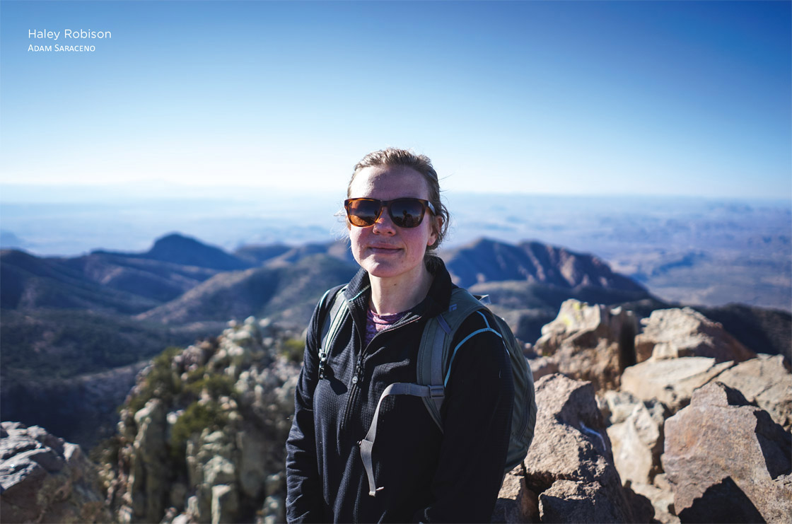
Haley Robison is not only one of the youngest chief executive officers in the outdoor industry, she is also one of the few females in this top position. As CEO of outdoor gear company and certified benefit corporation Kammok, Haley joined the company in 2015 as chief operating officer (COO). But she quickly moved up the ranks, as she was promoted to her current position in 2016. At the helm of such an innovative outdoor brand, Haley hopes to inspire and encourage others to find their own adventures in life.

Additionally, the quarterly magazine Conscious Company named Haley one of the Top Conscious Business Leaders of 2018 thanks to her commitment to exemplifying conscious leadership. Over one hundred business leaders were nominated for this honor but only twenty-one were selected. Haley holds a master’s degree in business administration and education from Stanford University and spent her undergraduate years at the University of Texas in Austin studying Spanish and business.
There is a place in West Texas where the nights are eerily dark and filled with sparkling stars, the coyotes howl at the moon and send goosebumps down your spine, and the Rio Grande curves around towering limestone fortresses as it gurgles along the US–Mexico border. The imposing body of water continues on its journey before emptying out into the Gulf of Mexico, preparing for its extended voyage ahead. The South Rim Trail in Big Bend National Park is one such place thanks to its stunning scenery and wilderness sentiment. It’s a classically Texas hike filled with wildlife encounters (be on the lookout for cats and bears), romantic desert sunsets, colorful wildflowers, and that special mystique that can only be found in the wilds of the Lone Star State.
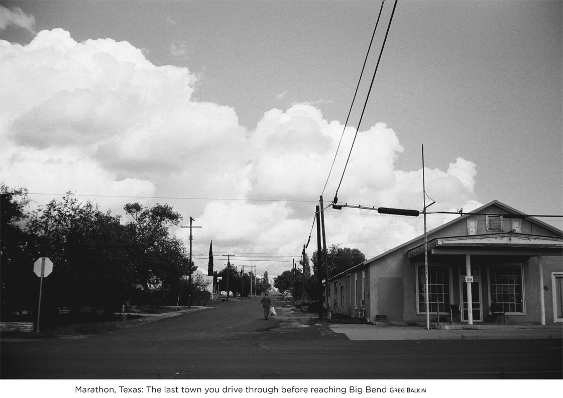
Nearest Town: Marathon, Texas
Getting There: From Marathon, head south on US 385 for roughly 67 miles. Take a right on Gano Springs at the Panther Junction Visitor Center and drive for approximately 3 miles. Drive 6.5 miles until you see the Chisos Basin Visitor Center. This is the trailhead.
Trailhead: Basin Trailhead GPS: N29 16.199', W103 18.067
Fees and Permits: $30 per vehicle or $50 annual pass to Big Bend National Park. If you opt to treat this is as a 2- or 3-day overnight hike rather than a day hike, a permit ($12) is required.
Trail Users: Hikers, backpackers, trail runners
Elevation Gain: 2,250 feet
Length: 11 miles RT (loop)
Approximate Hiking Time: 1–2 Days
Difficulty: Moderate–Strenuous
Insider Info: Most recommend doing this as a multiday hike. Not only can you better enjoy the stunning views, you can also avoid hustling through the good stuff. Bonus: Sunrise along the rim is absolutely spectacular, and the easiest way to catch it is by camping in one of the backcountry sites. The best time to hike this loop is in the winter to avoid the unbearable heat.
Managing Agency: Big Bend National Park

According to Haley Robison, the South Rim Trail is all Texas. And that’s just fine by her.
The 33-year-old Haley completely identifies as a Texan even though she spent the past decade bouncing around various locations like a pinball. She guided wilderness trips in Wyoming; enjoyed a National Outdoor Leadership School (NOLS) course in Utah; went to graduate school in California; studied theology in Maryland; and filled in the gaps with a consulting job that asked her to consistently travel. But after all of the excitement of constant travel wore down, Haley knew one thing: She needed to return to her roots. She needed to return to Texas.
Born in the Dallas area, Haley loves talking about her big Texas family. She sparkles when she shares stories of her outdoor childhood and laughs as she remembers cramming her homework in on the bus ride home so that she could bound up the steps, chuck her backpack inside the front door, and spend the remainder of her afternoon and evening playing outside with her friends. In quintessentially southern style, all the backyards in her neighborhood connected—no fences allowed—so Haley and her friends could wantonly frolic through the extensive ditch system, digging in the dirt and rolling in the grass until the street lights came on and she heard the dinner bell calling her home.
STARGAZING IN BIG BEND
In 2012, Big Bend National Park received gold-tier certification from the International Dark-Sky Association, effectively naming the park one of the best places in the world to stargaze. To accomplish this goal, Big Bend spent 5 years eliminating or retrofitting all the outdoor lights on the park’s buildings, parking lots, and campgrounds. The result? Otherworldly beauty.
Why is Big Bend so prone to life-changing night sky views? In addition to the park’s efforts to minimize the light effect, its location helps. Big Bend is relatively far away from civilization (the nearest airport is 250 miles away in Midland), minimizing potential factors that could ruin the views. While you may be able to see a few hundred stars on a clear night from any random city, you will likely witness more than 2,000 glistening stars on any given night while camped out in Big Bend. If you really want to up your chances of a memorable evening, ditch your car and hit the trail on foot. Choose a trail such as the South Rim Loop and backpack in, spending at least one night in the wilderness. Only one in ten visitors to Big Bend actually backpack in the park, so you’ll have utter solitude to enjoy your unrestricted view of the Milky Way.
Texas roots are deep. They stretch far within your soul and expand around you, holding you as close as a hug and reminding you that no matter where you go or how far away you wander, you can always return. For Haley, those Texas roots constantly tickled her heart, but it wasn’t until Kammok offered her the COO position in 2015 that she finally responded to her roots. She returned to Texas; she returned home.
Kammok was the perfect fit as it is Texas to its core. Birthed in Dallas and grown in Austin, the brand encapsulates all that southern roots and Texas charm can offer. But Haley wants more than that. She wants the world to see her company—and her beloved state—as an outdoor paradise. As the second-largest state in the country, Texas has less than 2 percent of its acreage marked as public land, making this an uphill battle. States such as Oregon (53 percent) and California (46 percent) dedicate a lot more territory to public lands and, by default, the outdoor industry. But Haley won’t give up because she knows Texas is something special.
Big Bend National Park encompasses over 800,000 acres of Texas territory, by far the largest swath of Texan public land and certainly the state’s crown jewel of outdoor territory. Within these confines live more than 1,200 plant species, 450 bird species, 56 reptile species, and 75 mammal species. When combined with the dinosaur bones, sea fossils, and archaeological sites dating back 10,000 years, it is no wonder that Big Bend National Park is revered in its home state.

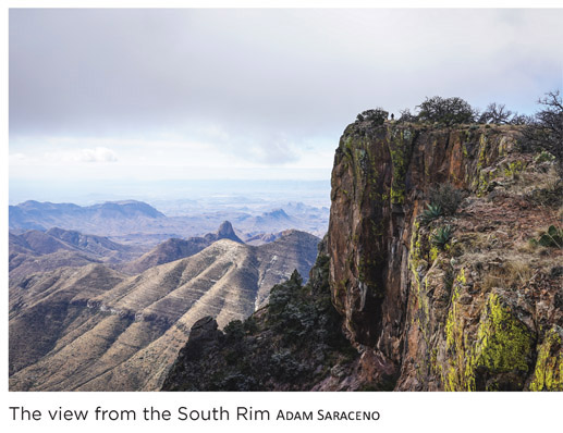
The South Rim Trail is easily the masterpiece of the Chisos Mountains. This hike may consist of only 11 miles, but the diversity of ecology within that short distance is memorable. Established oak and maple trees soar skyward, shading various parts of the trail, while spiky cacti and archetypal agave dot the trailside horizon. Juniper is a common sight, as is Arizona Cypress. In fact, the South Rim Trail (more specifically, the Boot Springs Trail) is the only known trail in the entirety of Big Bend to house Arizona Cypress. Once you reach the actual rim, the hike becomes less about the flora and more about the geology. Without a doubt, the view from the rim is the best viewpoint you can find. Not only can you see the iconic Rio Grande as it wraps through the park, you can also see mountains in Mexico—once your heart stops pounding from the 2,000-foot drop in front of you.
All said, the South Rim Loop is classically Texan and showcases the best of the best in terms of what the Lone Star State can offer visitors. Haley likes to compare the loop to a Salvador Dali painting with its bizarre portrayals and dynamic contrasts of space and time. It can be tough to imagine Texas coinciding with a Dalí painting, but that is why we hike: to experience the surrealism for ourselves.
Although you have a few options, this description details starting up the Laguna Meadow Trail and returning via the Boot Canyon/Pinnacles Trail. Starting near the visitor center in Chisos Basin, head up the Laguna Meadow Trail until you reach a junction with the Basin Loop Trail. Follow the signs for Laguna Meadow and stay straight as you gradually climb up through multiple switchbacks, enjoying views of the saddle all the while. After roughly 1.5 miles, the climb will grow steeper and the warmup is over. Steadily climb for another 1.5 miles before hitting close to the maximum height of the trail, as well as a great place for a break.
With the steep portion behind you, gradually ascend, staying to the left at the next trail junction with Blue Creek Trail. Hike for another 1/2 mile, enjoying the breather as the uphill slows down, until you reach a trail junction with Colima Trail and South Rim Trail. To continue on this route, take a right and opt for the South Rim Trail. Continue on the now-level trail, eventually reaching unobstructed views of the South Rim proper. Once you hit 5.5 miles, you will have full views of the southern half of Big Bend, as well as the Santa Elena Canyon. Hike along the rim until you reach the junction with Boot Canyon Trail. To stay on this shorter route, you’ll take a left and head away from the rim. Once the trail coincides with the creek bed, the scenery will dramatically change, offering towering cliffs rather than sweeping views. The trail is very straightforward from this point. Stay to the left through the first two trail junctions you encounter. Then stay right at the third junction with the Colima Trail; this will funnel you onto Pinnacles Trail, gradually descending until you hit steep switch-backs around 8.3 miles. Once you trek through these switchbacks, the remainder of the route eases downhill until you return to the trailhead at 11 miles.
0.0 Begin near the parking lot for Chisos Basin Visitor Center; look for the wooden sign that says “Laguna Meadows.”
0.3 Stay right at the trail junction, staying on Laguna Meadow Trail.
0.7 Major trail junction with Basin Loop Trail; stay right to stay on Laguna Meadow Trail.
1.5 Steep switchbacks.
2.9 You’ve reached the top of the switchbacks; this is a great place to take a break.
3.1 Trail junction; stay left.
3.3 Trail junction; stay left. This location also boasts a magnificent viewpoint.
3.9 Trail junction with Colima Trail; stay right to turn onto South Rim Trail.
5.3 The best views of the South Rim, complete with a wooden sign indicating your location.
5.8 More excellent views of the South Rim.
5.9 Trail junction; stay left to hike onto Boot Canyon Trail.
7.1 Trail junction with Juniper Canyon Trail; stay left.
7.3 Trail junction with Colima Trail; stay to the right.
8.0 Best views of a prominent rock spire to the east.
8.3 Trail junction with Emory Peak Trail; stay to the right (unless you opt to summit Emory Peak).
8.4 Steep downhill switchbacks.
10.2 You will see a resting bench if you need it, but you are almost finished!
10.6 Trail junction; stay right.
11.0 Arrive back at your car.