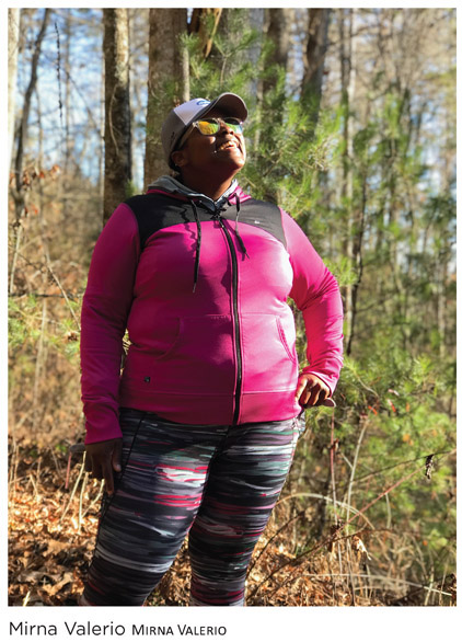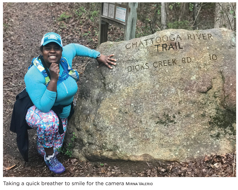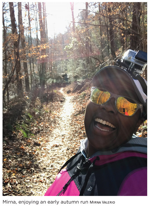
Mirna Valerio—aka the Mirnavator—is arguably one of the largest breakout stories in the twenty-first century’s world of ultrarunning. To date, she has finished ten ultramarathons and nine marathons, authored a book, picked up a handful of sponsors, and been named National Geographic’s 2018 Adventurer of the Year. And she did it all without winning a single race. Matter of fact, her goal is quite the opposite: Don’t be last.

Mirna is a plus-sized runner whose aim is to spread a message of body positivity. The founder of the blog Fat Girl Running, she began her website in 2011 while training for her first marathon. Over time, the blog picked up traction but her story didn’t explode until the New York Times wrote an article about her in 2015. From there, it was like dynamite. Runner’s World, Shape, Self Magazine, ESPN, and NBC Nightly News all followed, lauding Mirna for her inspirational messaging regarding “fat fitness.” In an era full of marketing jargon and social media hyperboles, Mirna’s honesty is refreshing. “I’m good in my body,” she says. “And I’ll continue to insert my big butt into conversations to help others feel comfortable too.”
Mirna is currently a public speaker and runner and is sponsored by Merrell, Swift-wick, and Skirt Sports.
Within two hours of Atlanta, the Chattooga River Trail continuously runs along the border between Georgia and South Carolina. Since the Chattooga River has been designated a National Wild and Scenic River by Congress, motorized vehicles aren’t allowed within ¼ mile and facilities are limited. But this adds to the charm as hikers, trail runners, and kayakers are aplenty. While not on this particular section, the Chattooga River Trail’s northern segment is known as “Waterfall Trail” thanks to the five cascades you can see within the last 15 miles.
Nearest Town: Clayton, Georgia
Getting There: From Clayton, take I-76 E for 9 miles. You will see the trailhead parking on the left side, on the west end of the US 76 bridge. You will park in Georgia, walk across the bridge, and pick up the trail in South Carolina.
Trailhead: Highway 76 Bridge Trailhead GPS: N34 48.852', W83 18.434'
Fees and Permits: None
Trail Users: Hikers, trail runners
Elevation Gain: 3,107 feet
Length: 19.1 miles (point-to-point)
Approximate Hiking Time: 1–2 Days
Difficulty: Moderate
Insider Info: The entire Chattooga River Trail is over 37 miles long and concludes at the North Carolina border, far beyond what this guide details. If you have the gumption, take 3–4 days to trek the entire trail while viewing scenery in three states.
Managing Agency: Chattahoochee National Forest
For Mirna Valerio, the Chattooga River Trail is akin to the last 5 years of her life: tumultuous, exciting, and downright southern.
As a born-and-bred New Yorker (she was raised in Brooklyn), Mirna didn’t think that anything could pull her away from her beloved New York. She even experimented with a brief stint in Maryland only to find herself stomping on the brakes before returning north. She was a Yankee, better suited for life north of the Mason-Dixon rather than the gently sloping terrain of the old-soul Appalachians. But life is predictably unpredictable. Change was inevitable and 2013 saw Mirna and her family packing up their belongings and moving to the North Georgia mountains where she had been offered a new position at a boarding school.
The transition was rocky with a very real adjustment period. The already stressful situation became exacerbated with a bizarre illness that threw yet another wrench into her new life. But Mirna is nothing if not an adaptable chameleon. Eventually, she settled into her new home, her new job, and her new way of living.
There is a slower pace in the South, a stillness in the air that sweetly invites you to sit on the front porch with some lemonade while watching the world spin around you. At first, this gentle environment helped her find her feet figuratively. But eventually Mirna thought it was high time she found them literally. Her new home faced the eastern spine of the Appalachians so the predawn rays of sun frequently saw Mirna on her front porch, eyes toward the hillside almost as if she was gazing at her future. Because in a way, that’s exactly what she was doing.

As a lifelong runner, it was easy for her to find her stride in Georgia. She started simple, seeking out basic paths that meandered through corn-colored meadows full of grazing cattle, each beast slowly chewing breakfast while lazily watching her as she jogged by during her life-affirming daily runs. She scaled cow gates and cattle guards—something she certainly never found in New York—and bit by bit, pushed herself outside of the box she had unknowingly constructed. Eventually, her burgeoning sense of adventure spilled over, asking for more. Eager to explore, Mirna took her runs to new locations and new terrain. She found the mountains.
The Appalachians aren’t like mountains anywhere else in the world. First formed 480 million years ago when North America and Africa smashed into each other, the Appalachians once reached heights equal to the behemoth peaks of the Rockies or even the Alps. Alas, this super continent (known as Pangea) eventually split apart, leaving behind half eroded remains in its wake. We now call these remains the Appalachian Mountains.
These days, the range certainly isn’t the largest in size, but it more than makes up for that with character. Mirna quickly discovered that Appalachia has an inordinate amount of personality hidden within the lush and thick tree canopies that cover the hillsides. Each mountain held a surprise for anyone who wished to seek it out. With an entire range at her doorstep, Mirna simply rolled out of bed, laced up her sneakers, and chose a mountain to investigate. Many of the peaks were rolling and gentle, allowing Mirna to ease into her run with a gracious forgiveness that can only be found in the South. Some peaks felt demanding and relentless, unyielding by nature and uncomfortable by topography. Others still felt mysterious and challenging, constantly asking more of Mirna as she delved deeper into the mountainous region. She ran until she was tired and when she felt fatigued, she would walk. But she always kept moving as she explored more and more of her new neighborhood.
THE CONTROVERSY BEHIND A WILD AND SCENIC RIVER
The Chattooga River has long been hailed as the last wild river in the country, but many locals believe that magic disappeared in 1972 when the movie Deliverance was released. Before it hit theaters, only a few people trickled down to Southern Appalachia’s toughest river, but then “Deliverance Fever” hit, and it hit hard thanks to the Chattooga River’s role as the fictional Cahulawassee River in the film. The number of visitors quickly escalated into the tens of thousands, causing many locals to refer to the film as “the worst thing that ever happened to the river.”
But then, on May 10, 1974, the Chattooga River was designated a Wild and Scenic River, the first river east of the Mississippi to earn such an accolade. Signed into law by President Lyndon B. Johnson on October 2, 1968, the National Wild and Scenic River Act designates that our country protect wild rivers from development that would significantly or detrimentally change their scenic nature. By 2018 (the 50-year anniversary of the law), over 12,700 miles along 208 rivers have been preserved, a statistic that pleases many environmentalists. However, this classification isn’t without controversy.
In 1976, the U.S. Forest Service banned paddling in an effort to protect trout populations. As years rolled by, this ban greatly ruffled the feathers of the paddling community since the Chattooga was the only boat-friendly river in the Forest Service to ban paddling. In fact, in 2006 American Whitewater sued the Forest Service to reverse the paddling ban, arguing that the ban violated the Wild and Scenic Rivers act, which encourages recreational use. A U.S. District Court agreed, but through a series of appeals, the ban was not lifted until 2012. Finally, the Forest Service announced that boaters with permits could paddle the Upper Chattooga if water levels were high enough.
It was during one of these many runs that Mirna discovered the Chattooga River Trail.
Located just a hop, skip, and a quick run away from her new home, the Chattooga River Trail epitomized everything Mirna had grown to appreciate about life in the South. Like Mirna herself, the trail was pleasant and amiable with just a dash of sass. Her standard run became a 20-mile roundtrip voyage (10 miles out, 10 miles back) that amounted to just over 2,000 feet of elevation gain. It was enough elevation to challenge Mirna and contribute to her training, but truly it was more of a pleasant addition to the beautiful sur roundings. The trail is lush and wet, frequently filled with brightly colored rhododendrons whose happy blooms stand on woody stems in stark contrast to the dense greenery covering the slopes. On damp mornings, the earthy smell of the spongy soil combined with the clean scent of the morning dew, creating a memorable assault on her senses as she journeyed down the path.

The trail also moves at a pace that Mirna associates with the South. There aren’t any quad-busting climbs or knee-banging descents, and hikers certainly won’t battle high altitude. Rather, the Chattooga River Trail meanders to and fro, wrapping around rolling hills and winding up and over forest-covered knobs, so thick with trees that the probably pleasant views are choked out by creeping vines and scattered leaves fitting together over the exposed sky, like puzzle pieces on a coffee table. It’s the perfect trail to be one with your thoughts as you catch occasional glimpses of the Chattooga River in all its glory, babbling around the bend with ecstatic groups of kayakers caught amidst the frothing waves.
It became the default trail for Mirna in her early southern years, the trail she would reliably visit whenever she wanted to log some miles. It was consistent and steadfast, and she continued to run its comfortable curves through all of her life’s journeys: when the New York Times article published, before speaking with Runner’s World, and whenever she needed to get out and find some nature.
These days, southern living is in Mirna’s rearview mirror as she has once again relocated to the North. But still, when asked to choose any single trail in the entire country, Mirna immediately opted for the Chattooga River Trail. After all, she always knew she could rely on the Chattooga River.
Once on the actual trail, follow the bright green blazes to guide you along the way. Almost immediately, you gradually climb from the trailhead, the lowest point (1,110 feet) of the entire length. Cross a wooden bridge and ignore any side trails you encounter within the first mile; you want to stay on the main path. Continue hiking as the trail winds away from the river; you won’t reach the water again until Mile 4. From there, the trail once again turns away from the Chattooga River to climb up and over a few rolling hills before returning to the river just before Mile 6; you will stay along the water for 1.5 miles. After 10 miles, the Chattooga River Trail merges with the Bartram Trail and you will hike along them both until this segment’s terminus at the Russell Bridge (GA 28 Bridge).
0.0 From the parking area in Georgia on the west side of the US 76 bridge, walk across the bridge and pick up the path at the trailhead in South Carolina.
0.5 Trek across the small wooden bridge.
0.7 Cross Pole Creek.
1.3 Come to a nice, small waterfall.
2.9 Pass a small trailside campsite.
4.1 Near the Chattooga River once again.
6.0 After trekking away from the river, you reach the river once more. This is a great place to fill up water if needed.
6.5 Trail intersects with Licklog Trail; stay straight.
7.4 Trail turns left through a series of switchbacks up the hillside.
8.4 The path splits; stay to the right.
10.0 The Chattooga River Trail merges to the right with the Bartram Trail.
10.3 The path splits; stay to the left.
16.6 The trail intersects with Willis Knob Horse Trail; stay straight.
17.3 The path splits; stay to the right.
18.0 Just after a stream crossing, the path splits again; stay to the right.
19.1 Reach Russell Bridge (GA 28 Bridge).