Allow a whole day for this coastal walk, taking a picnic lunch or stopping for freshly caught seafood. Fermain Bay with its café/restaurant makes an ideal place for a break. Parts of the walk are quite steep, particularly as the path climbs up from the bays, but there is nothing that would challenge an averagely fit adult, and the paths are in good condition. Public buses Nos 81 or 91 can provide transport for part of the way. Timetables can be picked up at the Guernsey Information Visitor Centre, at the bus terminus or are available online at www.buses.gg. If you have a car, parking is available at both ends of the walk, at La Vallette and at Moulin Huet Bay. Although the footpath is well signed and fairly obvious, a map is nevertheless useful. The best map is the Ordnance Survey-style map of the Bailiwick of Guernsey (but not updated since 2010) or alternatively Perry’s Official Guide to Guernsey (£7.95), a booklet of road maps showing every little lane, available from the tourist office and shops. Remember to take binoculars for the birdlife, along with sun cream, a hat and plenty of water.
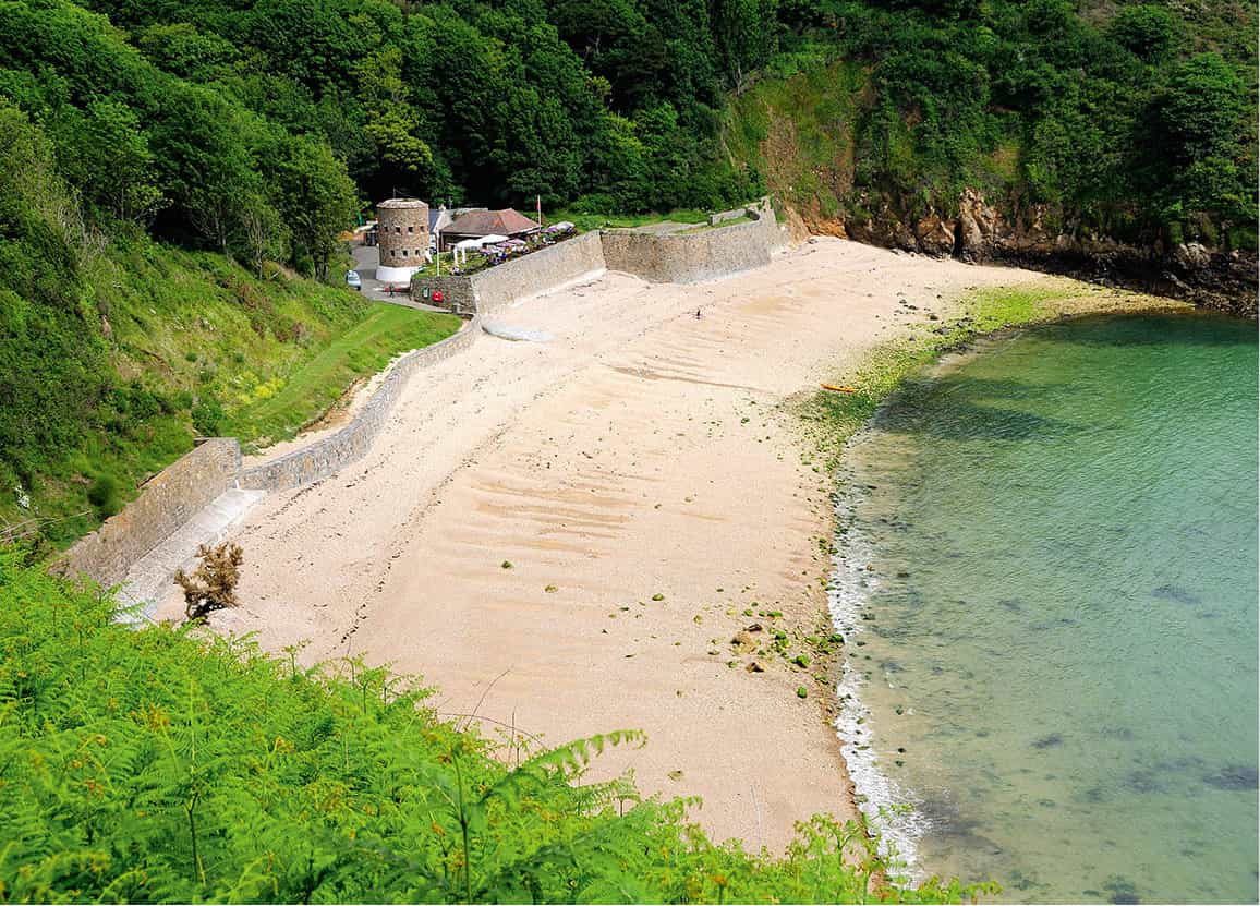
The view over Fermain Bay.
Mockford & Bonetti/Apa Publications
St Peter Port to Fermain Bay
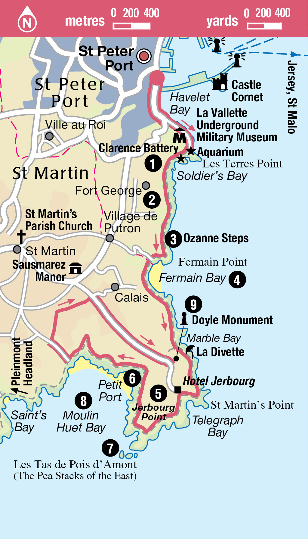
Start from the South Esplanade in St Peter Port, and follow the roadside footpath past the open-air swimming pools (covered at high tide) and La Vallette Underground Military Museum, as far as the entrance to the Aquarium (for more information, click here) within the tunnel. Follow the steps up the cliff face to the left of the museum. Catch your breath by admiring the views from Clarence Battery 1 [map] whose entrance is found near the top of the path (see box, click here). This headland is covered in Napoleonic-era fortifications.

The Clarence Battery.
Mockford & Bonetti/Apa Publications
From the battery, continue uphill. The path to the left drops down to Soldiers’ Bay, so-called because it was reserved for the soldiers from Fort George who used to come and swim here. Sadly, this sheltered shingle and sand beach, which is good for swimming, has become impassable, and there is no public access.
St Peter Port to Moulin Huet Bay.
Fort George
To the right and ahead as you climb the hill are some of the walls of Fort George 2 [map]. This massive Georgian fort was built to house Guernsey’s main garrison and to take over from Castle Cornet (for more information, click here) as the island’s main stronghold, overlooking the approaches to St Peter Port. It served its purpose throughout the 19th century, then during World War II it became the headquarters of the Luftwaffe radar defences. An obvious target for Allied air raids, the fort was severely damaged in the war. In the 1960s the site was sold to a private developer and the granite walls now protect an upmarket housing estate. The fort still retains an imposing gatehouse, with its 1812 date and the name of Sir John Doyle (see Doyle Monument, click here).
Turn left when you meet the tarmac road called La Corniche to follow the clifftop road for 400yds/metres, past balconied houses on Guernsey’s largest open-market estate – a cross between the south of France and Los Angeles.
Where La Corniche bends to the right, the cliff path continues left, with fine views back to Soldiers’ Bay. Further fortifications line the path to the right as you climb away from the cliffs through woodland. At the next path junction, go left to descend through woods that are a haze of bluebells in the spring. At the next junction turn left to climb up to the clifftop again. As you follow the cliff path you will pass the 88 Ozanne Steps 3 [map] which were built by a former governor of Guernsey to provide access to a rock platform where he and his wife could bathe in privacy. Nowadays anyone can come and take a dip here.

Looking down on Fermain Bay from the coastal path.
Mockford & Bonetti/Apa Publications
Fermain Bay
Continue along the path until you come to a junction, then go straight ahead, up the concrete steps, and turn left to follow a tarmac path which rounds the cliffs to give breathtaking views over Fermain Bay 4 [map], one of Guernsey’s prettiest beaches. Bobbing with boats and washed by gentle waves, the bay has the air of the Mediterranean. This is a lovely spot for sunbathing, swimming in the clear waters (though sand is only exposed at low tide) and diving from the steps. Despite being one of Guernsey’s most picturesque spots, the bay is rarely crowded since the only vehicular access is by a private road, closed to all but permit holders, and there is no nearby parking. This does not put off the punters coming by day or evening to the Fermain Beach Café, one of Guernsey’s top café/restaurants and an ideal spot for a break. Beyond the café the round tower was one of 15 built along the coast in 1778–9 as defence against French attacks. Twelve of these towers still stand.
If you feel you have walked far enough, you could always head up the valley behind the bay to reach Fort Road and wait for one of the buses that pass at regular intervals. Alternatively, you can walk back to St Peter Port via Fort George Military Cemetery and Belvedere House.

Twitchers should head for the bird-hide at Jerbourg Point.
Mockford & Bonetti/Apa Publications
Fermain Bay to Jerbourg Point
Leaving Fermain Bay by the bridge at the western end, follow signs for St Martin’s Point. The path takes you through a forest of Monterey pines and affords fine views of the tiny island of Herm. Shortly after joining a road go left down a ‘private drive’ which is a right of way to the cliff path.
You can take a diversion down the valley to Marble Bay, named after the quartz found there, or turn immediately right towards the Jerbourg Road. The path takes you just above a seductive and secluded little sandy beach called La Divette, with a late medieval jetty. Continue along the heavily indented steep cliffs towards the exposed St Martin’s Point.
Jerbourg Point
A steep stepped climb brings you to the car park on Jerbourg Point 5 [map] where you’ll also find toilets and a refreshment kiosk. To the left of the car park, the roof of the German Naval Battery Command Bunker provides a good lookout point for views of other Channel Islands. With good visibility you can see Jersey and the coast of France on the horizon, as well as Alderney, Herm and Sark. Closer to, there are fine views of Vau Bêtes lying between St Martin’s Point and Jerbourg. This is better known as Telegraph Bay, named after an old submarine telephone cable which used to be linked to Jersey.
Clarence Battery
Dating from 1782, Clarence Battery formed part of Fort George, built to defend St Peter Port from the threat of French invasion. Little remains of the battery, though the ramparts have been restored and there are informative panels on the history of the structure. Stunning sea views take in St Peter Port and neighbouring Channel Islands. Nearest is Herm, and on a clear day you should also be able to see Sark and Alderney.
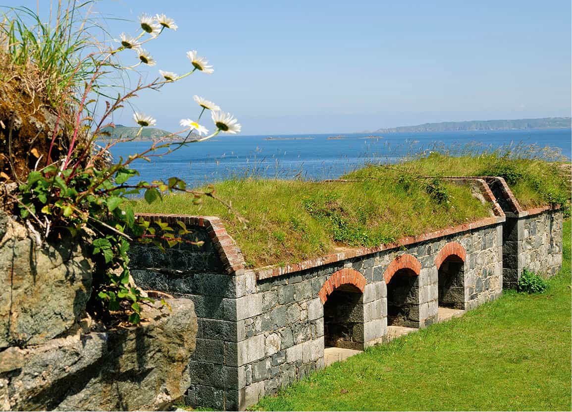
Clarence Battery overlooks the sea, with Herm in the distance.
Mockford & Bonetti/Apa Publications
Follow the road between the hotel and clifftop. Where the road bends to the right, just beyond a granite memorial to Bill Green, look for a path that leads off to the left. This goes down towards a German bunker – one of several along this route, all sited to take advantage of the panoramic views. The second bunker you pass is now used as a birdwatching hide, which is maintained by the Royal Society for the Protection of Birds. From here you can (with binoculars) watch nesting gulls and shags on the nearby rock stacks, and linnets and whitethroats feeding among the cliff-top vegetation.
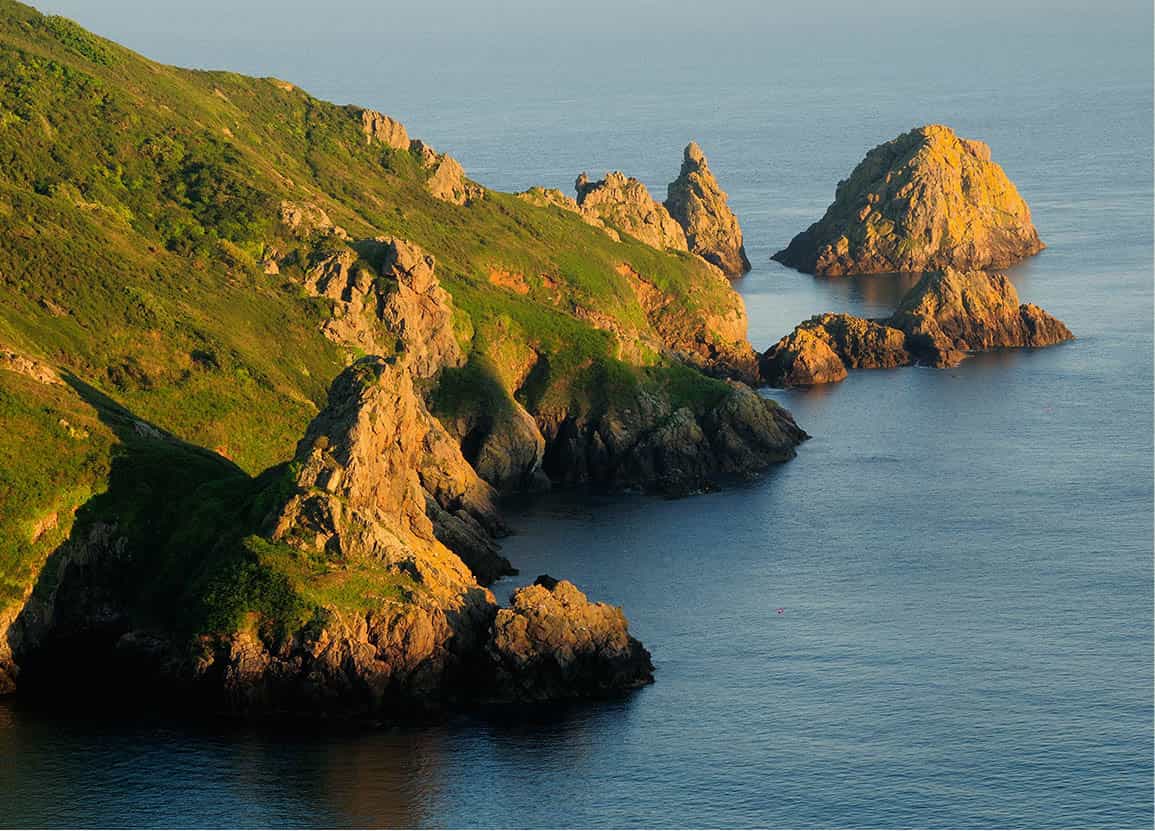
The rugged Pea Stacks at Jerbourg Point.
Mockford & Bonetti/Apa Publications
Towards Petit Port
Continue along the path and eventually you will reach a memorial to Sir Victor Gosselin, in whose memory the nearby land was donated to the island of Guernsey. Straight ahead there are views of Moulin Huet Bay, which you now approach, continuing down the cliff path. Turn left where the cliff path joins a tarmac path, then left again after 20yds/metres, and left again shortly after. Keep taking the left turn each time a junction appears, passing several German bunkers. Over to the right you will see the obelisk of the Doyle Monument, which you will reach later, at the end of the walk.
Wildlife
The variety of colour, on clifftop path verges and in wooded valleys, creates a strong visual impact and shows what we have lost elsewhere through excessive use of herbicides. May is especially colourful, with red and white campion, the purples of massed thrift, the woodland bluebells and wild garlic. Don’t forget to bring binoculars to spot fulmars, cormorants and shags – and the gannets and puffins that nest on offshore islets. Dolphins, grey seals and basking sharks are also occasionally spotted from the cliff paths.
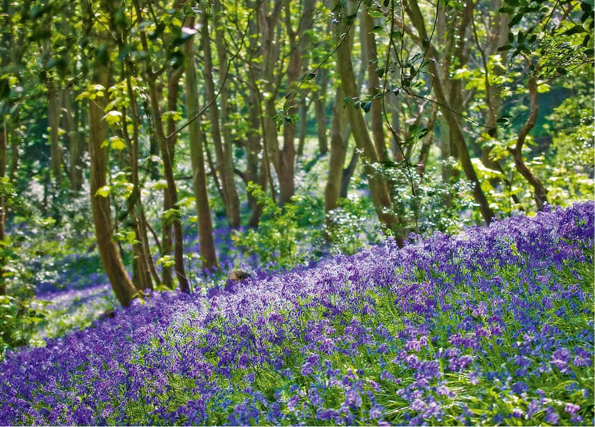
A carpet of spring bluebells.
Visit Guernsey
The cliff path next meets a concrete path – turn left here and follow it down to a junction. The path to the left goes down to Petit Port 6 [map] which – if you don’t mind the long haul back up 300 steps – is a delightful bay and spot for bathing when the tide rolls out to reveal sand. Our route goes right along the cliff and left at the next junction. The path reaches some steps and comes out onto a tarmac road: go left and downhill to rejoin the cliff path, past a small spring and stream whose waters add lushness to the wooded valley. On the left, the granite wall of Le Vallon estate has strategically placed railings, allowing you a view of the ponds and fine gardens beyond the wall.

The meandering south coast cliff path.
Mockford & Bonetti/Apa Publications
The Pea Stacks
As you return to the clifftop, you are greeted by a superb view of the six rock formations known as Les Tas de Pois d’Amont 7 [map] (The Pea Stacks of the East). The rocks look like monks, with stooped backs and deep pointed hoods – especially the middle stack, which is known as Le Petit Bonhomme d’Andriou (The Little Good Man Andrew). The story goes that Andriou, a pagan priest, witnessed a ship heading for the rocks in a storm and prayed to his gods to calm the waves. The weather only worsened so he then beseeched the Christian God, vowing to become a Christian if his prayers were answered. The ship was saved, Andriou was baptised and built a chapel on the site. In bygone days sailors used to pay their respects as they sailed past Andriou. Today the stacks are a habitat for nesting birds.
Moulin Huet Bay
The path now passes through holm-oak woodland and eventually emerges at a tarmac road, by a pink and white farmhouse. The path to the left descends to the picturesque Moulin Huet Bay 8 [map] with its striking rock formations. The bay was named after Monsieur Huet who owned a water mill (moulin) above the bay. The French Impressionist painter, Pierre-Auguste Renoir, was captivated by the bay’s rock pools, cliffs and sea caves: he painted no fewer than 15 pictures of the scenic cove on a painting trip to Guernsey in 1883.
South coast cliff path
This delightful stretch of coastline may tempt the energetic to tackle the whole south coast cliff path. It is 15 miles (24km) from St Peter Port all the way to Pleinmont Headland in the west. The path requires a good deal of stamina, especially for the steep climbs up and down from the bays, and it’s best to break it up. The walk can be done at any time of year, but the scenery is at its best in the spring, when wildflowers carpet the cliffs.

Rough steps hewn into the cliff path.
Visit Guernsey
Moulin Huet windmill
No less scenic is the pretty lane to the right, the original site of the Moulin Huet windmill. If you walk up the lane, you can enjoy the sounds of gurgling water from a stream that is channelled along the right-hand side of the road.

Stunning views from a tearoom at Moulin Huet Bay.
Mockford & Bonetti/Apa Publications
Our route back lies up the even prettier water lane that leads off from the right-hand side of the car park, with another gurgling stream running in a stone-lined channel to the left. The path climbs steeply and narrows until there is just room to pass between steep, moss-covered banks (according to Guernsey folk legends, lanes like this are the abode of fairies).
All too soon the path ends at a granite shelter that protects the spring. Alongside is a fine group of 17th-century farmhouses, one with a good example of a five-stone Guernsey arch over the front door. Here you should turn right to take the narrow path signposted Route Fainel, which passes between the farms. The lane emerges at a pretty parish pump, dated 1828, and a delightful neo-Gothic house whose wooden front doors are carved with windblown palm trees.

Distinctive rock formations can be seen at Moulin Huet Bay.
Mockford & Bonetti/Apa Publications
French spice
On a clear day you can see the French coast from Jerbourg Point. Geographically the Channel Islands belong naturally to France rather than to England and, not surprisingly, they have a heady mix of French and British cultures. The great French Impressionist, Pierre-Auguste Renoir, who appraised Guernsey’s light with a painter’s eye at Moulin Huet Bay, noticed how ‘the Anglo-Saxon miss sheds her prudery when she arrives in Guernsey’. Victor Hugo, for his part, was prepared to broaden minds still further: ignoring Anglo-Saxon decencies altogether, he lived on the island with both wife and mistress (for more information, click here).
Turn left by the house to emerge onto a road. Turn right along the road, and left at the next junction. After a short distance you will meet the main Route de Jerbourg road. Turn right here to follow this road south.
The Doyle Monument
A short way beyond the pub, climb the mound up to the Doyle Monument 9 [map] for far-reaching views out to the Normandy coast. Named after Sir John Doyle, lieutenant-governor of Guernsey from 1803–16, this soaring granite column is a post-war replacement of the original, which the Germans demolished to prevent its use as a clandestine signal station. It was under Doyle’s supervision that the modern road network on Guernsey was established – principally to allow for rapid troop movements at a time of continuing hostilities from France. Doyle also directed the building of Fort George and he was responsible for three Martello towers – Fort Grey, Fort Saumarez and Fort Hommet, which were built after a number of smaller towers erected more than 20 years earlier were deemed too small. The peninsula here had been fortified long before Doyle’s arrival on the scene. You can still make out the three parallel lines of ramparts and trenches running to the cliff edge from either side of the monument. These were originally thought to be Roman but are in fact part of an even older Iron Age fortification. The stone-walling west of the monument is the only remnant of the Château de Jerbourg, a medieval castle mentioned in ancient documents.

The Doyle Monument.
Mockford & Bonetti/Apa Publications
Eating Out
Fermain Bay
Fermain Beach Café
Fermain Lane, Village du Putron; tel: 01481-238 636; www.fermainbeachcafe.gg; daily Apr–Sep and weekends only from Oct.
This seafood café-cum-bistro is a great place to refuel after a bracing walk along the coast. Choose from such delights as crab sandwiches, scallops with bacon, locally caught monkfish or sea bass, and enjoy the views of this lovely bay. The secluded location entails a steepish walk down the hill – but it is well worth it. £–££
Fermain Valley Hotel
Fermain Lane, St Peter Port; tel: 0800-316 0314; www.fermainvalley.com; daily for breakfast, lunch, tea and dinner.
A swishly modernised hotel with fine views from tiered terraces down to Fermain Bay. Dining options include a Mediterranean-inspired menu at Ocean Greek Eats; cocktails and steak at the contemporary Rock Garden Steakhouse; Mexican at Buho, or tea and cakes on the terrace in the Valley Tea Rooms. ££–£££
Jerbourg
Hotel Jerbourg
Jerbourg Point, St Martins; tel: 01481-238 826; www.hoteljerbourg.com; daily Mar–Dec for lunch, tea and dinner.
The restaurant offers a comprehensive menu featuring fresh seafood and local produce, with dishes such as linguine of chancre crab and seared fillet of brill, as well as surf and turf and char-grilled steak. The hotel’s Cliff Top Coffee Shop and Dessert Bar are open daily from 10am, serving coffee and tea, homemade cakes and pastries, and ice cream. ££–£££