Ten
TOURISM AND MORE
Tourism has always been the backbone of the Tusayan area. Without it, many of those who made the small South Rim village what it is today would not have come, or at least not spent their lives there. It is the beauty, the grandeur, and sheer power of the Grand Canyon that keeps visitors coming to the park year after year. Those same attractions hold true for those who live in the village of Tusayan.
Visitor amenities continue to evolve in Tusayan to this day, as they have evolved since George Reed’s homesteading days. Tourism in the area boomed with the completion of Highway 64 in the mid-1960s and the addition of the Grand Canyon Airport. Hotels, restaurants, air tours, land tours, curio shops, a grocery store, and employee housing were quick to spring up in the area. Fast food restaurants, such as McDonald’s and Taco Bell, as well as others, further added to the amenities offered to visitors in the area.
The IMAX Theater is by far one of the largest structures in the village of Tusayan. The theater, which opened in 1984, was built on the site of the Western Village. The film originally showed Grand Canyon—The Hidden Secrets, a 35-minute production that soon became a popular hit for travelers to the national park.
Aside from accommodating the millions who travel to the canyon annually, Tusayan was also an attractive locale for miners who once flocked to the area in search of valuable minerals. A number of Grand Canyon notables, including the Kolb brothers and John Hance, tried their hand at mining in the area, though rarely with much success. The discovery of high-grade uranium deposits in 1951, however, created the first notable population boom in the Tusayan area. In order to house their employees, the owners of the Golden Crown Mining Company bought 10 acres of land, which they fashioned into a campsite for their workers. Both the mine and campsite were later sold. The Orphan Mine ceased operations in 1969. Employee housing remains in and around Tusayan area, though these days the residents work almost entirely in the tourism industry.
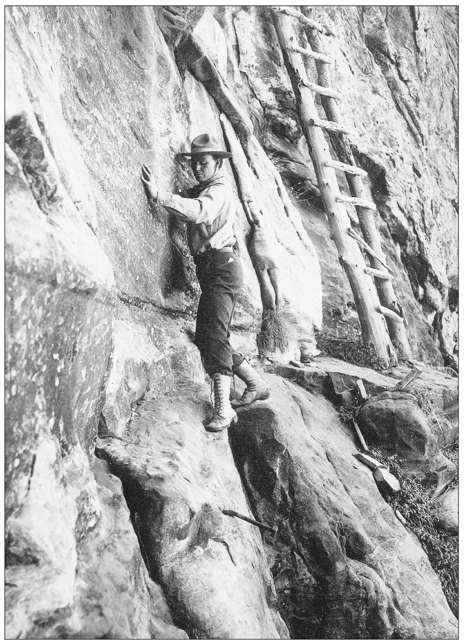
Ellsworth Kolb negotiates a ladder and rough terrain in this 1913 photograph. Kolb is making his way along a route built through the Coconino sandstone on the famous Hummingbird Trail. The route was built in order for miners to gain access to Dan Hogan’s Orphan Copper Claim. (Photograph by the Kolb brothers; courtesy of the National Park Service.)
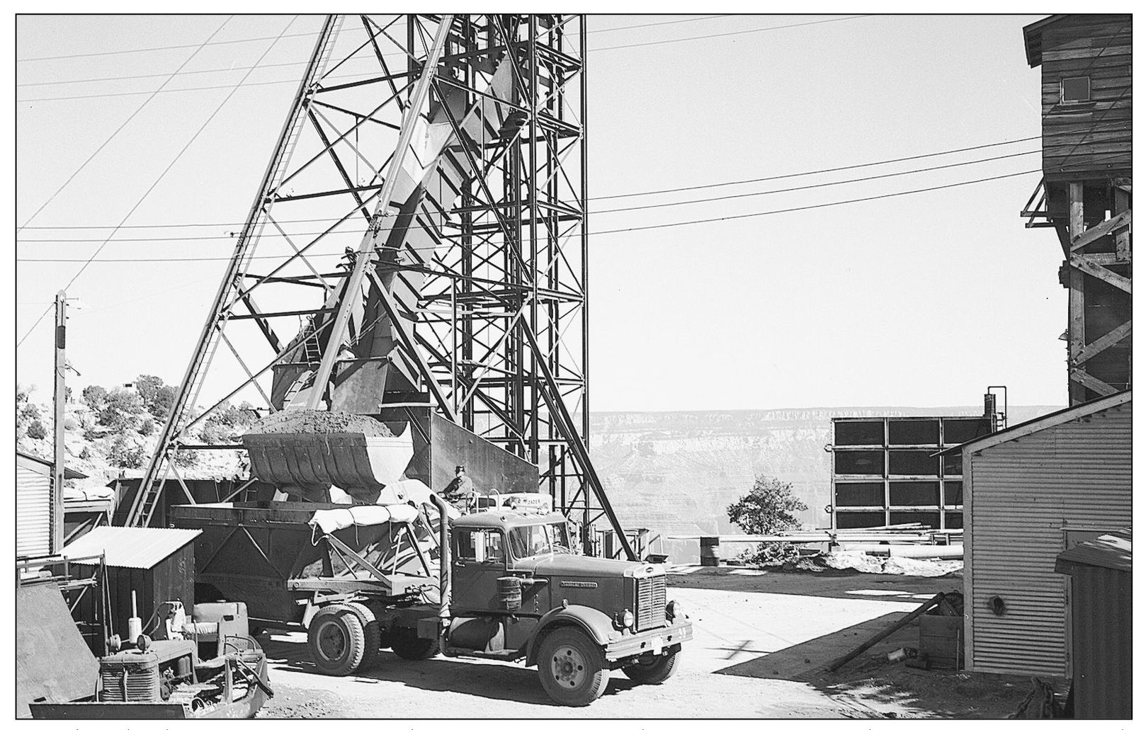
Besides the lucrative tourist trade, many came to the Tusayan, Grand Canyon area to seek employment in the mining industry. An ore truck can be seen in this March 21, 1963, photograph as it is loaded by a head frame at the Orphan Mine. The mine is located along Hermit Road, also known as Rim Drive. (Photograph by Blaisdell; courtesy of the National Park Service.)
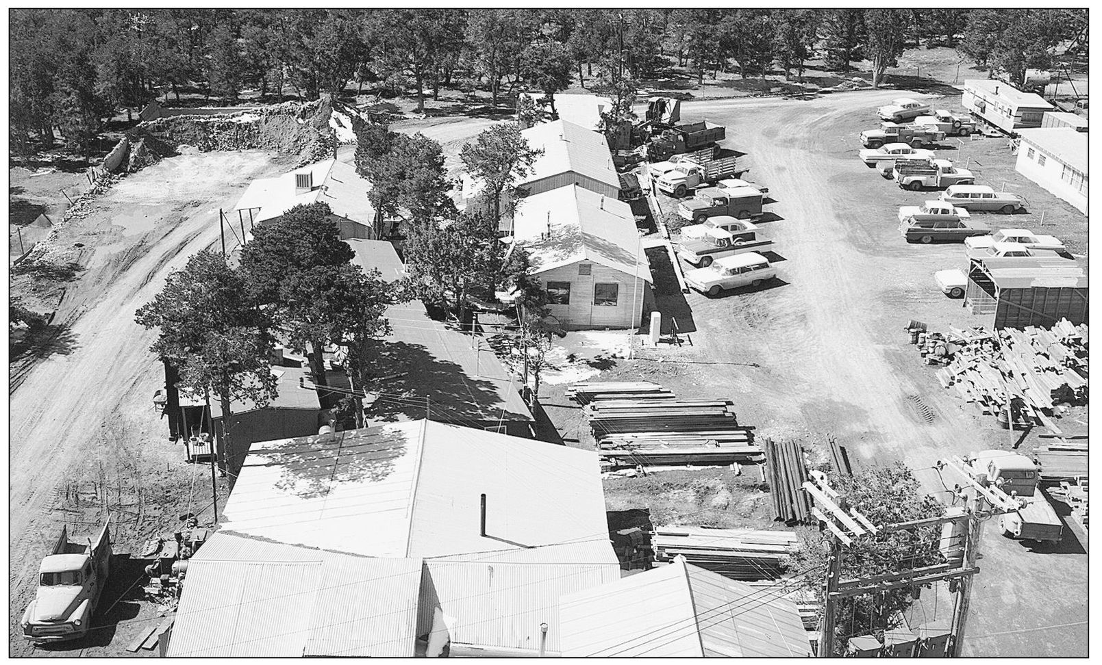
This March 21, 1963, photograph was taken from the top of the head frame located at the Orphan Mine on the Grand Canyon’s South Rim. The view faces south and looks down on the buildings and parking areas that were a part of the mine. Many miners who worked in the area would live in camps located in Tusayan village. (Photograph by Blaisdell; courtesy of the National Park Service.)
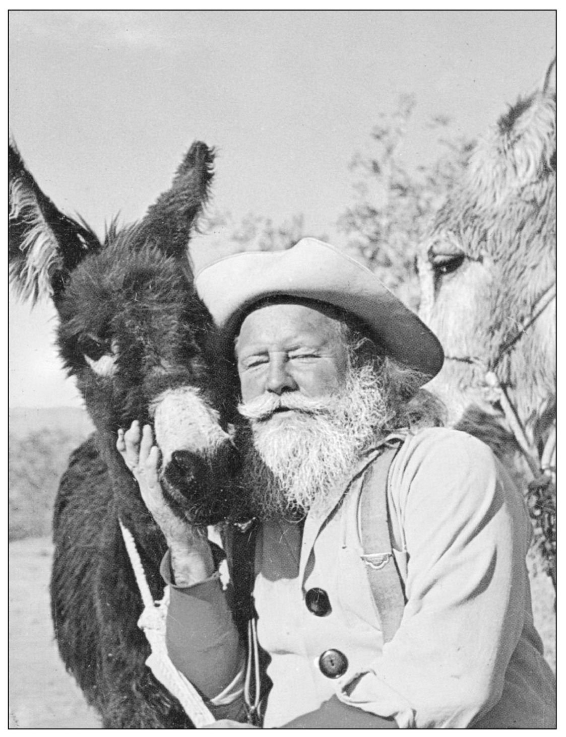
Badwater Bill can be seen with a couple of his furry companions in this 1960s photograph. Bill was a staple of the Tusayan community for a number of years, having moved to the area from Death Valley in California. In both locations, Badwater Bill was a popular attraction for tourists in the area. (Courtesy Clarinda Vail and the Thurston family.)
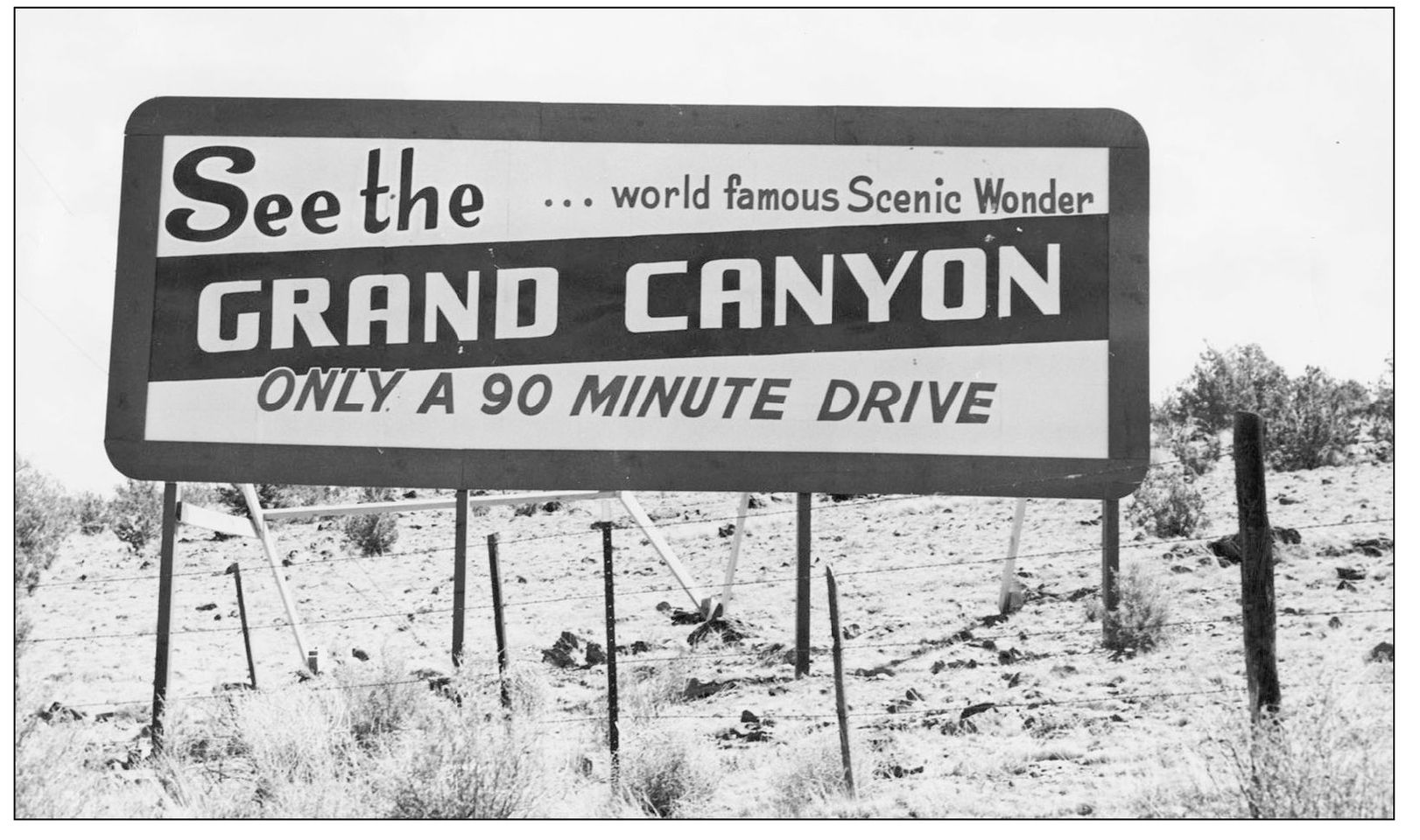
This sign for the Grand Canyon is said to have once been located near the community of Ash Fork, located roughly 90 minutes away from the South Rim. While no longer there, many in the area recall the sign as they drove through northern Arizona from Ash Fork to Williams. (Courtesy of the Williams Public Library.)
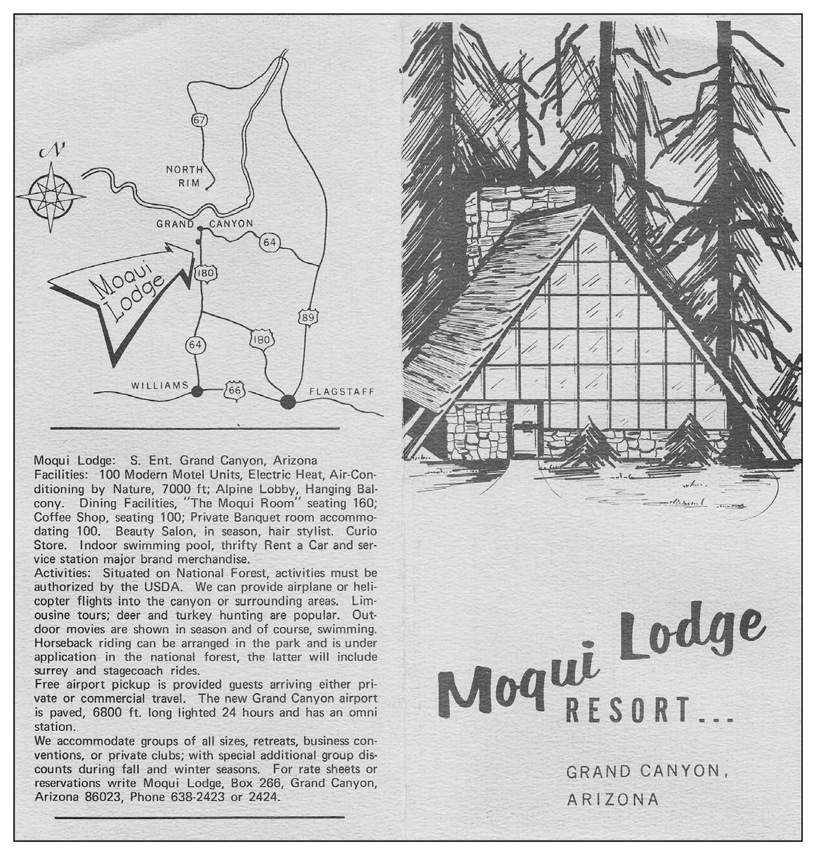
Pictured is a brochure for Moqui Lodge that boasted luxury accommodations for its visitors. The lodge offered 100 rooms and a number of dining choices for guests. The brochure also listed the elevation, at 7,000 feet, and “air conditioning by nature.” Besides other accommodations, the lodge also offered a salon. (Courtesy of Thomas Ratz.)
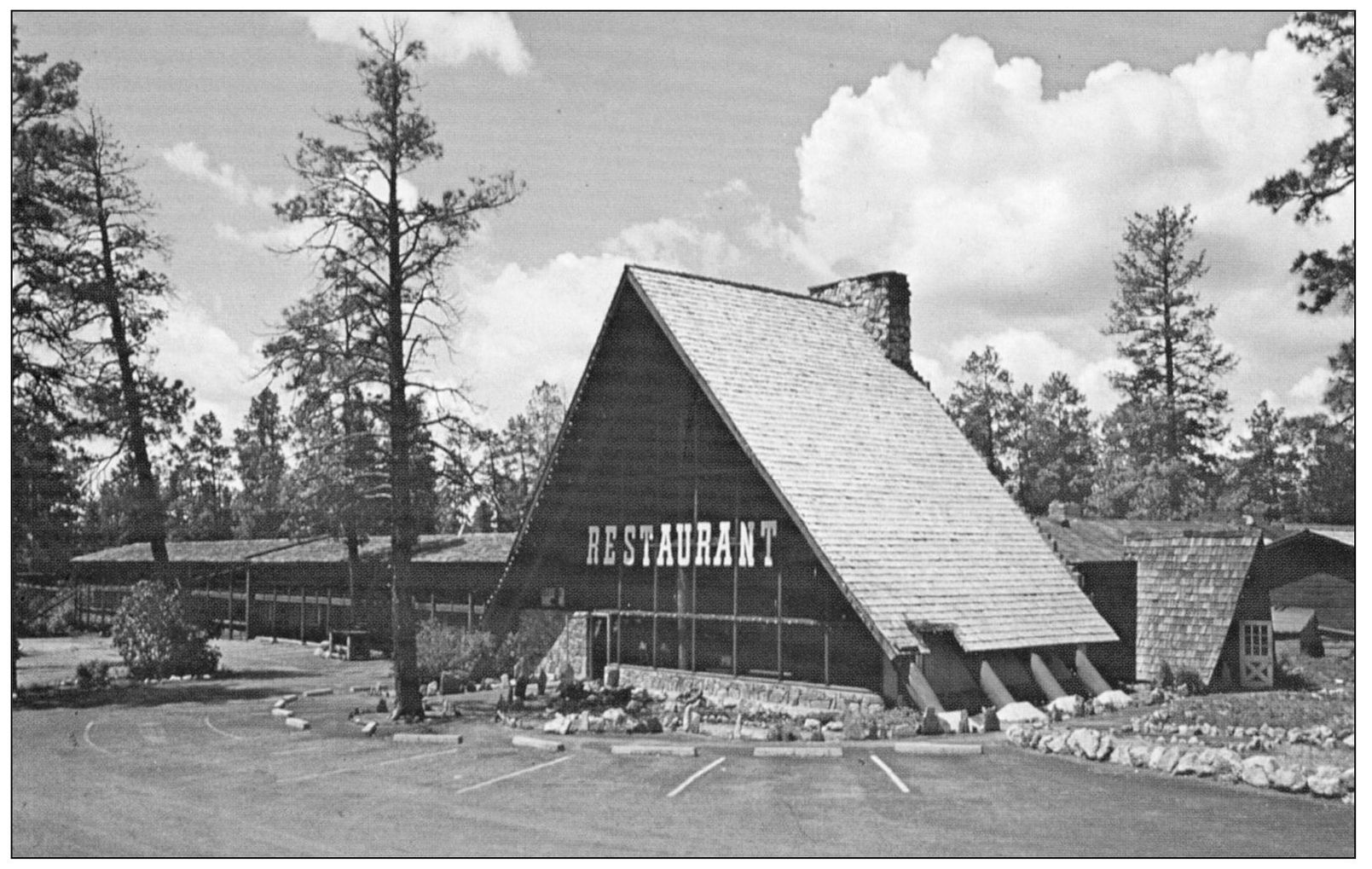
Moqui Lodge can be seen in this photograph during its prime. The lodge sat empty for a number of years before it was torn down. Moqui Lodge was a popular destination for those visiting Grand Canyon. Its restaurant was also a popular spot for locals in the Tusayan area. (Courtesy of Thomas Ratz.)
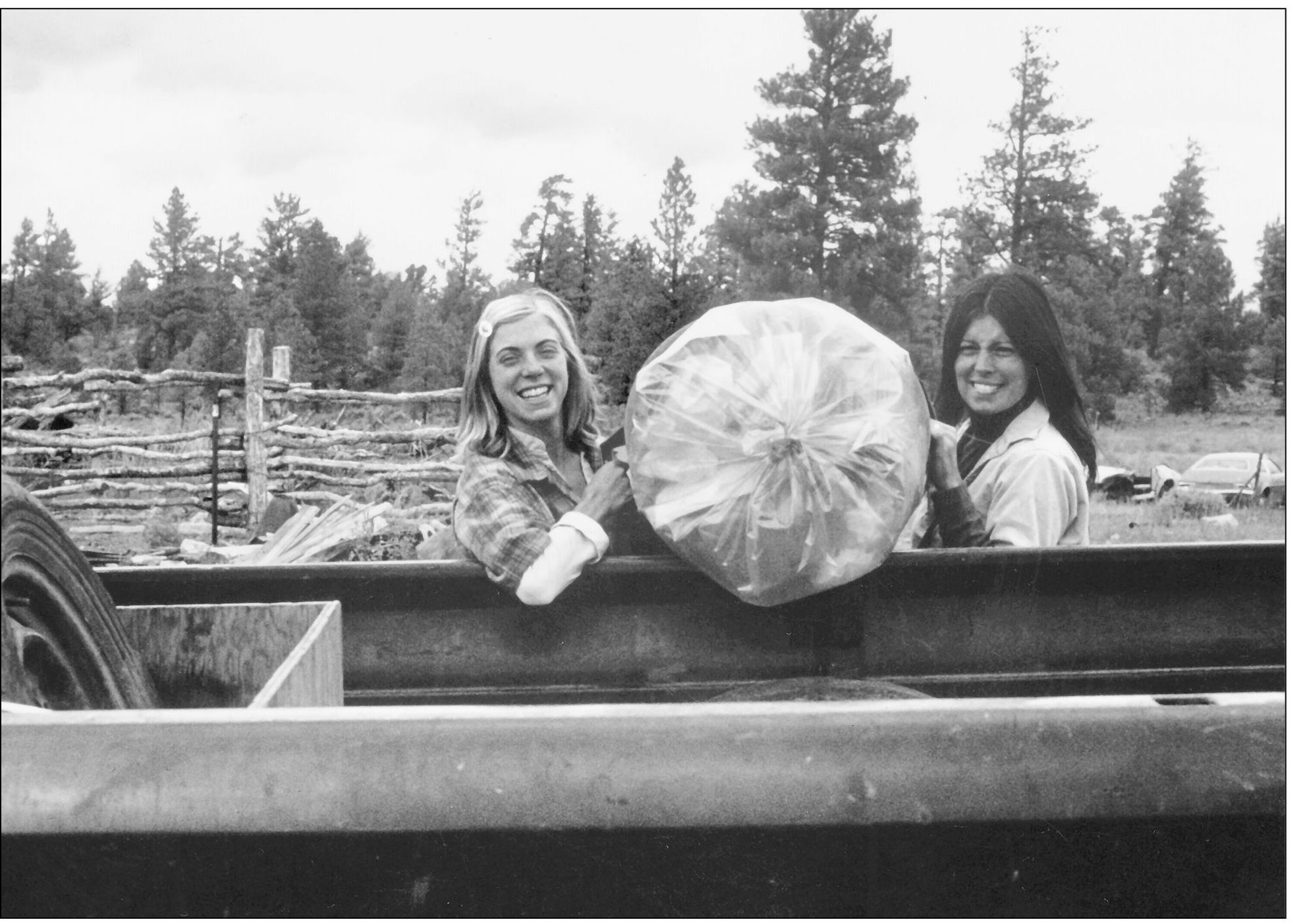
Local residents Chris Brickley and Michelle Ketering are pictured as they load a bundle of trash into the back of a truck. The two women began the Super Trash hauling company in the 1975 to help those living in the area to dispose of their rubbish. (Courtesy of Clarinda Vail and the Thurston family.)
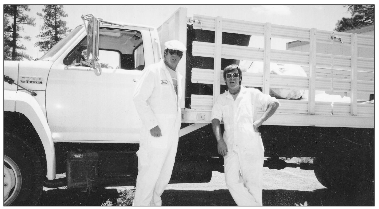
Chris Crossland (left) and Tom Maier stand before a garbage truck in the Tusayan, Grand Canyon area in the 1980s. The two are sporting their new uniforms after beginning their new contract as the first recycling company within the Grand Canyon National Park. (Courtesy of Clarinda Vail and the Thurston family.)
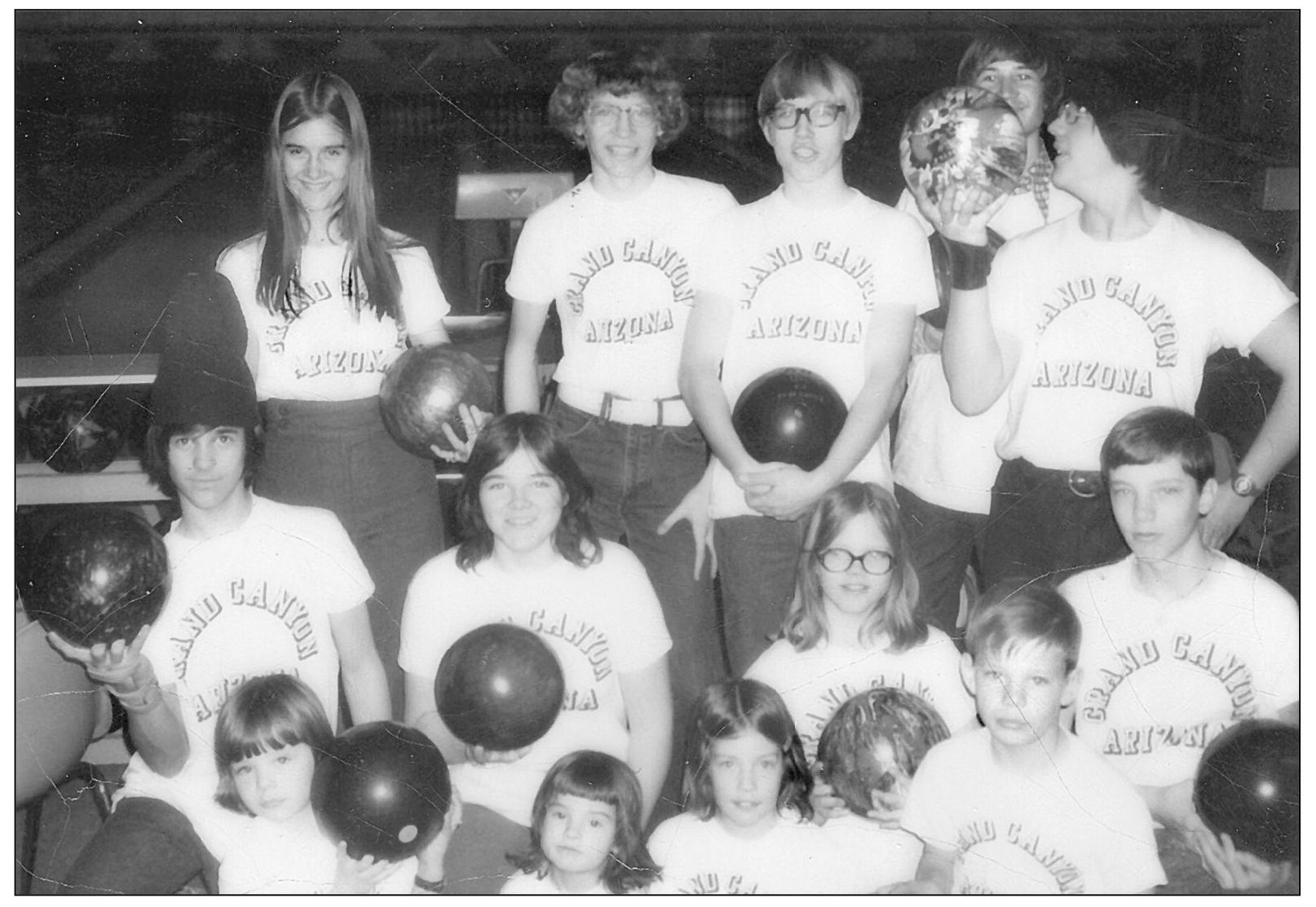
Members of the youth bowling league of Tusayan can be seen in this early 1970s photograph. Bonnie Thurston, along with Bill and Shirley Back, organized the youth league. Bill Back was employed as a department of public safety officer in the area. He is also known as one of the only ones to bowl at least two 300 games at the Squire Inn. (Courtesy of Clarinda Vail and the Thurston family.)
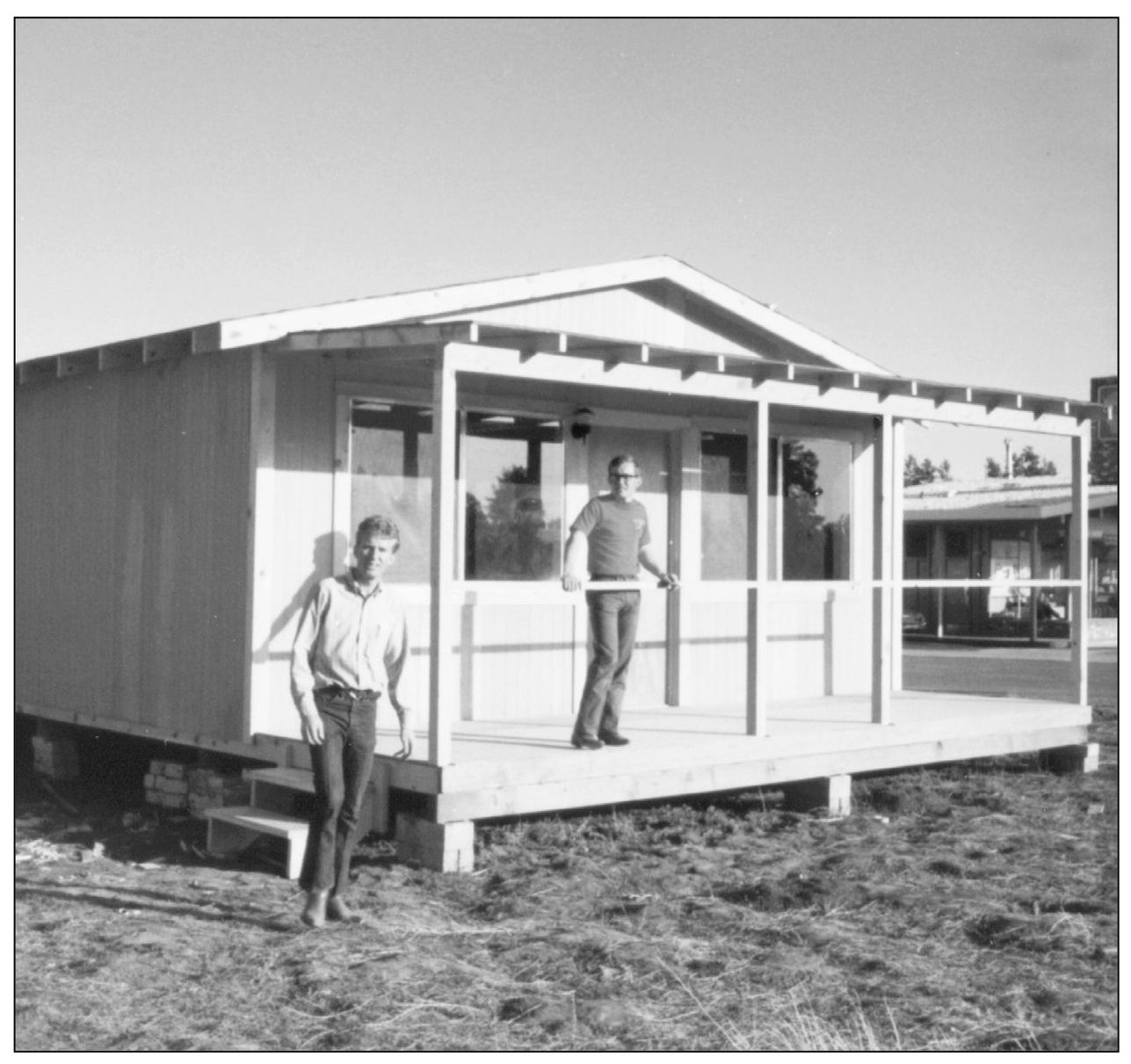
A number of new businesses began to open in the Tusayan community in the 1970s and 1980s, including the Village Sports Den. The business was owned by Clyde Dillon and Norm Johnson, pictured above around 1971. The sporting goods store, part of a franchise from Utah, sold and rented hiking equipment, among other items. (Courtesy of John Dillon.)
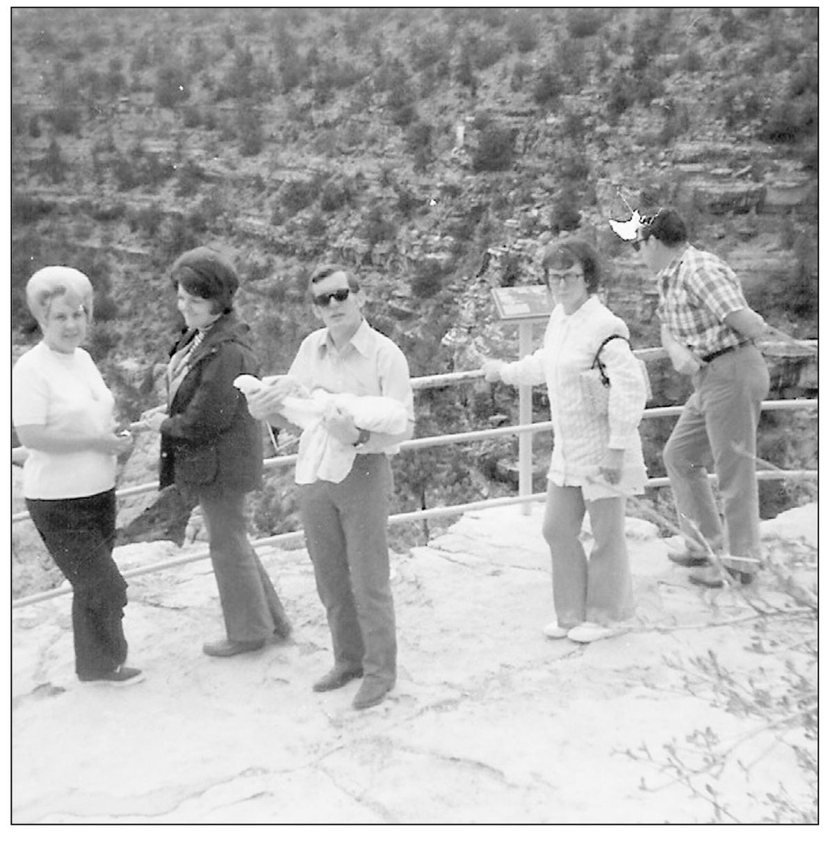
Helen Belnap, Marty Dillon, Clyde Dillon (pictured holding his son John Dillon), Dona Dillon, and Fay Dillon (grandpa) can be seen as they visit Mather Point in 1972. Besides owning a business in Tusayan, and eventually closer to the South Rim as well, the Dillon family also had a number of other business interests throughout northern Arizona. The family eventually settled in the Flagstaff area. (Photograph by Bob Belnap; courtesy of John Dillon.)
Bob Sutton (who ran the Super Trash company out of Tusayan), Boyce McClung, and Michael Vedekeya are pictured in Grand Canyon National Park in the 1970s. The three were employed with the Fred Harvey Company and were well known in the area. (Courtesy of Clarinda Vail and the Thurston family.)
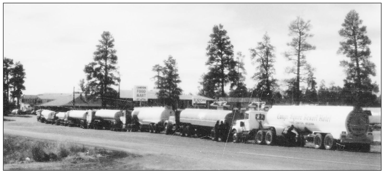
Water trucks can be seen participating in this 1970s Fourth of July parade, which was held every Independence Day in the Tusayan area. Parades once consisted primarily of water trucks, which played a big part in the area’s history as water was hauled in from a number of local sources. (Courtesy of Clarinda Vail and the Thurston family.)
Pictured is an old fire truck used by Moqui Lodge and donated to the Tusayan community. The community’s first fire truck, which never really worked, according to residents, is pictured as it is hauled away by Tom Maier in the 1980s. (Courtesy of Clarinda Vail and the Thurston family.)
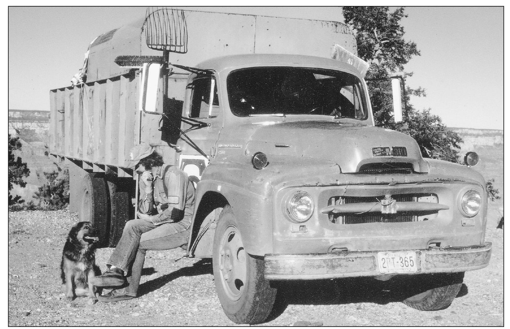
Tusayan resident Bob Sutton can be seen in this 1970s photograph on the South Rim of the Grand Canyon. He is pictured with “Old Clark,” the name for the truck he hauled throughout the national park and Tusayan village area. His dog, commonly called the mayor of Tusayan, was named Papillon. (Courtesy of Clarinda Vail and the Thurston family.)
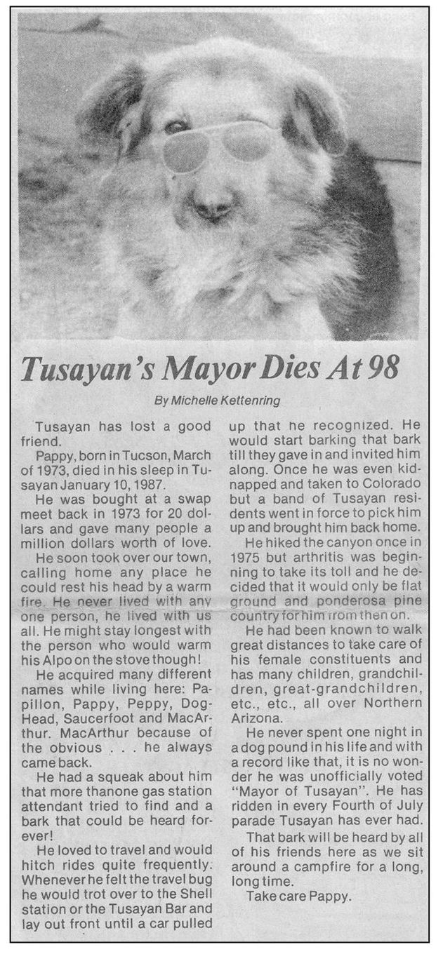
Papillon, the famed Tusayan canine, was featured in a Grand Canyon News article around the time of his death. Born in 1973 and alive until 1987 (98 in dog years), Papillon reportedly passed away in his sleep. (Courtesy Clarinda Vail and the Thurston family.)
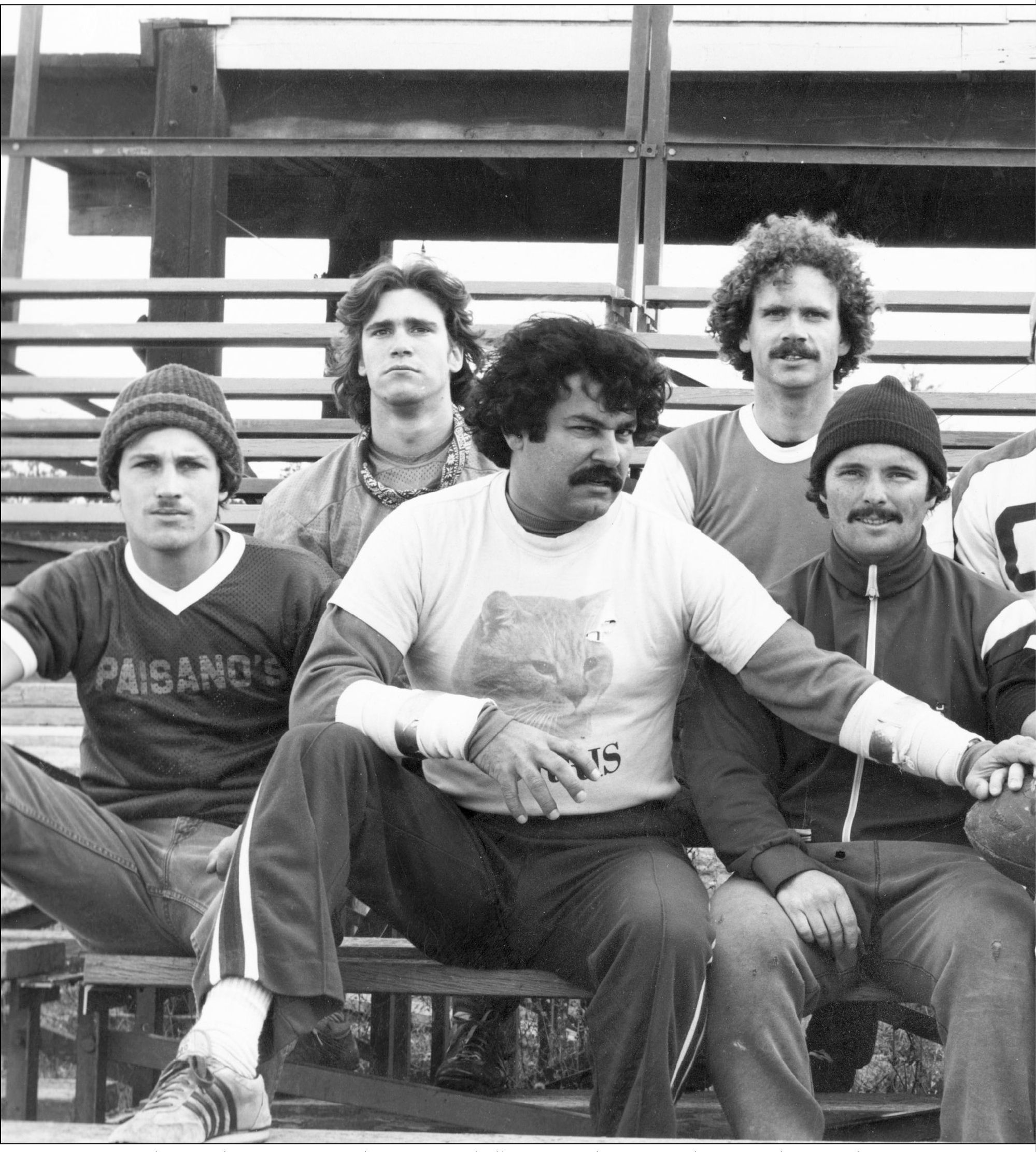
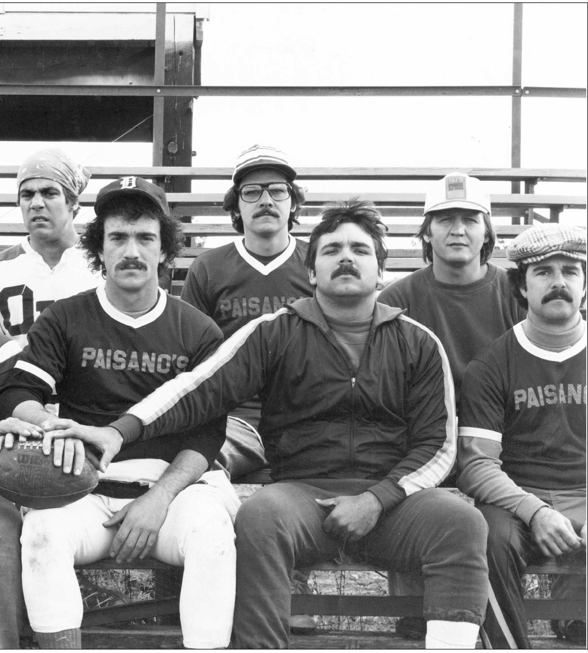
Members of the Paisano’s Fred Harvey football team can be seen in this 1979 photograph. Many members of the Tusayan community, as well as within the national park, often participate in adult sporting leagues within the area. The Paisano’s are pictured on Guthrie Field, located within the park between Grand Canyon School and the Grand Canyon Recreation Center. The Xanterra league for adult sporting leagues is currently called the All Stars. Guthrie field was named for Carl Guthrie, a former superintendent of the Grand Canyon School District. (Courtesy of the National Park Service.)
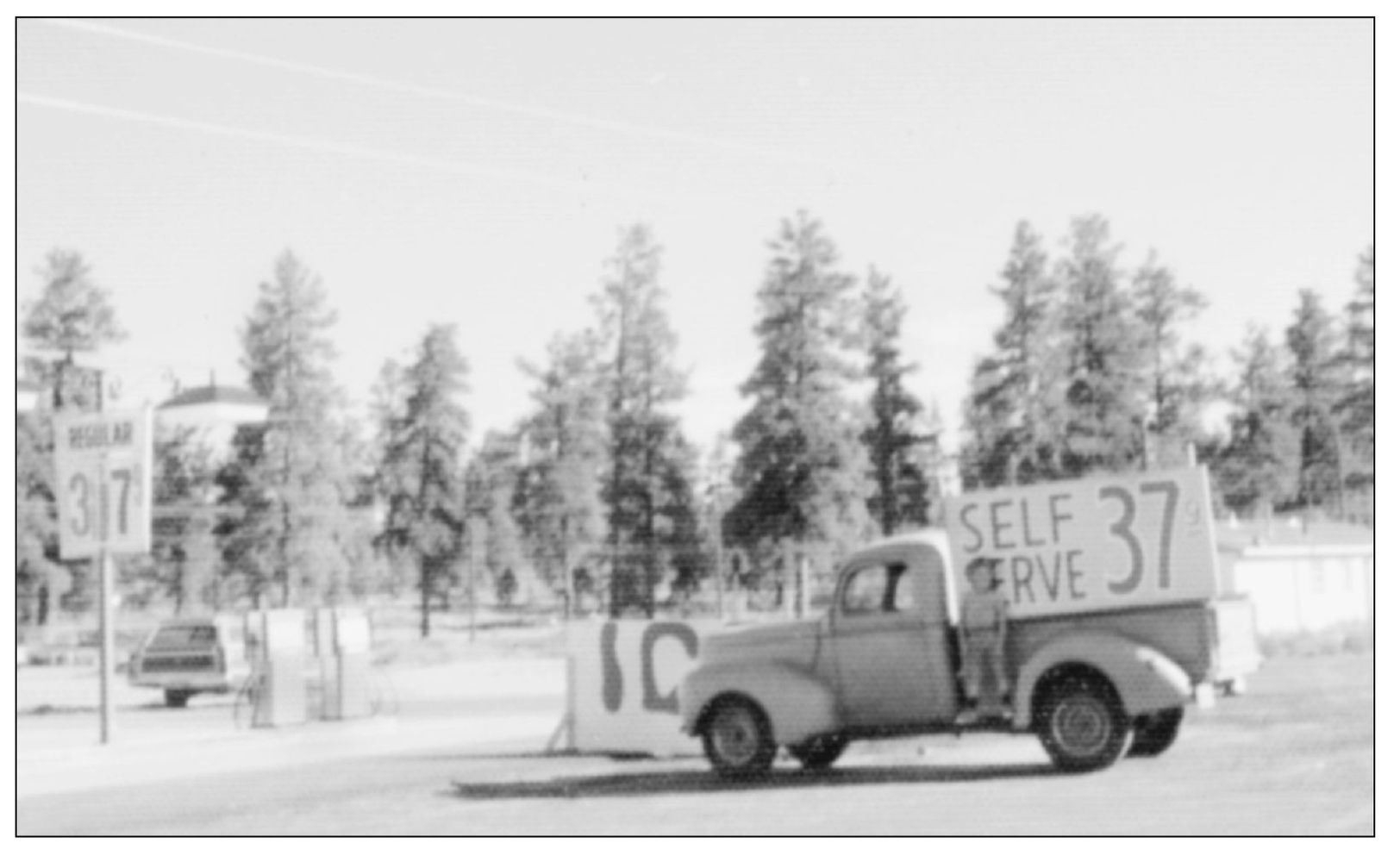
This photograph was taken in the early 1970s in front of the gas station built by Bill and Bonnie Thurston. Their son John Thurston can be seen on the running board of a 1940 Ford truck that was once used at the Grand Canyon Airport in the Red Butte area. (Courtesy of Clarinda Vail and the Thurston family.)
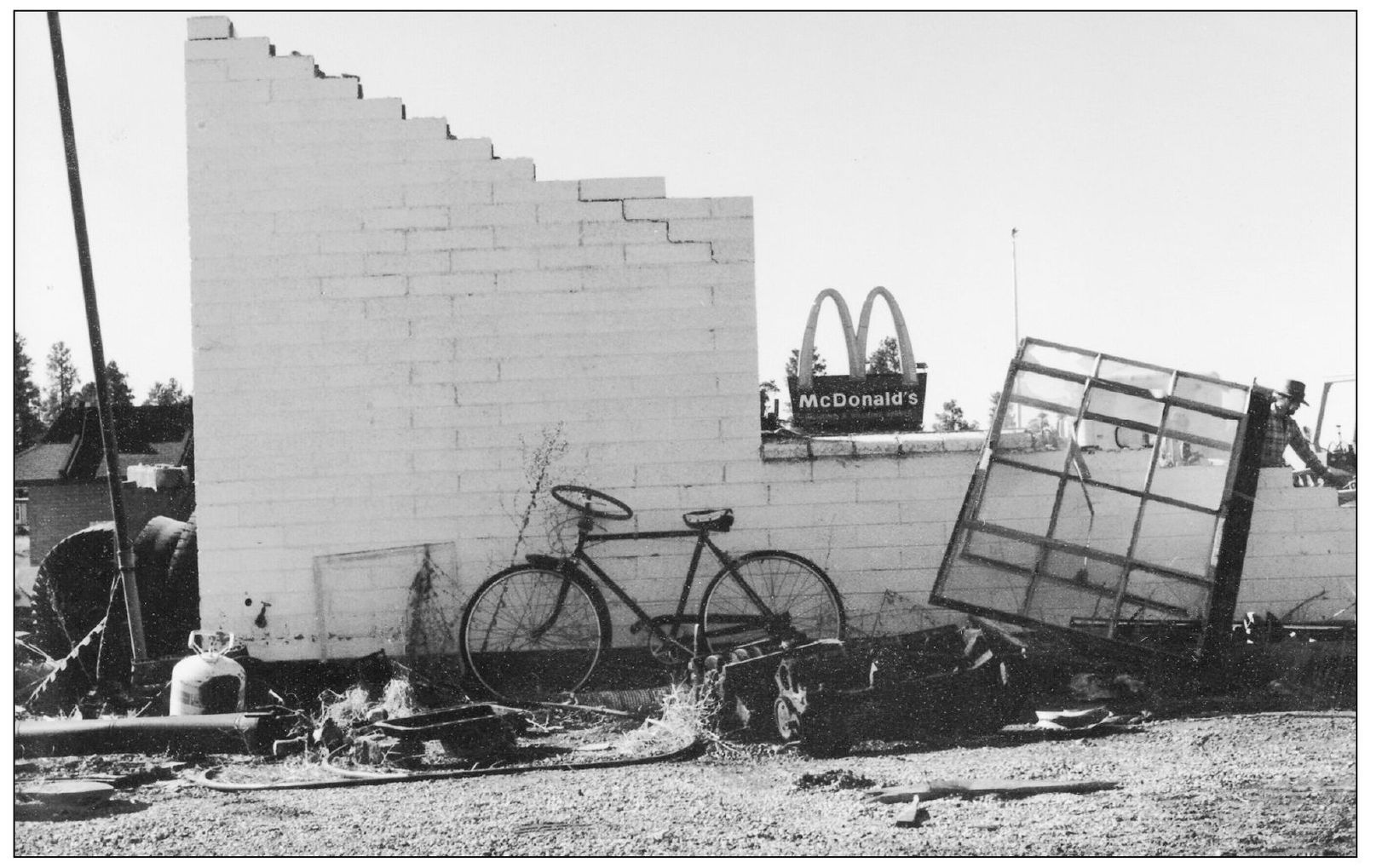
The bicycle belonging to Tusayan resident Rich McNeal’s can be seen in this late 1970s photograph, complete with a steering wheel instead of handlebars. The photograph was taken during the demolition phase of the gas station that once belonged to the Thurston family. (Courtesy of Clarinda Vail and the Thurston family.)
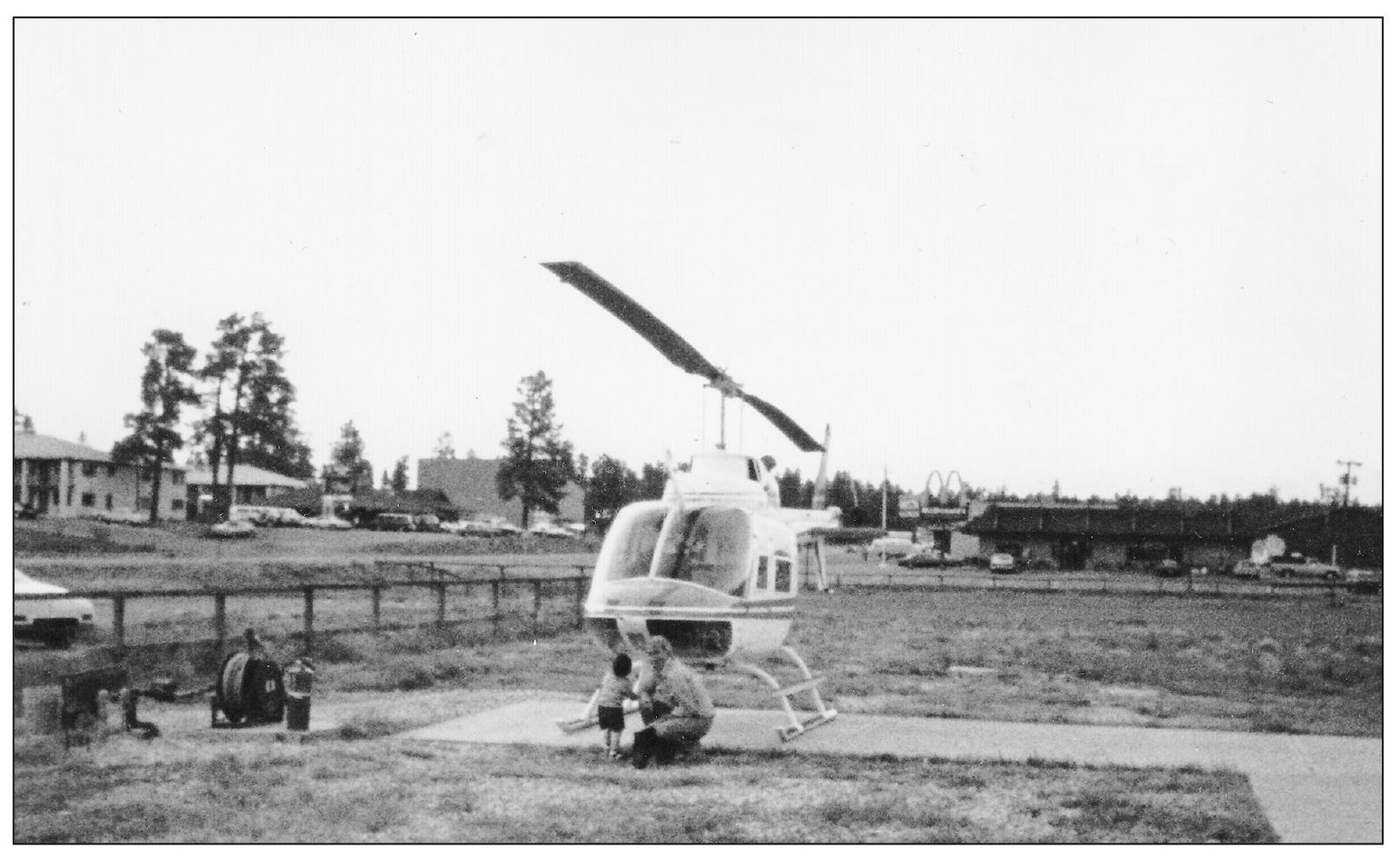
Local Tusayan resident Dan O’Connell introduces his son Patrick to one of the helicopters owned by Madison Aviation. The O’Connell family attended the official kickoff festivities for the tour company, which started around 1982 in the village of Tusayan. O’Connell managed the new company for Madison Aviation. These days, tours are operated from the airport and not from the community itself. (Courtesy of Clarinda Vail and the Thurston family.)
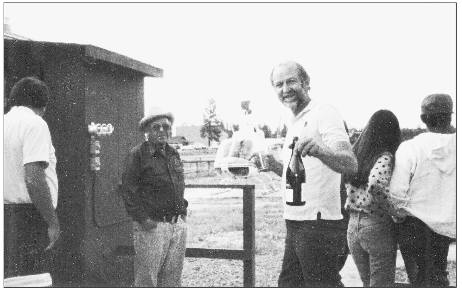
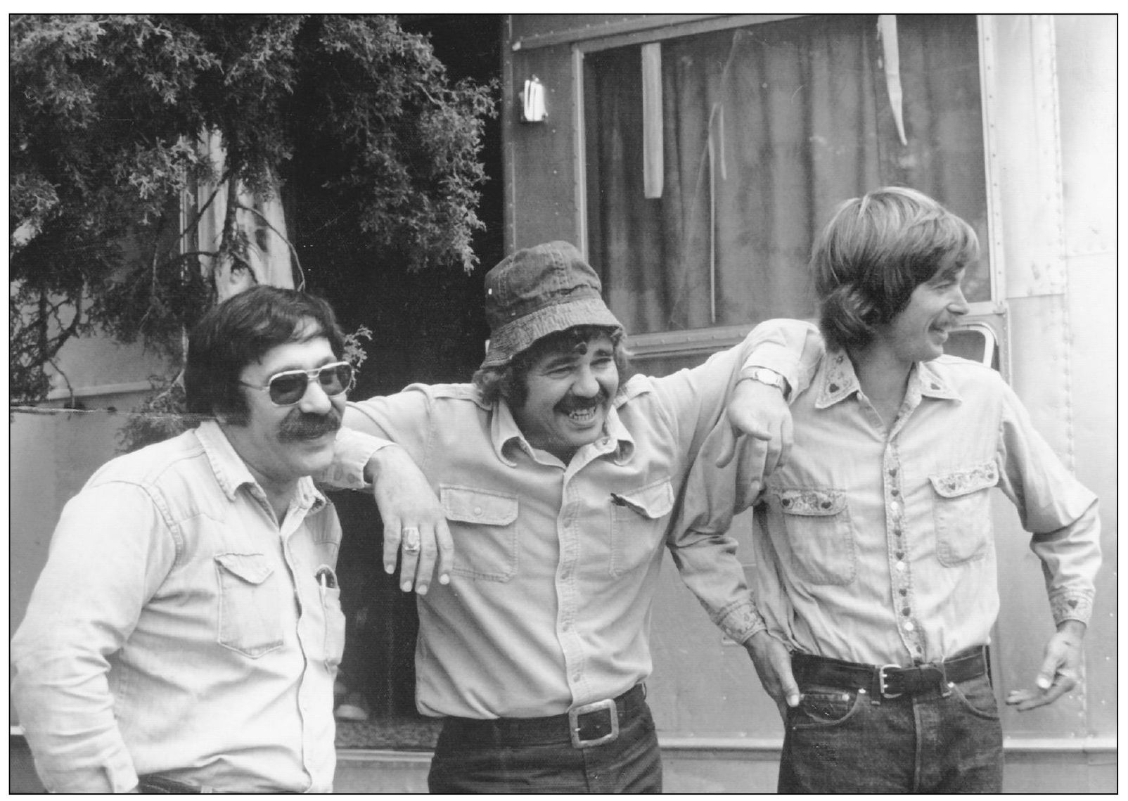
Bill Thurston, seen in a hat and sunglasses, is pictured with Joe Babbitt and a number of other attendees as they celebrate the opening of Madison Aviation in the village of Tusayan. Babbitt is holding a bottle of champagne to commemorate the event. (Courtesy of Clarinda Vail and the Thurston family.)
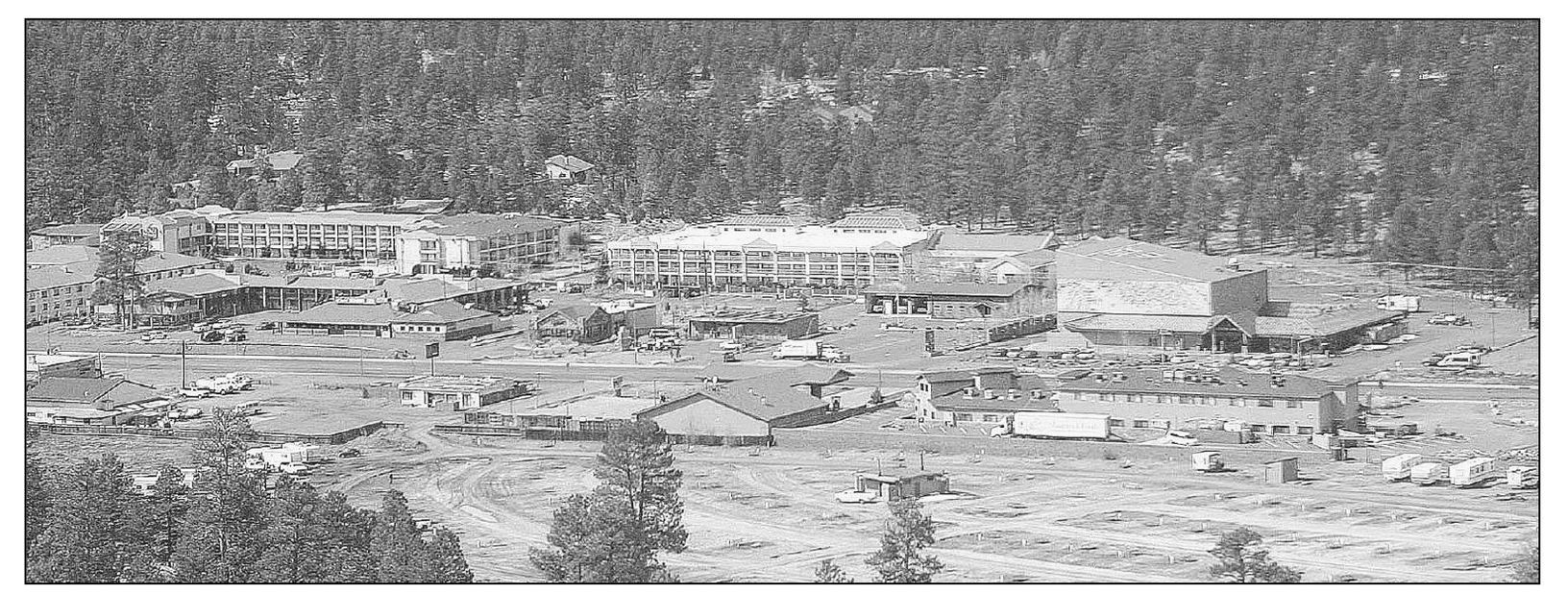
Pictured is an aerial view of Grand Canyon’s Tusayan village as it appears today. This is what travelers see on the final leg of an air tour over the national park. A number of air tour operators can be found in and around the Grand Canyon Airport at the south end of the community. (Courtesy of the author.)
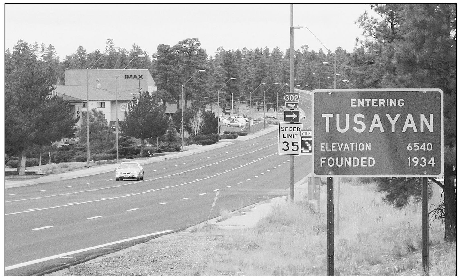
This sign for Tusayan was put in place in 1987 when construction was completed on Highway 64, turning the road from two lanes to five lanes. A lighting district was formed to bring lights to the area in order to make crossing the street at night safer for residents and visitors to Tusayan village. Residents voted to incorporate the small South Rim community in March 2010. (Courtesy of the author.)