The Middle Atlas is a huge but relatively little-visited mountain region stretching between the High Atlas and the Rif, and from the Atlantic Coast up to Taza. It is a stunning area of forests, upland pastures, running rivers and lakes, high enough to be blanketed in snow in winter, but not as harsh as the High Atlas, rising to a peak of 3,356 metres (11,010ft) at Jebel Bou Naceur. The mountains are also home to the Beni Mguild Berbers, some of Morocco’s most gifted nomadic weavers.
The mountains emerge in the west as the Zaër Zaïane highlands, inland of the Rabat/Casablanca coastline, and dip down towards the High Atlas at Kasba Talda. They then re-emerge from the High Atlas north of the great artificial lake, Bin el Ouidane, to become the Middle Atlas proper, crowned with stands of lofty cedars and running northeast between Midelt in the south and Azrou in the north. The range continues past the Fez and Sefrou, becoming the Jebel Tazzeka, then falters at the Taza Gap, guarded by Morocco’s least touristic medina city.
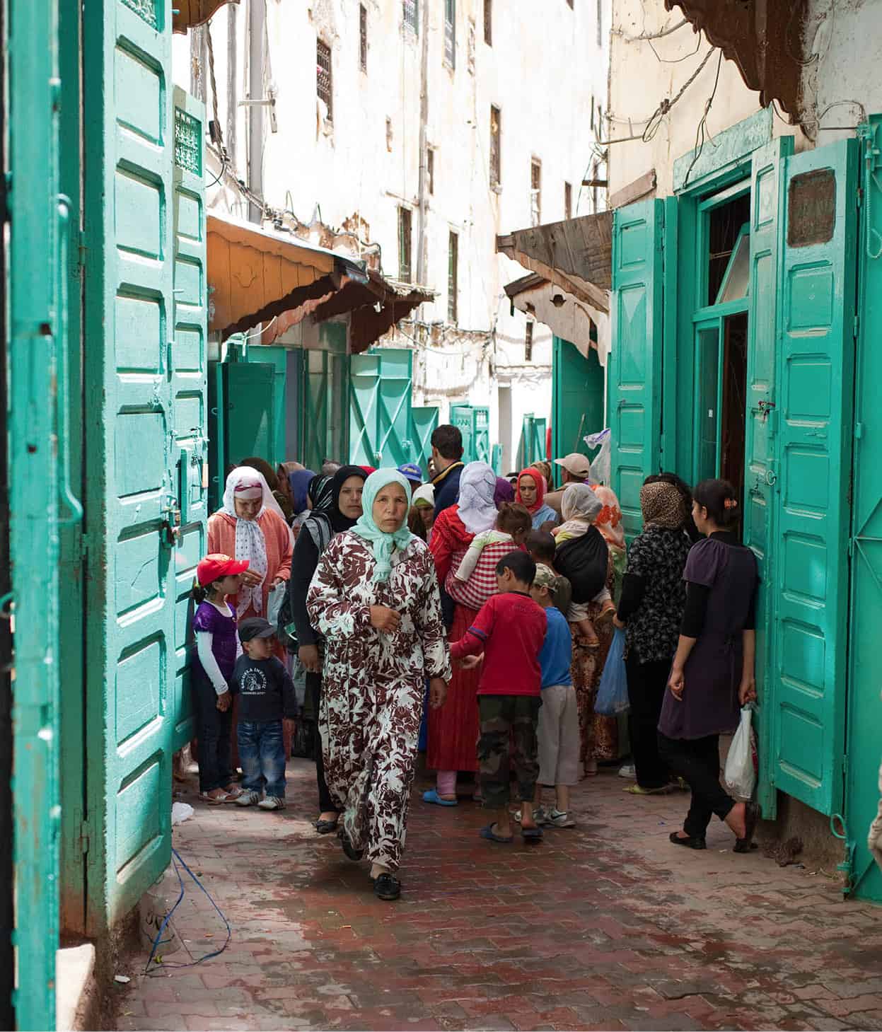
Sefrou street scene.
Ming Tang-Evans/Apa Publications
The Zaër Zaïane highlands
The R401 southeast of Rabat winds through the cork oak trees and steep valleys of the Temara Forest, over rolling hills and through cleared rich agricultural land up to Rommani (Wednesday souk), where the R404 turns left to Maaziz.
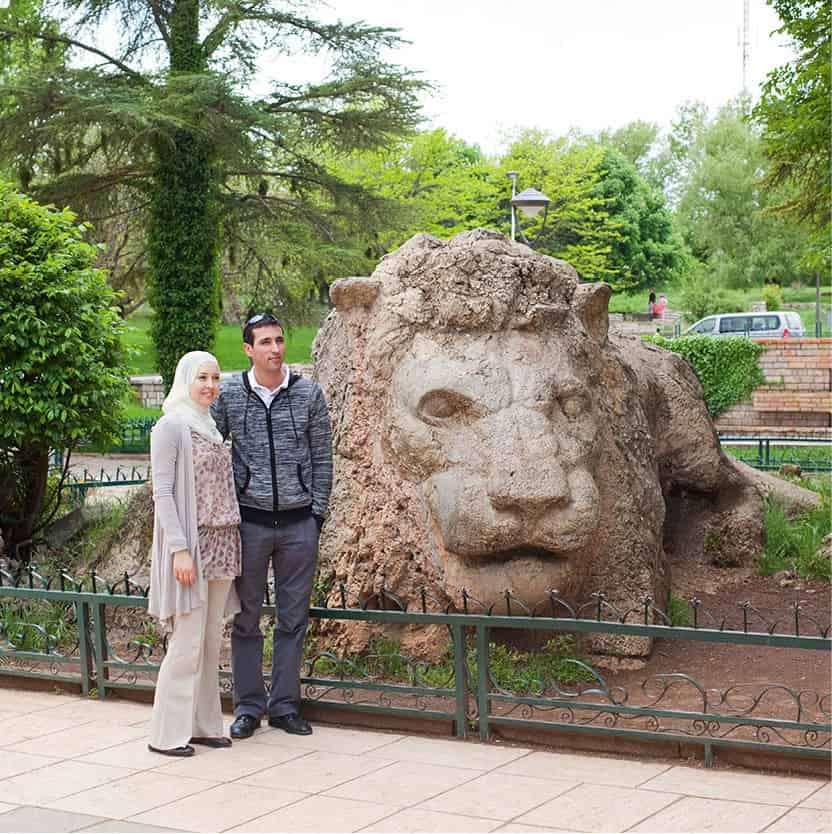
Sculpture in Ifrane commemorating the last wild Atlas lion.
Ming Tang-Evans/Apa Publications
Beyond Maaziz on the R407, Tiddas is set in a large agricultural valley dominated by neat rows of apple orchards. Past here, the road climbs steeply through forests of fir trees towards Jebel Mouchchene (1,086 metres/3,563ft), with scattered hamlets and fields offering views to the south of tree-covered hills.
After El Harcha, a dead-end road leads to Tarmilate, home of the Oulmes and Sidi Ali bottling plant. The town is set on a spur, surrounded by higher forested peaks. Accommodation is available in the once stylish 1930s Hôtel des Thermes (tel: 037-52 31 73). Company-owned, the hotel is rarely visited by tourists, but has clean rooms, hot baths, a licensed restaurant and a congenial atmosphere at a very reasonable price. From the hotel there is a pleasant walk down the deep valley to Lalla Haya, the source of Morocco’s most famous mineral water. The spring emerges hot and slightly sulphurous, and gushes through an iron pipe into a large basin streaked with red iron deposits. It is a great place for a restorative bath.

Imouzzer du Kandar.
Ming Tang-Evans/Apa Publications
The nearby town of Oulmes has very little to offer except its souk each Tuesday. The place has an air of rural poverty and, like Tarmilate, is surrounded by shanty town housing, the homes of peasants who work on the surrounding company-owned farms.
From here the R407 makes its way southwards through holm oak forest, past the shrine of Sidi Otmane to Khenifra.
The Jebel Tazzeka
Most trips into the Middle Atlas begin in the region of Fez. The N6 from Fez, heading east, takes you past the enormous Idriss I Dam (Barrage Idriss I). An easily missed turnoff to the north at Sidi Abdallah des Rhiata quickly twists back on itself to go under the main road and climb immediately up into the spectacular rust-red-stained Zireg Gorge. This is the start of the Tazzeka National Park (www.tazekka.com), perhaps the most beautiful upland landscape in northern Morocco. The loop road (which eventually comes out at Taza) climbs through cork, evergreen oak and pine trees with spectacular views over forest wilderness inhabited by reintroduced Barbary deer. Along the way are a couple of picnic sites with kiosks and display maps. To the north of the R507, the 1,980-metre (6,495ft) summit of Jebel Tazzeka itself is easily identifiable by its aerial mast and is accessible via a signposted track.
Taza
Taza 1 [map] lies midway between the Rif and the Middle Atlas in a mountain pass known as the Taza Gap. The town was founded in the 7th century by Berbers, and for centuries saw waves of invaders pass through the Taza Gap on their way down through the country. It later grew to importance when the Almohads occupied it in the 12th century, making it their second capital (Tin Mal being the first) after failing to capture Marrakech from the Almoravids.
Middle Atlas Hiking
With ancient forests and a wealth of flora and fauna, the Middle Atlas is a paradise for hikers – the most popular hikes being the Jebel Tazzeka Circuit near Taza and various treks in the area around Azrou. The Jebel Tazzeka Circuit begins 10km (6 miles) from Taza at the Cascades de Ras el Oued (which only flow in spring) and the little village of Ras el Ma, from where the view of the Taza Gap can be admired. If you do not have a car, you can hire a grand taxi. Information and guides can be found in Taza.
Twenty-five kilometres (16 miles) further on from Taza are the Friouato Caves (Gouffre du Friouato), supposedly the largest and deepest in Africa. The route back from the caves to Taza takes in compact Bab Bou Idir, which is a good base for further hikes around the area. In summer, the Tazzeka National Park office can provide information on trails, which are also marked. A few kilometres on from Bab Bou Idir is Jebel Tazzeka itself, which has a rough trail leading to the summit that takes a few hours to ascend and descend for fit climbers. Azrou is also a popular base for short hikes into the surrounding cedar forests, with glimpses of the Barbary apes for which this region is known. Hikes can involve just a day or an afternoon from Azrou or longer four- to six-day treks starting from Ain Leuh. Guides can be found in Azrou.
The medina (also known as Taza Haute) is set on a hill above the Ville Nouvelle and is blissfully untouristy, if you’ve just come from Fez. There are few historic monuments to visit, though you may get glimpses of the Andalous Mosque, built in the 12th century. Near the Gate of the Wind (Bab el Rih) is the Grand Mosque, built by the Almohads also in the 12th century. In the heart of twisting pedestrian alleys of the pale-ochre medina, near the Sidi Azouz Mosque, are the souks full of tapestries, jewellery, wickerwork and local Berber crafts. But the real draw here is the chance to buy the increasingly sought-after dark-brown and cream woollen carpets woven by the Beni Ourain tribe.
Cherry country
Two routes head south from Taza to Sefrou, in the heart of the Middle Atlas. The first route backtracks along the main N6 to Fez and then heads south down the R503 to Sefrou; the second also starts out on the N6, but turns off at Bir Tam Tam onto a single-track road, reaching Sefrou via a slightly longer but more scenic drive.
Sefrou 2 [map] is rarely disturbed by tourists despite being just 30km (19 miles) from Fez. It was once a major centre for Morocco’s Jews, popularly known as ‘Little Jerusalem’ and with a sprawling mellah occupying half the entire medina – you can still see many distinctive Jewish houses with wooden balconies, similar to those found in the mellah at Fez. The whole medina is dissected by the River Aggai, which enters the town via a small waterfall above a separate ksar, enclosed in its own set of walls.
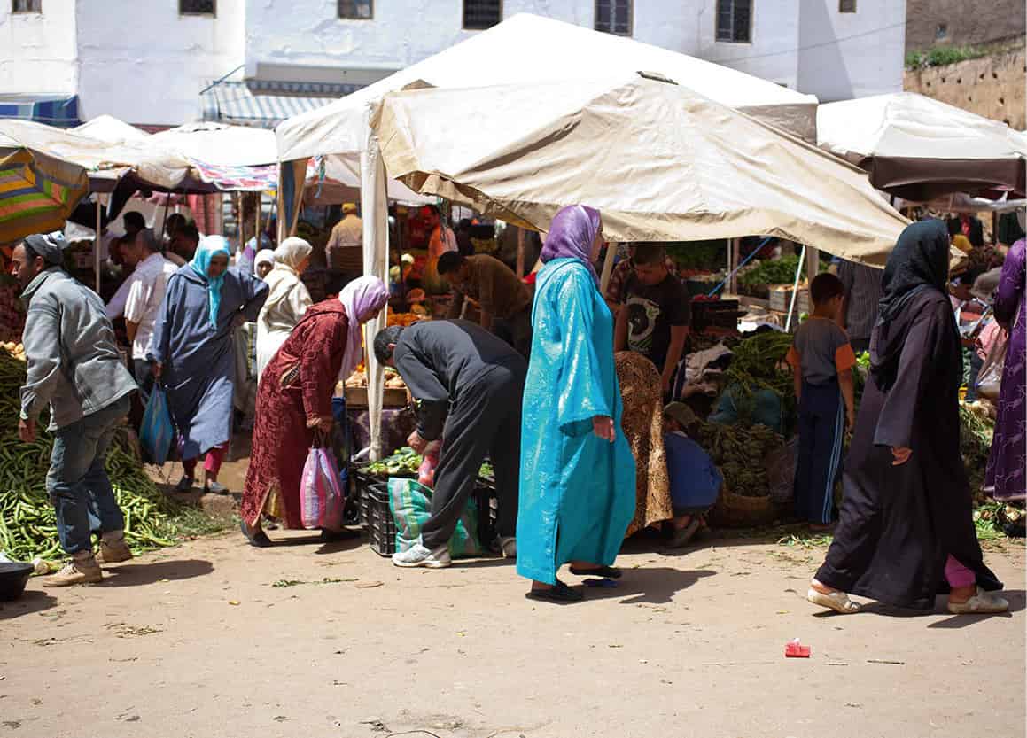
Sefrou market.
Ming Tang-Evans/Apa Publications
Modern Sefrou, however, is most famous for its Cherry Festival. Held in June to mark the end of the cherry harvest, the festival offers several days of music and celebrating and culminates in the crowning of the Cherry Queen.
A detour to Boulemane
Immediately east and south of Sefrou there are a few roads open to normal road vehicles including a worthwhile detour along the P5033 to Tazouta and then the P5016/15 via Skoura and Tafradous to Boulemane. The last has no accommodation, although there is a café. The rewarding drive follows the Gigou Valley, with views of the towering cliffs of the Tichehoukt massif (2,796 metres/9,170ft) to the south. On one particularly tight twist in the river stands Tafradous, accessible only via a footbridge that leads up an enormous ramp to a village built like a crusaders’ castle. This one site alone makes the whole drive worthwhile.
Touring the lakes
From Sefrou, head south again on the R503 and just after Aioun Senanne, take a smaller single-track road off to the right heading for Imouzzer du Kandar 3 [map]. Built by the French and characterised by tidy avenues lined with deciduous trees and a cheerful square, the town offers a plethora of cafés and a park with a couple of ponds, and is a good place to stop for lunch.
Just south of Imouzzer du Kandar, the P5016 heads off on the left, marking the start of the signposted ‘Circuit Touristique des Lacs’, which weaves around a series of pretty little lakes nestled amongst the mountains. Immediately beyond the turnoff you’ll reach the Dayet Aoua 4 [map] lake, on whose shore you’ll find the imposing Chalet du Lac. Despite its rather austere exterior, this has a good restaurant and the most enormous potbelly stove to ensure that the place stays warm even on the coldest nights.
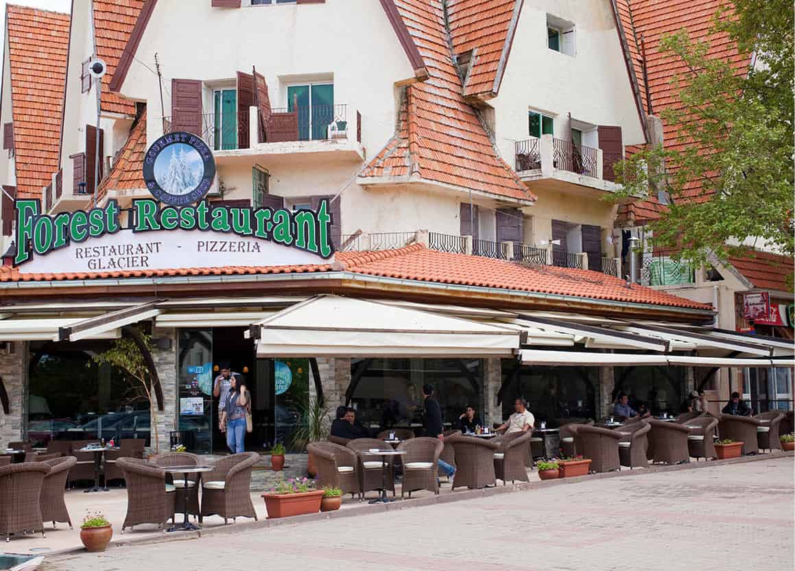
Ifrane was built by the French.
Ming Tang-Evans/Apa Publications
The lake tour continues around a series of less-visited lakes, Dayets Afourgah, Iffer, Ifrah and Hachlaf, via a series of tiny tarmac roads, each reasonably signposted. The area is particularly frequented by fishermen and it is said that Hassan II used to enjoy taking off from his palace in Ifrane for the day to fish in the waters here.

Sefrou is a pleasant town unspoiled by tourists.
Ming Tang-Evans/Apa Publications
Ifrane
Ifrane 5 [map], south from Sefrou on the N8, is something of a shock. Cool and tranquil with manicured lawns, pristine red-roofed houses, oak and London plane trees and the outward appearance of a Swiss Alpine resort (it is often referred to as ‘Little Switzerland’), it is a surreal place to come across in the heart of Morocco.
Ifrane was built as a summer retreat by the French in 1929 and today is where the king and rich Moroccans come in the summer to escape the heat of the plains and in the winter to ski. The population of Ifrane is very young and very chic. The celebrated El Akhawayn University (where courses are taught in English) is on the edge of town, as is the Hotel Michlifen, a five-star hotel and ski (www.michlifenifrane.com) lodge owned by the king. There is a tourist office on Avenue Prince Moulay Abdallah and, in the centre of town, a rather depressing statue of a lion, commemorating the last Atlas lion, which was shot near here in 1922.
Some 20km (12 miles) southwest from Ifrane, Azrou 6 [map] is an important market town known for its Berber carpets, beautifully situated in the heart of the Forest of Cedars (Forêt de Cèdres). The French-era Place Mohammed V is bordered one side by the Hôtel des Cèdres and the Relais Forestier restaurant. The other side of the square gives onto a small souk. Every Tuesday a large market, at which locals come to sell kilims, fruit and vegetables, is held about a kilometre north of the town.

Barbary ape.
iStock
There are a growing number of licensed mountain guides in the region – a good choice if you want to explore more of the area on foot or by 4x4. It is probably best to ask at your hotel for the best guides. Barbary apes (which are actually monkeys, not apes) are often seen on roadsides throughout the region. These macaques are yellow-brown or grey in colour, with pink faces. They live only in the forests of Morocco and Algeria and are now an endangered species, with only a few thousand left in the wild.
South from Azrou, a rough track off the N13 takes you to the huge and ancient Gouraud Cedar, a tree said to be over 800 years old.
More practical if you haven’t got a four-wheel-drive vehicle is the route further south to the turnoff for the Mischliffen and Jebel Hebri ski resorts. Situated in the crater of an extinct volcano, Mischliffen (or Michlifen) is one of Morocco’s major skiing centres, despite sometimes-erratic snowfall. Skis can be rented here during the season, which runs (if there is snow) from January to March. Out of season there’s not much to see at either resort apart from a couple of stationary chair lifts, although Mischliffen does have a few hotels which make a good base for walks through the forest.
Further south again on the N13 is the isolated lake of Aguelmame de Sidi Ali, surrounded by 2,000-metre (6,560ft) peaks.
Cedar country
From Azrou the P7215 heads south through cedar forests with good views down into the valley below and on to Ain Leuh 7 [map], which has a thriving Wednesday market. Continuing south on this winding road, you reach the picturesque hollow containing the springs that form the Oum er Rbia. The main spring has a car park beside a pool, a pleasant spot for a summer dip and a walk towards the spring (in fact, four separate springs) that cascades in waterfalls from underneath the mountains to form the Oum er Rbia River, the longest in Morocco.
Between here and Khenifra is the small Aguelmam Azigza Lake, at the end of a highland sheep meadow, surrounded by a half-moon of cedar forest and limestone cliffs.
The road continues to wind through evergreen oak forest, which gives way to lofty stands of cedar, some of the trees reputedly measuring over 60 metres (195ft) tall, before reaching Khenifra on the banks of the Oum er Rbia and built around a small, tightly packed medina. Houses are a dark brick red with the woodwork of windows and doors painted turquoise. The way out of town towards the mountains is via a busy street that offers tantalising glimpses up cobbled side alleys.
El Kbab, reached by turning off the N8 just after the town of El Herri, is a small pottery- and carpet-making centre and also hosts a market on Mondays.
Towards the High Atlas
From El Kbab, a winding mountain road that takes you through the mountainous uplands where the Middle Atlas and High Atlas merge.
Roughly 40km (25 miles) due south of El Kaba, Arhbala was once a French administrative centre but the red tile and stone houses that are so typical of towns in the Middle Atlas. A further 40km (25 miles) or so west of Arhbala at Tiz n’ Isly, the road forks; the left-hand fork takes you south to the village of Imilchil in the High Atlas. Continuing ahead on the R317 instead brings you after a further 30km (19 miles) to the pretty village of El Ksiba, which has a busy souk on Sundays.
Five kilometres (3 miles) northwest of El Ksiba you rejoin the main N8. Turn left here and drive a further 20km (12 miles) to reach the former garrison town of Kasba Tadla 8 [map], with a kasbah built in the 17th century by Moulay Ismail. Two walls enclose the town, which has a couple of run-down mosques and a former governor’s palace. Around Kasba Tadla and Khenifra there are acres of olive plantations and many mills.
Thirty kilometres (19 miles) south of Kasba Tadia on the N8, the large market town of Beni Mellal is one of the main cities of the Middle Atlas, although of little interest to visitors. Press on instead to Bin el Ouidane 9 [map] a further 50km (31 miles) south. Situated on the shore of the Bin el Ouidane Lake, the town has become a centre for water sports, and nowadays there are a few luxury holiday homes and hotels, with private jetties for Morocco’s inland sailing enthusiasts.
Tip
You may be hassled by ’guides’ at the Cascades d’Ouzoud, but don’t bother paying for their services as the walk down to the falls is clearly marked and much more peaceful alone.
From Bin el Ouidane, take the R304 via Azilal and then branch off onto the 980 to the Cascades d’Ouzoud ) [map]. The cascades are a popular spot and are especially beautiful in spring, when the waters crash into the El Abid River canyon 100 metres (328ft) below. There are a couple of camping spots lining the edge of the water at the foot of the falls and there is a little village at the top of the falls, which also has a restaurant and place to stay, Riad Cascades d’Ouzoud (www.ouzoud.com), with sweeping views across the surrounding countryside, good Moroccan food and guided tours into the surrounding region. From the village, a path heads down to the waterfalls, past rickety stalls selling trinkets and some rudimentary cafés. Little boats can be hired to paddle about in, and further downstream, away from the bustle of the falls, you can swim in some calm pools.

