16
The Land of Meadows and Water
Gaspereau River and Salmon River, Summer 1911
He always returned well and full of enthusiasm, holding his family breathless with his tales of thrilling experiences in the deep woods.
— Susan B. Ganong1
In the summer of 1911, Ganong wanted to continue his fieldwork on the Gaspereau River and extend it into the Salmon River. Accompanied by William Laskey, he planned to start with physiographic studies of the Gaspereau and its tributaries, first paddling from its source to the confluence with Salmon River. Ganong felt that the Gaspereau had never been adequately surveyed above the settlement at Cochrane Brook and was intrigued by the fact that it ran through a remarkably little-known wilderness. After this, the pair planned to conduct a careful study of the Salmon River from the headwaters near Harcourt down to Chipman.
They transported their canoe and gear overland from Chipman into the vast heath surrounding Briggs Brook and established a camp at its mouth. Ganong spent time mapping the upper region of the Gaspereau watershed before they launched the canoe in the headwaters of the river at Gaspereau Lake. It was surrounded by large meadows stretching northwest towards Bantalor Brook and the Little River. Ganong described the countryside: “[it] contains some low ridges distinguished by their remarkably fine hemlock trees, while between the ridges lie the swamps, bogs and barrens, everywhere characteristic of this flat sandstone plateau.”2 At first, the river ambled through heath land, where several smaller brooks joined it to form, Ganong explained, what the Maliseet called an obscache, or small stream.

W.F. Ganong’s 1912 map of the Gaspereau and Salmon River (PANB-MC1799)
For several miles downstream, the clear brown river ran easterly over a sandy bottom with occasional small rips where there were shallow gravel bars and ledges. Ganong and Laskey hoped to paddle most of the river, but instead found themselves wading beside the canoe as they lined it through low summer water. Fortunately, they had made sure their canoe was “specially prepared by shoe runners, for shallow water, of which we found plenty below Flewelling Brook, though above that point the canoeing was pleasant.”3
Ganong must have had a sense of déjà vu as they waded past the Cains-Gaspereau portage he had explored the year before. This time, he noted that the Gaspereau above and below the portage coursed eastwards through alternating sandstone ridges until Meadow Brook, where it turned abruptly south before meeting the Salmon River. The river’s disposition also changed below the turn at Meadow Brook, taking on postglacial characteristics. Ganong noted that it was “a much newer looking, and apparently much younger, river, with steeper and more cliff-like walls.”4 Along this stretch, the Gaspereau had worn a path through the undulating terrain to a depth of thirty metres or more, the slope of the land toward the southeast causing it to wear the southeast banks more aggressively. This abrupt change posed an interesting problem. After hiking up Meadow Brook to investigate the physiographical evidence, Ganong suggested that the original preglacial Gaspereau River must have continued eastward along the brook into the Kouchibouguacis River valley, eventually emptying into the Northumberland Strait.

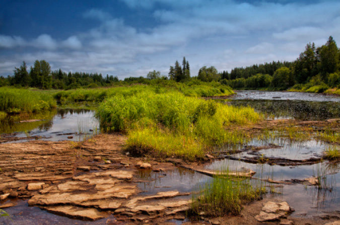
Gaspereau River, September 2014
Just above the bridge over the upper Gaspereau, the river began to flow through extensive intervales until it met the Salmon River at Gaspereau Forks. Ganong and Laskey canoed down the Salmon to Chipman to get provisions for the second phase of the summer field trips. A successful exploration of the Gaspereau River buoyed their spirits as they travelled overland by train to Harcourt Station. At Harcourt Station they hired a wagon for the trip to Smith’s Landing on the Salmon River. From there, they poled upriver to the mouth of Hazen Jam Brook, where Ganong measured the elevation above sea level and took compass bearings. As the major river of southeast New Brunswick, the Salmon was well documented on early French maps and in subsequent geological surveys, many done to assess coal deposits. Ganong had a good understanding of the river’s basic physiography, supplemented by anecdotal information from local residents. Although he did not expect anything unusual, he still wanted to paddle the full length of the river to Grand Lake in order to form scientific opinions based upon his own fieldwork and observations. His report to the Natural History Society confirmed that:
The Gaspereau River just above the Burpee Bridge, July 2012
Salmon River, as the geological maps well show, lies wholly within the great Carboniferous basin of New Brunswick; and hence nothing is to be anticipated from its geology except the usual jointed gray sandstone of that formation, while its physiography may be expected to harmonize with that of the other rivers in the same region.5
Like the headwaters of the Gaspereau, Cains, and Canaan Rivers, the Salmon River rose from dark peaty waters that formed an elongated still water in the heart of a large barren that dominates the Maritime Basin. Ganong described the uppermost stretch of the river as placid and pretty if rather monotonous, the low banks, “mostly with a border of meadow or alders, backed by birches and poplars, though here and there small groves of princes pine appear on low sandy terraces.”6 The Salmon River was easy canoeing as it flowed easterly through the wide, flat basin before making the first of two sharp turns at a point in the river aptly called the Oxbow. There, the river almost doubled backed on itself, turning north and becoming swifter as it cut through a slightly elevated terrain, then turning west and regaining its placid slow character.
A few hundred metres from Indian Portage Brook, Ganong and Laskey made a side excursion to try to determine the ancient portage route to the headwaters of the Richibucto River. They found that the portage followed a narrow sandstone ridge with the land sloping west to the Salmon River and east to the Richibucto. Ganong observed that the wide land basin between was no more than thirty metres above sea level, even at its highest point by the Oxbow. He speculated that it would not take a huge geological change to allow seawater to flood inland from the Northumberland Strait, completely changing the province’s geography. He envisioned the whole region underwater in preglacial times, from the mouth of the Salmon to the Bay of Fundy, saying:
The origin of this basin is plain enough. It lies exactly in the line of that great trough, occupied by the Richibucto and Salmon Rivers, which almost converts the part of New Brunswick southeast of it into a separate island; for it would require a depression of not much over 100 feet, as the railway levels show, to fill this trough with salt water all the way from Richibucto Harbour to Saint John Harbour.7
Back on the Salmon River, Ganong and Laskey paddled easily through long stretches of calm water interspersed with short sections of shallow rips. The river became faster at Lake Brook, with more frequent small rapids as it cut through a series of undulating ridges. One of the main tributaries of the river, the brook has its source in two lakes located in the large central barren dominating the region. Locals claimed that the upper lake was poisonous to fish, recounting how large numbers were sometimes found dead in the water and on the shore. Since Ganong believed in a scientific explanation for every natural occurrence, he theorized that “at times in these shallow and fish-infested lakes, the supply of dissolved oxygen, essential to the support of fish life, falls for some reason below the normal, causing the death of the weaker individuals.”8 Later, he was pleased to find his theory substantiated in a 1912 article on oxygen deficiency in lakes, published in German in Deutsche Landwirtschaftliche Presse.9
At the confluence of the Salmon and Gaspereau Rivers, Ganong and Laskey pulled their canoe onto the shore, their summer field trips finished. Exploring the river was of little interest beyond this point since it flowed through well-settled farmland to Grand Lake.

The beauty and tranquility of the Salmon River, June 2012
Ganong returned to Salmon River with Leonard Smith of Grangeville, Kent County, in the summer of 1913. From Chipman, they boarded the eastbound train and were dropped off close enough to carry the canoe and their gear to Upper Lake. Ganong conducted research around the headwaters of Lake Stream, before he and Smith canoed down the Salmon River to Chipman. Another train trip eastward to the headwaters of Coal Creek followed. These were just two of many short trips that Ganong made to complete his physiographic studies of the region.