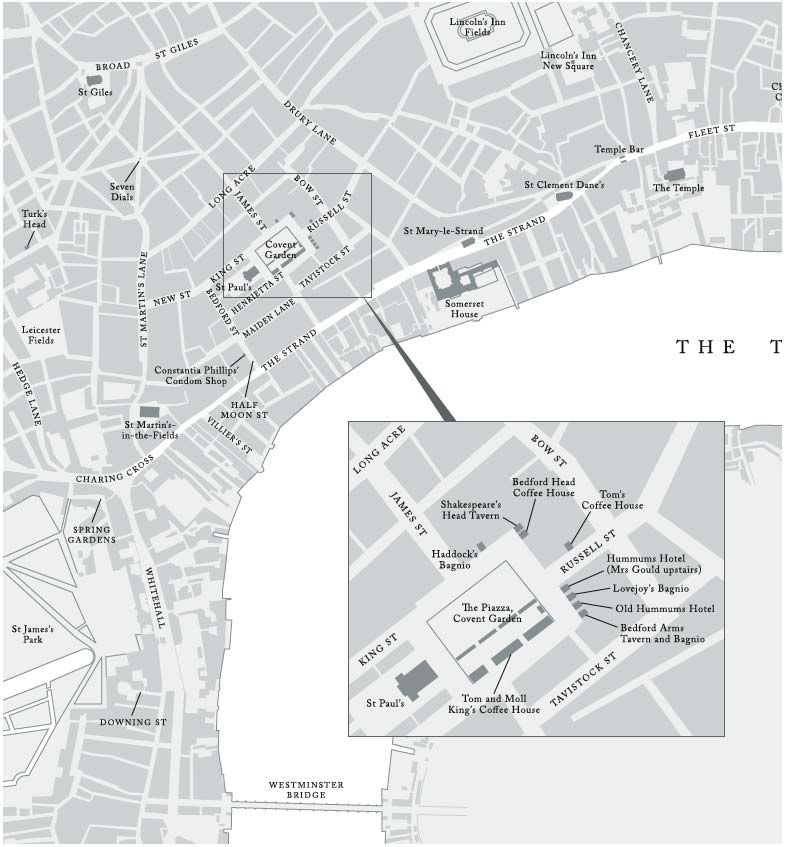
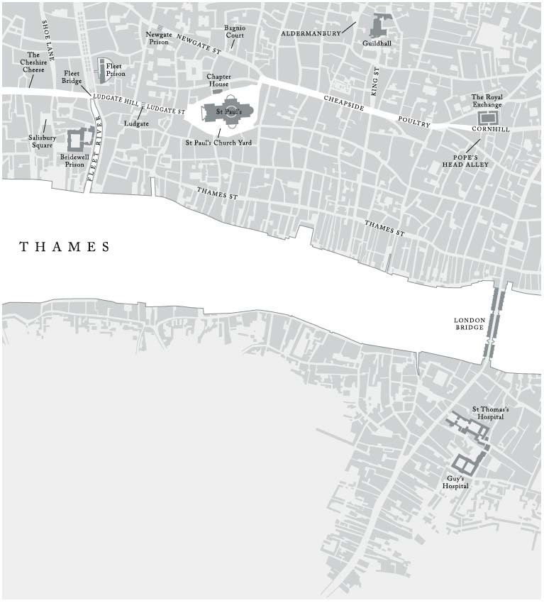
‘The sexual highway’: the heart of mid-eighteenth-century London, based on John Rocque’s map of 1746. Key locations of the city’s sex industry are shown, notably the bagnios, taverns and coffee houses in and around the Covent Garden Piazza, and the great sexual highway running from the Royal Exchange in the east, via the north side of St Paul’s Cathedral, to Charing Cross and St James’s in the west. Along this highway, which was also the great thoroughfare of trade and commerce, harlots would patrol, pick up clients and have sex in the alleys and courts off Fleet Street, the Strand and in St James’s Park. London’s other great east–west highway – the promenade of death – led from Newgate Prison, via Holborn, St Giles and Oxford Street, to the scaffold at Tyburn.