The province of Žemaitija covers about a quarter of Lithuania, and roughly corresponds with the Žemaitija Upland. The adjacent coastal area, known as Mažoji Lietuva or Lithuania Minor, stretches south into the Russian exclave of Kaliningrad. Although the ancient tribes probably took their names from the places they came from, the Žemaitijans (Žemaičiai) lived not in the Upland but around the mouth of the Nemunas, trading with the Aukštaitijans towards the river’s source. On this coast there is also archaeological evidence of Romans and Vikings, and of Bronze Age trade with Britain and the Mediterranean.
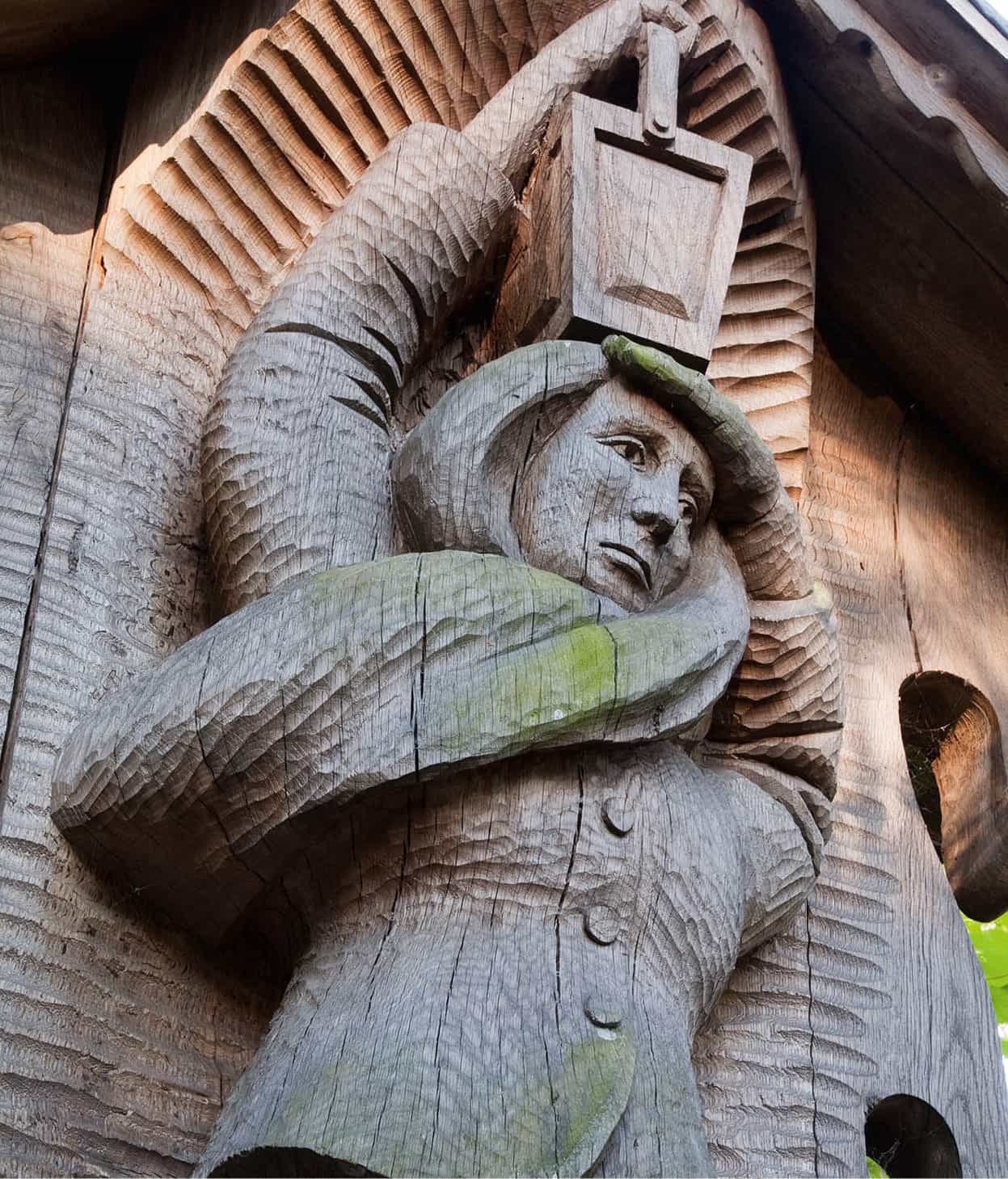
Neringa looks out for sailors at Witches’ Hill sculpture park.
APA Micah Sarut
A mysterious land
For 200 years the Žemaitijans had a running battle with the German crusaders of the Livonian Order who had established their Baltic base in Rīga, and with the Teutonic Knights who harried them from the west. Between 1382 and 1404 the Grand Dukes of Lithuania ceded Žemaitija to the knights, but in the 15th century it became a self-governing district and duchy.
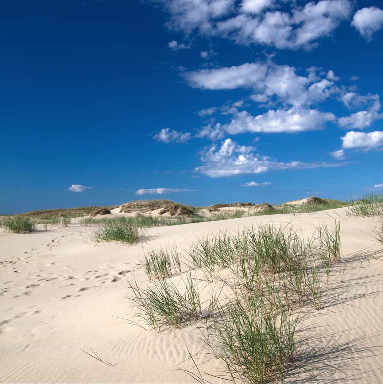
Sand dunes at Nida.
APA Micah Sarut
To outsiders Žemaitija long seemed a rather mysterious, wild and pagan land, an image enforced by the French dramatist Prosper Mérimée’s 1869 novel Lokis. The Žemaitijans maintain a strong regional dialect that’s a mystery even to many Lithuanian-speakers, and they keep their links with the past.
Inhabited by men of few words, this is not a land of songs. Most of the countryside is rather severe, and the western slope of the Upland is windier, foggier and wetter than elsewhere. The trees are mostly firs and once-sacred oaks, and the landscape is dotted with old wooden crucifixes in roadside shrines and cemeteries. The main motorway from Vilnius to Klaipėda via Kaunas is the well-maintained A1 (E85) dual carriageway. To the north and somewhat parallel to the A1 runs the A9 (E272) from Panevėžys, which becomes the A11 (E272) west of Šiauliai. The A12 (E77) runs horizontally to these roads and connects Šiauliai with Tauragė. Connecting the northerly town of Mažeikiai to southerly Tauragė (via Plungė) is the 164.
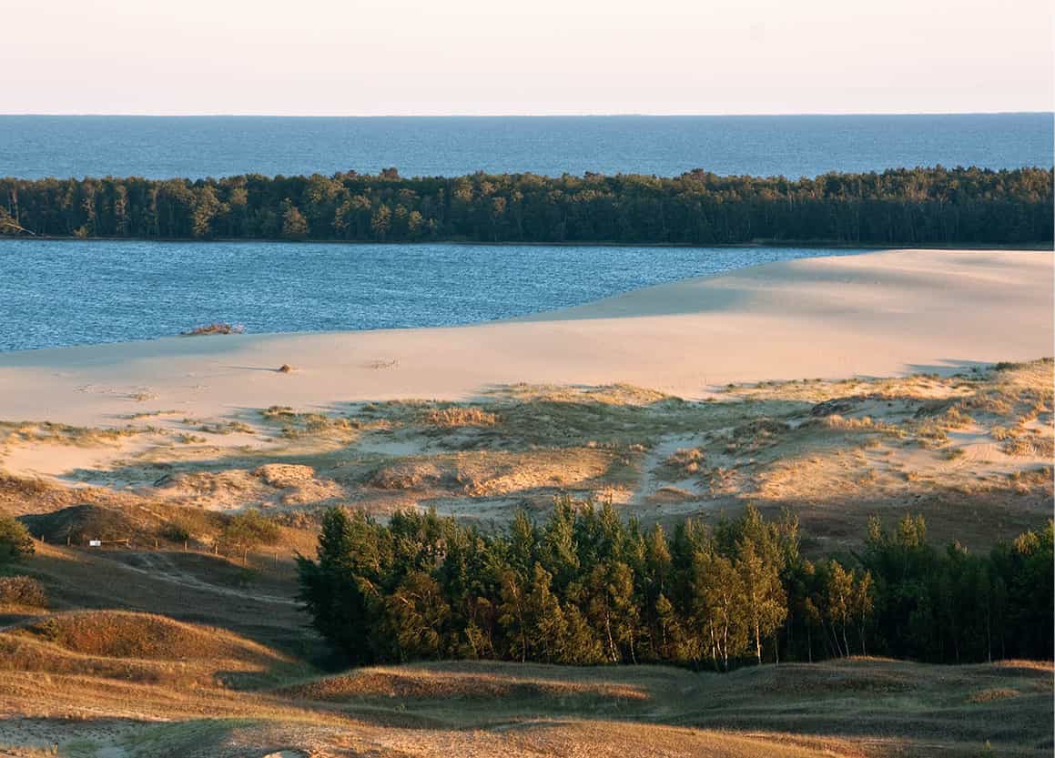
The coast near Nida.
APA Micah Sarut
Kaunas–Klaipėda Highway
The A1(E85) motorway from Vilnius via Kaunas to the coast is a lovely 311km (193-mile) stretch. There are a number of diversions not far from the main road should you want to explore lesser-known parts of the country. The first of these that falls within the Žemaitija region is Raseiniai º [map], 86km (53 miles) west of Kaunas and about 5km (3 miles) off the A1 on Route 146. This town is typical of the region and worth visiting for this reason alone. Historically significant, it was one of the focal points of the 1831 rebellion against the tsar. The 18th-century church and abbey is dedicated to the Assumption of the Holy Virgin (Švč. Mergelės Marijos Ėmimo į Dangų bažnyčia; Bažnyčios 2). Also of interest further into town and past the city’s park is the Raseiniai Regional History Museum (Raseinių krašto istorijos muziejus; Muziejaus 3; www.raseiniumuziejus.lt; Tue–Fri 9am–6pm, Sat 11am–4pm) in a former prison building, which includes photographs of prisoners from 1940–52 and exhibits about the area and the diaspora from this region. There is also an area dedicated to flax, national patterns, ceramics, early 20th-century household utensils and folk art. It’s worth seeing the Pasandravys Memorial Reservation (Bernotų ir Pasandravio village, same hours as above), the birthplace of the poet Jonas Mačiulis-Maironis (1862–1932) in a picturesque, wooden house of the Maironis family.
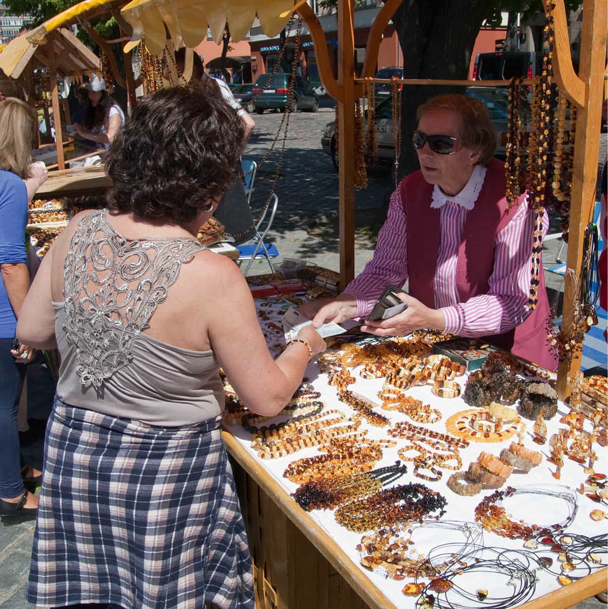
Amber for sale at Klaipėda.
APA Micah Sarut
Šiluva
About 17km (10 miles) north of Raseiniai on Route 148 is Šiluva ¡ [map], which has the beautiful twin-towered Basilica of the Birth of the Blessed Virgin (Švč. Mergelės Marijos gimimo bazilika; Jurgaičio 2), a Baroque building dedicated to the “Lourdes of Lithuania”. It is believed that in the mid-17th century the Virgin Mary appeared on a rock near the site of a former church which had been seized by Calvinists, and she wept for its destruction. Moved by these tears, a passing blind man was able to remember that a former church had stood on the grounds and he was able to locate both an icon of the Virgin and the original deed to the land, and through this apparent miracle he regained his sight. The existing church was returned to the Catholics. Although this miracle was historically advantageous, many still come here to worship. Large congregations attend services on major holidays to see both the icon, which is now partially covered in gold, and the holy rock.
Tytuvėnai ™ [map] is about 10km (6 miles) north on Route 148. The area surrounding the town is popular due to its lakes and forested areas. The 17th–18th-century Church of the Holy Virgin Mary (Švč. Mergelės Marijos bažnyčia) is one of the largest and most important religious houses in Lithuania, with a two-storey monastery, where concerts take place in summer.
Village detours
Heading out of Raseiniai, Route 196 runs parallel to the significantly faster A1, or you can return to the A1 via Route 146. About 5km (3 miles) outside the tiny settlement of Kryžkalnis there is a small sign for Bijotai village. Follow the signs towards D. Poška Hallowed Trunks (D. Poška Baubliai, May–Oct daily 9am–6pm, lunch break at 1pm, Nov–Apr Mon–Fri 8am–5pm, lunch break at noon), the first and oldest public museum in Lithuania, in order to find Dionizas Poška’s hollowed-out oak-tree trunks with pagan carvings in them.
Along the same road, heading away from the A1, is the town of Girdiškė. Its church, dedicated to the Virgin, has an oak altar with six main branches shooting upwards and intertwined. Continue along the road and circle around the church in the village of Upyna to return to the A1 at the town of Prienai via Gudirvės. Stasys Girėnas, the doomed transatlantic aviator, was born into a peasant family in 1893 in Vytogala, a little further west. He was the youngest in a family of 16 children. There is a small memorial museum in this village (Tue–Sat 9am–5pm).
Another detour from the A1 is along Route 164 towards the town of Rietavas, an ancient settlement (pop. approx. 3,000) centred around an old square. The main attraction is the Manor House and Estate of the Oginskis (Ogiński) Family housing the Culture History Museum of Rietavas Oginskiai (Rietavo Dvaras sodyba; Parko 10; www.oginskiriet.lt; Tue–Fri 9am–5pm, Sat–Sun 10am–3pm; free). From 1812 to 1909 they ruled over their own autonomous domain, with their own laws and even their own currency. In 1835 they granted civil rights to their peasants, organised agricultural exhibitions, promoted Lithuanian culture and written language, and started publishing the Lithuanian calendar. They established a music school in the town, and in 1872 mustered a famous brass band. The manor house is famous for being the first residential property in Lithuania to have electric lighting, courtesy of its own power station, in 1892, and the building is an intriguing place to spend an hour or so. In 1874 a beautiful church in the Venetian style was built on their orders by the Prussian architect Friedrich August Stüler.
The road continues through 50km (30 miles) of uninhabited forest. At Endriejavas there is a small lake and 8km (5 miles) to the north is the former village of Ablinga. On 23 July 1941 it was burnt down by the Nazis and its 42 inhabitants perished. A wooden sculpture has been erected to each of the dead.
Baltic coast
The coastal plain, Pajūris, is 15–20km (10–13 miles) wide and rises to around 40 metres (132ft). The landscape is diverse, consisting of fertile clay soils, dunes, sandy forests and wet bogs. In the south is the swampy Nemunas Delta and the 1,600-sq km (618-sq mile) and 4-metre (13ft) deep Curonian Lagoon (Kuršių marios). The coastline has urbanised resorts, around Palanga in the north, and in Neringa along the Curonian Spit (Kuršių Nerija), which like much of the area was part of Prussia’s Memelland. Neringa is not actually a town, but an administrative area with its capital at Nida, near the border with Kaliningrad at the southern end of the spit. The area has many miles of empty beaches and some nature reserves.
Klaipėda
Klaipėda # [map] is the main city on the coast, situated at the mouth of the River Danė at the far northern end of the Curonian Spit and Lagoon. It suffered colossal damage during World War II, when it was used by the Germans as a submarine base. Since the 1970s, when investment was ploughed into local industry, its population has dramatically risen and then fallen. It is currently around 149,000, making it the third-largest city in Lithuania. In 1252 the Livonian Order built a castle here, called Memelburg, and the city became known as Memel in German. Today the port city has a flourishing shipbuilding industry, a thriving expat community and ferry services to Germany and Sweden.
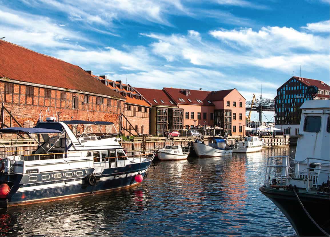
Klaipėda’s old town.
iStock
What is left of the Old Town is strung out along a small network of cobbled streets on the left bank of the Danė, where there are some decent bars and restaurants plus a few remaining half-timbered (Fachwerk) buildings. The area around Daržų and Bažnyčių streets is of special interest as it is peppered with craft workshops, small galleries and souvenir shops. The city also has two theatres, at one of which Hitler spoke from the balcony in March 1939 in the old town square, where the resurrected Annchen von Tarau statue now stands. The original, erected in 1912, was dedicated to the native Prussian German poet Simon Dach, and it is still a matter of debate whether it fell into the hands of the Nazis or Soviets.
Also of interest in the Old Town is the History of Lithuania Minor Museum (Mažosios Lietuvos istorijos muziejus; Didžioji Vandens 6; www.mlimuziejus.lt; Tue–Sat 10am–6pm), which houses all sorts of ethnic, archaeological and historical pieces related to the area and its former inhabitants. Most attention-grabbing are the eerie photographs of the city during World War II.
South of the Old Town is the Blacksmiths’ Museum (Kalvystės muziejus; Saltkalvių 2a; www.mlimuziejus.lt; Tue–Sat 10am–6pm), which is both a museum and a working smithy, where perspiring blacksmiths forge all types of ironwork.
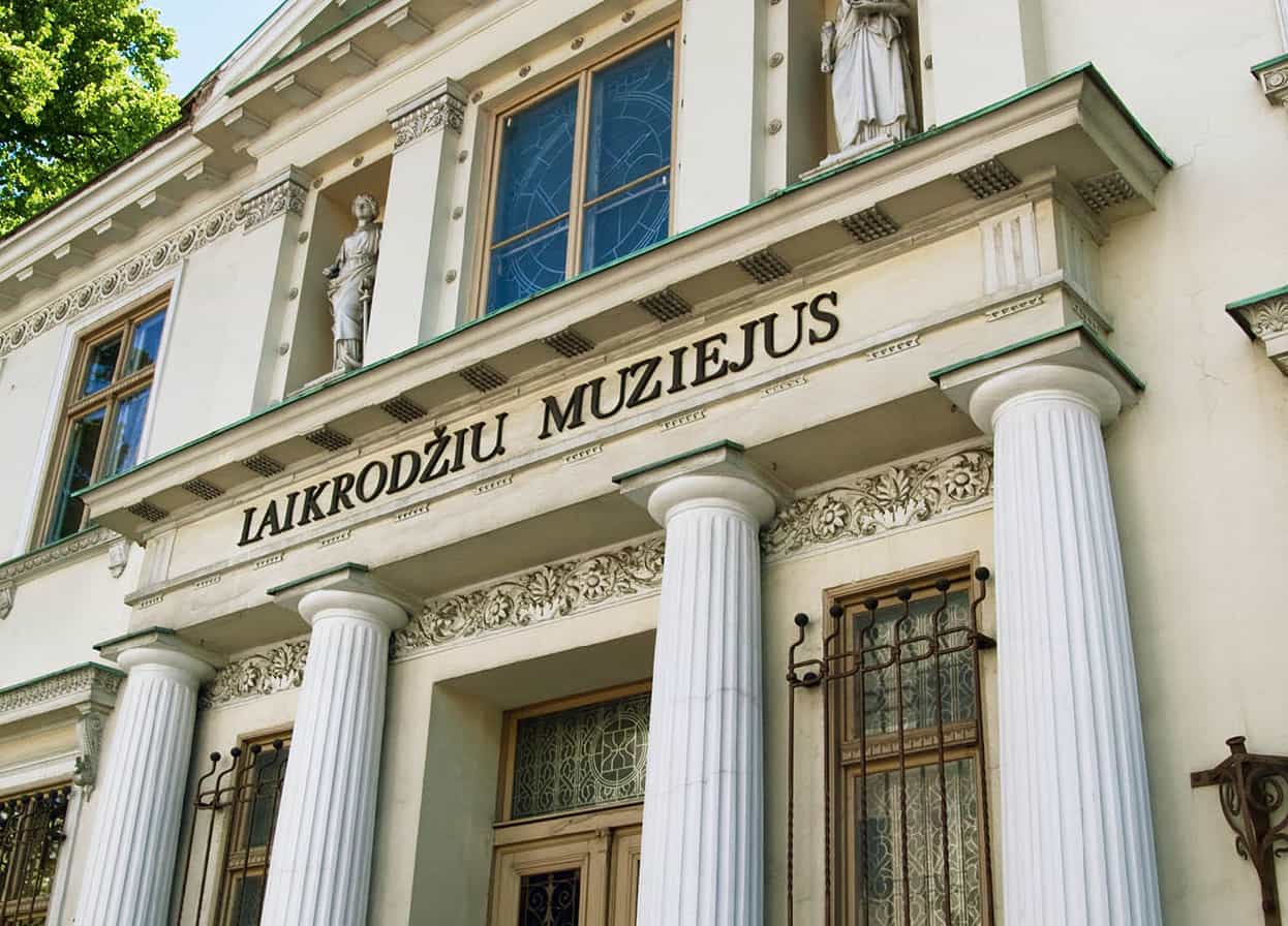
Klaipėda Timepiece Museum.
APA Micah Sarut
On the other side of the Danė, the Klaipėda Clock and Watch Museum (Klaipėdos laikrodžių muziejus; Liepų 12; www.ldm.lt; Tue–Sat noon–6pm, Sun noon–5pm; guided tours available in English) is another strangely satisfying museum. Centred around clocks and how they are made, it displays mechanisms from sundials to atomic clocks. In the rear courtyard is a splendid sundial.
Almost next door at Liepų 12 is the magnificent, 19th-century neo-Gothic Post Office. A 48-bell carillon in its tower is played to startling effect by local enthusiasts every Sunday at noon.
Drink
When in Klaipėda, have a glass of Švyturys beer. The brewery has been here since 1784, and its reputation in recent years has been spreading.
Sculpture park
Continuing along Liepų leads to the M. Mažvydas Sculpture Park (M. Mažvydo skulptūrų parkas; www.mlimuziejus.lt), which is bordered by Daukanto, Liepų and Trilapio streets. The park was the city’s main cemetery until the 1970s, when it was closed. Some of the crosses were salvaged and are now housed in the Blacksmiths’ Museum. The 10-hectare (25-acre) park, which contains around 180 sculptures by more than 50 artists, is a nice way to come across many and disparate styles of sculpture, most with more than a touch of whimsy. In the far northern section of the park is the wonderfully bombastic Monument to the Port Liberators (Paminklas uostamiesčio išvaduotojams), depicting the Soviet military in all its glory and unveiled in 1980 to commemorate the liberation of the city from the Nazis on their final push to Berlin.
Palanga
At 33km (20 miles) and 46km (29 miles) north of Klaipėda on the A13 respectively are the two resorts of Palanga and Šventoji. An old settlement of fishermen and amber-gatherers, Palanga ¢ [map] became popular in the late 19th century when it developed as a spa and health resort. Considered the wildest of the resorts on the Lithuanian coast, Palanga still manages to maintain its charm even with the heavy influx of hotels, restaurants and bars that open their doors the moment the weather turns warm.
Meilės alėja (Lover’s Lane), which runs parallel to the Baltic Sea, and Basanavičiaus, which leads into the pier, are the two most popular places to take a stroll, especially as the sun is setting. A trip to Palanga without watching the sun set over the sea is a wasted trip indeed.
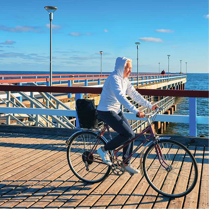
Palanga waterfront.
Shutterstock
Despite the bars and cafés touting karaoke, drinking contests or just playing loud thumping music that leaves the sound of the ocean unheard, peace reigns in some parts of the resort. One of the best places to visit besides the beaches is the 110-hectare (272-acre) Botanical Park (www.pgm.lt), which lies alongside the Baltic Sea. In summer, concerts take place regularly throughout the park, where there are more than 500 plant species, dominated by pine trees.
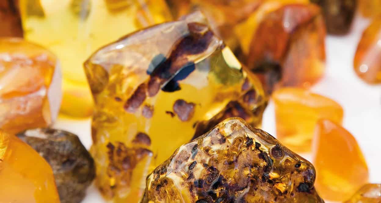
You can buy amber from various vendors along Nida’s waterfront.
Getty Images
Amber
Amber is interwoven in Lithuanian folklore, and leaving the country without a piece or two is bordering on sin.
There is amber everywhere in the southern half of the Baltics. At any opportunity, stalls are set up to sell bracelets, necklaces, earrings, key rings and brooches. In its raw state, buffeted by tides and exposed to the elements, these are dull stones, scattered like pebbles the length of the beaches. People are always on the lookout for them, particularly after storms, though most of the amber bought today will have been dug out of the ground by excavators in Kaliningrad.
Amber is not, in fact, a stone, but fossilised resin of primeval pine trees. The amber deposit, dating back 40 million years, forms a seam 60–90cm (2–3ft) thick beneath the surface of the seabed. In spring, fishermen used to comb the beaches with large nets to pull in flotsam that might contain amber. The Curonian Lagoon was also a source of it. In the 19th century Juodkrantė was known as Amber Cove: the Stantien and Becker company used to dredge up to 85 tonnes of it here every year.
Unusual attraction
The stone’s peculiarity is that, while it was sticky resin, insects were attracted to it, and it often solidified while they were trapped by its surface. If you hold a polished stone to the light you will see flies and mosquitoes perfectly preserved inside. The 18th-century English poet Alexander Pope wrote:
Pretty! in amber, to observe the forms
Of hairs, or straws, or dirt, or grubs or worms;
The things, we know, are neither rich nor rare,
But wonder how the devil they got there.
Amber was a commodity that the earliest tribes could easily trade: according to Tacitus, the price it fetched astonished them. It has been found in the tombs of Mycenae, and Tutankhamun’s treasure included an amber necklace. The Baltic shoreline was first called the Amber Coast by the ancient Greek poet Homer, who described the brilliant “electron” on his warriors’ shields. The best place to see amber is at the Amber Museum in Palanga.
A palace of amber
A local legend tells how “Lithuanian gold” was created. There was once a Baltic queen named Jūratė who lived in a submarine palace made of amber. She was to be the bride of Patrimpas, god of water, but she fell for a mortal fisherman called Kastytis whom she visited in his hut on the banks of the Nemunas near Klaipėda at sunset every night for a year. The liaison came to the attention of Perkūnas, god of thunder, and in a rage he threw down bolts of lightning, killing Jūratė and shattering her amber palace into 10,000 pieces. Perkūnas then punished Kastytis by binding him to a rock on the seabed. It is said that when the west wind blows Kastytis can be heard moaning for his love, and when the wind dies the shore is strewn with fragments of Jūratė’s palace.
Even today many people hope to find the scattered pieces of the precious palace. According to the cogniscenti, the best time to look for amber on the Baltic beaches is after a storm, early in the morning. However, it takes a lot of experience, patience and a bit of luck to find a nugget of the Baltic gold.
Amber Museum
In the centre of the park is Count Tiškevičius’s mansion, which is now home to the Amber Museum (Gintaro muziejus; Vytauto 17; www.pgm.lt; June–Aug Tue–Sat 10am–8pm, Sun 10am–7pm, Sept–May Tue–Sat 11am–5pm, Sun 11am–4pm). After touring the museum there will be no question left unanswered about Baltic gold. Numerous pieces of amber contain particles of animal or vegetable life, which adds to their fascination. Behind the mansion is a garden full of fragrant roses.
Also in the park is Birutė’s Hill (Birutės kalnas), the tallest point in town and on which a small chapel now stands. The hill is considered to be a former pagan shrine, and the presence of a large oak – sacred in local pagan tradition – at the foot of the hill supports this theory. In the middle of the park sits one of the most famous statues in the town, of the mythical Eglė. According to the legend, Eglė met an enchanted lake-living prince during a swim. The two married, had children and tried to live happily ever after in their lake. However, when Eglė brought her children to meet their grandparents, her brothers killed her husband. In despair Eglė turned herself and her children into trees.
Another worthwhile stop is the Antanas Mončys House Museum (Antano Mončio namai muziejus; Daukanto 16; www.antanasmoncys.com; May–mid-Sept Wed–Sun 2–7pm, mid-Sept–Apr Wed–Sun 11am–5pm). All the wooden pieces by the sculptor (1921–93) can be handled by visitors; in fact, the artist requested this in his will.
Šventoji ∞ [map], a little further up the coast, is a quieter resort. On the mouth of the small River Šventoji, it is famous for its sand dunes, beach and bogs. Shown on Hansa maps, it became a resort at the beginning of the 20th century. A community of small cottages and simple houses, this is the place to go if you want peace and quiet.
Tip
To rent a boat for the lagoon or for the open sea, with or without a skipper, contact the Klaipėda Yacht Club, Smiltynės, Klaipėda (tel: 4639 1131).
The Curonian Spit
The Curonian Spit (Kuršių Nerija) is named after the Curonians (Kuršiai), an ethnic group who lived in the region from the 5th to the 16th century. It was formed about 5,000 years ago and geologically it is the youngest part of the country. It has no rivers, a few lagoons and along its shore lies a chain of man-made beaches and dunes. A bird’s-eye view is a wonderful picture of white, sandy hills against a dark blue background, and it was the sight of these extraordinary dunes that inspired the German naturalist Alexander von Humboldt to write in 1809: “[the] Curonian Spit is such a peculiar place as Italy or Spain. One must see it to give pleasure to one’s soul.” It was awarded Unesco World Heritage Site status in 2000.
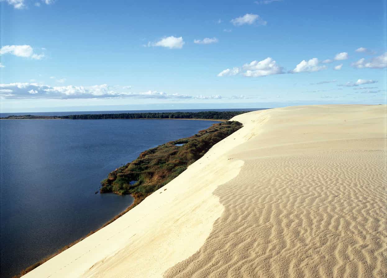
Curonian Spit, located close to Nida.
Lithuania State Dept of Tourism
Winds formed the long, narrow coastal spit no more than a mile wide and 60 metres (200ft) high. It runs 98km (60 miles) from Klaipėda south to Kaliningrad; 51km (32 miles) of the spit are in Lithuania. The lagoon on the inland side is formed by the mouth of the Nemunas. On the tip of the spit opposite Klaipėda is Smiltynė, reached by regular ferries from the port.
The Lithuanian Sea Museum and Dolphinarium (Lietuvos jūrų muziejus delfinariumas; Smiltynės 3; www.muziejus.lt; June–Aug Tue–Sun 10.30am–6.30pm, Apr–May and Sept Wed–Sun 10.30am–5pm, Oct–Jan Fri–Sun 10.30am–4.30pm, Feb–Mar Fri–Sun 10.30am–5pm) is home to a number of seals, penguins and dolphins. The Dolphinarium has 40-minute-long dolphin shows (July–Aug Tue–Sun at 11.30am, 1pm, 3pm, 4.30pm, June Tue–Sun at noon, 2pm, 4pm, Apr–May noon, 3pm, Sept Wed–Sun noon, 3pm, Oct–Mar Fri–Sun noon, 3pm), especially enjoyable for younger visitors. Nearby is Klaipėda Yacht Club, one of the venues of Klaipėda’s annual Sea Festival.
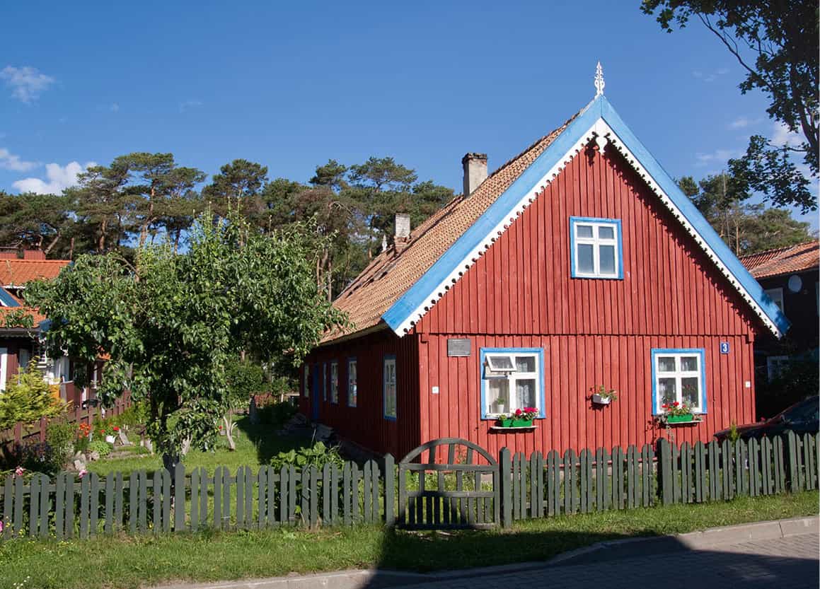
A typical late-19th century house.
APA Micah Sarut
Lagoon-side villages
Most of the peninsula, however, lies to the south, where all tourist traffic needs to pay a toll. All the little villages along here face the lagoon. Until 1992, the white sandy coast was occupied by the Soviet Army. Shifting sands have meant many of the villages have constantly been on the move. During the 18th and 19th centuries more than a dozen were affected, some of them covered over by sand. Pervalka and Preila are typical small seaside communities with signs for žuvis (fish) and locals quietly going about their business. Juodkrantė is larger and has a harbour once known as Amber Cove because of the amount of the material that was dredged up for the local industry.
Witches’ Hill
Also of note when driving through town is Witches’ Hill (Raganų kalnas), which was established in the 1980s by a group of local sculptors. This large wooden sculpture park filled with fabled figures – such as the main pagan god, Perkūnas, and Neringa, a local girl who became a giant and helped sailors in trouble – makes a pleasant excursion through the pine trees. This spot is especially appreciated by children, as some of the sculptures double as slides and see-saws. Look for the sign on your right as you are heading south through town. A walk beside the lagoon path with its stone sculptures provides a pleasant contrast.
Nida
At the southern end of the spit, just before the border with Russian Kaliningrad, is Nida § [map], which has moved several times to escape the mobile sand. This is the largest of the resorts (pop. approximately 2,400, rising to more than 10,000 in summer), with the best facilities. It is the sunniest and most famous place on the Lithuanian part of the peninsula.
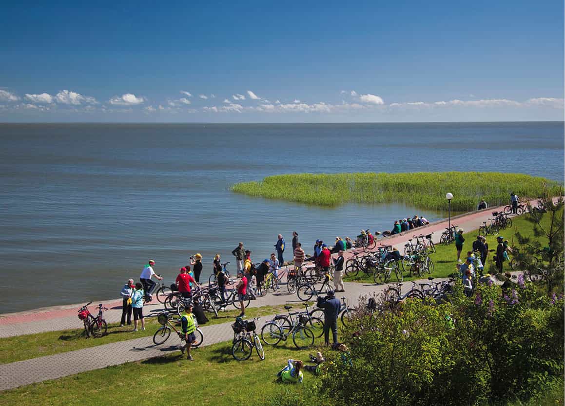
Cyclists gather on Nida’s waterfront.
Getty Images
Nida has a distinctive landscape, created by the wind and the sea. White sand dunes stretch away like a desert to the south, and trunks of trees show where ancient forests once flourished. It is known among Lithuanians as a place where the landscape forces you to take stock of your life. The area is fantastic, and exploring the dunes is an integral part of any visit. Because of the fragile ecosystem, however, it is forbidden just to traipse through them. Instead, visitors are asked to walk through the forest at the end of Naglių to view them or to walk alongside the beach and then climb the steps.
Those who plan on visiting the area’s beaches should pay particular attention to the signposting as some are women-only, others are men-only. According to local custom, however, men are allowed to cross women-only beaches if they are close to the water and not disruptive.
To find out more about local life, there is a small recreated fisherman’s house, the Nida Fisherman’s Ethnographic Homestead (Nidos žvejo etnografinė sodyba; www.neringosmuziejai.lt; June–Aug daily 10am–6pm, Sept–May Tue–Sat 10am–5pm) from the 19th century at Naglių 4. For some local shopping and further information, head for the Amber Gallery (Gintaros galerija; Pamario 20; www.ambergallery.lt; daily June–Aug 9am–8pm, Apr–May and Sept 10am–7pm). Further along is the Curonian Spit History Museum (Kuršių nerijos istorijos muziejus; Pamario 53; www.neringosmuziejai.lt; June–Aug daily 10am–6pm, Sept–May Tue–Sat 10am–5pm), which houses amber figures from the Stone Age as well as numerous exhibitions chronicling life on the spit as it used to be. The writer Thomas Mann lived in Nida for three consecutive summers between 1930 and 1933. There is a museum in the house he had specially built, the Thomas Mann Memorial Museum (Thomo Manno memorialinis muziejus; Skruzdynės 17; www.neringosmuziejai.lt; May daily 10am–5pm, June–Sept daily 10am–6pm, Oct–Apr Tue–Sat 10am–5pm). There is also a cultural centre that organizes Thomas Mann festival in July.
Tip
Look out for the signposts indicating that some beaches are for women only, some only for men, and others are for both. Men caught loitering on women-only beaches will often be chastised and herded off by a group of half-naked grannies.
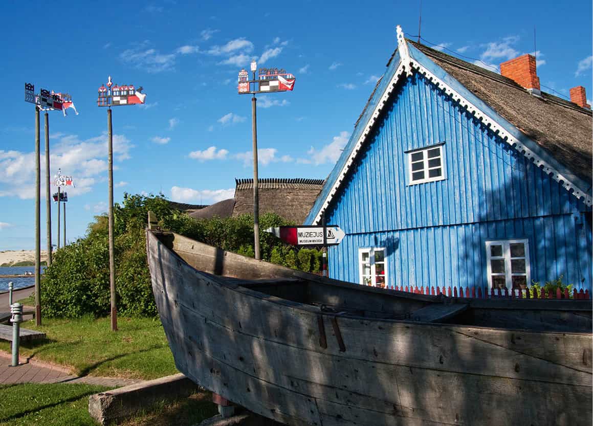
An old fishing boat faces out to sea beneath the local village coats of arms.
APA Micah Sarut
Nemunas Delta
From Klaipėda, Road 141 runs southeast through Šilutė and Pagėgiai, following the north bank of the Nemunas to Kaunas. From the small town of Priekulė, Road 221 goes south, past the fishing village of Kintai, as it enters the Nemunas Delta Regional Park (Nemuno deltos regioninis parkas; www.nemunodelta.lt), an area of islands and waterways teaming with fish, and a main port of call for migrating birds.
Among the typical fishing villages here are Mingė, the “Venice of Lithuania”, where the River Minija serves as its main street, and Skirvytėlė, whose traditional houses are made of timber and reeds and include an ethnological farm museum.
At the western edge of the park is Ventės Ragas ¶ [map], marked by a lighthouse built in 1863. The main reason for coming to this backwater is the wildlife. An important bird-ringing centre, which keeps track of the many coastal migrants, has been operating here since 1929. It has vast bird-catching nets. A small museum with erratic opening times has display cases of stuffed birds.
From Saugos the 141 falls down into the Nemunas Delta plain, passing through Šilutė • [map] on the River Šyša. The town of Šilutė spent most of its time under German rule and was only integrated into Lithuania in 1923. Most of its economy centres on textiles, livestock and machinery plants. The city has its own museum (Šilutės muziejus; Lietuvininkų 36; http://silutesmuziejus.lt; Tue–Fri 10am–6pm, Sat 10am–4.45pm), which displays a vast amount of ethnic costumes, weaponry, folk art and photographs.
In the village of Macikai, just off the 141 to the east of Šilutė, the former Stalag Luft VI prisoner-of-war camp for Allied airmen, and later a KGB prison for Lithuanian dissidents, opened to the public in 1995. There are photographs and lists of prisoners along with their journals and drawings. The eerie and harrowing museum (http://silutesmuziejus.lt; by appointment, tel: 4416 2207) is not suitable for youngsters.
Fact
Lithuania’s national bird is the stork, seen in large numbers from April to September. Every spring and autumn around a million birds of many species pass over the Nemunas Delta.
Island town of Rusnė
Just west of Šilutė in the Nemunas Delta is 45-sq km (17-sq mile) Rusnė ª [map], Lithuania’s only island town, which rises just 1.5 metres (5ft) above sea level. It has a community of around 3,000, who earn a living by fishing and breeding cattle. The main town for the Nemunas Delta Regional Park, it has information on hiring boats and bikes. There is also an ethnographic fisherman’s farmstead (Skirvytėlės 8; by appointment, tel: 4415 0010), which shows an authentic farmhouse of Lithuania Minor.
The next town of any size on the 141 is Pagėgiai, 38km (22 miles) south of Šilutė. During World War II, in the forest to the west behind a tangle of barbed wire, the Germans kept prisoners of war under the open sky: 10,000 of them died. The ground is very hilly, and prisoners tried to bury themselves to escape the cold. From Pagėgiai the A12 (E77) goes 32km (20 miles) northeast to Tauragė, which gave its name to the Tauragė (Tauroggen) Convention, signed in 1812 between General Yorch for Prussia and General Diebitsch for Russia in Požeronys Mill: a monument records the event. The A12 joins with the Kaunas–Klaipėda (A1) highway.
Tip
You can hunt, fish and go horse riding in Žemaitija National Park (www.zemaitijosnp.lt/en), or rent boats and catamarans from the yacht club in Plateliai (Yacht Club: Ezero Street 40; tel: 6156 7354; http://www.plateliuose.lt).
North Žemaitija
One of the most interesting diversions in northern Žemaitija is the regional capital of Kretinga q [map] (pop. 17,000). Although parts of the city are not particularly eye-catching, all is made up for by the Kretinga Museum (Kretingos muziejus; Vilnaus 20; www.kretingosmuziejus.lt; Wed–Sun 10am–6pm, winter garden June–Aug Mon 10am–6pm, Tue–Sun 10am–8.30pm, Sept–May Tue–Fri and Sun 10am–6pm, Sat 10am–7pm). It is housed in a former mansion of Count Tiškevičius (Tyszkiewicz, 1814–73) and has collections of numerous Žemaitijan craftwork and articles belonging to the count and his family. There are also objects found from archaeological digs displayed in the cellar. The winter garden (Kretingos Žiemos Sodas) is one of the most spectacular displays in the area; it is covered by plants, their leaves regularly dusted by women attendants. The indoor café adds to the experience. The town has an important Franciscan monastery, founded in 1602, and concerts are sometimes given in its courtyard.
On the A11 (E272) between Kretinga and the next main town of Plungė is Kartena w [map], situated in the beautiful valley of the Minija. It has a 19th-century wooden church, which is dedicated to the Assumption of the Virgin (Kretingos 4).
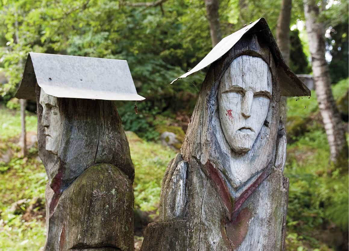
Artwork at Gargždelė.
APA Micah Sarut
Before reaching Plungė, an interesting diversion can be found by turning north on Route 169 towards Salantai. Here in the village of Gargždelė e [map] is the Orvidas Farmstead Museum (www.orvidusodyba.lt; 10am–7pm June–Aug Tue–Sun, Mar–Apr and Nov Sat–Sun, May and Sept Wed–Sun, Oct Thu–Sat), a tribute to all things wacky, serious and religious. The owner’s eccentric son, Vilius Orvidas (1952–92), is now considered part of the Naïve artist movement, and the area around the farmhouse features an arresting amount of carved stones, boulders, rescued crosses and other pieces of art he created during his short life.
Mosėdis
An even more bizarre diversion is to be found further north in the town of Mosėdis r [map] at the Vaclovas Intas Museum of Rare Stones (Akmenų muziejus; Salantų 2; www.akmenumuziejus.lt; Apr–Oct daily 9am–7pm, Nov–Mar Mon–Thu 8am–5pm, Fri 8am–3.45pm, lunch break noon), which is a collection of more than 20,000 stones and rocks from around the world. The point of this rock gathering may have most people scratching their heads, but the sheer willpower inherent in this museum’s existence does have a certain appeal. Interestingly, many of the rocks have not enjoyed their captivity and spilled out over the town.
Plungė t [map] (pop. 17,000) is a little larger than Kretinga and a centre of light industry and administration, with a long tradition of folk art. It became rich after the Oginskis (Ogiński) family arrived to buy up the local manor. They enlarged and cultivated the 18th-century park that surrounds the manor, and in 1879 entrusted the architect Karl Lorens with the building of a neo-Renaissance palace imitating the 15th-century Palazzo Vecchio in Florence. In 1889 they also sponsored the education of the painter and musician M.K. Čiurlionis. Today the building is the Žemaitija Art Museum (Žemaičių dailės muziejus; Parko 1; www.zdm.lt; May–Oct Tue–Sun 10am–7pm; Nov–Apr Tue–Sat 10am–5pm), which houses mostly paintings executed by Žemaitijan artists either living in Lithuania or abroad. There is also a small area dedicated to the folk art of the region.
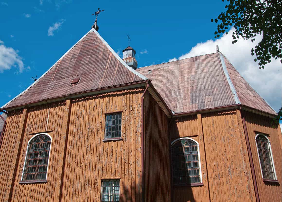
An 18th-century wooden church on the shores of Lake Plateliai.
APA Micah Sarut
Žemaitija National Park
Due east of Salantai is Plateliai, the heart of the Žemaitija National Park (Žemaitijos nacionalinis parkas) and its main tourist information centre (Didžioji 8; www.zemaitijosnp.lt). Though lying 146 metres (480ft) above sea level, there is a large lake beside it: Lake Plateliai (Platelių ežeras) is nearly 12 sq km (5 sq miles) in size and 46 metres (150ft) deep, and it has seven islands. There are boating facilities on its western side near the town, where there is an 18th-century wooden church and a ruined manor.
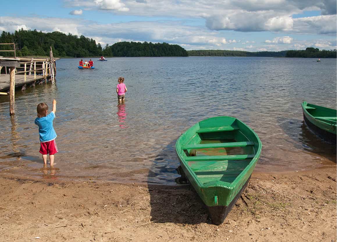
Lake Plateliai.
APA Micah Sarut
Other attractive small towns in this region, which is rich with festivals and calendar customs, include Alsėdžiai and Seda and Žemaičių Kalvarija, a pretty village that has 10 days of pilgrimage celebration every July.
Telšiai, on the A11, is an industrial town with a population of almost 24,000, but before World War II it was an important religious and cultural centre for both Catholics and Jews, with a bishop’s see and seminaries for priests and rabbis. It still has a school of applied art and the Alka Museum (Žemaičių muziejus Alka; Muziejaus 31; www.muziejusalka.lt; Mon–Thu 8am–5pm, Fri 8am–3.45pm, lunch break noon), featuring the usual collections of local interest as well as the extraordinary, recently rediscovered photographs of the local Jewish salon photographer Chaimas Kaplanskis (Chaim Kaplan, c.1860–1935).
On the southeast of the town is Rainiai Forest (Rainių miškelis), where 73 Lithuanian nationalists and Nazi collaborators were executed by the KGB in 1941; 50 years later a chapel was built in their remembrance. East from here is Luokė, famous for its folklore festivals, and Lake Germantas (Germanto ežeras), where there are holiday facilities and an airfield for pleasure flights.
Šiauliai
Heading east, at the junction of the A11 and A12, Šiauliai y [map] (pop. 100,000), Lithuania’s fourth-largest town, is an industrial centre, of shoes, textiles and, notably, bicycles, and there is a Bicycle Museum (Dviračių muziejus; Vilniaus 139; www.ausrosmuziejus.lt; Tue–Fri 10am–6pm, Sat 11am–5pm). There is also a Museum of Radio and Television (Radijo ir Televizijos muziejus; Vilniaus 174; www.ausrosmuziejus.lt; Wed 10am–7pm, Thu–Fri 10am–5pm, Sat 11am–5pm). Šiauliai’s vast 17th-century cathedral was rebuilt in 1954, as, like most other buildings in the town, it was flattened in World War II. Its spire is one of the tallest in the country. To the south are picturesque hills and lakes around Bubiai and Kurtuvėnai.
Hill of Crosses
Šiauliai is most famous for the Hill of Crosses u [map] (Kryžių kalnas, www.hillofcrosses.com), which lies in the countryside about 14km (9 miles) to the northeast on the A12 (E77). Nobody is sure of its origins, but it has been a religious site since at least the end of the 19th century. People come from all over the world to add their crosses to the thousands already here. The sight is nothing short of awe-inspiring. The hill itself is only a small hump. The Soviets bulldozed it three times, the first time in 1960, destroying an estimated 5,000 crosses. Each time they reappeared and today there are thousands of crosses, rosaries, pebbles, branches and other offerings.
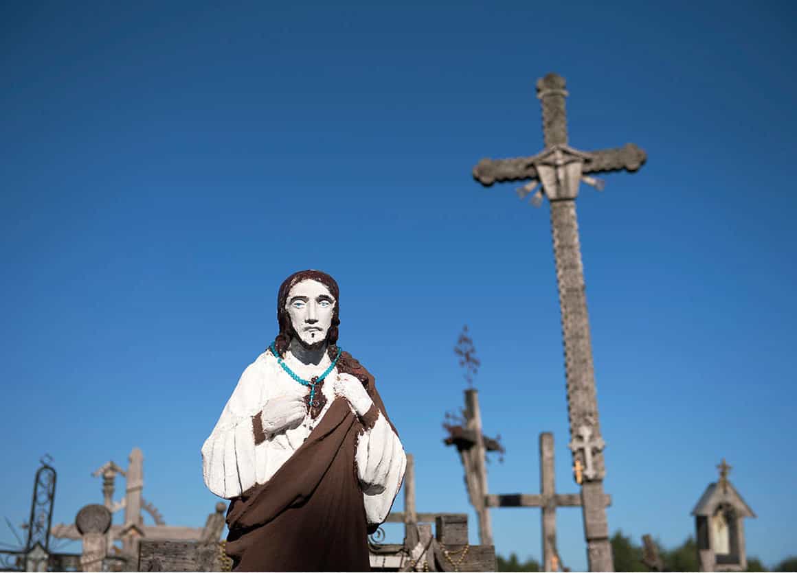
The striking sight of the Hill of Crosses.
iStock
The large statue of Jesus at the entrance was a gift from the late Pope John Paul II during his visit in 1993. The Pope subsequently encouraged Italian Franciscans to build a monastery for Lithuanian novitiates, and this opened in 2001 on the north side of the hill. The monastery is also open to pilgrims. The annual pilgrimage to the hill takes place on the third Sunday in July.