DISTANCE: 2.5 miles (4km)
TIME: 2 hours
START: Crissy Field
END: Fort Point
POINTS TO NOTE: Fort Point is closed Mon–Thur. A wide, fully accessible trail is convenient for wheelchairs and strollers. For a quieter and less blustery walk, do this tour in the early morning, as the wind generally picks up by mid-day. To get within four blocks of the tour’s starting point, take the 30 bus to Broderick and Jefferson streets. To return downtown from Fort Point, take the 28 bus to the Marina and transfer to the 30.
Perhaps the most photographed bridge in the world, the iconic Golden Gate Bridge, painted in “International Orange,” is certainly one of the world’s most famous. Numerous movies have featured it as a backdrop or contain scenes filmed on the bridge (for more information, click here). No trip to the city is complete without at least a visit to its base if not a walk or drive across it.

The Golden Gate Bridge seen from Baker Beach
Dreamstime
GOLDEN GATE PROMENADE
Begin at Yacht Road, north of Marina Boulevard. Head northwards along the bayfront promenade, enjoying stiff, salty breezes as you ramble along Crissy Field 1 [map], a restored tidal marshland with 22 acres (9 hectares) of dunes. It was once the airfield of the Presidio army base, and was named after military aviator Major Dana H. Crissy. With its flat, tidy trail and great views, it is a popular spot with locals and visitors alike, who come to walk, run, and bike, or simply to relax with a picnic and watch the expert windsurfing and parasailing taking place at the East Beach. You can also legally fish or crab without a license at Torpedo Wharf at the west end of Crissy Field. Look for posted regulations.
Crissy Field is also part of the 1,491-acre (603-hectare) Presidio (bordered by Lyon Street and West Pacific Avenue; www.nps.gov/prsf; free). A military post for over 200 years, the Presidio today is a shoreline park boasting beaches, cliffs, woods, historical sites, a golf course, a lake, 14 miles (23km) of paved roads, and 11 miles (18km) of hiking trails.

Fort Point
Dreamstime
FORT POINT
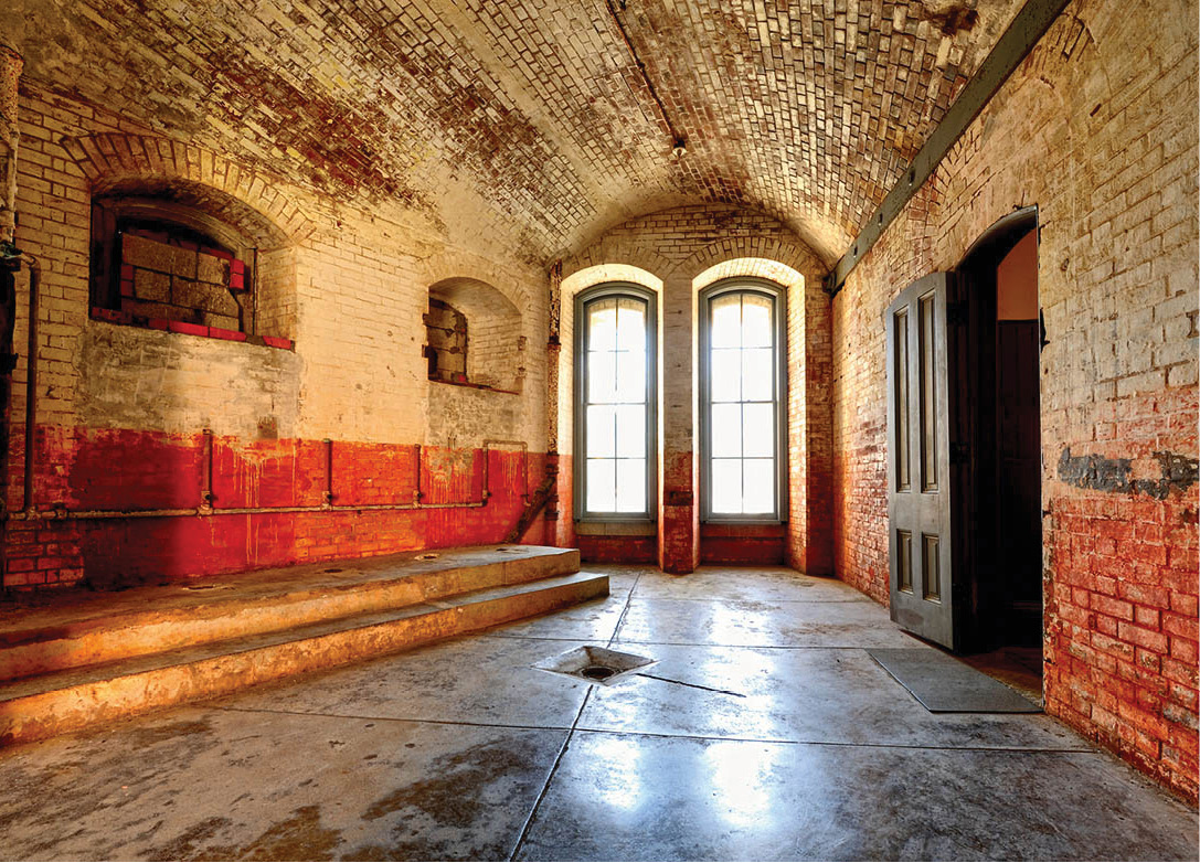
At the intersection of Long Avenue and Marine Drive are the administrative offices of Fort Point (Marine Drive; www.nps.gov/fopo; Fri–Sun 10am–5pm). Here you may take a break at the Warming Hut 1, and smooth your windblown hair. Follow Marine Drive to its end to reach Fort Point 2 [map], a massive structure that’s been called the “the pride of the Pacific,” “the Gibraltar of the West Coast,” and “one of the most perfect models of masonry in America.”
Fort Point is significant for its military and maritime history as well as its architecture. Built between 1853 and 1861, during the height of Gold Rush, Fort Point was designed to stand sentry and protect against foreign attack on San Francisco Bay.
Highlights
A collection of exhibits and information relating to the fort’s construction is found on the first floor. The floor above contains exhibits on the Fort Point lighthouses, African-American Buffalo Soldiers of the Civil War, and the roles of women in war. On the third floor, look for a photo exhibit of the Golden Gate Bridge’s construction, for which Fort Point was the headquarters. Films also recount the construction of the fort and its history from 1776 through World War II.
Free 30-minute tours (call for times) leave from the front entrance, and special programs are offered, such as a demonstration of how a Napoleon 12-pounder cannon would be loaded and fired during a Civil War artillery drill.

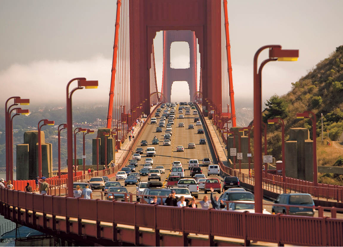
The bridge has six lanes of traffic and a sidewalk for pedestrians and cyclists
Nowitz Photography/Apa Publications
GOLDEN GATE BRIDGE
Fort Point offers a unique vantage point from its location beneath the Golden Gate Bridge 3 [map] (www.goldengatebridge.org). Work on the suspension bridge started on January 5, 1933, and was finished on May 27, 1937. More than 100,000 tons of steel were used, and its construction involved 25 million person-hours and the accidental death of 11 workers. It was the first bridge in the world to experiment with one-way toll collection. When the city celebrated the Golden Gate’s 50th anniversary, some 300,000 admirers made their way onto the bridge. It was the heaviest load the bridge had experienced in its history, and onlookers were shocked as the structure visibly sank beneath their weight.
Follow the signs to climb the bluffs to the bridge’s toll plaza. The walk across the bridge is 3 miles (3km), and pedestrian access to the bridge is permitted during daylight hours only. (Note: there is no public transport stop to return to the city on the Marin side on weekdays, and pedestrians and cyclists share the same sidewalks.)
Misleading Name
Despite its name, the Golden Gate Bridge is actually painted a burned orange. The original plan was to paint the approach pylons on either side of the bridge gold, but no one ever took that idea seriously. The chief engineer, who thought most bridges, rather boringly, were painted gray, had suggested a silvery aluminum color, much like the color chosen for the 1936 Bay Bridge, though the final color is thought to be the responsibility of Irving Morrow, the bridge district’s consulting architect, who was also responsible for the elegant Art Deco design. Known as “International Orange,” the hue is a unique blend of orange and black paint that does look rather golden when the sun sets behind it.
Food and Drink
1 Warming Hut
983 Marine Drive; daily 9am–5pm; $
The bright café is the perfect place to rest and recharge after a windblown walk along Crissy Field. Get toasty with a hot cup of coffee, fresh pastries, sandwiches, and other offerings with an emphasis on fresh, organic ingredients. Then browse the store selling books and gifts with an environmental theme.
The Bay area

