These 15 miles of beachfront property are among the best miles of trail in the whole national park system.
With due respect to the sugar-sand beaches of the world, we like our coastal treks wild, rugged, and with more than a chance of rain.
You could parachute into any of the park's 73 miles of coastline and have the trip of a lifetime, but the very northern tip of the beach gets the nod for its density of sea-sculpted rocks, gritty scrambling, and the oasis of Shi Shi Beach.
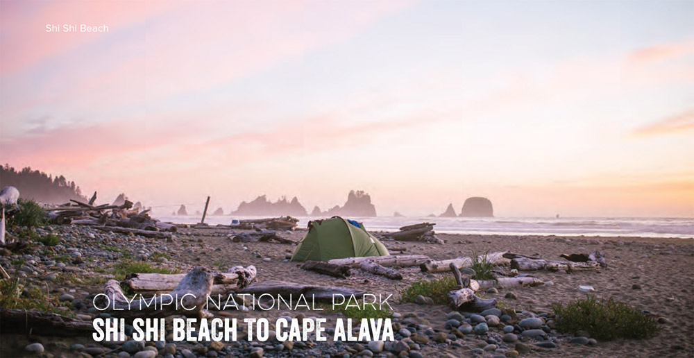
After 2 miles of Sitka spruce and Western hemlock forest on the Shi Shi Beach Trail, shimmy down a 50-foot bluff to pop out on Shi Shi Beach, with wide swaths of sand, Jenga-like towers of rock topped with trees called sea stacks, and tide pools rich in starfish and hermit crabs.
Point of the Arches, at the beach's southern boundary, offers a mile-long parade of pinnacles, boulders, and precariously balanced sea arches. For the next 2 miles, the Pacific swallows the beach at several vertical headlands during high tide (carry a tide table and round them only when the tide ebbs).
After the last crossing (around mile 7), the route widens into 4 miles of driftwoodscattered beach end-capped by the Ozette River, a shin-deep ford that swells to an impassable flood at high tide. Once across, stroll 2 miles to the turnaround at Cape Alava.
Camping is allowed at seven designated sites along the route—you can't go wrong with any of them. Reserve permits for sites south of Point of the Arches starting March 15. The trip also requires a $10 Makah Recreation Pass.
DISTANCE: 30 miles.
TIME REQUIRED: 3–5 days
DIFFICULTY: Intermediate
CONTACT: Olympic National Park, (305) 565-3100; nps.gov/olym; $10 Makah Recreation Pass (makah.com/activities)
THE PAYOFF: Tide pools, sea stacks, the wildest coast in the Lower 48.
TRAILHEAD GPS: 48.319167, -124.675556
FINDING THE TRAILHEAD: From Port Angeles, take US-101 west for 5 miles. Turn onto SR-112 west for 64 miles to Neah Bay. Continue on Bayview Avenue for 1 mile and then turn left on Fort Street, turn right on Third Street, and turn left on Cape Flattery Road. Drive 2.5 miles and turn left on Hobuck Road. Drive 4.3 miles, following signs for the fish hatchery to the trailhead and day-use parking. Overnighters should park about 0.6 mile back at a private home. Bring cash: It's $10 per day for every day you will be parked there.
WAYPOINTS & DIRECTIONS

GPS: 48.319167, -124.675556 From the trailhead, travel 2 miles down Shi Shi Beach before shimmying down a 50-foot bluff to pop out on Shi Shi Beach.
GPS: 48.247283, -124.700747 Point of the Arches offers a mile-long parade of pinnacles, boulders, and precariously balanced sea arches. For the next 2 miles, the Pacific swallows the beach at several vertical headlands during high tide, so use a tide table to plan accordingly.
GPS: 48.185832, -124.703321 The camping option at North Ozette is one of seven designated sites along the shore that allows camping with a permit.
GPS: 48.181482, -124.708214 Crossing the Ozette River is usually a shin-deep ford but swells to an impassable flood at high tide.
GPS: 48.178049, -124.718599 Southside Ozette Camping is another option for spending the night on the beach.
GPS: 48.160246, -124.730959 Cape Alava marks the turnaround point; take in the view of Ozette Island across the water before heading back north to the trailhead.