Skirt wind-scoured lakes and scramble up the edge of a waterfall to arrive at Sky Pond, where crumbling spires stretch 2,000 feet into the air.
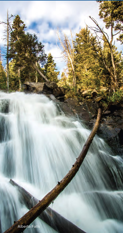
From Glacier Gorge Trailhead, follow the well-traveled path as it winds through a thick pine and fir forest with shivering aspens. Pass the crowds gathered at Alberta Falls (mile 0.6) and climb around boulders to a rocky point above the canyon formed by Glacier Creek. To the north, craggy peaks guard the mouths of Glacier Gorge and Loch Vale.
Enjoy a downhill stretch to the junction for Mills Lake and Loch Vale. Stay right and switchback up to the Loch, a gorgeous tarn with a backdrop of jagged peaks at mile 2.5. Pass the Loch on the northwest side as you continue the gradual climb south up Loch Vale. A half-mile above the Loch's shores, Cathedral Wall rises to your right; pause and search for climbers high on this popular crag.
Timberline Falls rushes below Lake of Glass, and reaching the lake requires a fun scramble up wet (or icy) rocks on its far west side. Top out the climb on the windy aquamarine shores of Lake of Glass, then look for cairns to the right that reveal an easy scramble to a trail on rock through krummholz—stunted, twisted fir and spruce trees—above the lake's western shore.
The Cathedral Spires dominate the skyline at Sky Pond. Find a comfy rock and kick back, have a snack, and break out the binoculars to spy on climbers on the Sharkstooth, Petit Grepon, and Saber (arrayed left to right).
DISTANCE: 8.1 miles
TIME REQUIRED: 1 day
DIFFICULTY: Intermediate
CONTACT: Rocky Mountain National Park, (970) 586-1206; nps.gov/romo
THE PAYOFF: Neck-craning views, waterfalls, peaceful alpine tarns
TRAILHEAD GPS: 40.310556, -105.640197
FINDING THE TRAILHEAD: From the Beaver Meadows Entrance Station, go south on Bear Lake Road for 9 miles to the Glacier Gorge parking lot on the left.
WAYPOINTS & DIRECTIONS

GPS: 40.310556, -105.640197 From the Glacier Gorge trailhead, hike southwest toward Glacier Creek.
GPS: 40.308323, -105.642139 Cross a bridge over Glacier Creek.
GPS: 40.307717, -105.643265 Bear right at Y junction, following signs for Loch Vale.
GPS: 40.303847, -105.638480 The trail travels past the popular Alberta Falls. Stop to get a look at this photogenic waterfall that pours over massive boulders.
GPS: 40.297473, -105.646108 At the Y junction, veer right and follow signs for Loch Vale.
GPS: 40.294028, -105.654477 Turn right at Y junction.
GPS: 40.288054, -105.664380 Cross Andrews Creek, then continue left at the Y junction. The trail to Andrews Glacier enters on the right.
GPS: 40.283070, -105.665216 Climb up talus and rock ledges; water runs down the rocks along this stretch. (Note: This can get icy in early fall, so exercise caution.)
GPS: 40.282505, -105.665281 Glass Lake is picturesque but windy. Plan to take your snack break elsewhere.
GPS: 40.278658, -105.667813 Sky Pond. Kick back in a wind-protected spot and enjoy the view of the Cathedral Spires to the west. Follow the same route back to the trailhead.