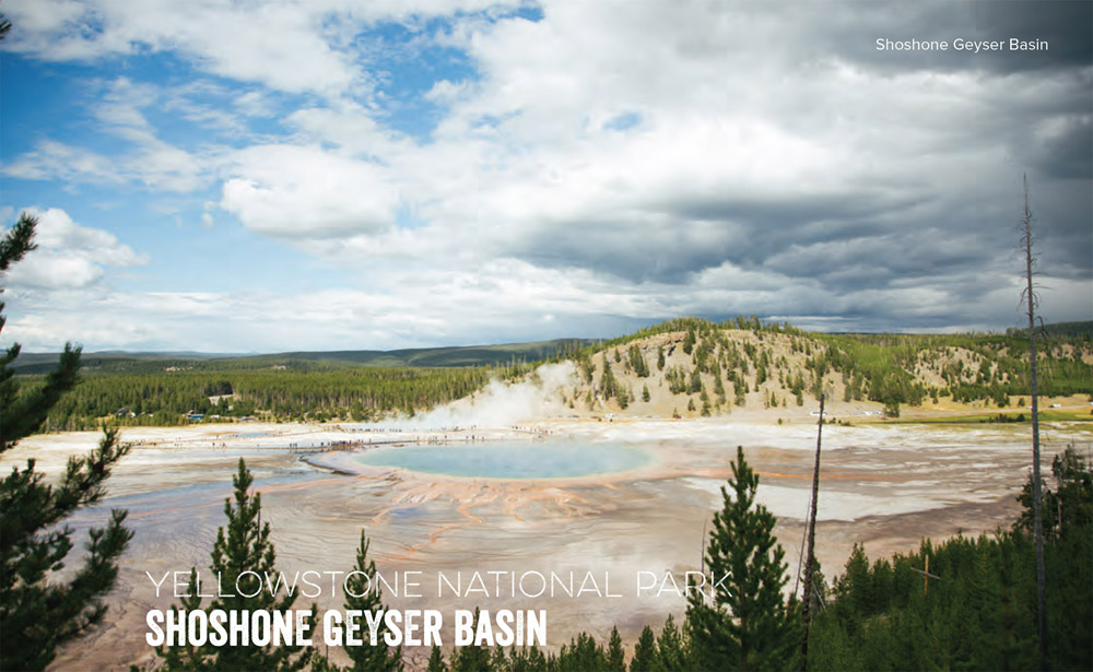
Camp in an active geyser basin teeming with wildlife.
Frontcountry geyser basins are cool. But backcountry geyser basins, where no boardwalks or crowds interrupt the steaming, bubbling, bursting landscape, are where the earth really comes alive. Getting to Shoshone's geysers and hot springs is half the fun: You'll hike deep into a wilderness filled with grizzlies and bison, crossing the Continental Divide at 8,010-foot Grants Pass before dropping to the basin on the edge of Shoshone Lake. This ain't no Old Faithful area: You'll experience Yellowstone's thermal zones like the early explorers did, so step carefully.
Start on the Lone Star Trail, hiking along the Firehole River to the Lone Star Geyser, which erupts every three hours. Turn left onto the Shoshone Lake Trail and look for bison around trailside thermal areas. Keep climbing to Grants Pass and the Continental Divide. Watch for moose after the Bechler River Trail junction as you descend along the Shoshone Creek to forested lakeshore. After taking the right fork of the Shoshone Lake Trail past a patrol cabin, you'll see spur trails to the Shoshone Geyser Basin. Careful: Signage and boardwalks are scarce. The North Shore Trail contours past the spurs to the splendid campsite 8R5, fronting Basin Point Bay; it's the closest site to the geyser basin.
DISTANCE: 34 miles
TIME REQUIRED: 2–3 days
DIFFICULTY: Intermediate
CONTACT: Yellowstone National Park, (307) 344-2163; nps.gov/yell
THE PAYOFF: Charismatic megafauna, private geysers.
TRAILHEAD GPS: 44.418486, -110.805745
FINDING THE TRAILHEAD: From the Old Faithful overpass, in Wyoming, go 2.5 miles south on Grand Loop Road and park in the Lone Star Trailhead lot.
WAYPOINTS & DIRECTIONS

GPS: 44.444443, -110.804565 Start on the Lone Star Trail, hiking south along the Firehole River.
GPS: 44.418946, -110.805659 Round the Lone Star Geyser, which erupts every three hours, before taking a left onto Shoshone Lake Trail.
ES Camp? Landmark Trailhead
GPS: 44.380220, -110.822825 Cross the Continental Divide at Grants Pass before descending to the Shoshone lakeshore. Take the right fork of the Shoshone Lake Trail. (Side Trip: Take one of the spur trails to the Geyser Basin.) Turn left onto the North Shore Trail, which leads to campsite 8R5 on Basin Point Bay.
GPS: 44.369300, -110.748754 Spend the night at Basin Point Bay. In the morning, head back to the trailhead, forking right to cut directly up Shoshone Creek if you want to bypass the geyser basin.