Take a dip in the first national park's steamy rivers.
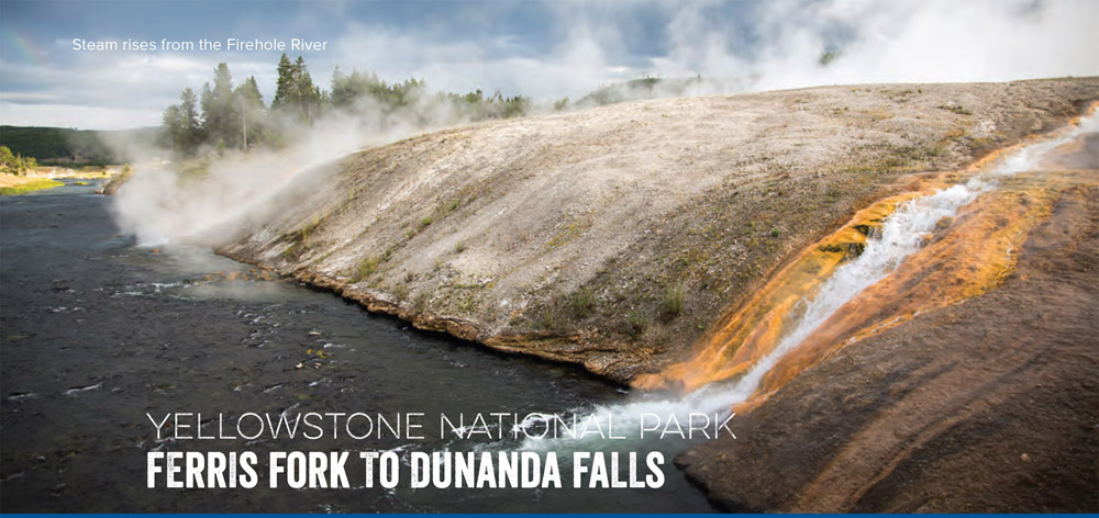
Hot springs form when molten magma heats underground water, so it makes sense that the highest concentration of geothermal spouts in North America would surface above the 300-mile-wide ocean of magma that is Yellowstone National Park. While most of Yellowstone's boiling baths are off limits to soaking (with good reason—they're hot enough to cook dinner), Dunanda Falls and Ferris Fork mix with creek water, making them fair—and Park Service–approved—game. (Make reservations at the Yellowstone backcountry information center before hitting the trail.)
You won't find much company among the belching geysers and grizzly dens of Bechler River country. Located in the southeast corner of the park, it requires a 26-mile dirt-road drive from Ashton, Idaho, just to get to the Bechler Trailhead. From there to Ferris Fork, it's a 15-mile walk along the roaring Bechler River through dense stands of lodgepole pine that give way to the steep walls of Bechler Canyon. You'll pass 12 raging drops (some slightly off-trail) that pour into the Bechler River, including funky wonders like Ragged Falls, named for its chaotic five-foot tumble, and Twister Falls, which—you guessed it—coils downward along its 55-foot flume.
Day one ends with a short detour through Bechler Meadows to 150-foot-high Dunanda Falls. Take your pick from several soaker-made pots (averaging 110 degrees) and camp in your designated site for the night. Make it a hot-springs doubleheader by trekking back to the Bechler River Trail and following it 6 miles northeast to Three Rivers Junction (where the Phillips, Gregg, and Ferris Forks converge). An obvious user trail leads to a steaming pool hidden along the banks of the river. Continue upstream to splash in cascading beauties like Gwinna Falls and Sluiceway Falls, and spend your second night just downstream of Three Forks, near sloping, 260-foot Albright Falls.
DISTANCE: 30 miles
TIME REQUIRED: 2–3 days
DIFFICULTY: Intermediate
CONTACT: Yellowstone National Park and Preserve, (307) 344-2163; www.nps.gov/yell
THE PAYOFF: Melt your post-hike muscles in a hot pool all your own.
TRAILHEAD GPS: 44.149206, -111.046286
FINDING THE TRAILHEAD: The Bechler River trailhead is at the end of unpaved Cave Falls Road, 26 miles from Ashton, Idaho.
WAYPOINTS & DIRECTIONS

GPS: 44.144676, -110.997448 Start at the Bechler trailhead and head north for 15 miles along the roaring Bechler River and through dense stands of pine that give way to the steep walls of Bechler Canyon.
GPS: 44.245814, -111.025386 Make a short detour through Bechler Meadows to Dunanda Falls. Take your pick from several hot springs and camp in your designated site for the night. In the morning, trek back to the Bechler River Trail and following it 6 miles northeast to Three Rivers Junction. Head up the Ferris Fork (farthest right) to see Gwinna Falls and Sluiceway Falls.
GPS: 44.282140, -110.880032 Gwinna Falls.
GPS: 44.279314, -110.878916 Sluiceway Falls. Retrace route back to Three Rivers Junction and head up the center fork (Gregg Fork) to visit Twister Falls.
GPS: 44.296517, -110.859690 Twister Falls. Head just downstream of Three Rivers Junction to Albright Falls.
GPS: 44.277808, -110.907712 Make camp near the 260-foot Albright Falls. In the morning, head back south to the trailhead.