![]() Utah
Utah
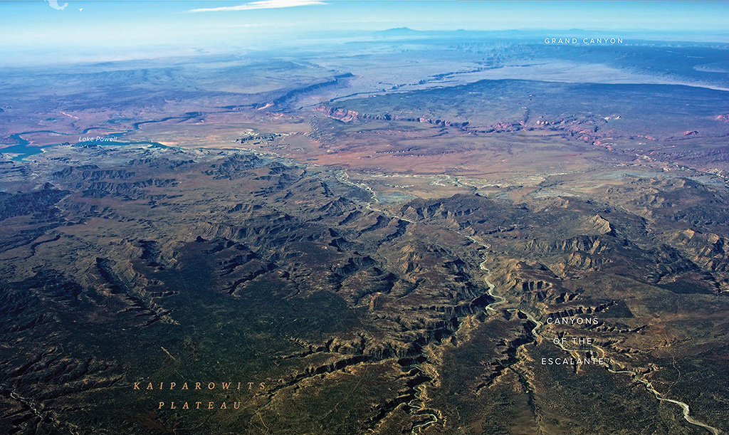
Looking south across the Kaiparowits Plateau toward Lake Powell and the Grand Canyon, in the distance.
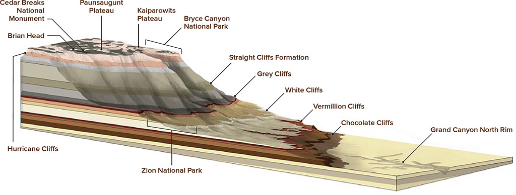
With its labyrinth of canyons, southern Utah’s landscape can seem chaotic. One helpful way to visualize the geology of this region, especially from an aerial viewpoint, is to think of it as a staircase of mesas, plateaus, cliffs, and canyons that decreases in elevation from Brian Head Peak, at 11,300 feet, to the floor of the Grand Canyon, at 2200 feet. In between, the landscape drops dramatically from north to south in a series of steps, each with a different underlying geology that has eroded and evolved in its own unique patterns.
Brian Head Peak, a popular Southwest skiing destination, is known as the top step of the Grand Staircase. Between Cedar City, Utah, in the valley to the west, and Brian Head, the landscape swoops steeply upward more than 4000 feet along the Hurricane Fault, the largest earthquake fault in southern Utah. This dramatic fault scarp, known as the Hurricane Cliffs, formed after repeated earthquakes over the last million years. Each major quake dropped the west side of the fault five to ten feet, with more events expected in the future.
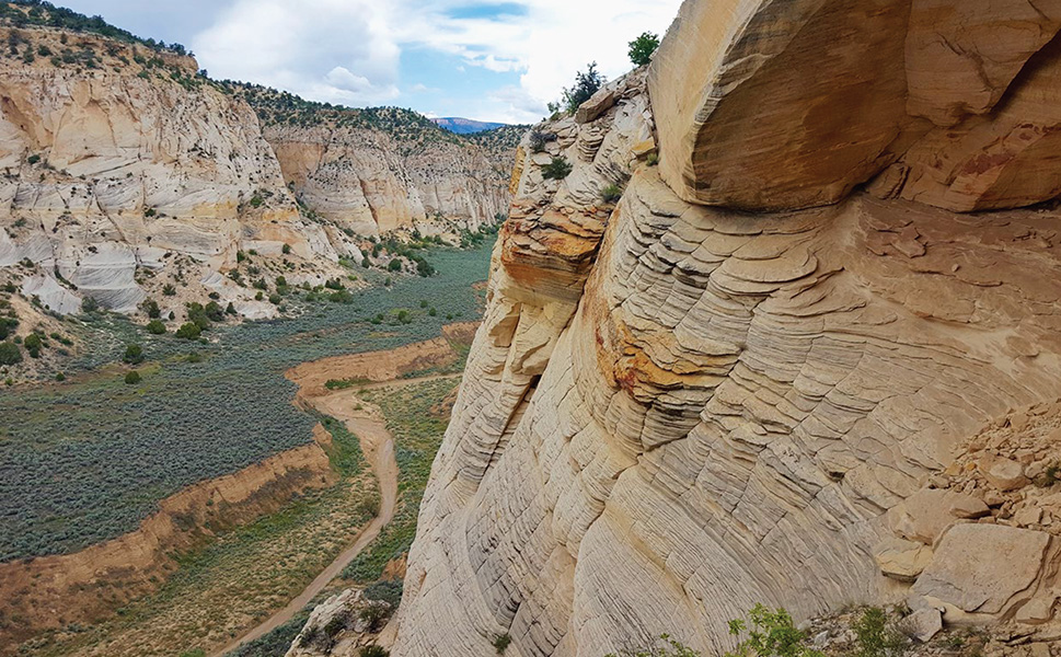
Moving down the Grand Staircase from Brian Head Peak, the next section of the staircase can be grouped into three regions: (1) the highlands of Bryce Canyon, Cedar Breaks, and the Paunsaugunt Plateau, (2) the long, ridge-running step of the Kaiparowits Plateau (also known as Fifty Mile Mountain), divided from north to south by the folded-over, 150-mile-long monocline known as the Cockscomb, and (3) the lower canyons of the Escalante, which drain the higher elevations and often take the form of deep, narrow slot canyons. From there, the staircase descends over the Vermilion Cliffs, down the Chocolate Cliffs, and on to the North Rim of the Grand Canyon. All told, this super-sequence of sedimentary rock layers spans more than 2 billion years of geologic time.
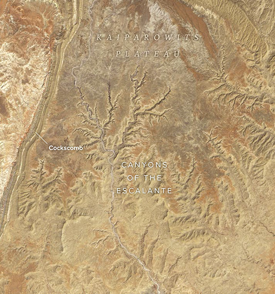
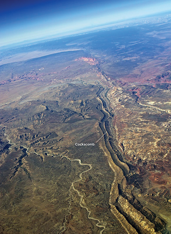
A network of canyons drains the middle portion of the Grand Staircase, which stretches roughly from the long folded ridge of the Cockscomb east across the Kaiparowits Plateau.
The Cockscomb is a monocline of sandstone slabs in the Grand Staircase that have been stood on end and folded by fault movement, forming a long, colorful hogback.
This region remains some of the most rugged country in the lower forty-eight states, with few highways linking a maze-like network of rough dirt roads and trails that frequently dead-end at impassable cliffs. In 1996, nearly 2 million acres of the Grand Staircase were preserved as Grand Staircase-Escalante National Monument, which encompasses three main regions: the Grand Staircase, the Kaiparowits Plateau, and the Canyons of the Escalante. A number of other national monuments and parks define the area as well, including Bryce Canyon National Park, Cedar Breaks National Monument, and Vermilion Cliffs National Monument.

The Grand Staircase may be visible en route to Saint George, Utah, or on one of the many scenic charter flights offered in this rough-hewn corner of the world, which is often best explored from the air.