
Plan your walk |
|
 |
DISTANCE: 3½ miles TIME: 1¾ hours START/END: SD286930 Layby parking area opposite a large garage on the Coniston to Ulverston road, one mile south of Torver TERRAIN: Moderate; some wet sections MAPS: |
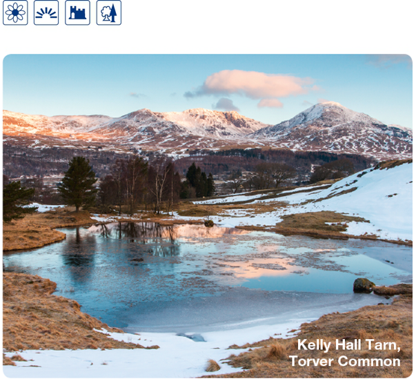
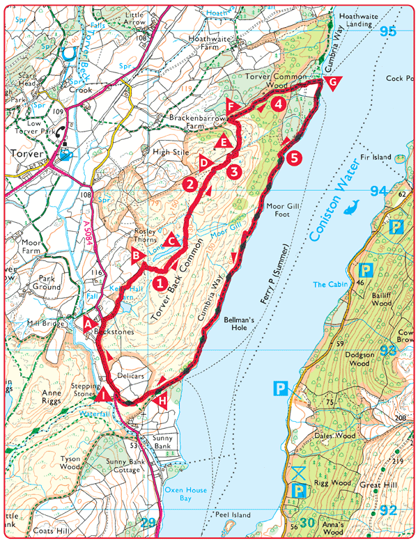
 The walk starts from the A5084 Torver to Ulverston road 1 mile (1.5km) south of Torver, at Beckstones. There is a layby parking area here opposite a large garage. Walk up through a gate and around to the left of the tarn. Continue up the path with the wall on your left.
 At the wall corner you should see the next tarn ahead. Take the path up the hill to the right of it.
 Viewpoint above the tarn. Excellent view of Coniston Old Man range and a stretch of the lake. All this is common land. Many years ago this would have been wooded, but the trees have been cleared and the land grazed by sheep. Now most of the land is covered with bracken which spreads rapidly in deep-soiled open land and is almost impossible to eradicate. The grazing area is now very limited. Only a few trees survive here as seedlings are soon eaten by sheep. There are a few mountain ash (rowan).
 Looking up the lake from the viewpoint a path will be seen descending to the outflow of the tarn. Take this path past the tarn, over a small hill and down to a stream to join another path. Follow this down for a short distance and then bear left, up beside another stream and across to
  .
.
 This viewpoint gives a perfect view of the Old Man range and there is a small natural stone seat facing it. The view over the lake goes right to the head, and away to the north is the Helvellyn range.
 Continue on this path, dropping into another valley with a wall beyond, and go through the juniper bushes.

 Junipers are getting scarcer in many parts of the country but they still survive in the Lake District. Juniper is our only native cypress. Note the varied shapes of the shrubs here; some are quite old. Chew the berries, whether green or ripe, and you will find out how gin gets its flavour. The berries have long been valued in medicine.
 At the point where the wall curves away from the valley, cross the stream and go up the bank opposite to follow the wall round. A short distance afterwards bear off down across the common to the right and join a path.
 When this path joins a larger path just in front of another wall, turn right onto the larger path and descend into the woods.
 The path goes through woodland which was once coppiced, that is cut every 12 years or so, and new growth allowed to come from the ‘stools’ (stumps). Formerly these woods were used to supply charcoal for the iron furnaces; mainly oak, alder and birch.
 This path eventually meets the lakeshore just after it crosses another path. At the lake turn right and follow ‘The Cumbria Way’ along the lakeshore.
 There are several good viewpoints along the shore with two things in particular to look for along the shoreline. Clinker can still be seen where ‘bloomeries’, small ‘do-it-yourself’ smelting operations were carried out here in ancient times. Ore was brought by boat to points where charcoal was readily available. In boggy areas there are insect-eating plants; the butterwort, and the sundew. They are small plants, easily missed, but once identified can be observed in many places.
 Just after the landing stage the path bears to the right, leaving the lakeshore and climbs beside the wall. Just before a wall junction the path bears right away from the wall and climbs across the common to a gate.
 Shortly after going through the gate, you arrive at the main road. Turn right up the road and follow it back to the starting point.