Chapter 21: Guadalupe River
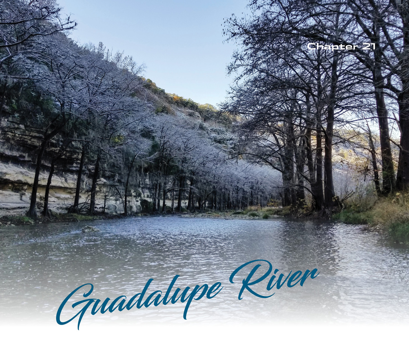
Rainbow and brown trout; striped bass; fast, cold water and gorgeous scenery. Access points: 8
The Guadalupe River is the most popular recreational stream in Texas, and namesake and home water for the nation’s largest Trout Unlimited chapter. Rising in two forks in Kerr County, it flows 250 miles to San Antonio Bay on the middle Texas Gulf Coast. The stream was named for Nuestra Señora de Guadalupe by Alonso de Leon in 1689. In the 1840s, the area became the focus of German immigration led by Prince Carl of Solms-Braunfels.
Noted for its rugged beauty, the Guadalupe is really three rivers: the upper Guadalupe, a typical Hill Country stream above Canyon Lake; the lower Guadalupe, the cold, tailwater fishery below Canyon Lake Dam; and the lazy, turbid river that meanders across the coastal plain. The upper portion of the river and its tributary streams offer fine warmwater fishing opportunities but are outside of the scope of this book.
The Canyon Lake tailwater has two distinct seasons: Roughly May through September is “tubing” season on the river, and people come from all over the state to float and drink beer on the reach between the dam and the city of New Braunfels. That city, at about 80,000 souls, is the largest on the stream and receives more than three million visitors annually, mostly in the summer months, and mostly people who come to play in the water. By the end of the summer, visitors will have deposited several tons of beer cans and plastic water bottles in the river.
“Nymphs: they are borderline amusing to read about in Greek mythology, but not for fishing Texans. Matching the hatch is certainly obsessive and cute, yet finding your own style in life is far more interesting.”
From November through March, when trout anglers who reside in more northerly latitudes put away their waders and rods, sit down at their vises in front of a crackling fire, and dream of spring “ice-out,” the southernmost trout fishery in the nation is in full swing. Skip the middle weeks of March (spring break), and come back for a six-week shoulder session before the tubing starts in earnest the middle of May. During the fall and winter, outfitters and campgrounds, which during the summer months maintained a frenetic pace shuttling families and young adults, enter a state of brumation; everything slows down, and the local businesses turn to providing parking and river access to fly anglers. Tire inner tubes give way to guide rafts in much smaller numbers.
My relationship with the Guadalupe is complicated. I’m a native fish guy, mostly, and when it comes to salmonids, I prefer to hunt wild trout in the headwaters streams they were made for. Unfortunately, there are no longer any of those in Texas.
I also really enjoy being the only person, or one of just a handful of people, wading a particular stream on a given day. There are opportunities to experience that on the Guadalupe, but it won’t be every time you visit, and it surely won’t be on a weekend at the height of the winter season. Those weekends, and perhaps some intemperate comments on the water and on social media, have earned the stream a nickname: the “Dramalupe.”

In some ways, the Guadalupe is a victim of its own success. It is an incredibly productive trout stream, and people have noticed. Like every North American tailwater east of the Rockies, the Guadalupe is an entirely manmade fishery stocked with non-native fish. In the case of the Guadalupe, stockings are done multiple times each year between November and March with farm-raised rainbow and brown trout. There are “holdover” fish most years, naturalized trout that look and act wilder with every passing month, and the rainbow trout that make it to the fall are as fine as any you’ll find anywhere.
What makes the Guadalupe River unique is that, well, it’s in South-Central Texas—roughly at the same latitude as Houston and Orlando and well south of San Diego. The Guadalupe has been named one of the hundred best trout streams and fifty best tailwaters in the U.S.
Between the Texas Parks & Wildlife Department (TPWD) and the Guadalupe River Chapter of Trout Unlimited (GRTU), something like 24,000 trout are stocked in the first dozen miles below the dam every winter. That’s a fish every yard or so, on average. TPWD stocks more fish in more locations, but Trout Unlimited stocks bigger fish; GRTU-stocked fish average 15 inches in length, and rainbows in excess of 20 inches are not uncommon.
Some of my favorite childhood memories are of elementary school spring break vacations catching rainbow trout (the small ones) on canned corn or cheese at Camp Beans. The campsites are long gone, but that stretch of river is still one of my favorites. Thanks to the hard work of TU members and the state, the Canyon Lake tailwater is an even better place to put a kid on a feisty rainbow these days. For more experienced anglers, it is an excellent stream to learn the ins and outs of indicator nymphing, mending line, and making drag-free drifts—skills that are useful on any tailwater fishery in the country. You can also catch trout here on streamers (that’s all some stubborn Texans will throw) and, especially late in the season, dry flies.
Unlike almost every other Texas stream, there is little right-of-way access at road crossings, and even less parking. With the exception of the U.S. Army Corps of Engineers (USACE) park just below the dam, all of the streamside property in the tailwater section is privately owned. Access to the river is through a shifting network of private and leased sites. Mostly due to the large numbers of anglers, tensions can sometimes run high. This is a river where booking a float trip with a guide, for your first visit at least, would be a worthwhile investment.

Stocked rainbow and brown trout aren’t the only attractions on the Lower Guadalupe; here you will also find escapees from the (also stocked) striped bass population in Canyon Lake. The stripers that have made their way into the river gorge on high-fat rainbow trout and grow to impressive sizes. Smallmouth bass, also stocked in Canyon Lake, do well in the cold water, too. Smaller numbers of sunfish and largemouth bass, as well as Guadalupe bass, persist below the dam. Nymph-eating redhorse suckers are regular incidental catches.
It’s worth checking with every campground and resort along River Road to see if they will let you park and access the river for a small fee. Some have exclusive agreements with GRTU (see Lease Access Program), and others may not allow day users. During the 2017–2018 season, TPWD leased four free public access sites; in the 2018–2019 season, there was only one. For the current year’s lease sites and stocking schedule, visit tpwd.texas.gov and search for “Guadalupe River trout.”
The access points below have for many years welcomed day users for a small fee (usually $10 per person), and Guadalupe Park is free.
|
Guadalupe Park, Canyon Lake |
|
|
29.869756, -98.196098 |
|
|
South Access Rd., Canyon Lake, TX 78133 |
|
|
54.5 road miles, 1:03 drive time |
|
|
Difficulty: Easy to Moderate |
|
The free park below Canyon Lake Dam, not to be confused with Guadalupe River State Park above the lake, is open sunrise to sunset and is the only truly public land on this part of the river. There are no facilities. The access road leads to two parking areas; one serves the cemented and safety railed spillway observation deck river left (29.87056, -98.19417). (There also is a short stretch of rocky shoreline between the deck and the mouth of a small creek). This short reach just below the spillway is deep, and you’ll want a sinking line or split shot to get down to the fish. Across the river, along the south bank, a hiking trail provides access to nearly 1 mile of water. That’s the section we’ll look at here.
What You Will Find
From the parking area, look for the well-maintained South Trail, known locally simply as the “nature trail,” really two parallel hiking trails specifically designed (in part) with anglers in mind. The trail does have steps (railroad ties embedded in the river bank) and several bridges, but overall it’s an easy walk in the shade of the riparian forest.
 South Trail Reach (Bank and Wade Fishing below Canyon Lake Dam)
The South Trail follows the course of the river at a bit of a remove, so you’ll have to look for spur trails leading down to the water. Wadeable water begins about 350 feet below the spillway, at the first bend in the river. This long, rocky run continues for more than 700 feet.
At about 0.2 miles below the spillway, a stepped limestone ledge river right provides good access to the narrow pool along the north bank. This is not only a good place to find trout, but in the summer months it can also be productive for all of the bass species in the river. Probably because it’s a good place to find trout, by now preferred forage for striped, smallmouth, and largemouth bass. The ledge continues past a riffle at about 0.3 miles, where the river slows and deepens. The South Trail continues for some distance beyond this point, nearly to the end of the USACE property at 29.86695, -98.18113, just before the first really big bend in the river, but access to wadeable water becomes more difficult.

The South, or “nature,” trail below Canyon Dam—shown here during high flows—offers access to a fine reach of fast, cold water.
Keep in mind that unlike many warmwater species (Guadalupe bass excepted), trout actively feed in fast water. They prefer to have the current bring food to them and are adept at using seams, crevices, and even small rocks in the riverbed—anything that alters the flow of water—to conserve energy. That said, when biologists survey the river using electro-shocking, they find the most fish in deeper pools.
![]() From downtown, take I-35 south to Exit 195 and go right on Watson Road, which dead ends at Hunter Road (Farm Road 1102). Go left on Hunter Road and continue to Hoffman Road. Go right on Hoffman Road, and then right on Farm Road 306. If you miss any of these turns, the I-35 south frontage road will take you to FM 306 anyway. Follow FM 306 approximately 8.8 miles to South Access Road on your left. The parking area and trailhead will be across the spillway on your left.
From downtown, take I-35 south to Exit 195 and go right on Watson Road, which dead ends at Hunter Road (Farm Road 1102). Go left on Hunter Road and continue to Hoffman Road. Go right on Hoffman Road, and then right on Farm Road 306. If you miss any of these turns, the I-35 south frontage road will take you to FM 306 anyway. Follow FM 306 approximately 8.8 miles to South Access Road on your left. The parking area and trailhead will be across the spillway on your left.
|
Maricopa Riverside Lodge, Canyon Lake |
|
|
29.86456, -98.16477 |
|
|
12381 FM 306, Canyon Lake, TX 78133 |
|
|
(830) 964-3600 |
|
|
52 road miles, 0:54 drive time |
|
|
Difficulty: Moderate |
|
Maricopa Riverside Lodge is an old-school, nineteen-room motel remodeled in 2011. Located at the very end of the upper tailwaters (12–18-inch slot limit) and beginning of the “Trophy Zone,” where only one fish over 18 inches may be kept (fly or lure only), this is a year-round hotspot for big browns and rainbows. Maricopa’s property includes more than 100 yards of stream bank, and a cement sluice next to the FM 306 bridge is a dandy launch for a kayak or canoe. Maricopa charges $10 per vehicle for day-use anglers and paddlers.
What You Will Find
When you get to the motel, check in and pay your $10 at the office. You can back down the cement drainage to drop a paddlecraft off, or simply park in the motel’s lot if you plan to wade. Access the water anywhere from the bridge to the end of the Maricopa property, a little more than the length of a football field upstream.
 Maricopa Wade (Wading or Paddling Upstream from the Bridge)
The water here is still very cold, just a little less than 3 river miles below the spillway. Wading upstream in knee- to waist-deep water is fairly straightforward, though, with the deeper channel along the far bank, river right. A bit more than 400 feet above the bridge, a shallow run with some large rock formations is a likely spot to find trout.
Continue wading river left (your right) to get around the bend and to a rocky run and rapid that has produced some beautiful holdover fish in the past. At about 400 yards above the bridge, the river gets wide and deep and is best paddled if you continue upstream. Horseshoe Falls, easily portaged river left, is 1.4 miles above the bridge. If you choose to paddle downstream, through the extremely productive Horseshoe, or “Tuber’s Loop,” the next access point is at Whitewater Sports (see below).
You shouldn’t be afraid to throw streamers in this (or, really, any) section of the river. Black, beadhead woolly buggers (size 6–12) almost always (eventually) get bitten, and one friend fishes nothing but Lunch Money baitfish imitations here and does well enough.
But the most productive setup for trout on the Guadalupe is usually going to be a nymph rig. On the Guad, this typically is an indicator, an attractor fly (girdle bugs, Pat’s Rubber Legs, and aggravators are popular choices, as are egg flies) with a nymph (hare’s ears and zebra or sparkle midges in sizes 16–22 are popular choices) dropper tied 12–18 inches below the attractor fly. Check with a local fly shop to see what flies have been working best in recent days. The strike indicator should be adjusted for the water depth, allowing the nymph to bounce along on or just above the bottom.
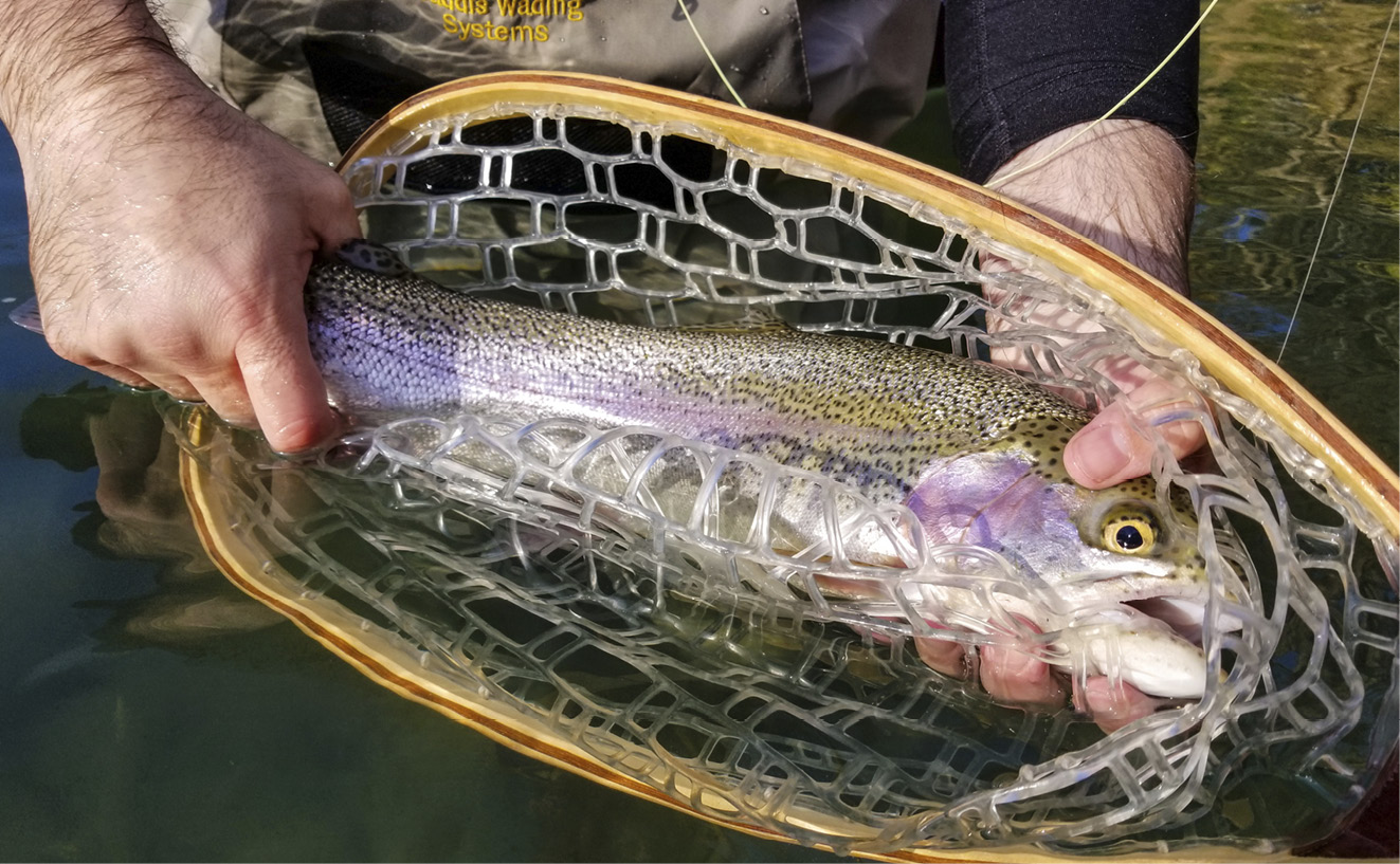
Stocked and holdover rainbow trout are the main attraction on the Guadalupe River. There are plenty of fish in the 15- to 20-inch range, and 20-plus inch fish are not uncommon.
![]() From downtown, take I-35 south to Exit 195 and go right on Watson Road, which dead ends at Hunter Road (Farm Road 1102). Go left on Hunter Road and continue to Hoffman Road. Go right on Hoffman Road and then right on Farm Road 306. If you miss any of these turns, the I-35 south frontage road will take you to FM 306. Follow FM 306 approximately 6.9 miles to the motel on your left.
From downtown, take I-35 south to Exit 195 and go right on Watson Road, which dead ends at Hunter Road (Farm Road 1102). Go left on Hunter Road and continue to Hoffman Road. Go right on Hoffman Road and then right on Farm Road 306. If you miss any of these turns, the I-35 south frontage road will take you to FM 306. Follow FM 306 approximately 6.9 miles to the motel on your left.
|
Whitewater Sports, New Braunfels |
|
|
29.86129, -98.15757 |
|
|
11860 FM 306, New Braunfels, TX 78132 |
|
|
(830) 964-3800 |
|
|
51.4 road miles, 0:54 drive time |
|
|
Difficulty: Easy to Moderate |
|
Whitewater Sports is, with Maricopa Riverside Lodge, one of the bookends of the “Tubers’ Loop” or “Horseshoe”—a 1.0 mile-long bend of the river. The lower half of the loop is eminently wadeable, but you’ll want to wait until after Labor Day when the tubers thin out. Between September and May, Whitewater offers $10 per vehicle day passes for anglers.
What You Will Find
Park in the lot near the office, pay the day fee, and walk or drag your kayak down to the water; there are paved paths next to the bridge and just upstream from the office. You’ll definitely want to drop your boat off if you have to park in the overflow parking area next door.
 The Horseshoe (Wading Upstream from the Bridge)
The Horseshoe holds big trout all year long, and at flows of 350 cfs or less it can easily be waded river right (your left, the inside of the bend) a little more than halfway back around to Maricopa Riverside Lodge, or about 0.6 miles. You’ll encounter some waist-deep water along the way, and even deeper pools in the center of the channel, but also some beautiful rock gardens and riffles, particularly near the end of the wadeable section.
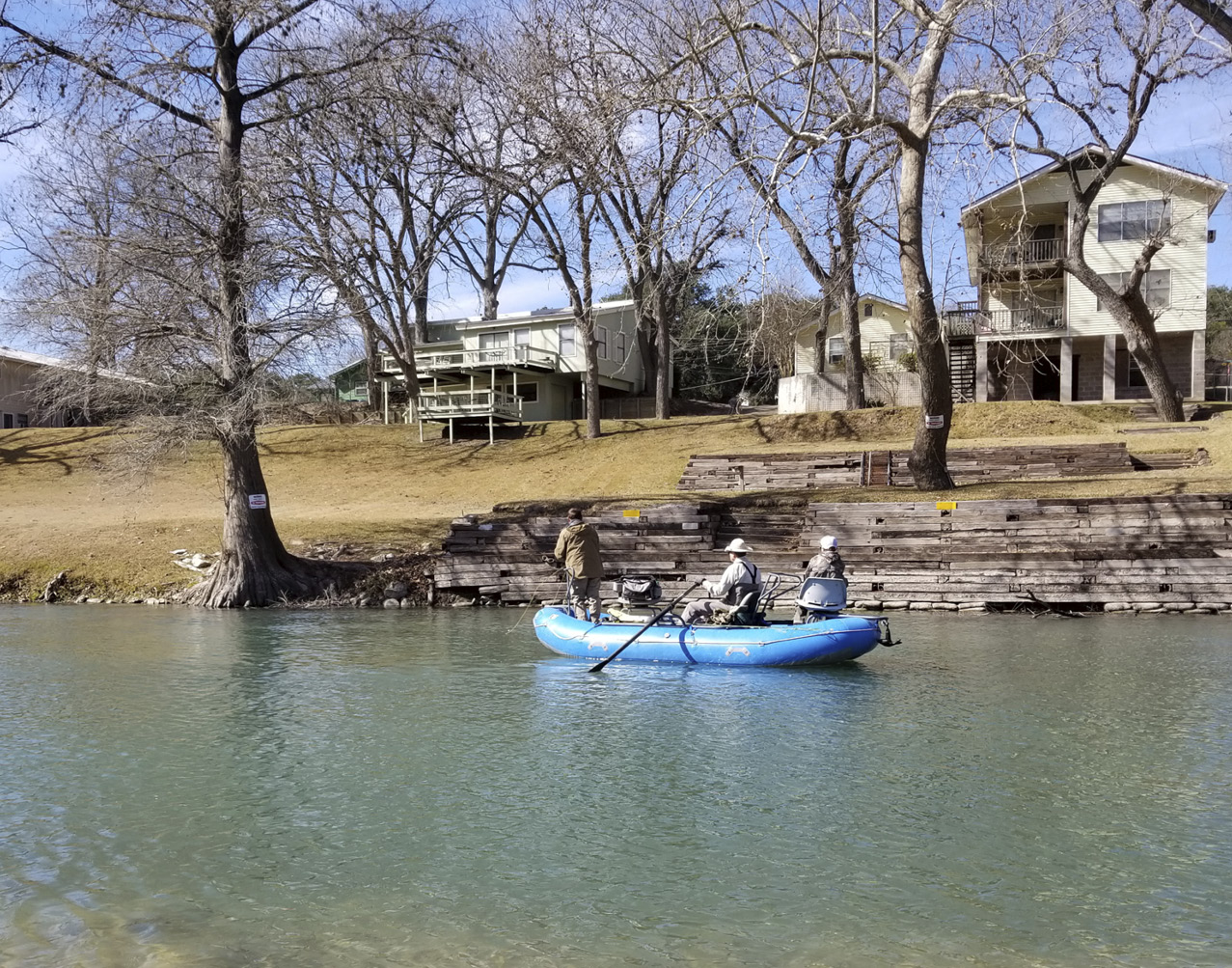
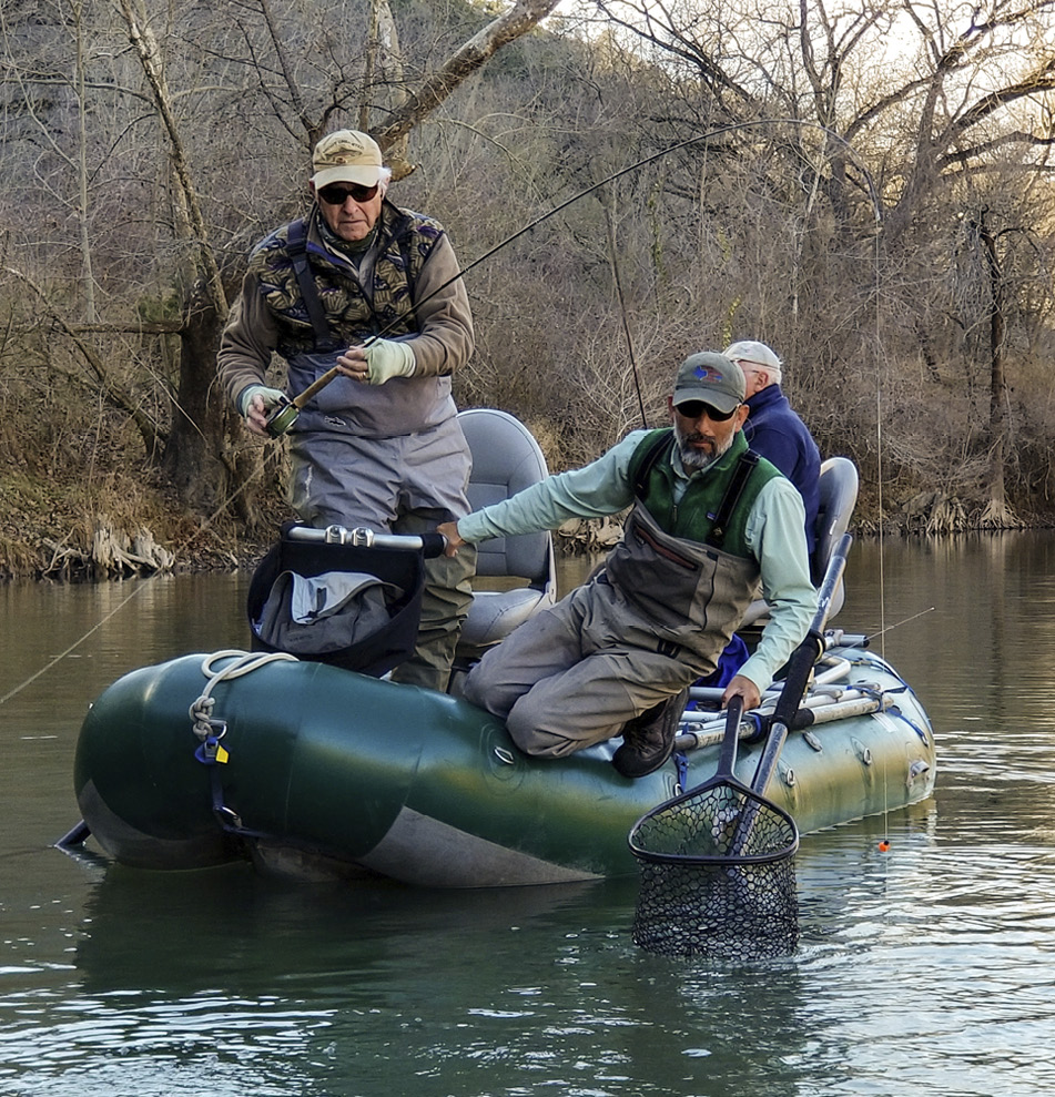
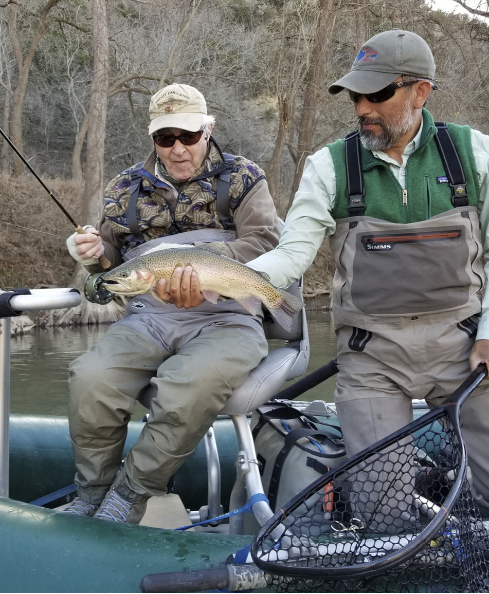
Rodriguez with a client's rainbow trout. The Guad is one river it pays to learn with a guide.
One of the locals here feeds the trout from his residence; he’ll probably let you know if he thinks you are mishandling fish.
Remember that setting the hook on a trout can be a bit different than the strip-set we usually use on bass and carp. You can raise the tip of your rod sharply to hook a turning fish (this is a classic “trout set” and works especially well when fishing nymphs under an indicator), but you can also strip set on trout, especially the streamer eaters. Some experts argue that trout sets should be done sideways, sweeping the tip parallel to the water and in the direction of curve in the line. The thought here is that the weight of line and water will do most of the work for you, requiring only a short tug on the line. Dry flies call for a trout set, with the added thrill of watching it happen in front of you.
If you paddle downstream from Whitewater, the next access point is at Rio Guadalupe Resort (29.84372, -98.16888), 1.6 miles downstream.
![]() From downtown, take I-35 south to Exit 195 and go right on Watson Road, which dead ends at Hunter Road (Farm Road 1102). Go left on Hunter Road and continue to Hoffman Road. Go right on Hoffman Road and then right on Farm Road 306. If you miss any of these turns, the I-35 south frontage road will take you to FM 306. Follow FM 306 approximately 6.4 miles to Whitewater Sports (you’ll also see a sign for Whitewater Amphitheater) on your right.
From downtown, take I-35 south to Exit 195 and go right on Watson Road, which dead ends at Hunter Road (Farm Road 1102). Go left on Hunter Road and continue to Hoffman Road. Go right on Hoffman Road and then right on Farm Road 306. If you miss any of these turns, the I-35 south frontage road will take you to FM 306. Follow FM 306 approximately 6.4 miles to Whitewater Sports (you’ll also see a sign for Whitewater Amphitheater) on your right.
|
Lazy L&L Campground, New Braunfels |
|
|
29.81800, -98.17563 |
|
|
11699 River Rd., New Braunfels, TX 78132 |
|
|
(830) 964-3455 |
|
|
55.6 road miles, 1:26 drive time |
|
|
Difficulty: Easy |
|
Lazy L&L is a sprawling campground along River Road with a boat launch, restrooms, a small camp store, and a shoreside trail that offers access to two additional properties upstream, all the way to the Ponderosa Bridge. L&L charges $10 per person for day use, and the campground’s 5 mph speed limit is strictly enforced.
What You Will Find
The Lazy L&L Campground covers fifty-five acres and may be the best deal going for day users on the Guadalupe. The main campground features about three-quarters of a mile of river frontage, with an additional 0.6 miles between River Road and the water upstream to just above the Ponderosa Crossing. Day users can cover much of this on foot. (Lot 3, above the Ponderosa Crossing, is off-limits except to GRTU lease access program members, but the stream bed is public; see below.)
 The Hog Trough and Bear Creek (Fishing Lazy L&L—a Large Property/Multiple Access)
In addition to plentiful parking, lots of bank access, and an improved kayak and raft launch, there is a broad, limestone shelf that follows the north bank of the river here. That ledge is the key to wading this stretch of the river at higher flows, up to 450 or 500 cfs, and in any flow provides shelter for fish and funnels the river current into feeding lanes. In other words, be sure to drift some flies along the edge of the ledge.
Target seams at the edge of faster water as you wade upstream river left (your right). About 400 yards above the boat launch (29.81887, -98.17540), you’ll encounter a rock garden, and just above that, the “Hog Trough,” a narrow funnel that usually holds large trout.
The river is not especially fast here, and you should have no problem paddling up to the Ponderosa Crossing (or farther) if you would like to go upstream. Downstream, though, is a bit more interesting. At about 0.4 miles below the boat launch, Bear Creek flows out of the Ingram Ranch river right. A short drag across a gravel riffle will bring you to a huge, deep pool that is home to some heart-stopping bass.
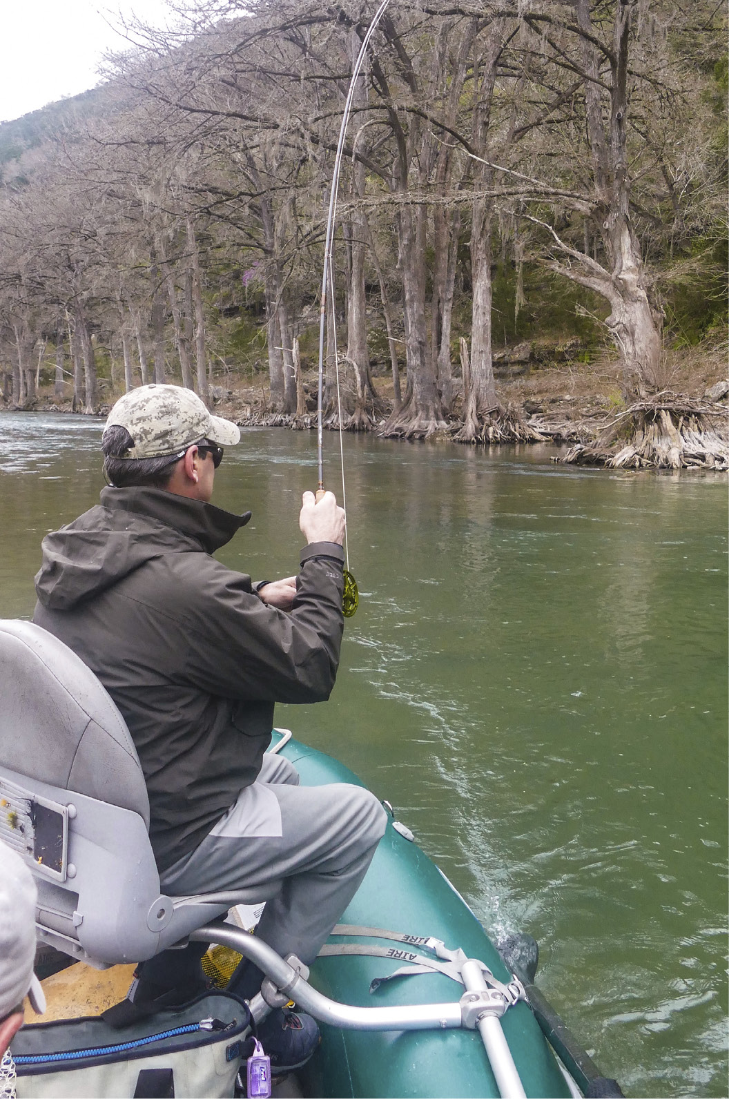
This pool, about an acre in size, is deepest near the northwest corner, where there also is some good structure. The shallow water below the mouth of the creek here also holds fish, as does the brushy, undercut bank on the east side of the pool and the shallower, boulder-strewn southern end … basically, the entire pool is sort of magical. These big fish do see quite a few flies, so bring your A-game, and some meat.
At the bend in the river where the Bear Creek pool joins the Guad, a deep washout beneath several cypress trees almost always holds trout (on my last trip, we also caught a redhorse sucker here). This fast run and the riffle below it are also somewhat accessible from the bank river left, which is still part of L&L.
If you are paddling—and this is a fine reach of river to experience in a kayak—you’ll see the private Ingram bridge at just over 1.0 miles below the L&L boat launch. An eddy here collects trash; be a pal and stop and pack some out, would you? Your next access point downstream is Rocky Beach (29.80294, -98.17272), 1.6 river miles below L&L.

The reach below Rocky Beach is broad and deep. Fish hold in the deep, limestone seams in the river bed, which also make wading treacherous.
Getting There
From downtown, take I-35 south to Exit 195 and go right on Watson Road, which dead ends at Hunter Road (Farm Road 1102). Go left on Hunter Road and continue to Hoffman Road. Go right on Hoffman Road and then right on Farm Road 306. If you miss any of these turns, the I-35 south frontage road will take you to FM 306. Follow FM 306 over the first Guadalupe River bridge at Whitewater Sports, and then—before you get to the second bridge and Maricopa Riverside Lodge—go left on Farm Road 2673 (Sattler Road). Just past the Stripes convenience store in Sattler, take a left on River Road. Follow River Road approximately 2.8 miles to the campground on your right.
|
Action Angler, New Braunfels |
|
|
29.80374, -98.16235 |
|
|
9751 River Rd., New Braunfels, TX 78132 |
|
|
(830) 708-3474 |
|
|
55.5 road miles, 1:15 drive time |
|
|
Difficulty: Easy to moderate |
|
Action Angler, a fly shop and guide service (see the Appendices) on the upstream side of the 3rd Crossing bridge, also offers access to fly anglers for $10 per person. Pay inside if the shop is open, or at the honor box on the trail to the water if it isn’t or you can’t be bothered to walk up the hill. This also typically is a non-exclusive lease access site for GRTU members.
What You Will Find
Parking at Action Angler is up the hill from River Road, in front of the shop. From the parking area, follow the well-marked trail to the river. If you plan on launching or retrieving a canoe or kayak here, you should do that right next to the bridge; it’s still going to be a haul getting it up to Action Angler’s driveway.
 Old Camp Beans (Wading Upstream from the Bridge)
The slack water between bridge pilings and a deeper hole river left, under and just downstream from the bridge, are worth a few casts. I’ve always found trout here, though they are rarely large.
Wade upstream in ankle- to knee-deep water with a spectacular, honey-colored and honeycombed cliff rising above you river right (your left). This shallow run can sometimes hold smaller trout. Watch for them rising from lies around the scattered rocks in the stream.

At about 0.3 miles above the 3rd Crossing bridge, you’ll begin to see deeper runs and pools, particularly river left. This is the reach known as Old Camp Beans, where I caught my first rainbow trout more than forty years ago. The first of the pools you’ll encounter is a washout around a cypress stump (it was a tree when I first saw it). There is usually at least one trout hanging out here, at the edge of the fast water. The next pool upstream is chest-deep against the east bank. I recall one day several winters ago when my friend Cory Sorel and I tricked four trout from this one spot.
A bit farther upstream, cross a deep chute over jagged karst to reach the deep, quiet pools against the bank river right. This is an excellent spot to sight-cast to rainbows. The bank upstream from these pools also holds good fish.
A gravel beach river left (your right), 0.5 miles above the bridge and just above the narrow chute marks the end of easily wadeable water here. You can go a little farther, and in lower flows, you can wade all the way to Rocky Beach by hugging the east bank, but I’ve never been able to do it without taking a swim.

The Trophy Trout Zone (only one fish over 18 inches may be harvested, on lure or fly only) continues another 3.2 river miles downstream to the 2nd Crossing bridge. Camp Huaco Springs (29.76037, -98.13989), about 5.5 miles below Action Angler, has in previous years served as a free TPWD lease access point and receives wintertime trout stockings. Those fish are not expected to survive through the summer.
![]() From downtown, take I-35 south to Exit 190B in New Braunfels. From the frontage road, go right on Post Road and then right on Gruene Road and left on Rivercrest Road. This little zigzag will bring you to TX 46 (Loop 337). On TX 46, continue for about 1.3 miles to River Road on your right. Follow River Road for a little more than 8.1 scenic, winding miles to Action Angler on your left. This is the back way in to all of the Guadalupe River trout fishing access points, unless you’re coming from points south, in which case it may be the most direct route.
From downtown, take I-35 south to Exit 190B in New Braunfels. From the frontage road, go right on Post Road and then right on Gruene Road and left on Rivercrest Road. This little zigzag will bring you to TX 46 (Loop 337). On TX 46, continue for about 1.3 miles to River Road on your right. Follow River Road for a little more than 8.1 scenic, winding miles to Action Angler on your left. This is the back way in to all of the Guadalupe River trout fishing access points, unless you’re coming from points south, in which case it may be the most direct route.
GRTU Lease Access Program
GRTU’s popular lease access program is tweaked almost every year. For the 2018–2019 season it was expanded to 850 available spots and came with improved digital maps and orientation materials. It sold out within weeks. For an additional $165, active GRTU members (you can pay for your membership and the lease access program at the same time) are given access to fourteen to eighteen leased properties on the river and a heads-up on GRTU’s stocking locations and schedule. That second thing is important, because telemetry studies show that trout don’t move very far from the place they are planted. A pair of studies between 2008 and 2010 found that trout moved a median distance of just 245 meters and 420 meters, respectively, from the places they were put in the water. A few of the sites, like Action Angler, also are pay-to-play locations, but lease access program members get in free. Most years slightly fewer than half the leases provide access year-round; the others are available just for the trout “season.”
Open 11–7 Tues.–Sat., 11–5 Sun., and 11–2 Mon.
The barbecue joint next to the Canyon Lake VFW Hall, at the corner of River Road and Ranch Road 2673, is a no-frills, come-as-you-are kind of place. There can be a bit of a line at lunchtime (usually at least one of the patrons is wearing waders), and seating is at picnic tables on a semi-enclosed patio. Order at the window and then wait to be called. Everything is good here, including the house-mixed limeade, but there is no alcohol. Fortunately, ReelFly Fishing Adventures is just across the street, and Donovan will be happy to serve you a complimentary Real Ale while you browse the shop.
