SEGMENT 3.
ROANOKE TO ROCKFISH GAP
WHY GO?
The Appalachian Trail once ran the crest of the Blue Ridge from Roanoke north to Rockfish Gap, until construction of the Blue Ridge Parkway pushed sections onto outlying peaks. That’s good news for hikers who like climbing. From heights of 4,000 feet atop The Priest and Cold Mountain, the trail descends to an elevation of 659 feet at the James River. The Blue Ridge, Virginia’s oldest mountains, show weathered knobs of resistant bedrock at Humpback Rocks, Spy Rock, and Fullers Rocks. Views from each seem better than the last.
THE RUNDOWN
Start: Shoulder of US 220 west of I-81
Distance: 133.4 miles point to point
Difficulty: Difficult
Trail surface: Using dirt footpaths and abandoned dirt roads, hike along ridge crests, peaks, and rock outcrops and through open meadows, virgin hemlock, and the James River Gorge.
Nearest towns: Roanoke, VA (south access); Waynesboro, VA (north access)
Canine compatibility: Dogs permitted
Trail contacts: Appalachian Trail Conference, Harpers Ferry, WV, (304) 535-6331, www.appalachiantrail.org; Old Dominion ATC, www.odatc.net; Tidewater ATC, www.tidewateratc.com; Natural Bridge ATC, www.nbatc.org; Shenandoah National Park, Luray, (540) 999-3500, www.nps.gov/shen; George Washington and Jefferson National Forests, ww.fs.usda.gov/gwj
Maps/Guides: AT Guide Set #8 Central Virginia covers the AT from Pearisburg, VA to Rockfish Gap (northern end of the Blue Ridge Parkway). www.atctrailstore.org
FINDING THE TRAILHEAD
 To Roanoke Trailhead: From Roanoke, drive north on combined I-581/US 220 to I-81 north. Drive north on the combined routes of I-81/US 220 for 6 miles and take exit 150. Turn left at the bottom of the exit ramp onto US 220. In 0.2 mile, turn left onto VA 816 and park in the park-and-ride lot. Walk the few steps back to US 220 and turn left (north). In 0.2 mile, reach the Appalachian Trail (AT) where it crosses US 220. DeLorme: Virginia Atlas & Gazetteer: Page 42, B3. To Rockfish Gap Trailhead: See Segment 4: Rockfish Gap to Chester Gap.
THE HIKE
The AT route north of Roanoke begins with a steep climb up Fullhardt Knob. In Tollhouse Gap, the main trunk of the Blue Ridge is visible slightly east. It will be another 10 miles before the trail and the mountain crest intersect at the Blue Ridge Parkway, a scenic highway that runs south into the North Carolina Smokies.
Like Skyline Drive in Shenandoah National Park to the north, construction of the Blue Ridge Parkway followed a route AT volunteers blazed decades earlier. Subsequent trail relocations moved the AT off the main Blue Ridge. On the outlying mountains, like The Priest and Three Ridges, the AT gains and loses 3,000 feet in elevation in a few miles. Bumpy terrain—AT thru-hikers call them PUDs (pointless up-and-downs)—along Cove Mountain’s ten small knobs are punishing, as are the short sprints up Spy Rock and Humpback Rocks.
The newest section of AT falls within James River Face Wilderness. The James is Virginia’s longest river, running 450 miles from its mountain headwaters into Hampton Roads on the Chesapeake Bay. Between Buena Vista and Lynchburg, the river breaches the Blue Ridge in a deep gorge. Land south of the river falls inside Virginia’s first and largest wilderness area, the James River Face. Inside the wilderness boundaries the AT follows tall river cliffs and a scenic stream, Matts Creek. A pedestrian footbridge across the James, opened in 2000, made the relocation possible. The footbridge honors the memory of Bill Foot, a Natural Bridge ATC president who pioneered construction of the James River Foot Bridge, but passed away before seeing it completed.
On the north bank of the James River, the AT enters the Glenwood-Pedlar district of the George Washington—Jefferson National Forest. A series of fires dating from the 1890s, including one as recently as 1963, consumed thousands of acres of woodland in this area. The 1963 fire stopped at Little Rocky Row (reached via twenty-one switchbacks out of the gorge). It’s here, from a vista on Fullers Rocks, that the last—and perhaps best—view of the James and the gorge unfolds south and west. More climbing awaits for northbound hikers to Bluff Mountain (3,372 feet) and Rice Mountain (2,228 feet). Past Rice Mountain, the trail gains 2,000 feet to the summit of Bald Knob (4,059 feet), which is actually crowned with a healthy head of trees. After dipping into Cow Camp Gap, the AT climbs again to Cold Mountain (4,022 feet), a grassy peak once grazed by livestock. The Forest Service, swayed by the beautiful views from the peak, keeps it clear with controlled burns.

The view from Cold Mountain includes the Religious Range—a series of peaks named by Robert Rose, a large landowner in the area. There is The Priest and Little Priest, as well as the Friar and Cardinal Ridge. The Priest stands within Virginia’s newest wilderness area, designated in 2000. Because of the prohibition on mechanical tools for trail maintenance in a wilderness, the board of the Natural Bridge ATC opposed this initiative. Instead, they sought a special management area designation, like that which covers Mount Pleasant. Special management areas offer similar protection as wilderness, but with relaxed rules that allow chainsaws. But wilderness advocates prevailed, and in November 2000, President Clinton announced creation of Virginia’s seventeenth wilderness, The Priest-Three Ridges Wilderness Area.
AT SHELTERS/HUTS (MILEAGE ON THE AT FROM US 220 NORTH TO ROCKFISH GAP)
Mile 5.0 - Fullhardt Knob Shelter
Mile 11.2 - Wilson Creek Shelter
Mile 18.5 - Bobbletts Gap Shelter
Mile 24.9 - Cove Mountain Shelter
Mile 31.8 - Bryant Ridge Shelter
Mile 36.8 - Cornelius Creek Shelter
Mile 42.1 - Thunder Hill Shelter
Mile 54.5 - Matts Creek Shelter
Mile 58.4 - Johns Hollow Shelter
Mile 67.2 - Punchbowl Shelter
Mile 76.0 - Brown Mountain Creek Shelter
Mile 91.8 - Seeley-Woodworth Shelter
Mile 99.2 - The Priest Shelter
Mile 106.1 - Harpers Creek Shelter
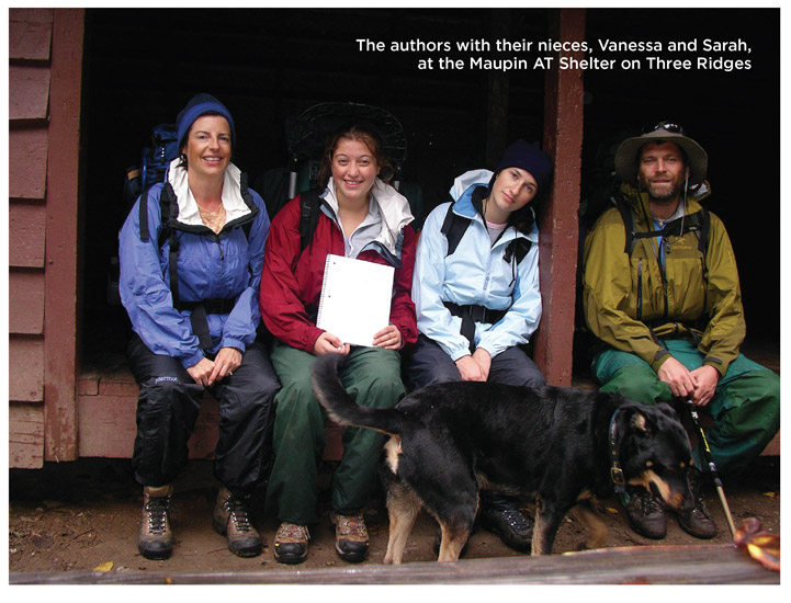
Mile 112.3 - Maupin Field Shelter
Mile 128.4 - Paul C. Wolfe Shelter
Humpback Rocks (3,080 feet) is the AT’s last hurrah before it descends to Rockfish Gap and enters the Shenandoah National Park. With views in all directions, it’s a perfect spot to get a glimpse of how far you’ve come. And what lies ahead.
HIKE INFORMATION
LOCAL INFORMATION
Lynchburg Tourism, (434) 485-7295, www.lynchburgvirginia.org
Roanoke Valley Convention & Visitors Bureau, Roanoke, (800) 635-5535, www.visitroanokeva.com
