SEGMENT 5.
CHESTER GAP TO HARPERS FERRY
WHY GO?
The Blue Ridge of northern Virginia has none of the 4,000-foot-plus heights so plentiful on the Appalachian Trail farther south. Still, the northern Virginia leg is one exhausting climb after another. On open mountain balds, views drop west onto the Great Valley. The bumpy spine of the Blue Ridge runs southward, and to the east lie the rolling meadows of Virginia’s hunt country. Come fall and winter, the mountains here harbor quiet moments, interrupted occasionally by the thrashing of birds foraging among the hornbeam, dogwood, spicebush, and sassafras.
THE RUNDOWN
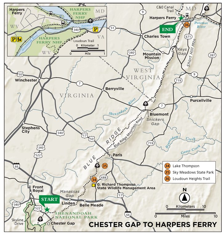
Start: Parking lot on the southbound side of US 522
Distance: 54.5 miles
Difficulty: Moderate
Trail surface: Using dirt footpaths and abandoned dirt roads, hike along low ridges, cliffs, and rock lookouts and through fields, meadows, and stream hollows.
Nearest towns: Front Royal, VA (south access); Harpers Ferry, WV (north access)
Canine compatibility: Dogs permitted
Trail contacts: Appalachian Trail Conference, Harpers Ferry, WV, (304) 535-6331, www.appalachiantrall.org; Potomac Appalachian Trail Club (PATC), Vienna, (703) 242-0693, patc.net; Harpers Ferry National Historical Park, Harpers Ferry, WV, (304) 535-6298, www.nps.gov/hafe
Schedule: Open year-round. Hunting season in G. R. Thompson Wildlife Management Area, mid-Nov through first week in Jan.
Maps/Guides: AT Guide Set #6 covers the AT from Chester Gap, VA, to Harpers Ferry, MD. www.atctrailstore.org
FINDING THE TRAILHEAD
 To Chester Gap Trailhead: From Front Royal, drive south 3.4 miles on US 522 from its intersection with VA 55. The Appalachian Trail (AT) crosses US 522 here. There’s parking for several cars on the southbound side of the highway. DeLorme: Virginia Atlas & Gazetteer: Page 74, A3.
To Harpers Ferry Trailhead: From Harpers Ferry, WV, cross the Shenandoah River bridge and drive west 0.9 mile on US 340 to the Harpers Ferry National Historical Park Visitor Center. There’s an entrance fee. A free shuttle runs every 10 to 15 minutes into Lower Town, where the AT is located. Notify park rangers if you intend on leaving the car for multiple nights. Alternate parking for day hikers is located at the junction of US 340 and VA 671 (in Virginia), at an unsecured roadside parking area near the Tri-State Amoco gas station. From the east end of the Shenandoah River bridge, proceed east 1.6 miles on US 340 to the parking area, on the left. On foot, backtrack 0.3 mile on US 340 to the Loudoun Heights Trail on the southbound side of the road. DeLorme: Virginia Atlas & Gazetteer: Page 79, B7
THE HIKE
Small as it appears on a map, Chester Gap looms big on the AT. The Blue Ridge tapers suddenly into this gap, located east of Front Royal. Northward, the range becomes a chain of low, rounded ridges. After hundreds of miles of exposed ridges, mountain balds, and towering cliffs, this section shrinks into short, vigorous climbs. From Manassas Gap to Snickers Gap, it’s either steep up, or steep down, with little in between. Thru-hikers nickname it the roller coaster for its many breath-stealing bumps.
The story of Chester Gap touches on the mystery of Virginia’s first white explorer who crossed the Blue Ridge. John Lederer explored the mountains for Virginia’s colonial government and, in 1670, wrote of the inspiring view from the mountains. Where exactly he stood is still debated. The AT passes a monument in Linden, Virginia, at Manassas Gap, in honor of his explorations. Some historians say he climbed the Swift Run Gap in Shenandoah National Park. Others say Mount Marshall, also in Shenandoah. Because Lederer’s mission was to locate the headwaters of the Rappahannock River, many believe Chester Gap is where he broke through the Blue Ridge in 1670. The Rappahannock starts as a small mountain stream east of Chester Gap, eventually to become a major tributary of the Chesapeake Bay.
Wherever he stood, Lederer’s first impression of the mountains speaks volumes about how early explorers and settlers viewed the Blue Ridge. It was, for the English, terra incognito. Lederer, maybe feeling lightheaded from his long climb, initially described the blue haze covering the western mountain slope as some kind of great western ocean. When the haze lifted, he moved across the Great Valley and explored present-day West Virginia.
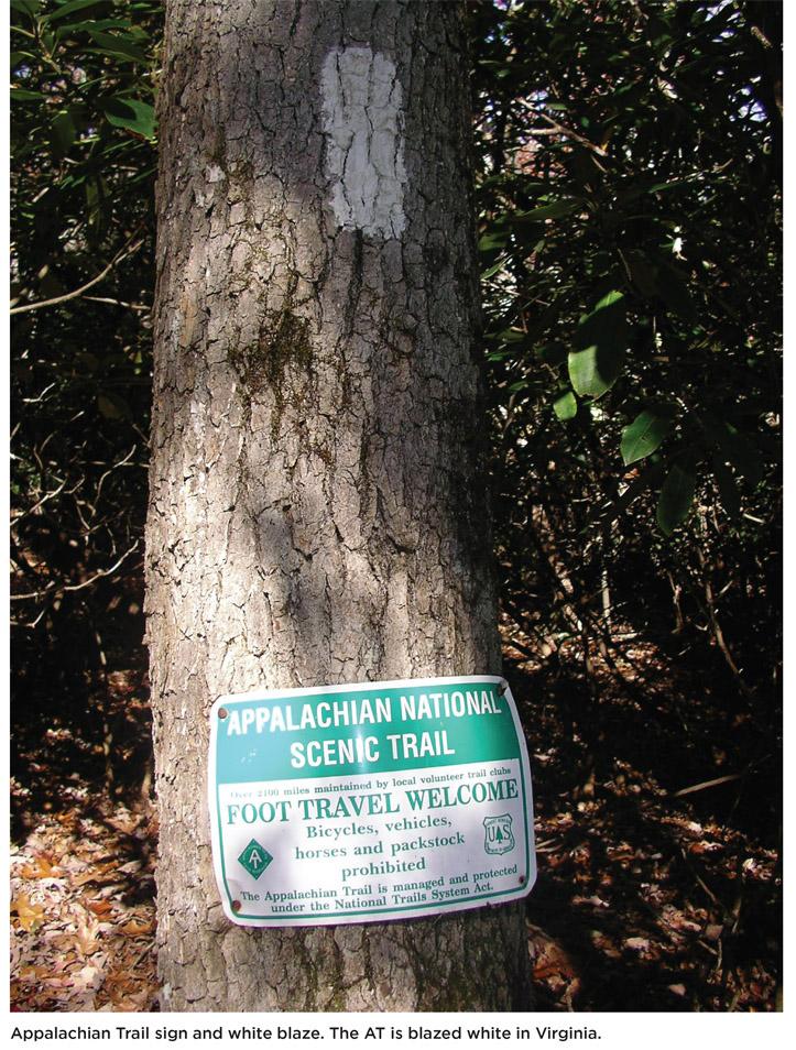
It’s nostalgic, as you hike this 54-mile stretch of the AT, to imagine how volunteers in 1927 plotted the first miles of the world-famous long trail in this region. Only a few stretches of original trail remain intact north of Chester Gap. Trail relocations peaked in the 1950s, when private landowners blocked access. With Washington, DC, only 60 miles east, and because of the many gaps that permit short hikes, the AT in this region has historically received heavy day use. Landowners’ protest is now a moot point. The AT passes near homes and uses several dirt and paved roads south of Manassas Gap. But there are also long stretches through heavy forestland where the scarlet tanager’s song floats down from tall treetops.
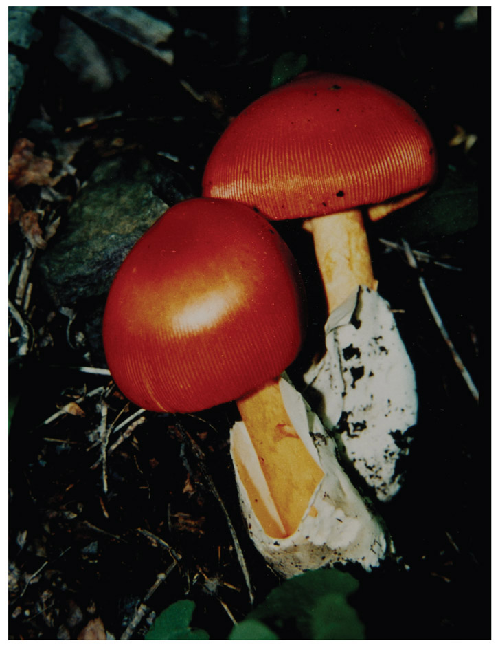
Birds make much racket in the overgrowth of spicebush, honeysuckle, and Virginia creeper along the trail. Redstarts, vireos, wood thrush, bluebirds, robins, and thrushes flit branch to branch, wavering for a second or two on a twig that can barely hold their weight. If they’re lucky, the noisy forage for food ends with a prize: the grapelike fruit of Virginia creeper. Any hiker who has violently pitched forward, tripped up by a camouflaged creeper, knows this vine deserves to be pruned rather than admired. The vine grows adhesive discs on its tendrils that cement to the surfaces of trees, fence posts, and all forms of climbable surfaces. Perhaps we would all have higher regard for the creeper if Virginia’s General Assembly had enshrined it as the state flower. Instead, by a one-vote margin, the vine lost to the flowering dogwood.
The climb on the AT north from Snickers Gap follows a rocky switchback ascent. After topping out, the trail drops and crosses a boulder-lined stream in Pigeon Hollow Sounds of water bubble up from beneath the rocks. The trail will climb again, descend to another stream, and then climb once more to Crescent Rock. Beyond this folded section of Catoctin greenstone, the trail continues its roller-coaster route. Three times between Snickers Gap and Ashby Gap, the AT climbs to high points: Lookout Point, Tomblin Hill, and Buzzard Hill. Three times the trail drops, first into a valley formed by a branch of Spout Run, then into Fent Willey Hollow and Reservoir Hollow.
During the Civil War, the mountain hollows of northern Virginia sheltered a group of Confederate raiders known as Mosby’s Rangers. John Singleton Mosby led the group and coordinated his soldiers’ guerrilla-style tactics. They sprang upon Union soldiers in the mountain passes, took clothes, weapons, and money, then led prisoners into Confederate strongholds. By the end of the war, Mosby ruled a small fiefdom in Loudoun County, from Bull Run Mountain to the crest of the Blue Ridge. Ruled isn’t too strong a word, either. His rangers were not allowed to leave the boundaries of the Confederacy without permission. Any man who missed two roll calls without good reason was discharged. At war’s end, Mosby received a pardon (as did most Confederate soldiers), and then supported his old battlefield enemy Ulysses S. Grant in the presidential election.
Few towns are richer in Civil War history than Harpers Ferry, West Virginia. This national historic park is the end of the AT in Virginia, at the bridge crossing on US 340. The Shenandoah River thunders below this symbolic crossing. The Blue Ridge extends into Maryland and southern Pennsylvania. In that region, the chain goes by the name South Mountain. Not until the White Mountains of New Hampshire does the AT reach heights equal to Virginia’s mountains. From Weaver Cliffs, north of Harpers Ferry, the AT hiker can look back south along the Blue Ridge. If conditions are right, you might see (or believe you see), if only for a whimsical moment, what John Lederer saw in 1670, an endless ocean of blue haze.
AT SHELTERS/HUTS (MILEAGE NORTH FROM CHESTER GAP)
Mile 5.2 - Denton Shelter
Mile 10.7 - Manassas Gap Shelter
Mile 15.1 - Dicks Dome Shelter
Mile 24.1 - Rod Hollow Shelter
Mile 31.0 - Sam Moore Shelter
Mile 45.1 - David Lesser Shelter
HIKE INFORMATION
LOCAL INFORMATION
Loudoun Tourism Council, Leesburg, (703) 771-2170 or (800) 752-6118, www.visitloudoun.org
Front Royal Visitor Center, Front Royal, (800) 338-2576, www.frontroyalchamber.com