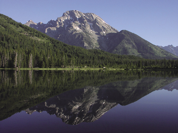
String Lake reflection. National Park Service
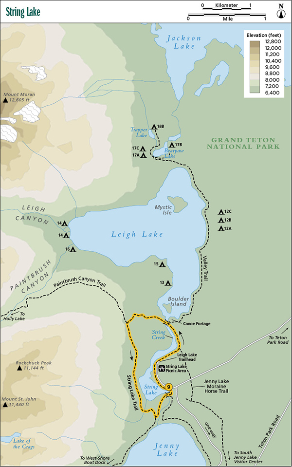
9 String Lake
Best season: June through Sept
Maps: Earthwalk Press Grand Teton map; National Park Service handout map
Finding the trailhead: Take US 89 north of Jackson for 11.5 miles and turn left (west) at the Moose Junction. Drive past the Moose Visitor Center and through the entrance station (about a mile after turning off the highway). Follow this paved park road for another 9.7 miles from the entrance station to the Jenny Lake turnoff. Turn left (west) here and drive 0.6 mile (follow the signs and take two right turns) to the String Lake Trailhead. From the north, drive 9.9 miles from the Jackson Lake Junction and turn right (west) at the Jenny Lake turnoff. Park in one of the large parking lots at the trailhead or picnic area. No toilets right at the trailhead, but you can find one in the nearby picnic area. Trailhead GPS: 43.784082 / -110.727354
The Hike
Short hikes really don’t get much nicer than this one, a mostly flat loop around a gorgeous mountain lake in the shadow of the high peaks. It’s also a good choice for an early-season hike because the snow usually leaves the area long before it gives up the high country.
The first 0.3 mile of the String Lake Trail is wheelchair accessible, with magnificent views of the Teton Range over placid String Lake. This is a piedmont lake formed by valley glaciers at the head of Paintbrush Canyon. The same goes for Jenny Lake at the head of Cascade Canyon and Leigh Lake at the head of Leigh Canyon.
String Lake reflection. National Park Service
After passing by the picnic area and parking lot, the trail is no longer wheelchair accessible but is still double wide and in terrific shape, with more sandy beaches and outstanding views. The Jenny Lake Moraine horse trail comes in from the east.
At the end of String Lake, go left (west) at the junction. You immediately reach a long footbridge over the short but scenic stream connecting String Lake and Leigh Lake.
From the bridge, walk through a mature forest up to the junction with the Paintbrush Canyon Trail. Go left (south) and continue through mostly open terrain down to the west shoreline of String Lake. The views aren’t quite as nice here with no Teton Range backdrop, but they are still well worth the walk. At the next junction, go left (east), cross the stream between String Lake and Jenny Lake on another big footbridge, and you’re back at the trailhead.
Camping: No camping allowed on this route.
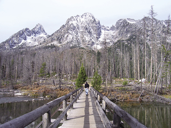
The bridge over the outlet of String Lake. National Park Service
Option: This loop hike can be taken in reverse with no extra difficulty.
Side trips: If you need more hiking, you can hike down to the head of Jenny Lake (0.4-mile round-trip) or up to the foot of Leigh Lake (0.3-mile round-trip).
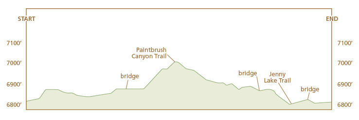
Miles and Directions
0.0String Lake Trailhead
0.3String Lake Picnic Area
0.7Horse trail comes in from the east
1.1End of String Lake and junction with loop trail; turn left
1.2Bridge over String Creek
1.8Junction with Paintbrush Canyon Trail; turn left
3.1Junction with Jenny Lake Trail; turn left
3.3Bridge over stream between String Lake and Jenny Lake
3.4String Lake Trailhead