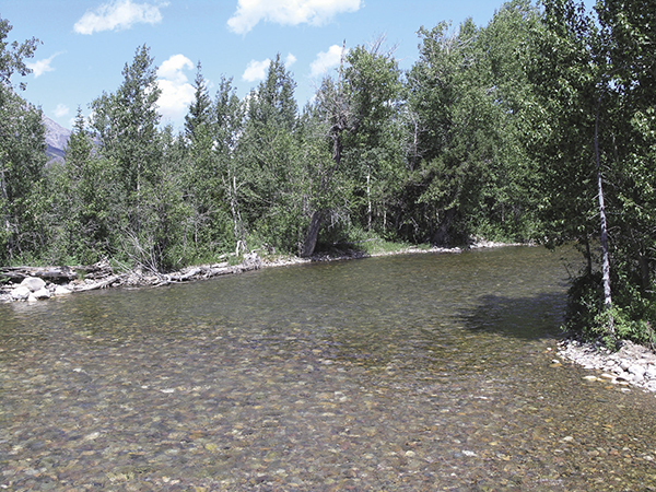
Cottonwood Creek leaving Jenny Lake. National Park Service
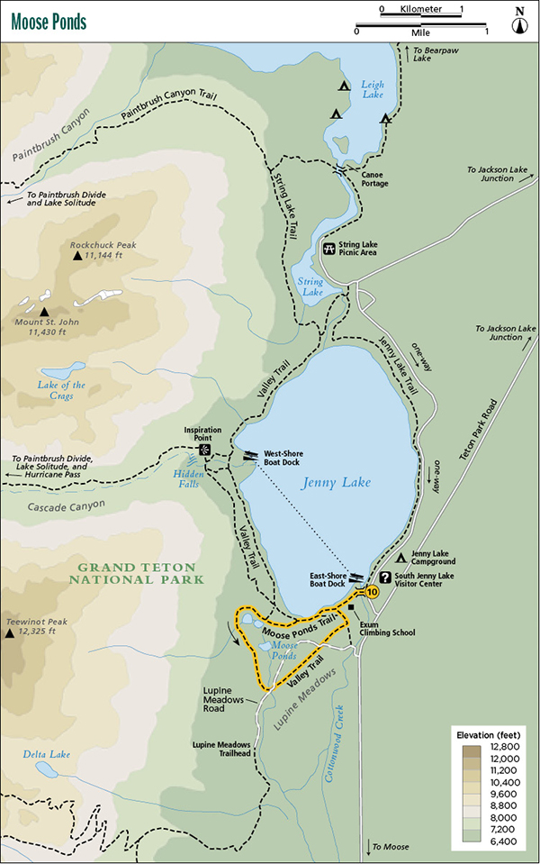
10 Moose Ponds
Description: A short loop hike for wildlife watchers
Start: South Jenny Lake Visitor Center
Total distance: 2.6-mile loop
Best season: June through Sept
Maps: Earthwalk Press Grand Teton map; National Park Service handout map
Finding the trailhead: Take US 89 north of Jackson for 11.5 miles and turn left (west) at the Moose Junction. Drive past the Moose Visitor Center and through the entrance station (about a mile after turning off the highway). Follow this paved park road for another 6.8 miles from the entrance station to the South Jenny Lake turnoff. Turn left (west) here and drive less than 0.5 mile to the South Jenny Lake Visitor Center. From the north, drive 12.8 miles from the Jackson Lake Junction and turn right (west) at the South Jenny Lake turnoff. The South Jenny Lake area has a general store, visitor center, boat dock, toilet facilities, and usually plenty of room to park. This is a heavily used area, and the boat ride across the lake is very popular, so in midday during the summer, the parking lot is often full. Trailhead GPS: 43.751604 / -110.725388
The Hike
The area around South Jenny Lake is heavily developed—and a bit confusing to the first-time visitor. Fortunately, if necessary, you can get your questions answered at the visitor center.
From the visitor center, start following the trail around the south edge of Jenny Lake. You immediately cross over Cottonwood Creek (outlet to Jenny Lake), along the north edge of a road, and pass the boat-launching area before getting to what looks like a real trail (Jenny Lake Trail). Follow this trail for less than a half mile to the junction with the Moose Ponds Trail, which is on top of a glacial moraine at the south end of Jenny Lake. Go right (west) here and drop down a short but steep slope to the Moose Ponds. The trail winds through willow flats and over footbridges around the three ponds. Watch for elk and moose on the slopes above and waterfowl on the ponds.
Cottonwood Creek leaving Jenny Lake. National Park Service
After leaving the Moose Ponds, go through a short section of mature forest and then out into the sagebrush flats of Lupine Meadows. The last mile of the hike can also be confusing as you cross the unpaved road to the Lupine Meadows Trailhead twice and go behind the Exum Climbing School before getting back to the South Jenny Lake area.
Camping: No camping allowed on this route.
Options: This loop hike can be taken in reverse with no extra difficulty. You can also add this loop to the Jenny Lake hike.
Miles and Directions
0.0South Jenny Lake Visitor Center
0.1Footbridge over Cottonwood Creek, the outlet to Jenny Lake
0.3Boat-launching area; junction with Jenny Lake Trail
0.6Junction with Moose Ponds Trail; turn right
2.0Lupine Meadows Road
2.3Lupine Meadows Road
2.5Exum Climbing School
2.6South Jenny Lake Visitor Center