Taggart Lake. National Park Service
11 Taggart Lake
Description: A short hike to a low-elevation lake
Start: Taggart Lake Trailhead
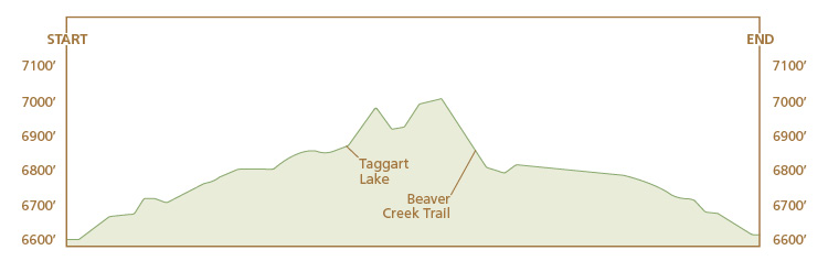
Total distance: 4.0-mile lollipop loop
Best season: June through Sept
Maps: Earthwalk Press Grand Teton map; National Park Service trail guide to Taggart and Bradley Lakes
Finding the trailhead: Take US 89 north of Jackson for 11.5 miles and turn left (west) at the Moose Junction. Drive past the Moose Visitor Center and through the entrance station (about a mile after turning off the highway). Follow this paved park road for another 2.2 miles from the entrance station and turn left (west) into the Taggart Lake Trailhead. If you’re coming from the north, drive 17.4 miles from the Jackson Lake Junction and turn right (west) into the trailhead parking lot. This trailhead has toilet facilities and plenty of parking. Trailhead GPS: 43.693164 / -110.732919
The Hike
The short lollipop hike to Taggart Lake is one of the most accessible and popular day hikes in the park. The trail is in great shape all the way, with a few rocky sections.
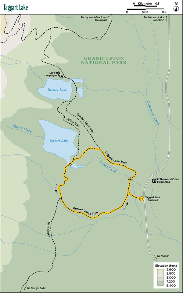
The first 0.2 mile of the Taggart Lake Trail to the first junction is double wide and flat and goes through a sagebrush-dotted meadow. At the junction, go right (northwest); the trail becomes singletrack and goes past some minor development and over Taggart Creek, which you cross on a sturdy footbridge. After the creek the trail climbs gradually up to the top of a moraine, where you get consistently good views of the Teton Range, including Grand Teton. This section of the trail also goes through the track of a 1996 forest fire, so you can observe how the forest regenerates.
When you reach the junction with the Bradley Lake Trail, go left (west) and continue for another 0.5 mile to the lake and the junction with the Valley Trail. Go left (south) here and hike along the lakeshore to a large footbridge over the outlet.
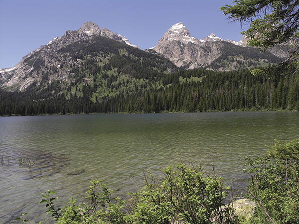
Taggart Lake. National Park Service
Forest-lined Taggart Lake sits at only 6,902 feet at the foot of Avalanche Canyon. You get a gorgeous view of the Grand Teton over the lake on the horizon. You can look around and see how glaciers left a moraine, which formed a natural dam to create the lake.
After leaving the lake, you hike on the Valley Trail for 0.8 mile to the junction with the Beaver Creek Trail. Go left (east) and follow Beaver Creek until you climb over a small hill (bigger in the counterclockwise direction) and drop down to the sagebrush flat to the junction with the loop trail and back to the trailhead.
Camping: No camping allowed on this route.
Option: You can take the loop in the reverse direction.
Miles and Directions
0.0Taggart Lake Trailhead
0.2Start of loop trail; turn right
0.4Taggart Creek
1.1Junction with Bradley Lake Trail; turn left
1.6Taggart Lake and junction with Valley Trail; turn left
2.4Junction with Beaver Creek Trail; turn left
3.8End of loop; turn right
4.0Taggart Lake Trailhead