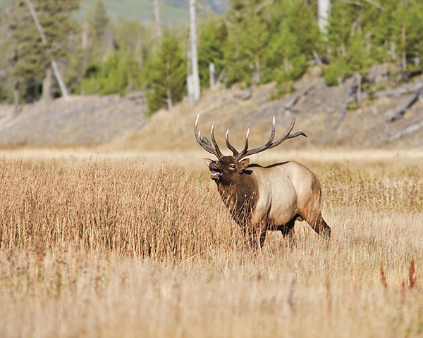
Lots of elk and not many hikers on the Elk Ridge hike. Shutterstock
35 Elk Ridge
Description: A remote and seldom-hiked loop through the North Trails section of the park, a long day hike or overnighter
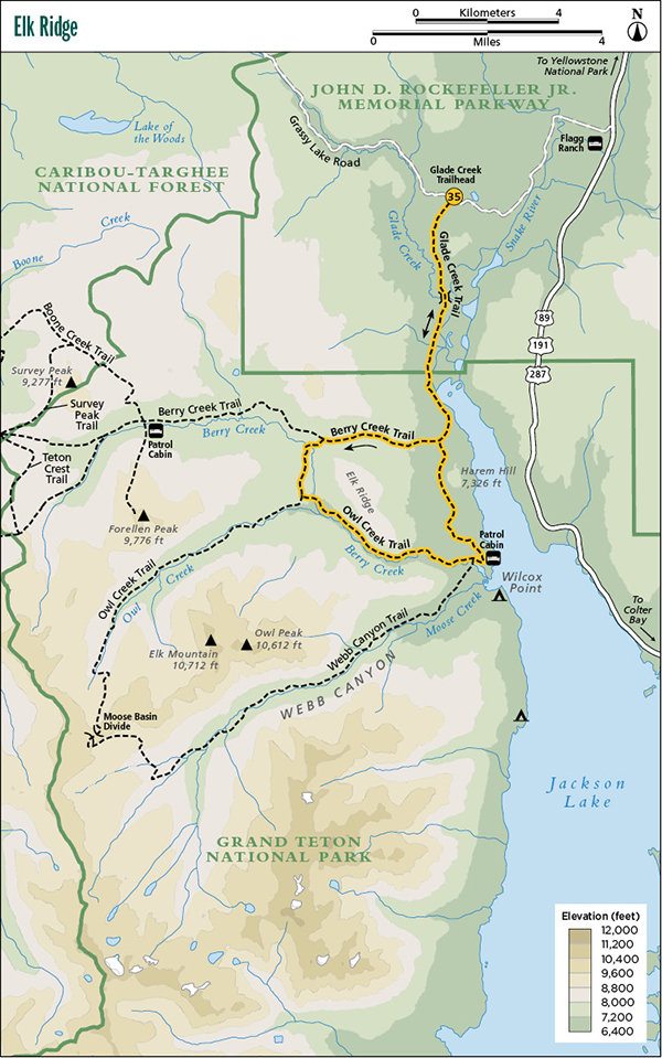
Start: Glade Creek Trailhead
Total distance: 19.3-mile lollipop loop
Best season: July through Sept
Maps: Earthwalk Press Grand Teton map; National Park Service handout map
Finding the trailhead: From US 89, drive 4.4 miles west of Flagg Ranch on Grassy Lake Road (also known as Ashton-Flagg Ranch Road) and park at the trailhead on the left (south) side of the road. Trailhead GPS: 44.089717 / -110.724238
The Hike
This trail loops around forested Elk Ridge in the remote North Trails section of Grand Teton National Park. It lacks the alpine vistas of many hikes such as nearby Moose Basin Divide and Jackass Pass, but it provides the quiet solitude of a walk in the woods with, most likely, only wild companions. You aren’t likely to see many hikers on this route, but you might see Old Ephraim, the grizzly bear.
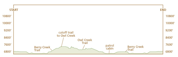
For details on the first section of this route, refer to the Glade Creek hike. About 0.5 mile after crossing into the park, the trail leaves the meadow and climbs up onto the slopes of Harem Hill through a short section of mature forest before emerging into another huge mountain meadow. The trail follows the east side of the meadow until you see the junction with the Berry Creek Trail. Some older maps may show a triangle junction at this point, but the NPS removed this in 1995.
When you reach the Berry Creek Trail junction, go right (west) and continue hiking through a series of big meadows until you see a junction with the cutoff trail to Owl Creek. Go left (south) and cross Berry Creek (sorry, no footbridge), then climb a small ridge above the creek and back down into the confluence of Berry Creek and Owl Creek. At the junction, go left (east) and cross Berry Creek again just before it disappears into Owl Creek (sorry again, no footbridge).
If you’re backpacking, the confluence area is a reasonably good point about halfway through this trip for your camp. You won’t have trouble finding a great campsite in this area, which is at the east end of a huge meadow lining Owl Creek.
Lots of elk and not many hikers on the Elk Ridge hike. Shutterstock
The trail gradually climbs up to a bench above Owl Creek and stays there until you drop down to a big, flat meadow on the shore of Jackson Lake. At the beginning of the meadow, go left (northeast) at the junction with the Webb Canyon Trail and left (north) again at the junction with the Glade Creek Trail at the patrol cabin.
It’s about 2 scenic miles more (nice views of Jackson Lake) back to the junction with the Berry Creek Trail. Turn right (north) here and retrace your steps to Glade Creek and the trailhead.
Camping: You can set up a no-trace camp anywhere along this route, before or after entering the park.
Options: You can knock 9.8 miles off this trip by paddling a canoe from Leeks Marina on the east side of Jackson Lake over to Wilcox Point and doing only the 9.5-mile loop around Elk Ridge. This loop might be more difficult when done clockwise instead of counterclockwise as described here because of a fairly big hill coming from the south on the 2-mile cutoff trail between Owl Creek and Berry Creek. You can also make this a three- or four-day backpacking trip.
Side trips: If you’re camping at Owl Creek, take a morning or evening stroll west on the trail along the stream and watch for wildlife.
Miles and Directions
0.0Glade Creek Trailhead
1.5Cross the Glade Creek footbridge
2.0Break out into a big meadow
3.5Park boundary
4.9Junction with Berry Creek Trail; turn right
6.4Junction with cutoff trail to Owl Creek; turn left
8.4Junction with Owl Creek Trail; turn left
12.3Junction with Webb Canyon Trail; turn left
12.4Patrol cabin and junction with Glade Creek Trail; turn left
14.4Junction with Berry Creek Trail; turn right
15.8Park boundary
19.3Glade Creek Trailhead