Getting There
By Air
San Francisco International Airport (SFO)
Tel: 650-821-8211 or 1-800-435-9736; www.flysfo.com.
The airport is 14 miles (23km) south of downtown San Francisco near the town of San Mateo. For public transportation to and from the city, Bay Area Rapid Transit (BART; www.bart.gov) provides a Metro rail service within the Bay Area and has a station at SFO and several within San Francisco. Take the SFO AirTrain to the Garage G/BART Station stop where you can buy your ticket and board. The one-way fare from SFO to downtown San Francisco is $8.10. SamTrans (tel: 800-660-4287; www.samtrans.com) operates a public bus service to San Mateo County. The taxi fare from SFO to downtown San Francisco is approximately $50. Several private shuttles, including BayPorter Express (tel: 415-467-1800; www.bayporter.com) can also be booked in advance or upon arrival.
Oakland International Airport
Tel: 510-563-3300; www.flyoakland.com.
Much smaller and less crowded than SFO, Oakland Airport is well-served by public transportation and much closer to East Bay destinations. Free shuttles link the airport with the BART system and SFO. As with SFO, private shuttles can also be booked.
Los Angeles International Airport (LAX)
Tel: 310-646-5252; www.lawa.org.
LAX is one of the world’s busiest airports, handling the majority of the state’s international, domestic, and regional air traffic. There are information booths just outside the terminal for MTA (Metropolitan Transportation Authority) buses (tel: 213-626 4455). A free, frequent shuttle bus connects LAX with METRO’s Green Line Light Rail. The LAX FlyAway bus service provides frequent nonstop transportation between LAX and Van Nuys Bus Terminal, Union Station in downtown Los Angeles, and Westwood/UCLA. You can also arrange for door-to-door shuttle van service, rental cars, and taxicabs ($15.00 minimum fare for trips originating at LAX, a $46.50 flat fare for trips between LAX and Downtown, and a $4.00 surcharge for all trips originating at LAX).
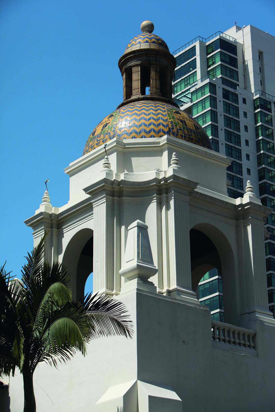
Santa Fe train station in San Diego.
David Dunai/Apa Publications
Palm Springs International Airport
San Diego International Airport (Lindbergh Field)
Tel: 619-231-2100; www.san.org.
Airlines
Numerous major airlines fly regularly into California, including:
Air France, www.airfrance.com
Alaska Airlines, www.alaskaair.com
American Airlines, www.aa.com
British Airways, www.britishair.com
Delta Airlines, www.delta.com
Southwest, www.southwest.com
United, www.united.com
US Airways, www.usairways.com
Virgin Atlantic, www.virginatlantic.com
Flights arrive from most major American cities. Transportation information: tel: 619-233 3004.
In addition to the international airports listed above, there are smaller, regional airports in several locations throughout California, including Palmdale, Ontario, Burbank, Fresno, Sacramento, San Jose, Van Nuys, and Orange County. Shuttle flights are usually available at all of the larger air terminals.
By Rail
Amtrak
Tel: 1-800-872-7245; www.amtrak.com.
Amtrak is the major rail passenger carrier in the US. Though the system is little used by Californians, it can be a pleasant way to get around the state, provided you are not in a hurry. The California Zephyr is the main rail line into Northern California, stopping at Sacramento, Colfax, Davis, Martinez, and Truckee before reaching Emeryville station, where there is a free bus service to San Francisco.
Amtrak also offers several major rail lines in Southern California. The Sunset Limited from New Orleans stops at North Palm Springs, Ontario, and Pomona before it reaches Los Angeles. The Pacific Surfliner links San Diego to Los Angeles and on to Santa Barbara and San Luis Obispo, while the San Joaquin runs between Sacramento and Bakersfield, with stops at Stockton, Modesto, Merced, and Fresno.

Cable car in San Francisco..
Richard Nowitz/Apa Publications
The state is tied together by the Coast Starlight, which travels north from Los Angeles all the way to Seattle, stopping at Van Nuys, Simi Valley, Oxnard, Santa Barbara, San Luis Obispo, Paso Robles, San Jose, Oakland (from here, there’s a bus transfer to San Francisco before the route continues), Emeryville, Martinez, Davis, Sacramento, Chico, Redding, and across the Oregon border. Amtrak offers some local services also.
By Bus
Greyhound Lines
Tel: 800-231-2222; www.greyhound.com.
The national bus line, Greyhound Lines, as well as a number of smaller charter companies, provide an impressive network of ground travel throughout California, offering daily service to major towns and cities. Routes and schedules are subject to change; it is a good idea to check all arrangements with local stations, in advance. San Francisco, Oakland, Los Angeles, San Diego, and other large towns all have municipal bus systems.
By Road
The principal north–south byways in California are listed below:
Interstate 5 (the Golden State and Santa Ana freeways), which covers the distance from Canada to Mexico via Seattle, Sacramento, Los Angeles, and San Diego.
Interstate 15, which transits San Bernardino and San Diego after a long passage from Montana’s Canadian border, via Salt Lake City and Las Vegas.
US 101 (the Ventura and Hollywood freeways), which proceeds south down the Pacific coast from Washington state, crosses San Francisco’s Golden Gate Bridge, and ends in downtown Los Angeles.
State Highway 1, which hugs the coast from south of Los Angeles to San Francisco and further north.
The principal east–west byways in California are:
Interstate 8, which departs from Interstate 10 at Casa Grande, Arizona, and ends in San Diego.
Interstate 10 (the San Bernardino and Santa Monica freeways), which begins on the east coast in Jacksonville, Florida, and continues through New Orleans, Houston, El Paso, Tucson, and Phoenix before cutting through Los Angeles, then ending at the coast in Santa Monica.
Interstate 40, which connects Knoxville, Tennessee, with Barstow, California, via Memphis, Oklahoma City, and Albuquerque.
Getting Around
Public Transportation
San Francisco
San Francisco is served by an excellent public transportation system. The city’s Muni network (tel: 415-673-6864; www.sfmuni.com; runs 6am–late, with some night service) of buses, street cars, and historic cable cars makes getting around a snap. Bus fare for adults is $2, which is paid in exact change upon boarding the front of the bus. Riders paying cash are given a transfer slip, and can ride other buses for several hours by just flashing this piece of paper to the bus driver. The “owl” late-night service runs every 30 minutes from 1–5am.
The Bay Area Rapid Transit (known locally as BART) subway system (tel: 415-989-2278; www.bart.gov; runs Mon–Fri 4am–midnight, Sat 6am–midnight and Sun 8am–midnight) connects San Francisco with the East Bay via a tunnel that goes under the bay. BART is one of the most efficient and modern rail lines in the United States and serves 43 stations in three counties, from San Francisco to Millbrae and throughout the East Bay. Its stations provide maps that clearly explain routes and fares, and nearby ticketing machines allow passengers to purchase tickets.
To save on transportation costs, consider purchasing a 1-day ($14), 3-day ($22), or 7-day ($28) Visitor Pass which covers unlimited bus, historic street car, and cable car rides.
Oakland and Berkeley are serviced by East Bay Transit (tel: 510-839-2882, www.actransit.org)
Caltrain (tel: 1-888-500-4636; www.caltrain.com) runs passengers between San Francisco and San Jose, with several stops along the peninsula. This rail service operates from the terminal at Fourth and King streets in San Francisco.
Many locals use ferries to get to and from work, but for visitors they provide a great scenic and environmental alternative to driving. Departing from Fisherman’s Wharf or the Ferry Building, they travel to Angel Island and throughout the North and East Bay areas:
Blue and Gold Fleet, Pier 39 Marina Terminal, The Embarcadero at Beach St; tel: 415-705-8200; www.blueandgoldfleet.com.
Golden Gate Ferry, Ferry Building, The Embarcadeo at Market St; tel: 415-455-2000; www.goldengateferry.com.
Los Angeles
The main public transportation option in Los Angeles is the Los Angeles County Metropolitan Transportation Authority bus company (tel: 213-626-4455; www.mta.net), which everyone calls the Metro. The MTA oversees the city’s surprisingly comprehensive bus system, as well as the newer Metro and light rail system.
The popular Red Line operates between Downtown, North Hollywood, and Universal City; the Purple line overlaps part of it. The Blue Line operates between Downtown and Long Beach. The Green Line runs all the way to Redondo Beach, crossing the Blue Line just north of Compton. The Gold Line, travels between Downtown and Pasadena, and the Expo Line goes out to Culver City.
A basic fare is $1.50, and a day pass (which is valid until 3am the next day) costs $5. Drivers do not have change, so carry the exact fare. A $20 seven-day pass for Metro bus and rail lines is also available – check sale locations at www.mta.net, where you can also plan your route with schedules and maps.
San Diego
The public transportation service here is the San Diego Metropolitan Transit System (tel: 619-231-1466; www.sdmts.com), which offers bus and trolley routes throughout the San Diego area, from Old Town to Mission Beach and Mission Valley. One-way bus tickets are $2.25, trolley tickets are $2.50; an all-day pass for either is $5. Without the all-day pass, no transfers are allowed without purchasing a new ticket. Purchase your ticket before boarding the trolley from the ticket vending machines at each station.
The system also provides access to other towns in and around San Diego County, including Coronado, Del Mar, Escondido, Oceanside, Borrego Springs, and Tecate. For tickets, monthly passes, and general and route information, contact the Transit store (102 Broadway; tel: 619-234-1060).
A handy tool for public transportation in California is NextBus (www.nextbus.com). Also available as a mobile phone application, this service provides real-time arrival information for publication transportation so you can find out whether your bus is coming in 5 minutes or 35.
Private Transportation
Driver’s License and Insurance
Drivers are required to carry a valid license at all times. California visitors may drive for up to 12 months with a non-California driver’s license. Visitors can also obtain an International Driving Permit (IDP) from international automobile associations.
Be sure to keep these and a certificate proving you have liability insurance with you at all times because you will be required to show them to any law enforcement officers who stop your car. It is illegal to drive without these items.
The Napa and Sonoma Valleys are perfectly suited for scenic, day-long road trips.
David Dunai/Apa Publications
Renting a Car
National car-rental companies are located at all airports and large towns. The best rates are usually available by booking in advance. In most cases, you must be at least 21 years old to rent a car (often 25), and you must have a valid driver’s license and at least one major credit card. Foreign travelers may need to produce an international driver’s license or a license from their home country. Be sure to take out collision and liability insurance, which may not always be included in the base price of the rental. It is also a good idea to inquire about an unlimited-mileage package, especially on a long trip, if not already included: given the vast area of California, the extra mileage costs can add up quickly.
Alamo: Tel: 1-877-222-9075; www.alamo.com
Avis: Tel: 1-800-331-1212 in US, 1-800-331-1084 outside US; www.avis.com
Budget: Tel: 1-800-527-0700; www.budget.com
Dollar: Tel: 1-800-800-4000; www.dollar.com
Enterprise: Tel: 1-800-261-7331; www.enterprise.com
Hertz: Tel: 1-800-654-3131; www.hertz.com
National: Tel: 1-877-222-9058; www.nationalcar.com
Thrifty: Tel: 1-800-847-4389; www.thrifty.com
Laws for Safety
Belts and child seats: California law requires that every passenger wear a seat belt. Youth or infant seats are required for babies and small children under 60lbs or 6 years of age.
Cell phones: It is illegal in California to talk on a cell phone while driving unless you are able to listen and talk hands-free.
Emergency vehicles: When a fire truck, ambulance, or police vehicle approaches from either direction with flashing lights and/or a siren, you must immediately pull over to the side of the road.
Helmets: State law requires all motorcycle riders to wear helmets.
Hitchhiking: Hitchhiking is illegal on all highways and Interstates and on many secondary roads as well. Because traffic is sparse in some regions, it can also be quite difficult. In California, as elsewhere in the United States, hitchhiking can be dangerous and unpredictable. However, if you do decide to hitch, it is best to do it from an exit ramp (if legal) or a highway rest stop, rather than on the road itself. For long distances, it is advisable to make a sign clearly stating your destination. To find the safest situations, try checking ride services and college campus bulletin boards for posted rideshares.
Roadside assistance: The Highway Patrol cruises the state’s highways, not just monitoring speed limits but also looking for drivers in trouble. If you have any emergency that won’t allow you to continue the trip, signal your distress by raising the hood. Motorists are often advised that they are safer staying in the car with the doors locked until a patrol car stops to help, rather than leaving it and trying to hitchhike.
Motoring Advisories
If you plan on driving any distance, it’s a good idea to join the American Automobile Association or one of its affiliate offices. Locations include those near the LA airport (tel: 310-390-9866; www.aaa-calif.com) and in San Francisco (tel: 415-565-2012; www.csaa.com). In addition to emergency road service, AAA offers maps, guidebooks, and insurance. There are reciprocal arrangements with many international AAA organizations, such as those in Great Britain, Germany, and Australia.
Parking
Parking meters accept coins, and sometimes credit cards. Parking meters do not need to be fed on Sundays or major holidays. When you’re looking for a parking space, note the color of the curb, which corresponds to the following limitations:
No color: No specific limitations; follow guidelines on nearby signs or meters.
White: You may stop only long enough to pick up or drop off passengers.
Green: You may park for a limited time; look for a sign nearby with the time limit, or a time limit painted on the curb.
Yellow: Stop no longer than the time posted to load or unload passengers or freight; drivers of non-commercial vehicles usually must stay in the car.
Red: No stopping or parking.
Blue: Parking is permitted only for a disabled person who displays a special placard or license plate.
Rules of the Road
Some roads are for one-way traffic only and are identified by a black and white sign with an arrow pointing in the permitted direction of travel. At an intersection with a four-way red stop sign, motorists must completely stop and then proceed across the intersection following the order in which they arrived at the stop. If you arrive at the same time, the person to the right has the right of way, but usually one person just waves on another.
In California, it is legal to make a right turn on a red light after making a full stop, unless signs indicate otherwise.
Speed limits for roads and highways are posted on white signs to the right, as are all other road signs. Unless otherwise indicated, the speed limit is 65mph (105kmh) on freeways, 55mph (88kmh) on two-lane highways, 35mph (56kmh) on main city streets, and 25mph (40kmh) near schools and in residential or business districts.
Watch for white signs warning that you will be in a different “Speed Zone Ahead.” Be prepared to slow to the lower speed you will soon see posted on upcoming white signs. Some very small towns are notorious for catching and fining drivers who have not slowed down quickly enough from the highway speed to the (much lower) in-town speed limit
Taxis
Taxis are an easy, though expensive, way to get about major cities. They hover around popular tourist or nightlife spots, but in out-of-the-way locations it’s best to call a radio-dispatched taxi. Your fare will be displayed on the meter and will include a flag-drop charge plus a per-mile and/or a per-hour charge. Fares follow standard rules by city, listed below. A 10 percent tip, rounding up to the next dollar, is standard.
San Francisco
Standard charges are $3.50 for the first one-fifth mile or flag, $0.55 each additional one-fifth mile or fraction thereof, $0.55 each minute of waiting or traffic time delay, plus a $2 airport surcharge.
DeSoto Cab Company: Tel: 415-970-1370
Sharing the road in Marin County.
David Dunai/Apa Publications
Green Cab: Tel: 415-626-4733
Luxor Cab Company: Tel: 415-282-4141
Yellow Cab: Tel: 415-333-3333
All cabs authorized by the city (look for the metal “license plate” on the dashboard, and the driver’s ID, visible from the back seat) Error! Hyperlink reference not valid.are obligated to let you pay by credit card, though they will often complain that their machine is “broken” as they prefer cash to avoid paying a surcharge to the credit card companies. For a list of these companies, see www.sfmta.com.
Los Angeles
Look for the Official City of Los Angeles Taxicab Seal before boarding – this means the taxi driver is insured, well trained, and authorized by the city to operate. Fare is $2.85 for the first 1/9 mile or flag, $0.30 for each additional 1/9 mile ($2.70 per mile), and 0.30 for each 37 seconds waiting ($29.19 per hour).
For taxi cab companies and the areas each serves, go to www.taxicabsla.org.
Tours via Car
Seagull signs in blue and white mark San Francisco’s 49-Mile Scenic Drive, a name which says it all. A free map from the San Francisco Visitor Center at Powell and Market streets details the route.
Drivers who seek to explore old US Route 66 in the south of the state can get a free map from the LA Visitors Center (6801 Hollywood Blvd; tel: 323-467-6412) which charts 29 points of interest along 62 miles (100km) of the historic road.
The 17-Mile Drive in Pebble Beach is another beautiful ride (motorcycles prohibited).
San Diego
Standard charges are $2.20 for the first 1/10 mile, $2.30 for each additional mile, and $19.00 per hour of waiting time.
Traveling in Deserts and Mountains
A word of caution for desert travelers: the single most important precaution you can take is to tell someone your destination, route, and expected time of arrival. Be sure to check tires carefully before setting out; heat builds pressure, so have tires at slightly below normal air pressure. The desert’s arid climate makes carrying extra water – for passengers as well as for vehicles – essential. Carry at least 1 gallon (4 liters) per person. Keep an eye on the gas gauge; it’s a good idea to have more than you think you need. Remember, if you should have car trouble or become lost, do not strike out on foot. A car, visible from the air and presumably on a road, is easier to spot than a person on their own, and it affords shelter from the weather. Just be patient and wait to be found.
Mountain drivers are advised to be equally vigilant. Winter storms in the Sierras occasionally close major roads, and at times chains are required for tires. For 24-hour information on road conditions throughout the state, call tel: 1-800-427-7623. Remember to phone ahead for road conditions before you depart.
Traveling to Mexico
Since March 1, 2010, all US citizens – including children – have been required to present a valid passport or passport card for travel into Mexico, as are all other nationalities (along with their Green Card, if they have one, for re-entry to the US.)
US citizens do not require a visa or a tourist card for tourist stays of 72 hours or less within the 12–19-mile (20–30km) “border zone”. US citizens traveling as tourists beyond this zone, or entering Mexico by air, must pay a fee to obtain a tourist card, also known as an FMM, available from Mexican consulates, Mexican border crossing points, Mexican tourism offices, airports within the border zone, and most airlines serving Mexico. Proof of nationality must accompany the visa.
Mexican law requires that any non-Mexican citizen under the age of 18 departing Mexico must carry notarized written permission from any parent or guardian not traveling with the child to or from Mexico. This permission must include the name of the parent, the name of the child, the name of anyone traveling with the child, and the notarized signature(s) of the absent parent(s).
US insurance is not valid in Mexico and it is definitely a wise move to obtain short-term insurance, obtainable at innumerable sales offices just north of the border.
Crossing into Mexico can be relatively easy. There are three major crossings: at busy San Ysidro, 18 miles (29km) south of downtown San Diego, which is the gateway to Tijuana; at Tecate off State Highway 94, where there is rarely a wait, although the border does tend to close in early in the evening; and at Mexicali (which is also Baja’s capital), a dreary industrial city situated opposite the California town of Calexico, about 90 miles (145km) to the east.
Because driving in Tijuana for those unfamiliar with the city (and the Spanish language) can be troublesome, many drivers park in San Diego’s San Ysidro, crossing into Tijuana via the elevated pedestrian walkway. Avoid leaving your car in the parking places of merchants as it will be towed away by police.
There’s an all-day secure lot off the “Last Exit US parking” ramp – turn right at the stop sign to the Tijuana side. Cheap taxis and buses are also available.
The return to California can be a bit more tense than the entry into Mexico, as US Border Patrol officers take far more interest in who’s coming into the country (hence those passports and Green Cards). Waiting several hours to cross back into the US is not uncommon.