20 Verde River Greenway North

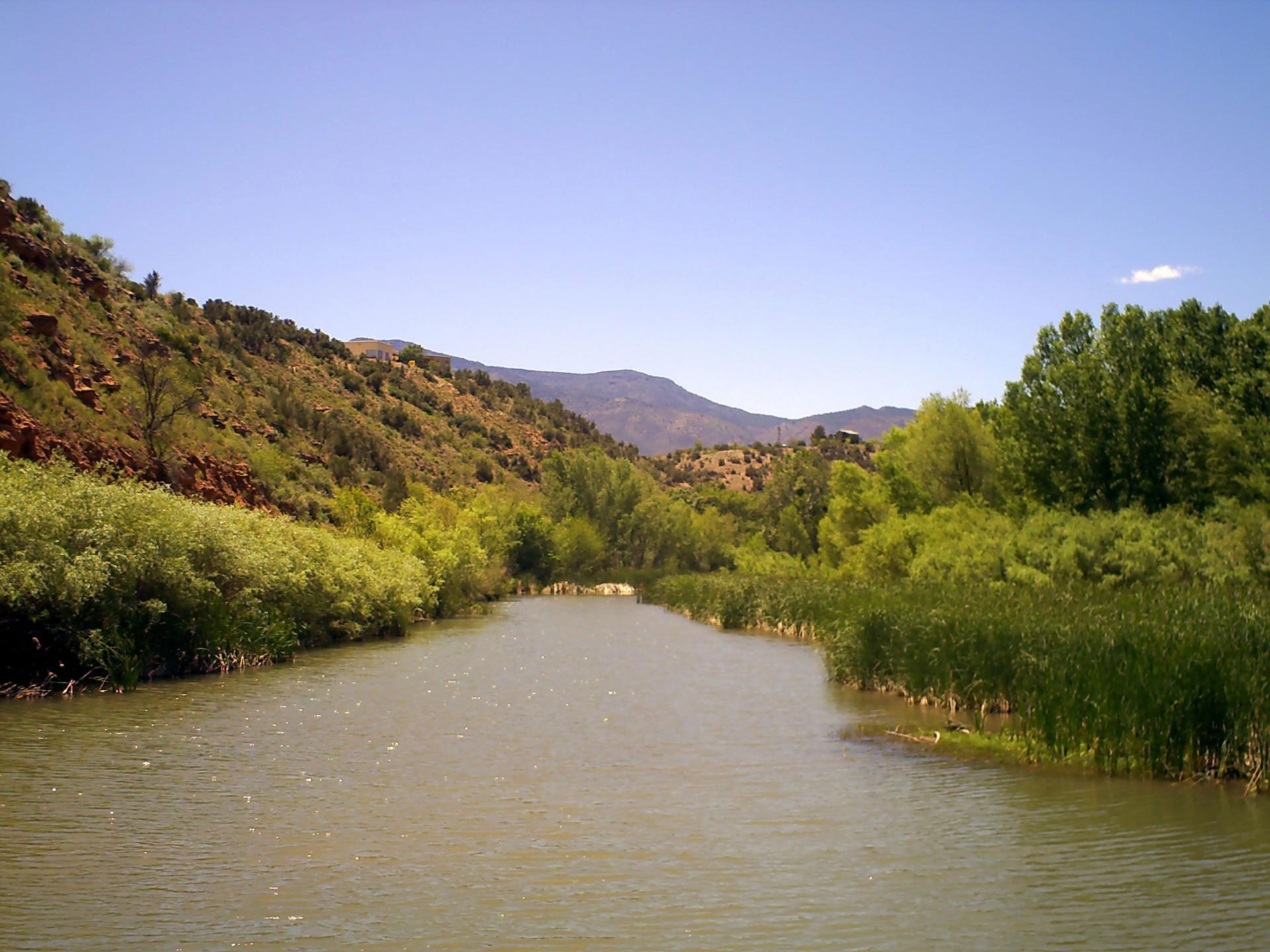
THE MIGHTY VERDE RIVER FLOWING THROUGH ITS GREENWAY
SCENERY: 
TRAIL CONDITION: 
CHILDREN: 
DIFFICULTY: 
SOLITUDE: 
GPS TRAILHEAD COORDINATES: Western trailhead–Verde River access: N34° 46.010′ W112° 02.257' Toppock Marsh Trailhead–Dead Horse Ranch State Park east end: N34° 45.781′ W112° 01.277'
DISTANCE & CONFIGURATION: 3 miles out-and-back
HIKING TIME: 2 hours
HIGHLIGHTS: Verde River access, mesquite bosk, bird-watching, and fishing
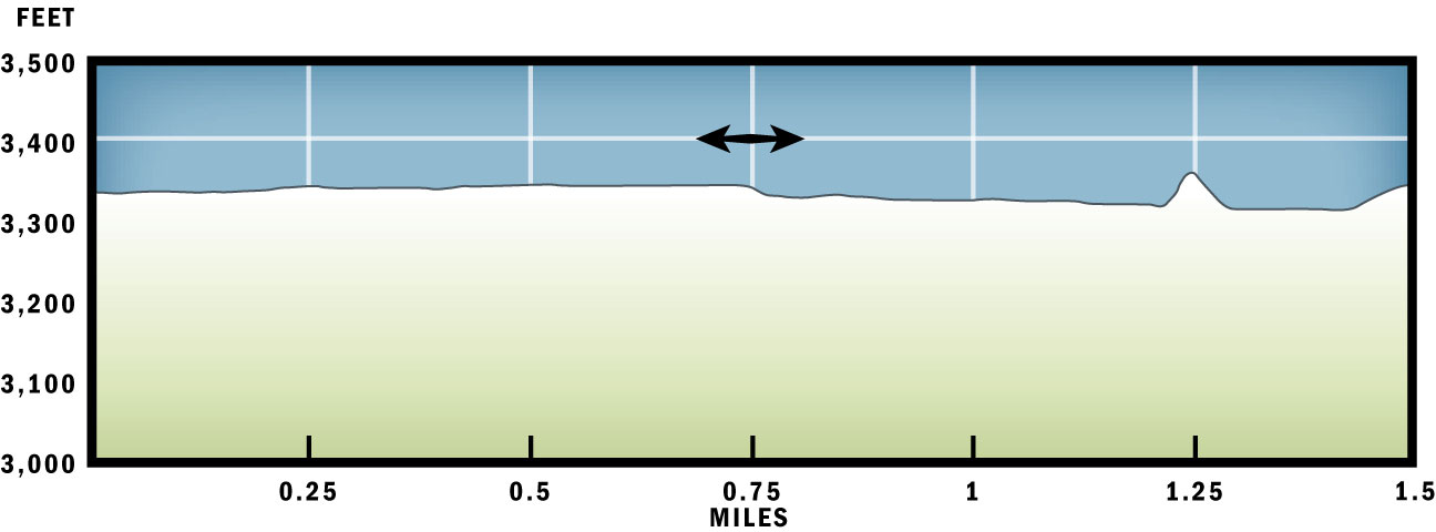
ELEVATION: Approximately 3,300 feet throughout
ACCESS: The river access has no fee but is day-use only. Dead Horse Ranch State Park has a day-use entrance fee of $7 per vehicle.
MAPS: USGS maps are insufficiently accurate, so pick up the Cottonwood Chamber of Commerce's good street map of Cottonwood, available at either visitor center at the highway junction or at the downtown jail and from a number of local merchants. Dead Horse Ranch State Park also has a free map of the trails within that park.
FACILITIES: None
WHEELCHAIR ACCESS: None
COMMENTS: Despite what may be shown on some maps, this route does not actually cross the river. Do not confuse this Verde River Greenway with a trail of the same name within Dead Horse Ranch State Park.
CONTACTS: Dead Horse Ranch State Park, 2011-B Kestrel Rd., Cottonwood, AZ 86326; (928) 639-0312; pr.state.az.us/parks/VERI


Overview
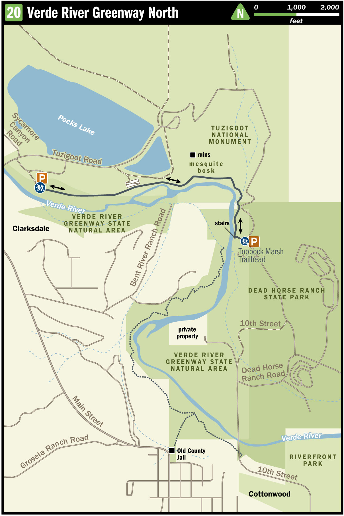
The hike route follows the north bank of the Verde River between Clarkdale and Cottonwood. Starting at a popular swimming hole, the trail parallels the riverbed, and then, as the river bends south, winds through a bosk of mesquite trees and a wide field within the bounds of Tuzigoot National Monument before returning to follow the river once more. The trail terminates at an alternate trailhead within Dead Horse Ranch State Park.
Route Details
From the river access and swimming hole, proceed east along the north bank of the river; any of the social trails will do. All of these trails funnel through the tall cottonwoods and sycamores. The river corridor narrows as you go, and you are soon reduced to one path heading up the bank through the mesquite trees. Spray-painted arrows guide you along the bank for just under 0.5 mile to a break in the fence, allowing the trail to join the road.
Continue east along the road. To your left (north), the wide, fenced-off field was once filled with copper tailings from mines in the mountains behind you. Straight ahead, the adobe tower of Tuzigoot looms above.
Within 0.25 mile the road ends, but spray-painted arrows indicate a sidewalk crossing a concrete-and-stone floodwater runway. Below, to your right, the Verde flows around an irrigation-diversion embankment. The sidewalk leads to a gate marking the national park boundary. Go through the gate. There’s no charge to use this trail.
The trail now winds through a beautiful bosk of Arizona mesquite, providing the first shade you’ve had since leaving the river. On the far side of this bosk, the landscape opens into a weed-choked arroyo, and the trail comes to a Y. The trail to your left goes north, forming a long loop around the arroyo that is of more interest to mountain bikers. The trail to your right continues east straight across. Stay right.
Across the arroyo you come to a second Y in the path. The trail to the left is the other end of the northern loop. It also has a spur leading to a gigantic sycamore tree. That spur is worth exploring, but it’s a dead end. The trail to your right leads down to the river and continues on.
The trail cuts down the sandy embankment into the marshy banks of the Verde. Colored ribbons now guide you through the willows, salt cedars (also known as tamarisks), and tall reeds. As you pick your steps through the marsh, you are also bending south, along with the river. The route emerges onto an angler trail hugging the now-steep and hard dirt banks of the river. By this point, you are definitely heading south.
Continue along this bank, popular with local anglers, for about 0.1 mile, where you encounter a stairway. This leads up to a short spur trail to the parking lot of the Toppock Marsh Trailhead. Return the way you came.
Nearby Attractions
Tuzigoot National Monument sits atop a hill overlooking what is now Cottonwood. Here, more than 1,000 years ago, the Sinaguan people built themselves an apartment complex. You can tour the remains at the national monument. Entrance fee is $5 for adults, free for children. The monument is open 8 a.m.–6 p.m. through the summer and until 5 p.m. the rest of the year. Call (928) 634-5564 or visit nps.gov/tuzi.
Directions
From Cottonwood, take AZ 89A south, past the city limits, to the Tuzigoot National Monument turnoff (there will be signs). Cross the bridge and look for a dirt road turning off to the right. That dirt road will wind down to a dirt lot near the river access. The final bit of the road is steep but doable in a passenger vehicle. The trailhead has no services.