16
Organized Caving
It often happens the local people don’t know what exists in their own county as only the most daring venture into unlighted caves. If the entire data on Missouri caves can be gathered, it will some day make a very readable book of reference for tourists and citizens.
—A. C. Burrill, Missouri Cave Remains: A Wonderland with Records of Ancient Life, 1925
There are many kinds of geologic wonders and curiosities in Missouri such as lost hills, knobs, shut-ins, waterfalls, bluffs, sinkholes, springs, and caves. Yet it was not until the second decade of the twentieth century that some Missourians began to recognize the need to protect outstanding examples of these geographic features. In 1913, Governor Herbert Hadley recommended the appointment of a legislative commission to select some of the natural wonders and beauties of the state for purchase as parks. He envisioned a “chain of parks” across the Ozarks.
Among the first geologic wonders selected and proposed to the General Assembly was Onondaga Cave, near Leasburg in Crawford County, and Ha Ha Tonka, in Camden County. Ha Ha Tonka is one of Missouri’s most outstanding examples of cave and karst topography. Unfortunately there was no money available for creating state parks. A bill was passed in 1917 setting aside a percentage of game and fish receipts for a state park fund, but it was not until 1924 that the state began acquiring land in the Ozarks for parks. The acquisitions targeted historic sites and tracts of land that contained large springs. The one exception was the creation of Meramec State Park in Franklin County. There are thirty-eight caves in the park. “These 7,000 acres of wilderness provide one of Missouri’s cavelands,” reported a state publication in 1929. So the state’s involvement with caves actually began before the creation of any organized caving groups in Missouri whose interest in caves was more academic than recreational.
In 1936, Missouri created its Department of Conservation. The agency began working in 1937 and teamed up with the Civilian Conservation Corps (CCC) to restock wildlife in the Ozarks, plant trees, and build dams, roads, and recreational areas. At Meramec State Park, the CCC made significant improvements to Fisher Cave, which was the park’s signature show cave.
In 1933, Missouri passed legislation enabling the U.S. Forest Service to start defining areas for a national forest. By 1945, the Forest Service had created the Mark Twain National Forest, mostly in southern Missouri. Its 1.25 million acres contains hundreds of caves, but no effort was made to inventory or study the cave resources. It would be decades before true cave resource management would begin in the Mark Twain National Forest.
By 1956, no one had any idea how many caves were on land owned, leased, or managed in Missouri by federal or state agencies. Nor did anyone have the foggiest notion how many caves might be on privately owned land. One early estimate was that Missouri might have as many as one thousand caves, but it was just a guess.
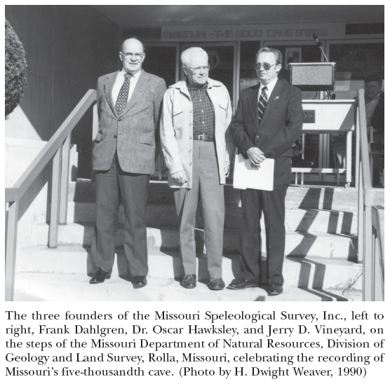
This was the situation in the fall of 1956, when the Missouri Speleological Survey was created. It was the first and remains the only private statewide organization in Missouri whose goals are to locate, record, explore, map, and study the caves of the state. The MSS is a nonprofit organization that unites the cave-oriented ambitions, skills, knowledge, enthusiasm, and dedication of both amateurs and professionals. Its membership is open to anyone who demonstrates responsibility in cave conservation and who cooperates with the MSS in its effort to achieve its goals. Its work is largely carried on by the organized caving groups of Missouri who sit on the MSS board of directors.
To facilitate its work and provide a permanent repository for material gathered by the affiliate caving groups, the MSS entered into a cooperative agreement with the Missouri Geological Survey and Water Resources (now the Missouri Department of Natural Resources Division of Geology and Land Survey). Former state geologist Thomas Beveridge extended a hand of friendship to the cavers right from the beginning. It was a handshake that would bear fruit and foster a partnership that has lasted for more than fifty years and hopefully will last for generations to come.
Since the MSS was a fledgling private organization in 1956 with no permanent headquarters and no start-up funding, the Missouri Geological Survey agreed to be a repository for all Missouri cave maps and reports and agreed to reproduce cave maps for the MSS. It was mutually beneficial, since the geological survey needed the cave information that the MSS would be providing.
The accomplishments of the MSS since 1956 toward fostering a better understanding and appreciation for Missouri caves are considerable. For instance, starting with a list of only 437 known caves in the state when it was founded, the MSS has added caves to that list at the rate of more than 120 caves per year for the past fifty years. There are now more than 6,200 known caves in Missouri, and as the hunt for more continues, the statistics change on an almost weekly basis.
In the 1960s, Congress established the Ozark National Scenic Riverways in Dent, Shannon, and Carter counties. It was the first national scenic riverway and subsequently influenced the establishment of the Eleven Point National Scenic River in Oregon County. The National Park Service soon discovered there were hundreds of caves on these properties in need of special attention.
Also in the 1960s, the MSS took a stand opposing the construction of the Meramec Park Dam by the U.S. Army Corps of Engineers, which would have resulted in the inundation of scores of caves in the Meramec River valley. The valley has a high density of caves. Several of the caves possess unique formations and provide habitat for rare forms of life, including endangered species of bats. The MSS was one of many groups and organizations that opposed the project, which was eventually defeated.
In the 1970s, the conservation department, influenced by endangered species laws, threats to habitat by proposed dams that might inundate caves, several major bat studies, and the creation of the Natural History Section in the Missouri Department of Conservation, began acquiring numerous tracts of land to preserve forest and wildlife resources and protect threatened and endangered species. In the late 1970s, the department began specifically targeting cave resources. Early acquisitions included Bat Cave in Miller County, Powder Mill Creek Cave in Shannon County, Coffin Cave in Laclede County, Smittle Cave in Wright County, and Great Spirit Cave in Pulaski County. The Department of Conservation currently owns 236 Missouri caves. With government agencies acquiring significant karst areas of the state, an imperative was born to protect and manage cave resources with conservation and preservation in mind.
Conservationists discovered that Missouri caves are the habitat for rare and delicate life forms, contain invaluable prehistoric human and extinct ice age animal materials, and are ornamented with beautiful, unique, fragile cave formations. They also contain vast reservoirs of water and are sensitive components of the major spring systems and groundwater aquifers of the Ozarks. In 1980, the Missouri Cave Resources Act was passed. It protects caves by prohibiting vandalism of any type and recognizes the value of caves. It also maintains the right of private cave owners to manage or use their cave as they see fit. The law also helps protect the quality of Missouri’s groundwater by prohibiting the use of a cave or spring for sewage disposal or other pollution-causing activities.
In the late 1960s and 1970s, the Department of Natural Resources Division of State Parks began adding parks to its system where karst and caves were a focus of interpretation and visitation. Examples include Rock Bridge Memorial State Park, in Boone County south of Columbia, and Ha Ha Tonka State Park, near Camdenton in Camden County. There are more than 120 caves in sixteen state parks administered by the Missouri Department of Natural Resources.
By the early 1980s, under contractual agreements, members of the MSS and Cave Research Foundation, a private research group, teamed up to inventory cave resources on government lands in Missouri, so the agencies could make wise decisions in the development of their cave management plans. The agencies own about 1,500 of the more than 6,200 caves recorded in the state.
In 1985, the MSS received the silver medal of the President’s Volunteer Action Award. The award was presented at the White House by President Ronald Reagan and was accepted on behalf of the MSS by H. Dwight Weaver and Gregory J. “Tex” Yokum. The MSS is the only caving organization in the United States ever to win such an award and to be recognized by a sitting U.S. president for its work in documenting the cave resources of a state.
In 1993, the cavers of Missouri took a bold step into the future by organizing the Missouri Caves and Karst Conservancy (MCKC) with the help of the Ozark Regional Land Trust (ORLT). Today, in partnership with ORLT, the MSS, state agencies, and several caving clubs, the MCKC is helping to protect the endangered Ozark cave fish and is managing several wild caves that need special protection; the organizations have become cave owners themselves.

If the cavers of Missouri have learned anything at all over the past fifty years of intense cave recording, mapping, and data collection, it is that our caves deserve protection. Since the early nineteenth century, our remarkable cave resources have been put to many uses in serving the people of the state. But only since the 1950s have caves been recognized to have importance well beyond that of providing some service or materials useful to individuals and society. Today, we realize that caves are unique features of our landscape. Considering their age and their very existence, they merit respect. They are nonrenewable, irreplaceable natural resources and should be wisely managed and preserved for all future generations of Missourians to enjoy and cherish.