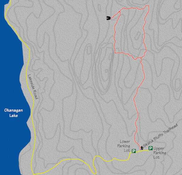
29. Skaha Bluffs Scenic Route
Category: Return with an end loop
Distance: 4.5 km round trip
Height gain: 112 m
High point: 613 m
Time: 1.5 hrs. round trip
Difficulty: Easy
Seasons: Spring, summer, late fall
Trailhead coordinates: N49 25.873 W119 33.874
Directions to trailhead: In the city of Penticton, at the intersection of Industrial Ave. W. and S. Main St., follow S. Main for 3.3 km to where it becomes Lakeside Rd. Continue on Lakeside for 2.7 km to Smythe Dr. Turn left onto Smythe and drive along this narrow paved road to the Skaha Bluffs Provincial Park parking lot.
- From the uppermost parking lot, walk back down the road a very short distance until you come to the first information kiosk. There will be a sign directing you into the bushes to “Daycare.”
- The trail begins as an old service road but comes to an end, becoming a single-track path at an intersection within the first five minutes of the hike. Take the right fork at this first minor intersection. Ahead of you, some rock walls begin to come into view.
- A few minutes on the single-track path brings you to another fork. This is unmarked and not quite as obvious as the previous one. Stay straight (left) to stay on the main trail.
- Shortly afterward, again stay straight along your course where a sign to the right tries to send you to “Diamondback.”
- Fifteen minutes into the hike brings you to a well-marked intersection. Go left, following the signed marker to “Wave.” Take note that this is where the end loop of this trek begins and to which it ultimately returns.
- Immediately after turning left, you will go up and over some exposed rocks. Look down to your right to see a sign sending you to Wave and “Fortress.” Follow this path as it takes you down to the bottom of a shallow gully.
- As you come out of the gully on the other side, turn right at a fork and climb up a rock slab staircase, following a sign to the Red Trail.
- At the top of the rock staircase you will reach the base of the Fortress rock-climbing area. Continue straight as you skirt the base of this enormous rock wall.
- About 30 minutes, or 2 km, into the hike, you will come to a solar-powered outhouse. Go past the outhouse, maintaining a straight trajectory up and over some exposed boulders.
- You will arrive at a noteworthy intersection a couple of minutes later. At this junction, take the right fork where the signs direct you toward “Go Anywhere” and “Great Whale.” Prior to taking this path, you can take a side journey and head to your left to a rocky outcropping that provides splendid viewing of Skaha Lake.
- Now, back to the trail. By taking the right fork, you will descend briefly into the bottom of a gully, only to come out the other side, climbing upward for about 6–8 minutes.
- Where the trail plateaus, turn right at a fork where a sign sends you to “Blazing Buttress.” This stroll through open grassland, which is dotted with the occasional pine tree, gives up scenery of magnificent rock walls on your left and Skaha Lake on your right.
- Ten minutes from the Blazing Buttress sign brings you to a T-junction, where you will follow the “Great White” sign directions guiding you to your right.
- A couple of minutes later, you are back at the loop intersection, with a little over a kilometre of hiking to return you to the parking lot.


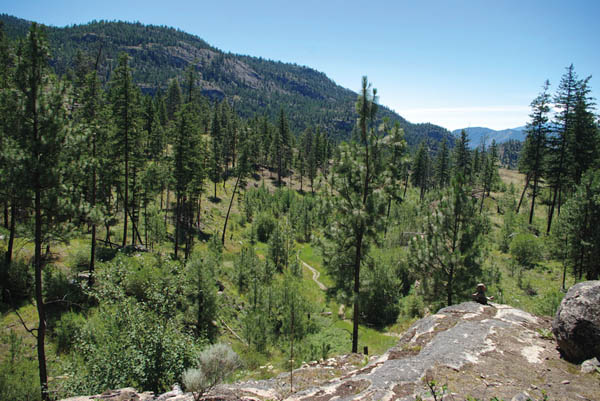
For the most part, the hike through Skaha Bluffs Provincial Park is open forest, grasslands and rock – lots of rock.


