31. Ellis Ridge Trail
Category: Return
Distance: 10.4 km round trip
Height gain: 227 m
High point: 1204 m
Time: 2.5–3.5 hrs. round trip
Difficulty: Easy
Seasons: Spring, summer, fall
Trailhead coordinates: N49 28.412 W119 30.389
Directions to trailhead: In Penticton, at the intersection of Government St. and Carmi Ave., drive east on Carmi for 6 km to Beaver Dell Rd. Turn right on Beaver Dell and drive 2.2 km to reach a gravel parking lot on the right side of the road. This is labelled the Garnet Fire Interpretive Site parking lot, but it is also the trailhead for the Ellis Ridge Trail.
- The journey begins on a broad, flat, gravel path. Immediately into the hike, a narrow unmarked trail departs to the right, leaving the main trail. Take this trail.
- The path descends briefly as it crosses a seasoned double-track trail. It continues its brief descent over a rocky outcropping to intersect with another narrow path. It is important that you turn left onto this trail. All of this happens quickly at the beginning of the hike, so it is imperative to get these landmarks right.
- The trail now wanders through an open forest, taking you closer to the ridgeline.
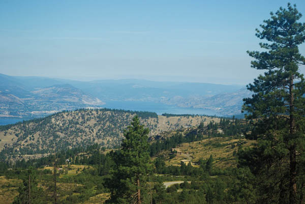
- Ten minutes into the hike, you will see spectacular views of Penticton and Okanagan Lake.
- A single signpost with the number “5” on it marks a great place to leave the trail and view the canyon below. This is the only point on this hike where the canyon bottom is readily visible.
- At the 1.2-km (20-minute) mark of the hike you will come to the only signage on the trail. One sign points you to Canyon View Trail where you just came from, while the other marker sends you leftward to Ellis Ridge Trail. You want to follow Ellis Ridge Trail.
- As you hike along this ridge walk there will be various vantage points that provide you with good vistas of the canyon walls, but these are indiscriminate and will require some bushwhacking on your part, as there aren’t any dedicated trails to the ridge’s edge.
- For over 2 km the trail rolls up and down with many flat spots as it follows and departs from the canyon’s slope, but the net result is an increase in elevation.
- It is at this point that Beaver Dell Rd. comes into view. The trail has been below the road for most of the hike, but at this point, 30–35 minutes from the signs, the gradual elevation gain has brought the path almost up to the altitude of the road. Unfortunately, the trail stays within earshot of the road for the next 20–30 minutes.
- At the 4.5-km mark there is a fantastic open viewpoint in a patch of grassland that provides wonderful vistas of the hills across the canyon and of the south side canyon walls themselves.
- The trail comes to an end five minutes later where a gravel road from Beaver Dell Rd. enters the forest. This road replaces the trail and continues eastward. You can continue to walk this road, but motorized traffic is allowed. This is made most evident by the piles of garbage that have been dumped on the side of the road. Just a few minutes farther up the road brings you to a target practice area as well. I’m all for sharing the great outdoors with everybody, and the outdoors provides a multitude of activities, but I know that most of my readers will agree you should just simply pick up after yourself. The neglect to follow this simple rule is very evident at the target practice area.
- Return the same way or hike the road back to your vehicle.


Gazing to the northwest from Ellis Ridge Trail, Okanagan Lake extends as far as the eye can see.


