9
Rearranging Nature
Water is both reusable and infinitely divisible. It can be shared any way you want, and recycled again and again. When you look at how easily this resource is moved and measured, it seems unconscionable that there isn’t water for wildlife. The history of water rights allows for my agricultural water and your municipal water, but a fish that lives in a stream has no right to water at all.
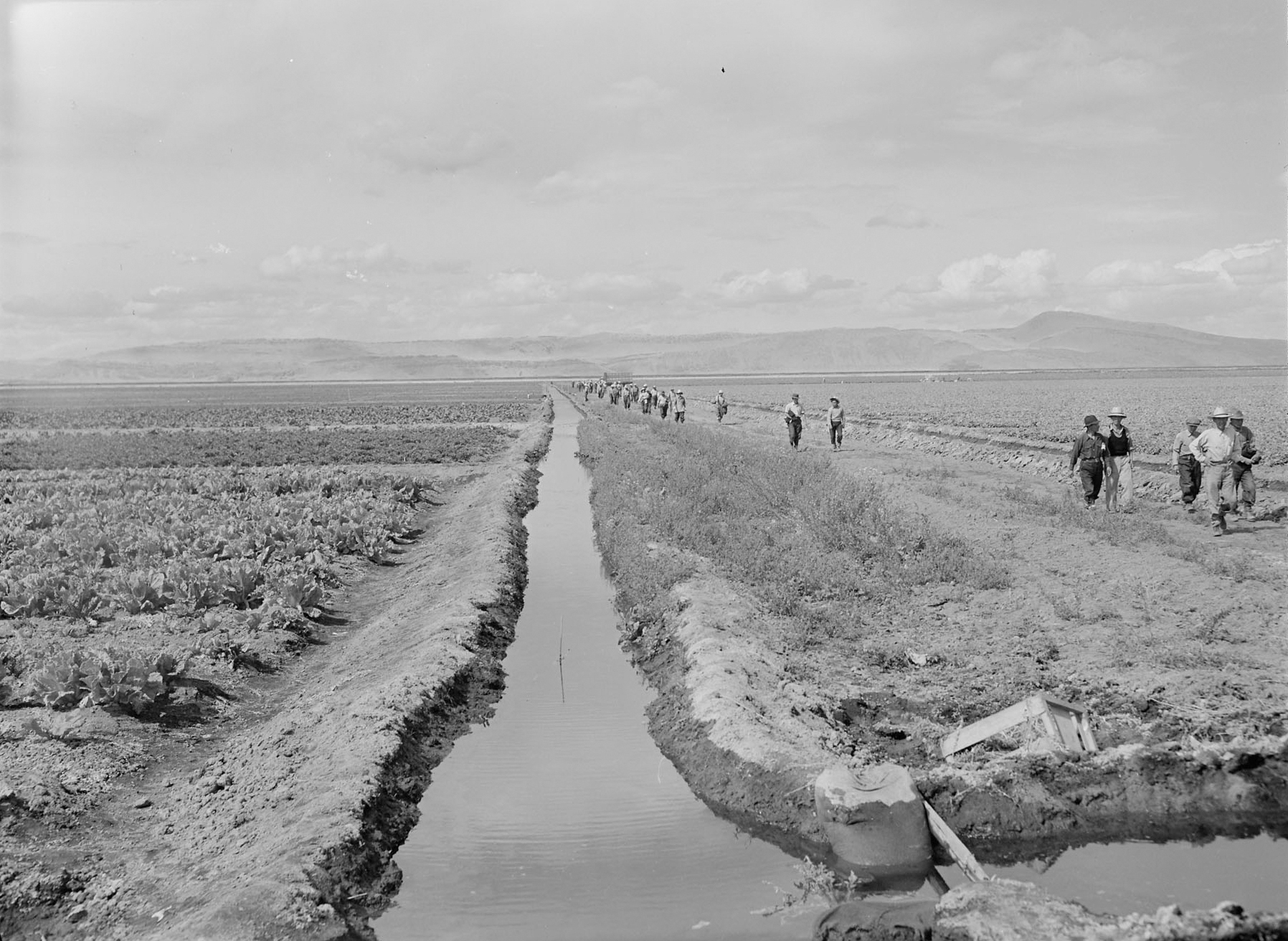
Nature relies on the water provided by rainfall and snowpack, while agriculture requires specific inputs of water at certain times during a plant’s life cycle. There is too little rain in most western states to support domesticated plants and animals, so nearly every lake, river, stream, pond, and underground aquifer is diverted into a network of ditch systems. Without irrigation ditches, the crops and livestock in most of the western United States would not survive.
Laws determine how we share water, and water laws vary from state to state. East of the Mississippi River there is generally enough rainfall to grow crops, and surface water can only be used by the people living next to a river, lake, or pond. This riparian (“riverside”) system requires that a landowner who diverts water put it to reasonable use for a household, livestock, gardens, irrigation, industry, or recreation. Most riparian states use permits to make sure that upstream landowners’ water use doesn’t affect the rights of downstream landowners.
West of the Mississippi, there is generally too little rainfall for unirrigated agriculture. Water laws are critical in this region, but the existing legal system is based on an accident of history. Miners settled the region first, and they needed water to develop their mining claims. Their fierce competition for this scarce resource was ultimately settled with money, and a set of laws that favored the mine owners. Those laws have endured, resulting in a deeply irrational system.
My Jack London–ish vision of mining includes men wearing Levi’s panning for gold nuggets in gravel-bottomed rivers and men wielding pickaxes in underground tunnels to break up ore. These Norman Rockwell versions of placer and hard rock mining had disappeared by the early 1860s, when industrial-scaled mining processes funded by great companies bought out the small operators. Industrial placer and hard rock mining both depended on poorly paid workers and vast quantities of water.
Placer miners (from placel, Spanish for “sandbank”) remove minerals from the fine-grained mud, silt, and sand deposited in the streambed by flowing water. Rather than sifting gravel with a pan, cup by cup, hydraulic mining—hydraulicking—uses high-pressure water jets to sluice alluvium by the cubic yard.
A holding pond is built above the stream, and a system of hoses and nozzles shoots high-pressure water at the streambed to wash the mineral-bearing deposits—along with the hillside—down and through huge sluice boxes similar to wooden troughs with ridged bottoms that catch the gold. This process, where gravity separates the minerals from the slurry of water and sediment, dates back to Roman times. Hydraulicking was first used in California in 1853.
A placer deposit lies on the surface of the Earth and is easy to get to. By assaying samples, you can calculate the value of a deposit at a certain location before you start mining, making it practically risk-free compared to hard rock mining’s invisible veins. But in the arid West, it took enormous sums of money to develop the water-delivery system.
An account of hydraulicking from 1905 explained how to set up a placer mine: First, a complete set of samples are assayed to chart the quality and extent of the deposit, and with a little solid geometry you can estimate the total value of the site. Then the price of the water system is calculated, including the cost of constructing “flumes, pipe-lines, and ditches from one to one hundred miles in length, and in doing so it may be necessary to tunnel mountains, span chasms, siphon across valleys, bracket flumes to the side of the cliffs, build reservoirs and dams, and finally, settling dams.” According to a 1901 publication by the Institution of Civil Engineers, “In California, the water had to be brought … hardly ever less than 25 miles, and sometimes as much as between 100 and 290 miles, to do the work.” It was not unheard of for companies to spend a million dollars for their water system, roughly $27 million in 2017 dollars.
Millions of tons of earth were washed into the rivers that flowed into the Sacramento Valley, and the river’s valuable streamside habitat, the riparian zone, was inundated with silt. The faster flows of mountain streams carry suspended sediment, but when the stream reaches the valley and floodplains, the water slows and the silt drops out. Upstream hydraulicking raised the riverbeds downstream, broadening the rivers and increasing the extent of spring floods.
The water used by the early miners was diverted before there was any law up in those high mountains, often by ditch companies on a first come, first served basis. When there wasn’t any more water to divert, tough luck. Ditch companies sold the water by the miner’s inch, the rate of water flow through a one-inch hole in a two-inch-thick plank with a head of six inches. The amount of water in a single miner’s inch varies by state, from a low of 31,000 gallons a day in Southern California to Colorado’s robust 40,000 gallons a day. Water was sold in huge quantities, and the mines used it limitlessly. California’s North Bloomfield hydraulic mine used over 15 billion gallons of water in 1879, a year’s water for a modern city of 400,000. According to the report of the state engineer of California, over 92 million cubic yards of debris from hydraulic mining was dumped into the streams between 1879 and 1881.
It’s hard to imagine how much earth was moved by these miners. By the mid-1880s, the California Gold Rush yielded perhaps 344 tons of gold (worth around $14 billion in 2018) and washed the mountainsides into the valleys. They sluiced away the equivalent of eight Panama Canals of high mountain soil, and dumped it onto the floodplains, making the valleys more fertile and the mountains less so.
Water was the critical element that separated gold from silt in placer mining, and separated gold from its host rock in hard rock mining. In the nineteenth century, a hard rock miner in a tunnel would break the ore into fist-sized pieces with a pickax and then bag the rocks and pack them out by burro to a stamping mill. There, the rocks were smashed into gravel by water-powered stamps. It took four to ten tons of water to stamp a ton of ore, so hard rock mining, like placer mining, was a water-dependent process.
Mines weren’t usually adjacent to a stream, so there was no way to apply the riparian system used by eastern states. When the mining companies first started diverting water, miners figured that the person who diverted water from a river first has the right to continue using that water. But if that person stopped using their water, they lost their rights to it: you can sell your rights to the highest bidder, but you can’t hold onto rights you don’t use. When Colorado became a state and the law came to those high mountain mines, water courts regularized this concept as prior appropriation based on priority. The most senior rights have the highest priority and get their water first during dry years, while those with junior water rights get none.
The reason why this matters is that this system of water rights has endured. West of the Mississippi, the right to use water from a stream, river, or lake is still private property that can be bought and sold like a car or house. Each water right has the original date that water was first diverted, the amount, and the location where water must be extracted from the river. If you don’t own a water right, you can’t take water from a stream or river no matter where you live or if your animals are dying of thirst—and if you own a water right, you can take water from that stream or ditch and live in Timbuktu, provided you take it every year.
If you own water rights, there is little reason to sell them unless you sell the land, and some individual ranches have more water rights than small cities. In addition, there is no impetus to conserve water. If you do not use your entire allotment, you technically—legally—can lose the right to use it. Even if there is a better way to use the water, the owner of the original water right has the right to use her water any way she pleases, no matter how wasteful it may seem. Many ranchers use the same irrigation techniques as their grandparents because there is no reason to adopt a more efficient system. Most arid states use prior appropriation to distribute their water; most wet states use riparian rights; and some states (including California and Oklahoma) use a hybrid system that combines both riparian and appropriative rights.
It takes a surprising amount of infrastructure to live in dry country. One of our neighbors has their own well, and another has drilled four dry holes over the years. We drilled for water, but came up dry. The bill was $10,000, and Bob’s comment was that it would have been more fun to make a campfire of $20 bills. People who don’t have wells have to haul their own water, so we bought an 1,800-gallon cistern and a pump. The concrete cistern is buried near the drive and filled by a hose from the truck. We bought a 350-gallon tank that sat on the back of the pickup truck, but when the tank was full, the weight was too much for the one-and-a-half-ton truck. Bob had the suspension system beefed up by installing larger shocks and welded a steel bar onto the back of the truck bed so the tank wouldn’t come through the back window. There’s a water station in Durango and another in Ignacio, both twenty minutes away, where you can fill a water tank with town water. Water is cheap—a $20 punch card is good for four loads—but the loaded truck is dangerous to drive because the water weighs more than a ton, so the truck is slow to stop and the tank is quick to slide into the cab. I never once picked up a load (I’m a sketchy driver), and after two years, Bob finally retired from water hauling this spring when the driveway was too muddy to manage without chains. We have water delivered once a month now, by a man whose knuckles are tattooed HARDWORK. He’s a single dad who takes $100 cash for an 1,800-gallon load. It’s a bargain.
In cities and suburbs, people use drinking water on their landscaping. In the country, westerners often have completely separate systems for house water and irrigation water. Our water rights on the ditch an eighth of a mile down from our house are substantial and the ditch rights date to 1893, so in dry years that ditch will get filled first. We get water from a spur of the Morrison ditch system that carries water from the Vallecito Reservoir, about ten miles away as the crow flies but much farther by ditch.
Our rights, which came with the land, give us 7,200 gallons a day between May and October, but it’s not easy to use that water. We had to build a pond to store it, and a distribution system to move it around. Once the pond was filled, it was just the beginning. Bob rented a trencher that had two handles like a rototiller and a chain-linked rotating blade that dug a four-inch-wide trough about two feet deep. He laid a trench from the pond to the greenhouse and another that went up the hill and around both sides of the house. He installed a smaller pump at the pond, wired it to the same electrical line that powers the greenhouse, and laid a one-and-one-fourth-inch line in the trenches that fed seven spigots, including one in the greenhouse, one in the lower field, two on both sides of the house, and one in the back.
The pond is cleverly designed, with a beach for the deer to drink and a steep backside where we dump weeds and scraps. Bob seeded it with a native mix calibrated for this altitude and watered it daily for an entire growing season. He transplanted six clumps of cattails from the ditch, and the next year the entire shallow end was crammed with cattails from rhizomes lying dormant in the swale. The frogs came on their own, and the pond is full of native fish from the river that were pumped there as minnows. We’re hoping a pair of ducks will settle on the pond this summer because their wastes make a biofilm that will help seal the bottom. Owning shares in a ditch gives you water rights, but it takes a lot of work to use the water.
When the rivers run low in dry years, states that use prior appropriation make sure that the people who own senior rights get their water. If a senior right holder makes a call on the river to claim the water they own, the upstream junior rights holders have to stop diverting water until the downstream senior rights are fulfilled, and the ditch walker will make sure this happens. In dry years, some people can grow crops and some people can’t.
The system of prior appropriation is not about sharing water; it’s about permanently securing the most water you can use on your land. It’s an acquisitive system, and early ranchers and farmers soon owned rights to most of the surface water in the West. Cities grew after that time, and the only way for these latecomers to get water was to either change the laws or to increase the amount of water that was available to appropriate. The answer was dams, and lots of them.
Dams had been built in the United States for as long as the settlers used waterpower for mills, and the Atlantic salmon have been blocked from many East Coast rivers for centuries. The Atlantic salmon that recently spawned in the Connecticut River are thought to be the first breeding pairs in the river since the Revolutionary War.
Until 1902, dams were relatively small structures built by private investors. Then Congress passed the Reclamation Act. In time, the Bureau of Reclamation built dams nearly everywhere it could, and it didn’t shy away from large projects. The dams increased the amount of water that was available for withdrawal in the western states, providing drinking water for cities while preserving the system of prior appropriation for ranchers. But agriculture was changing.
After the buffalo were exterminated, immigrant farmers grazed cattle on native grasslands until the end of the 1800s. The prairie soil was held in place by the root systems of native grasses that often extended ten, twelve, and even twenty feet deep. When wheat farming expanded west, farmers plowed up the sod and planted wheat, an annual grass that dies at the end of the season.
Horses were replaced by tractors and then larger tractors. Power was provided by internal combustion engines rather than muscles, so truly massive tillers and combine harvesters could be used. During planting season, tractors worked around the clock, plowing more and more land. These farmers were the first agriculturalists not confined by the limits of animal strength, shifting their relationship with labor and nature, and they unwittingly ruined their land.
Fewer horses meant fewer perennial hayfields to feed them and less manure to top-dress the fields, reducing the amount of organic matter in the soil and the acreage under grass. Farmers usually grazed their livestock on the fields after harvest, leaving the soil with no vegetative cover during the winter. The same fields were cultivated year after year, pulverizing the earth into a fine dust that did not clump like healthy soil. This powdered soil was ready to be swept away.
The wheat farmers of the Great Plains were among the most successful farmers in the nation until the autumn of 1931, when the rains stopped falling. The winter wheat crop failed, leaving the soil uncovered during the spring winds. The dust storms started in early 1932 when sixty-mile-per-hour winds kicked up dust clouds two miles high. There were fourteen dust storms in 1932, and thirty-eight in 1933. These storms brought boiling clouds of dust, miles high, carrying millions of tons of soil. Sometimes the middle of the day was dark as night.
Farmers kept plowing and sowing their bone-dry fields, but the rain never came. And it was unusually hot. In 1934, temperatures in Vinita, Oklahoma, were over 100°F for over a month, culminating in a hellish day of 117°F. Women would hang wet sheets in the windows to catch the dust. The bread would get so dirty that women kneaded their dough in a bureau drawer covered with a cloth with two holes cut in it to stick their hands through. Meals were eaten as soon as they were ready, and pitchers were no longer used: water and milk had to be stored in screw-topped Mason jars. During a storm, people would wear handkerchiefs over their faces and coat their nostrils with Vaseline; afterwards, housewives swept up buckets of dust that had seeped through gaps in the sashes and sills. Children were particularly susceptible to dust pneumonia, when the alveoli in their lungs filled with soil, and chickens smothered on their roosts. Hungry and thirsty range cattle were blinded when dust mixed with tears and glued their eyelids shut.
By the time the drought was over, 100 million acres of grasslands had been scoured. The area of greatest damage moved around. The years 1935 to ’36 were the worst, when an estimated 850 million tons of topsoil were swept from the southern plains. “The soil is the one indestructible, immutable asset that the nation possesses,” wrote the federal Bureau of Soils in 1909, “the one resource that cannot be exhausted, that cannot be used up.” The bureau was as surprised as everyone else when drought came in the 1930s, and the newly plowed topsoil blew away.
On April 2, 1935, a storm blowing dust from the Plains darkened the skies of Washington, DC, as the director of the Soil Erosion Service testified to a congressional committee about the need for a national program for soil conservation. Less than a month later, the Soil Conservation Service was created in the Department of Agriculture to promote farming practices that conserved the soil and provided farmers with seeds, equipment, and expert advice as well as food aid, social assistance, and jobs programs. Every county of every state already had an agricultural extension service office staffed with experts who provided free agricultural advice, and that network was used to reduce wind erosion.
Laissez-faire capitalism does not work for agriculture, because farmers will ruin their land trying to make a living. A common argument today is that ranchers don’t need regulations because no one understands better how important it is to protect their land, but history shows otherwise. The 1935 Soil Conservation Act provided subsidies for farmers who planted native grasses and trees. “It will pay farmers, for the first time,” said White House adviser Rexford Tugwell, “to be social-minded, to do something for all instead of for himself alone.” The US Forest Service planted 200 million trees on farms from North Dakota to Texas to provide shelterbelts. Contour plowing and no-till farming were adopted across the Dust Bowl. The Department of the Interior hired soil scientists whose research showed that cattle should not be grazed on harvested land, and that stubble shouldn’t be burned. It hired agronomists to help farmers adopt new practices. Everyone participated with the hope that it would help the land hold the water, and it did help. There just wasn’t very much water to hold.
Farmers needed government help, and the commodity markets date from the decadelong drought of the Dust Bowl era, as do crop insurance, the concept of the government paying farmers to fallow their less-productive lands, and the requirement that farmers participate in soil conservation activities. Soil and water conservation districts were a conduit for projects, education, and social pressure. These programs, like the extension service, are still a major aid to American agriculture. Farmers caught in regions ruined by dust storms made use of New Deal programs, including the Drought Relief Service, Federal Emergency Relief Administration, Federal Surplus Commodities Corporation, Works Progress Administration, and Civilian Conservation Corps. Some of the farmers were able to hang on until the fall of 1939, when the rains finally returned.
About 2.5 million people abandoned the region after losing their crops, livestock, and often their land. People whose great-grandparents arrived in Conestoga wagons drove away with everything they owned tied down to the bed of their truck. The Great Depression and the failure of dryland—unirrigated—agriculture was a socio-ecological crisis that launched fifty years of dam building. After the prolonged drought of the 1930s, it became a national goal to provide farmers with reliable sources of irrigation water.
Dams allow people to manage rivers for their own benefit. All of the major rivers in the United States were dammed again and again for irrigation, flood control, electricity generation, transportation, and for cities and industry. From the Tennessee Valley to the Central Valley of California, dams, levees, canals, and ditches allowed the Army Corps of Engineers to manage the landscape to meet human needs. Farmers, cities, and factories all had a say in how water was used but nature, the red-headed stepchild, was barely considered.
The Dust Bowl region recovered by the early 1940s, and grew bins of wheat for the war effort. The fifties, like the thirties, was a dry decade and farming based on groundwater became common. The Ogallala Aquifer underlies most of the former Dust Bowl, and when people figured out how to fix car engines to pump well water, this aquifer started to be used in earnest. The center pivot irrigation set-up was developed in the 1950s, and soon crop circles were farmed from Texas to the Dakotas.
Irrigation projects did not benefit farmers equally. Large landowners with large machines enjoyed substantial economies of scale, so megafarms proliferated as smaller farms went broke. Today, more than a quarter of the irrigated land in the United States is watered by the Ogallala Aquifer. Groundwater, like surface water, is regulated by the states, and each state follows a different doctrine.
Today, irrigation and thermoelectric power both use about 115 billion gallons of freshwater per day; the public water supply is another 42 billion gallons, and that accounts for about 90 percent of water use in the United States. Much of the electricity in this country is generated by thermoelectric power plants that burn fossil fuels to heat water that turns to steam and spins a steam turbine that drives an electrical generator. But the water used to cool thermoelectric power generation is mostly returned to the water body it came from, while return flows from irrigation are generally about half of the initial diversion, though they can vary widely. This makes irrigation the largest consumer of water by far, using 80 to 90 percent of the water in many arid states. During drought years, city residents are begged to conserve while the agriculturalists, who have a giant share of the water pie, are not asked to change their patterns of water use. Power, money, and politics have resulted in farmers flooding desert fields with water to grow crops.
By the 1960s, nearly all of the water in western states had already been allocated with rights that could be bought and sold. Many western rivers are over-appropriated, with more water rights owned than there is water flowing between the banks. The water system was settled except for the unfortunate fact that tribal water rights had never been addressed.
Tribal peoples were moved onto reservations and told to practice agriculture. Therefore, the US government surely must have intended for those reservations to have water. The precedent was set in 1908 (Winters v. United States) that a reservation’s water rights are based on the date that the reservation was established, whether or not the rights were ever claimed, and the quantity of water they are owed is the amount needed to irrigate the reservation’s irrigable acreage. Since the tribes were forced onto reservations before the ranchers established their herds, native water rights generally predate most other water rights in the West.
The tribes have had the law on their side since 1908, but it was the Indian Gaming Regulatory Act of 1988—the federal law that governs gambling on Indian territory—that changed water history. Indian gaming revenues were $100 million in 1988, and after 2009, the annual cash flow has been over $27 billion. One result of the gambling windfall is that tribal councils hired lawyers and sued for their water rights. Cases that had been filed in the 1960s and were still disputed a generation later have finally been resolved.
The standoff over Native American water rights lasted so long because there is no extra water in the system. It could have been the end of privately owned water rights based on first come, first served, but changing the system would have created winners (who previously had no access to water) and losers (the present owners of water rights). Politicians in western states are often ranchers who own water rights, and the problem was eventually resolved by providing money to build more dams and reservoirs, enlarging the water pie yet again.
In 2010, officials in New Mexico settled a 1966 lawsuit involving four Native American pueblos and non–Native American residents in northern Santa Fe County for 4,000 acre-feet of water and over $175 million for storage and distribution. The Crow tribe’s 2010 settlement was for $460 million to rehabilitate their irrigation system and build a water distribution system with a reservoir that holds 300,000 acre-feet. The Blackfeet tribe settled their case with Montana in 2016, securing tribal rights of more than 800,000 acre-feet—enough water for a city of 800,000 to 1.6 million people—along with almost half a billion dollars for storage and distribution. Colorado’s Southern Utes and Ute Mountain Utes got 62,000 acre-feet from the Animas-La Plata Project, which ended up costing about half a billion dollars. The Navajo Nation got 81,500 acre-feet and $200 million for infrastructure. One acre-foot equals about 326,000 gallons, enough water to cover an acre of land one foot deep. An average California household uses between one-half and one acre-foot of water per year for indoor and outdoor uses; households that haul water use much less. These are just a few of many tribal water settlements that, after generations of litigation, have finally been resolved.
Nature depends on water as surely as humans do, but until recently the needs of the natural world were barely considered when it came to water management. When dams are used to generate electricity, for example, the river’s flow was routinely determined by consumer demand rather than the needs of riverine species. Politics rather than science continues to determine how water is allocated, and the private ownership of water rights in regions where water is scarce makes the system very resistant to change.
The Colorado pikeminnow lived throughout the Colorado River basin, and was historically a gigantic fish that grew up to six feet long. It was the river’s top predator, and migrated as far as 200 miles to spawn in favorite canyon beaches. But the pikeminnow depends not only on unimpeded passage to its spawning sites, but also on large spring flows from snowmelt and a steady base flow. Today, the adults rarely exceed two or three feet because the rivers are too puny to support them.
Before big dams were built, a river’s flow was high in the spring and dwindled throughout the year. Many western rivers are much smaller than they once were, and a river’s flow is nearly always determined by humans rather than nature.
Dams usually skim off the high spring flows for storage, a useful tool for flood control that fills a reservoir to provide water for human use later in the year when flows are low. Removing high spring flows changes the environment for every creature that depends on the river and floodplain. The riverbed is no longer shaped by big water. Farther downstream, the spring floods no longer replenish nutrients by depositing silt on the floodplain. Floodwater no longer seeps down to recharge aquifers, and the active floodplain narrows along with the river channel, reducing riverine habitat.
During irrigation season, the flows in many western rivers are skimpy. The Rio Grande runs so low that the silvery minnow, a little three-and-a-half-inch-long fish that was once the base of the food chain, is going extinct because diversions have reduced this mighty river to a weak and shallow stream. All the big fish are already gone, and there’s too little water left in the river to support a minnow.
The National Inventory of Dams, a public database that includes information on every dam in the country, lists over 45,000 dams under twenty-five feet high and another 45,000 dams over twenty-five feet high, including 1,687 dams over one hundred feet high, truly massive constructions that change the entire watershed by slowing the flows upstream and altering water temperature and chemistry for dozens of miles downstream.
Water that sits in a reservoir stratifies, with lower oxygen content and lower temperature water at the bottom of the reservoir, along with higher organic content and higher concentrations of heavy metals. In addition, water evaporates in a reservoir, increasing the concentration of salts and minerals. In a desert climate, evaporation from Lake Powell and Elephant Butte Lake is estimated to exceed a tenth of the dam’s capacity every year.
Below a dam, the water is typically colder, saltier, and carries less oxygen than water upstream of the dam. Dams serve as sediment traps, and the clean water released below a dam can cause river downcutting, and may decrease the amount of sand available for the shoreline. With enough dams, a fast-flowing, cold-water river can be transformed into a sluggish, warm watercourse punctuated by placid lakes. The ecological complexity of the ecosystem disappears along with the native plants, fish, and insects characteristic of cold rivers, and species that live in lakes take their place. This shift can decrease the river’s ability to assimilate wastes.
In addition to changing the chemistry of water downstream, dams block species from moving upstream, and dams prevent some fish and mollusks from reproducing. Anadromous species that breed in fresh water and grow up in the ocean, like sturgeon and salmon, are often unable to reach their spawning grounds; eels that breed in the ocean and grow up in fresh water are also blocked. As more dams were built, fish runs dwindled and sometimes disappeared, as did many species of freshwater mussels whose life cycle includes a larval stage living on the gills or fins of a fish. This hitchhiking allows the offspring of a parent mussel stuck in the mud to travel to another part of the river. When fish species were changed by dams, many species of mussels were unable to complete their life cycle.
North America is blessed with the greatest temperate freshwater biodiversity on Earth. Its streams are a biological treasure. Fish, mollusks, crayfish, amphibians, damselflies, and snails are especially varied in the New World, but our dams and diversions have taken a toll on freshwater biota. Freshwater species are uniquely threatened in North America, where the extinction rate for freshwater fauna is five times that of land animals.
Since 1900, 123 freshwater species have been listed as extinct in North America, and hundreds of species of fish, mollusks, crayfish, and amphibians are considered imperiled. Nationwide, nearly 30 percent of fish species are at risk of extinction, along with almost half of the crayfish species and about 70 percent of the nation’s mussel species. The culprits are dams, sedimentation from construction, runoff from mining and agriculture, municipal and agricultural pollution, channelization and dredging, and the introduction of alien species with a special shout-out to zebra mussels, a proud member of the continent’s freshwater biota since 1988.
According to scientist Tierra Curry at the Center for Biological Diversity, the southeastern United States is a hotspot of unparalleled aquatic biodiversity for temperate freshwater species. There are 493 species of fish, 330 crayfish species, at least 269 species of mussels, and 241 species of dragonflies and damselflies, as well as more amphibians and aquatic reptiles than any other region. All things considered, the southeast has the richest aquatic fauna of any temperate area in the world.
Alabama may be the richest state in the union for freshwater species, and in a state that harbors so many species, each river is a particular gem. The Cahaba River, for example, is home to 125 species of fish, 50 species of mussels, and 15 species of crayfish in a modest 190 miles. This extraordinary diversity is coupled with extreme endangerment.
The Coosa River is the site of the greatest modern extinction event in North America. Thirty-nine species went extinct after a series of seven dams was built, providing electrical power to most of the state. And this is where the complexity of these water-management issues becomes clear. It’s easy to point out that losing thirty-nine species in a single river is bad. But bringing electricity to much of Alabama’s rural population was good. I’m sorry those snails and mollusks no longer exist, but the lakes that took their place are filled with freshwater fish that are often dinner, including largemouth, spotted, striped, and white bass; bluegill; crappie and other sunfish; catfish; and walleyes. Reasonable people could prefer a watershed filled with fish to a handful of native snails and mussels.
Until the 1970s, destruction was seen as an inevitable by-product of progress. But the fact is that minimum flows can be enforced and fish ladders can be installed. Dams can be removed. This story ends well, I promise, but it’s going to take a few more chapters.