The bonfire of socialist austerity began first in China, where the reforms of Deng Xiaoping enshrined the notion that “to get rich is glorious.” From 1978 to 2012, the Chinese economy grew at an average annual rate of 9.4 percent, “the fastest sustained expansion by a major economy in history.”1 The Indian economy was slower to accelerate, but by the 1980s average annual growth was around 5 percent. Following an emergency loan from the International Monetary Fund to meet a critical shortage of foreign exchange, the Indian economy underwent a process of liberalization after 1991, orchestrated by the economist Manmohan Singh. This involved a dismantling of elaborate regulations governing private investment and trade, dubbed the “License-Permit Raj.” High growth followed, picking up in the late 1990s; but it was accompanied by galloping inequality. India has remained home to more poor people, in absolute terms, than any country on Earth.2 In India, more than in China, the ecological threats generated by new prosperity intensified the more familiar, water- and weather-related risks of extreme poverty. Unlike China, India’s population has remained predominantly rural, and will continue to be so by the middle of the twenty-first century. The destabilization of Asia’s water ecology, which accelerated in the 1980s, put more people at risk in India and in neighboring Bangladesh than anywhere else.
This chapter shows how, starting in the 1980s, Asia’s waters submitted to a concatenation of demands from industry, from agriculture, and from the needs of booming cities. The mining of groundwater exceeded the capacity of the hydraulic cycle to replenish aquifers. A hunger for energy led to a renewed interest in hydroelectric power. States and private investors eyed the upper reaches of the great rivers. From the 1980s hydraulic projects converged upon the Himalayas. The most promising lowland dam sites were exhausted by the 1970s; the steep drops of the mountain rivers made them ideal for power generation. As a cluster of competing projects lined up along the rivers’ descent from the 1980s, the potential for conflict grew. States acquired the capacity to deny water to others downstream; not so much the technical capacity, since dam technology had changed relatively little from the 1950s, but rather the financial and infrastructural capacity—and above all, the will. New demands on resources, and new demands for water, came from the revival of trade between South, Southeast, and East Asia, which had ebbed in the 1950s and 1960s.
The final ingredient in this cocktail of ecological destabilization came with the accelerating effects of climate change. Already in 1982, environmental activists in India invoked what they called a “rather futuristic problem”—the “possibility of global climatic change taking place by the end of the century because of increasing carbon dioxide in the atmosphere.” They raised an ominous prospect: “It is quite possible… that agriculture as practiced for centuries in India may have to change and crop outputs may become a matter of even greater uncertainty than today.”3 Since then, the scientific consensus on the reality of anthropogenic climate change has been overwhelming.4 Climate change is no longer a “futuristic” problem—its effects are here, now. And its effects menace the coastal rim that stretches from India to China.
Climate change affects water in every form: it affects the rain clouds and the Himalayan glaciers, the flow of rivers and the shape of coastlines, the level of the ocean and the intensity of cyclones.5 Climate change is irreducibly historical. As historian and Marxist theorist Andreas Malm observes, “The storm of climate change draws its force from countless acts of combustion over, to be exact, the past two centuries.”6 But the current crisis is a product of history in another sense too. The acute impact of climate change on Asia, and on South Asia in particular, will play out across a landscape shaped by the past—shaped by the cumulative effects of social inequality, shaped by the borders of the mid-twentieth century, shaped by infrastructures of water control. And it will be shaped by the legacy of ideas from the past, including ideas about climate and the economy.
I
Water was a core ingredient in Asia’s experience of what economist Angus Deaton calls the “great escape” from scarcity.7 The intensification of agriculture driven by the Green Revolution—a package of high-yielding seed varieties and extensive fertilizer use, sustained by vast quantities of water—augmented food production to an extent that would have been unthinkable even one generation earlier. Between 1970 and 2014, India’s production of cereals grew by 238 percent, compared with a 182 percent expansion in population over the same period. This took place with only a marginal increase in the quantity of land given over to food crops. In China the expansion was more dramatic still: a 420 percent increase in cereal output with no increase in land area under cultivation.8 Just a decade after the desperate recourse to American food aid during the monsoon failures of the 1960s, India became a food surplus country.
Intangible though it was, an unshakable sense took hold among the Indian elite that the threat of an uncertain monsoon had receded. It was a sense expressed by writer and newspaper editor Khushwant Singh in a 1987 essay on the monsoon in Indian literature. Singh ranged widely across Indian epics and poetry to show how deeply the monsoon had shaped Indian cultural sensibilities over hundreds of years. But he concluded that, in recent decades, “India has taken enormous strides toward freeing herself from dependence on the vagaries of the monsoons.” Technology led the charge: India had “raised enormous dams, laid thousands of miles of irrigation canals, and dug innumerable electrically operated tube-wells to supply water to her farms.” A sense of security brought disenchantment. “There is no longer the same agony waiting through long summer months of searing heat to catch a glimpse of the first clouds,” he argued. The monsoon had vanished from Indian literature; it “no longer stirs the imagination of the poet or the novelist with the same intensity it used to.”9
Those closer to rural India had a different view. The same year as Singh, the modernist artist Jyoti Bhatt, trained in the influential Baroda school in Gujarat and immersed in local artistic traditions, wrote that for all of the improvements in weather forecasting, the ability to predict the character of a whole monsoon season remained elusive. In folk culture, if not in high poetry, the monsoon’s mysteries lived on. Bhatt described an annual festival in the arid lands of Kutch and Saurashtra, in Gujarat, celebrating Bhadali—the daughter of a shepherd and a gifted diviner of rain. The festival was bound up with anxious expectation. Villagers in Gujarat, he wrote, “keep observing and interpreting various omens, signs, and factual symptoms around them.” They relied on the “collected experience of many generations” to decide when to plant their crops each year. Bhatt was agnostic about how far these rituals helped farmers, but at the very least he saw that they provided more excitement and drama than “watching a Door Darshan [the state broadcaster] weather forecast based on data received from Insat, on a small TV screen.”10
Also in 1987, but on a larger scale and in the language of economics rather than poetry, Harry Oshima revisited the old region of “monsoon Asia.” Hawaii-born Oshima (1918–1998) wrote his dissertation on the national income statistics of Asia’s new states; he worked for the United Nations in the 1950s, and served as the Rockefeller Foundation’s representative in the Philippines in the 1970s.11 Oshima found that monsoon Asia’s coherence had been shattered by a transformation in the relationship between water and productivity. Oshima began with a timeless vision: across the coastal and deltaic sweep from South Asia to East Asia, the intense seasonality of rainfall created common patterns of agriculture—labor-intensive paddy cultivation, high population density, a preponderance of small farms. He wrote, too, of the “philosophy” of the “monsoon economy”—an ethos of “harmony… compromise, moderation, diligence, and cooperation.” In writing this, Oshima echoed the language of an earlier era, which drew a straight line from climate to culture. But the period since 1970 had broken deep historical patterns. There had been an unexpected differentiation in income levels across the region, which was now, in Oshima’s view, “crystallizing with a few modifications into the three basic regions of… East, Southeast, and South Asia.” Oshima was least sanguine about South Asia’s prospects; pessimism about India was widespread among economists at the time. South Asia was effectively now the residue of “monsoon Asia”; everywhere else, industrial growth and intensive irrigation had powered an escape from the monsoon.12 But even in India, it was clear by the 1980s that something fundamental had changed.

IN INDIA, THE REVOLUTION IN FOOD PRODUCTION DEPENDED, above all else, on groundwater. As we have seen, the first experiments with using motorized pumps to extract groundwater in India date from the late nineteenth century, but until the 1960s, their use was negligible. The greatest growth came in the use of private tubewells: there were half a million in use across India in 1968; that number had grown to 5 million by 1994. As the exploitation of groundwater increased, so too did the depth that tubewells had to reach. Investment in tubewells has been almost entirely private, in contrast with dams and other surface irrigation works that have been publicly funded. But under Indira Gandhi’s government in the 1970s, landowners were encouraged to utilize groundwater and install tubewells through the provision of subsidized or even free electricity; state electricity boards were left to set prices, and many of them incurred heavy losses. The use of groundwater proceeded with no regulation. Large farmers, with the capital to invest in technology and with the large landholdings to benefit from irrigation, dug deeper than their neighbors, capturing groundwater for their private use and even selling it on to others. Cheap electricity provided an incentive for farmers to extract as much groundwater as they could, with little thought for replenishing the aquifers. Tushaar Shah, a leading expert on groundwater policy in India, has described it as “an atomistically managed water-scavenging irrigation regime involving tens of millions of pump owners who divert surface and groundwater at will.” In all, nearly three-quarters of the expansion in India’s irrigated cropland since independence has come from groundwater, and much of the expansion came in the 1970s and 1980s.13
The effects of this boom in water mining were clearest in Punjab. Already by the 1910s, Punjab was India’s most prosperous agricultural region; the elaborate system of canals built by the British made its arid lands productive. By the early twenty-first century, Punjab produced 20 percent of India’s wheat and 42 percent of its rice, on just 1.5 percent of the country’s land area. Punjab possessed only around eleven thousand tubewells in the late 1960s, on the eve of the Green Revolution—that number would grow more than 100-fold to 1.3 million over the next forty years. Groundwater provides two-thirds of Punjab’s water supply. But the water table has declined perilously since the late 1970s. The intensive use of pesticides in farming has contaminated water sources, and this is widely acknowledged to be responsible for a substantial increase in the incidence in cancers in the area. In the western Indian state of Gujarat, another region where agriculture is dependent on groundwater, the water table has dropped by 1.4 meters each year from the late 1970s through the end of the 1980s, and at an even faster rate since then.14
If the monsoon no longer inspired India’s poets, as Khushwant Singh observed in the 1980s, the infrastructure of groundwater extraction has become an unavoidable feature of the landscape in ways that have left their mark on South Asian literature. In a powerful short story published early this century, Pakistani-American writer Daniyal Mueenuddin evokes the landscape of that part of Punjab that formed part of Pakistan after Partition—the agrarian heart of a country even more dependent on irrigation than India. The protagonist is Nawabdin, the village electrician; his special talent was “a technique for cheating the electric company by slowing down the revolutions of electric meters.” This mattered deeply, because electricity was the lifeblood of agriculture—“In this Pakistani desert, behind Multan, where the tube wells ran day and night, Nawab’s discovery eclipsed the philosopher’s stone.” In that simple detail, as Mueenuddin sets the scene, we glimpse a vast agrarian transformation.15
INDIA AND CHINA HAVE MUCH IN COMMON IN THEIR RELIANCE ON groundwater to secure an increase in food production, in their vulnerability to the depletion of water sources, in the economic geography of their water use, and in the sheer scale of change they have experienced since the 1980s. But China has grown much faster than India, and India has been even more vulnerable than China to water- and climate-related risks, as a result of its greater dependence on agriculture, its higher levels of poverty, and, to return to a theme that has recurred throughout Unruly Waters, because of the particular characteristics of the monsoon.
If China’s use of groundwater since the 1970s has not been quite as prodigious as India’s, it is not far behind. Underground aquifers provide water to 40 percent of China’s farmland, and drinking water to 70 percent of the population of China’s arid north and northwest. Across the North China Plain, groundwater levels have dropped by approximately 1 meter a year since 1974, a rate of depletion comparable with that of Punjab. Like India, China’s groundwater is contaminated. A study undertaken by the Chinese government in the 2000s showed that 90 percent of China’s groundwater was polluted, and 60 percent severely polluted with heavy metals and fertilizer and chemical waste.16
In the broad sweep of history, China and India have undergone comparable shifts in their economic geography—in both cases, groundwater and other sources of irrigation were the driving force of change. Historian David Pietz points out that China, in the second half of the twentieth century, underwent a “reversal of food production patterns that pertained for most of the imperial period.” The dry North China Plain now produces 60 percent of China’s wheat and 40 percent of its corn on 22 percent of its land, and just 4 percent of its water resources. This has led to the transfer of what hydrologists call “virtual water”; that is to say the water that is embedded in crops, from water-scarce to water-abundant areas.17 This is a story that parallels, in nature and in timing, the emergence of arid Punjab as India’s agricultural powerhouse. As the economist Harry Oshima noted in the 1980s, even before the scale of China’s and India’s transformation was evident, the old geography of monsoon Asia had been shattered. It had been shattered, above all, by new sources of water. At any point until the late nineteenth century, it would have been self-evident that agrarian wealth in Asia lay in areas of abundant rain—the essence of monsoon Asia was the intensity of cultivation, especially rice cultivation, that the monsoon climate allowed. In a remarkably short space of time—the forty or fifty years after 1960—this pattern had been reversed by technology, and by fossil fuels.
The terrible paradox is that this stunning expansion in food production was achieved in a way that cannot be sustained. Groundwater resources are under acute strain in the regions of Asia that most depend on them. A study using data from the NASA Gravity Recovery and Climate Experiment satellites showed that, between 2002 and 2008, groundwater depletion in northwestern India—the heartland of the Green Revolution—amounted to 109 cubic kilometers of water, an amount that exceeds the storage capacity of India’s largest reservoir. Freshwater availability per capita in India is projected to fall to 1,335 cubic meters by 2025, in comparison with a global average of 6,000 cubic meters. Groundwater has been the cornerstone of India’s and China’s food security since the 1970s—but for how long?18
THE SUSTAINABILITY OF INDIA’S GROUNDWATER BOOM IS ONLY ONE aspect of a deeper crisis of water. It was clear from the earliest years of the Green Revolution that one consequence of the new approach to agriculture was deepening rural inequality. In his commentary on the Maharashtra drought of 1970 to 1973, economist Wolf Ladejinsky had seen how sharp the contrast was between irrigated and nonirrigated lands. Long-standing fault lines between wet and dry, rain-fed and groundwater-supplied lands grew deeper. Access to water was both a cause and a symptom of inequality.
In the 1980s, recognition of the extent of water inequality energized an intellectual and political movement that called into question the fundamental pillars of India’s development strategy. Disagreements over economic policy were common enough in the 1950s and 1960s. India’s policymakers included committed planners as well as those in favor of free markets. But they disagreed about the means, and not the ends of development. By the end of the 1960s, India faced a radical alternative, in the shape of a Maoist insurgency that began in West Bengal and soon spread to other parts of the country. The insurgents, led by an urban elite committed to the romance of revolution, believed that only the violent dispossession of India’s landowning class could bring about substantive change. Paradoxically, they drew inspiration from China at just the moment when Chinese agriculture changed course, embracing its own version of the Green Revolution. Others looked to India’s past, to the history of water, for inspiration as they considered alternative economic models.
Mahatma Gandhi was a clear source of inspiration for many of those who, in the 1980s, challenged the assumptions of the Indian state. Though their influence on economic policy was muted, Gandhians continued after independence to urge upon India a different model of development—more rooted in rural communities, less wedded to monumental technology. They called for a holistic approach to development that emphasized both social and ecological equilibrium. The essence of their philosophy was encapsulated in Gandhi’s 1946 pronouncement that “the blood of the villages is the cement with which the edifice of the cities is built. I want the blood that is today inflating the arteries of the cities to run once again in the blood vessels of the villagers.” The 1970s saw the rise of the Chipko movement that brought together concerns with environmental degradation in Himalayan forests with the assertion of forest peoples’ rights to the resources on which their livelihoods depended. The movement was explicitly Gandhian in inspiration, and women played a leading role within it.19
That spirit infused a new approach to India’s water problems in the 1980s, an approach that looked back to a golden age of local, sustainable water management, embedded in the ancient practices of rural India. Just as Gandhi evoked a largely mythic notion of India as a collection of village republics—an idea that he drew primarily from Western writers—environmental activists in the 1980s harked back to an ecologically responsible, traditional India. It mattered little that this vision bore little resemblance to the picture that was emerging from historical and archaeological research. Archaeologist Kathleen Morrison puts it this way: “nostalgic” environmentalists evoked “a mode of life that I have simply been unable to reconstruct even as my work has expanded to incorporate three thousand years of agrarian history.”20
In those same decades, research on the history and diversity of India’s water practices painted a more complex picture. Water management was often tied to the exercise of royal power. Irrigation works depended on coerced labor. Access to common property was governed by the exclusions of caste—and those commons were under pressure even before the nineteenth century. The valorization of communitarian solutions could often serve to legitimize inequality and oppression. Many of the architects of independent India, including Jawaharlal Nehru, had seen this clearly. B. R. Ambedkar, leader of India’s Dalits and architect of the Indian constitution, was no rural romantic: “What is the village but a sink of localism, a den of ignorance, narrow-mindedness, and communalism,” he had asked in the Constituent Assembly in 1948. The divergence between these different visions of India’s past reminds us that water has a public as well as a scholarly history—throughout the 1980s, idealized narratives about water management in the past had rhetorical and strategic value for the debates of the present, and they informed contending visions of the future.21
Even if it was little more than a useful fiction, the idea of a return to a more ecologically harmonious past motivated many strands of the Indian environmental movement, which emerged in earnest in the early 1980s. The movement’s foundational text was the First Citizen’s Report on the State of India’s Environment, written by Anil Agarwal and his colleagues at Delhi’s Centre for Science and Environment, which Agarwal had founded in 1980. Agarwal was by then one of India’s most influential environmentalists. Born in the northern industrial city of Kanpur in 1947, to a landowning family, Agarwal studied mechanical engineering at the Indian Institute of Technology there. His work as the science correspondent of the Hindustan Times in the 1970s brought his writing to international attention. The citizen’s report paid close attention to the water crisis facing rural India. A few years later, in 1985, a report by the center urged the importance of recovering and repairing India’s ancient practices of harvesting the waters of the monsoon. The report’s authors, Agarwal and his protégé Sunita Narain, went further; in their view, nothing less than a revitalization of rural India would reverse India’s slide toward ecological degradation and social crisis. They described India’s traditional villages as “integrated agro-sylvo-pastoral entities,” dependent on common property resources: the rivers and the lakes and the forests. They claimed that the Indian state’s approach to development—top-down, reliant on big technology—had “torn asunder this integrated character of the villages.” In this was more than a trace of the holistic “rural sociology” of Radhakamal Mukerjee in the 1920s. Agarwal and Narain argued that “the process of state control over natural resources that started with colonialism must be rolled back.” Their prescribed solution was the final decolonization of rural India, a reversal of the process that began in the mid-nineteenth century with the British search for India’s water wealth.22
A similar commitment to elevating traditional practices and indigenous knowledge underpins the most wide-ranging and influential condemnation of the Green Revolution, written by environmental activist Vandana Shiva. Shiva emerged as a distinctive voice in Indian debates in the 1980s, and in the 1990s she would go on to become internationally influential within the antiglobalization movement. Trained as both a physicist and a philosopher, Shiva started the Research Foundation in Science, Technology and Ecology in the Himalayan town of Dehra Dun in 1982. In the opening pages of her book, The Violence of the Green Revolution, published in 1991, Shiva looked back on the 1980s, and described that as the decade when Asian societies came under the grip of what she described as “an ecological crisis and the threat to life support systems posed by the destruction of natural resources.” Taking aim at the idea that the Green Revolution had brought about an agricultural “miracle,” Shiva highlighted its costs. Many of these were well known, but Shiva’s forceful prose gave them new prominence. She called Punjab a “tragedy,” a cautionary tale of the folly of “breaking out of nature’s limits and variabilities.” She argued that the use of high-yielding seeds, pesticides, and ever-more water had left Punjab with “diseased soils, pest-infested crops, water-logged deserts, and indebted and discontented farmers.” She challenged the Indian state’s obsession with technological solutions to social and ecological problems; echoing Agarwal and Narain, she implied that India had not rid itself of its colonial legacy. Juxtaposing the quest for water with her emphasis on conservation, she posed it as a struggle between “diversity, decentralization and democracy,” on one side, against “uniformity, centralization, and militarization” on the other.23
Shiva’s book epitomized a new sort of environmental thinking in India. But it also reflected a new set of intellectual and political connections that crossed Asia’s borders in the 1980s. Her book was published by the Third World Network, which was based in Penang, Malaysia. Formed in 1984, the Third World Network was an offshoot of the Consumers’ Association of Penang—which, founded in 1970, was one of Asia’s earliest pressure groups devoted to a broad range of causes ranging from fair prices and housing to food safety. It was the group’s report on the State of Malaysia’s Environment that had inspired Anil Agarwal to undertake a similar exercise in India after attending a conference in Penang. The Third World Network marked the incorporation of environmental concerns fully under the umbrella of issues on which Asian activists made common cause. The network—which reached beyond Asia to encompass groups in Africa and Latin America, with many allies among activists and nongovernmental organizations in Europe and North America—brought together a commitment to social and economic justice with a new concern about sustainability. The Third World Network helped to bring Shiva’s work to a wide audience among activists in Asia and beyond. For her part, Shiva applied her analysis to Asian societies writ large, and not just to Punjab. Even if the 1970s’ movement for a New International Economic Order at the United Nations had proved short-lived, marginalized by the Anglo-American turn toward privatization in the 1980s under Reagan and Thatcher, ethical claims on behalf of what we now call the Global South lived on. The sense of a unified Third World fighting against the legacies of colonialism as well as new forms of imperial power began to crumble as parts of Asia began to experience very rapid economic growth, but it continued to influence movements for environmental justice that focused on the ways poverty heightened environmental vulnerability and inequality worsened environmental harm.24
The networks of activism that linked environmentalists across Asia’s borders turned, in the early 1990s, to the problem of climate change. In a 1991 text that remains influential to this day, one of the earliest and most eloquent expressions of the argument for global environmental justice, Anil Agarwal and Sunita Narain wrote about the problem of Global Warming in an Unequal World. Their opening sentence is powerful and stark: “The idea that developing countries like India and China must share the blame for heating up the earth and destabilizing its climate… is an excellent example of environmental colonialism.” They pointed out that historical responsibility for the accumulation of carbon in the atmosphere lay entirely with the advanced industrial countries of the world; they highlighted the hypocrisy of those countries now telling India and China to cut their emissions, when in per capita terms, India’s or China’s emissions were miniscule. Their conclusion was that “the Third World today needs far-sighted political leadership” to resist the calls by Western political leaders and environmentalists to “manage the world as one entity,” which could only be a mask for exploitation as long as the world remained so unequal and so divided.25
The pamphlet was published just on the eve of India’s economic liberalization: a series of market reforms that followed an emergency IMF loan, secured when India faced a crisis of foreign exchange. In its language, it belongs firmly in the era that was closing, though few saw it at the time. The idea of the Third World, invoked repeatedly, had already started to come unstuck; with the collapse of the Soviet Union, it dissolved. What Agarwal and Narain could not have anticipated was just how rapidly the Indian environment, with the Indian economy, would be transformed by a new openness to global capitalism. China’s own economic transformation was well underway in 1991, but its colossal scale and its colossal implications for the world were only slowly becoming evident. With good reason, the 1991 pamphlet called for a united front against the powerful nations in international negotiations over climate and emissions. But it was blind to the proliferation of cross-border challenges confronting Asia—in the realm of water above all.
THE EXCHANGE OF IDEAS ABOUT SHARED ENVIRONMENTAL CONCERNS took place alongside a focus on deeply local problems. As the crisis of rural India became more visible, it appeared to be rooted in climatic and social characteristics that were distinctive to the Indian subcontinent, familiar to observers going back to the nineteenth century—the deep and particular unevenness of water’s distribution, and the pervasive social and caste inequalities that limited people’s access to water.
Journalist Palagummi Sainath (b. 1957) spent the 1980s working on the Bombay tabloid Blitz. In 1993, he received a Times of India fellowship that he chose to spend traveling through India’s poorest districts. He traveled one hundred thousand kilometers over a few years, more than five thousand of them on foot. The Times published his dispatches in installments, at a time when ever-less reporting from impoverished rural India reached a metropolitan audience that was now in the grip of economic expansion. Sainath wanted to move beyond what he saw as the media’s focus on “the spectacular” and to highlight “the long-term trends that spell chaos [but that] don’t make good copy.” Sainath’s articles were collected and published as a book in 1996 with the deeply ironic title Everybody Loves a Good Drought. In his many articles on water, Sainath drew attention to the opportunities for profit that water scarcity brought to a new cabal of “water lords.” Sainath observed something familiar from earlier times—absolute scarcity of water was not always the problem, its distribution was. “Simply put,” he wrote, “we have several districts in India that have an abundance of rainfall—but where one section, the poor, can suffer acute drought.” With the insight that came from his immersion in rural India, Sainath distinguished between “agricultural drought” and “meteorological drought,” arguing that the latter was not necessary for the former to bite—there were droughts that were “real,” and droughts that were “rigged.”26
The Indian countryside reeled from a double burden. Many farmers, those inhabiting the 60 percent of India’s farmland without irrigation, suffered under the age-old burden of their dependence on an uncertain monsoon. But high-intensity farming brought its own burdens. When the history of late-twentieth-century India is written from a perspective of greater distance, alongside vertiginous economic transformation there will be a less visible, shameful, story: the story of an epidemic of farmer suicides on a scale that may be without parallel in the world. Sainath was among the first to bring this silent crisis to public attention. Starting in the late 1990s, an estimated seventeen thousand farmers each year have taken their lives—at least two hundred thousand deaths from suicide between 1997 and 2010. At the root of the intolerable pressure that many of India’s farmers labor under are their growing debts—debts for purchases of seed and fertilizer and pesticide and fuel for groundwater pumps.27
Meanwhile access to water continues to be an indicator of the most fundamental social inequalities. In a comprehensive survey of the practice of untouchability in rural India, undertaken at the start of the twenty-first century, Delhi sociologist Gyansham Shah and colleagues found that Dalits in rural India regularly face exclusion from access to basic public services—and of these, the authors found, the most important by far was the denial of access to water. No fewer than 48 percent of villages surveyed reported such denial. Pervasive upper-caste beliefs about the polluting effects of Dalits having contact with water sources leads to systematic discrimination, enforced by violence. The practices that Shah and colleagues documented ranged from absolute exclusion from tubewells and tanks to Dalits being forced to wait until everyone else had taken their water before being allowed limited access. Ninety years after Ambedkar’s march on the tank at Mahad, unequal access to water remains pervasive in India. And caste discrimination explains why such inequalities are sharper in India than anywhere else in Asia.28
Sainath’s dispatches from rural India in the 1990s date from a time when climate change was not foremost among India’s concerns. To revisit his urgent reportage two decades later, when the signs of climate change are everywhere, reminds us that, in India and elsewhere in Asia, climate change comes on top of a mountain of intersecting ecological and economic crises that has been building since the 1980s.
II
If the ocean underground began to recede as a result of the unsustainable use of groundwater in the 1980s, Asia’s running waters—its rivers—were more visibly scarred. The rivers were the conduit between the countryside and the insistent demands of growing cities. Since the late nineteenth century, the engineering of rivers—damming, diverting, impounding them—has governed efforts to redistribute water. The twentieth-century quest for the “white gold” of hydroelectric power intensified that quest. In India and China alike, the abuse of rivers provoked a new environmental consciousness in the 1980s. The dreams of the 1950s and 1960s gave way to an unfolding nightmare. The circumstances under which the Indian and Chinese environmental movements emerged were very different from those of their counterparts in North America, Europe, and Japan earlier in the century. In Asia, rapid growth followed, rather than preceded, awareness of scarcity and natural limits. And a sense of fragility before the power of nature, a sense that hard-won gains were under threat, led authorities in India and China to the defiant, even violent defense of large technological solutions to the problem of water.
In India, the crisis of river pollution was clearly visible by the 1980s. In their first report on India’s environment, Anil Agarwal and his colleagues at the Centre for Science and Environment wrote that “river pollution in India has reached a crisis point. A list of India’s polluted rivers reads like a roll of the dead.” They described the holy Ganges as a “network of cesspools,” and came up with a grim list of industries responsible for the damage: “DDT factories, tanneries, paper and pulp mills, petrochemical and fertilizer complexes, rubber factories…”29 A few years later, Darryl D’Monte, a pioneer of Indian environmental journalism and a contributor to the Centre for Science and Environment’s report, declared that the “destruction of life support systems along the Himalayas” constituted “the world’s single biggest ecological crisis.”30
In 1985, a campaigning lawyer, M. C. Mehta, took up the river’s cause. Mehta, born in a small village in Jammu and Kashmir state, worked as a public interest litigation lawyer in India’s supreme court. A 1984 visit to the Taj Mahal awakened him to the harm being done to the monument by polluting factories nearby—by the early 1980s, the Taj Mahal’s lustrous marble had been stained a dirty yellow. Mehta filed a public interest case against the offending industries. The following year, he turned his attention to the pollution of the Ganges. In a series of landmark cases, heard weekly over several years, Mehta succeeded in having three hundred factories closed and five thousand forced to install cleaner technology; the court ordered 250 municipalities to install sewage treatment plants. Mehta’s were the most significant cases brought under India’s Water Act of 1974; their proceedings revealed the extent of river pollution in India by the 1980s. In its 1988 judgment on a case Mehta brought against the owners of tanneries in the industrial town of Kanpur, the Supreme Court of India noted that “any further pollution of the river is likely to lead to a catastrophe.” They noted the relentless discharge of sewage and chemical effluent into the river. In another case the same year, Mehta took on Kanpur Municipality. He brought as evidence a report from the Industrial Toxicology Research Centre, which showed that the water of the Ganges was completely unfit for human consumption.31 Mehta won his cases; the polluting industries were ordered to amend their ways. But in comparison with the scale of the problem of river pollution in India, these were small victories in an enormous battle.

Beginning in the 1980s, river pollution in India reached crisis proportions. CREDIT: Dominique Faget/Getty Images
PROPELLED BY ECONOMIC TRANSFORMATION FAR MORE RAPID than India’s, China’s rivers endured a comparable assault. In China, too, under tighter political constraints, the 1980s saw the emergence of an environmental movement—and there, too, water was a prime concern. One of China’s first private environmental organizations, Friends of Nature, was formed by Liang Congjie in 1993. Liang Congjie’s grandfather was Liang Qichao, the prominent late-nineteenth-century reformer; his father was an architectural conservationist who suffered brutal persecution during the Cultural Revolution. Liang Congjie took a keen interest in environmental issues from the 1980s. His approach initially was cautious; his activism began with seemingly innocuous targets, like his campaign to save the chiru, or Tibetan antelope. But Friends of Nature, like its counterparts in India, harnessed the power of information to illuminate a slow crisis. The organization began to publish the China Environment Yearbook, which was akin to the State of the Indian Environment reports, if less overtly critical of the government. Anxieties about water pollution and water shortages multiplied in China in the 1980s and 1990s, prompted by the breakneck pace of urbanization.32
In the 1990s, around the same time that P. Sainath undertook his investigative tour of rural India, journalist Ma Jun published a series of articles for Hong Kong’s South China Morning Post on the state of China’s waters, culminating in his influential 1999 book China’s Water Crisis. He wrote of his realization that government officials and engineers were “trying to rob nature of the last drop of water to serve economic expansion.” He noted that “while most people regarded the floods, dry spells, and sandstorms as some sort of evil force that demanded even larger engineering projects, I began to view them as nature’s way of retaliating for man’s reckless attempt to conquer and harness nature.” He described how the flow of the Yellow River—the “mother river,” cradle of Chinese civilization—began to decrease from 1972. In 1997, for a period of 330 days, the Yellow River failed altogether to reach the ocean. Ma Jun called the abuse of China’s rivers a “heinous crime,” as he made an emotional appeal to the power of the rivers and the reverence with which they had been treated for centuries. “To rescue the dying rivers with our devotion and work would be our most glorious effort,” he urged.
The most shocking passages of his book described the pollution of the lower Yangzi River—we can see similarities in both tone and content with the writings of Indian environmentalists. Ma Jun described the river as “a vast open sea of garbage and sewage.” It was clogged by rubbish from the dense traffic on the river: “Styrofoam lunch boxes and vegetable scraps, toilet waste, cooking oil, machine oil and industrial muck.” Worst of all was the pollution from the cities. Ma Jun wrote that “day by day, week by week, month by month, in a monotonously inexorable fashion, they throw or pour the detritus of 400 million people into the waterway.” In China, as in India, minor triumphs, small cleanups, have failed to stem a hurricane of waste.33
FACED WITH MULTIPLE WATER CRISES, THE INDIAN AND CHINESE states fell back on the strategy that they had favored since the 1940s—to turn, again and again, to large-scale hydraulic engineering. Ecological and social harm reinforced each other in the case of large dams, which continued to be constructed on an ever-expanding scale even after groundwater became a far more important source of water for irrigation. While they drowned forests and flooded fields, they also displaced millions of people. Concerns with the social suffering caused by large engineering schemes joined fears about water pollution to form a second major strand of environmental activism. Here, too, India was at the vanguard. The 1980s saw an escalation in the scale and reach of protest against large dams in India.
In 1978, India sought World Bank assistance for the mammoth Narmada project, which called for the construction of 30 large, 135 medium-sized, and 3,000 small dams along the Narmada River, which flowed west through the states of Madhya Pradesh, Maharashtra, and Gujarat to the Arabian Sea.34 In 1985, the World Bank committed US$450 million to the project, around 10 percent of its total cost. Little had changed since the 1950s in the Indian government’s iron certainty that the benefits of the project would outweigh its costs. On their initial estimate, seven thousand families would be displaced by the project. Plans were made for rehabilitation, but in keeping with common practice, only those with formal title to their lands were included. As the true scale of displacement and environmental destruction emerged, resistance grew. In the late 1980s, a cluster of nongovernmental organizations—a broad coalition that included human rights groups, environmentalists, students, and local people’s associations—came together to form the Narmada Bachao Andolan, or NBA (“Save Narmada Movement”), led by the social activist Medha Patkar. Patkar, born in Mumbai in 1954 to parents who were active in the nationalist and labor movements, studied social work at the prestigious Tata Institute of Social Sciences, but abandoned the doctoral dissertation she had started as she became more involved with the struggles of marginalized communities along the Narmada valley. Under her leadership, the NBA harnessed the power of Gandhian nonviolent protest and drew on a rich vein of ideas that insisted on people’s sovereignty over their lands and landscapes. Among their most resonant techniques was the “monsoon Satyagraha”—silent demonstrations held as the river’s waters rose during the monsoon, slowly submerging the protesters until they stood waist-deep in water. It appealed symbolically to the power of climate and seasonality, which the dams sought to engineer away.35
The NBA succeeded in harnessing international support. In the United States, Lori Udall of the Environmental Defense Fund took up the fight. Patkar met with the World Bank in 1987, and pressure on the bank from international supporters of the Narmada movement led it, in 1991, to initiate an inquiry into the project. The bank’s decision to withdraw funding for the project in 1993 was a victory for the Narmada movement, and marked a shift in the bank’s previously uncritical support for large dams.36 But the Indian government’s response was defiant. Alongside nonviolent resistance, the Narmada movement took to the courts: they had some early success, and then, from the late 1990s, faced a series of defeats as the Supreme Court ruled in favor of the project’s continuation. The World Bank’s withdrawal served to harden the government’s resolve to find private finance for the Narmada project. When the Sardar Sarovar Dam was finally declared open in autumn 2017 by Indian prime minister Narendra Modi—who had strongly supported the Narmada project when he was chief minister of Gujarat, condemning environmentalists as “anti-development” and purveyors of a “campaign of misinformation”—he took pains to point out that “with or without the World Bank, we completed this massive project on our own.”37
Environmental activist Medha Patkar, leader of the Narmada Bachao Andolan, joins a protest against the construction of a court complex at Pipliyahana Reservoir near Indore. CREDIT: Hindustan Times/Getty Images
Resistance to the Narmada Dam drew attention to the harm, both environmental and social, that arose from India’s post-independence addiction to large dams. Research undertaken by scientists and activists in the 1980s and 1990s showed that these problems combined to devastating effect. In the first two decades after India’s independence, an estimated half-million hectares of forest was submerged by dams; this loss of land accelerated in the 1970s and 1980s with ever-larger projects like the Narmada scheme and the equally controversial Polavaram Dam in Andhra, along the Godavari River. The dams themselves suffered from the failure of their designs to take into account the quantity of silt the rivers carried. Their architects had underestimated the extent of the problem, as silt-heavy rivers clogged up reservoirs. The lifespans of the great Bhakra and Hirakud Dams—two of the first to be built after independence—was significantly reduced by higher rates of siltation than planners anticipated. Large dams also caused a major problem with waterlogging—inundating agricultural land beyond its capacity to absorb moisture and so rendering it infertile. An estimated thirty-three thousand hectares of productive land were lost as a result of the Tungabhadra Dam. Here we see yet another contrast—as India’s arid regions drew down their water tables by pumping groundwater, well-watered areas near the headworks of large dams suffered from excess. As they interfered with the ecology of water, dams also created the conditions for water- and insect-borne diseases to thrive. Many studies around large dams in India and elsewhere showed a significant rise in the incidence of malaria, as large reservoirs and canals provided conditions for the anopheles mosquito to flourish.38
All the while, the social disruption caused by large dams continued unabated. As we saw, the most comprehensive estimate for the number of people that have been displaced by dams in India since independence reaches 40 million people. The projects with the highest cost in lives disrupted were those of the 1980s: two of the largest dams in the Narmada project, the Sardar Sarovar and the Narmada Sagar, displaced two hundred thousand people each. A high proportion of those displaced were marginalized adivasis (tribal peoples), who had little power to negotiate adequate compensation from the state.39 The fate of these internal refugees—refugees from water development projects—too often goes unrecorded. The work of journalists like P. Sainath and environmental campaigning organizations like the NBA has brought some of their stories to light. Novelist Arundhati Roy found a wide international audience with a visceral essay on the profound costs of India’s addiction to large dams, though her polemical style also drew criticism.40 Others have turned to fiction to depict their suffering. In 2001, Vairamuthu—a prolific lyricist who has written the words to more than seven thousand Tamil film songs—wrote a novel, Kallikaatu Ithihaasam (“Saga of the Drylands”), which won him the Sahitya Akademi award in 2003, India’s highest literary honor. Vairamuthu chose a historical setting from his childhood to explore the suffering of those displaced in the name of progress. As a child, in the 1950s, Vairamuthu lived in one of fourteen villages flooded by the Vaigai Dam in Madurai, in southern Tamil Nadu. The wide attention his work received had a striking contemporary resonance in the 2000s, when debates about dams and displacement raged in India.41
AFTER ITS NARMADA DEBACLE, THE WORLD BANK SUPPORTED THE creation of a World Commission on Dams in 1997, charged with assessing the benefits and costs of dam building worldwide over the previous half century. The commission’s membership included strong supporters as well as opponents of dams, among them Medha Patkar—but its report, when it appeared in 2000, was more critical of large dams than most critics expected it to be. The commissioners estimated that on average dams were 56 percent overbudget, and that they delivered less irrigation water and hydropower than they promised. The commission’s assessment of their environmental impact was equally bleak. Challenging the view that hydropower was an ecologically preferable alternative to the use of fossil fuels, the commission’s studies pointed to the large greenhouse gas emissions from rotting vegetation in the reservoirs of large dams. It also pointed to the ecological consequences that Indian scholars and environmentalists had long highlighted—dams altered river flow to the detriment of aquatic habitats; they interfered with the paths of migratory fish. By impounding silt, they robbed lands downstream of fertility.42
One of the consultants to the World Commission on Dams was Ramaswamy Iyer, a career civil servant who served as India’s secretary of water resources in the mid-1980s. Iyer’s intellectual rigor and honesty set him apart, reflected in his willingness to change his mind. As water secretary, Iyer had taken for granted the value of large dams. He played an important role in pushing through government approval for the Narmada project. But by the end of the 1980s, he began to be influenced by what he called “newly emerging concerns about environmental impacts and the displacement of large numbers of people.” Environmental thinking began to influence government decisions in the late 1980s, he recalled, but the growing force of popular opposition to dams led to what he describes as a “retreat from enlightenment” in the 1990s. Indian administrators and policymakers came to view Medha Patkar and all that she represented with antagonism, particularly after the World Bank’s withdrawal of funding for the Narmada project. The Indian government’s response to the World Commission on Dams was brusque dismissal. The cavalcade of arguments about the harmful effects of large dams fell on deaf ears. Searching and thoughtful in his analysis, Iyer turned to history for illumination. The fundamental problem, he discerned, was the persistence of a deep legacy of water engineering, going back to Arthur Cotton; this had bequeathed to India a Western tradition of water engineering, to which Iyer had no objection, “but also the underlying Promethean attitude to nature,” which he had started to see as more problematic. To that tradition was added a distinctively postcolonial addiction to what Iyer called the “magic spell of gigantism.”43
Far from retreating from dam construction, the Indian state redoubled its efforts in the 2000s. It embarked on a scheme to link India’s rivers, through one of the largest and most expensive construction projects in human history. It plans to spend at least US$80 billion on a project to link thirty-seven of its rivers through 14,000 kilometers of canals, transferring 170 billion cubic meters of water across India. Among the promised benefits of the scheme are an additional thirty to thirty-five gigawatts of electricity and better water supply for irrigation. The roots of the river linkage scheme lie in the nineteenth century, in the dreams of Arthur Cotton. More proximately, it was the brainchild of irrigation engineer K. L. Rao, who had worked alongside Kanwar Sain and A. N. Kholsa to launch India’s dam-building revolution after independence. The idea gained traction in the 2000s, under the coalition government dominated by the Hindu nationalist Bharatiya Janata Party. In 2012, the Indian Supreme Court decreed that it was a matter of “national interest” and that the project should be completed as quickly as possible. Environmentalists have raised concerns about the project’s consequences and its disruption to already fragile hydrological systems.44
In the years leading up to his death in 2015, Ramaswamy Iyer remained an eloquent critic of the scheme. “The project is in essence an attempt to redesign the entire geography of the country,” he wrote; “underlying it is the old hubristic idea of ‘conquest of nature.’” He argued that the water diversion project was based on a simplistic and dangerous view of India’s hydrology; even to divide India simply into “water surplus” and “water deficit” areas, in ignorance of local ecology, was absurd. The problem went deeper, Iyer thought: “Rivers are not human artefacts; they are natural phenomena, integral components of ecological systems, and inextricable parts of the cultural, social, economic and spiritual lives of the communities concerned.”45 Iyer gave voice to a view of water ecology that was at odds with the conceptions of the Indian state, but it was a view of which we have seen echoes throughout Unruly Waters. It was a view that sustained numerous local initiatives that pushed against the juggernaut of large dams, including careful local efforts to restore ancient irrigation systems, through a system of small and simple check dams, in arid regions of Rajasthan.46
But still, “gigantism” prevails. At the time of writing, the river-linking project has been given renewed emphasis, though it is years behind schedule, and it is far from clear that it will ever be realized. The counterpart project in China is much further advanced. China’s own river diversion project seeks to redress the country’s inequalities in the distribution of water by redistributing it on a massive scale. The South to North line, from Danjiangkou reservoir in central China to Beijing, opened in 2014; it is the most expensive infrastructure project the world has ever seen. Two-thirds of Beijing’s tap water now comes from Danjiangkou, almost nine hundred miles away. Another arm of the diversion project, the “eastern route” that follows the old Grand Canal, opened in 2013. Already, the diversion scheme has brought similar problems to those predicted in India—heightened water conflicts, wastage, social disruption, and substantial ecological harm to riverine ecosystems. The most ambitious part of the project—the western line, linking the headwaters of the Yellow and Yangzi rivers across the Tibetan Plateau—lies in the future, and it is the most likely to cause problems for China’s neighbors.47
The ecological and social effects of dams have been well documented; over the past decade, new scientific research suggests that, cumulatively, the world’s dams exercise a fundamental geological impact on Earth. The sheer scale of water engineering in the second half of the twentieth century is changing the shape of the world’s most densely populated river deltas, which are now denied up to a third of the sediment from flowing rivers that have, over thousands of years, built up the deltas and replenished them. On one estimate, reservoirs have increased by 600 or 700 percent the amount of water held in the world’s major rivers, but much less of it now reaches the sea. The once mighty Indus, like the Yellow River, is now a trickle by the time it reaches the Arabian Sea—dammed and diverted into a web of canals, many of them first built by the British in the late nineteenth century. The effect of hydraulic engineering has been to put coastal settlements—and mega-cities, above all—at greater risk of flooding, even before we take into account the effects of climate change and sea level rise.48
AS THE RISKS OF CLIMATE CHANGE BECOME INCREASINGLY EVIDENT, water becomes ever-more central to political and strategic conflicts at the heart of Asia. In the face of ecological uncertainty and strategic competition, the Himalayas are home to the greatest concentration of dam construction projects in the world. In historical perspective this marks the final frontier in a conquest of water that began in the nineteenth century. From the 1880s, as European and Indian explorers reached the source of Asia’s great rivers in the Himalayas, it was known that the interaction of the Himalayan rivers and the monsoons held the key to Asia’s water supply. As territorial borders sharpened up in that era—the border between British India and Tibet, for example, was marked by the McMahon line in 1914—there came the faint knowledge that struggles over water may lie in wait. Even when imperialism was overthrown in Asia after the end of the Second World War, the problem of transboundary rivers arose directly only in relation to the partition of India. As late as 1960, as we have seen, Indian intelligence agents dismissed reports that the Chinese were planning to dam the Brahmaputra, arguing that they had neither the labor nor the infrastructure to do so.
That Indian assessment was not mistaken. But things changed rapidly in the 1980s. It was in that decade that the Chinese state’s dam-building ambitions fixated upon the Tibetan Plateau, source of Asia’s rivers. By the 1980s, the large-scale settlement of Han Chinese in Tibet had changed the composition of the region’s population; the construction of roads and railways made it less remote from the lowlands and river valleys. Above all, China’s frenetic economic growth produced a demand for energy—and an uncomfortable dependence on imported oil—that the hydroelectric potential of the mountain rivers promised to meet.49 As long as the Himalayan source of Asia’s great rivers remained remote and forbidding, it mattered little who formally controlled them; but if the unruly waters were to be tamed, it mattered profoundly who brought them under control.
As I write this, more than four hundred large dams are planned in the Himalayan regions of India, Nepal, Bhutan, and Pakistan. Construction is already underway on many of these projects. A further one hundred dams are planned on the Chinese side, where so many of the rivers originate.
If these projects come to fruition, there will be a dam every thirty-two kilometers along the Himalayan rivers, making it the most heavily dammed region in the world. A secretive complex of public and private interests converge and compete to harness the waters of the high mountains. The hunger for energy is widely shared across the region, though demand is driven primarily by the voracious needs of China and India. Geopolitical rivalries play out in the negotiations over who will build the dams, and on whose terms. As multiple dams line up along the same river valleys, the risk to downstream users is grave. In the Indian states of Arunachal Pradesh and Assam, there are fears about Chinese plans for the Brahmaputra upstream in Tibet, where it is called the Yarlung Tsangpo. Downstream, Bangladesh is most vulnerable of all. Already in the 1980s, Bangladesh protested the effects of India’s Farakka barrage, built in 1975 to divert water from the Ganges to the Bhagirathi-Hooghly, in part to revive the port of Calcutta that had, since the mid-twentieth century, suffered from severe silting. By reducing the river’s flow to Bangladesh, the dam had an impact on soil fertility, irrigation, and health. With an increasing number of dam projects upstream, the risk to Bangladesh has multiplied.50
In one respect, the latest wave of dam construction departs from the precedents of the 1950s and 1960s—it is financed in a different way. Until the 1990s, large dams in India and China were financed primarily by the governments, with India receiving additional funding from international financial institutions like the World Bank, and China, until the split with the Soviet Union in 1961, benefiting from Soviet aid. The new rush to build dams depends more heavily on private capital. In India, public sector organizations like the National Hydroelectric Power Company and the North Eastern Electric Power Company play a major role in dam construction; but so too do private companies like Tata Power (architect of one of India’s earliest hydroelectric dams, in the 1910s), and Reliance Energy. State governments have raised capital from domestic markets as international organizations have backed away from funding large dams. But the biggest shift is the role of China. China’s dam-building industry, in the late 1990s and early 2000s emerged as a major force in the world. Given the scale of China’s own dam building, the depth of engineering expertise in China rivals anywhere in the Western world; and that expertise has been matched by money. By 2008, ten Chinese companies were involved in thirteen dam projects in Nepal and nine in Pakistan, many of them financed by Chinese state-owned and private banks. When India’s leading hydraulic engineers had visited China in 1954, they had found their Chinese counterparts dependent on Russian expertise, having to make do and improvise. By the end of the century, the Chinese dam industry led the world.51
Such is the rush for growth that warnings about the impact and the potential risks of these new Himalayan dams have been brushed aside. Environmental assessments on many of the projects have been cursory at best. Given that the dams are entwined with geopolitical and security considerations, given that governments around the region fear popular protest against the dams—which has been widespread not only in India, but increasingly in neighboring countries, too—considerable secrecy shrouds the plans. Even data about river flow across borders is guarded as a state secret. The Himalayan region is less densely populated than the river valleys, but the same problems that accompanied the large dams of the twentieth century are likely to follow here—drowned lands and displaced people. Large reservoirs are less common at these heights than in the lowlands, but diversions to the course of rivers affect life on the river. Mountain species are under threat from the loss of their habitats—already, the brown bear, the snow leopard, the musk deer, the golden mahseer, and the snow trout are imperiled. Much of the power generated by the large dams will be sold to large cities far away, while many local livelihoods are imperiled. The Lower Subansari Hydroelectric Project in the northeastern Indian state of Assam, one of India’s most controversial—it has been stalled repeatedly by local protests—threatens the passage of country boats that carry a lot of local trade. The submergence of forest lands will deny local people their main source of firewood. Historian Rohan D’Souza describes the Brahmaputra as a “moving inland ocean” bound together by the rhythms of subsistence fishing and floodplain agriculture—a system that is under threat from the dam. The now familiar problem of siltation menaces many of the dams. But this is also one of Earth’s most active seismic zones, with earthquakes of 8.0 or more on the Richter scale not uncommon. Fan Xiao, a geologist from Sichuan and a brave opponent of recent mountain dam projects in China, fears that dams will become “a source of permanent grief and regret for future generations yet unborn.”52
THE GRAVEST RISK OF ALL—TO THE DAMS, TO THE HIMALAYAS, TO billions of people downstream—comes from climate change. Climate change affects the Himalayan glaciers two ways: by changing patterns of snowfall and by hastening the process of melting. Research findings are complex—not all glaciers are in retreat, and, more seriously, there are very few monitoring stations and few long-term studies. While research has been ongoing in the Chinese Himalayas since the 1990s, the Indian side has been virtually untouched by scientists. The inclusion (and later retraction) of a careless claim by the Intergovernmental Panel on Climate Change (IPCC) about the speed at which the Himalayan glaciers are melting was wielded by climate change skeptics to try to discredit the organization’s work. But the consensus is overwhelming that the warming of the planet has led to a recession of the Himalayan glaciers since the mid-nineteenth century and at an accelerating pace in recent decades, if not uniformly everywhere across the mountain range. Most models predict that river flow will be augmented in the short term by the melting of the glaciers—bringing more frequent and severe floods, and even the risk of catastrophic dam collapses. Few observers believe that the designs for the large Himalayan dams have taken into account the uncertainties of climate change. The dangers are greater still given the heightened possibility of extreme rainfall—which, as we shall see, is likely. Around the middle of the twenty-first century, by 2050 or 2060, scientists predict that the dry season flow of the major Himalayan rivers will see significant declines. Not only will this diminution make many of the planned dams ineffective, it will put many lives and livelihoods at risk. More than 1.3 billion people rely directly on the Himalayan rivers for water; 3 billion people rely on the food, water, and energy the Himalayan rivers provide. Changes in the flow and behavior of the rivers as a direct result of the warming of the glaciers threatens a significant proportion of humanity.53
III
The monsoon has been a continuous thread through Unruly Waters—and it is with the monsoon that we conclude.
The breakthroughs in tropical meteorology of the late twentieth century shed new light on the scale and complexity of internal variability in the monsoon on multiple timescales—from the quasiperiodic impact of the ENSO system to the intraseasonal variations attributed to the Madden-Julian Oscillation. In recent years, the focus of scientific research has been on how the effects of anthropogenic climate change interact with the monsoon’s natural variability in dangerous and unpredictable ways.
The most fundamental forces driving the monsoon, as we have seen, are the thermal contrast between the land and the ocean, and the availability of moisture. Climate change affects both of these drivers of wind and rain. The warming of the ocean’s surface is likely to augment the amount of moisture the monsoon winds pick up on their journey toward the Indian subcontinent. But if the ocean surface warms more rapidly than the land, which appears to be happening in equatorial waters, this would narrow the temperature gradient that drives the winds, and so weaken circulation. Put simply, many climate models predict that the first of these processes will predominate: “wet gets wetter” as a result of greenhouse gas emissions. They predict, that is to say, that the moist monsoon lands will see an increase in rainfall. But the monsoon is an intricate phenomenon, as meteorologists have long known. It is increasingly clear that monsoon rainfall is affected not only by planetary warming but also by transformations on a regional scale, including the emission of aerosols—from vehicles, crop burning, and domestic fires—and changes in land use. The urgent challenge for climate science is to disentangle and to understand these global and regional influences on the behavior of the monsoon. And so far, the monsoon has proved much harder to capture in models than, say, global temperatures.54
The availability of detailed records of climate and rainfall in India—which themselves are a product of the history of Indian meteorology going back to the efforts of Henry Blanford and his colleagues in the late nineteenth century—have allowed scientists to reconstruct in detail the monsoon’s behavior over the last sixty years. The picture these data present is complex, and in some ways surprising. Average summer rainfall over India has declined by around 7 percent since 1950. But what lies behind this trend?55 The cause of the decline in rainfall lies in the pattern of India’s development since independence. Its explanation, that is to say, lies in the province of economic history.
In the late 1990s, research vessels observed exceptionally high concentrations of aerosols in the northern Indian Ocean. Satellite images showed a stain that spread across the Gangetic plain and over the Indian Ocean—researchers called it the “brown cloud,” an accurate if not a poetic description of the haze. Between January and March 1999, a large team of investigators set out to understand this brown cloud, taking readings from their base at the Kaashidhoo observatory on one of the most remote islands of the Maldives. The project was led by Veerabhadran Ramanathan, an Indian oceanographer based at the Scripps Institute in La Jolla, California. One of the scientists involved was Dutch atmospheric chemist Paul Crutzen, who around the same time also coined the phrase “the Anthropocene,” referring to a new geological epoch in which human activity is the most important influence on Earth’s physical processes.56
The project found that the haze was a noxious composite of sulfate, nitrate, black carbon, dust, and fly ash as well as naturally occurring aerosols including sea salt and mineral dust. Three-quarters of the composition of the brown cloud could be attributed directly to human activity especially concentrated along the densely populated Gangetic plain and northwestern India. In this region, where up to 80 percent of the population remains rural, and where many rural families continue to be deprived of electricity, much of the black carbon is produced by domestic burning of biomass—wood, crop residue, dung, and coal—used primarily for cooking. Open crop burning accounts for the rest. The stoves used in households are inefficient and combustion is incomplete, producing large amounts of soot. Apart from their likely effects on regional climate, these emissions also poison human bodies. On one estimate, more than four hundred thousand premature deaths each year in India can be attributed to indoor pollution. Black carbon combines, in the brown cloud, with sulfates and other aerosols—and the Gangetic plain bears an additional burden in this respect, as a result of pockets of intensive industrial and extractive activity. Since the late nineteenth century, the Indo-Gangetic plain has been the core region of India’s extractive industries, built around the rich coal and mineral deposits in the Chota Nagpur region. Further along Yamuna River, the Delhi region is one of India’s fastest-growing metropolitan areas, and its largest in absolute terms. Emissions have increased exponentially since the 1970s as India’s population has grown, as its economy has expanded, as inequalities within and among regions have widened. The Gangetic plain suffers from a double pathology: the sulfur, carbon, and nitrogen dioxide emissions that accompany energy-intensive growth are combined with the black carbon that comes from the use of cheaper, dirtier fuels by millions without access to electricity. If India leads in black carbon, China, too, has a brown cloud problem, with sulfates from factory emissions dominating the mix there.57
All of this is shifting the monsoon’s patterns. Aerosols absorb solar radiation, allowing less of it to reach Earth’s surface. This cools the land, diminishes the temperature contrast between the land and sea, and weakens the atmospheric circulation that sustains the summer monsoon. Changes in circulation over the Indian subcontinent in turn affects the tightly integrated air-sea interaction that binds the Asian continent with the Indian Ocean, a system that already contains plenty of internal variability. Because of the way the Asian monsoon is linked to other parts of the planet’s climate, it is possible that aerosols over South Asia and China have global consequences. When all of these effects are coupled with the impact of global warming on the ocean and the atmosphere, the instabilities multiply. Far from counteracting the effect of greenhouse gases in any simple sense, the impact of aerosols complicates them.58
A further driver of regional climate change is rapid changes in land use. Over the last 150 years, forest cover over most parts of Asia has declined dramatically. The intensification of agricultural production in India, and the use of more water for irrigation, have affected the moisture of the soil, its capacity to absorb or reflect heat. Crops reflect more solar radiation than forests, which tend to absorb it; the greater reflexivity of land planted with crops makes it cooler, once again weakening the temperature differentials that drive circulation and rainfall. Tropical meteorologist Deepti Singh points out that climate models have often failed to predict the monsoon’s behavior in part because they are too abstract to take into account the “complex topography, temperature and moisture gradients in the region that can influence the monsoon circulation.” The models omit, that is, precisely the details of landscape and microclimate that the meteorologists of a century earlier were so deeply interested in, which they depicted in their detailed local and regional maps of India’s climate.59
We are left with the most bitter of ironies. Many of the measures taken to secure India against the vagaries of the monsoon in the second half of the twentieth century—intensive irrigation, the planting of new crops—have, through a cascade of unintended consequences, destabilized the monsoon itself. When the geographers of the early twentieth century wrote of “monsoon Asia,” they saw the monsoon as sovereign—it shaped the lives of hundreds of millions of people, who waited on its every move. Monsoon Asia means something quite different now, when the monsoon’s behavior, increasingly erratic, responds to human intervention.
AT ONE LEVEL, THE STORY OF HOW THE MONSOON HAS CHANGED since the 1950s is a story of India’s resilience. India has experienced more droughts since the 1940s than in the half century before that, a half century that saw so many devastating famines. Even on a shorter timescale, there are signs of progress. In 2014 and 2015, India experienced two successive years of drought that were as severe as the monsoon failures of 1965 and 1966, which—as we have seen—India could only ride out with massive external aid. In 2014–2015, there was no noticeable drop in agricultural production, which observers attribute to better planning—but also to much better forecasts, enabled by the advances in meteorological understanding, and technology, that took root in the 1970s and 1980s. Intraseasonal oscillations—the MJO and the Boreal Summer Intraseasonal Oscillation—have become more amenable to prediction, improving forecasts on a timescale of two to four weeks. Alongside a general drying trend, the monsoon has grown more prone to extremes over the past several decades. If India has received less rain overall, more of it has come in torrents. Between 1981 and 2000, wet spells have been more intense, while droughts have been more frequent but less intense.60 From the nineteenth century, understanding and predicting the fearsome cyclones that visit the Bay of Bengal with regularity prompted the development of meteorology in India—just as the menace of typhoons spurred research in the Philippines and along the China coast. Predictions of the impact climate change will have on the development of cyclones are as uncertain as those that seek to model the overall behavior of the monsoon. The same countervailing forces are at work: warming seas are, in theory, likely to produce more cyclones—but not if the seas are warming faster than the land. A more definite finding is that the Bay of Bengal’s cyclones have grown in intensity in recent decades, as have hurricanes in the Atlantic and tropical storms in other parts of the world. In the Bay of Bengal, scientists predict that climate change will, in the coming century, lead to fewer but more powerful cyclones—though it is possible that the Arabian Sea, not known for cyclones, could see an increase.61
Nowhere in the world have tropical storms affected more lives than in Bangladesh. In the 1860s and 1870s, severe cyclones in that region of eastern Bengal, then part of British India, spurred the development of meteorological science. In the second half of the twentieth century, cyclones have been more frequent and just as devastating. Approximately 40 percent of global storm surges in the last fifty years have hit Bangladesh, including the two with the highest death tolls, in 1970 and in 1991. Five of the ten worst storms to affect any part of Asia in the twentieth century have struck Bangladesh.62 But the past twenty years have witnessed a dramatic reduction in cyclone mortality in Bangladesh. Cyclone Sidr, which struck Bangladesh in 2007, was as severe—in terms of wind speed and rainfall—as cyclone Bhola of 1970, but the death toll was one hundred times smaller. An estimated five hundred thousand people died in the cyclone of 1970; in 2007, that number was below five thousand. In part this is a tribute to improvements in forecasting. The Bangladesh Meteorological Department’s ability to track cyclones as they develop in the Bay of Bengal improved significantly, with assistance from a Japanese satellite as well as data from the US National Oceanic and Atmospheric Administration. After the fearsome cyclone of 1991, the Bangladesh government embarked on the construction of thousands of cyclone shelters, which have saved millions of lives. Cyclone warnings have become more effective, helped greatly by the spread of mobile phones to even the poorest villages. Changes in the landscape have also played a role. Coastal embankments have kept floodwaters out, although their impact on local ecology has been more controversial. An extensive program of mangrove reforestation has helped to restore one of the most effective natural flood defenses to parts of Bangladesh’s low-lying coast.63 But in Bangladesh, as in India and elsewhere in Southeast Asia, real gains in protecting people from tropical storms contend with a series of new risks—risks that the weather will become more extreme and less predictable, and manufactured risks in the form of unregulated coastal construction, rising population density, and galloping social inequality.
Research is underway into what governs the increasingly erratic, increasingly extreme behavior of the monsoon. It likely stems from the interaction, on multiple levels and over different timescales, of planetary warming, regional climate change, and natural variability. Recent advances in the oceanographic study of the Bay of Bengal make clear how much the sea’s chemistry itself affects climate. The bay is less salty than most bodies of water because of the vast discharge of freshwater from the Himalayan rivers, and because it receives more rainfall than any other sea. This has implications for ocean circulation, temperature differentials, and the interaction of ocean and atmosphere, but the forces at work are still the subject of intensive research.64 Some of that research looks to the deepest past for clues about the future. Satellites allowed for a new appreciation of climatic forces in the late twentieth century; now the seabed is the next frontier. In 2015, the 470-foot vessel JOIDES Resolution, equipped with a 200-foot drilling tower, collected sediment cores from the sea floor under the Bay of Bengal. Scientists seek a record of the monsoon’s behavior going back 15 million years, embedded in the sunken fossils of microorganisms known as plankton foraminifera that once inhabited the surface water and now lie buried. The project aims to use that deep historical data to predict the monsoon’s future behavior under conditions of global warming, by examining how the monsoon has responded to historic changes in temperature, salinity, sea level, and atmospheric carbon. It is ironic, perhaps fitting, that the Resolution was once an oil-drilling vessel, now converted to the more benign purpose of oceanographic investigation.65
ON JULY 26, 2005, 37.2 INCHES OF RAIN BATTERED THE CITY OF Mumbai, most of it between 2:30 p.m. and 7:30 p.m. A third of the city was flooded. Cellular phone networks crashed. The airport was shut when its runways flooded. Close to 150,000 people were stranded in stations on Mumbai’s massive commuter rail network, which came to a standstill. Almost one thousand people died, tens of thousands were made homeless. The government was completely unprepared when faced with this extreme amount of rain, even though such downpours were not completely without precedent in Mumbai’s history. To many observers, this was a freak of nature—or an act of God.

But a citizens’ commission assembled by the city’s nongovernmental organizations to report on the floods reached a different conclusion. The commission argued that Mumbai had put itself in harm’s way. After decades of relentless growth and expansion, Mumbai had few natural drainage channels left. They had been concreted over. There was nowhere for the water to go. Storm drains were clogged with waste, tidal flats had been built upon. What environmental regulations there were on paper could not rein in a boom in unauthorized construction—in a city where prime real estate was worth more than in New York or Hong Kong. The destruction of the mangroves of Mahim Creek—which stretched to seven hundred acres as late as 1930—for highway construction and urban development robbed the city of a natural buffer between land and sea.66
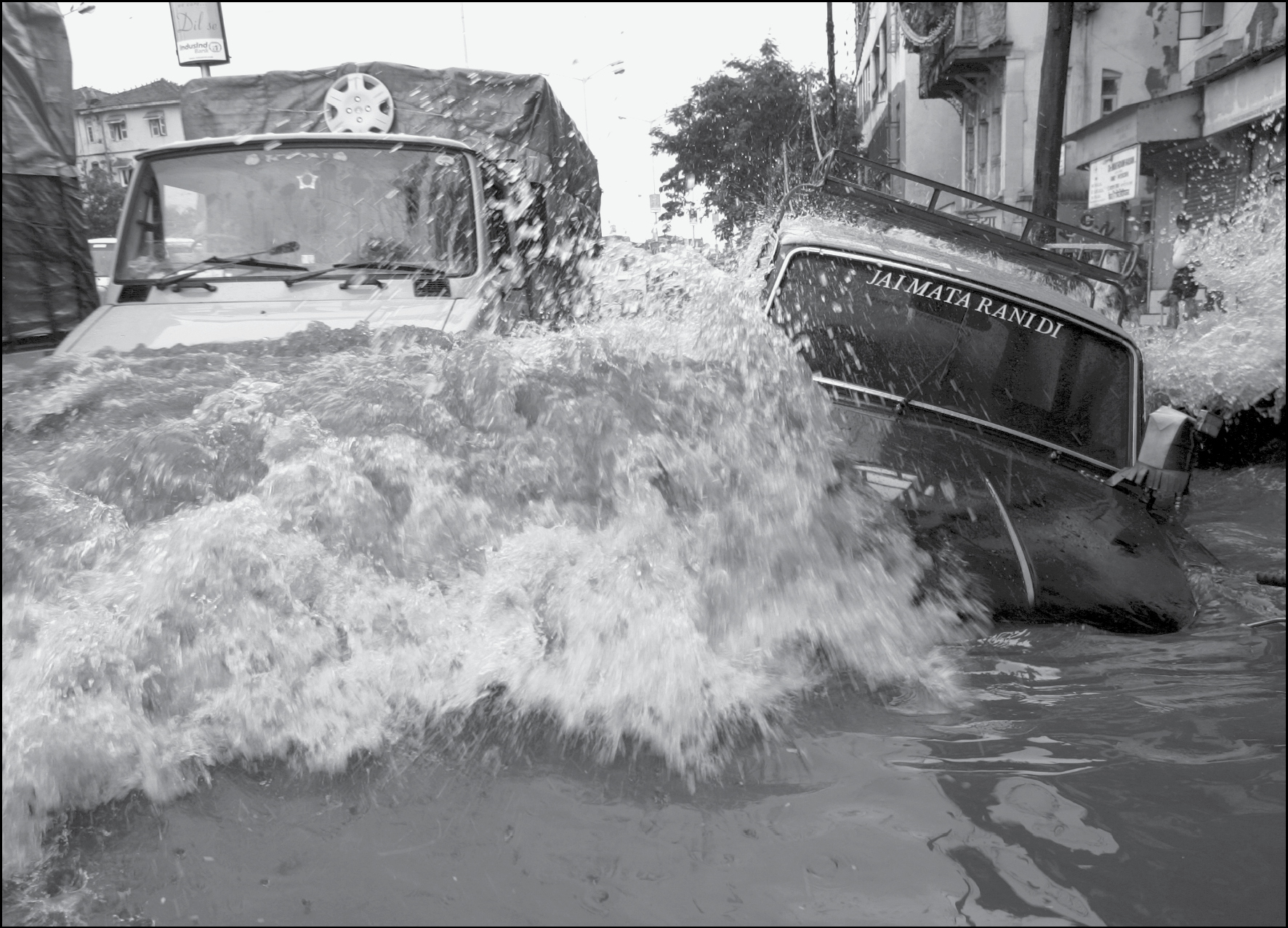
A taxi under water during the Mumbai floods of July 26, 2005. CREDIT: Hindustan Times/Getty Images
Beyond the suffering that the storm caused, it also provided a stark warning. If, as scientists predict, the “once-in-a-hundred-year” storm is likely, in the future, to materialize every ten or twenty years, or perhaps more regularly than that, Mumbai is acutely vulnerable, along with so many cities at the water’s edge. The threat to the coasts, once again, comes from the sea—fueled no longer just by natural patterns but also by human activity that is once regional and planetary in its sources and its effects.
The prospect of the next big storm hitting Mumbai is the alarming picture that Amitav Ghosh sketches, powerfully, in his nonfiction work on climate change, The Great Derangement. Ghosh forces us to imagine Mumbai in a superstorm:
At this point waves would be pouring into South Mumbai from both its sea-facing shorelines; it is not inconceivable that the two fronts of the storm surge would meet and merge. In that case the hills and promontories of South Mumbai would once again become islands, rising out of a wildly agitated expanse of water.
But in the face of catastrophe that is “inconceivably large,” Ghosh argues that most states, like most human beings, are guided by “the inertia of habitual motion.”67
In recent years, the view that we should live with and adapt to the natural hydraulic risks of littoral zones—to say nothing of how these risks are worsening with climate change—has infiltrated the worlds of architecture and design. Mumbai architects and urban theorists Anuradha Mathur and Dilip da Cunha insist that the colonial and postcolonial practice of drawing a firm boundary between land and water in Bombay stems from a fundamental misreading of the fluid coastal landscape. Mumbai during the monsoon demands to be seen “in cross-sectional depth,” they argue, not in the two dimensions of maps and plans. When the monsoon comes, “there is too little time and too much water to make an orderly exit through courses delineated on maps.” In their vision, the city in monsoon becomes a fluid, mutable organism at the boundary between land and water, shaped by the interplay of “the monsoon clouds above through the labyrinthine world of creeks, to the web of aquifers beneath.” Only if we understand this, design for it, adapt to it, they argue, can we live with, rather than trying to engineer away, risk.68
Working within a tradition that goes back a century—to Blanford and Isis Pogson and Ruchi Ram Sahni—Indian meteorologists have a distinctive understanding of the climate risks facing India today. However much patterns of rainfall may be changing, they suggest, the monsoon has always presented a risk to South Asia: the fundamental source of escalating risk today lies in foolhardy policies.
This is what emerged in my conversations with S. Raghavan, formerly a senior officer in the Indian Meteorological Department, now retired in Chennai, where we met at his home. His father was a large farmer in an arid tract of rural Tamil Nadu. Raghavan grew up with an intimate knowledge of water and crops; long before he became a meteorologist, he recognized the rhythms of the monsoon. After taking a degree in physics at Madras University, Raghavan received three job offers: one from All India Radio, one from the auditor general’s office, and one from the meteorological department. With little knowledge of meteorology, he took that option, excited in part by the chance to work with the latest technology, including the radiosondes he had seen on display at a stall in his college’s engineering fair. At the height of the Cold War, Raghavan was sent to the United States on a government scholarship to study radar technology. When Delhi’s Safdarjung Airport received its first radar in 1957, Raghavan was put in charge of its operation. In 1972, he returned to Madras to take charge of radar meteorology there, equipped with a cyclone warning radar purchased from Japan, which arrived only after a long tussle with the customs department at a time when India had stringent restrictions on imports and foreign exchange. That year, a serious cyclone struck the coastal town of Cuddalore. It was the first cyclone in India to be tracked by radar as it approached; with accurate information and early warnings, casualties were minimal. It was then, Raghavan said, that “I realized that I was doing some service to society.”
But just as forecasting capacities improved, in the 1980s, the risk posed by extreme weather in India multiplied. The cause was manufactured, not climatic, he said. The reason so many millions who live in coastal India are in danger, he told me, was because governments, planners, developers, and citizens had completely neglected the ordinary climatic risks that coastal South Asia faces. “Time and time again, we put ourselves in harm’s way,” he said. Raghavan does not believe that the risks of cyclonic storms, for example, can be engineered away; at best they can be prepared for. He believes in early warning, and for that there is no substitute for the patient observation of weather fronts developing in the Bay of Bengal. His mission in retirement is the production of a Tamil lexicon of climatological terms, in the same way that the colonial meteorologists of the late nineteenth century were not averse to collecting local proverbs. He regularly gives talks to schools and residential societies about climate and weather. He described the destruction of cities’ natural drainage and storm defenses. As late as the 1940s, he remembered seeing Chennai’s Cooum River busy with traffic, including boats carrying salt from Andhra; it had become a “cesspit,” he told me. Drains were blocked by a “plastics explosion”; the destruction of mangroves had taken away natural protection against storm surges. “Our own actions are responsible” for the crisis, he said.
The soft-spoken Mr. Raghavan was careful and precise in his judgments; as we talked, he often turned to his shelves to find a book, or to consult a folder of press clippings that he had maintained over many years. The day after we met he sent me a PowerPoint presentation he had made for a recent lecture. But there was no mistaking the emotion in what he said—he was both sad and angry at the way the risks of a monsoon climate had been disregarded. His was a view of the weather, and the climate, that was rarely about control—it was about adapting to known and felt risks. The long quest of India’s meteorologists to understand the monsoon continues to shape their responses to a changing climate.
THESE ARE NOT, FOR THE MOST PART, THE LESSONS THAT ARE BEING learned. The map of cities at risk resembles a series of beads on a necklace threaded along the coastline of Asia. One study predicts that by 2070, nine out of the ten cities with the most people at risk from extreme weather will be in Asia—Miami is the only non-Asian inclusion. The list includes Kolkata and Mumbai in India, Dhaka in Bangladesh, Guangzhou and Shanghai in China, Ho Chi Minh City and Hai Phong in Vietnam, Bangkok in Thailand, and Yangon in Myanmar.69 Each one of these cities will confront any change in the interaction of land and water, winds and rain over Asia’s oceans. Just two years after the Mumbai floods, it was the turn of Jakarta, the Indonesian capital and the fastest-sinking city in the world, pulled down by the weight of construction, by the extraction of groundwater, and by the rising sea. Jakarta is sinking by between three and six inches every year. The storm in 2007 washed over the sea walls built to protect the city. Half the city was underwater, displacing 340,000 people from their homes. In Jakarta and in each of Asia’s coastal megacities, climate change compounds a cavalcade of risks that are severe in and of themselves—hasty development driven by property speculation and new forms of middle-class consumption, crumbling health and sanitary infrastructures, and a lack of preparedness and precaution, are all symptoms of profound social and economic inequalities both among and within nations. Of all the countries in the world, few are more directly under threat than low-lying Bangladesh.70
IV
The struggle for water transcends Asia’s borders. The Himalayan rivers, dammed and diverted and vulnerable to changes in glacier cover, flow through many nation-states on their descent to the sea. Planetary warming is a result of the historical emissions of fossil fuels—initially and cumulatively by the wealthy and industrialized countries of the world, but also, and increasingly since the 1980s, by China and India. Global warming interacts with and compounds the effects of regional climate change. Aerosol emissions from the Gangetic plain or from fast-industrializing areas of China have effects far beyond India’s or China’s borders, creating a series of brown clouds that blanket the Indian Ocean and affect rainfall far away. Climate change creates problems of distance—between the source of pollution and its consequences—but it also creates new forms of proximity in the form of shared risks and interdependence. The image of the Himalayas as “Asia’s water tower” conveys both the scale of the hydraulic system that binds much of Asia, and the scale of the threat that they face from the destabilization of that source of so much water. By the 1960s, the sea itself was a form of territory. The Bay of Bengal was the crucible of the earliest monsoon science in the nineteenth century; it remains the crucible of monsoon science today. But it is a very different sort of space. It is crowded. It is contested. It is walled off by borders in the sea as much as on land.71 Even international cooperation in oceanographic research on the monsoon has to confront the reality of borders at sea. A major project between 2013 and 2015 set out to investigate the Bay of Bengal and its role in monsoon circulation; it brought together American, Indian, and Sri Lankan scientists. Their research vessels roamed the Bay for two years, taking an enormous number of measurements of ocean salinity, temperature, currents, and chemistry. Yet the map of their voyages, a dense set of tracks that the ships followed over those years, is divided up by a thin line marking the extent of territorial waters and exclusive economic zones; some, like the border of Myanmar, the ships could not cross for political reasons.72
If borders at sea are forbidding, those on land are even more so. Throughout Asia one of the ways in which communities have coped with extreme weather has been to move—often temporarily, and not necessarily over long distances. For regions that are threatened by climate change and water-related risks, borders create barriers to mobility. “Climate refugees” are much discussed in current legal and political debates. But the Red Cross rightly stresses that the “populist term ‘climate refugees’ is profoundly misleading”: environmental drivers of migration act “in conjunction with economic, social and political factors, and [are] linked to existing vulnerabilities,” and it is “conceptually difficult to establish a precise category of environmental or climate migrant.”73 It would be a mistake to separate a discussion of “climate migration” from a broader consideration of regional patterns of mobility.
There is an odd historical resonance to some of the pronouncements about climate and migration. In the nineteenth century, too, many observers saw the movement of people across the Indian Ocean and the South China Sea as driven by climate—not by climate change but by climate’s natural volatility.74 The use of liquid metaphors to describe migration remains pervasive: a language of “floods” and “tides” and “waves” and “flows.” Many of the region’s migrants today come from places and from communities that have been mobile in the past. This is hardly a surprise. Some of the places most threatened by environmental catastrophe are also places—the coasts and the great river deltas—that have the longest histories of migration. But other affected regions lack the accumulated family connections, knowledge, experience, and access to credit to allow them to move. Forced immobility can be as dangerous, as traumatic, as forced migration. Controls on mobility have intensified since the middle of the twentieth century, and they are likely to harden: hysteria in India about “illegal migration” from Bangladesh, for instance, has led to the securitization and fortification of the border, though many people risk their lives to cross it out of desperation. The slow effects of climate change are as likely to leave people stranded, unable to move, as they are to spark a rush of “climate refugees.”75
A recent study by the World Bank makes clear that although cross-border migration receives more attention, vastly more people migrate within their own countries than migrate internationally. The overwhelming majority of people who are displaced by climate change over the next three decades will move internally—an estimated 40 million people in South Asia alone, and 143 million people globally.76 In the depersonalized language common to climate policy documents, the World Bank concludes that “several hotspots of climate in- and out-migration are in transboundary areas” of South Asia, and that these “must be explored for their opportunities and managed for their challenges.”77 But what does this really mean? It means the options facing people whose lives are threatened by drought or deluge will be constrained by borders as well as by poverty, gender, caste, or a lack of opportunity. It means that the closest refuge, if it should lie across a border, may not be a refuge at all. It means that many routes that make social, cultural, or ecological sense to people—routes embedded in family histories, routes across regions that have not always been divided by borders—will be blocked. It means that those who are compelled to cross closed frontiers in search of security will face unprecedented risks.
GIVEN THE WEIGHT OF BORDERS, ARE THERE PROSPECTS OF CLOSER regional cooperation to confront the problems of water and the threat of climate change? If so, these prospects are modest in scope and ambition. Existing regional institutions—the Association of Southeast Asian Nations (ASEAN), the newer and smaller Bay of Bengal Initiative for Multisectoral Technical Cooperation (BIMSTEC)—are focused overwhelmingly on the development of infrastructure and the promotion of trade. Though environmental protection is not absent from their concerns, it is not a high priority. When policy documents refer to climate, it is often as a metaphor, as in the often expressed hope of creating a “climate friendly to investment.”78 And when new infrastructure projects threaten ecological and social harm—as do so many of the port projects that proliferate along the Bay of Bengal’s coasts—they have almost always proceeded regardless, except where they have met with significant public protest. Nevertheless the second half of the twentieth century did create agreements and institutions to manage water across borders, and these need to be strengthened wherever possible. Though flawed, the Indus Treaty signed in 1960 between India and Pakistan, with the World Bank’s mediation, has largely worked. The two hostile neighbors have for the most part worked cooperatively to manage that shared river, though there have been periodic surges of tension between them. The Mekong River Commission, created in the 1950s by the UN, has outlasted the Cold War. Though the commission has often failed to prevent reckless development along the river, the growing involvement of China in its discussions suggests that states are taking more seriously the shared threats they face.
But the most promising initiatives to address shared risks may lie in the realms of science and civil society. From the start, climate science in Asia has been a cosmopolitan enterprise. In the late nineteenth century, observatories and scientists across imperial borders exchanged data and theory and reports. This is not to say that climate science stands apart from politics. It never has. In the nineteenth century, the development of meteorology was deeply entwined with imperial interests. But climate science provided a way of visualizing Asia beyond borders, as a vast and connected climatic space, bound together in every dimension—the oceans, the air, and the land. Meteorologists saw that the same storms menaced the Philippines as India. Growing knowledge of climatic connections inspired attempts to share warnings if not coordinate responses. In an era of nation-states, that level of cross-border cooperation among scientists has continued—and it is more vital than ever. Even as an organization like BIMSTEC is hampered by political tensions among its member states, it has made small but tangible gains in coordinating the sharing of early warnings to bolster disaster preparedness.79 As meteorologists’ ability to forecast storms has advanced with improvements in satellite technology as well as better models, that information is now more readily accessible to a wide public—mobile phones are ubiquitous across South Asia; even the smallest fishing vessels are now equipped with GPS technology.
Some of the most promising recent efforts to increase cooperation across borders to tackle Asia’s water problems have focused on the sharing of information. As we have seen, data concerning the hydraulics of the Himalayan rivers are a closely guarded secret. The Third Pole, a nongovernmental organization based in London and New Delhi, dedicated to understanding and communicating the cross-border water issues faced by Asian states—with a focus on the Himalayan rivers—has compiled as much information as is available on river flow and on climatic trends. Using open source data, it has created a new mapping platform that allows for the sharing of data on river flow and hydropower, glaciers, and groundwater. This is now readily available to journalists, activists, and scholars. These maps of the Himalayan region transcend borders, emphasizing shared ecological challenges. The ability to visualize the risks holds the promise of stimulating a more coordinated response; it might even inspire new solidarities that come from a sense of shared vulnerability. These efforts to pool information have begun to mobilize public participation by so-called citizen scientists. Season Watch, an Indian organization, encourages its members, including schoolchildren, to submit detailed daily observations of climate, thereby linking very local experiences of changing seasonal cycles with changes on a regional and global scale.80 This effort extends to the preservation of local archives. The World Meteorological Organization has urged the importance of “data rescue”—the recovery of records and logs of rainfall and temperature, often handwritten, preserved in local repositories and threatened by physical deterioration. These are potentially invaluable to climatologists looking for long-term patterns of change. Those very archives, as we have seen throughout this book, are full of evidence of the ways in which, in earlier times, not only storms and currents but scientific information crossed borders.
From the 1980s onward, there has been close cooperation among environmental activists across Asia. They have pooled information, campaigned together, and recognized that environmental degradation—including but not limited to climate change—is a menace they all face. Historian Prasenjit Duara sees reasons for hope in the organizations of what he calls “network Asia”—the web of NGOs, some of them religiously motivated and others resolutely secular, coming together to confront problems of water and climate. The environmental movement has at times been genuinely transregional, yet in both India and China, it has become clear in recent years that environmental organizations are vulnerable to crackdowns by the state. There is also an imaginative barrier to cross. As we have seen, the power of environmental activism very often comes from the ability to evoke a sense of emotional attachment to particular landscapes. Narratives about the past have been fundamental to the rise of environmentalism in India and elsewhere in Asia, but the pasts they have appealed to are profoundly local ones; their narratives juxtapose an earlier age of ecological innocence with the depredations of colonialism and modernity. An appeal to nationalism has been, and remains, one powerful way that environmentalists can mobilize public support. But this can make it more difficult to work across borders.81
At a time of environmental crisis, local histories and national responses are insufficient on their own. It is now easy to see on a map, or in an alarming graphic, the scale of water-related risks that Asia faces. It is clear that those risks pay no heed to borders. The promise of a new sort of environmental history, a more connected and expansive history of Asia’s unruly waters, is to fill that space with cultural and political meaning—to show that the landscape of Asia’s mountain rivers and its monsoons have also constituted a space of migration, a zone of trade, a path of pilgrimage.
Throughout history, water has both connected and divided Asia. The rivers and oceans have been thoroughfares of trade as well as zones of imperial domination. In the nineteenth century, when European empires dominated the world, Asia’s hydrology underpinned many of the commodities that fueled global industrial capitalism. The storms that have always menaced coastal regions always crossed frontiers, but states have responded to them in different ways. As connections across Asia frayed in the mid-twentieth-century decades of nationalism and war, water, too, came under ever-tighter territorial control. One reason why almost all of Asia’s new nation-states tried so boldly to harness water was to gain self-sufficiency in a postcolonial era in which their autonomy was nevertheless called into question by the machinations of the superpowers in the Cold War. They were spurred to do so by memories of water’s lack—bitter memories of famine and suffering within living memory. They were spurred, especially in India, by a fear of the monsoon climate and the power it had over human life. “For us in India scarcity is only a missed monsoon away,” Prime Minister Indira Gandhi said—and this sense of a battle against enormous natural forces inspired in her, as in so many others, a tug between despair and optimism that science and technology held the key to liberation.82 Over time that insistence on self-sufficiency combined with a sense of perpetual crisis led to a narrowing of vision and a willful blindness to the consequences of repeated attempts to conquer nature. Today, the inability of states to think beyond their borders imperils lives and denudes the political imagination.
If there is one consistent lesson in Unruly Waters, it is that water management never has been, and can never be, a purely technical or a scientific question; neither can it be addressed on a purely national scale. Ideas about the distribution and management of water are deeply inflected with cultural values, with notions of justice, with ideas and fears about nature and climate—including very old fears about the monsoon, which grows more capricious. The battle continues to understand the monsoons and mountain rivers that shape Asia.