< Introducing New York City
Getting Around New York

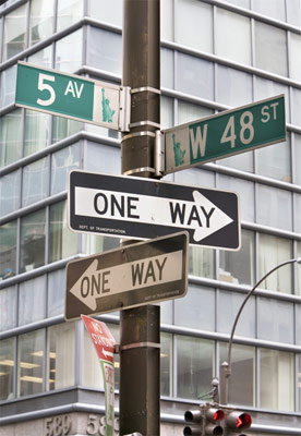
Street signs at an intersection of routes through the city
Thanks to the city’s extensive and efficient public transportation system, getting around New York is easy. When traveling by bus or subway, the Metropolitan Transit Authority (MTA) website’s Transit Planner can provide maps and directions. Getting around Manhattan is particularly straightforward, as most of the area is laid out in a regular grid pattern. But getting a little bit lost in New York can be a bonus – every block holds interesting discoveries.
Finding your way
Manhattan streets running east-west are numbered – toward Uptown (north), numbers get higher and toward Downtown (south) they get lower. The whole width of the island is only about 12 blocks, divided by avenues running south–north. These avenues may have names instead of numbers, but they too are mostly on a grid. Fifth Avenue divides the “horizontal” streets into “East” or “West” (as in “East 40th St”). It is more challenging to get around in the city’s older sections like Greenwich Village, Chinatown, or the Financial District. The fold-out street map in the Manhattan Yellow Pages phone directory – which will probably be available from your hotel concierge – is very useful for locating street numbers in the city.
The MetroCard
You need a MetroCard to use the subway, and it is convenient on buses too (eliminating the need for exact change). Cards are sold for $1 in all subway stations by booth attendants or vending machines, both of which accept major credit cards. A single ride is $2.50. Multi-ride cards may be purchased from $5 up. Up to three children can ride free with an adult, provided they do not exceed 44 inches (112 cm) in height. Put $5 or more on your card and receive a 5 percent bonus amount on the card. Buying a seven-day Unlimited Pass for $30 can amount to substantial savings, even on shorter stays.

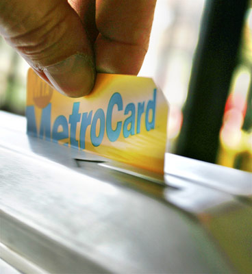
Swiping a MetroCard on a turnstile at the entrance to a New York subway station
Using the subway
The subway is the quickest way to get around the city, but avoid rush hours, before 9:30am and 3:30–8pm, when trains are packed. Train routes are identified by a letter or number and each route also has its own color, so it is easy to follow its path on a subway map – get the children to help out. The main routes run north–south along Lexington, Eighth, Broadway/Seventh, and Sixth avenues. N and R trains travel east–west across mid-Manhattan; an east–west shuttle connects Grand Central Terminal and Times Square on 42nd Street. Signs indicate which direction trains are headed – Uptown (north) or Downtown (south), and whether they are local (making all stops) or express (with limited stops). First and last stops are posted on track signs and in train cars. Large system maps are posted in all stations and free individual maps are available from booth attendants.
Swipe MetroCards at turnstiles to enter the subway; they are not needed to exit. During rush hours, the least crowded cars are at either end of the train. On weekdays, trains run every 2–5 minutes during peak times (6:30–9:30am, 3:30–8pm), every 5–15 minutes except every 20 minutes between midnight and 6:30am. Services are less frequent on weekends.
Stations serving railroad and bus stations and busy stops such as Rockefeller Center have elevators and ramps for the disabled and strollers. However, most stations have steep steps and gaps between platform and trains. A list of accessible stations is available on the MTA website.
Commuter Lines
Using buses
Buses are a relaxing way to travel around the city, although slow in heavy traffic. Without a MetroCard or exact change, you can buy a Single Ride ticket for $2.75 at vending machines only; no bills are accepted. Enter at the front of the bus and use a MetroCard or exact change at the fare box next to the driver. If you need a second bus or subway ride to complete your trip and have paid cash, you must request a transfer; subways will require another fare; you will be given a single-use MetroCard. (Note that MetroCards provide automatic free transfers to another bus or subway.) You cannot reboard the same bus line with a transfer.
New “Select Bus Services” that make limited stops are testing a new time-saving system – tickets are purchased at boxes on the sidewalk with MetroCards or cash and passengers can then enter the bus at the front or rear.
Bus stops are marked with round blue signs on a tall post showing a picture of a bus, with route numbers displayed below. Most also have maps giving stops and schedules for each line. Buses travel north or south on every major avenue except Park and 12th, with clearly marked stops at street corners every two to three blocks. Crosstown (east – west) buses run every 7 or 8 blocks, with stops on each block. All Manhattan routes begin with M; B means Brooklyn, Bx means Bronx, Q signifies Queens. Electronic signs at the front of each bus indicate the route number and which buses are “limited,” making fewer stops. Buses do not pick up passengers between designated stops.
To request a stop, press the yellow wall strips between the bus windows. Some buses also have stop buttons on central poles. On request, the driver will call out your stop clearly. Exit from the rear door; press the yellow tape on the door and it will open automatically. Many buses run 24 hours, though some lines do not operate between 2am and 5am. Most buses run every 3–5 minutes during morning and evening rush hours, every 7–12 minutes from noon to 4:30pm and after 7pm, every 30–60 minutes from midnight to 6am. Services are reduced on weekends and holidays.
Several bus routes are good for a pleasant and inexpensive sightseeing tour of the city. Among the best sightseeing routes are the M5, which travels Downtown from the Upper West Side along Riverside Drive to Fifth Avenue, then to lower Manhattan on Broadway, before heading back Uptown along Sixth Avenue. The M1 goes Downtown along upper Fifth Avenue from Museum Mile through Midtown to the East Village, then back Uptown via Madison Avenue. The M42 crosstown bus route runs from the United Nations Headquarters past Grand Central Terminal and the New York Public Library to Times Square; this is a two-way street, so you can travel in either direction.
Disabled access
All buses have ramp lifts for wheelchair or walker boarding and exit. When the passenger boards, the driver will help to secure wheelchairs and will ask for the stop required. Drivers will also help disabled people to exit the bus at the requested stop. Disabled people pay half fare.
Using taxis
New York taxis, or cabs, are easily identified by their yellow color and distinctive logo. They are convenient, but can be costly, especially when traffic is heavy and the meter keeps ticking. Always use the metered taxis licensed by the city – check the
NYC.gov website. If you hail a so-called “gypsy cab” – an unlicensed cab – you may end up paying a hefty bill at the end of the trip.
Taxis with their top sign illuminated can be hailed anywhere in the city and will pull up to the curb. No light means the cab is taken; “off-duty” lights mean the cab is not available. Cabs tend to congregate outside hotels and at train and bus stations. When hotel doormen hail a cab for you, a $1 tip is customary.
Taxis accommodate up to four passengers for one fare. The meter begins at $2.50 and increases $0.50 every fifth of a mile (third of a kilometer). A $1 surcharge is added to the meter Monday–Friday, 4–8pm, and a $0.50 surcharge from 8pm to 6am. Tolls are extra, and like surcharges, are added to the fare. All licensed taxis accept both cash and credit cards. There is no charge for luggage. A tip of 10–20 percent at the end of a trip is standard.
Limousine services such as
Carmel and
AllState can also provide a car and driver to chauffeur you around town, with stops wherever you choose. For Carmel, the hourly charge within Manhattan is $40 with a minimum of 2 hours. For Allstate, the charge is $42.

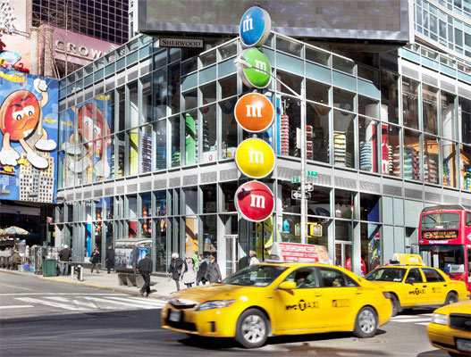
New York’s distinctive cheery yellow taxis, driving past Times Square
Walking
Given heavy New York traffic, walking is sometimes the quickest way to get around. Cross only at corners and obey the “walk” and “stop” electronic signs. To gauge distances, 20 north–south city blocks equal about 1 mile (1.6 km). Each crosstown (east–west) block is two to three times longer than north–south blocks, so figure 6–10 blocks per mile (1.6 km).
Walking the sidewalks can be hard on the feet – and little legs tire quickly – so be sure to bring comfortable shoes. The city has many places to rest weary legs. Space near both Times Square and Herald Square has been set aside to provide seating areas, and there are plenty of seats around Lincoln Center as well. Landscaped “vest-pocket” parks in Midtown, such as Paley Park on 53rd Street and Greenacre Park between Second and Third avenues, are also welcome oases, as is Bryant Park. Many of the big office towers on Sixth Avenue also have plazas with seating where you can rest for a spell.
Driving
Driving is the least efficient way to get around New York. Drivers are aggressive, traffic is heavy, street parking is scant (and parking tickets are punitive), gas stations are few, and commercial parking lots and garages are extremely expensive. Those lucky enough to find a parking space will need quarters for the meter. Rates vary depending on which part of New York you are in. One quarter (25 cents) buys 20 minutes of time, and there may be a 1-hour limit. For more specific information, call the Department of Transportation (DOT). If a car is truly essential, rentals from major companies such as Hertz, Avis, and National are available at all airports and numerous locations in the city.
In order to rent a car, you must be at least 25, have a valid international driver’s license, and a major credit card. Be sure you are properly insured for both collision and personal liability; travelers from other countries can buy insurance from the rental company.
Cycling
The number of bicycle lanes on New York’s streets is increasing, but it takes a brave soul to pedal beside heavy traffic, especially with children in tow. Recreational cycle paths in Central Park and along the East and Hudson rivers are more suitable for families. Rent bikes at Central Park Bicycle Shop or Bike NYC.
Ferries and water taxis
The 50-minute round trip on the
Staten Island Ferry, between Whitehall Street in Lower Manhattan and St. George, Staten Island, is the best free outing in town, providing great views of Manhattan’s skyline, the Statue of Liberty, and Ellis Island. No tickets are required; just show up at the Ferry Terminal and board the next boat.
Governors Island’s free ferries are another pleasant option.
New York Water Taxi offers free cruises at weekends ($5 on weekdays). These are designed to take shoppers to the Ikea store in Red Hook, Brooklyn, and give visitors a chance to explore a new area. The Hop-on, hop-off cruise is $28 per adult and $16 for kids between ages 3–12. The cost includes the NYWT Express Hop-on, hop-off bus. The 90-minute boat ride allows you to get off at any stop and get back on later. Order tickets online, by phone, or buy them on board. Water Taxi also runs commuter routes to Brooklyn, Queens and from Downtown to stops along the East River on a set schedule.
Sightseeing tours
Hop-on, hop-off bus tours allow visitors to see a lot of the city. The routes cover Uptown, Downtown, Harlem, and Brooklyn. You can get off to explore at will, knowing that another bus will be coming along. Gray Line and City Sights are among the leading operators: consult their websites or get a guide to departure points when you buy tickets. Tickets are valid for 48 hours. The fare for adults is $54, children $44, with $5 discount for those who book online.
Neighborhood walking tours are another option for an insider’s view of New York, as long as kids are still in strollers or old enough to enjoy a walk. Among the groups offering tours are the Municipal Art Society and Big Onion Tours.


